


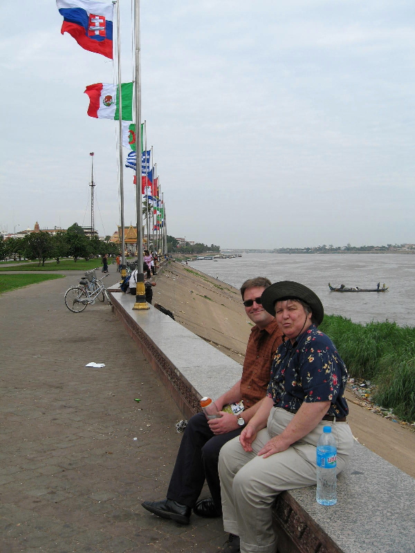
We really enjoyed the Phnom Penh waterfront: trying to figure out which flags represented which flags, trying to figure out how the decided which flags to include, and the general vibe. The Royal Palace and the National Museum are both right down by the waterfront, and our hotel wasn’t far away, so we spent a lot of time down there.
In the shot at the bottom, you see where the 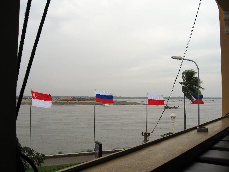 Tonle Sap River (closer to the flags) joins the Mekong (beyond the point, and at the far right). This shot, by the way, was taken from the lovely Foreign Correspondents’ Club Phnom Penh, which welcomes non-initiates of the fourth estate.
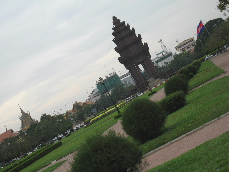
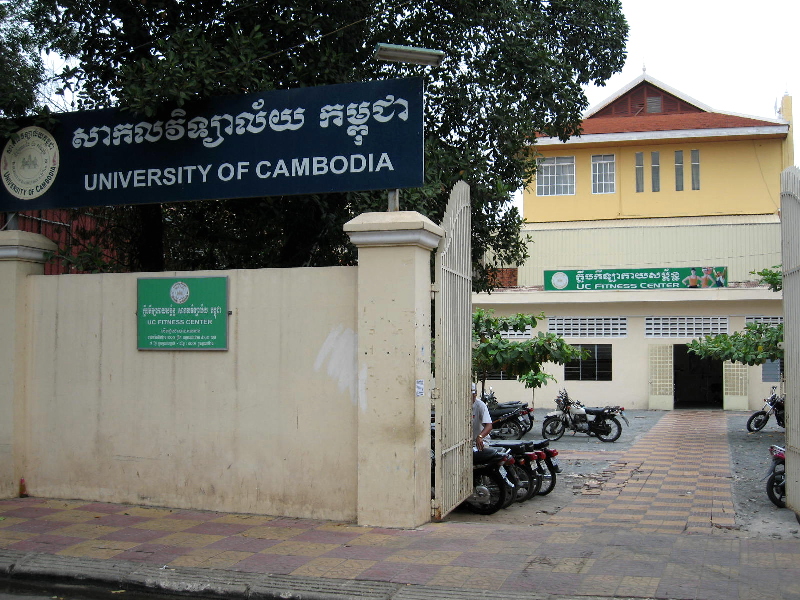 To the left: University of Cambodia Fitness Center; I enjoyed the contrast to, say the UC (Berkeley) Fitness Center. Yet another reminder, that – for all its grandeur, e.g. the Independence Monument no the right – Cambodia’s really a rather small country.
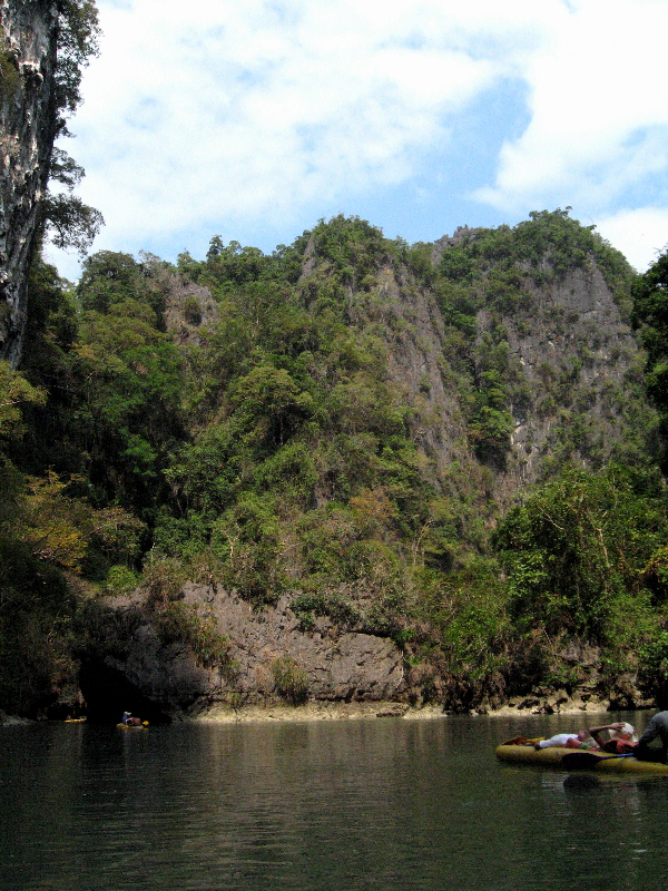
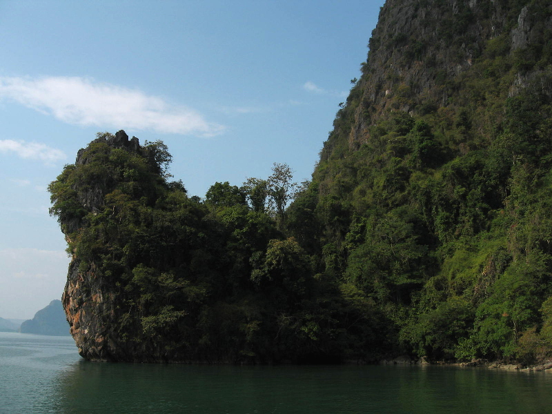
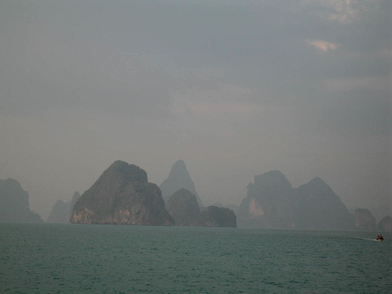
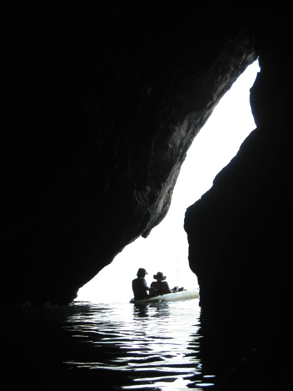
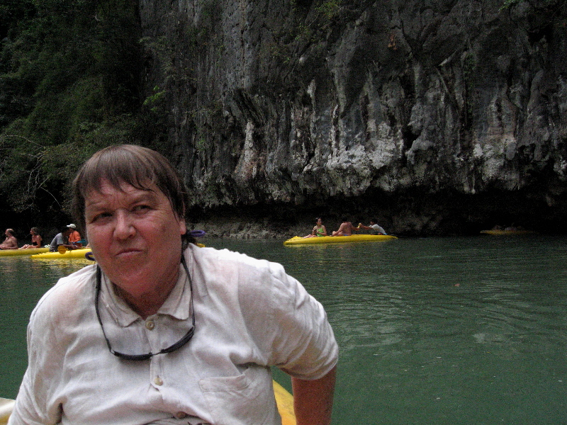
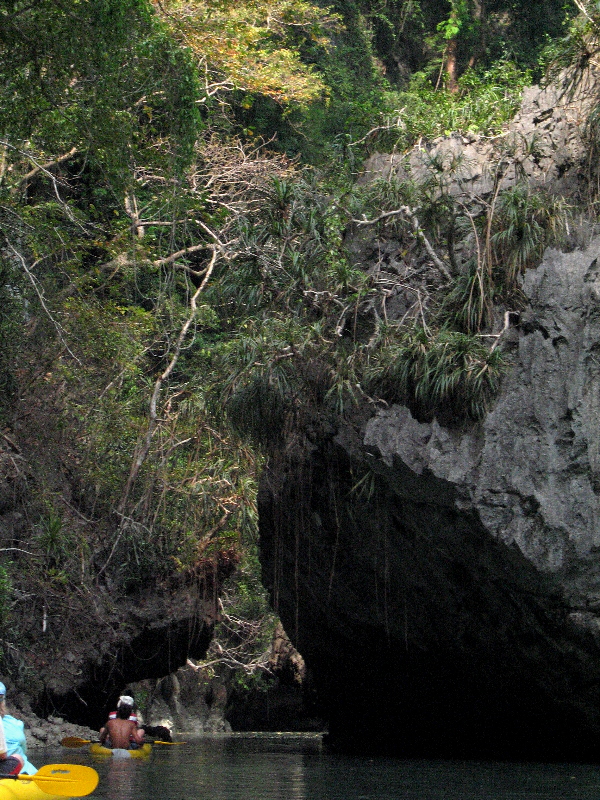
Phang Nga Bay, Thailand
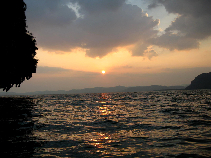
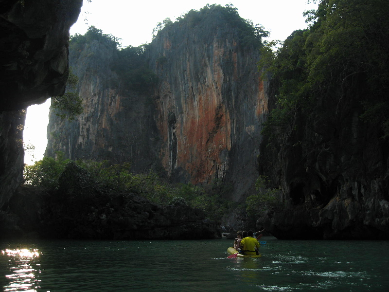
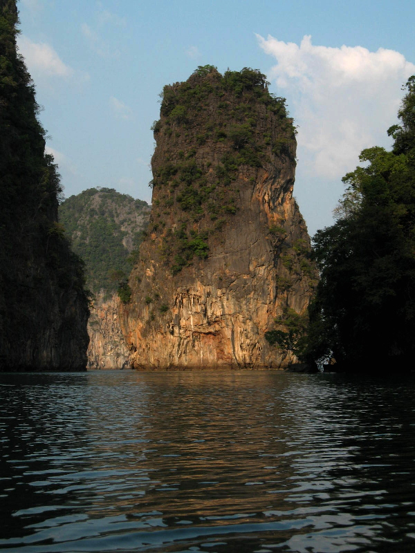 We all welcomed a chance to relax a bit in the sun, by the pool or at one of the more secluded beaches, when we got the Phuket Island. Nonetheless, I felt we just had to explore Phang Nga Bay, to the north of Phuket. On the very last day we were all together, we splurged on a magnificent full-day boat and kayak trip to the bay: lunch and dinner on board a bigger, comfy boat that took us from karst island to karst island, where we then hopped into guided, paddled kayaks (2 people per kayak, though Steve got one to himself) for tours through the limestone caves and cliff-bordered lagoons in the interior of the islands. It was a spectacular day, as you can see from the pictures.
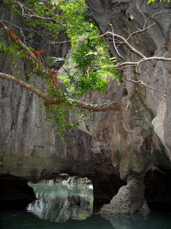


Floating Offerings
 After our third guided kayak outing into the inner lagoons and caves, we had a solid hour+ of free time. While I and many others hopped into kayaks for some independent paddling, Mom assembled the above floating offering for the gods of the sea, ably directed and helped by our guide.
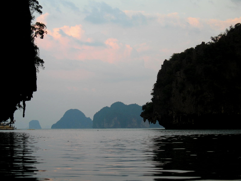
 After dark, we all hopped back in (guided and paddled, this time) kayaks for the fourth outing, back through a long cave into one of the inner lagoons, where we lit our offerings and floated them around the lagoon. It was an enormously beautiful site and a very special feeling, being on this little kayak inside a lagoon on the other side of a dark 200-meter long cave, watching the glow from candles all around the lagoon bobbing in the wake as their makers set them afloat.
Phuket Island
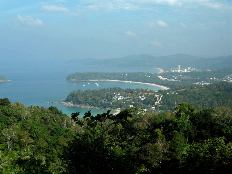 A few views of the west side bays of Phuket. The island’s certainly lovely, but with all the development, it feels more like Miami Beach to me than the kind of place I like to vacation normally.

Cave Frescoes @ Sirigiya
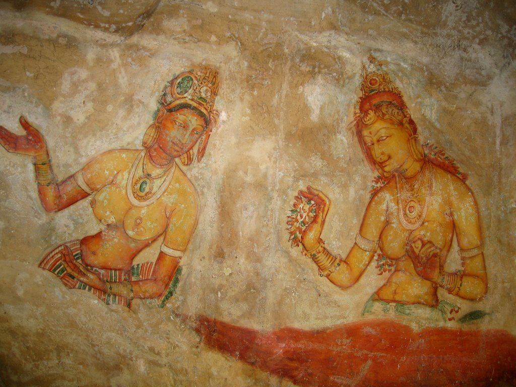
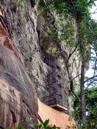 These beautiful cave frescoes, painted into a niche about halfway up the rock, are one of the most famous aspects of the rock. Theories on what the women represent: King Kasyapa’s concubines; celestial nymphs; or, perhaps the most current theory, aspects of Tara Devi, the consort of Avalokitsvara (a Boddhisatva) and, says the book, an important figure in Tantric Buddhism. Go figure. The big image is rather illegal, as my flash unintentionally went off. The spiral staircases go up to and then back down from the niche where the paintings are.
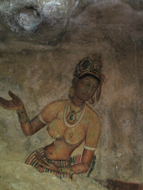


The last Sinhalese kingdom to hold out was based at Kandy, where no major archeological sites are located, but where Sri Lanka’s most important religious site is: the Temple of the Tooth Relic. Buddhism came to Sri Lanka in the 3rd Century BC, when Indian Emperor Ashoka sent his son and daughter to spread the word to Sri Lanka. In AD 371, the tooth relic (of the Buddha) is said to have been smuggled into Sri Lanka, hidden in the hair of a princess. The tooth is said to have been whisked away from the Buddha’s funeral pyre. In any case, the tooth relic pretty much went to wherever the most powerful Sinhalese (=Buddhist) kingdom on the island was, and thus it ended up at Kandy. It would be hard to overstate the importance of the tooth relic, or of Buddhism in the creation and maintenance of Sinhalese identity.
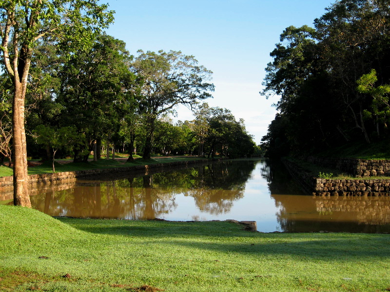
 An interesting aspect of Sigiriya is that the very top of the rock doesn’t actually have anything all that amazing: it’s got a lot of brick walls and moats that now host lilies but may once have been for bathing or just reservoirs for water. (Who’d wanna lug water all the way up there, after all?) Anyway, this image above is taken at the top; the two above and the one below are all from the garden and the moat, which forms the border around the rock compound.
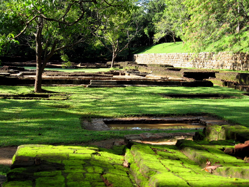
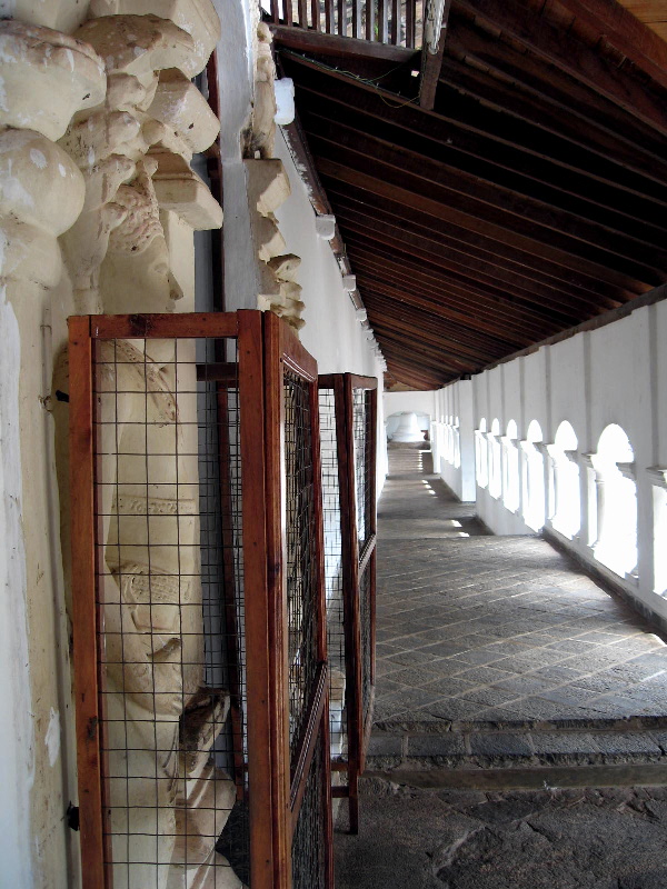
Dambulla: Royal Rock Temple

 So what does all this have to do with the pix we’re seeing, you ask? Sigiriya was developed, most likely as a Buddhist retreat and monastery (an alternate, mostly discredited theory says it was a fortress), by King Kasyapa in the late 5th Century AD. He’s the guy who kicked his older brother over to south India, whence he later returned with those aforementioned south Indian mercenaries. (Does that mean we can blame the current troubles all on him??) The caves at Dambulla were already occupied by Buddhist monks, but they became a major religious and cultural site after a king took refuge there around 90BC while evading south Indian invaders. After he returned to power, he expressed his gratitude by turning the caves into the rock temples you see in these pictures. Of course, later kings added embellishments of their own, but the roots go back pretty far.
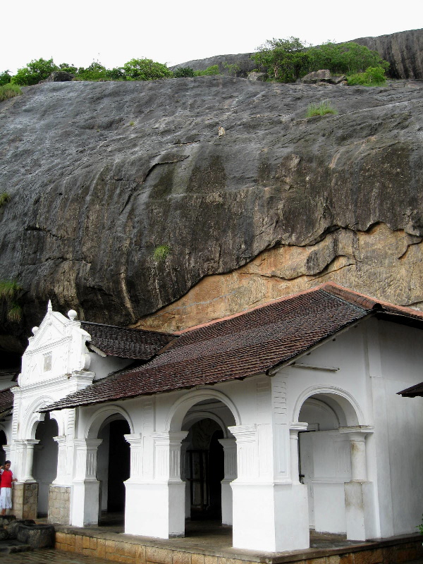
 Polonnaruwa, which I visited after Sigiriya and Dambulla and before Kandy, was initially founded by the south Indian Chola dynasty. In 1070, Sinhalese king Vijayabahu I drove the Cholas off the island and retained Polonnaruwa as his capital. It reached its peak under Parakramabahu I (1153-86), and then started a decline under his successor, Nissanka Malla (1187-96), who seems to have bankrupted the treasury trying to compete with the glory of his predecessor. It’s fitting that, after Polonnaruwa, I decided to hop down to Kandy, since that was the final base of power for Sinahlese kings in Sri Lanka.
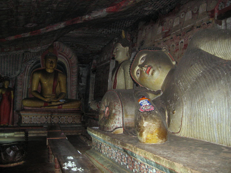
Enjoy the pictures. It’s a gorgeous island, with amazing history. If only it could really know a prolonged period of peace without communal violence, it would be simply amazing. As it is, it’s a bit confusing to my emotions, I must admit. Ah well.
 Dambulla rock as seen from Sigiriya. Look reeeeaaaallly closely right at the base of the small round hill at the center left of the pic, and you’ll see something sorta shiny. I’m sparing you any closeup shots of this enormous gilded Buddha image. (Quoth Lonely Planet: “…a very kitschy structure completed in 2000 using Japanese donations. On top…sits a 30m-high Buddha…Signs claim it’s the largest Buddha in the world, but it’s not even the largest in Sri Lanka.”)
 …And the unmistakeable Sigiriya (with some other round little hillock on the left), as seem from top o’ the rock in Dambulla.
 This would be the Dambulla rock. Note cow in foreground. Impressive slab of rock, yet not so pittoresque as the one in Sigiriya, wouldn’t you say?
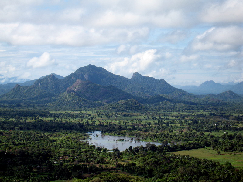
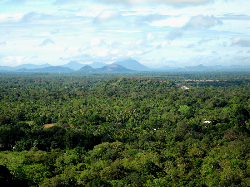
Below: the hill country as seen from the (lower) rock at Dambulla, then from the (higher) rock at Sigiriya.