
Jerash.12 – Two Theaters & Two Streets
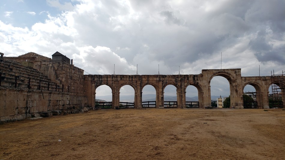
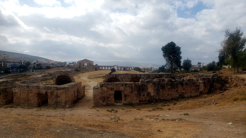
 This is the South Theater, and I’m looking north so you can make out the Artemis temple & other parts of the city I’ve shown before. Jerash in its heyday was important enough to have two theaters – just below you see a photo taken over the North Theater towards the northernmost gate. I didn’t walk up to the north gate – turned around and walked back past all that I’ve shown you already. Like this post, that was a farewell walk past the temple to Artemis, past the second street – called the South Decumanus – which I’m also showing you below, and thus to this theater still-working theater: there are outdoor concerts both here and at the Forum, as you might have guessed from modern chairs and stages in a few photos. A sign in one of the photos below reminded me that Jordan is celebrating 100 years since the current boundaries were drawn by a young Winston Churchill in the post-WWI dissolution of the Ottoman Empire. What better place to ponder the rise and fall of human empires than a place like this, eh?


..and with a last walk through the Hippodrome to soak up the atmosphere, we’ll bid farewell to Jerash. Hope you’re enjoyed this armchair introductory tour.
Jerash.11 – More Zeus & South Gate
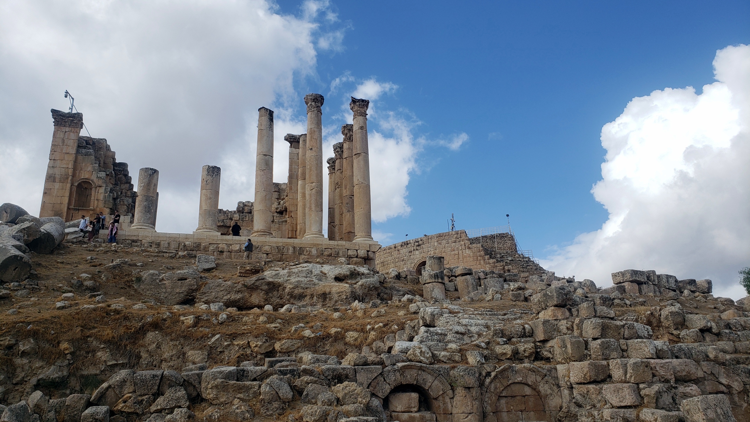
 Last photos from the upper and lower temples to Zeus, and of the South Gate.


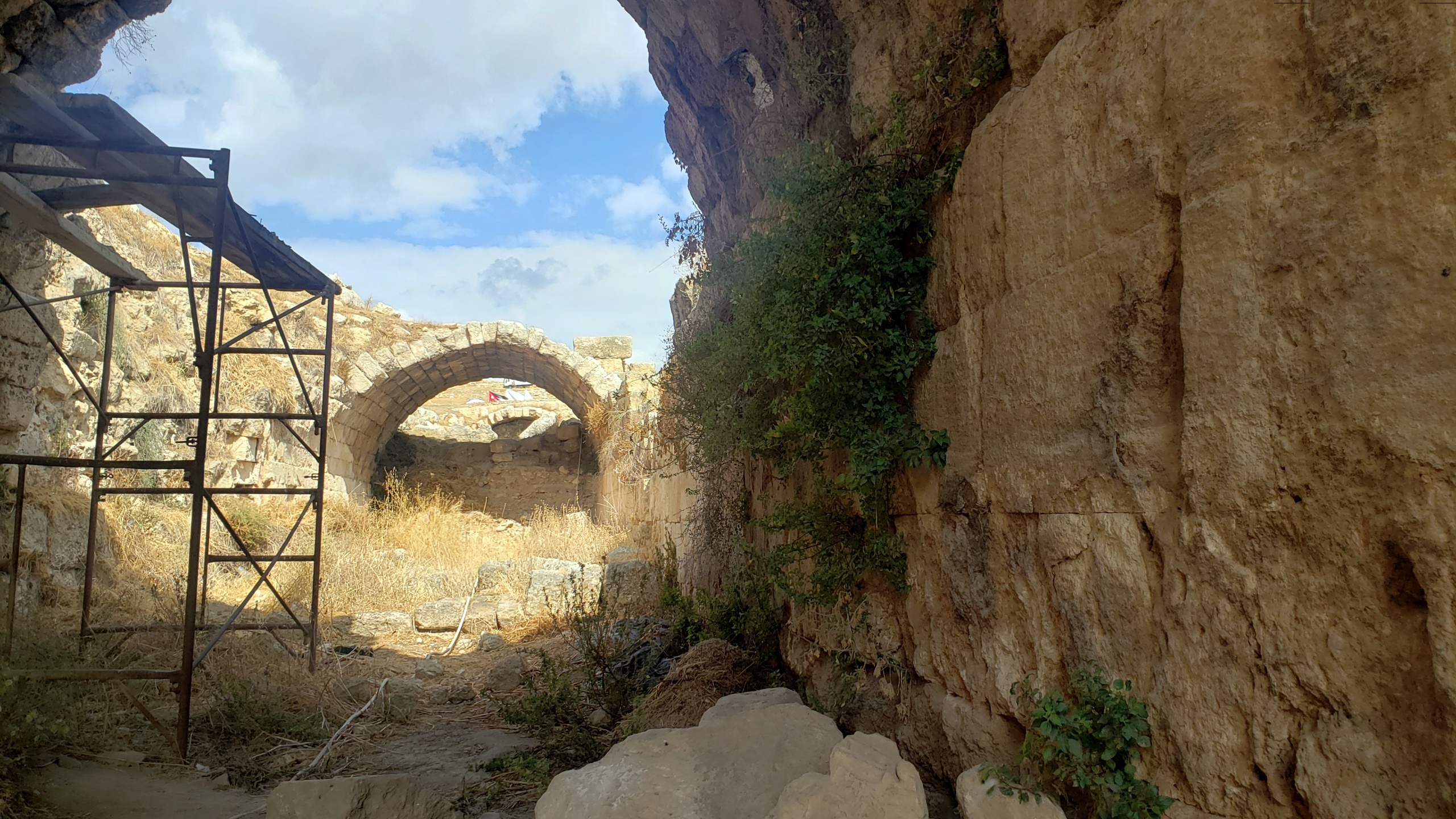
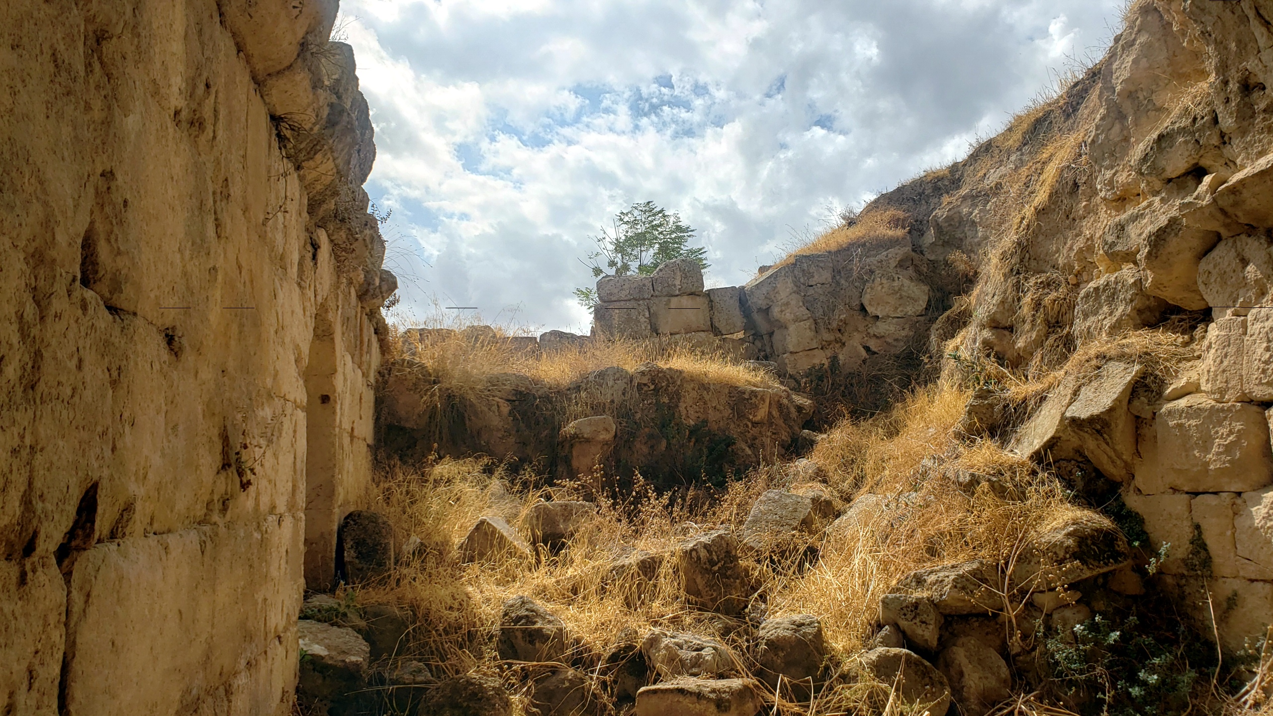
Jerash.10 – Byzantine Church Ruins
 It’s possible I mis-labeled the above photo, but I’m quite confident it came from the same hillside as the Fountain Courtyard and all those other churches named after saints, just above the Cathedral. Ditto all the other pics here, although many of them are looking out through columns at other buildings you’ll recognize – Hippodrome, Hadrian’s Arch, South Theater, etc.


Jerash.8 – Byzantine Cathedral
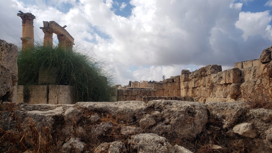
 On the map (last Jerash post), the cathedral and its uphill neighbors, the fountain court and the several churches named after various saints, look close together. As the photo just below shows, though, in fact these are built on a hill. I hope I’ve properly identified and grouped the photos from all these Byzantine-era ruins up and down this hillside 🙂


Jerash.7 – An Orientation
 Call me anal-retentive or obsessive, but I just hate to throw photos at you that I can’t identify better than just “Jerash.” If these Jerash photos are just lovely visuals for you, then do simply enjoy, and ignore the text. But a few folks have posted comments or written me emails with delight at learning of the existence of this fascinating site. Like me, they’d never heard of it.
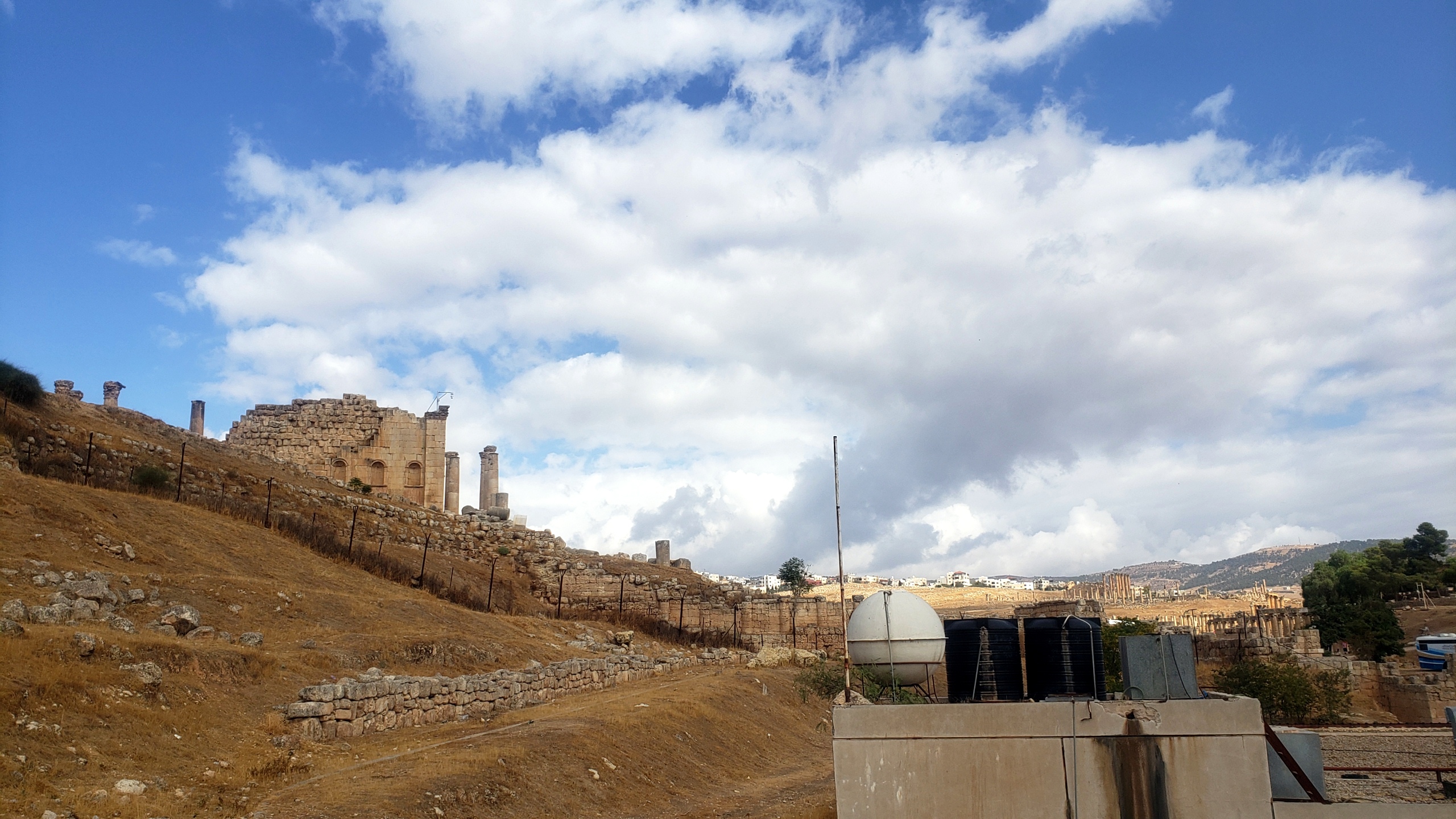
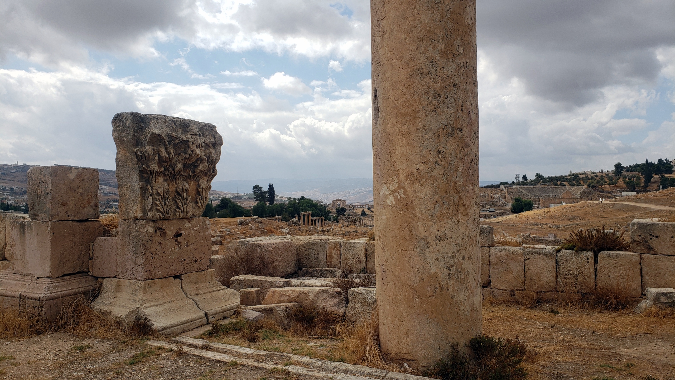
I’ve devoted more time now to actually sorting and combing through all my Jerash photos, and decided that I’d like to give you a better orientation. You may not believe it, but I’ve even deleted quite a few photos…and still have a lot left to show you! This city grew during Roman times because there was a local mine, and I think it was on important trade routes that went from Petra northward toward the truly important hub in Damascus. It’s not as massive as Petra – I spent a bit less than three hours there, whereas I spent more than 17 inside Petra.
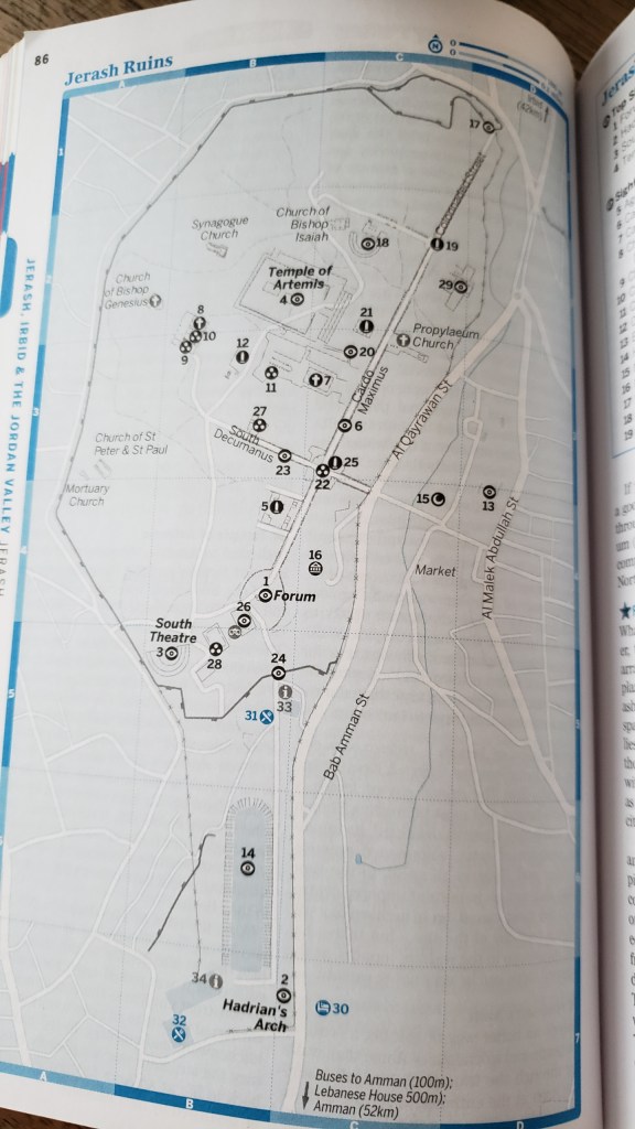
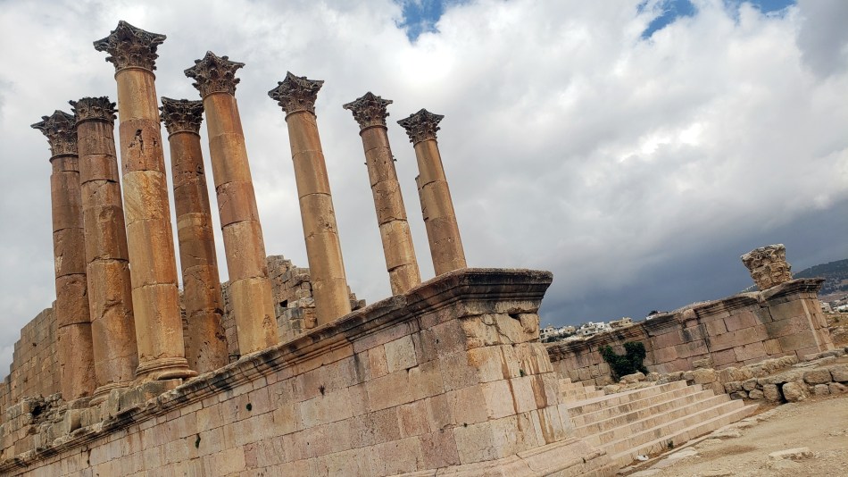
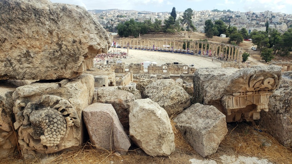
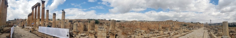
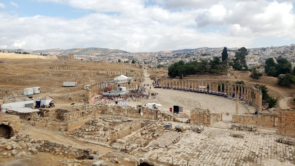
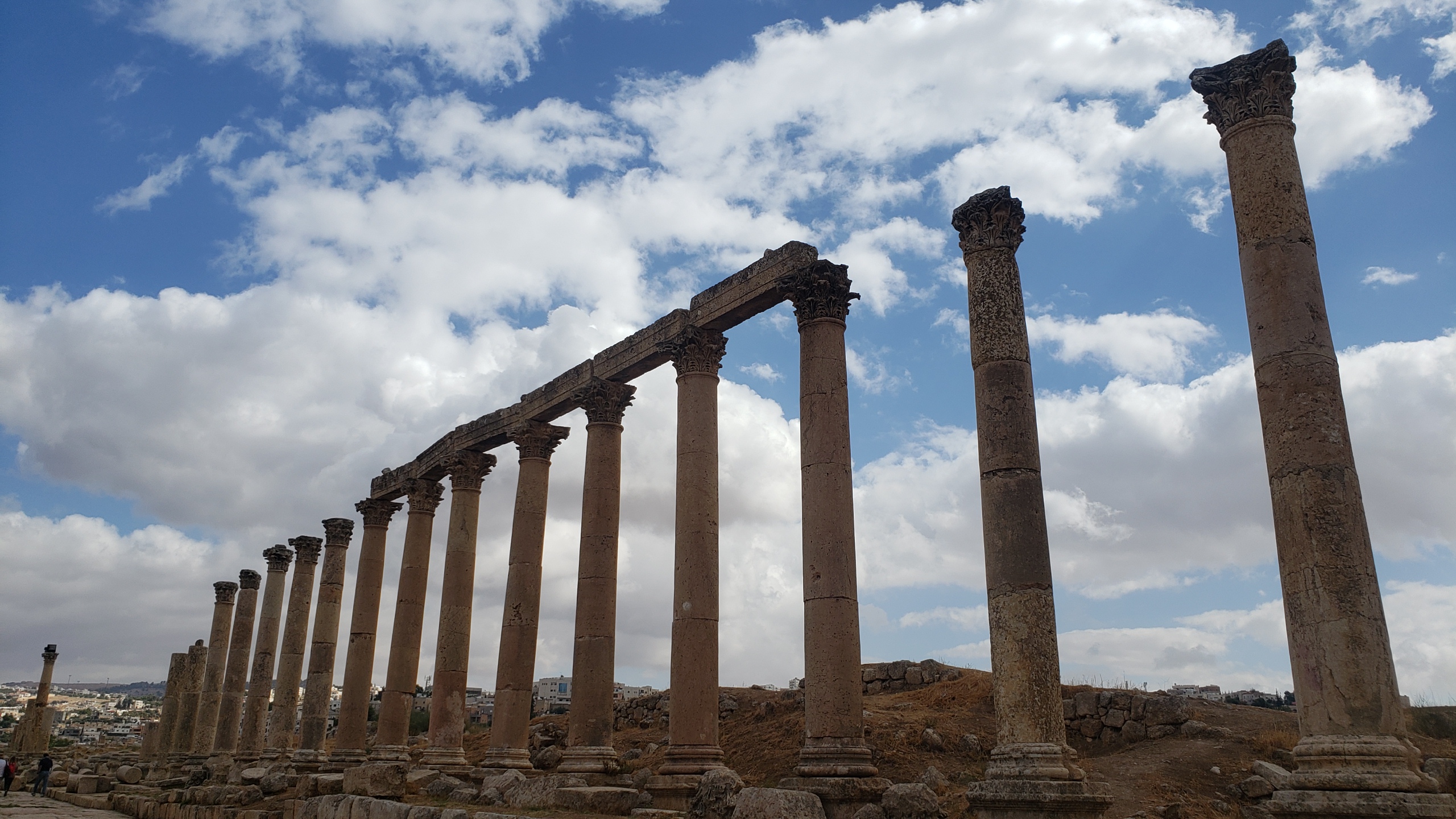
I’ve decided in this post to show you a map and to orient you a bit more. So far I’ve shown you the southern areas, where you enter the compound now: the grand entry at Hadrian’s Arch, the expansively open and moody Hippodrome, some of the columns and atmosphere of the Lower & Upper temples to Zeus. As you see from the map here, these are all one small corner at the southern end of this ancient city. From the hill of the Zeus temple (behind which is the South Theater), the main path takes you down to the Forum, a vast open oval plaza defined by columns which are largely still quite intact. From the Forum, you walk north into the Cardo Maximus, a long colonnaded street which would have been full of life and vendors, temples and businesses back in Jerash’s heyday, I suppose. In Jerash.5 I showed you precisely this: the Forum with the Cardo Maximus stretching off through the ancient city to the north and east, and today we’ll show you some of that.


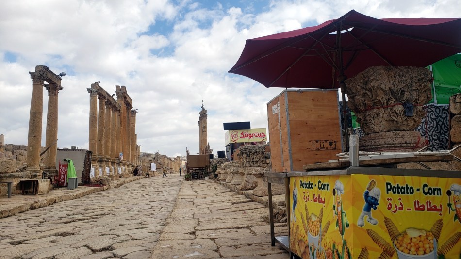
Today that Cardo Maximus main street is full of tourists and tour groups, with the occasional food stall selling Potato-Corn. 😊 (Which I chose not to sample, tempted though I was.) This is where it grew very complicated for me to identify which building I was looking at. In some cases I snapped a photo of the info signs as I took photos. Thus I knew, for example, that clusters of photos taken around the same time as I snapped the signs for the Temple to Artemis, The Cathedral, and the Fountain Court are likely related to those items. You have those to look forward to in future posts – they’re later on the route. Today, we’re orienting you and myself.
 I do need to add a caveat, though, that the names I’ve given these photos are likely accurate, but certainly not guaranteed. In cany case, I do hope you enjoy all these Jerash pics and posts. My current plan is try to post the rest of Jerash and Amman before I return for the final swathe of Petra photos. Do add Jordan to your bucket list. And when you go, do plan more than a day in Petra, and at least a day to explore Jerash and Amman as I did. And get a true printed guidebook before you go – that was one of my very best decisions, and I can recommend Lonely Planet which really helped guide me well in both Petra and Jerash…and also Amman. That evening rainy-day bike stop at the book store the day before I flew out was well worth it! 😊
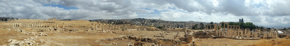
Last tip: if you really do want to follow this and imagine it as an arm chair virtual visit, then it’s definitely best to view these on a full computer with a large screen in the desktop view. This way, you can easily click on the link for “Jerash” at the bottom of each post (if you’re viewing this on a computer now, it’s right below this – Jerash, then Jordan) — and then you’ll see only the Jerash photos without having to sort through any other series or posts. I do that myself when I need to check what I’ve already shown you. Phones are PERFECT if your goal is just “get a quick sense of what Paul’s been seeing.” But on a phone you won’t know much detail even if I’ve shared it, because often the answer is visible only on what wordpress calls the “full site,” in a link you’ll find at the very bottom of your phone screen, probably 😊.
Jerash.5
 Although Jerash was mainly a Roman town, for some reason the first two main buildings you come to after the grand Hadrian’s Arch and then the Hippodrome are the Lower and then the Upper Temple of Zeus. Don’t ask me why they’re calling it Zeus in the guide book, when we all know the Romans decided to call the guy Jupiter instead of Zeus. 🙂 Both yesterday’s post, and the next several, will have more photos taken in, of, and from these two first main temple areas. The top and bottom shots today were taken from the hill leading to upper Zeus. The shot just above, sorry to say, got renamed incorrectly so I’m honestly not sure what time I took it, so I don’t know where it was taken, so — you can call it anythign you want! And yes, my beloved loyal reader in Houston, there will be more lovely puffy white clouds against blue skies to be seen. Enjoy!
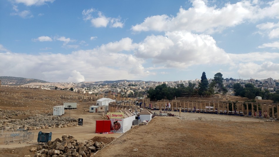

Jerash.3
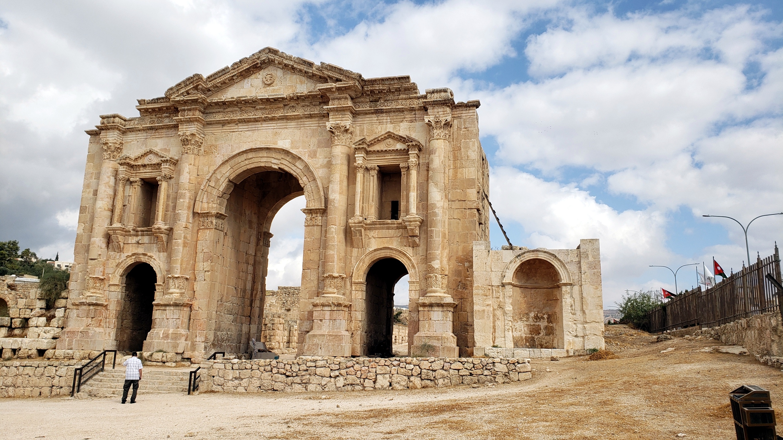
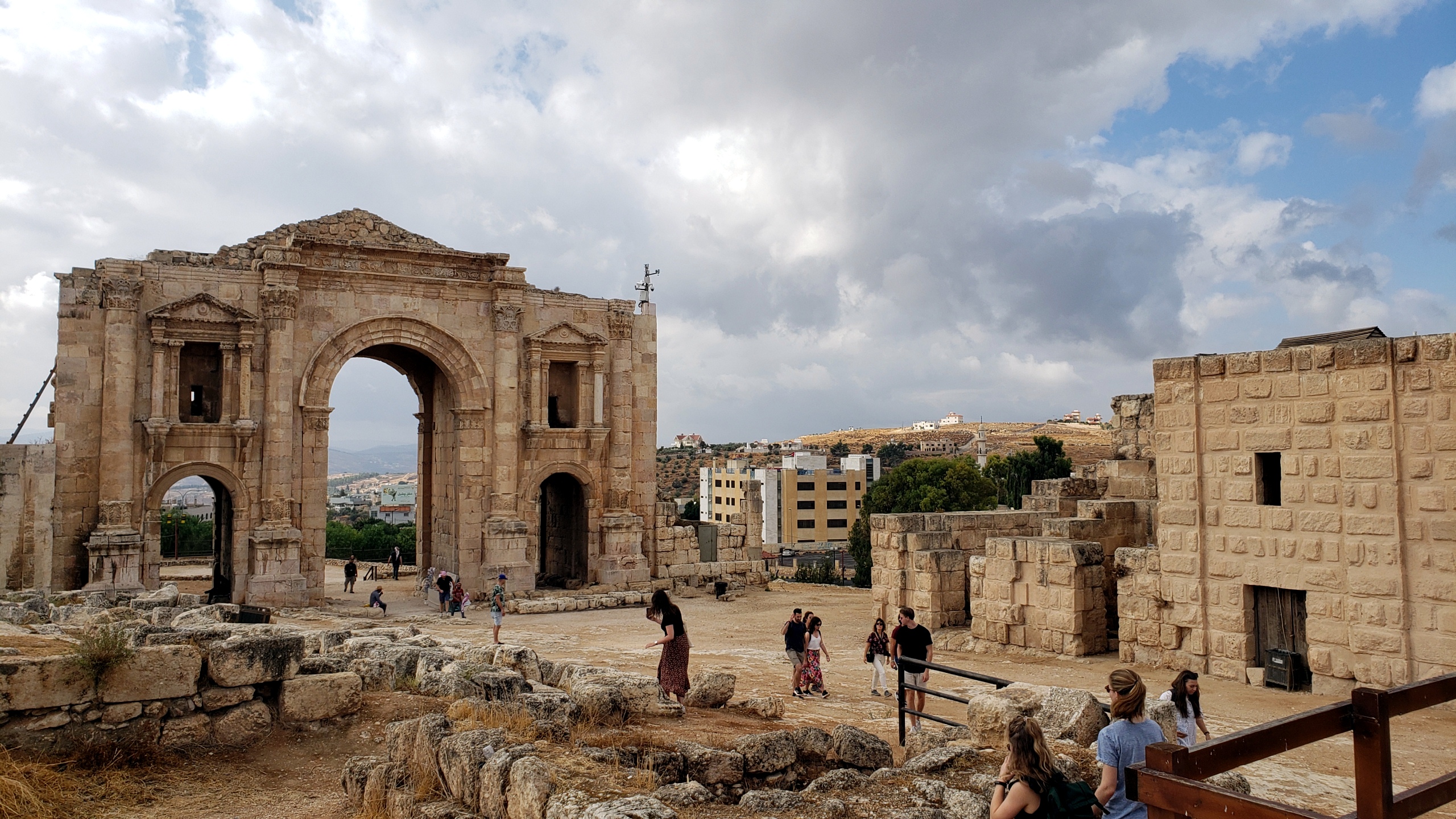
 I think with Jerash, I’ll try to to post photos in roughly the sequence in which I saw them, since it’s a reasonably compact but still quite large area with an awful lot of stuff, and this way I’ll remember what things were so I can name the photos files correctly. 🙂 Above: looking south at the hippodrome with its arches as the south end, and the dramatic Hadrian’s Arch entrance (viz Jerash.2) to the left, and the hills of Jordan and the contemporary city of Jerash beyond. Below: more of the same :-).


Jerash.2
