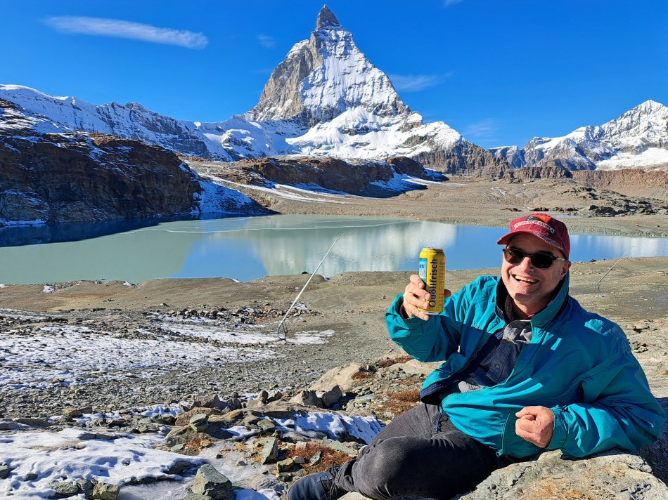
This is the closest I got to the actual mountain; as you see, it’s actually starting just across this lake. The last “From the Air” claimed I was posting all the remaining gondola-ride photos from the trip up to the “Little Matterhorn,” which may be technically true, but then there was also the ride back down, from which you’ll see one shot below and likely more in future iterations of “From the Air.” In any case: during that ride up, I stood just next to a rather strikingly red-headed chap with whom I struck up a conversation and turned out he lives in San Diego, a city I know fairly well. Since we were both solo travelers, he and I then shared our explorations up top, and then decided we’d jointly wander over to this lake just downhill from the bottom of the first transfer station going down. He’d packed beer and snacks with the hope of having his photo taken drinking beer in the snow, but up top there weren’t good spots so we found a suitable spot with just enough snow here, lower down. You’ll see the pics he took of me enjoying one of his beers lower down, as well as a gallery of air bubbles trapped in ice around the lake as well.
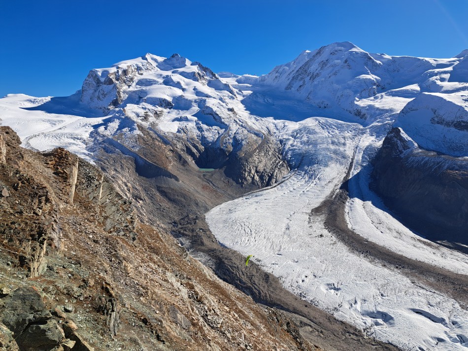
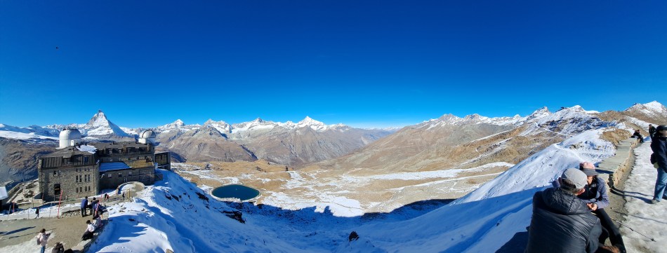
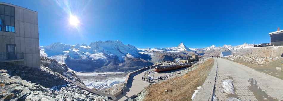
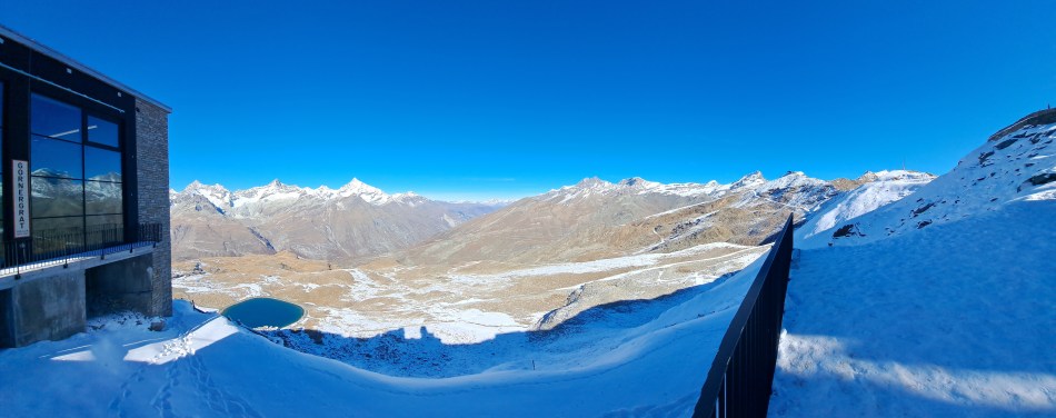
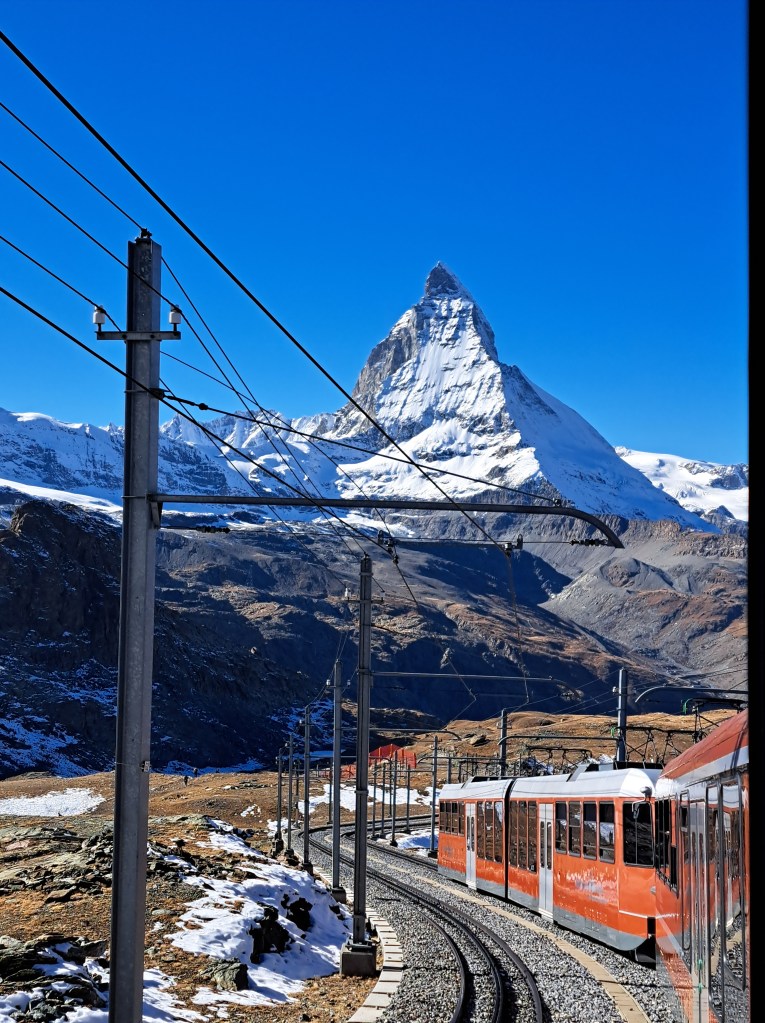
With some apologies, I’m going to throw a large post with a ton of photos at you. These are all the remaining photos that I took during my trip on the very expensive but quite remarkable Gornergrat Bahn, which connects from Zermatt in the valley below, to Gornergrat where (one of?) the highest hotels in the alps sits on a rocky ridge with views to the Gorner Glacier and more. Truly, I edited the photos down but felt each of the many I’m still sharing with you explores a different aspect of this particular journey and afternoon. Or maybe I just want to show lots of photos to make myself feel I got a lot out of the trip, given that the ticket was more expensive than what I’d pay to go from A’dam to Brussels…
Last of the photos taken while dangling in a gondola on my way up to the Little Matterhorn and Glacier Paradise on November 1st :-). Definitely not yet the last of our Zermatt photos, which I am in fact still paring down for quality and duplication-reduction reasons. But you gotta admit, it’s a pretty spectacular region, eh?
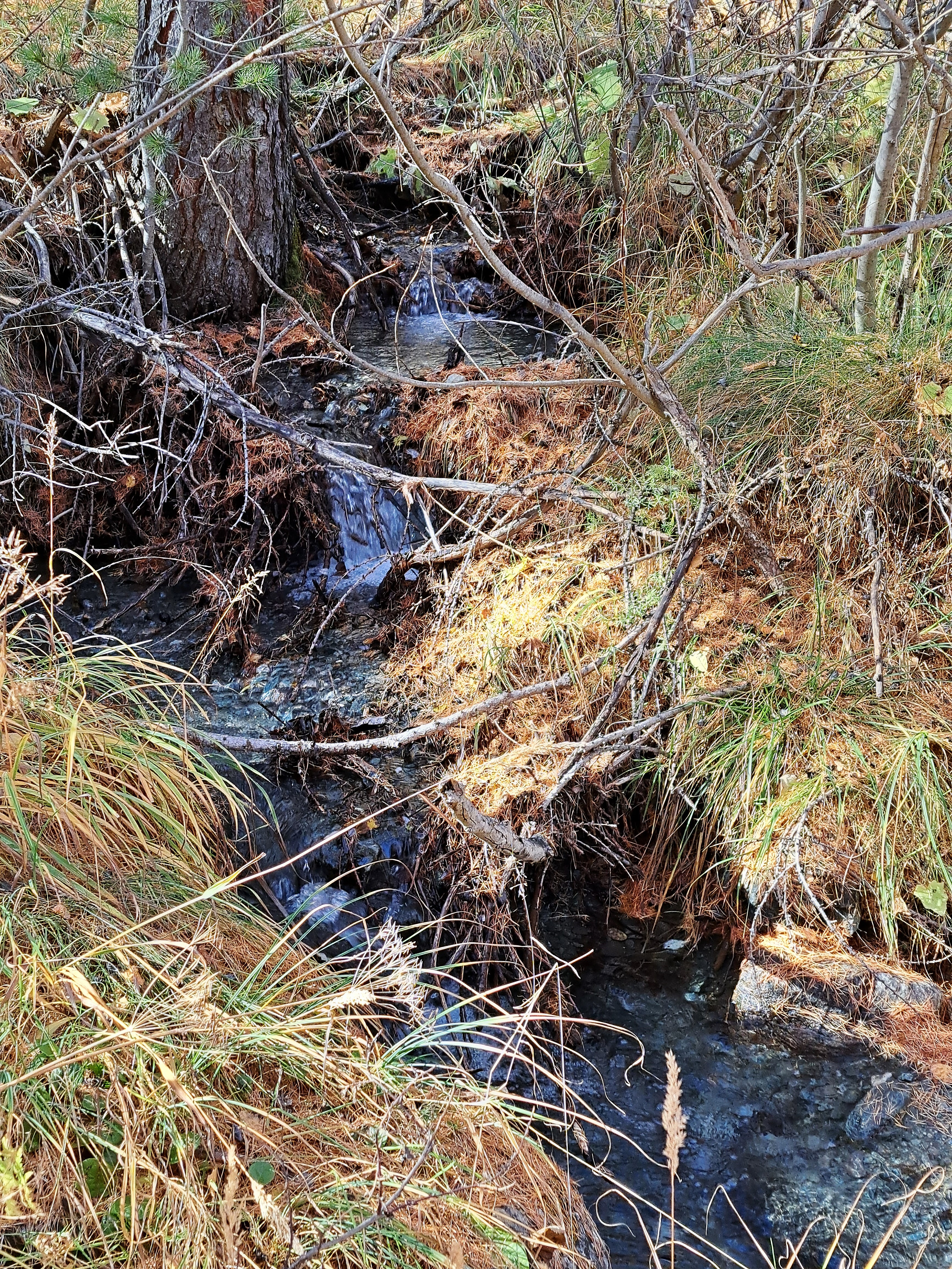
The stream above gets channeled into the pond below, and I believe becomes part of the water source for surrounding villages including Zermatt. But not sure.
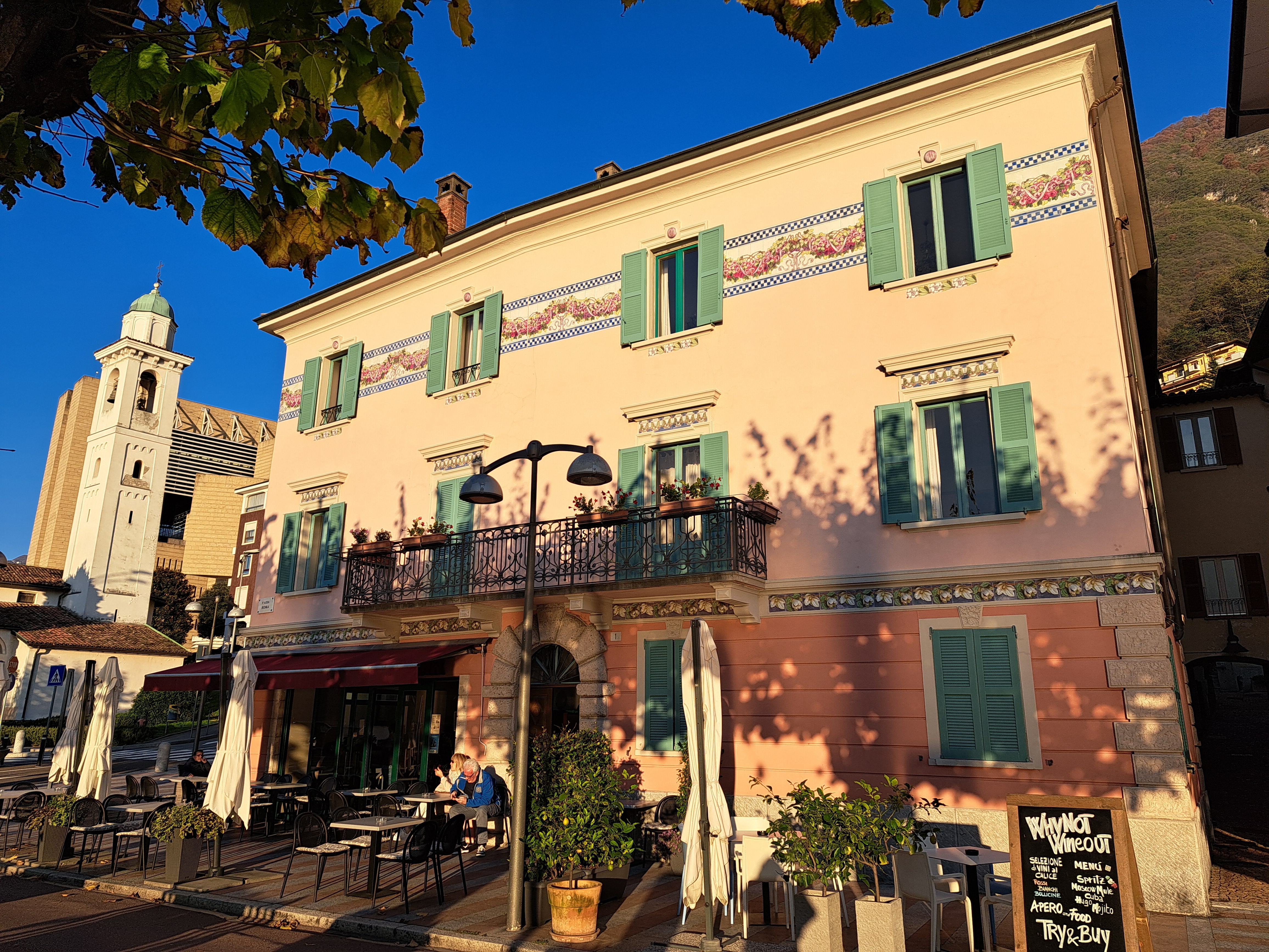
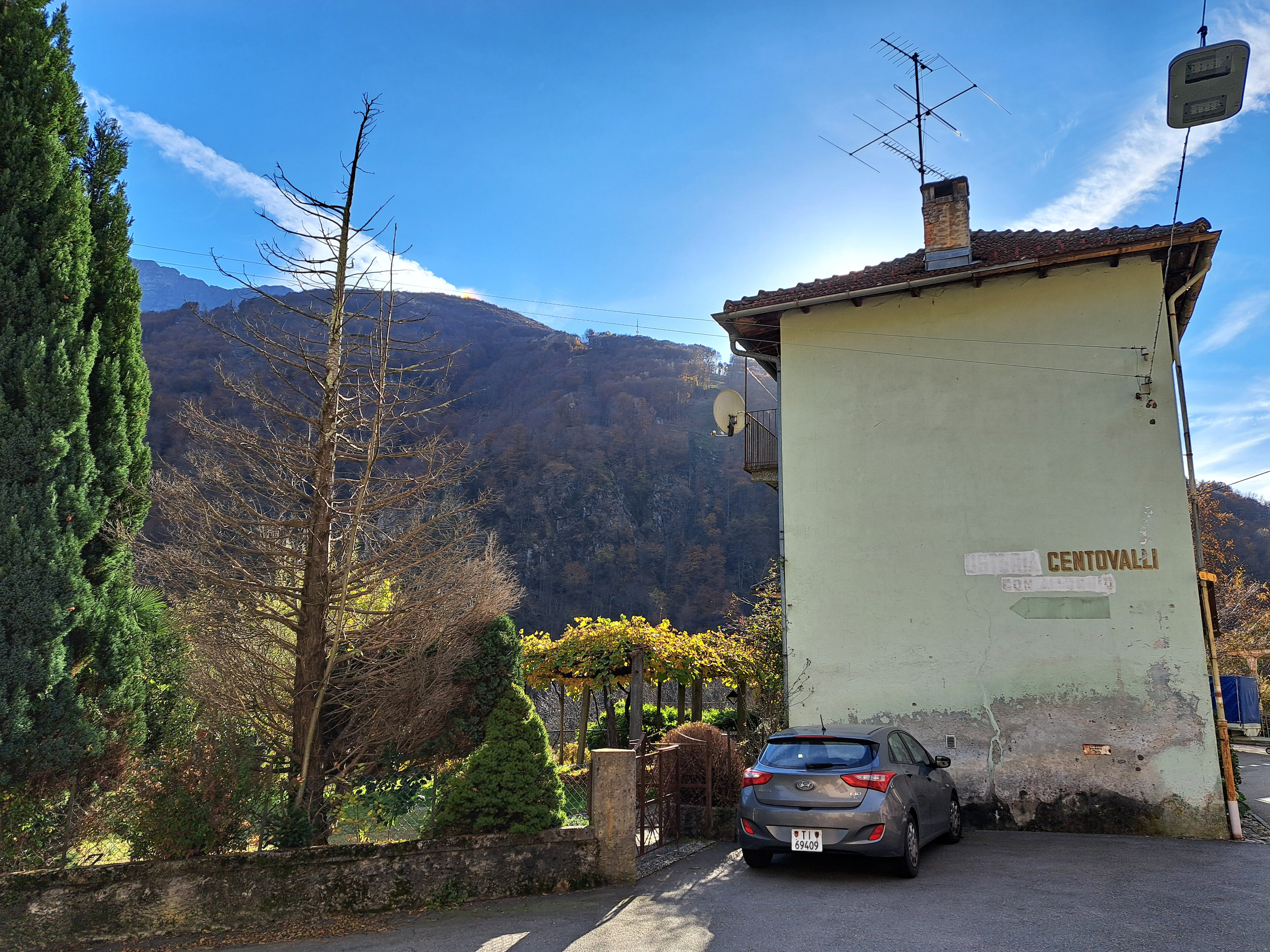
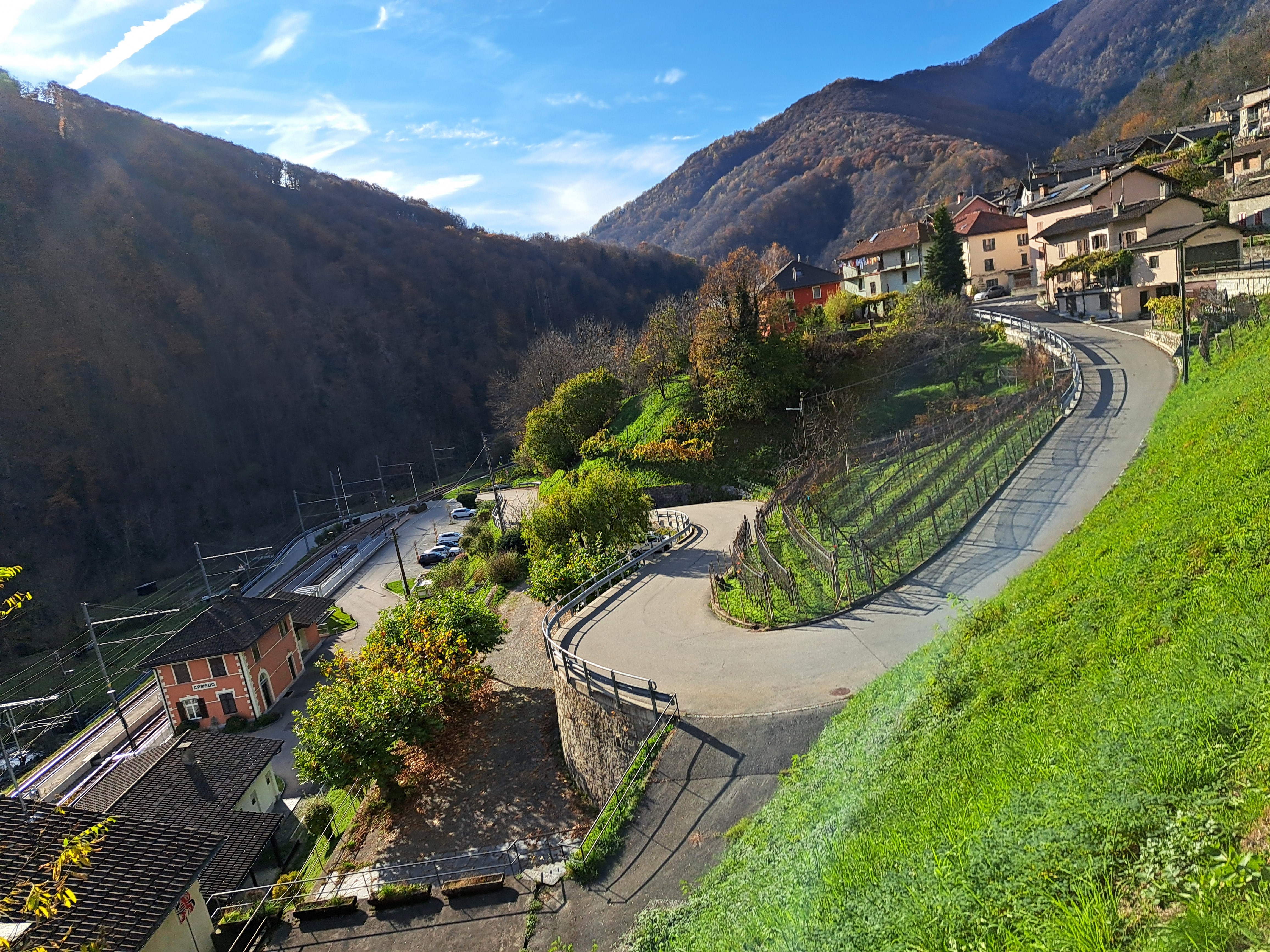
These are all from walks during my first afternoon & evening in Bissone, the lovely mountain & lakeside village in which I spent four days and and nights on the east shore of Lake Lugano, across a causeway and bridge from Melide, which has the train station. Pretty sure we’ve shown you the snake emblem (above) of the town before; if not, you’ll see it again in future for sure b/c these aren’t the last of my photos from that eye-opening visit more than a month ago already.
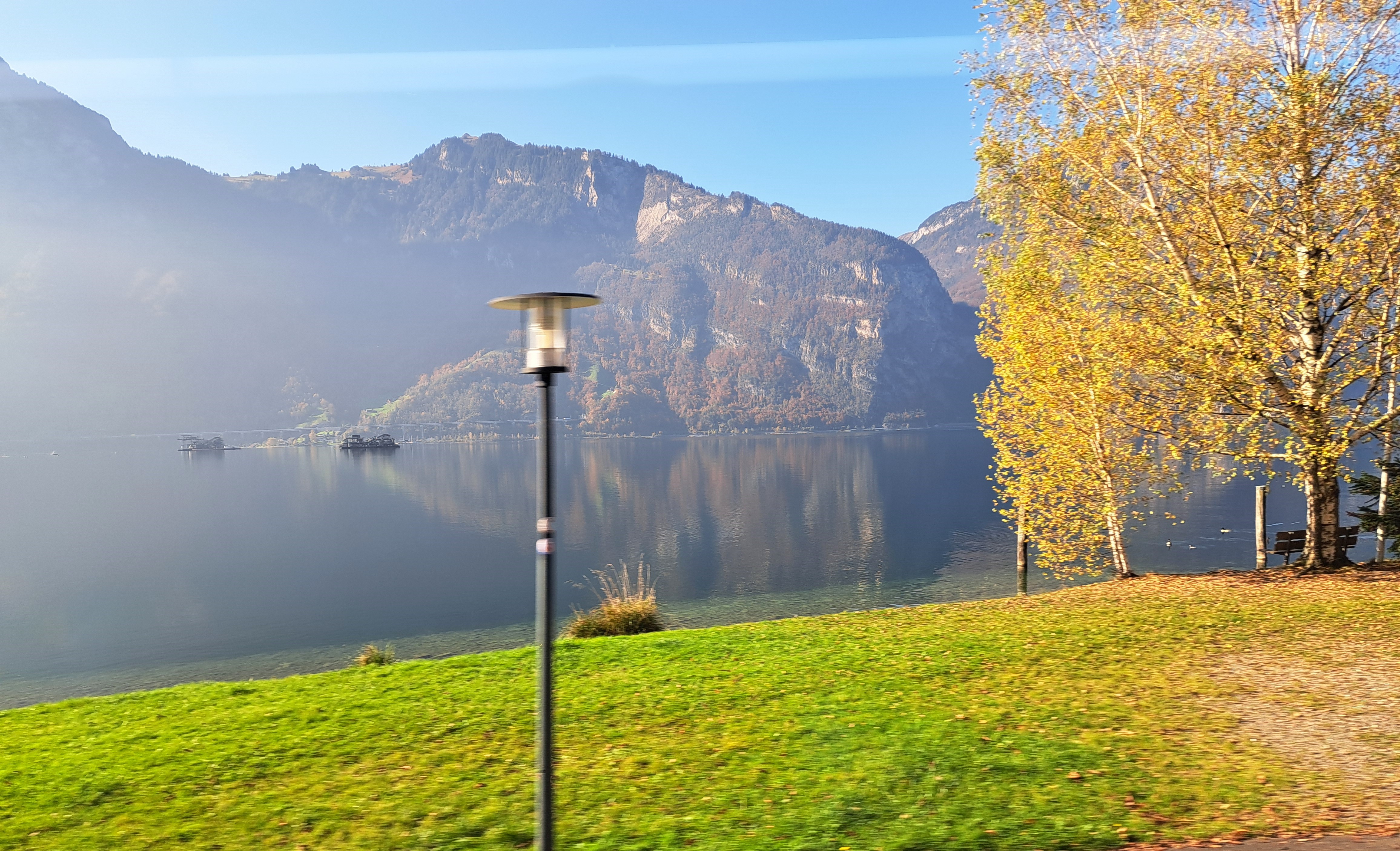
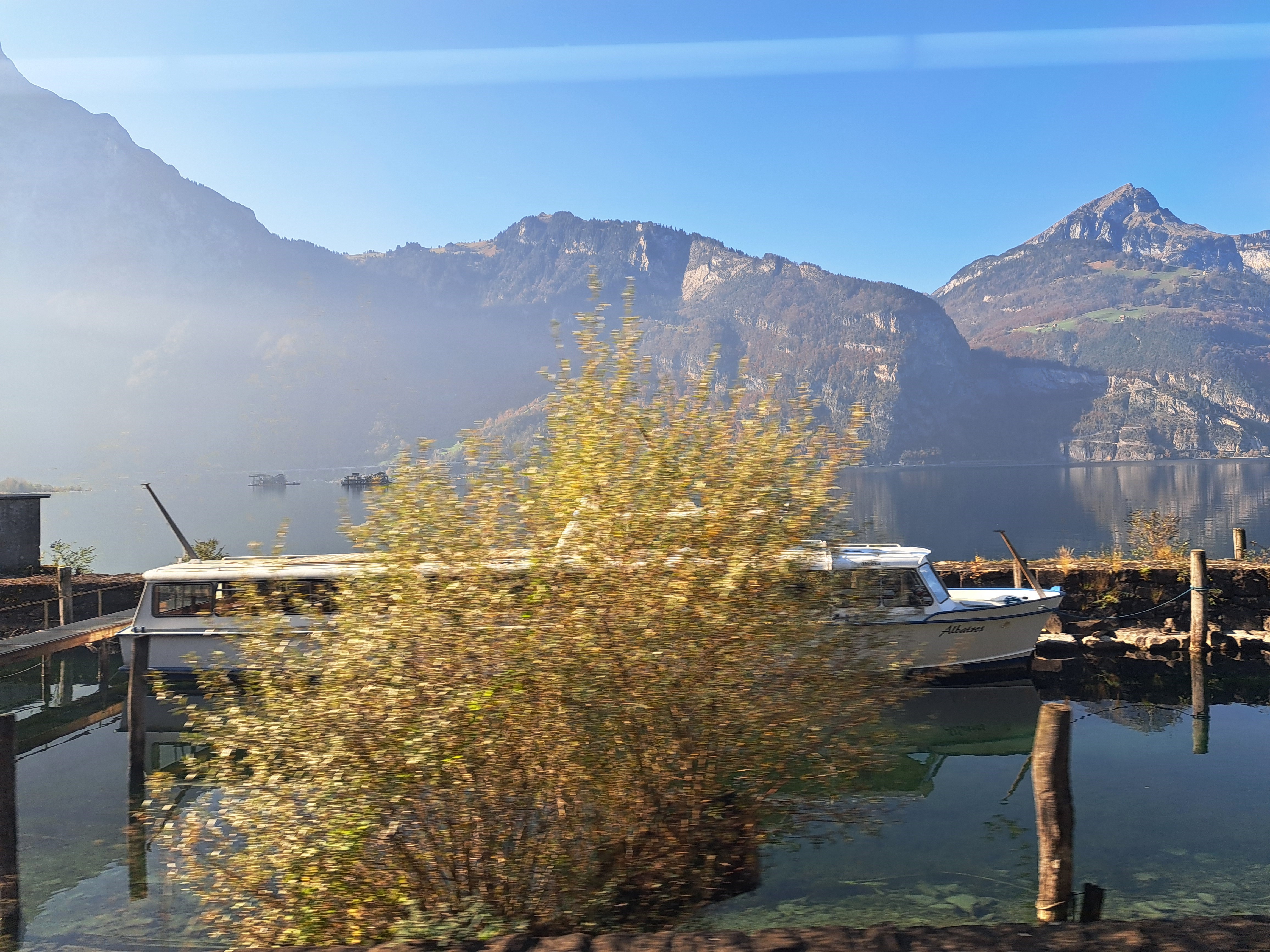
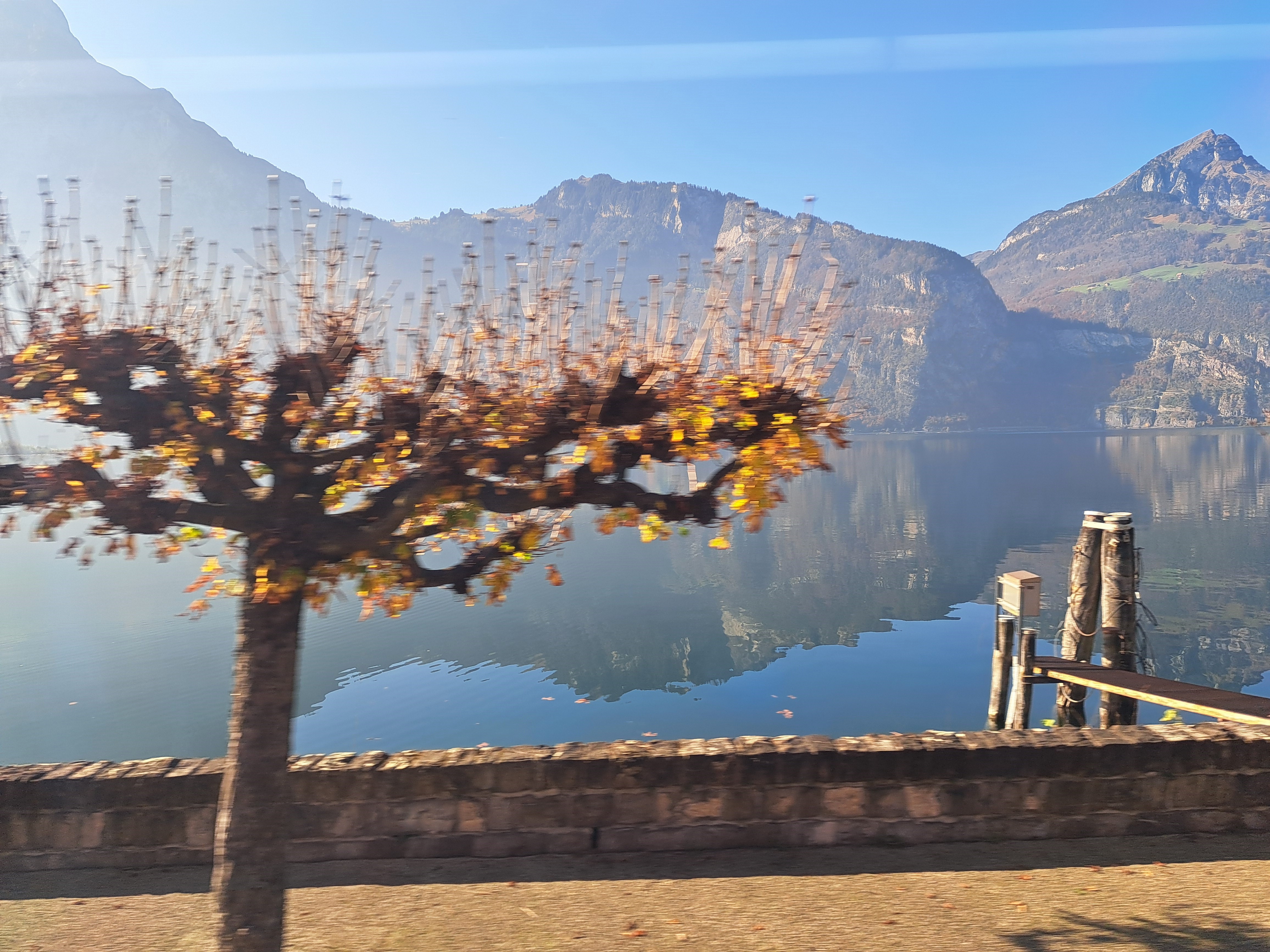
The blessing and curse of train travel through Switzerland is that you see so many beautiful things out your train windows, and you think to yourself “I’m sure I’ll remember which of the lakes and goregeous lakeside towns that our train passed through en route from Locarno to Zurich this one was.” And it turns out you’re wrong, because I’m not sure if these were taken along the eastern shores of Lake Lucerne, or the Zugersee. I’ll need to get back there some time to identify it properly :-).
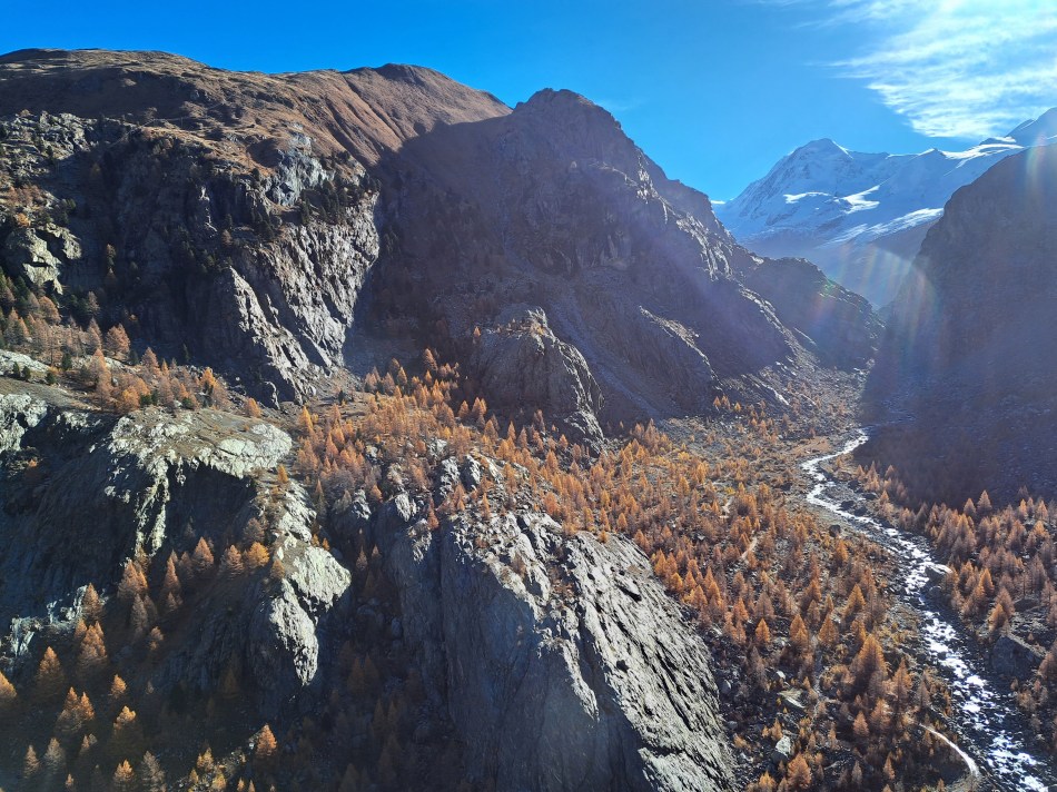
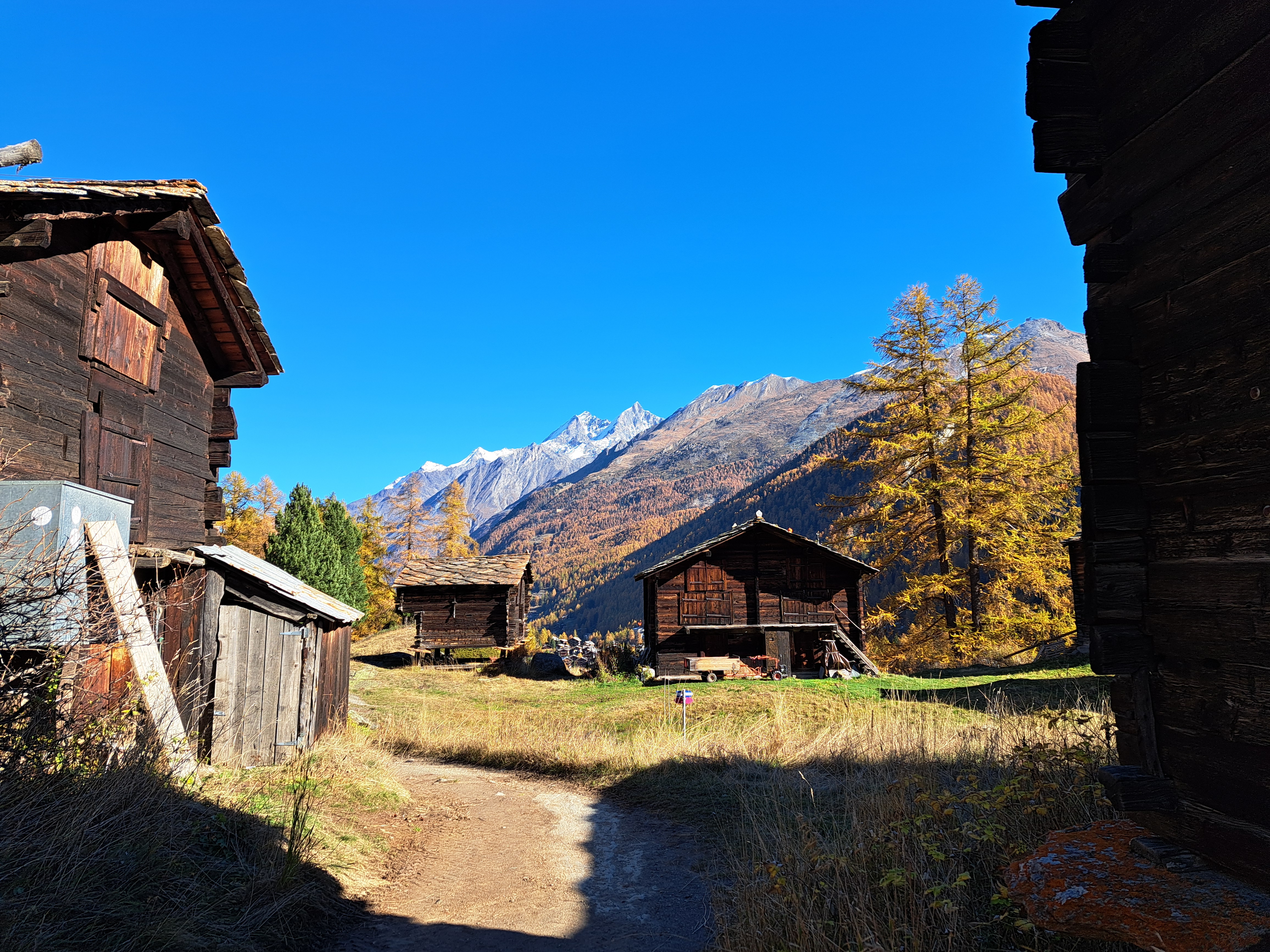
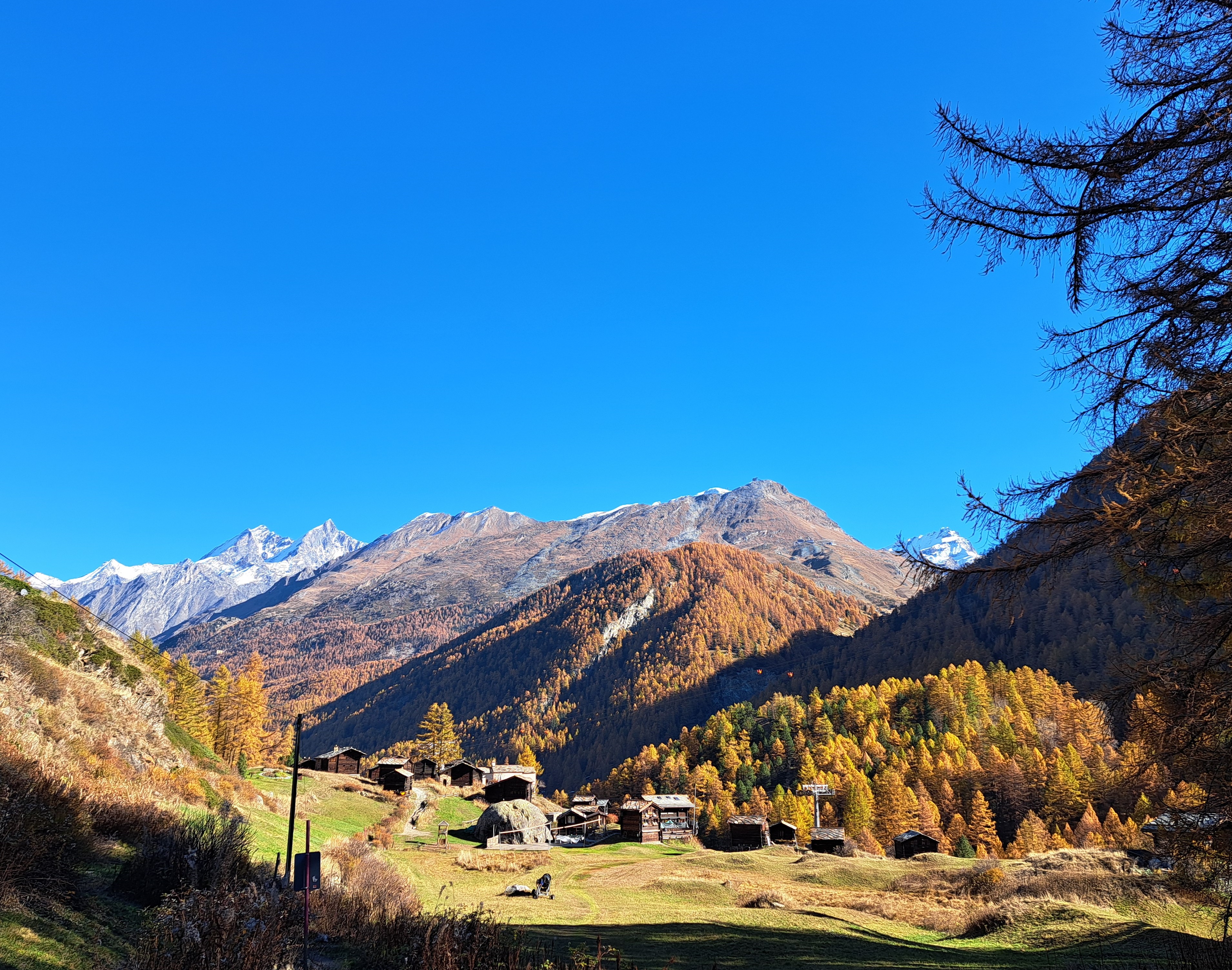
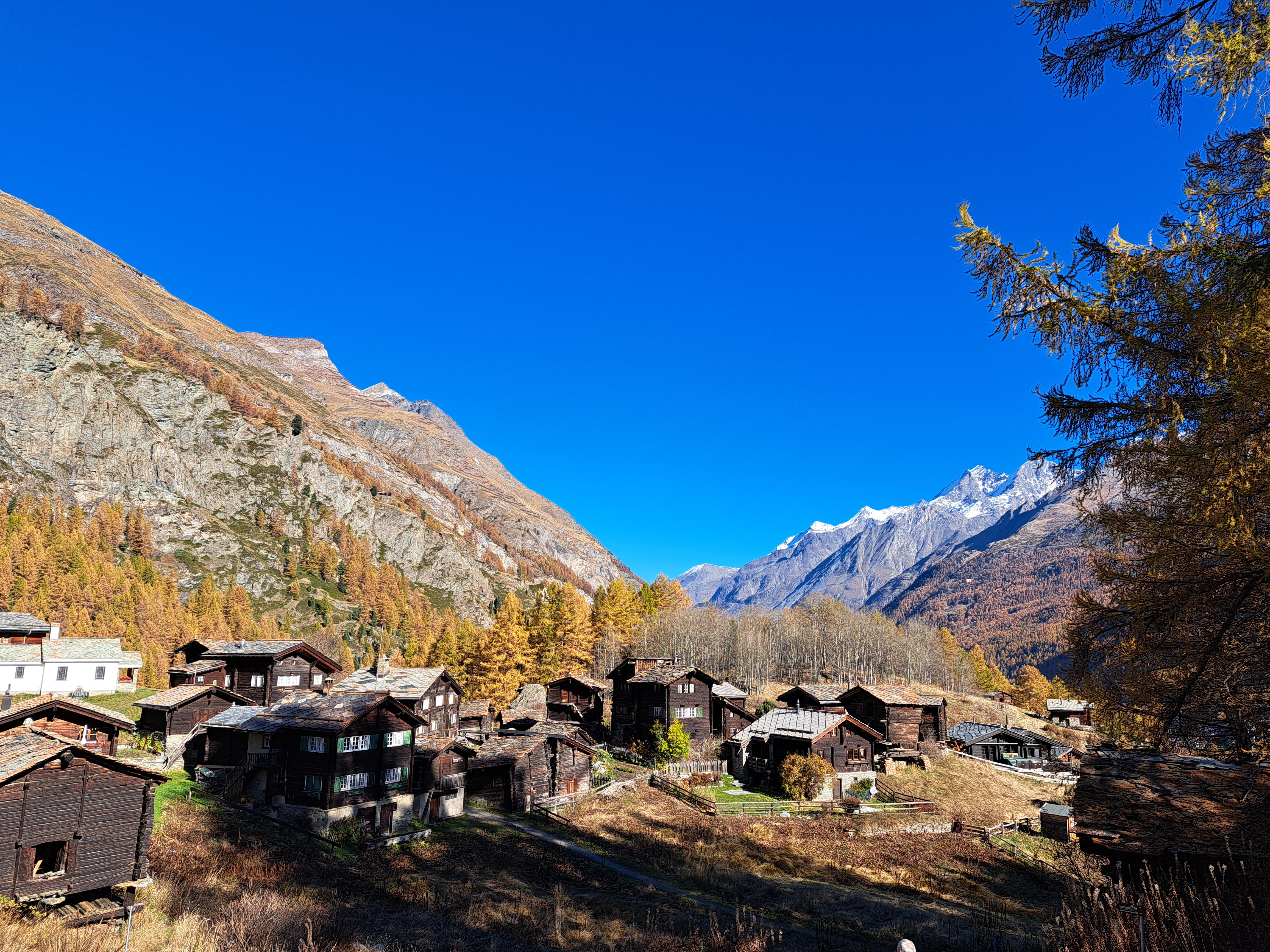
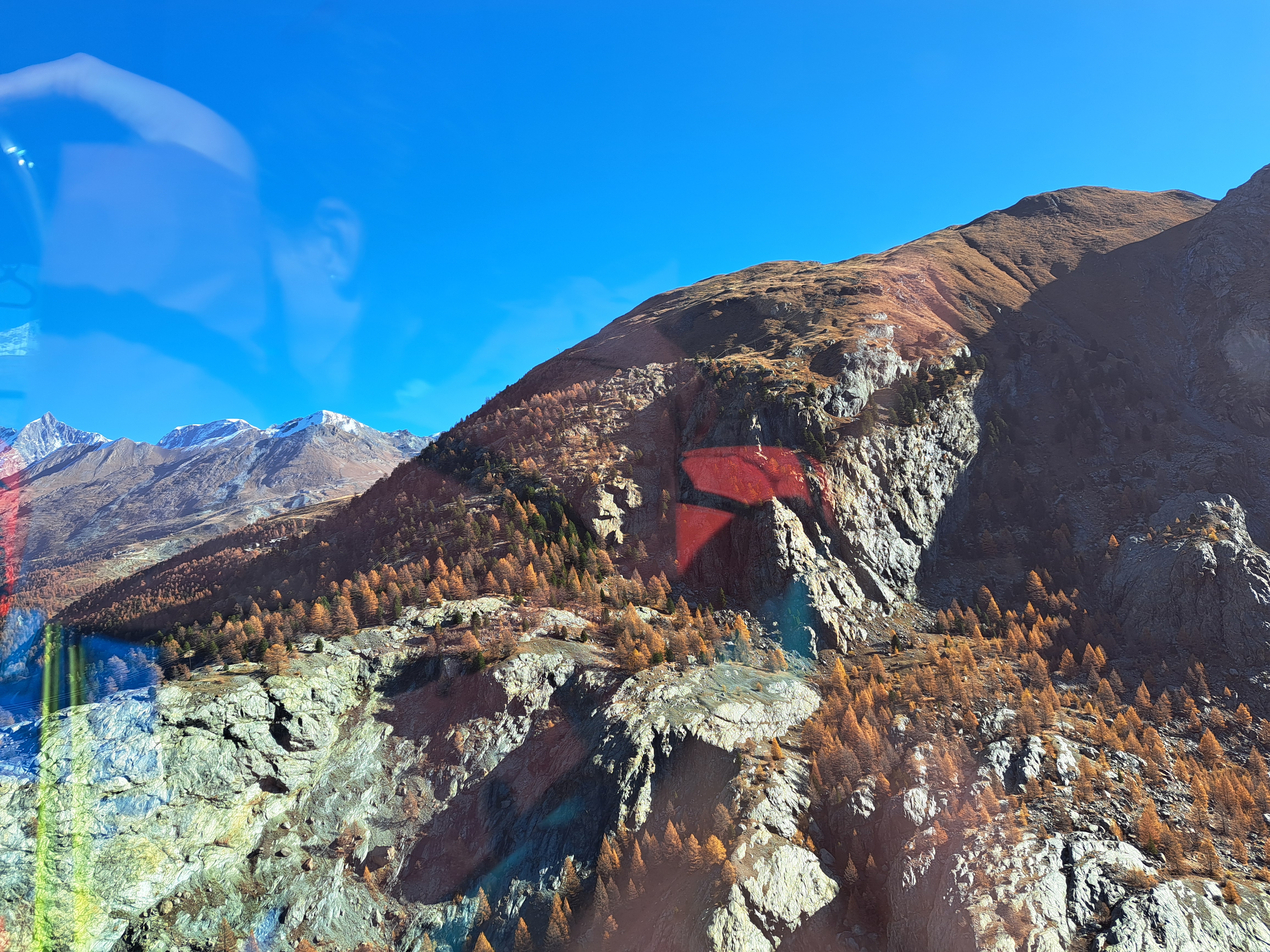
More from the first morning’s exploration of the slopes between the town of Zermatt and the Matterhorn. Only the bottom image here shows the Matterhorn itself b/c the other four photos were looking north, back down-valley, as I climbed up towards the hanging bridge over the creek that created the valley.
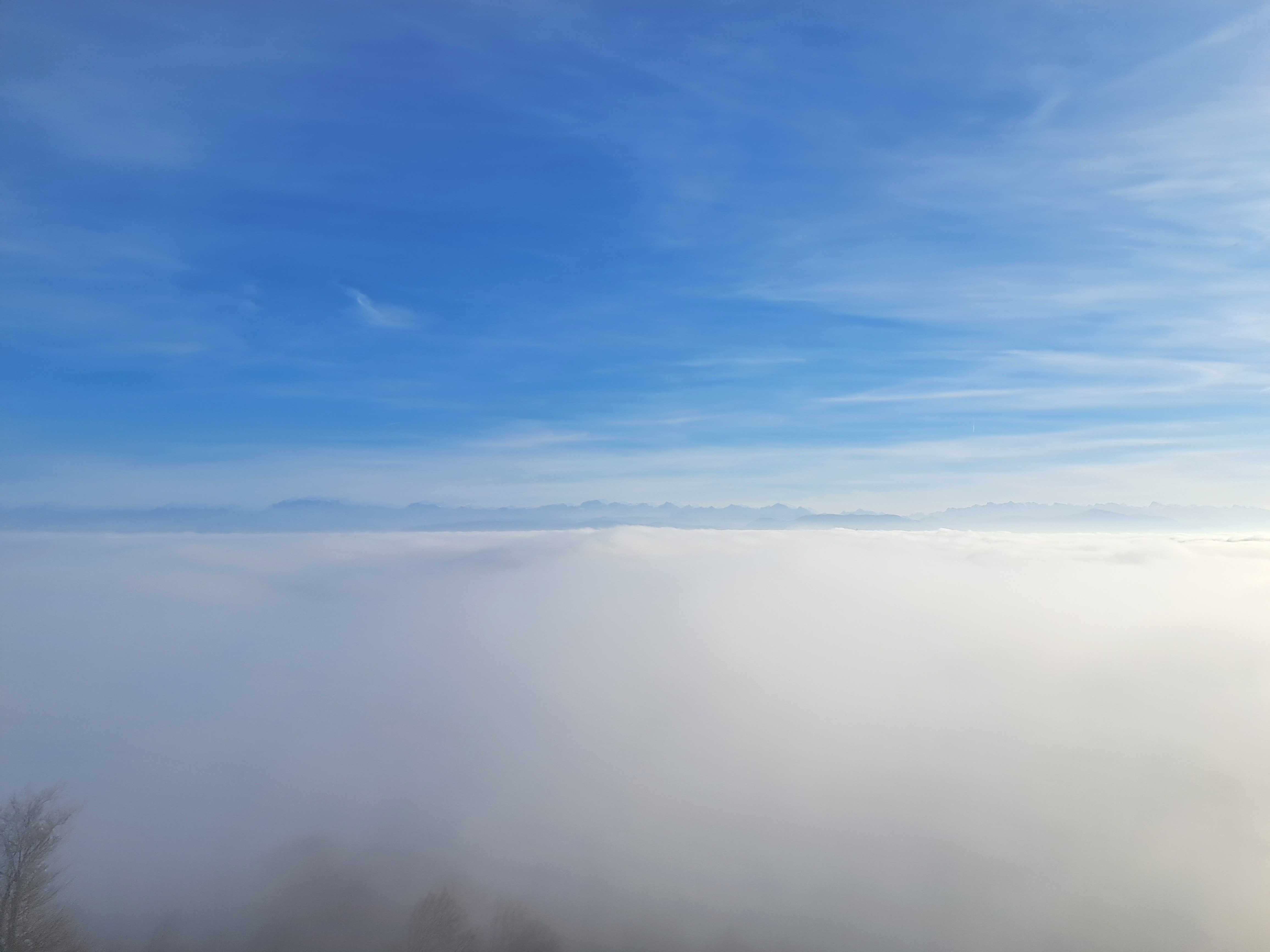
This is Uetliberg, 870 meters (2500 feet) or so above Zurich. Spent the last night of my Switzerland say, and then this last day (before the overnight train back to Amsterdam), exploring the city with a local friend who was also my host. We hoped the clouds- mist – would clear so that from the viewing tower, we’d see Zurich. But as this gallery demonstrates, from the viewing platform a long climb above the top of the mountain proper, the mountain itself and everything below it was still shrouded in clouds and mist. But the alps rose above the clouds :-). In the bottom photo, you see just a bit of a tree ghosting into the bottom left corner, while the southern alps rise above the clouds in the distance. It was an interesting and somewhat surreal experience.
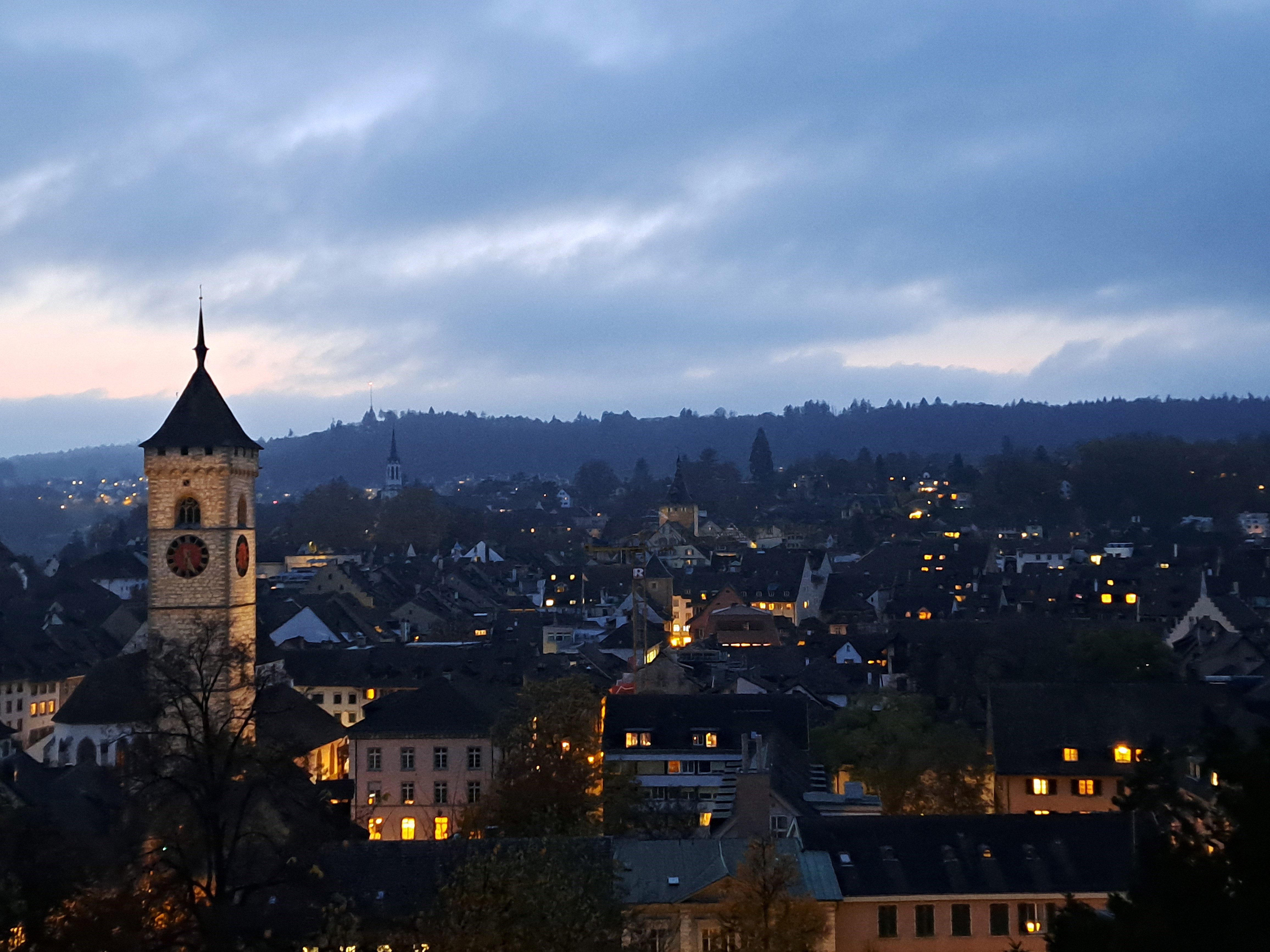
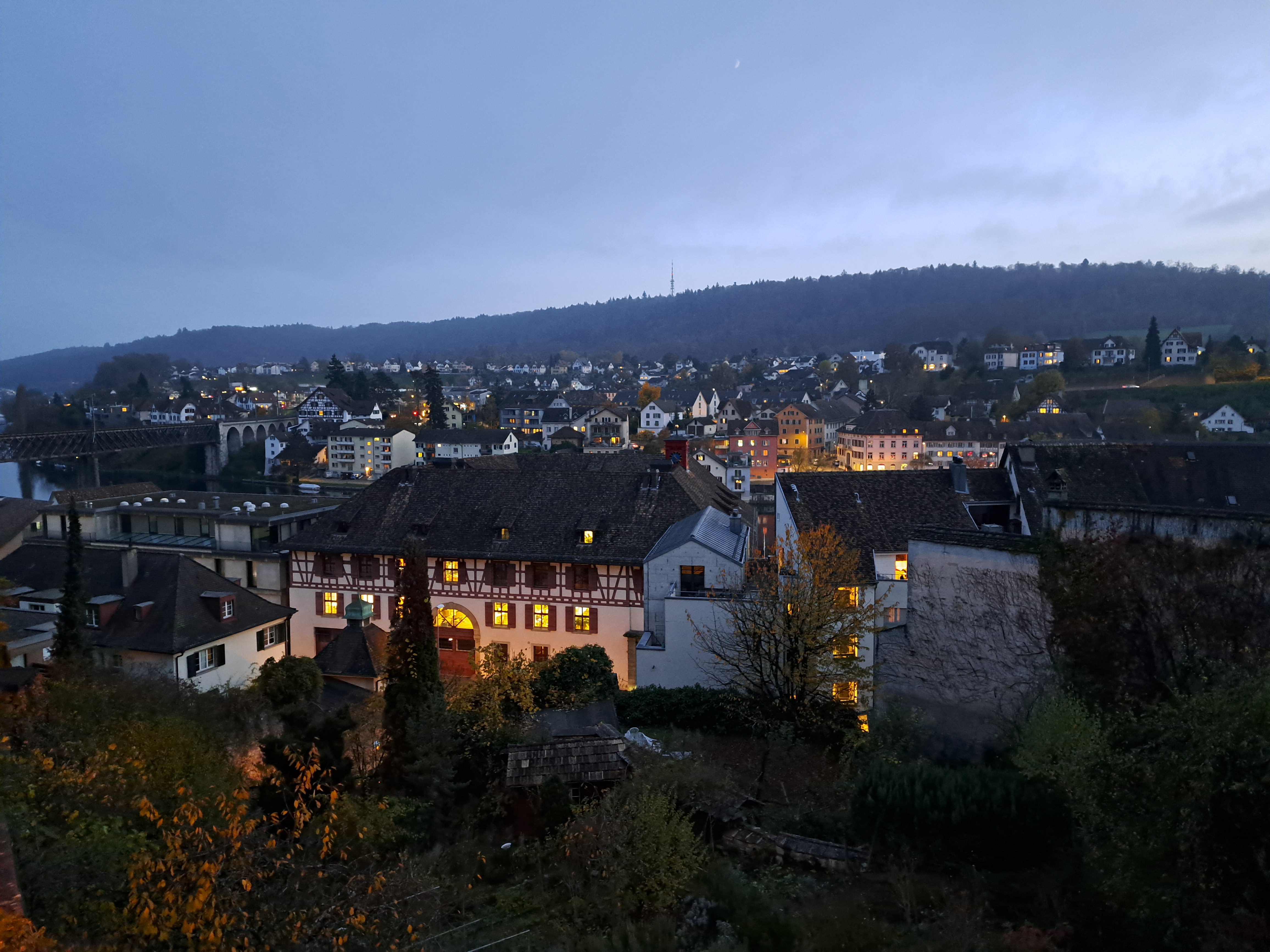
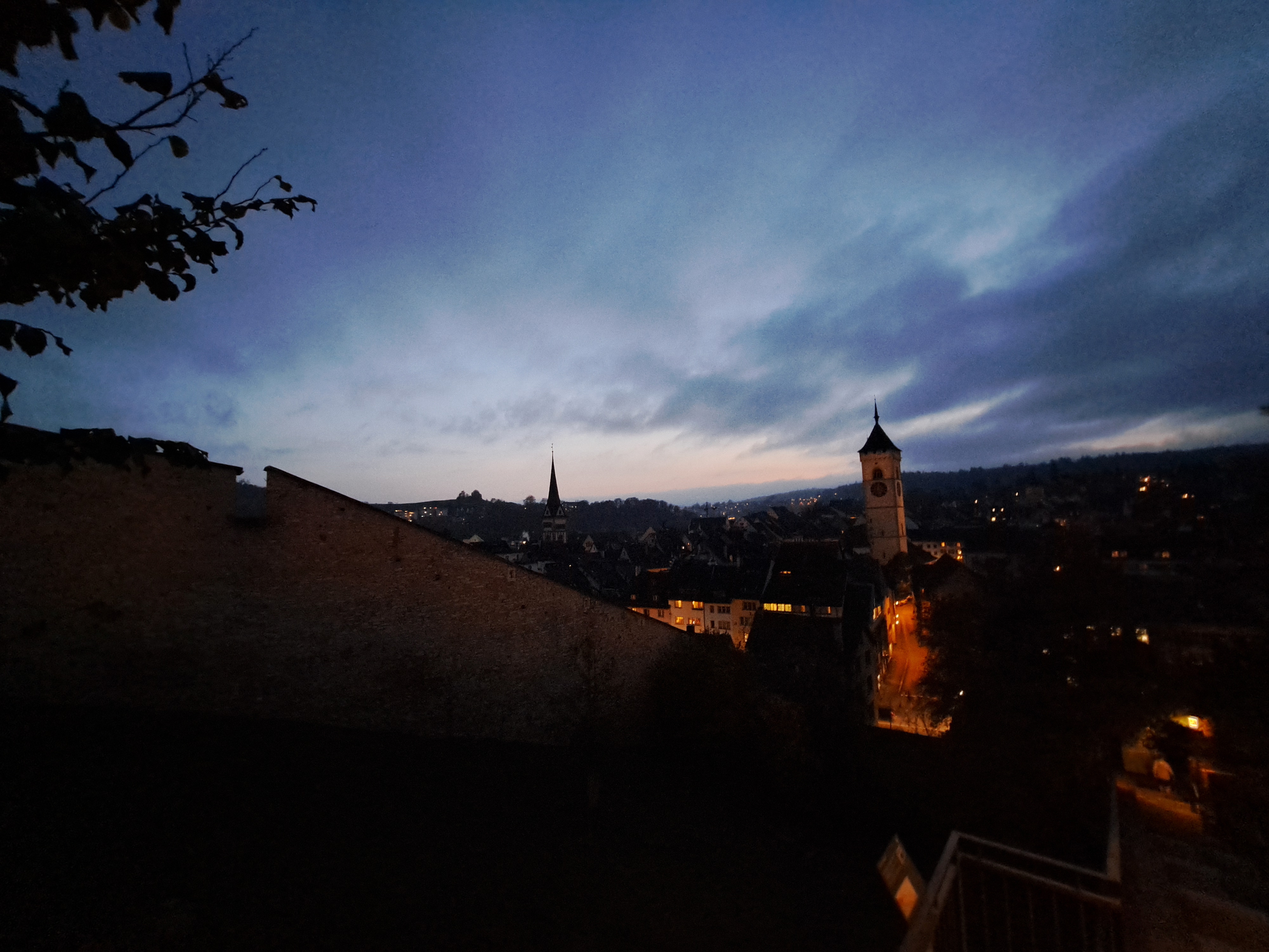
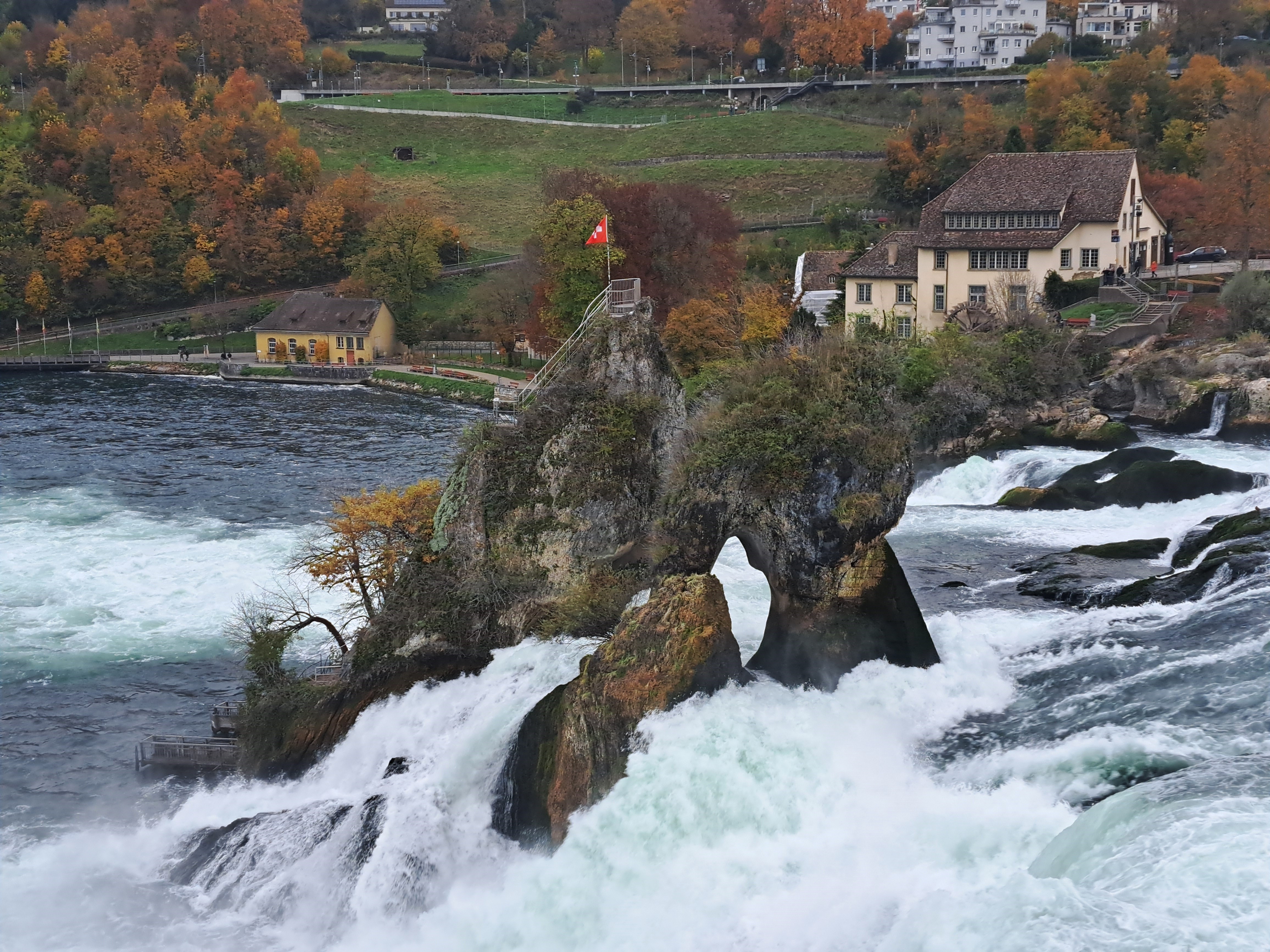
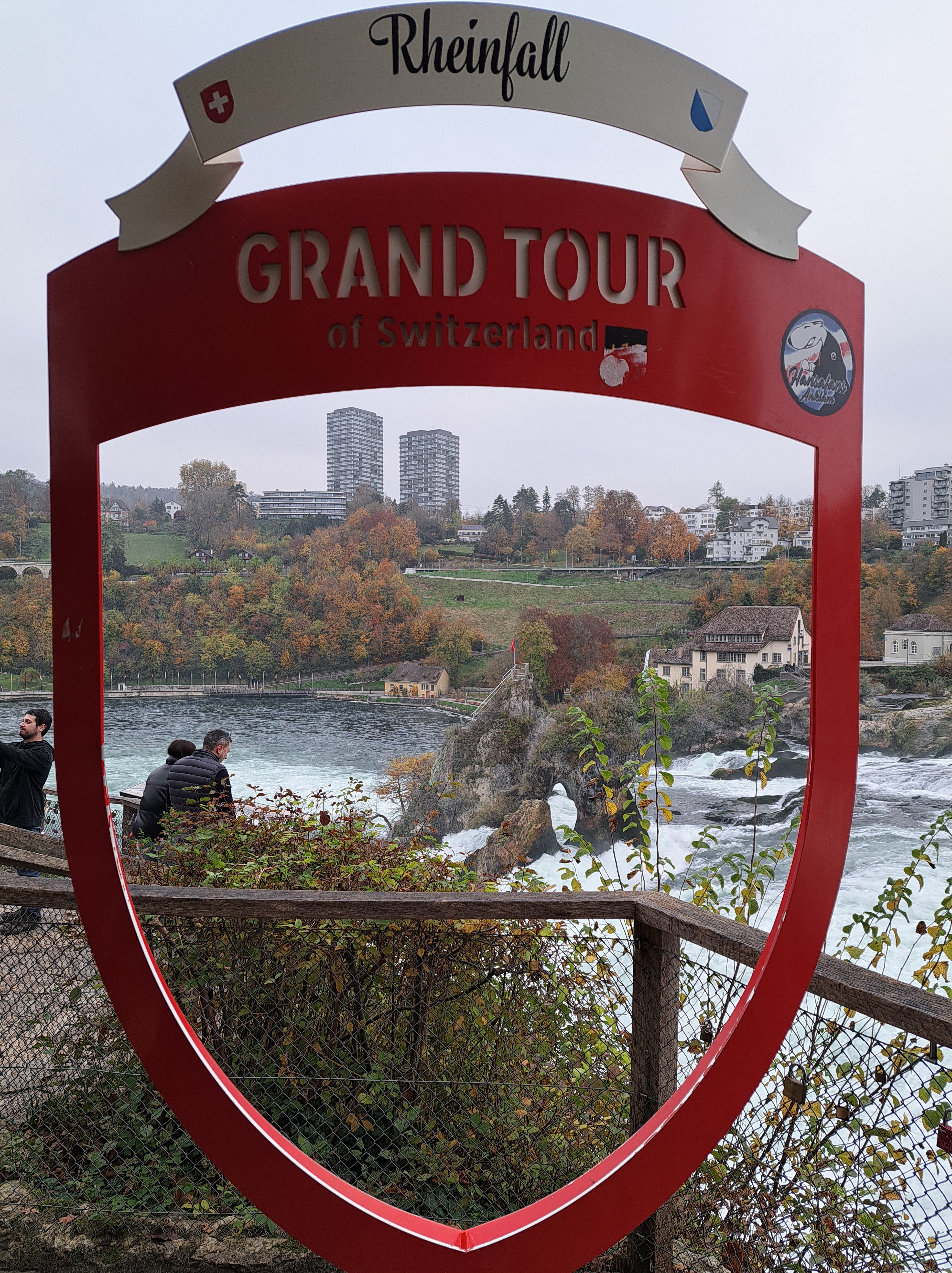
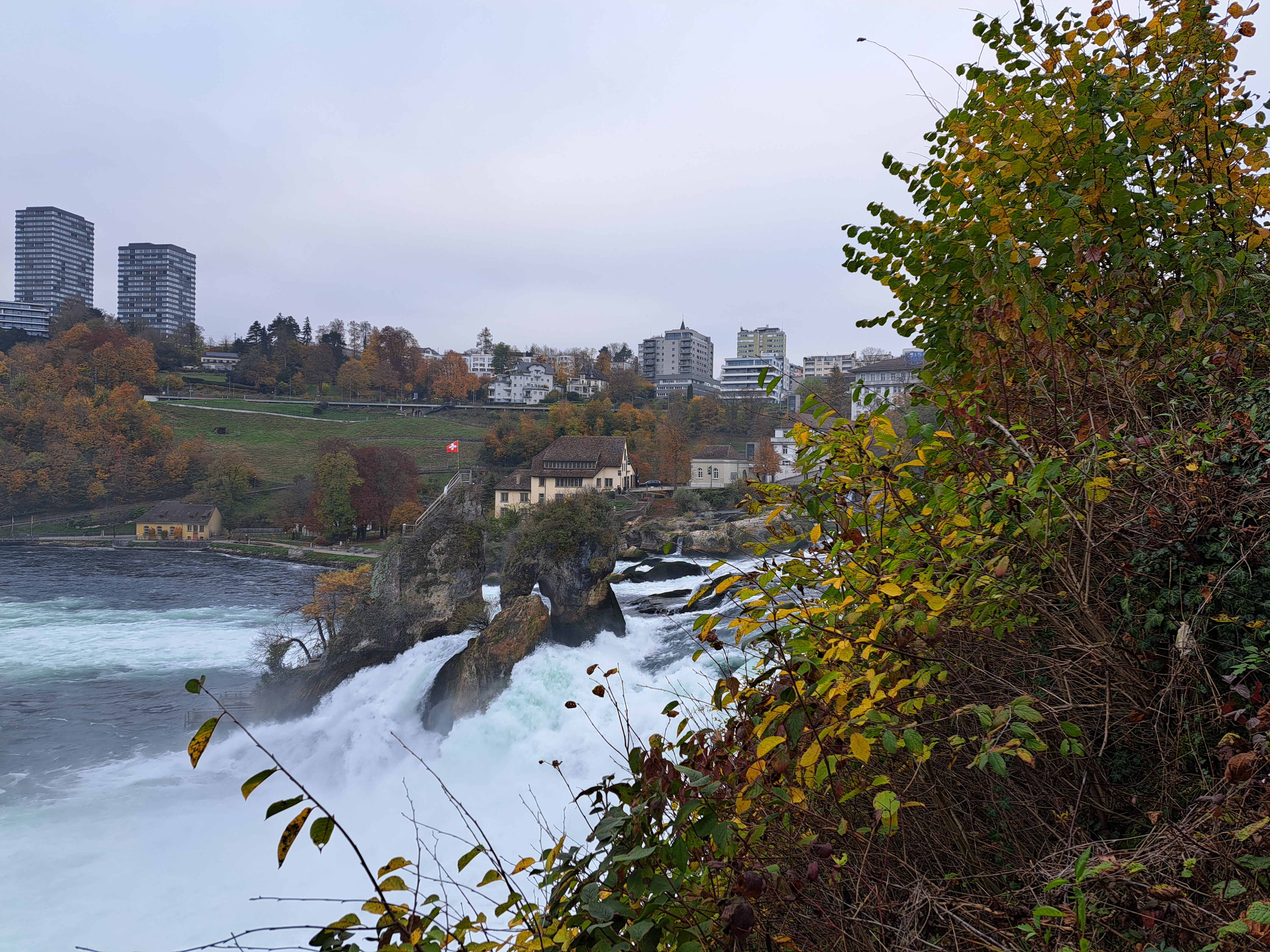
Schaffhausen, back in northern Switzerland, at dusk. Zermatt, a stream whose mountainsides featured in that last post, is the southernmost German-speaking town in Italy; Schaffhausen is pretty much the northernmost canton in Switzerland…and is both German-speaking and largely surrounded by Germany. And also hosts Switzerland’s other exclave (remember the Italian Campione?), a German town just upstream from Schaffhausen which has no direct connection to the rest of Germany. No, I didn’t have time to make it there: was too busy enjoying the mulled wine and hillsides, plus Schaffhausen’s most famous feature, which we’ll show you in the next post :-).
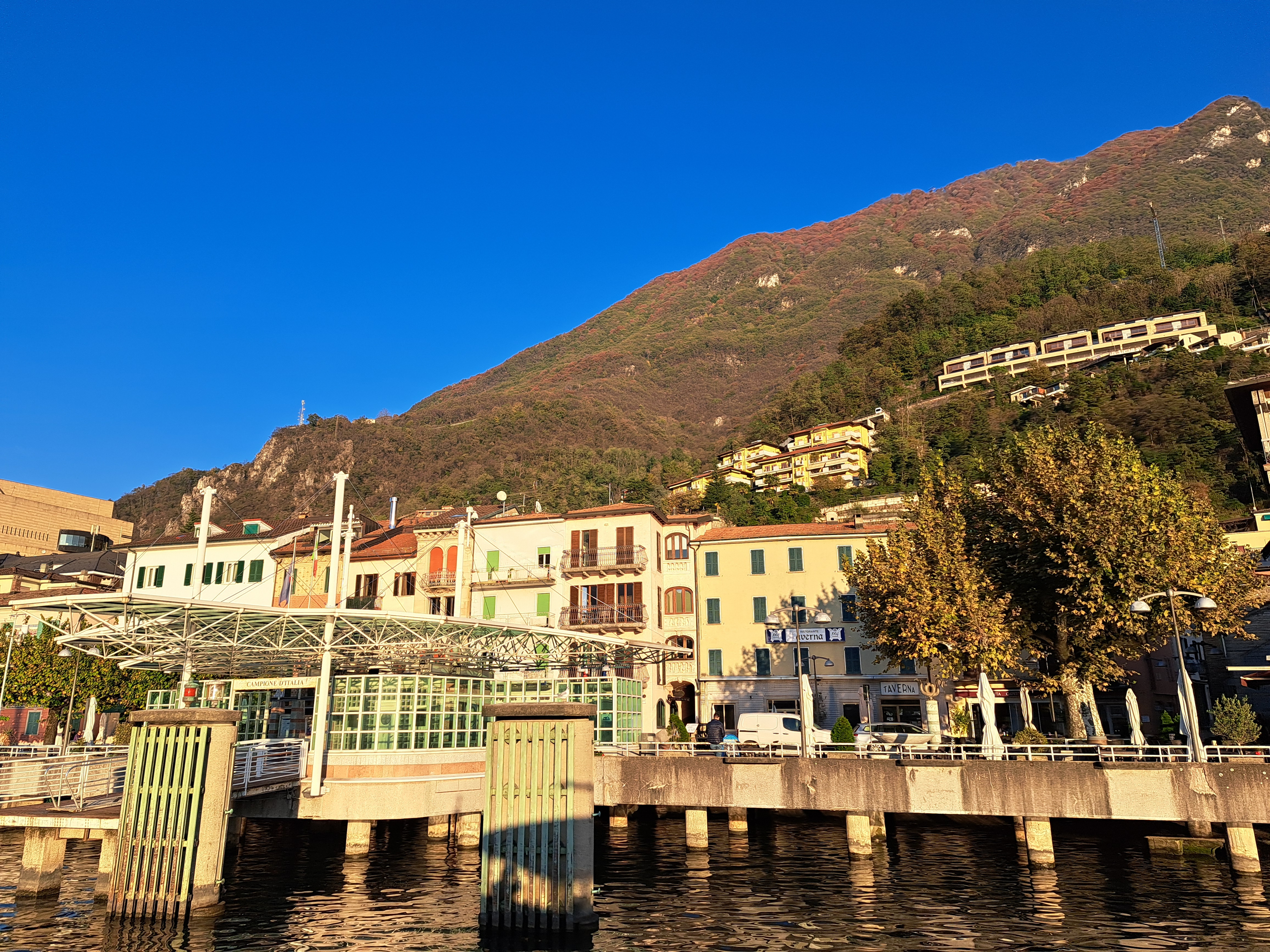
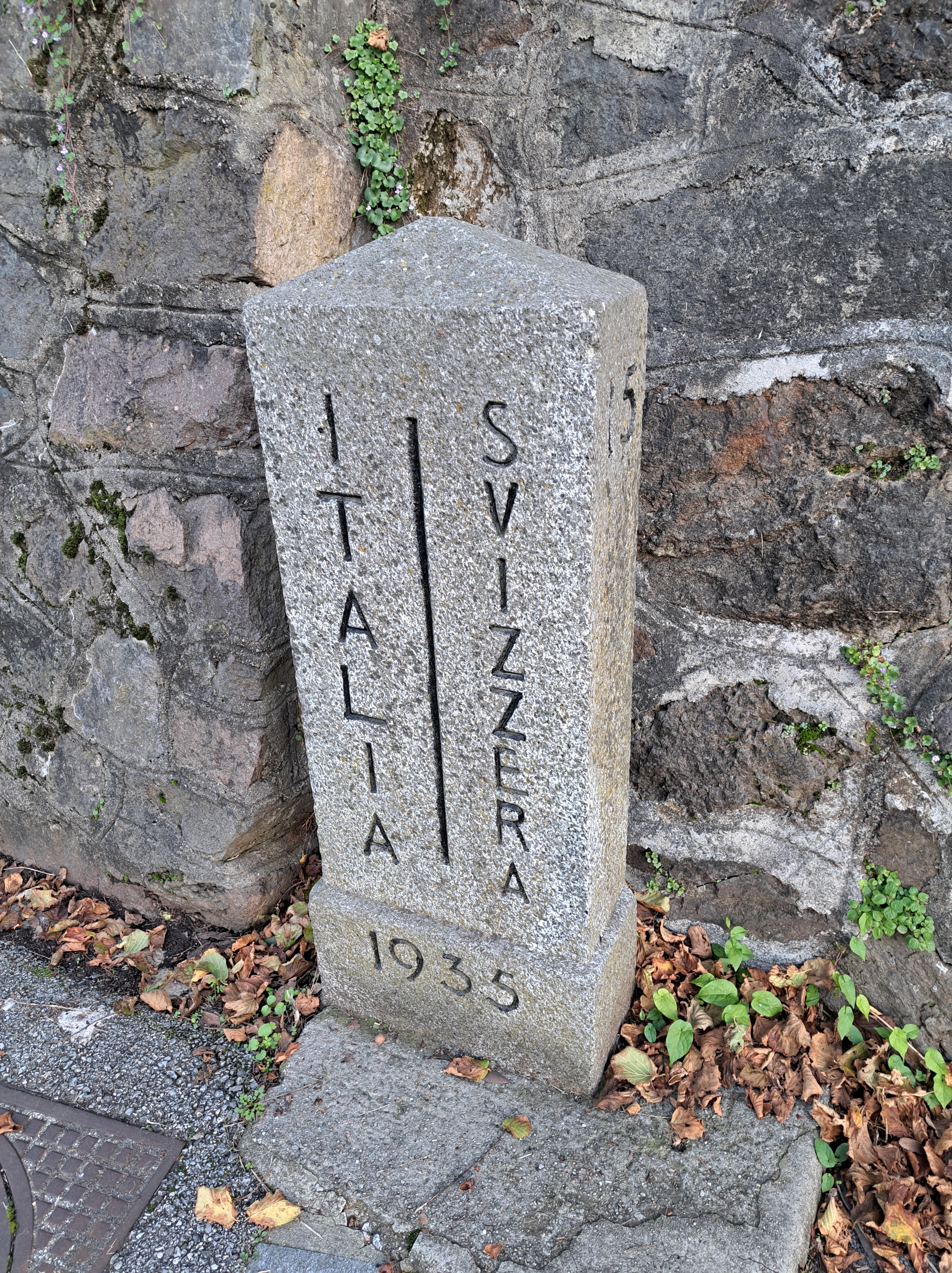
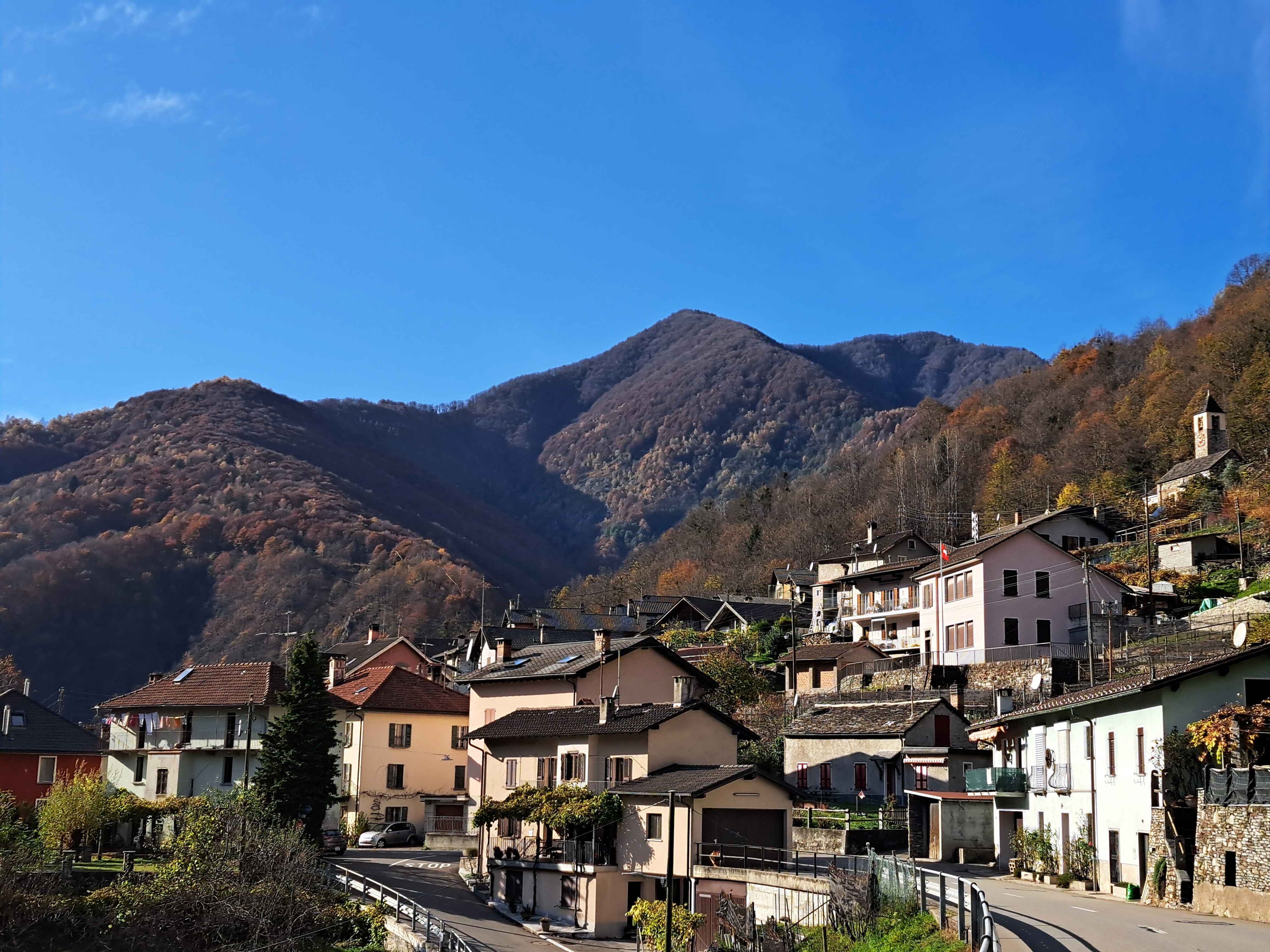
An exclave of Italy within Switzerland, on the shores of Lake Lugano. Below is the dock as our boat pulled in – tap or click the photo to see it better, b/c the gallery auto-crops it a bit to fit. Probably the top of the mountain in that photo is already Italy again, but in between is a steep Swiss mountainside :-). My first four nights in Ticino were spent a 15-minute walk to the right of that marker below.
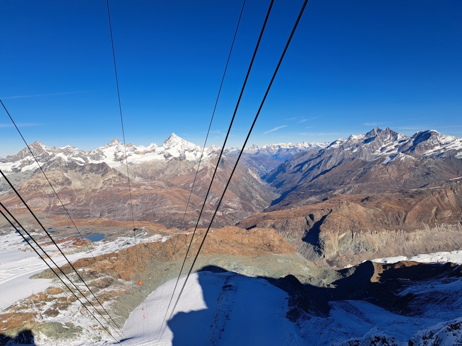
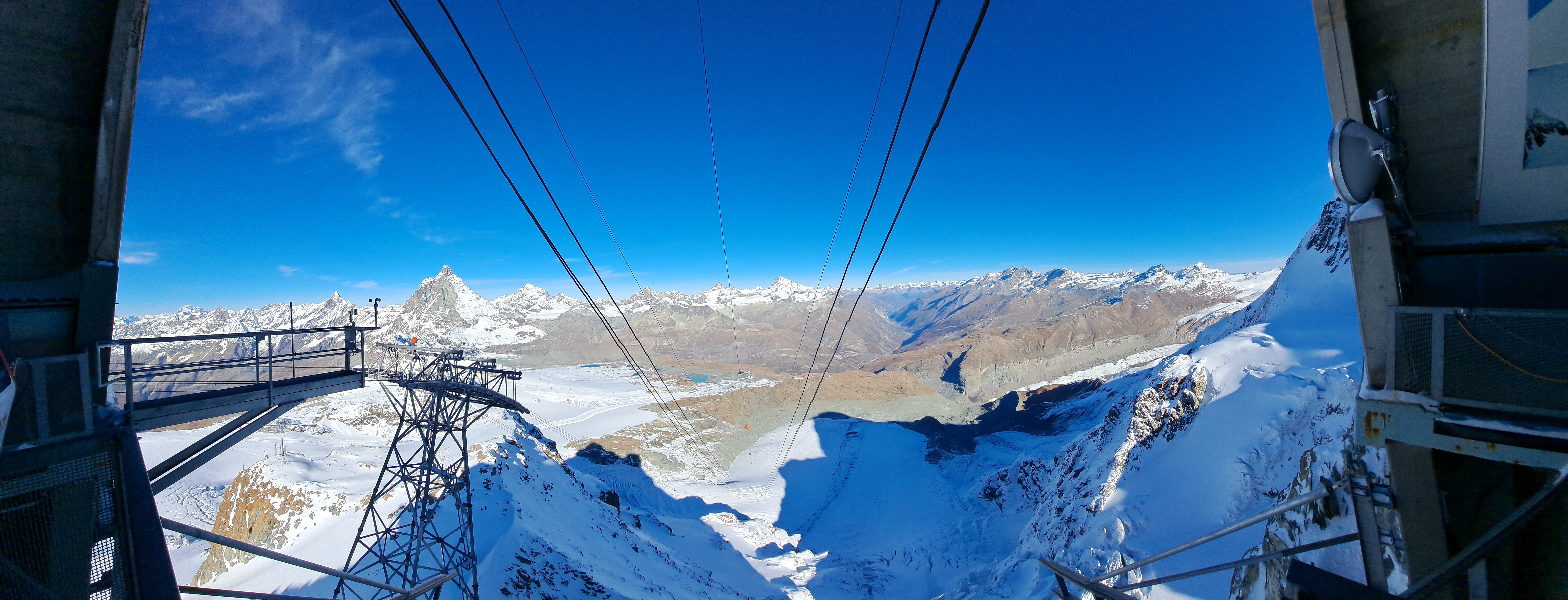
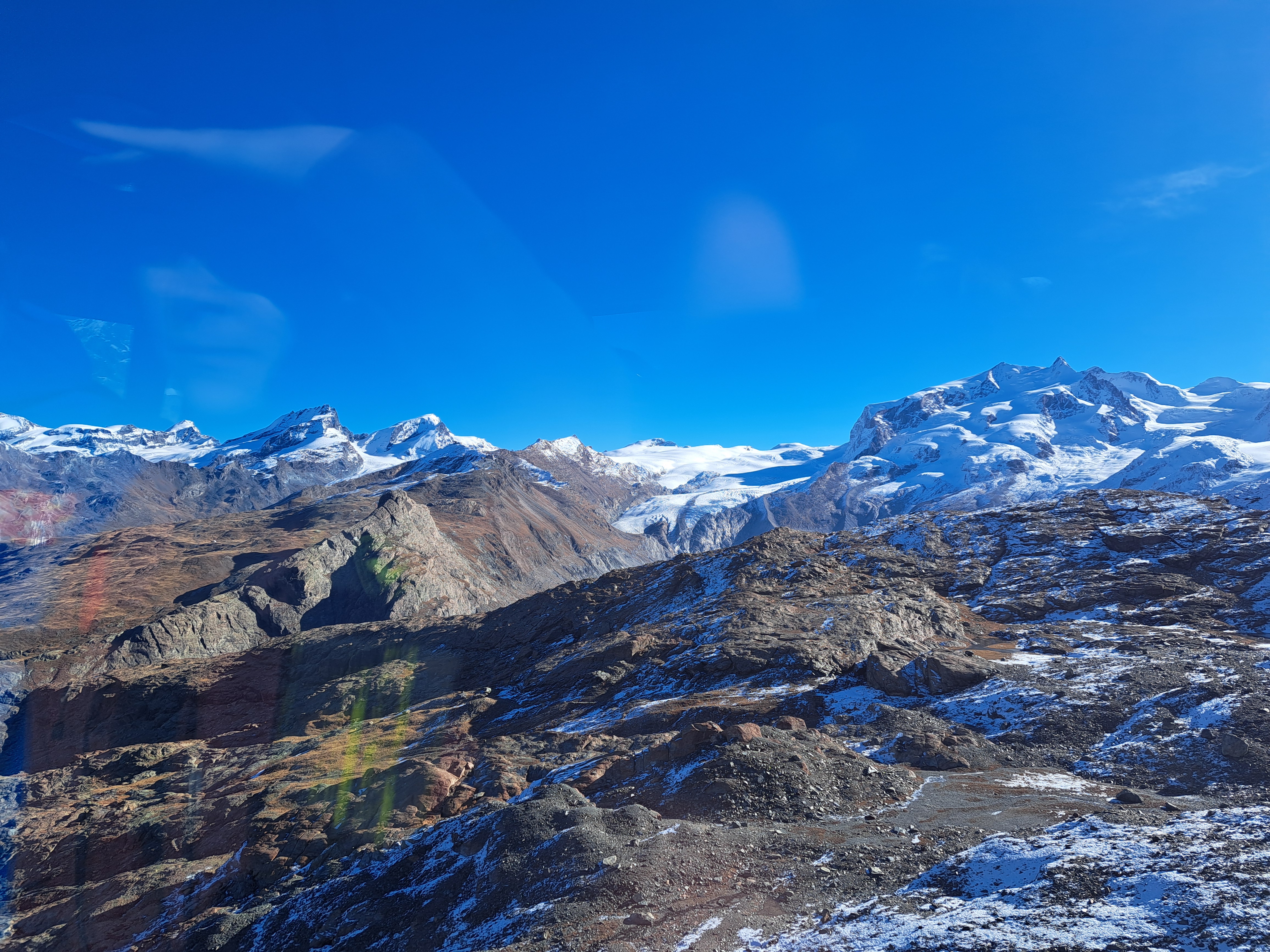
Taken as the Gondola swung towards its doc up at the top of what they call, I believe, the “Little Matterhorn” which is the highest gondola station or in the alps, or maybe the only year-round skiing option in the alps, or something of that sort. (I could verify it all in guidebooks or online, but will leave readers to do so if you choose.) Suffice for now to say these three photos were all taken while swinging in a different kind of metal enclosure in mid-air 🙂 en route to another high point looking at the alps – and yes, that’s the real Matterhorn again to the left of the left line of cables.

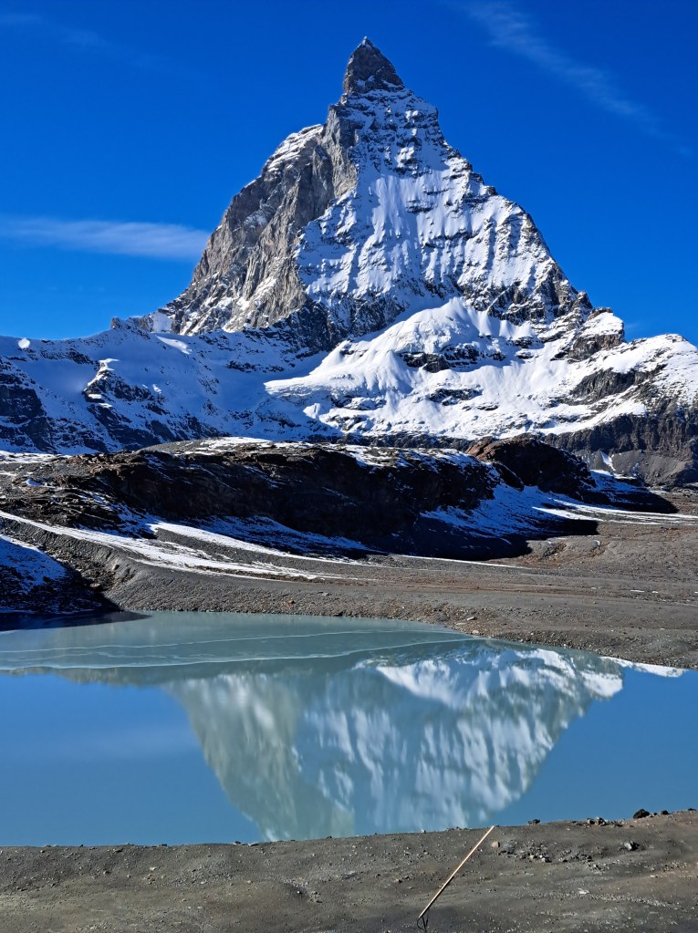 This is the closest I got to the actual mountain; as you see, it’s actually starting just across this lake. The last “From the Air” claimed I was posting all the remaining gondola-ride photos from the trip up to the “Little Matterhorn,” which may be technically true, but then there was also the ride back down, from which you’ll see one shot below and likely more in future iterations of “From the Air.” In any case: during that ride up, I stood just next to a rather strikingly red-headed chap with whom I struck up a conversation and turned out he lives in San Diego, a city I know fairly well. Since we were both solo travelers, he and I then shared our explorations up top, and then decided we’d jointly wander over to this lake just downhill from the bottom of the first transfer station going down. He’d packed beer and snacks with the hope of having his photo taken drinking beer in the snow, but up top there weren’t good spots so we found a suitable spot with just enough snow here, lower down. You’ll see the pics he took of me enjoying one of his beers lower down, as well as a gallery of air bubbles trapped in ice around the lake as well.
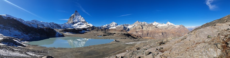


 With some apologies, I’m going to throw a large post with a ton of photos at you. These are all the remaining photos that I took during my trip on the very expensive but quite remarkable Gornergrat Bahn, which connects from Zermatt in the valley below, to Gornergrat where (one of?) the highest hotels in the alps sits on a rocky ridge with views to the Gorner Glacier and more. Truly, I edited the photos down but felt each of the many I’m still sharing with you explores a different aspect of this particular journey and afternoon. Or maybe I just want to show lots of photos to make myself feel I got a lot out of the trip, given that the ticket was more expensive than what I’d pay to go from A’dam to Brussels…