
Latest
Coasting.113

Bridges.3


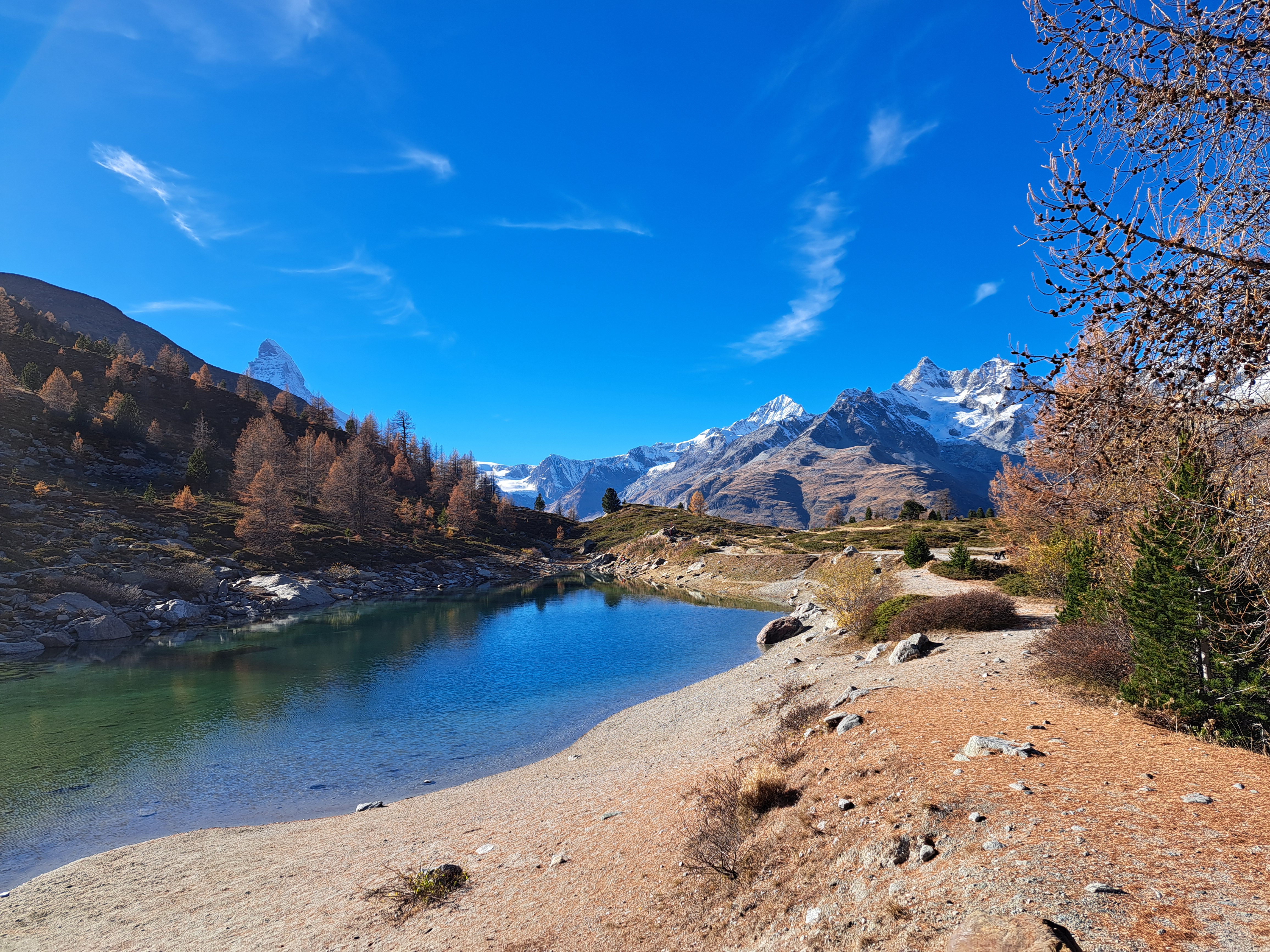
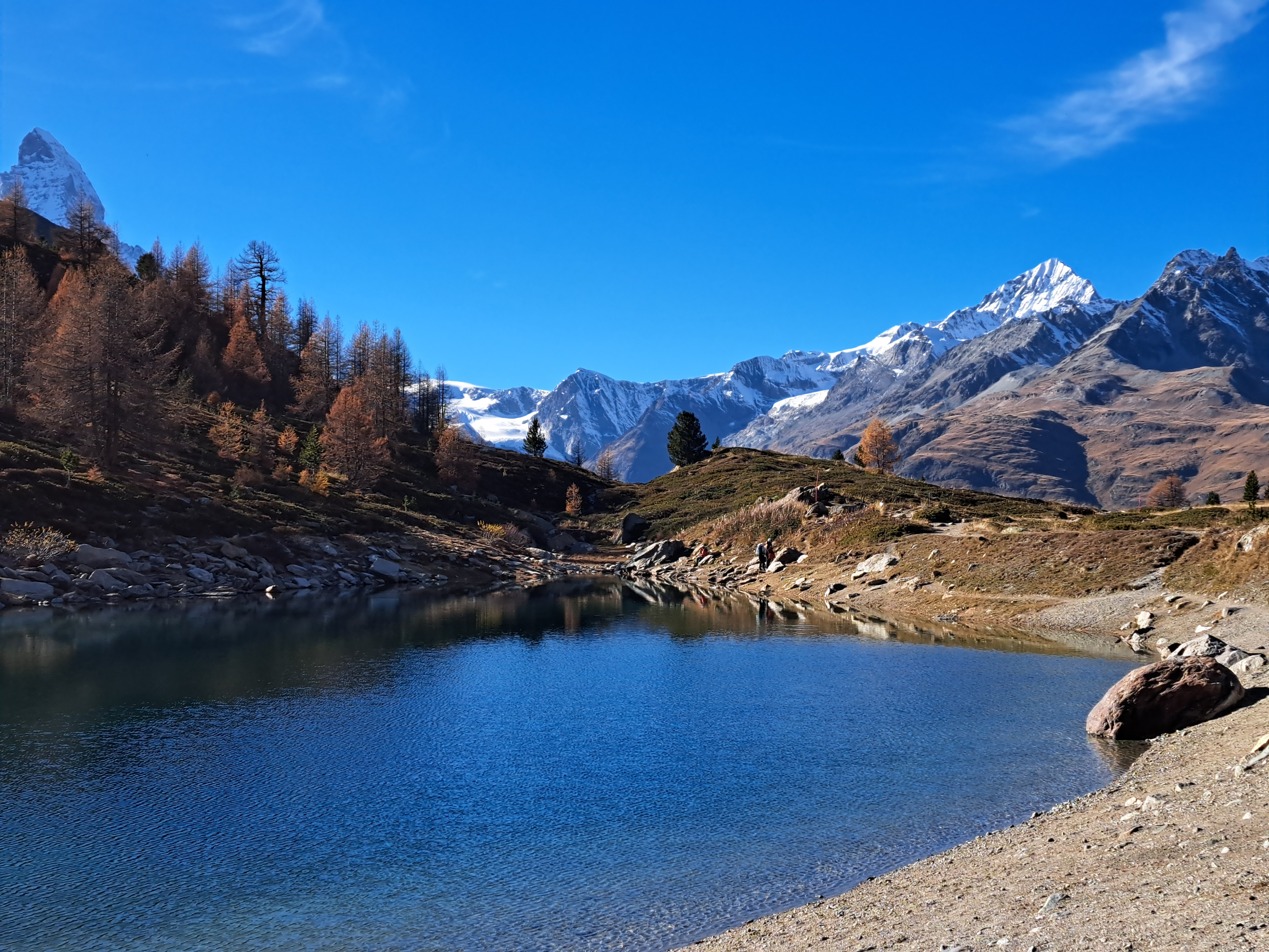
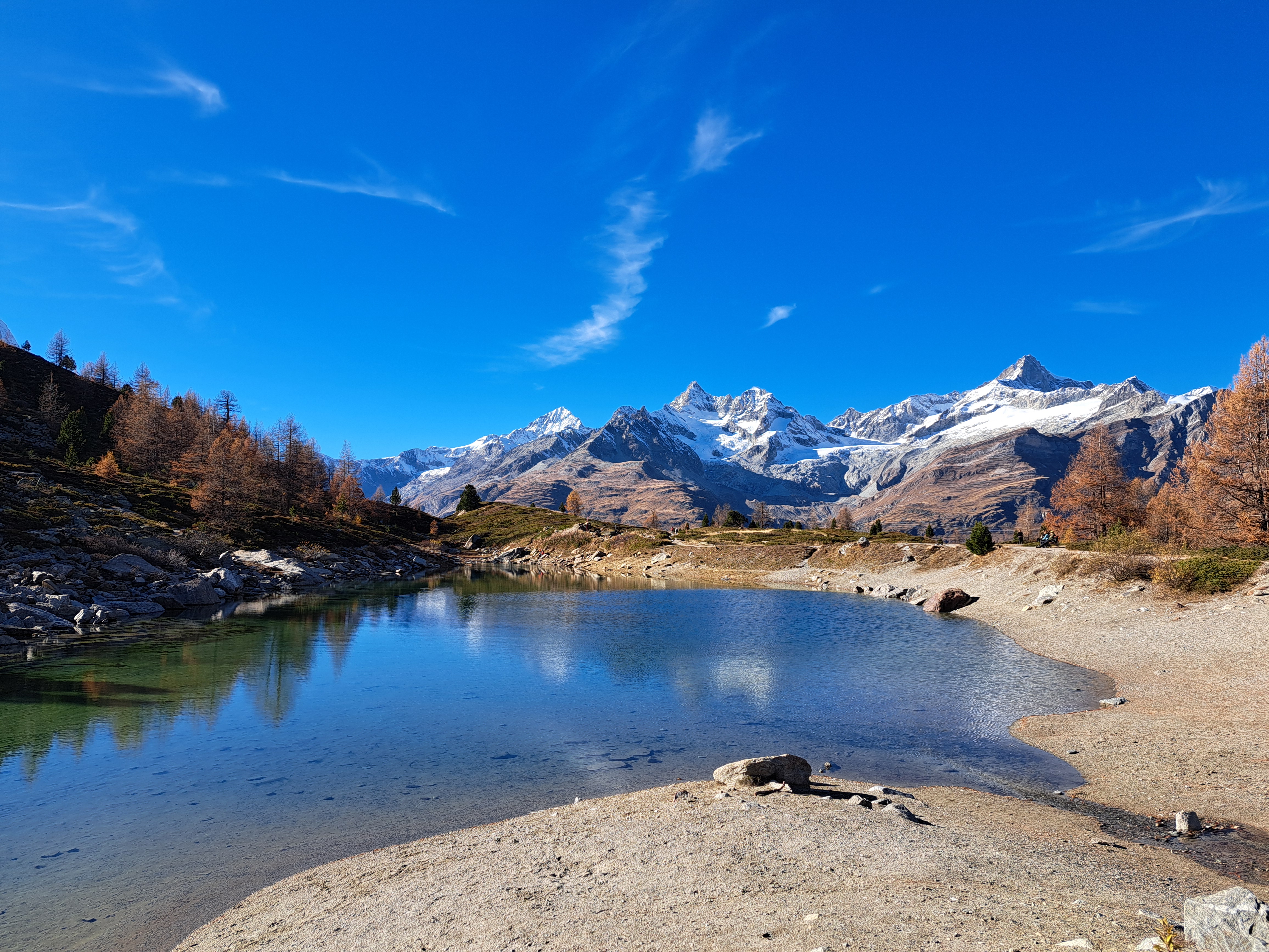
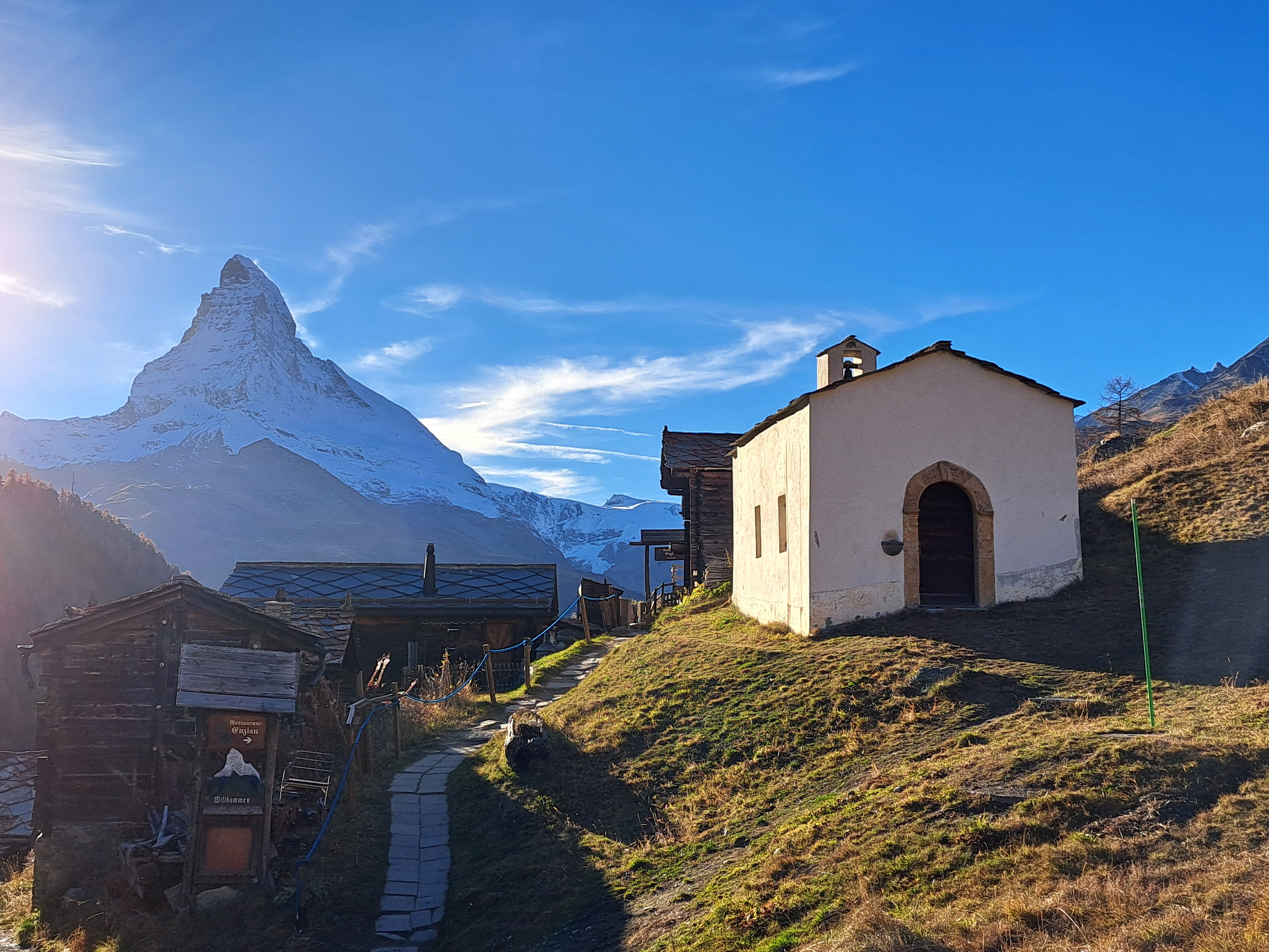
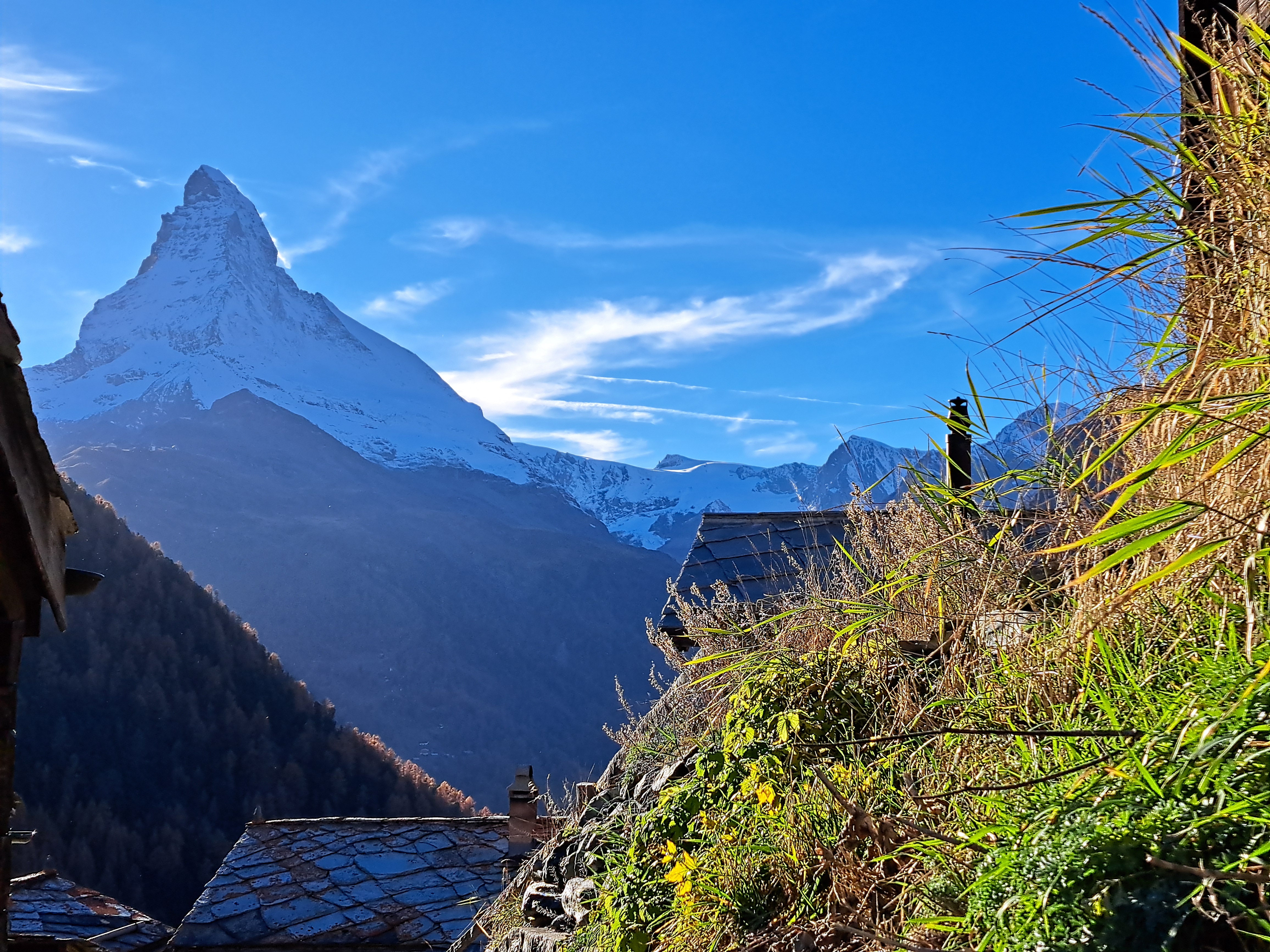
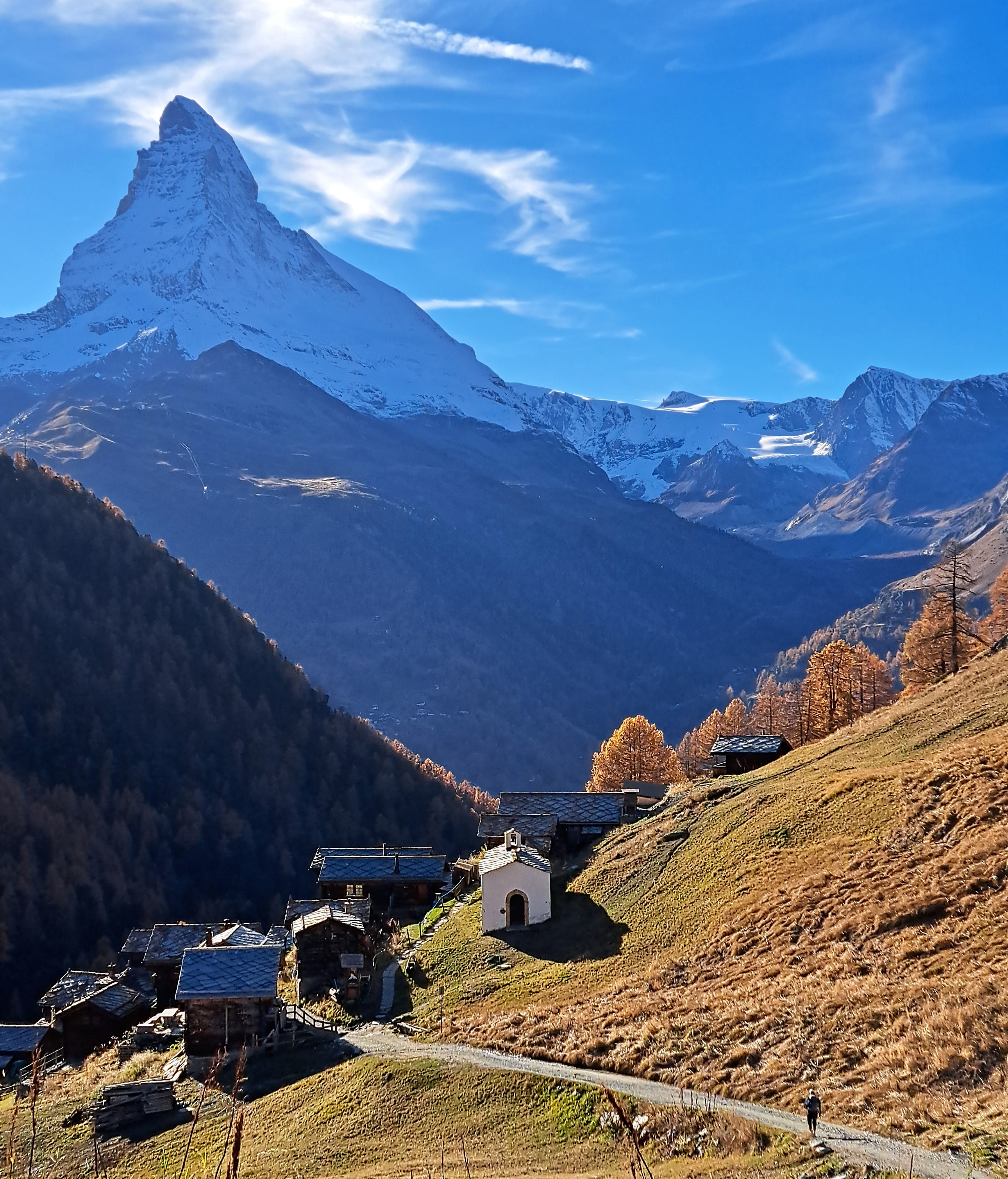
Mountains.61
Bridges.1

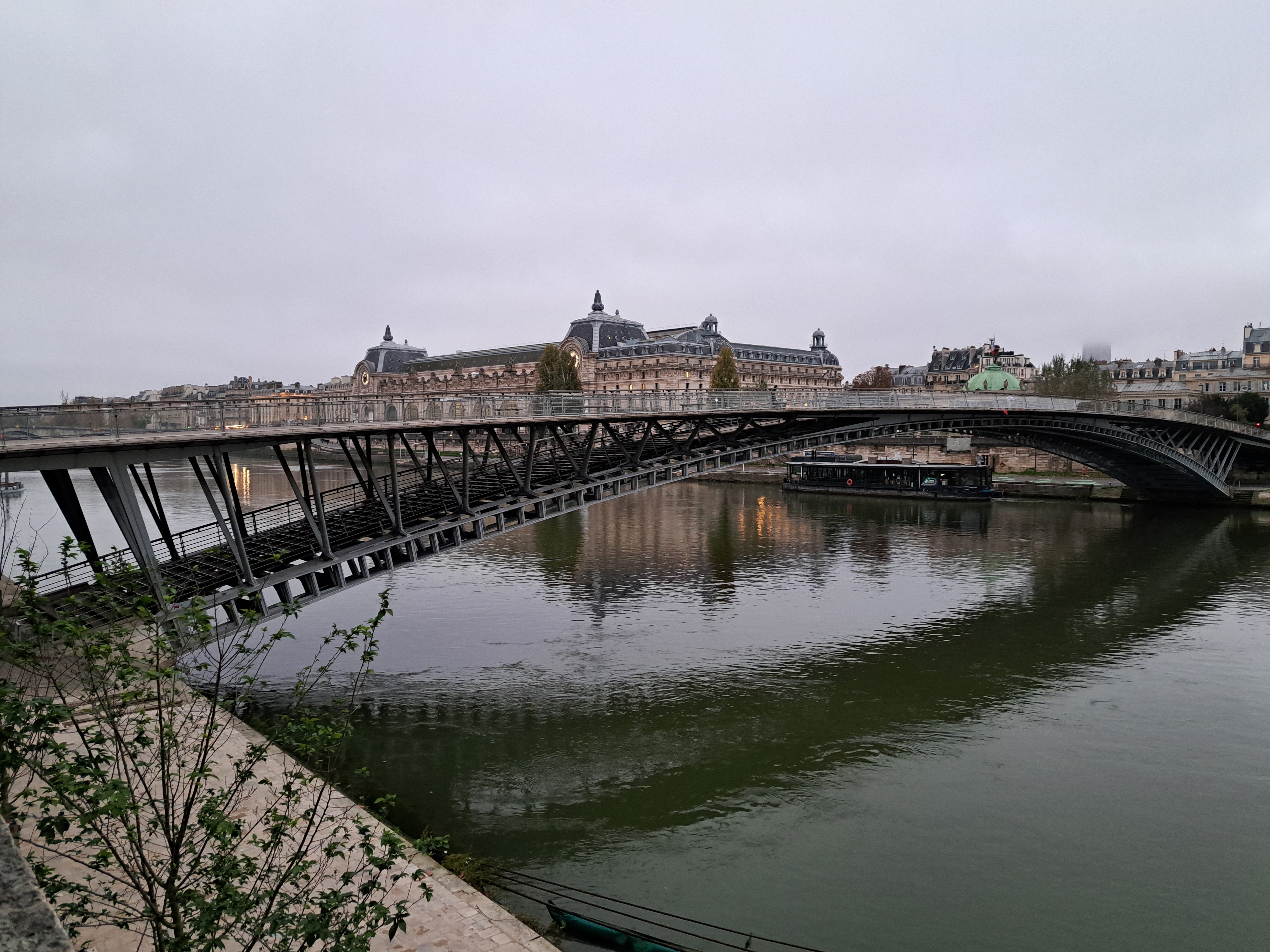
I decided while in Paris that this’ll be my first new series in a while: Bridges. Appropriate, for Paris — but there’s a backstory. These images were all taken my first morning in Paris nearly two weeks ago, when I realized upon waking up that I’d need to get out in order to have tea (no kettle in the room grrr nor even anything available at the hotel at all double grr). Checking my handy Paris guide and my map, I realized there was a well-respected park nearby that I’d never yet been too called Parc de Bercy, so I grabbed my handy go mug and headed out for tea and a stroll (and, of course, a croissant, pain au chocolat and I think even something else…).
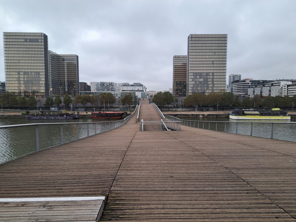
Unfortunately I made the wrong turn when I got there, so ended up royally annoyed at the pedestrian-unfriendly entrance and signage b/c I was walking around a big stadium or big walls, looking for an entrance to a park but instead I was on a narrow side walk next to noisy morning traffic on a major artery. When at long last I found my way into the park, I found it as delightful as suggested, and I even found the foot bridge across the Seine – named after Simone de Beauvoir – that you see above. These photos are all taken in the park, from the Passerelle Simon de Beuavoir, or of foot bridges that connected the two parts of the park to each other, over those busy streets.
I’m also happy to highlight infrastructure built for pedestrians first and foremost – usually an afterthought in too many places I’ve lived, and nice to see here, though they could improve their pedestrian-oriented signage up by that major commercial auditorium for us visitors 😊.


Lake Living.51
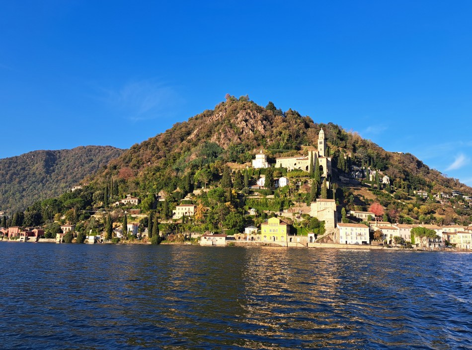
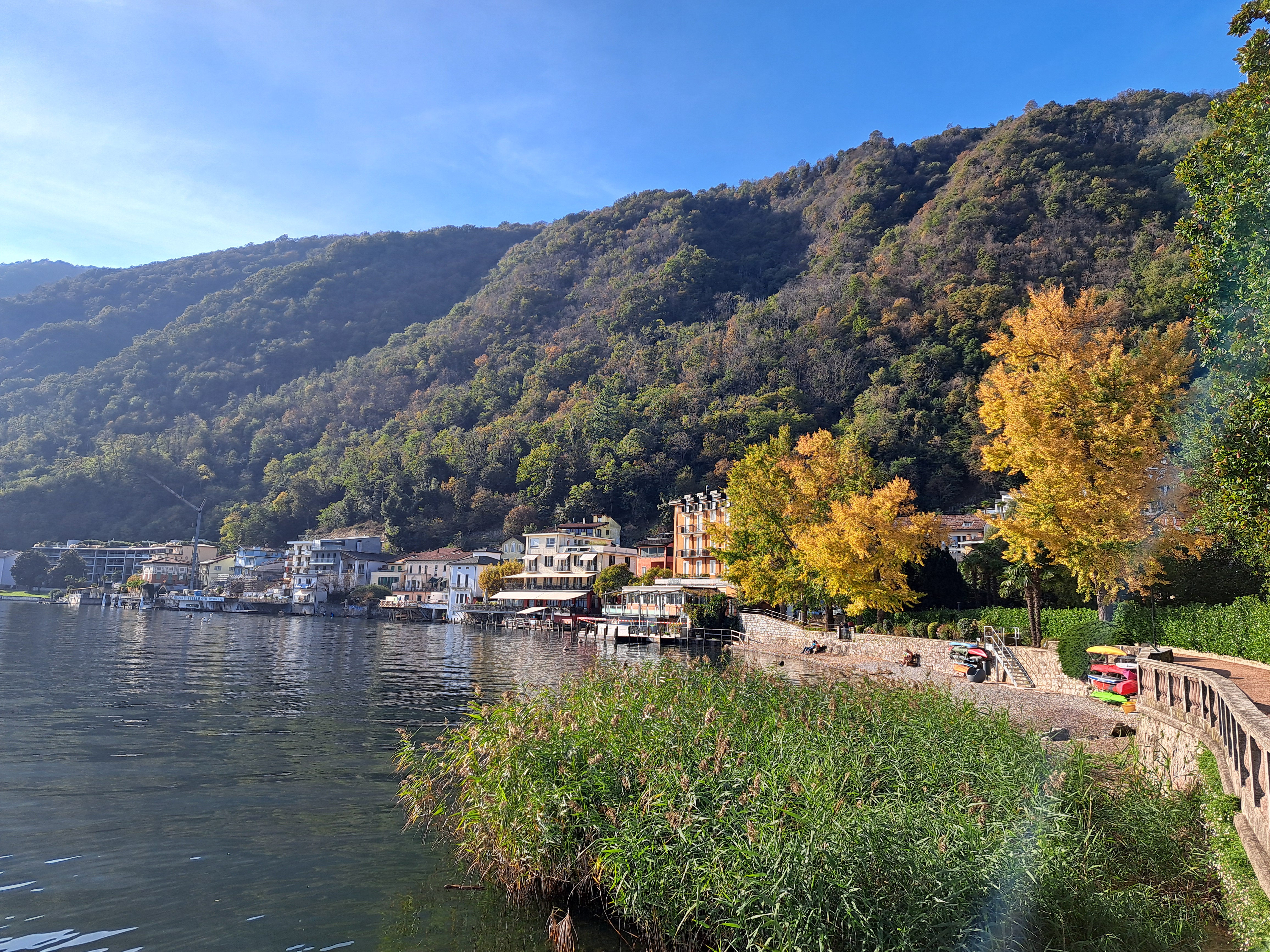
This is the gorgeous town of Morcote, at the southern tip of the peninsula that starts with Lugano, being wrapped around by two arms of Lake Lugano. At the bottom I’m showing you some of the towns streets, which are quite remarkable; the neighboring and smaller village of Vico Morcote has even more amazing little pedestrian staired streets and gorgeous houses built into the hillsides, which I’ll share at some point as well.
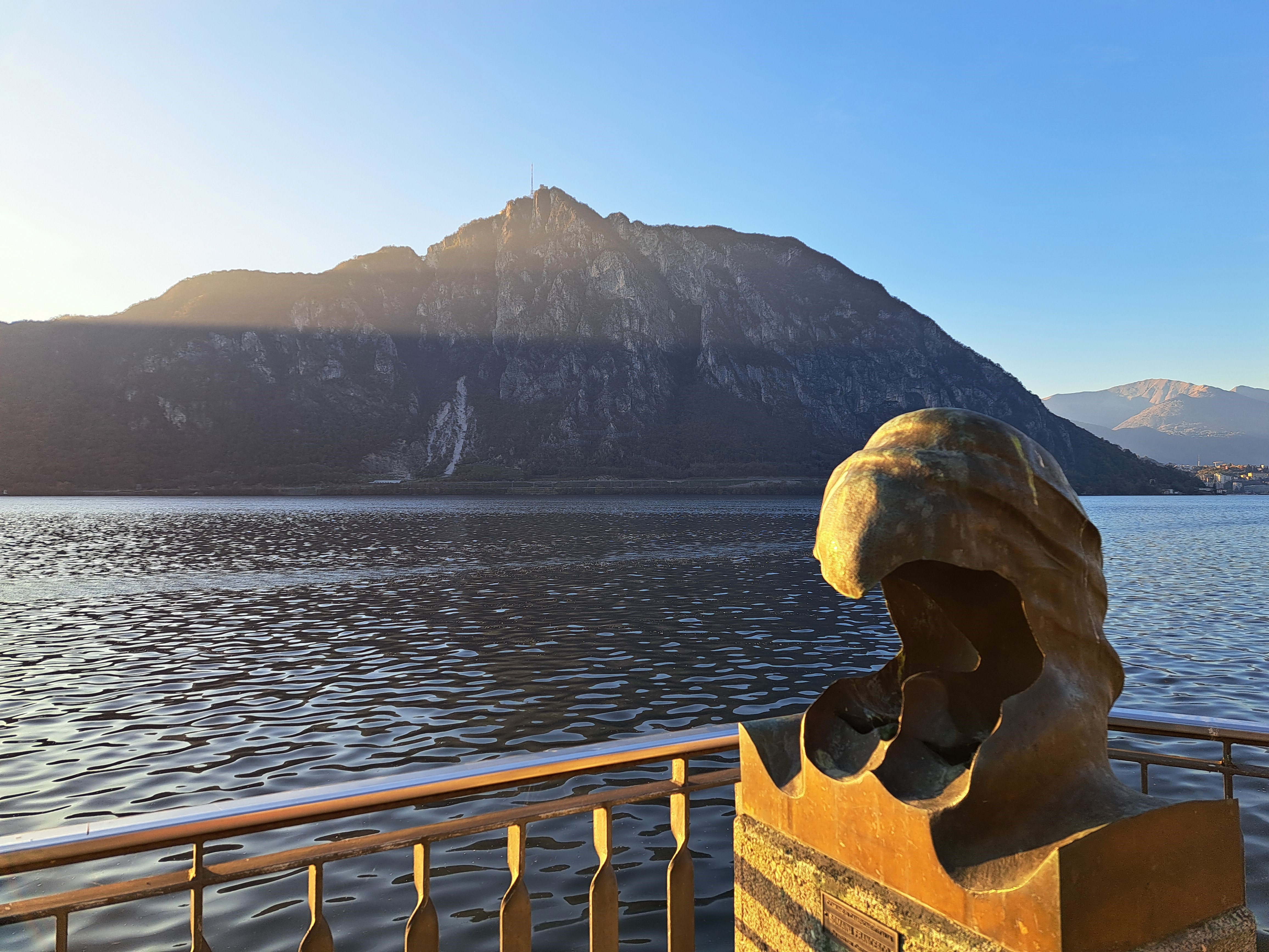
In the gallery below you’ll also see a “photo spot” which is part of something called the Grand Tour of Switzerland, and is apparently a thing. I’ve of course seen these, and folks posing for selfies or real photos by them, in many places…this time, with ten minutes to spare while I waited for the boat to take me back over to Campione d’Italia, I decided you might as well know you can do this as well, if you come to Switzerland. (More about that boat ride later, too: it went from Switzerland to Italy then back and forth another time while I was on it. Fun!)


Mountains.59


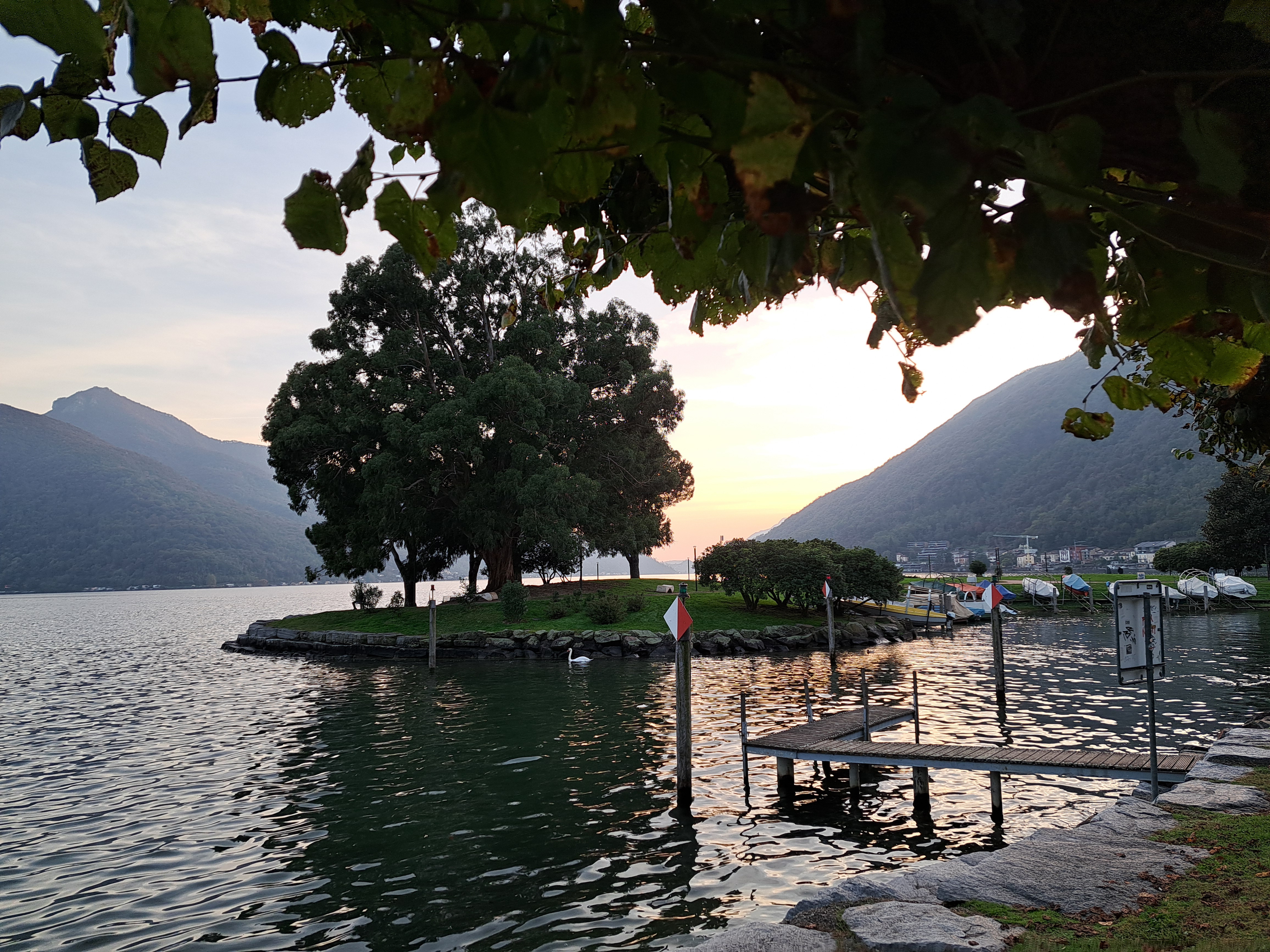
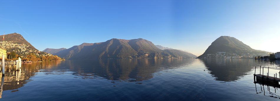
This and the last post are all from a lovely walk between Gandria, on the northern shore of the northeastern-most arm of the many-armed Lake Lugano, and the city of Lugano itself. (I’d taken a boat out to Gandria so I could walk back.) Below, you see a panorama which shows you the sunlit hill which marks the northeastern point of the bay on which Lugano sits, after which you get into that northeastern-most arm of which the majority is in Italy. As is the southwestern-most part, and also a wee exclave in the arm on which sits Bissone where I stayed. That arm, which connects to the rest of the lake further south & west, extends between the rounded mountain on the far right and the range in the middle (at the top of which it’s Italy again, fyi). Just sayin’ in case you wonder what you’re seeing or want to check it all out on a map :-). The photo at the top is looking from just below the sunlit hill (below) south towards the mountain that sits at the top of the arm I lived on. Sorry if this is TMI…


Lake Living.48