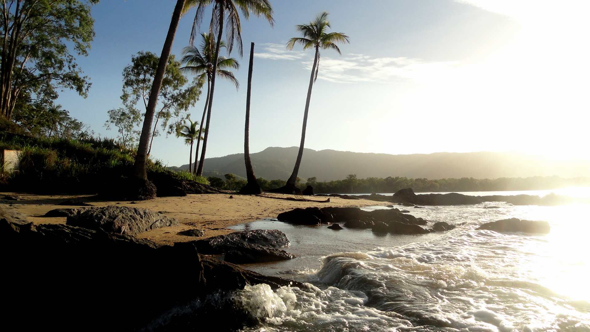
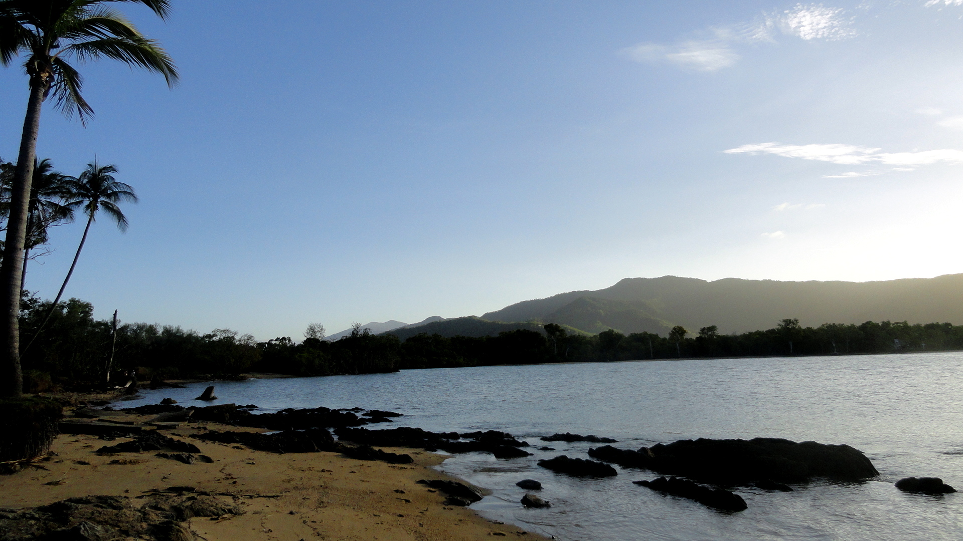
Flora, Fauna, Waves – Northern Queensland Beaches

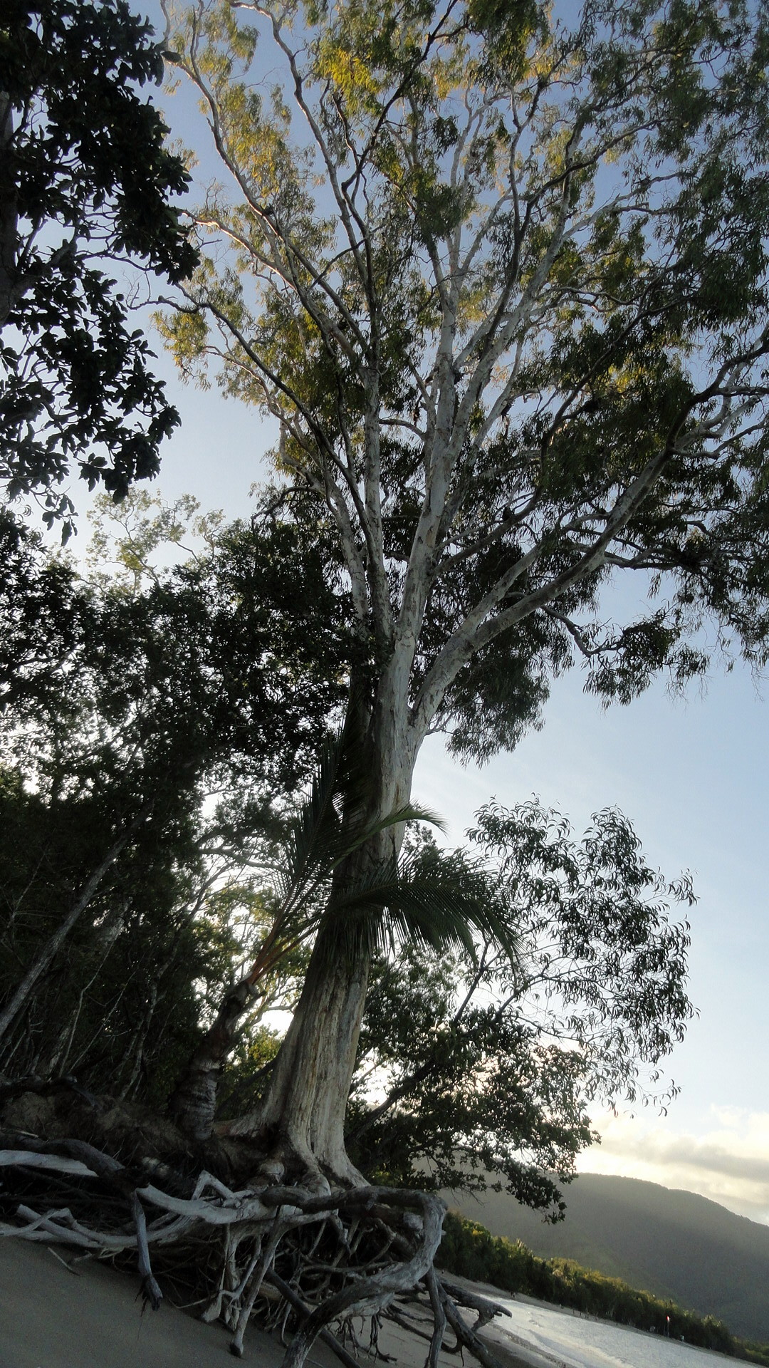
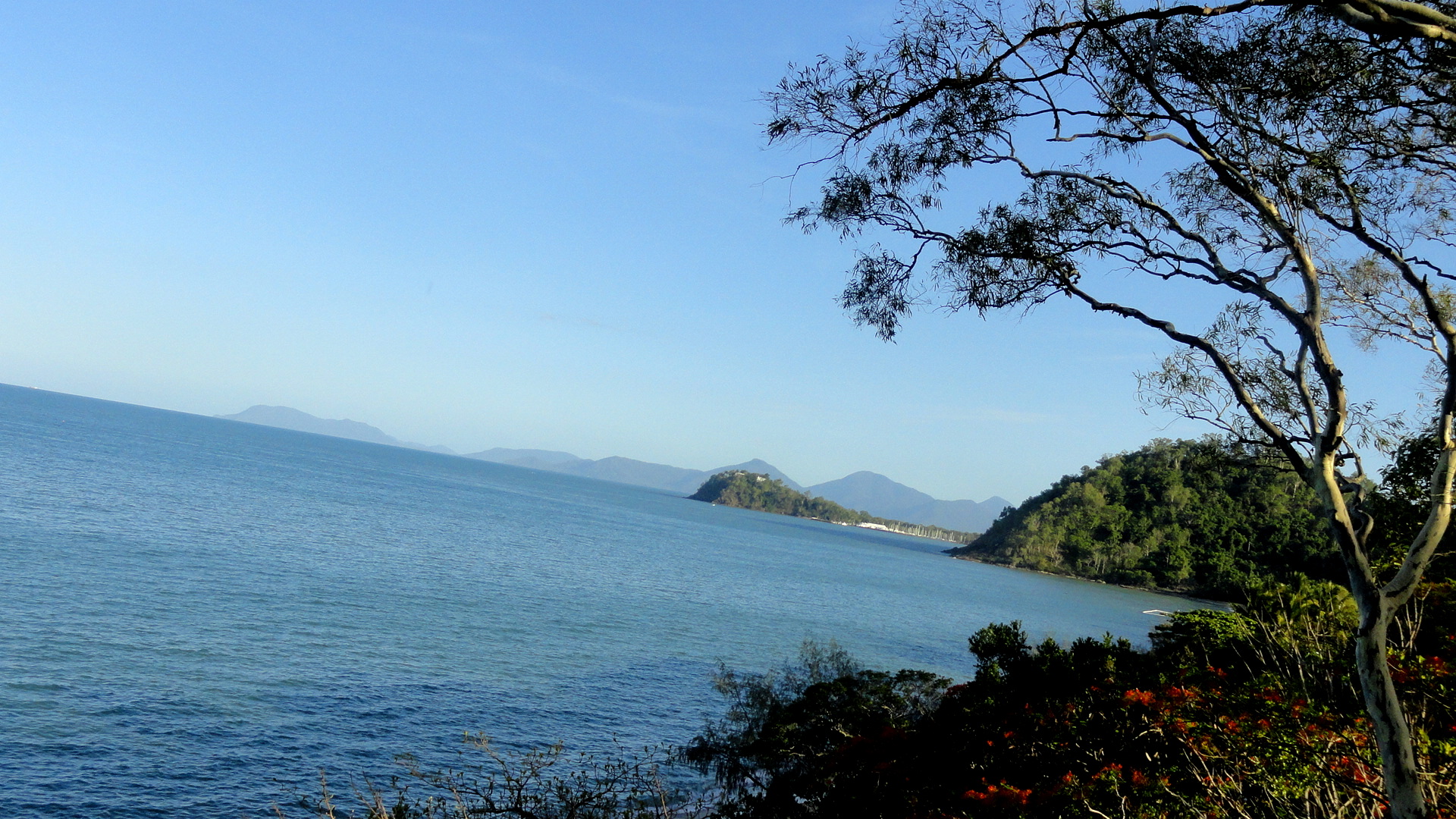
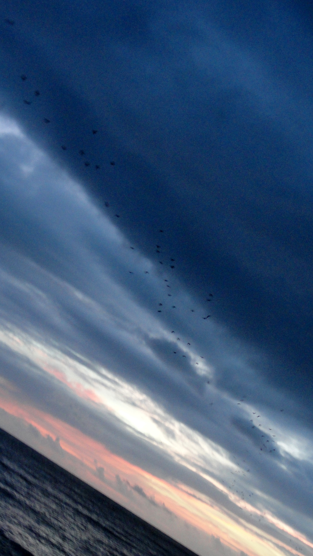
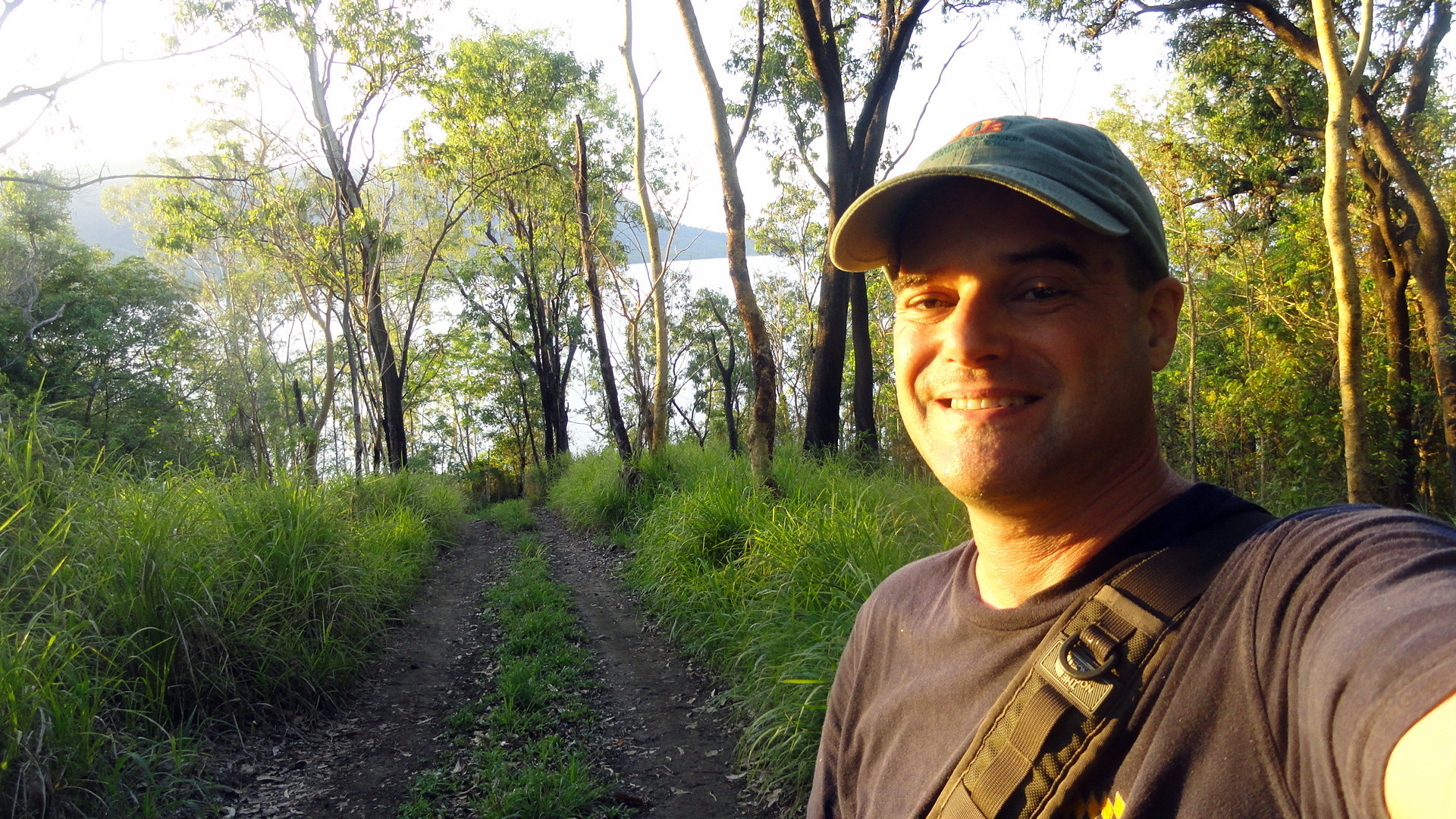
It’s been a very quiet week here in what smw, slt has learned is sometimes called fnq: far northern Queensland. It’s been all about runs by the water in the early hours, walks by the water in the evening hours, and being a lazy schlub with tennis on tv in between. All in all a quite restorative little respite just across the ol’ Coral Sea from POM. Herewith, and without further introduction other than the occasional caption, some of the things I’ve been seeing this week. (Yes, there were philosophical moments during all those walks, but I can’t remember any of it at the moment. Aren’t you glad?!)

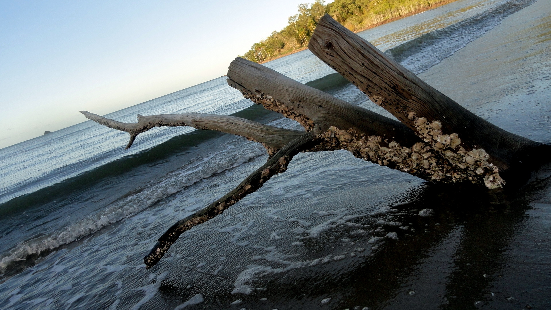
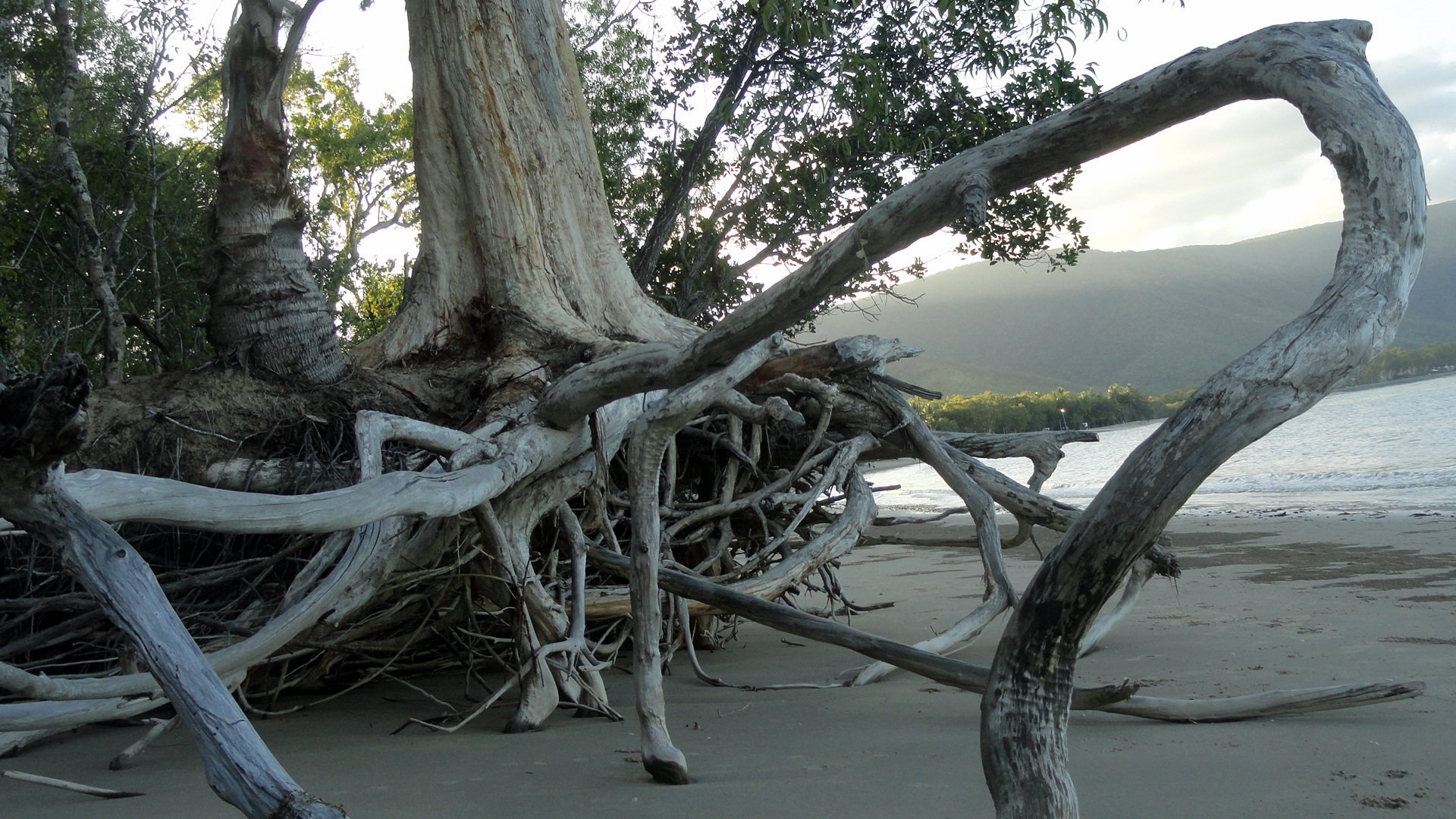
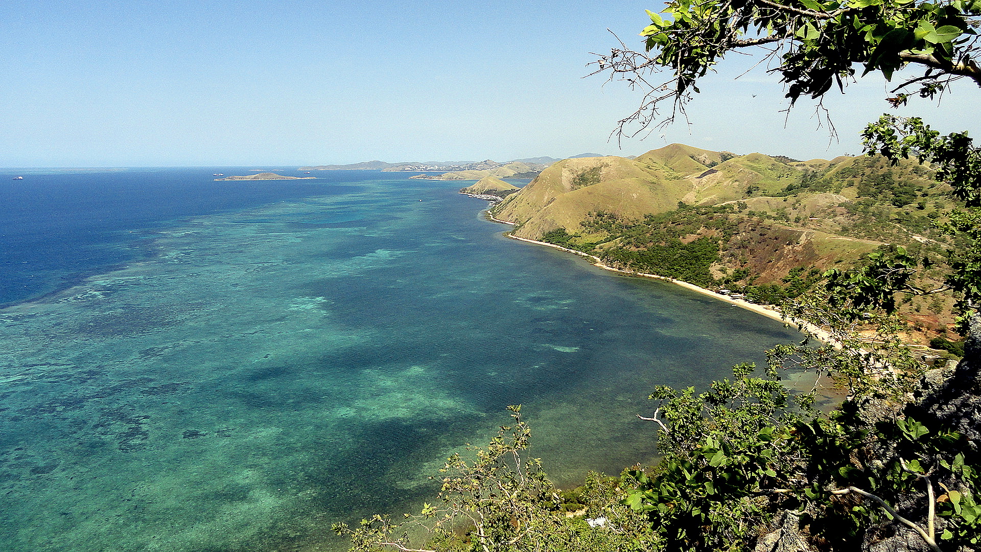
this is called tidal erosion made visible – above and below
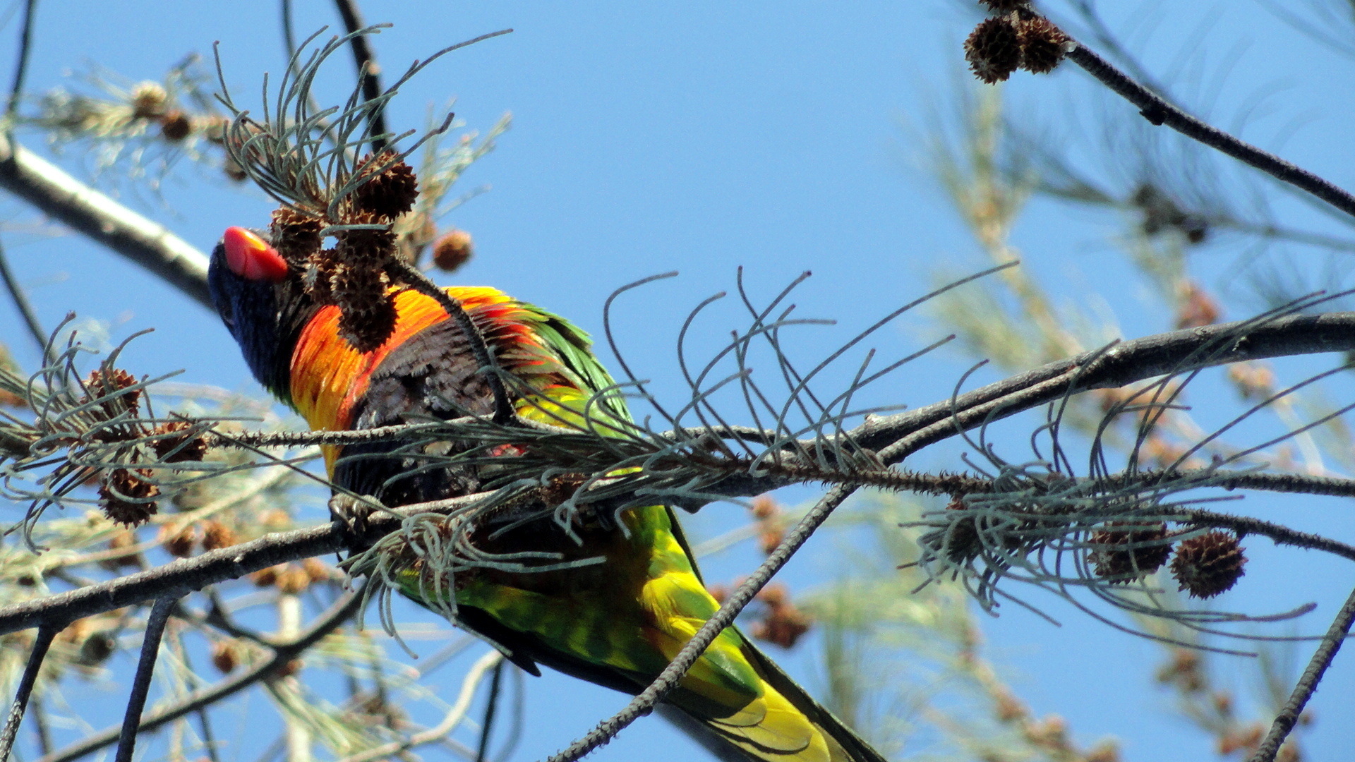
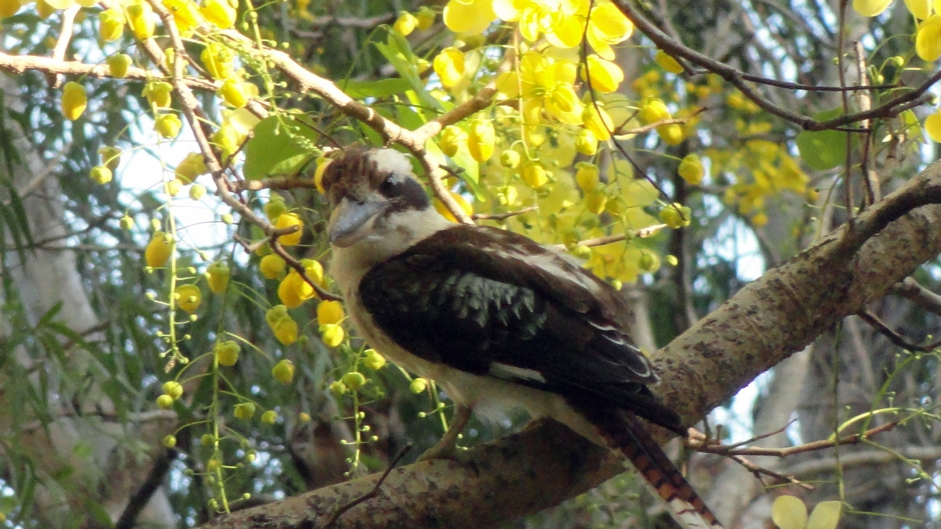
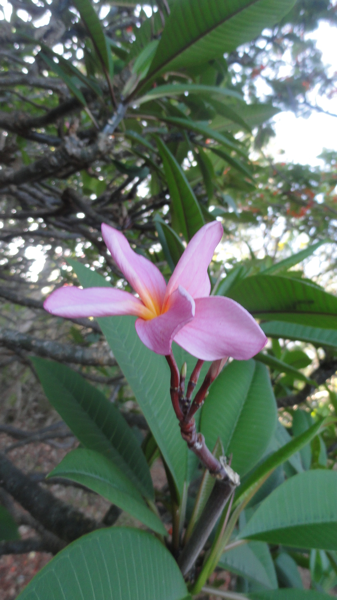
 Some flora & fauna in honor of Cate, whose dad mentioned this week that she’s enjoying seeing new members of the animal kingdom when the opportunity arises. Above: fruit bats on their morning migration back to their treetop roosts in the mountains, after a night’s foraging. Below, a gaggle of parrots and all I can say is any number of parrots creates an enormous racket. I have the impression there are lots of Australian-native species of parrot and parakeet and other such. These were the easiest to photograph here because they’re quite numerous; another white parrot was equally loud but higher in the trees and less numerous. Below that, there’s what I think is a kukaburra — stress the “think.” He was hanging out in a tree on my run this AM.


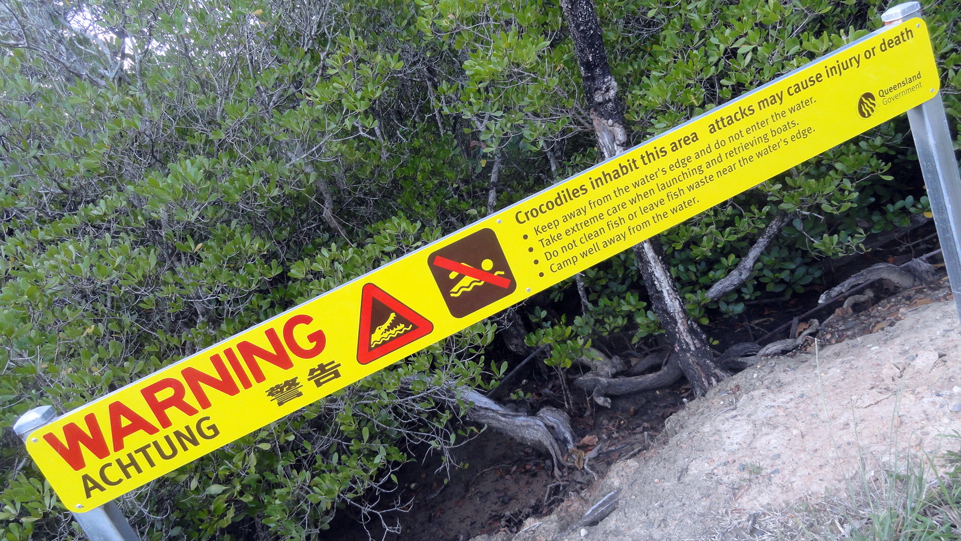
… it would hardly be coastal northern Australia without warnings for salties, and the occasional story of lost pets or worse. (Here, pets; in NT: occasionally the odd person, but the NT salties can beat up the FNQ salties any day.) ‘Twas awareness of the possible salties that made me extra wary when my runs and walks took me close to the mangrove areas – I felt most brave doing so. 🙂


Coast, Highlands, Coral Sea…by Land and by Air
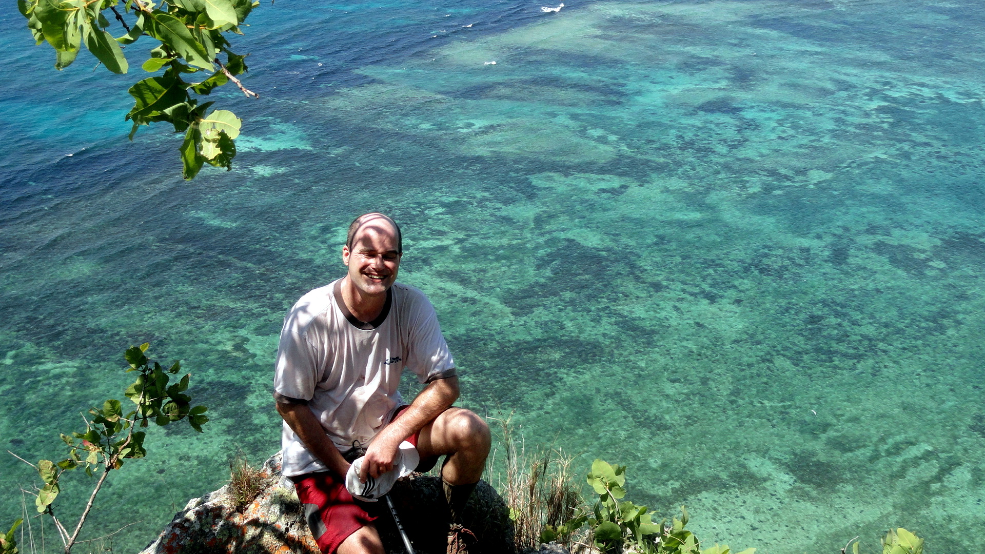


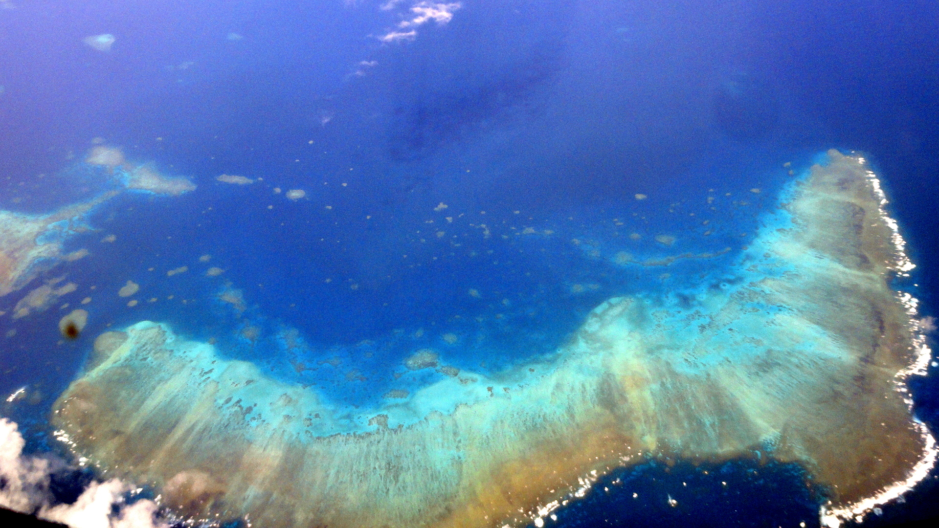
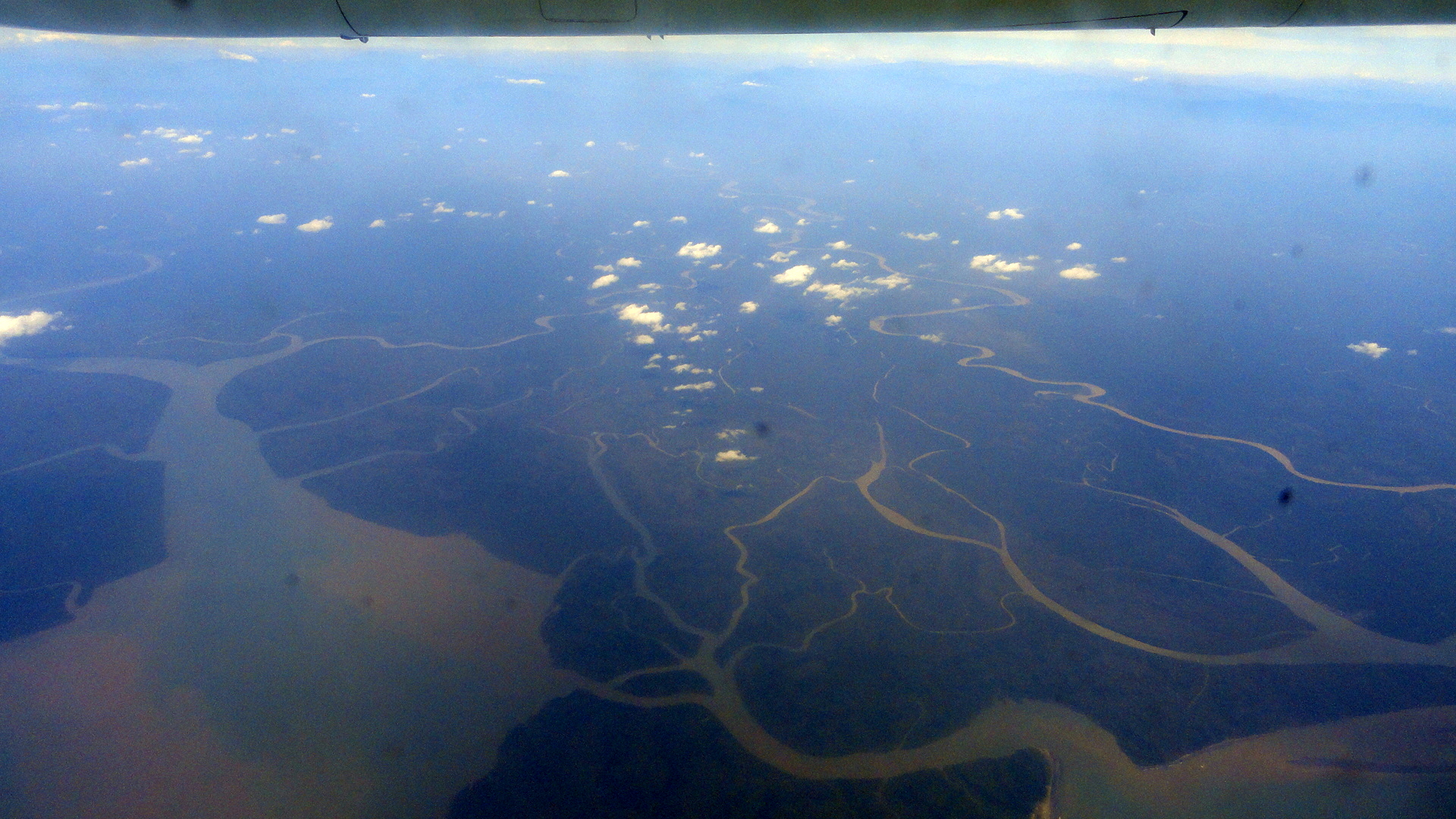
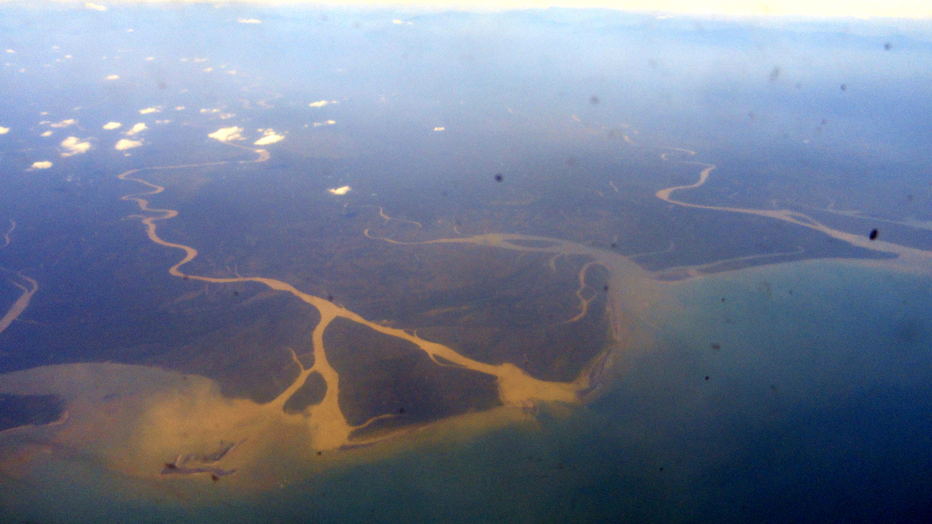
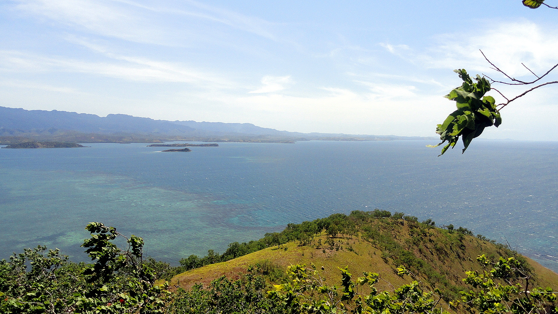
Those are not islands: that is coral just below the surface of the aptly-named Coral Sea, as I flew from POM to Cairns again yesterday – second time I’ve done that flight in this direction. God it’s a great view.
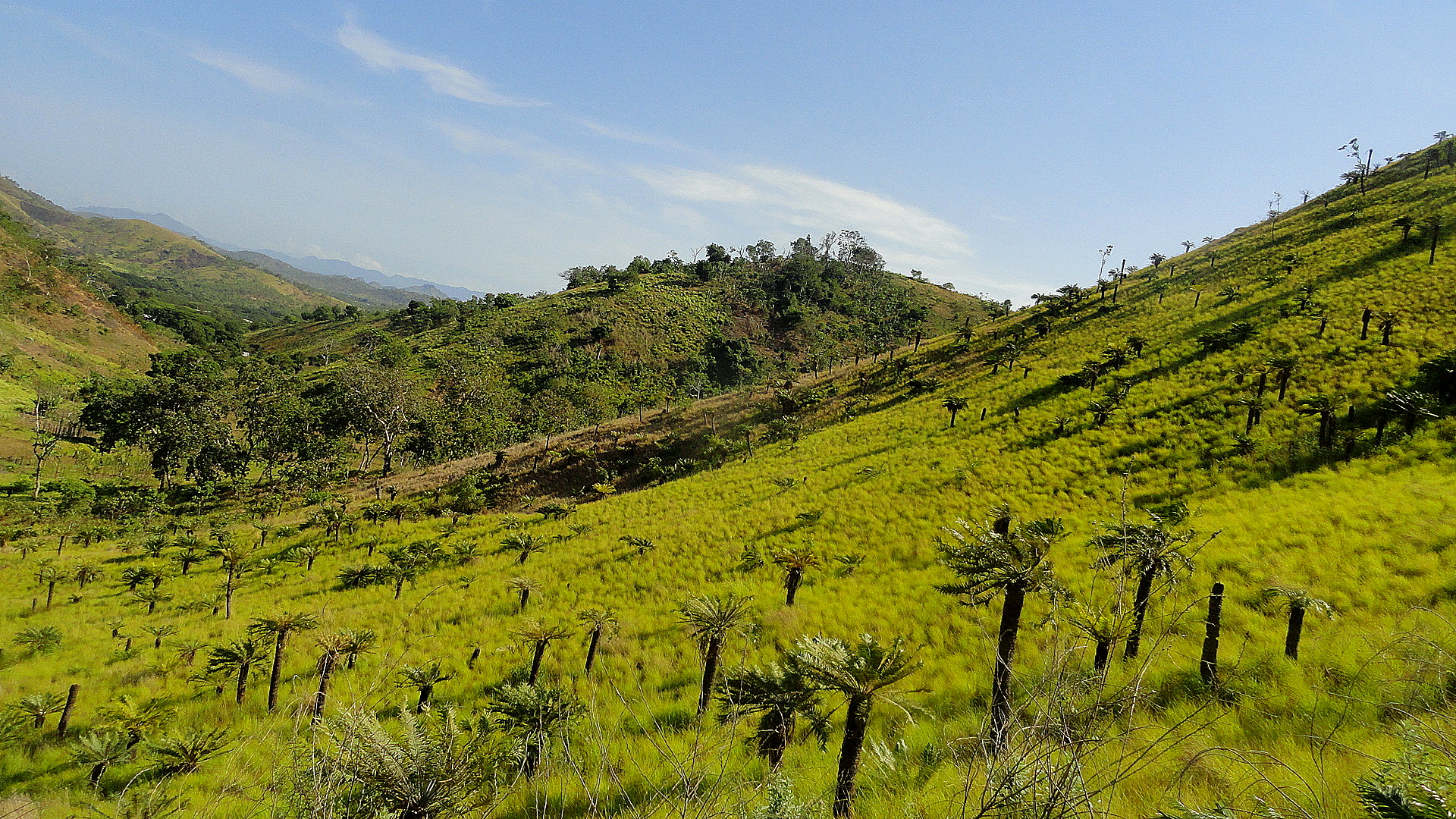
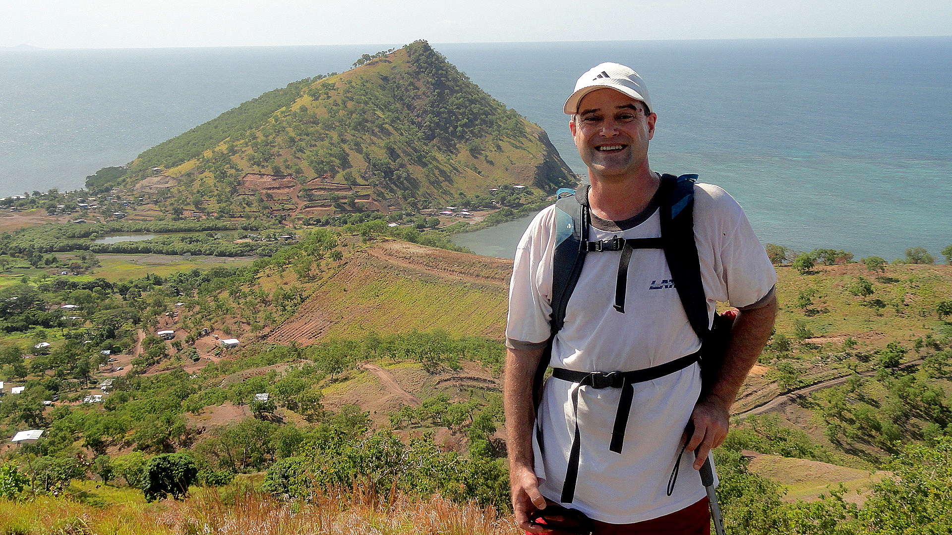
So if this text appears where I hope (this is never guaranteed, and can vary from browser to browser…so fingers crossed), then to the right & below is me at an office meeting; I put that there for the map! See the flag on the south coast, to the right side – that’s POM. The Coral sea is below it — all the stuff between Cairns — due south by southwest of POM, and where I sit watching the bright sun reflect on the ocean (that’d the Coral Sea ocean of course) as I write this — and all the pics in this entry were taken in and around POM, or in the air between Tari (left-most flag in the center of the island, of an appreciably different color) and POM in December, also from the air. Some of those shots are obviously rivers and river deltas of Gulf Province (to the left of POM, as you look at the map, and stretching inland a fair piece to abut Hela Provicne where Tari is located), but the one up above is, I think, the Highlands Highway as it stretches from Lae to Tari. (Lae is one of the flags on the map sorta due north of POM through a thick part of the island, and the HH starts there – not in POM. No roads to Highlands from POM, only planes.) Further up, you will note a photo of something I found truly stunning when I did the hike: a hillside of yellow grasses with short palms popping up out of the grasses, all sort of backlit by the sun which was just popping over the brim of the hill. It really was a stunning and unusual view.
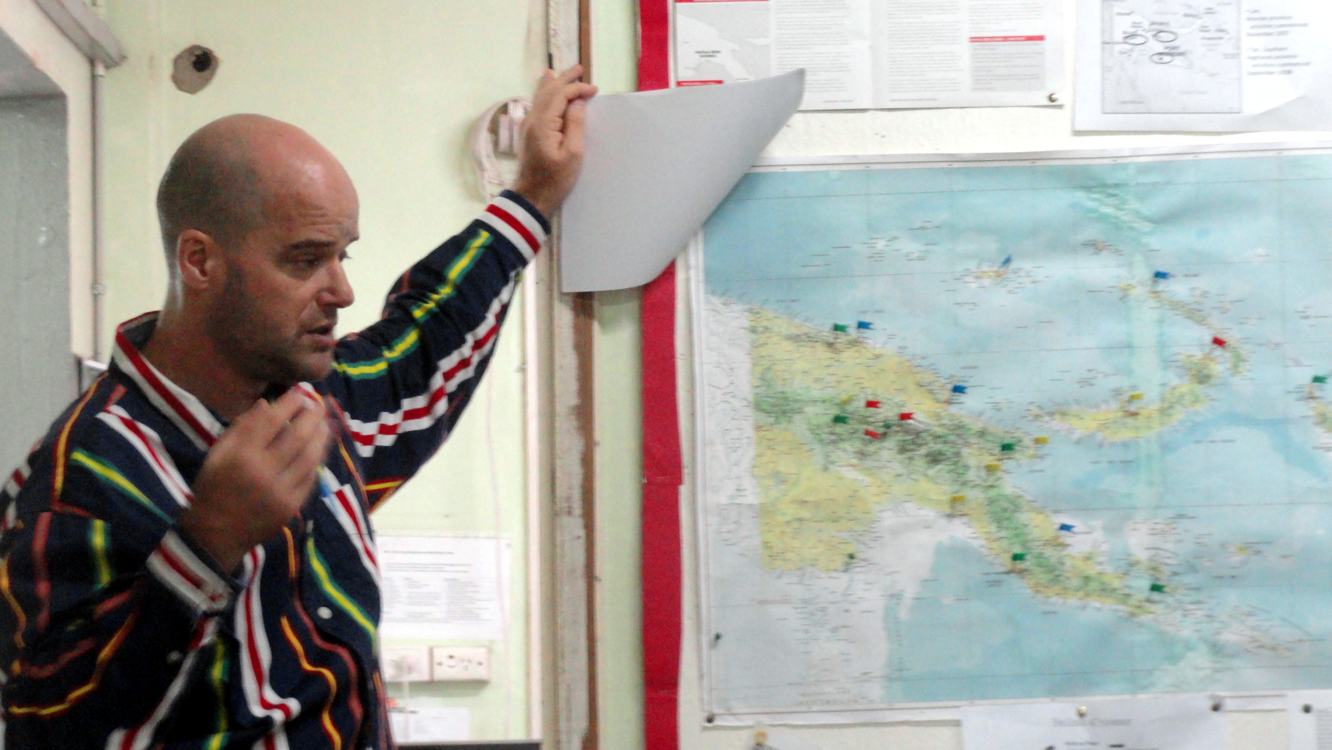
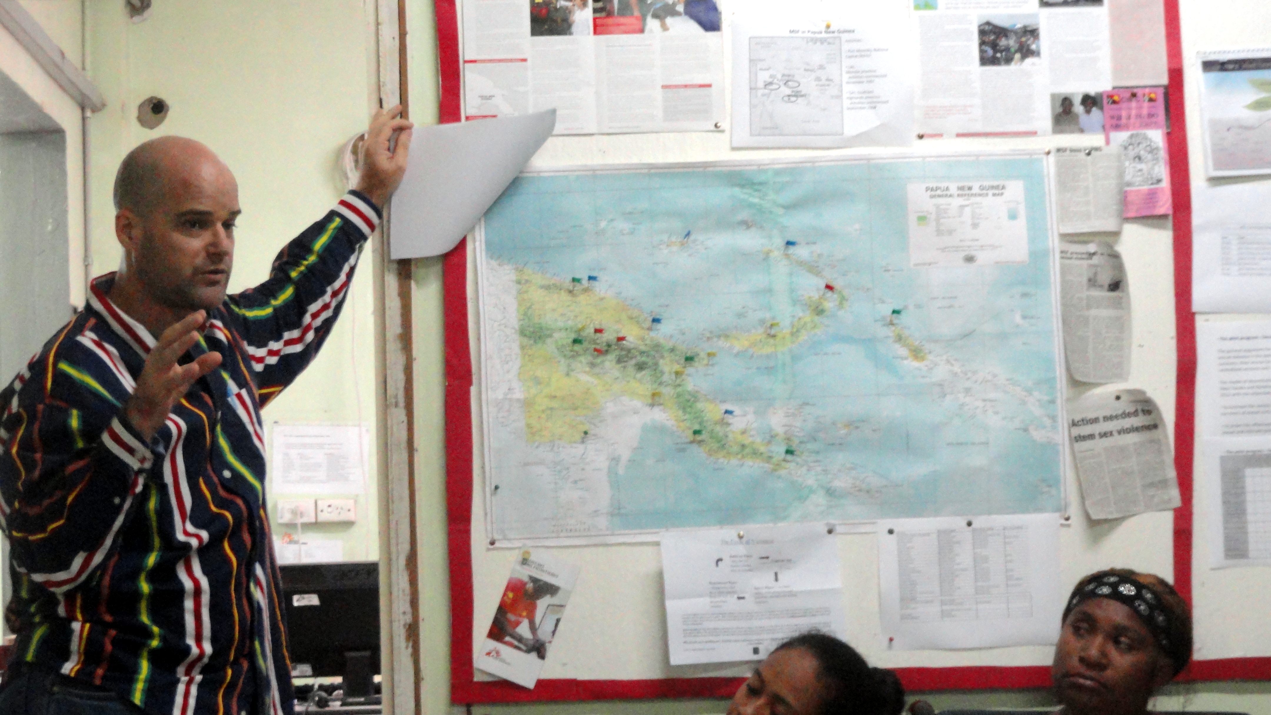
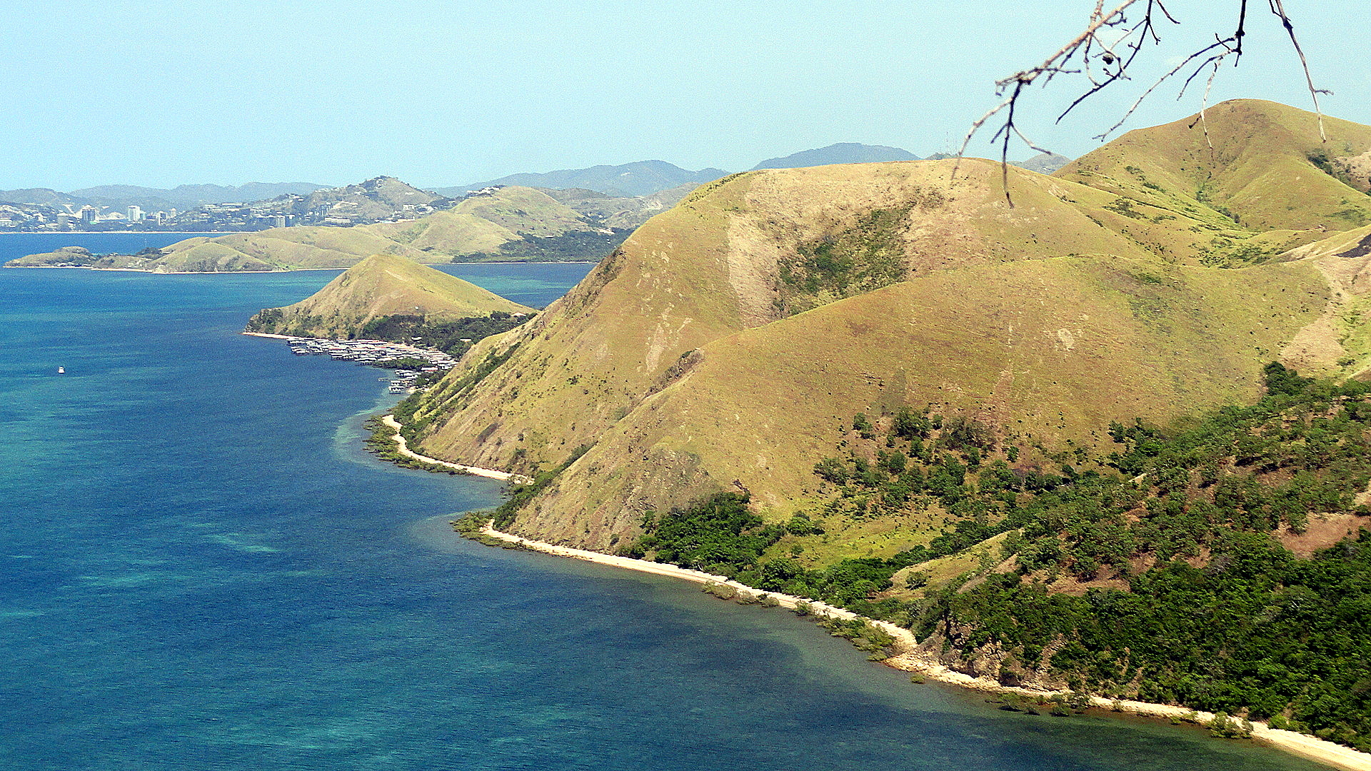
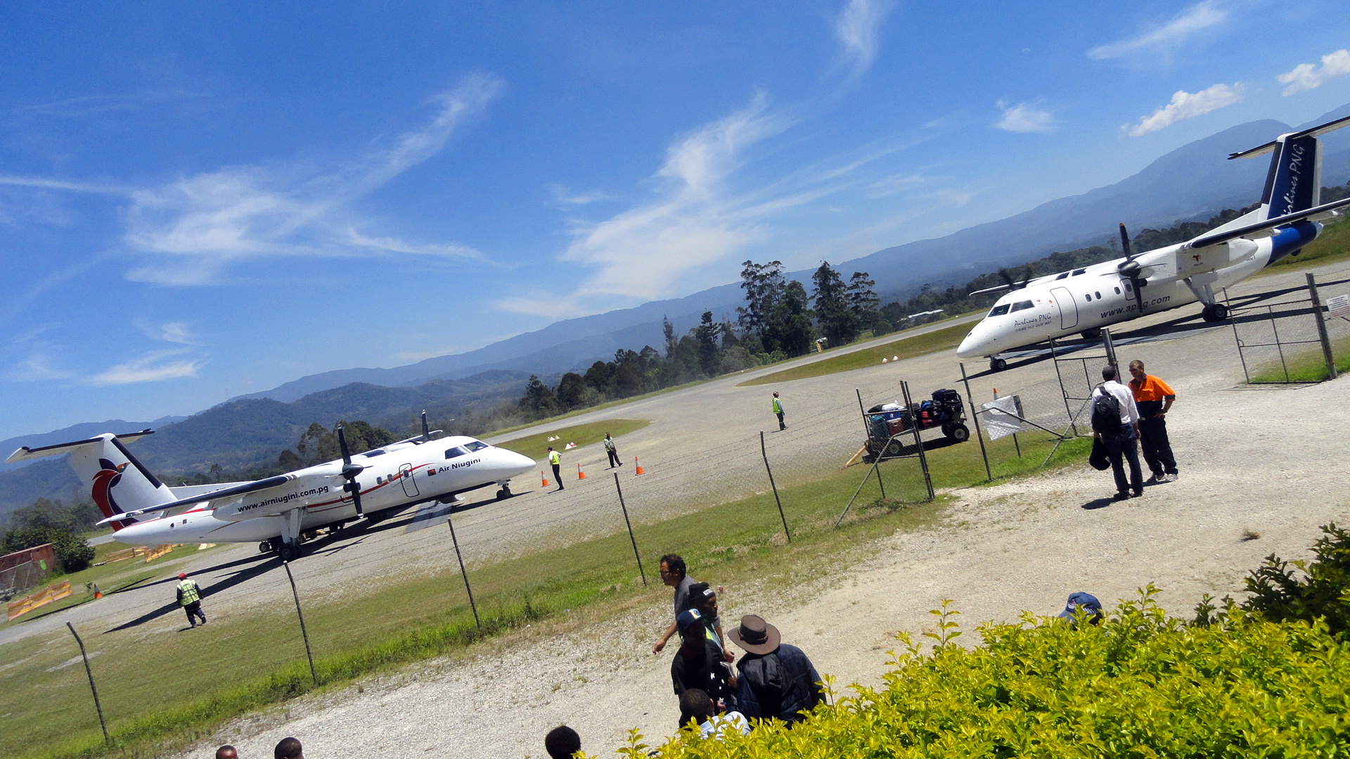
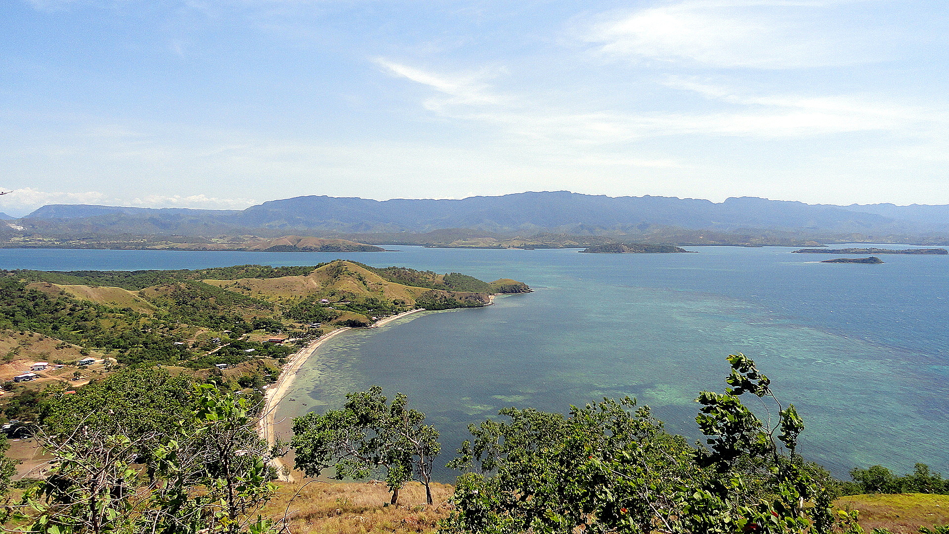
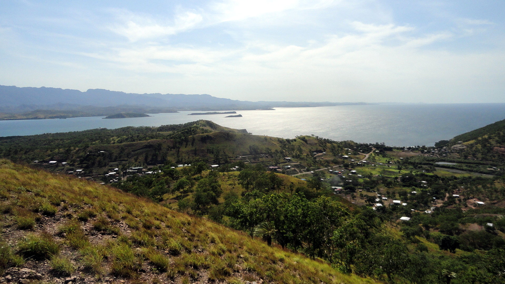
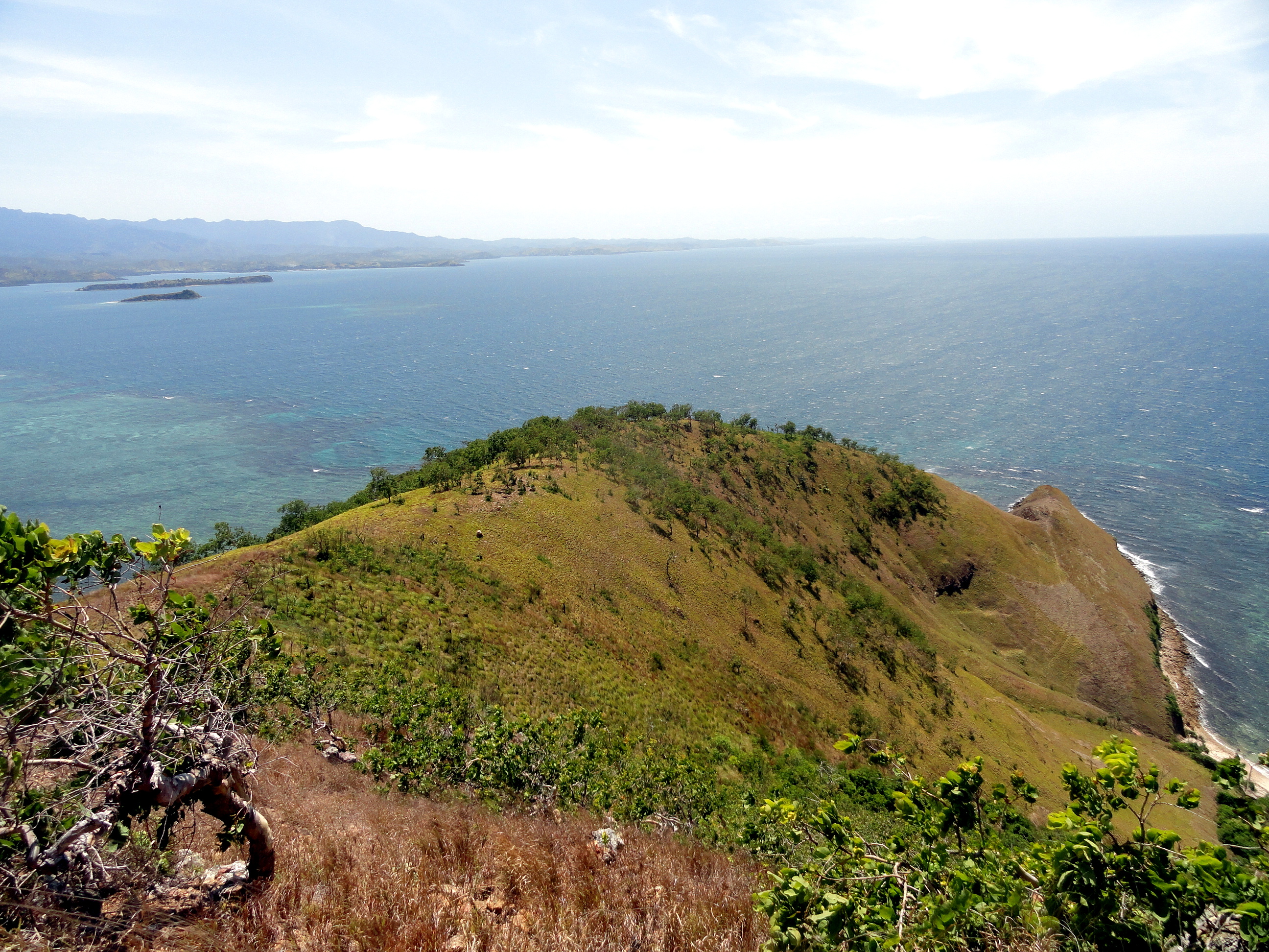
Now, again if this appears as planned: above is a coastal shot in which, if you look closely, you can see the (few) towers of downtown POM in the distance – from the same hike as the gorgeous yellow-grass hillside – and to the left you see both docking bays at the Tari airstrip. That Air Niugini plane is the one from which those other airborne shorts were taken.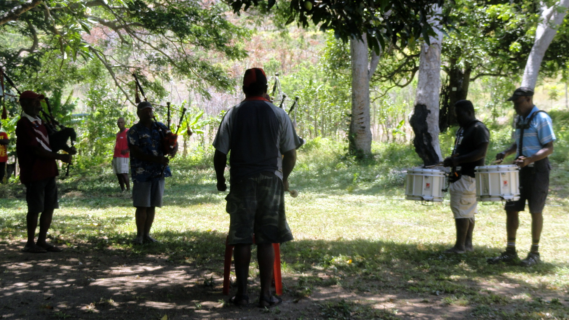

And yes, the drum-and-pipe band is part of the military barracks at Taurama, the start and finish point of our lovely coastal hike from which many of these shots come. After a hot hike in the blazing sun of tropical PNG, it was a classically where-am-I experience to sit and guzzle water while listening to militarily-precise drum-and-bagpipe music. Remember: the southern part of what’s now PNG was actually a direct British colony for a while, while the northern part became an Australian League-of-Nations mandate after it was taken away from Germany post-WWI.


This seems as good a place as any for me to put some general text. So here it is a new year- how did that happen? it feels like just last month I was baking croissants for Christmas breakfast with Mom and Steve! – and here’s Paul being a lazy so-and-so in a spacious apartment full of the mod cons in Cairns for a week of much needed sleep and disconnection before I return to start thinking about how to make 2013’s plans come to fruition as we’ve … well, as we’ve planned them, to the extent that’s ever possible in life let alone this particular line o’ work. I haven’t much of a general nature to say: these are a collection of photos taken either on the last bushwalk group hike that I joined in 2012, plus some aerial shots from the plane taken between Tari and POM in December, and between POM and Cairns (the entire flight path, all one hour of it, is over the Coral Sea aka Great Barrier Reef, more or less) just yesterday.
As always when I leave POM and come to Australia, I find myself going philosophical about human development, the development of nation states, cultural expectations of what makes for a good life or a good community. The driver who took me from airport to condo was a friendly and professional guy who would have been born just after WWII, and whose attitudes towards those of quite different skin pigments and cultural assumptions were likely more mainstream at that time than now, though I suspect I do live in a bubble and such attitudes are more common even among “my sort” than I know. Having lived as a pigmental minority in various parts of Africa and Asia, I realize it’s unavoidably universally human to single out those different from us for extra attention. I worry about the tacit assumption among those of my own pigmental type and general late-capitalist developmental background that our own ways of life, belief, eating, etc. are inherently superior. Seems to me we’ve made a fair hash of things on a number of fronts, while having real successes on others, so rigorous self-righteousness is hardly in order. On the other hand, I am reminded that when westerners first showed up in Japan we were found quite smelly (butter-smellers, I think?) and barbaric…heck, this dismissal of those who look, smell and act differently from us may e the most universal cultural trait defining humans. So I held my peace and took my driver’s attitudes as a lesson in humanity, rather than a depressing view of cultural realities in contemporary Australia.
For those on my email list, there’ll be another bit coming out shortly with random thoughts, hopefully not too terribly long. I’ve chosen to stay on for a second year in PNG. I find the place endlessly fascinating and confounding, and the work we’re doing well worth another year of my trying to get better at helping it happen. May we all be as tolerant as our hearts and heads can permit, and may the world – oy, please! – find a bit more peace and reason in 2013, especially in places close to my heart like DRC and the US Capitol building.


Two PNG Hikes — POM and Tari

smw, slt is in Berlin for a bit. This is about the annual-plan meetings and preparation for 2013. An aspect to my new role that, well…I think I can learn to like. I won’t go into much detail, but suffice to say that with so many projects and so many missions, so much need for good work in so many places in the world, when it comes to annual budget and planning time, one must really have one’s ducks lined up nicely if one hopes to conduct new activities, improve quality of management or outreach or communications, etc. – it’s pretty competitive and so many missions are trying to do a lot. I’m not used to being involved at this level – more used to defending an individual project rather than having a good bead on the kinds of things that HQ looks at for multiple projects or a mission as a whole. Not exactly an easy transition for me, but enough about that. After the meetings are all done, I’ll have a few days of vacation.
In the meantime, I am taking advantage of being here for some conerts, plays, etc. And of course I’m taking advantage of good, readily-available internet to post whatever photos I have up on the blog. Herewith shots from two hikes I took in the last month — most of the shots from a lovely hike around Tari up in the highlands (above, and all but the last three & the shot immediately below), and then four pics from a bushwalking group hike around POM. The POM ones stand out becuase it’s much drier – was the very end of the dry season; rains started up a few days later, about two or three weeks ago though my sense of time is a bit off these days. I’m trying to get a lot of sleep. Hope everyone is well. Ciao.


Love the contrast of this wooden hut above, and the pre-fab dwellings at the hospital compound below…


OK, one of my total favorite things is how kids everywhere feel they must do something, other than standing there and smiling, when some white guy takes their photo. It’s quite universal – I recall a photo I posted on the blog from Nigeria more than five years ago, remarkably similar to this in the style of the kids, posing as it were for their closeup. It’s great fun for all involved…


When we got to the first village on our hike, the kids came running. Seems we’re one of the more interesting parts of their weekend. 🙂 The hikes are definitely a highlight for those of us who get to go on them. Further below, you see how Tari is really situated in a basin ringed by hills, and all fairly high up in the highlands to begin with.


Below, that’s downtown Tari — which is basically an airstrip, the hospital, a few shops, and some government buildings. The people all still live in traditional compounds, divided by the kinds of steep walled walkways between and among different compounds that you’ve been seeing – and perhaps wondering about (example two shots above, with Katja). The guys on the fence, below, are bidding us farewell at what I assume is the edge of their family’s territory after walking with us, cutting us walking sticks from local bushes when the way got too steep and muddy (man, it’s slippery on those clay-y muddy hills after a bit of rain…), and generally keeping us company for much of the lovely walk.


For the final shots, we’re back to the end-of-dry-season hills around Port Moresby and that excellent hike I did a few weeks ago, last chance I had to get out hiking in POM for the time being. Now the rainy season is back in POM, so it’ll be mud hikes& mildewed clothes for the next several months.


Kakadu, Katherine Gorge & Litchfield – Out & About in NT!


On our last morning in Kakadu National Park, we took a boat ride along the East Alligator River, which separates Kakadu National Park from Arnhem Land, all within the political boundaries of Northern Territory in the contemporary nation-state of Australia. By that point I’d seen Aboriginal rock art that’s been dated back, in some cases, as far as 20,000 or more years. I’d heard how the current estimate of how long Aboriginal cultures have lived in this part of the world is now up to about 60,000 years — as archaeologists continue their studies and dig deeper down the layers, they can carbon date and look other clues to the time of each layer, based on known climate changes or changes in what animals were in which area when.
Anyway, so here we were coasting along this river with a very personal narrative from a guy who grew up here, whose parents grew up here…whose ancestors, one presumes, have been in and around this spot of land on the planet for something like 20,000 or 60,00o years or so. I’m seeing crocodiles much like the one below — huge saltwater (estuarine) crocs that look magnificently primeval and dinosaur-esque, I’m seeing beautiful and timeless landscapes on both sides of this deep green river. I’m imagining the flow of time. I’m thinking about where my own ancestors might have been 20,000 to 60,000 years ago – times when northern Europe was under mountains of ice, so they sure as heck still wandering somewhere else.

My most immediate thought was this: if global warming does sort of end contemporary late-capitalist civilization as we know it; if some of the movie fantasies that show up in films like Water World do come to pass…I bet the aboriginals of Australia will keep on going. So my first thought was about how these are people who have merged their culture with their land, with their fairly harsh environment surrounded by extremes, in ways that I and mine haven’t come anywhere near for millennia, if ever.
This was the relatively simplest expression of a wide range of far more complex reflections that I was having throughout my two weeks in Australia, about race and colonialism, history and society, and so on. While in Darwin after Kakadu, we saw an excellent Aboriginal & Torres Straits Islander art competition. The winner in one category (works on paper, maybe?) was drawn from a few facebook discussion groups about aboriginals, with a lot of really astoundingly racist and ill-informed or frankly ahistorical and anti-reality based comments about what Aboriginals are and represent in Australia. I had that to think about, compared with the (so far limited) experiences I’ve been having in PNG, a colonial-created modern nation, which from 40,000 years ago until about 100 years ago was hundreds of individual cultures…then went through a short phase as an Australian colony and is now working its way towards being a modern nation-state governed democratically by its own indigenous inhabitants who themselves have been around about as long as the aboriginals of Australia have. So there are interesting comparisons – Australia more like the US in that Europeans arrived and stayed, claimed primary ascendancy in governance and politics and rapidly outnumbered their predecessors; vs PNG where Australians did that for a period then left, leaving behind a created state.

There’s no way I could do a decent job of sharing the complexity of my thoughts. I have no conclusions. It worries me that humans are still tribal by nature, at a time when our technology and sheer numbers can have such global impacts. But we’re endlessly creative and problem-solving, we modern humans (meaning our species since about 100,000 years ago or something of that sort…not my field). So here’s hoping we’ll sort this out rather than continue to tear each other and our world apart.
Enough seriousness. Enjoy the pics! Northern Territory, Kakadu and so on ROCK.

What you’re seeing so far… Immediately above: Paul contemplates the impressive scariness of a termite mound at Maguk campsite in Kakadu. Above that, all shots from the various parts of Kakadu where we camped. Below, a suite of shots from Litchfield National Park (closer to Darwin – the two waterfall shots) and then Katherine Gorge (south of Kakadu).


NT is marked by extreme seasons: a very wet wet season, then a very dry dry season, called “the wet” and “the dry” by locals I believe. In the shot of Katherine Gorge below, you’ll notice many trees bending strongly in the downriver direction. This is from the wet, when half of the gorge is full of water and all the trees are deep underwater, and bent over by the force of the current. That’s when saltwater crocs can come all the way south the Katherine Gorge even though it’s hundreds of kilometers from the ocean, because there’s so much water they can easily swim in, then get stranded when the wet ends and the various bits of the gorge get more disconnected by rapids and rocky stretches as below.


…Howard & Gene enjoying a swim at Florence Falls in Litchfield, above; and the sunset at Katherine Gorge, below.


 And now, as of the shot of me above, we’re back in Kakadu. Immediately above: rock art showing inflamed joints, interpreted traditionally as the local spirits of a bad place punishing people for being there. Modern science tells us that there’s a lot of uranium in the spots that have traditionally be identified as not good for humans, but reserved for spirits instead. About rock art: the red color can last longest, so in the very oldest paintings it’s only the red that will hold up. The yellow, white, and some of the other colors can last a few thousand years – but the red can last tens of thousands, literally. And below is our tour guide, referred to above, demonstrating how to use a spear thrower to increase the range of a spear. Below that, Paul with the spears after he picked them from the river, once we were back on the boat. Yes, the same river where we’d been seeing 5-meter-long salties. 🙂


A car crossing from Kakadu into the fully-aboriginal-reserved Arnhem Land. Below, me in Katherine Gorge…yeah, some of these are a bit mixed up. Artistic license? 🙂


This is maguk — a waterfall, a big deep swimming hole below and a lovely set of pools above. Immediately below: how Paul spent the better part of an afternoon relaxing at the upper bit of Maguk.


Some views of the nature where we were. Immediately left (if this shows up as I hope once finalized), sunning itself on the sand by the side of Katherine Gorge, is a freshie – freshwater crocodile, not really a threat to swimmers etc. unless you step directly on them. A saltie (esturaine or saltwater croc) is showing off her teeth above. There are thousands of magnificent birds all over Kakadu – migrating waterbirds, parrots and singing or raucous birds of all sorts. And, of course, the ever-present agile kangaroos. And then, below, another freshie doing the crocodile rock… ![]()


The timing of this vacation was set to overlap with my 50th birthday. Howard & Gene had a few surprises on the evening of my actual birthday at the absolutely gorgeous Maguk area – as you see below.


Below: if you wonder how I got some of the angles on water, rock, and the landscape below…that’s me the intrepid travel photographer at work.


Art, Architecture & Sydney’s Lovely Harbor


smw, slt has returned from a magnificent two-week vacation in Australia. The focus of this vacation was the Northern Territory and specifically Kakadu National Park. But since getting into and out of Port Moresby usually requires many connections and long waits in various airports, I chose to break up the trip by stopping in Sydney for a bit on the way in — where I took nearly all the shots in this particular post. In the floral section, below (yes, this blog post has different theme groups just so you can see I’m trying to keep it interesting and show a wee bit of editorial intervention…), you will see a few that were taken in Kakadu and one that was taken in Litchfield National Park…where, as Gene succinctly put it, we spent 1-1/2 hours on our way via Katherine Gorge (4 hours) to Kakadu. Where we spent four days. And could easily have spent another few without feeling bored, from my perspective. But it was a magnificent vacation, a great way to spend my birthday, and I am well rested and delighted to be back with my colleagues here in POM this Sunday evening, with what will no doubt be a full work week ahead of me. (The work inbox, which has now been turned on, is at about 133 emails I believe – actually not a bad toll for 15 nights away from my station!) Happy end o’ northern summer to those of you in the northern hemisphere – and hope you enjoy these.


Above and in the following set of photos you see either Cockatoo Island in Sydney Harbor, or in some cases art installations, or the effects of art installations in the case of the mist on a clear sunny day above, at the Sydney Biennale. The Biennale is a fantastic large art show that takes place in many venues around the city, but with a major focus on this island well west of the main city, which over its post-European-arrival lifetime has hosted a prison and shipworks, and is now publicly held and open for tourism (great lodgings there, but not very easy access to restaurants etc.)…and, as you’ll see at the bottom, perhaps the best-located tennis courts I’ve seen. I’d have loved to play there.
You will notice that it was a day of bright sunlight and even though I arrived early, many shots were taken with bright mid-day sun so I just decided to go with the sharp-edged shadow look and try my own hand at a wee bit of artistic expression here and there. Hope you enjoy. 🙂


These yellow flowers appeared in every part of Kakadu where we traveled, so they are a teaser of the Kakadu photos that you’ll be able to see a bit later. We heard many times how they’re an important season indicator for aboriginal or traditional landownders — when they are blossoming is when the freshwater crocodiles have laid their eggs and people can go to the sandy riverbanks to dig for eggs.
The shot immediately below shows the flowers in situ, at Ubirr in the north of Kakadu. There are many, many more shots of Kakadu to come – it was amazing. But I like to go about things in an orderly manner…


Having shown you my “artsy” cluster of photos and displayed yet again my fondness for flower photography, I will now show you what magnificent views I had from the window of my inbound flights on this vacation – first over the islands and reefs of the Coral Sea, above and two below (this is all basically in the area of the Barrier Reef), then of the coast just south of Sydney airport — I started the entry today with my favorite shot from my inbound flight. Then…well, who doesn’t love the Sydney Opera House? Perhaps I’ve overdone it, I’ll readily admit…but I do find it endlessly interesting from all angles and in all weathers. Close second is the harbor bridge, and just the Sydney harbor generally which I really do think is lovely. Hope you enjoy. Cheers til next entry…


Green Hills & Highlands of Tari…Plus Some East Sepik Shots Also :-)


It will, I trust, not have escaped your notice that probably the coastal sunset shot might not have been taken in the same location as the shot of me above. For those of you aware that I’m now finishing a two-week vacation in Australia, it may not have escaped your notice that these don’t look like photos from Australia so much, either. I’m clearing the last photos from my visit to Wewak & Maprik and other parts of East Sepik Province, as well as a recent (late July) visit to Tari in the highlands, so that I can next focus on the shots of this lovely Australia vacation. This way, whenever I get around to it, those shots from Kakadu National Park etc. will sit at the main page of the blog for a long time, since I doubt I’ll do a lot of posts for a while once I get those finally sorted and up….I’ll be ready to do other things with my time hehe. 🙂
 But in the meantime I do hope you’ll enjoy these shots from the highlands, with a few shots from the coast, of PNG. For anyone who’s not already heard, I heartily recommend two links to radio interviews given by a wonderful colleague of mine who recent left the mission and did some interviews on her way out; those links are here:
and here:


It will not have escaped anyone that I love flowers. These were all shot on a nice walk I took with the Tari team around Ambua lodge, a tourist near Tari in the highlands where I also saw the waterfall that begins this entry.
Perhaps between the links, and these shots, I’ll keep you busy enough for the moment that no one will mind waiting a bit longer for the shots from Kakadu National Park where I spent a wonderful birthday with my friends Howard and Gene last week. For now, that’s it…Hope all’s well with everyone. Ciao.


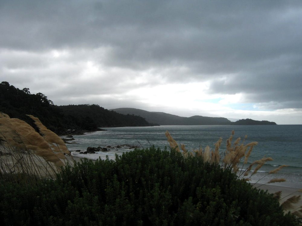
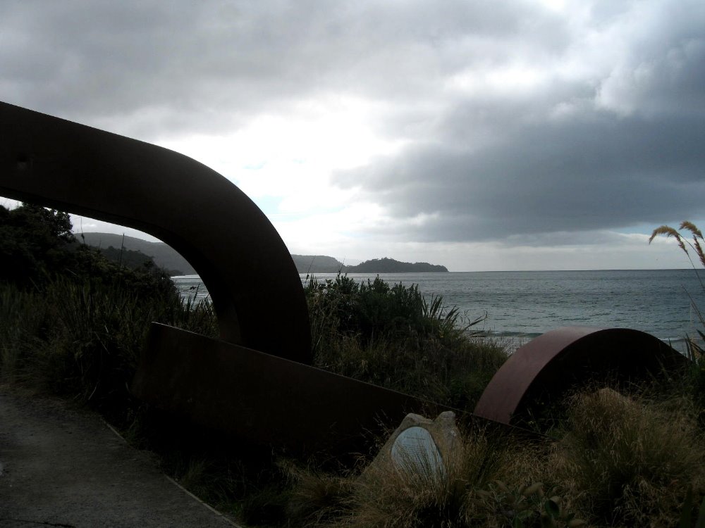
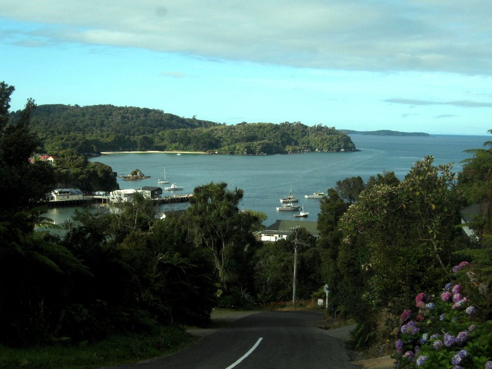
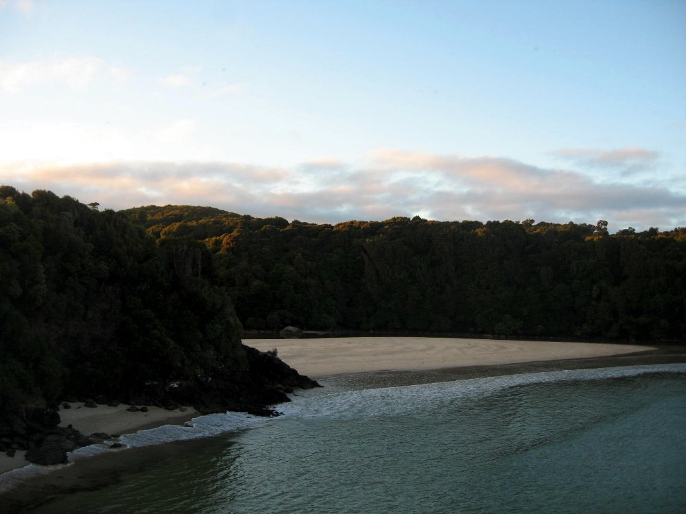
Stewart Island – Rakiura

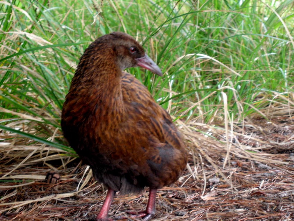
 Rakiura, or Stewart Island, is the third-largest of NZ’s islands, and it is (while still of significant heft) a very great deal smaller than either North or South Island. (Get this: the South Islanders like to call South Island ‘The Mainland’ since it’s bigger than North Island. Umm, guys, you’re both islands. No mainland here. Deal.) Anyhoo — Rakiura is now mostly national park, aside from a bit around Oban, the only town with all of 380 inhabitants at last census (there are maybe 15,000 kiwis on the island — the birds, that is) and some chunks that are Maori tribal lands. In Maori legend, there was a mythical man who, from his canoe (South Island) fished North Island out of the water; Rakiura, in this telling, was the anchor he threw over to anchor his big canoe when he realized how big a fish he’d hooked. Hence the chain, below; there’s also a chain on the South Island, near the town of Bluff. Rakiura is known above all for being more free than the rest of NZ of the scourge of mammal predators that have destroyed many of NZ’s native bird species. Therefore one can see, here, abundant native parrots, parakeets, little hens and other such birds which are decimated on the two larger islands. I had a lovely quiet two days at the South Sea Hotel in Oban, and walking the streets and trails of town and Ulva Island.
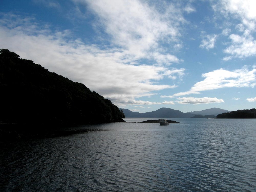

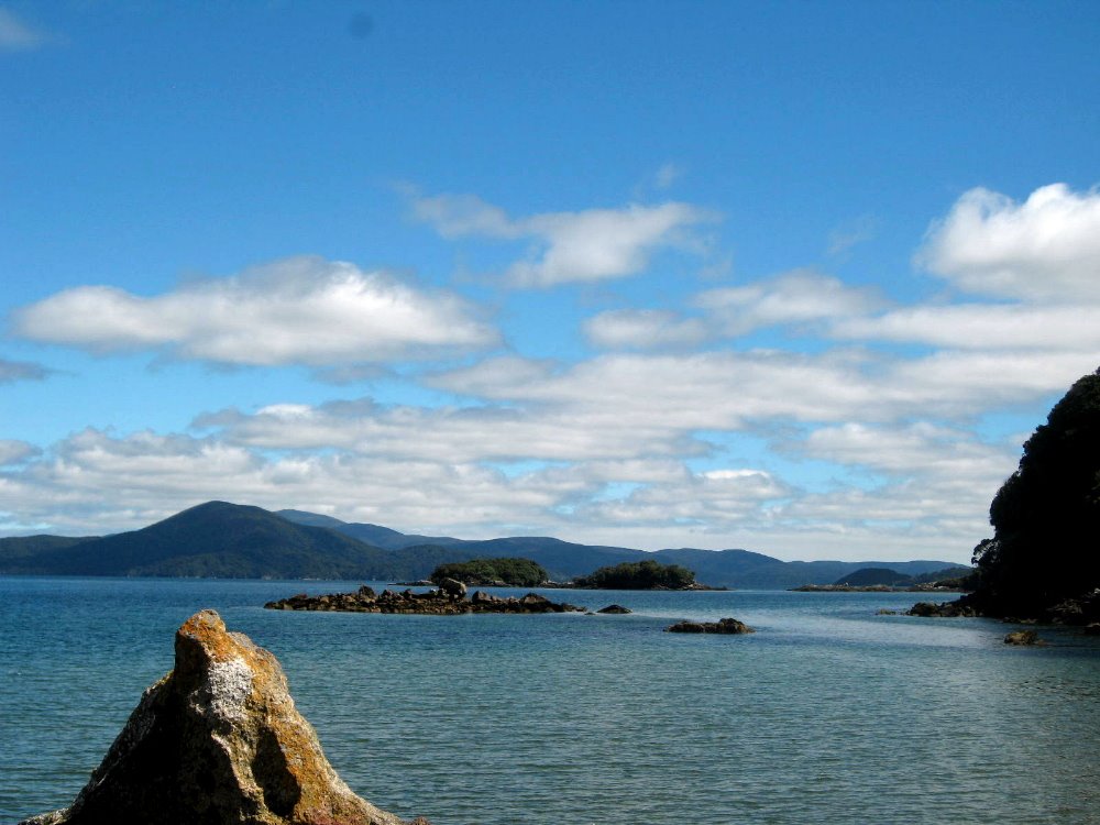
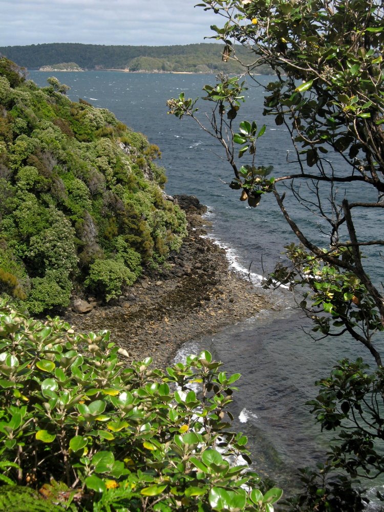
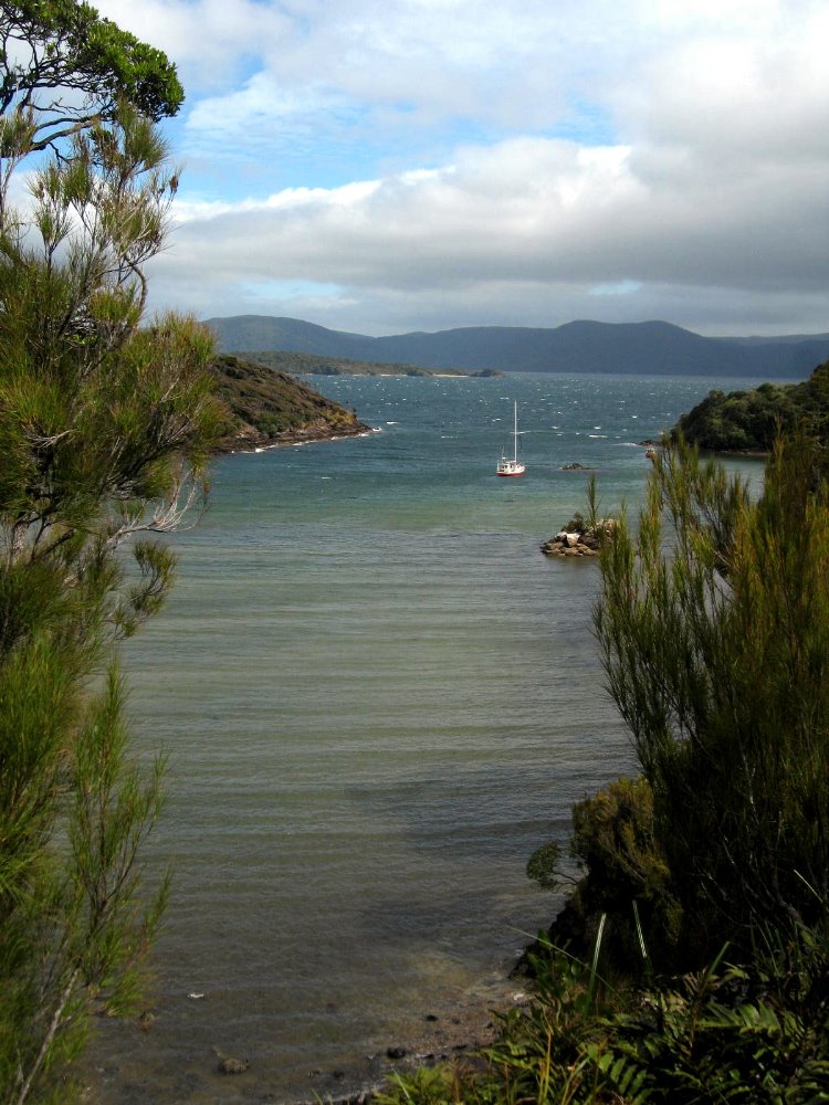
 That bump on the horizon, to the right of center, is the South Island. I think.
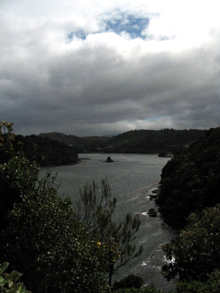

Dunedin & Otago Peninsula Wildlife
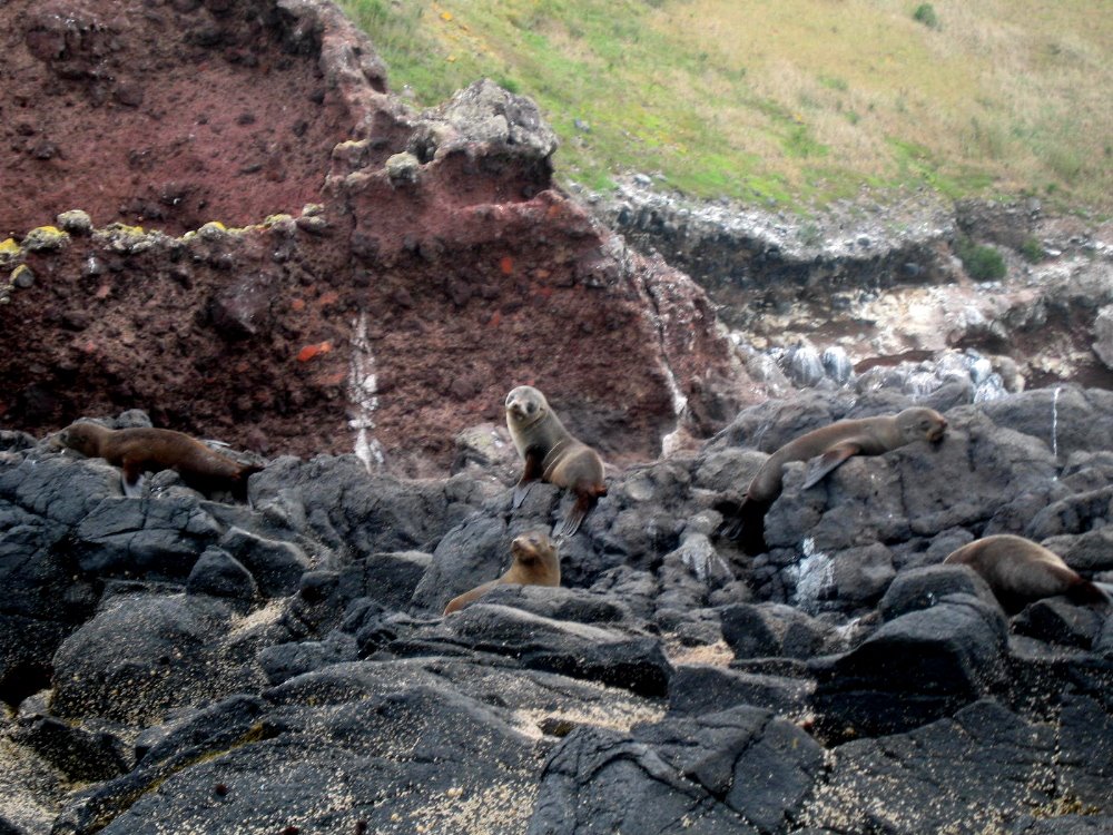
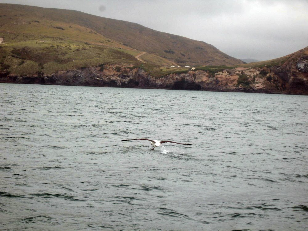
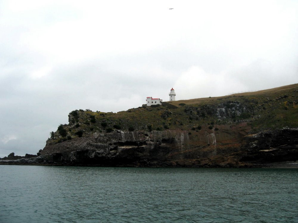
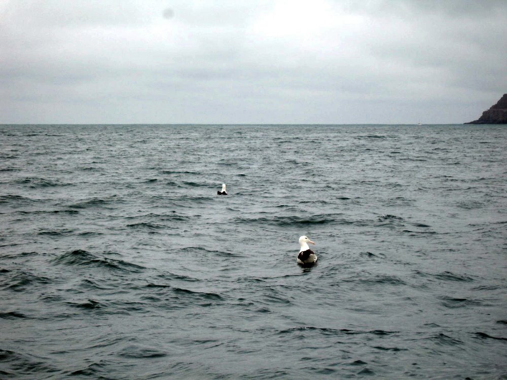
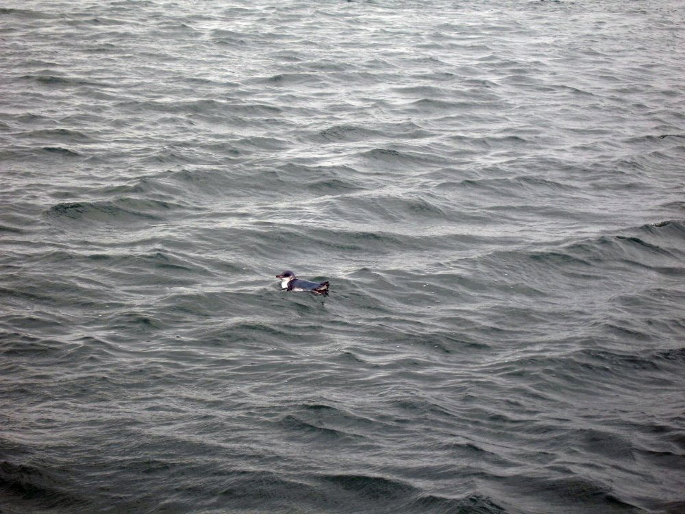 Seals, little blue penguins, and above all the impressive northern royal albatross are indeed what Dunedin and it’s adjacent Otago Peninsula are best known for. That and University of Otago, NZ’s oldest and (by acclamation, it seems) best University. Dun is to Gaelic as Borough is to English, so Dunedin is on some level an ode to Edinborough. The center of the city itself is a pretty little octagon of streets and parkland called, surprisingly enough, The Octagon. This formation at the city’s heart leads to some strange street patterns, but once one gets over that the city’s really quite manageable and very pleasant. Around 1900 it had about as many inhabitants as Auckland…but Auckland’s increased by a factor of 10+, while Dunedin — well, maybe it figured out it had nothing to gain by outgrowing itself. It’ll upset many Kiwis, but in many ways I found Dunedin the most interesting and unique of the cities I visited in New Zealand — I’m sure, and I was told by more than one native, that it’s dull to grow up in, but I can more easily imagine retiring there – sucky weather and all – than Auckland, which I found more gangly and awkward in its growth. Oh well, there you have it. Penguins and seals are as cute out in the wild as they are in museums. And royal northern albatrosses, in flight or on takeoff, have a grandeur these photos can never capture. Sorry.
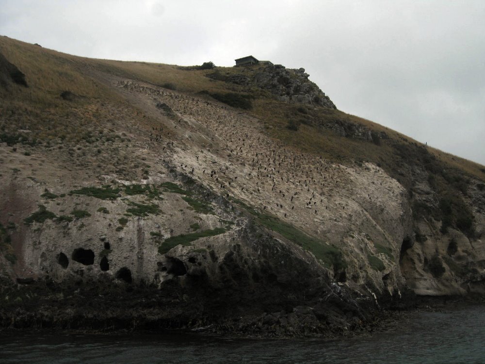
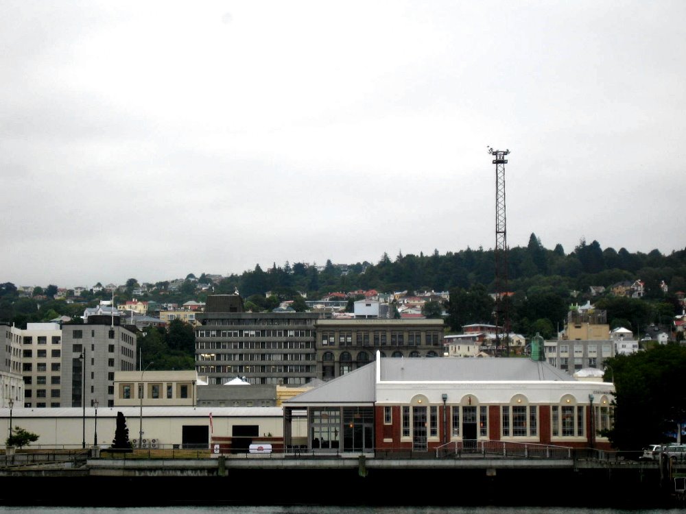
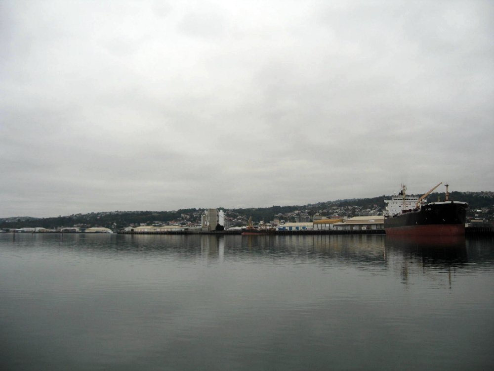 The harbor runs between the peninsula and the mainland on the other side, and the inner harbor is very shallow so admits only fairly small boats; the outer harbor is very active shipping out powdered milk and lumber to China and the rest of Asia. It was foggy when I was out there, in case you hadn’t guessed.
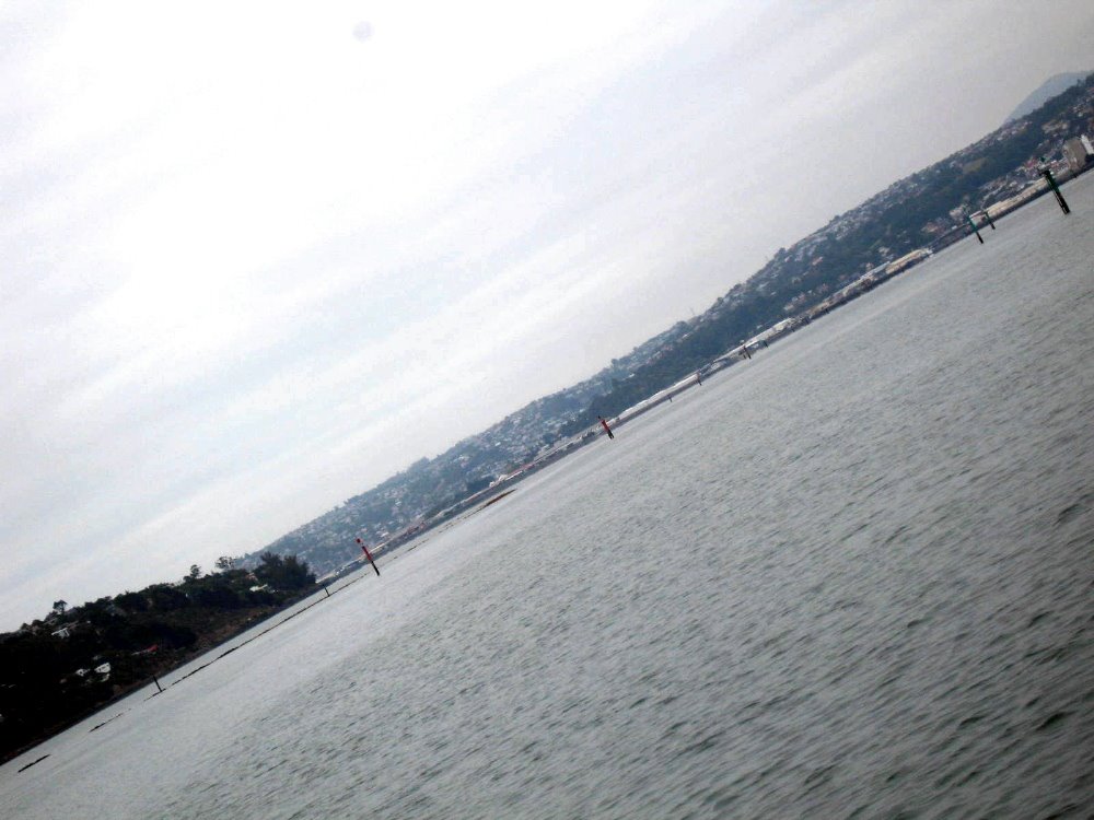


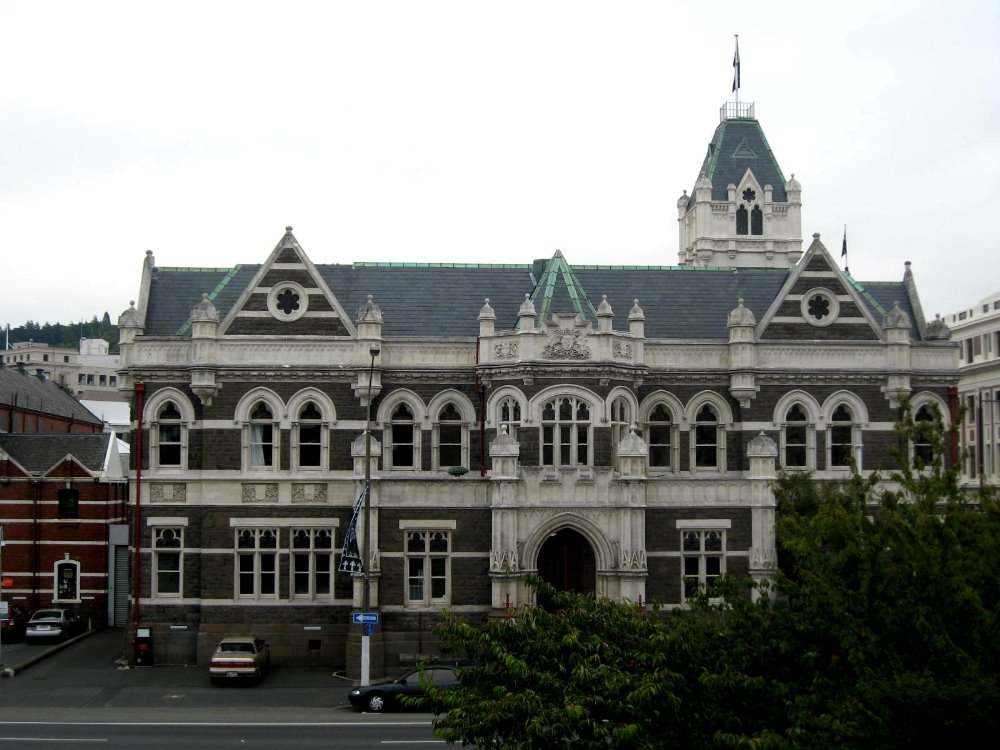
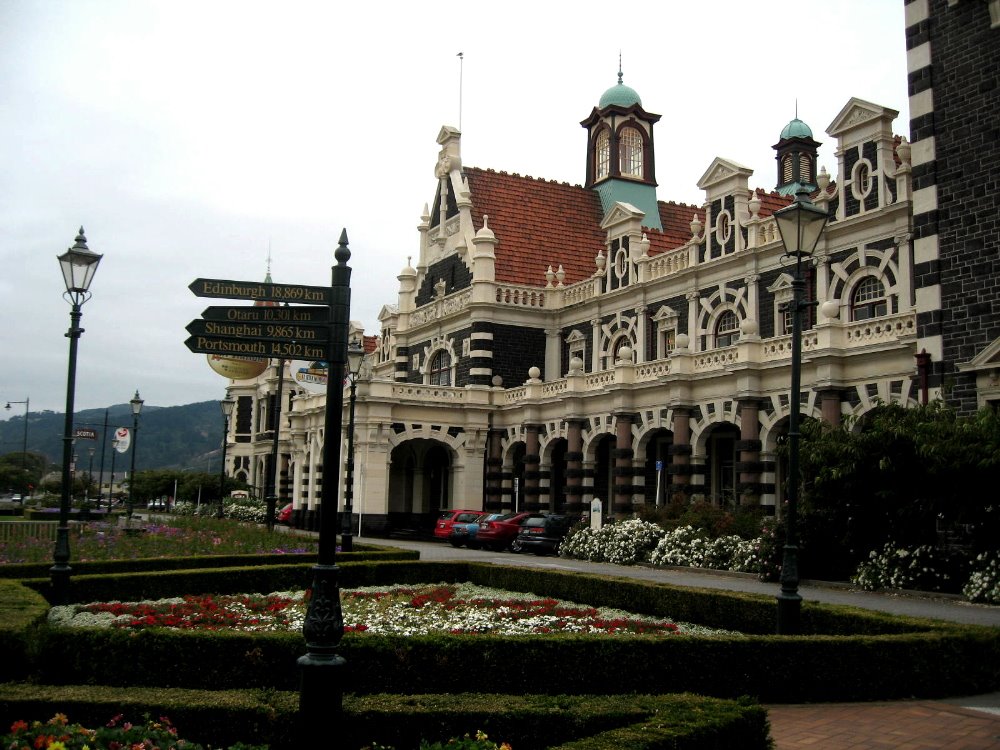
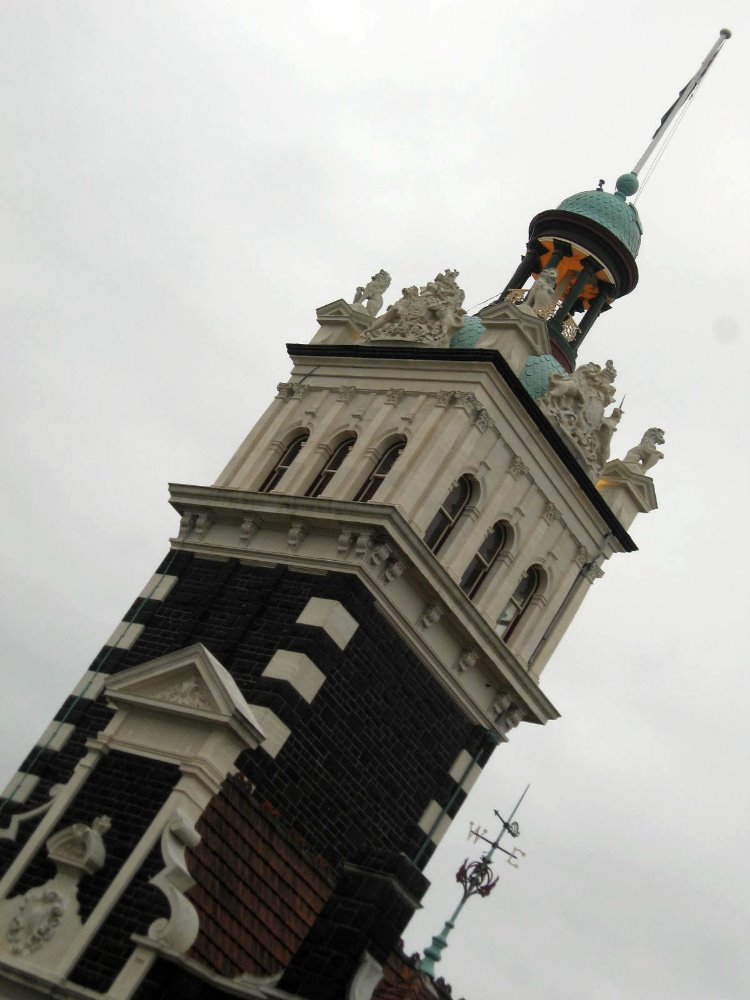
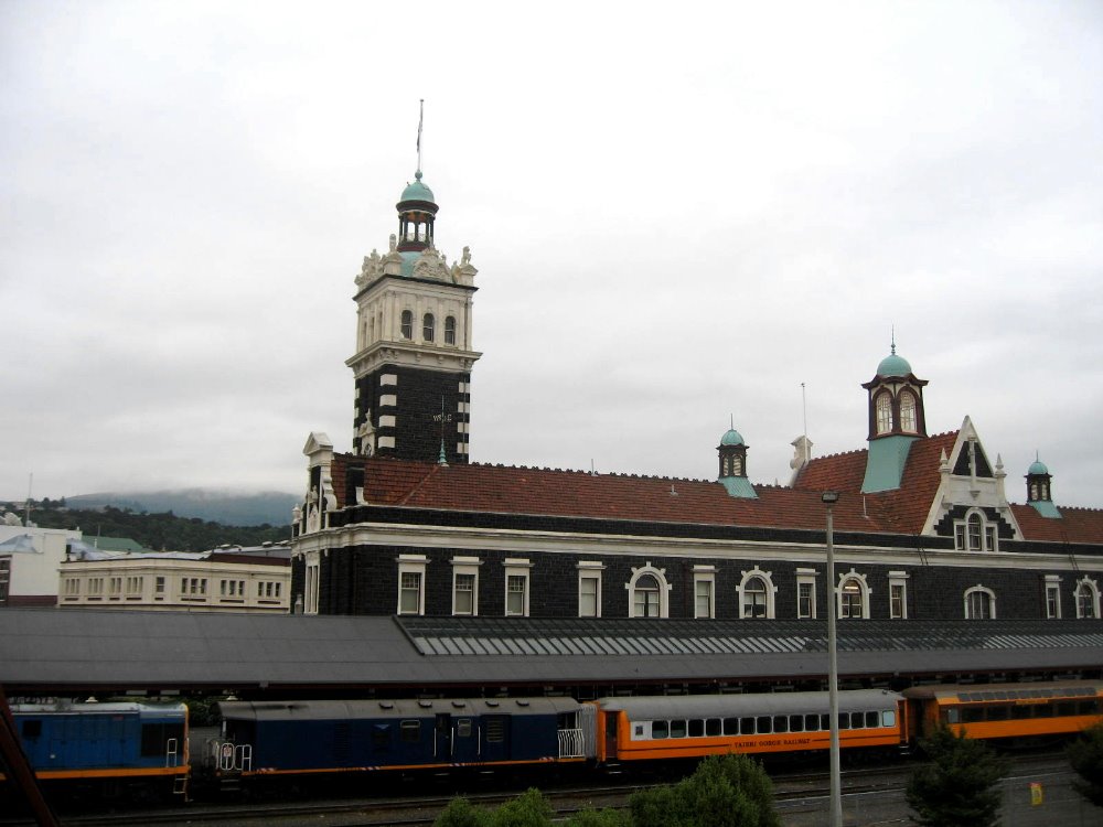
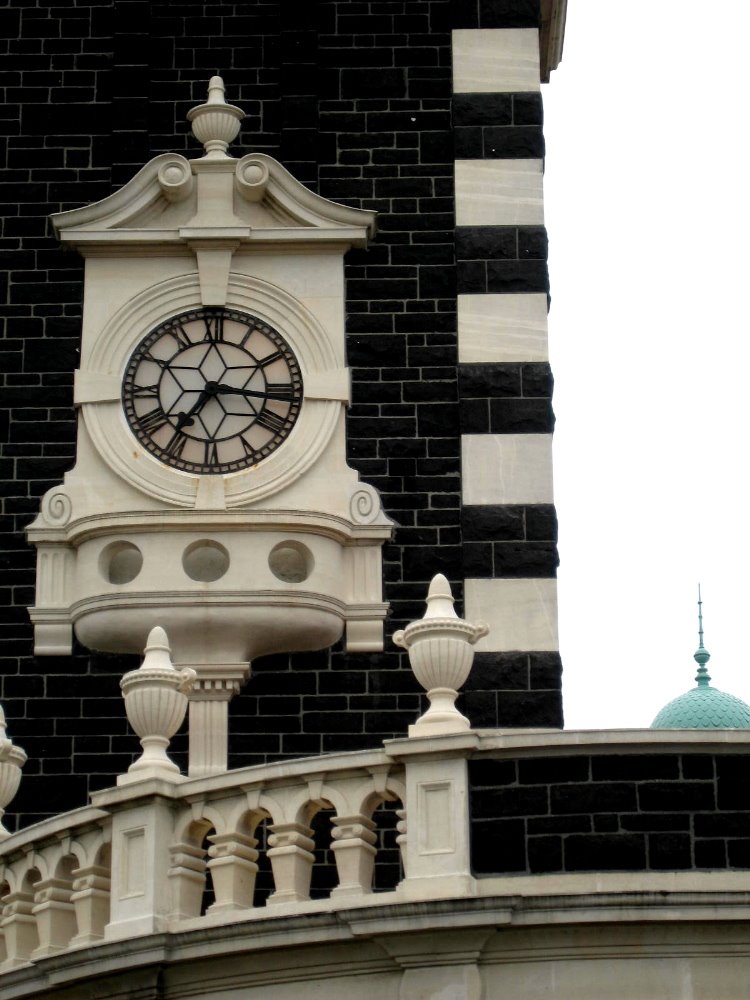 Above and also below: Dunedin’s famous train station. I don’t know where those train cars go: they’re not connected to the national network, which stops at Christchurch a good piece north of Dunedin. I think it’s some kind of regional tourist train. Or maybe they’re just there for show. Nice building, though, huh? Below: one side of The Octagon, with city hall opposite.