
Winter Wonderlands?
 Every so often I scan through my own blog and remember beautiful things I’ve seen. Last year for the first time, I did my own personal “greatest hits” selection of photos from the ten+ years I’d been blogging at that point. This year, I find myself thinking about ice, even though I’m a few hundred miles at least, I suspect, from the nearest naturally-occuring ice. Perhaps because of that: listening to seasonal tunes about winter wonderlands and white holidays has reminded me of the ice and snow I’ve seen.
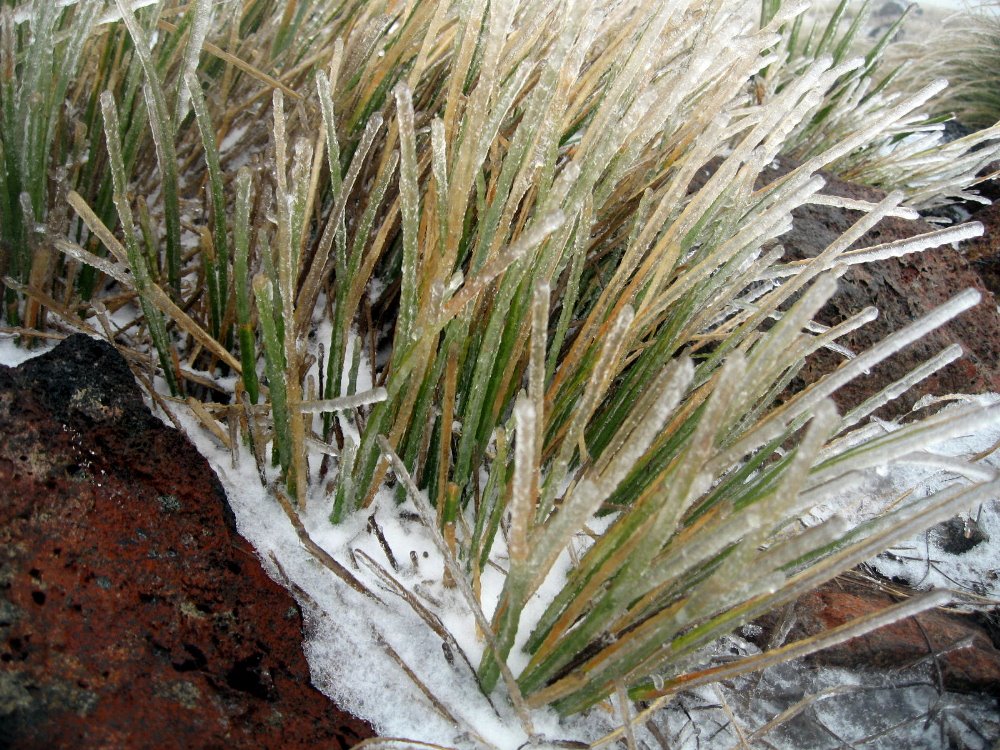
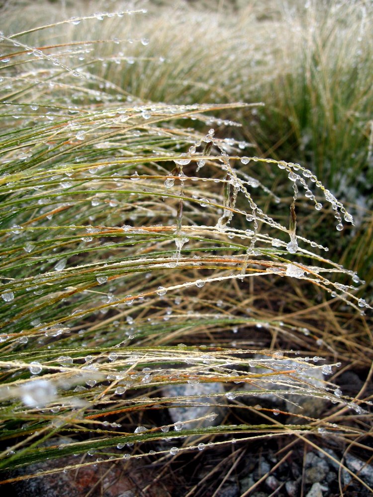
 I also realize I didn’t photograph things I wish I had, such as snow piling up on the streets of Beijing in the winter of 2005…although I do feature skaters on Beijing’s Qianhai, and cracking ice on a pond outside Beijing during a winter hike, taken the same winter. Above & in the collage below are photos from winter in Yosemite & summer in New Zealand (icy grass on the Keppler Track in Fiordland; and also a shot of the glacier on South Island’s west coast). There are also frosted grass & icicles from a winter trip to the Great Falls in Paterson, New Jersey: yes, such beauty can be found right off Interstate 80, if you know how and where to look :-). Plus some frosted grass in the early-morning shade at Hood Mountain in Sonoma County, two winters ago. If you’re already experiencing ice and snow, maybe these won’t do much for you…let me know, either way. May your year be warm, safe and dry in 2017.


Remembering in December
 My wandering field life passed the ten-year mark earlier this year. That’s ten years of finding my way into a new work environment and getting to know new colleagues once a year or so. In a more mundane way, it’s ten years worth of photo files to keep up-to-date and to try to remember to share on my blog. A cousin (thanks, Juliette!) noticed that the entries from my earliest days had lost their photos: mine was a rather early blog, and the ways of uploading photos have changed since then. (Many of those earliest posts appear frankly so embarrassingly shallow to me now that I’m tempted to simply wave my editorial wand and have done with them…but thus far my sense for historical accuracy is controlling that temptation…) If my continued research succeeds, many of those photos will be directly restored onto the blog as I find their originals in backup hard drives and other obscure locations: ah, new year’s resolutions before the old year has even wrapped up!


In the meantime, I’m uncovering little treasures that never made it up here, while fondly remembering where I’ve been and what I’ve done. I was recently saddened to learn that Nancy Schrom Dye, former president of Oberlin College, had passed this year. During my years of active alumni-association work I greatly appreciated her contributions to my alma mater – so I was proud to join some other colleagues in taking her for an end-of-year meal which, the digital date stamp tells me, occurred in Beijing on December 31, in 2005. Up above are also a few rediscovered December 2005 Beijing-area shots which somehow didn’t get posted at the time. (Posting photos was more challenging in those early days…)
Just below are some previously-unposted 2015 shots: early-morning moonset at my home here in Haiti; me with my brother and a colleague when I gave a talk at Carnegie Mellon University earlier this year; and some shots from the lovely Frick House & museum in Pittsburgh, from the same visit. And since this put me in the mood, I’ve wandered through the many countries & continents, family meals & trips & assignments on four continents that have filled the years between these two sets of photos so very fully. Assembling them’s been fun for me so I hope viewing them is fun for you too :-).


This time last year? In December 2014, I returned from Sierra Leone & later went with great friends to enjoy the Ai WeiWei exhibit on Alcatraz Island (more photos from that one in the original post….though that particular set of great friends – you know who you are! – are remarkably camera-resistant):


Where’d I spend 2013? Living in PNG, participating in meetings in Amsterdam & dive trips in Australia, then celebrating the holidays with Steve & Mom in New Zealand:


I began 2012 in the US (where I visited Washington, DC in cherry-blossom season), turned 50 in the company of Howard & Gene at Kakadu National Park in Australia, and finished the year in PNG:
2011 was mostly Mweso, a little Lamu, a little London and a year-end back home seeing Frank Lloyd Wright homes of Pennsylvania with family:
2010…wow, what a year. Just seeing all the continents and countries where I spent time (actually meaningful time, with friends and family and work) makes my head spin even now. The photos evoked so much for me that I just couldn’t narrow it down to three or four…so I’m giving you a lot from 2010, a mix of Manipur (start of year) and Mweso (end of year), with a sprinkling of Sweden, Berlin, Paris & California in between:


I entered 2009 in Tahiti, yes it’s true: during the year I took off from work to help Mom with her house, I dedicated two months to exploring Australia (and watching the Australian Open!) and New Zealand, flying in via Tahiti with a few nights in Papeete, just because I could. The year ended, of course, in Manipur and included a great trip to see excellent sites of Rajasthan with Howard & Gene:


2008 started in Nigeria, and ended in Tahiti…with a lot of good work in Nigeria, a short assignment for the earthquake in China, visits in Germany with my exchange family friends there….and a good deal of time in and around NYC (Mom, aunt Judy & I enjoyed a harbor trip past Ellis Island where our own immigrant ancestors entered the country, and also a trip to our favorite sculpture park up th Husdon)…with a side trip for some hiking in Sequoia and other California adventures:


2007…I began the year based in Colombo but spend the new year’s period with Mom & Steve at Angkor Wat, returned to Colombo to finish out an assignment, headed on for training in Paris where I also got celebrate Mom’s 71st birthday…back to the US to reorganize my life after my first two years in the field, and then off for a new assignment in Nigeria. At the time it felt big. Now it’s all fond memories:


…which will bring us back to year two of this current phase of life’s great adventure, the lovely year 2006. From Beijing & Yunnan in China, to Polonnaruwa & Sigiriya in Sri Lanka (where I was based at year’s end), with family time on Cumberland Island (Mom’s 70th birthday dinner!) and in Germany in between. With a special souvenir from Seoul, where I had the opportunity to work a bit with the young ladies pictured with their daffodils. In a small-world twist, I had dinner with one of those two young ladies just a few nights ago in Port au Prince, which she visits sometimes in her current work with the CDC. So much small world, so little time for it all. Happy end of 2015, and many good hopes for a 2016 of more peace and health to everyone, everywhere.


Many Muddy Misty Magnificent Miles on the Milford Track

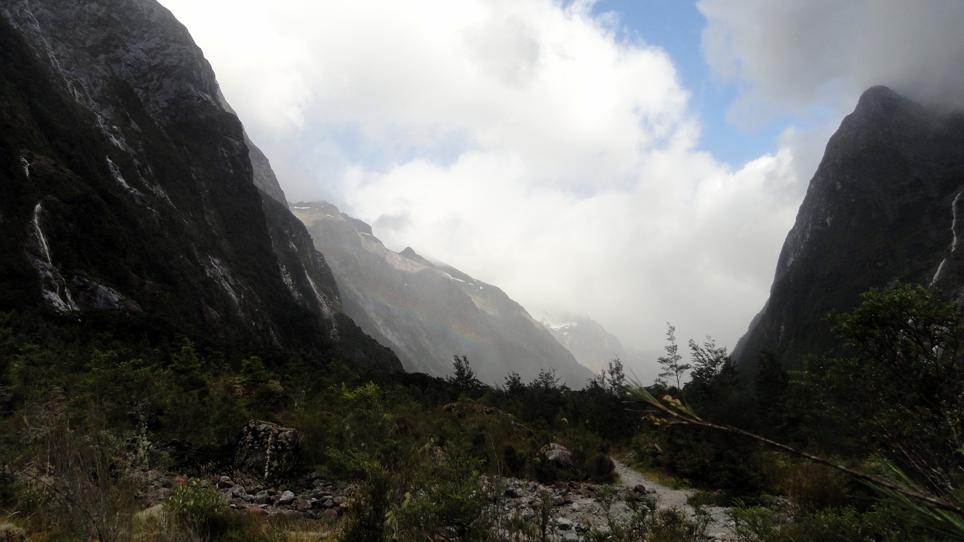
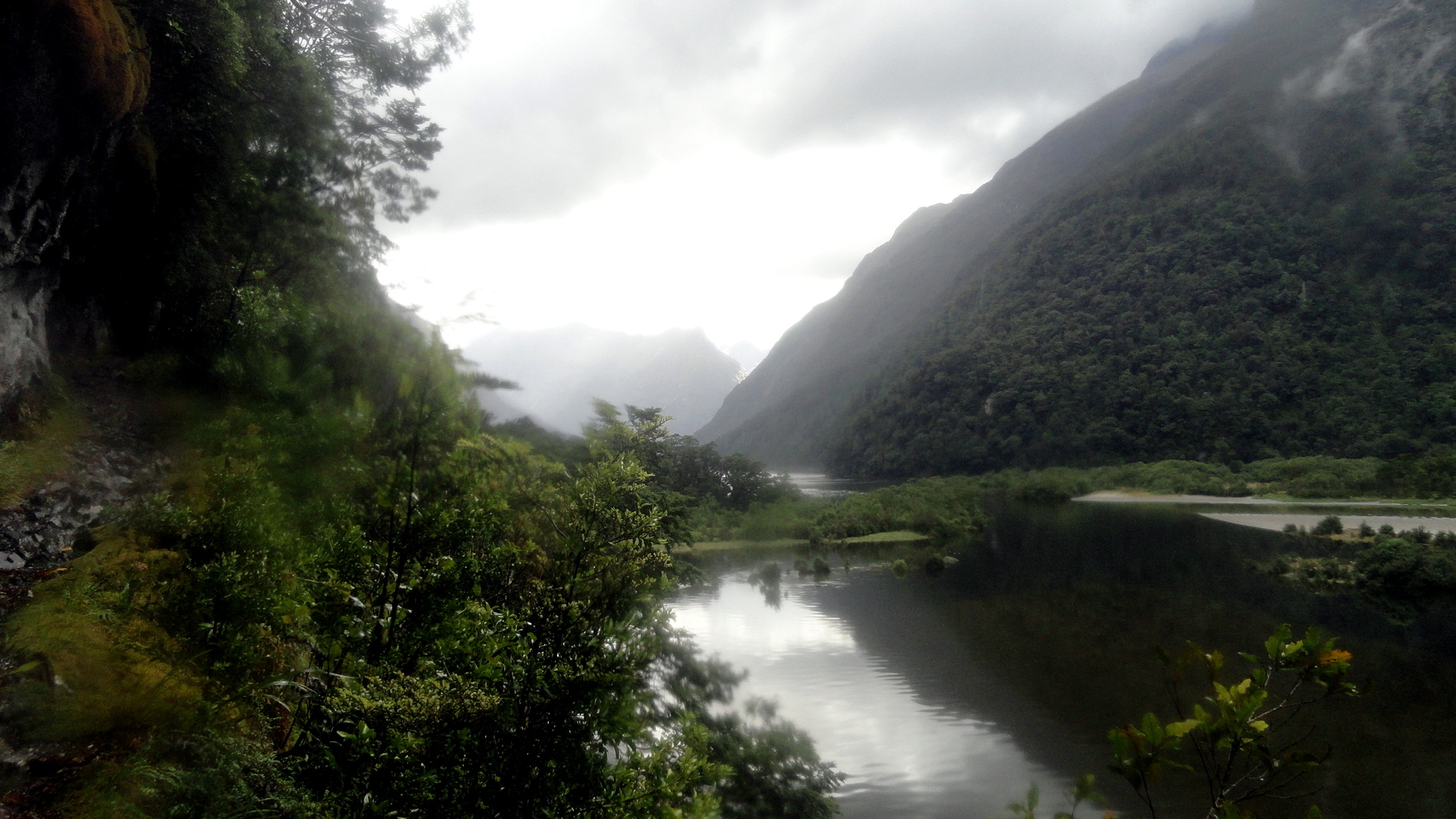
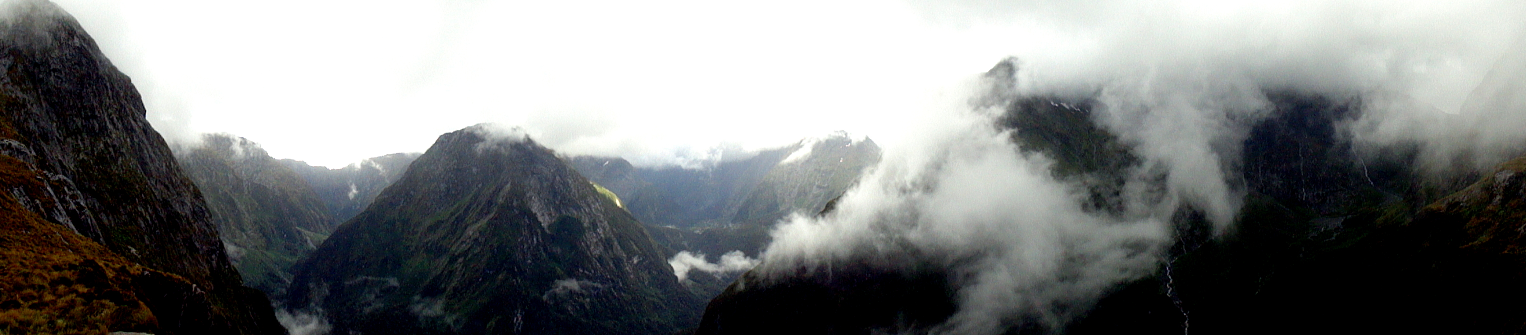
 The Milford Track is the most famous, and most popular, of the Great Walks. It starts at the bottom of the Clinton Valley, formed by the eponymous river which features a few times in the gallery of square photos further down. The first two nights of the three-night, four-day hike are spent within the Clinton Valley, hiking from the boat drop at the northernmost end of Lake Te Anau where the Clinton River feeds it, up to McKinnon Pass where the images above and the whole slide show below were taken. After the slide show, you’ll see a variety of views from other sections of the trail: rivers, waterfalls, dramatic valleys and trail segments snuggled into a rock face alongside the Arthur River at the end of the track, where it meets up with Milford Sound. Milford Sound has been cited by many magazines as one of the most beautiful places on earth; and Milford Track as has been cited as one of the most spectacular hikes on earth. I certainly found McKinnon pass to be one of the most spectacular places I’ve ever seen, and I found many of the miles along the Clinton Valley quite beautiful in an ever-changing, other-worldly manner that was different yet again from the other-worldliness of the glaciers featured in my last post.
But allow me to say this, of the Milford Track: it is indescribably wet. We hiked it in the midst of the southern summer, during peak season. Peak season is also, strangely, the rainiest season; but even the driest season has plenty of rain. And the drier winter season is, we were told, the season of such landslides as the one just below where you see the trail marker placed to navigate walkers across the rubble field. I can imagine that a mostly-dry hike over this trail would be an unbelievably great experience. And I can certainly attest the truth of that oft-quoted adage that rain makes waterfalls, which are the joy of the trail. But can I just say that my own brain can only really appreciate xx-many waterfalls, and after a certain point both my feet and my soul wish to be dry, warm and comfortable again? So I ended this trail – which, indeed, gave me more spectacular scenery than most other hikes I’ve done – with the sense that it won’t likely call to me again…whereas the Abel Tasman, for all its comparatively mundane (hah!) scenery, is one I’d readily return to again and again – in part because it’s just so much more warm and comfortable as a hiking experience. (Even the Kepler, another Great Walk within the extraordinary Fiordland National Park, showcases a wider range of terrain with a lower preponderance of heavily rainy days — witness this post: https://somuchworldsolittletime.wordpress.com/2009/03/05/kepler-track-fiordland-national-park/
But don’t get me wrong: even the most amazing of these photos (some of which still give me vertigo) can’t convey the gift of being present to feel and hear the roar of wind and rain, marvel at the shifting windows of sunlight along a mountainside, or see a rainbow materialize above one of those windows…with the sense perhaps you’re the only human positioned so as to appreciate that particular ephemeral wonder. Whatever the case, I encourage anyone who loves the great outdoors and appreciates natural beauty to bump NZ up your must-visit list, if you’ve not done so already. Feel free to research on this blog (from 2009, 2013-14, and 2015!) some of the many wonders you might consider experiencing in person. Enjoy. 🙂
…about the blurry spots you’ll see in some of the rainier images: my camera has survived but there were days where the lens never really got dry. Most of the rain-splattered photos are deleted, but I felt some of these convey what words cannot about the omnipresence of water at times…


Two Glaciers, Many Streams & Towering White-Tipped Peaks…


 …must mean we’re on the wild southwestern coast of NZ! In this entry you’ll see photos from both Franz Josef & Fox Glaciers, as well as shots from the temperate rain forest to which these glaciers descend at their lowest, warmest level where they’re melting all too rapidly these days, what with holes in the ozone layer and global warming more generally. There are also views from the Haast Highway along the south coast, and up and over the Haast Pass alongside Mt Aspiring National Park into the town of Wanaka. They all have names that identify them. To put this in some perspective, think of the last entry (or scroll down to it) and understand that we did a fairly substantial last-morning hike along the nearly-tropical-seeming Abel Tasman Coast track, grabbed a water-taxi back to Motueka, hopped in the car and stopped for some berries and dinner along the drive south, then spent the night a short walk downriver from the ice cave at Franz Josef Glacier just below. It’s really quite unreal and surreal at the glaciers because, despite significant melt and receding up their canyons to higher ground, they still descend to the level where rich dense temperate rain forest grows and unusual-sounding birds call, and it just feels utterly other-worldly. Certainly this close to sea level, this far downhill from their main bodies, neither of these will stand out if side-by-side with other, bigger glaciers you might have seen…but the clear way they’ve affected the landscape and the simple fact that a short walk away one is enveloped in dense temperate rainforest is pretty amazing.


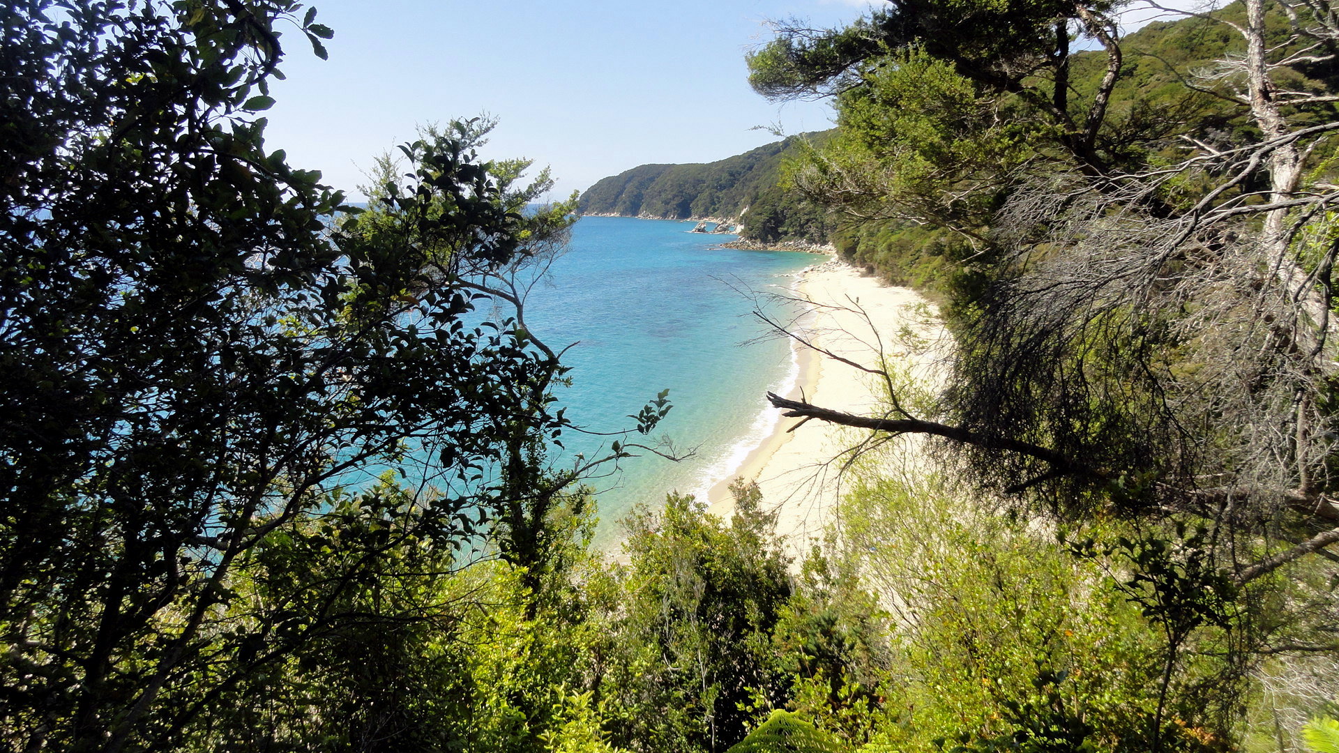
Hiking the Abel Tasman Coast Track

 With this third visit to New Zealand, I’ve grown more aware of how the country lives in the outside imagination. For many, it’s the middle earth of certain much-loved fantasy films. For me – and clearly many more – it’s probably the single best place on earth to get an amazing range of very well supported and managed backpacking options. Hut-to-hut hikes abound throughout North Island, South Island, and Rakiura/Stewart Island, meaning one can travel a bit lighter without a tent if one chooses, and – particularly important down in Fiordland – have a solid roof and walls around one when the rains fall and/or the temperatures plummet even in high summer. The best known and most popular of these hikes are managed as ‘Great Walks’ by the superb NZ Department of Conservation. When I first learned of them, while planning my very first trip to NZ more than six years ago, I think I read there were eight Great Walks at the time. Now it’s up to nine; and I’ve hiked three of them in their entirety, while touching on a fourth during both my first trip and the most recent one. Some friends have said they’re saving developed-world tourism for later, and focusing on less-developed cultural-adventure type travel now, while they’ve got the physical and mental energy and fitness to handle travel to relatively challenging locations without great tourist infrastructure or support. I fully understand that logic, and I’ve heard it applied also to the US by many European friends.
However, let me through some of these posts suggest that places like NZ, and the great national parks of the Western US, offer outdoor adventures which are more difficult when one’s body has lost the appetite for overnight camping and backpacking…and if you miss out on these places now, you might regret it when you visit them later and are limited to their cities and paved roads, unable to get off the highway and into the wilderness. Herewith a few too many shots of the Abel Tasman Coast Track, as support to my argument. This is an unbelievably beautiful place that I am incredibly happy to have hiked and would very gladly return to many times. By hiking it, and waking up early to cross certain estuaries at low tide with my shoes tied together and strung around my neck, I’ve had the unique opportunity to lay down the first set of footprints on the soft sand of those estuaries, to see the sun brighten the sky and rise above the horizon or the moon sink below it, to greet the sun with a mug of tea from my thermos while reveling in the absence of any sound other than waves or bird song…and generally to experience that mystical oneness with my universe that, sadly, I for one simply cannot quite achieve while behind my computer or the steering wheel of any motorized vehicle. Tasman is neither the most famous, nor the most over-subscribed of the Great Walks…but I’d definitely do this one again. Believe it or not, I really did cut out a TON of photos from this post but there are still a lot, for anyone interested in getting a more thorough feel for what it might mean if you were to lace up your boots, grab your walking stick, and step out onto this lovely trek. To reduce the length of the post, condensed two sets into galleries and one set into a slide show. (The gallery just below this focuses on tidal crossings and other cool visual and experiential effects of the tide’s action along this trail.) I hope you enjoy!


Nifty Buildings in Napier
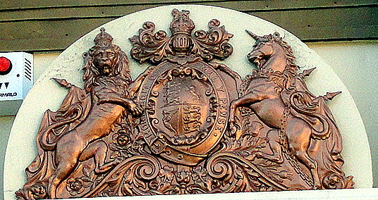
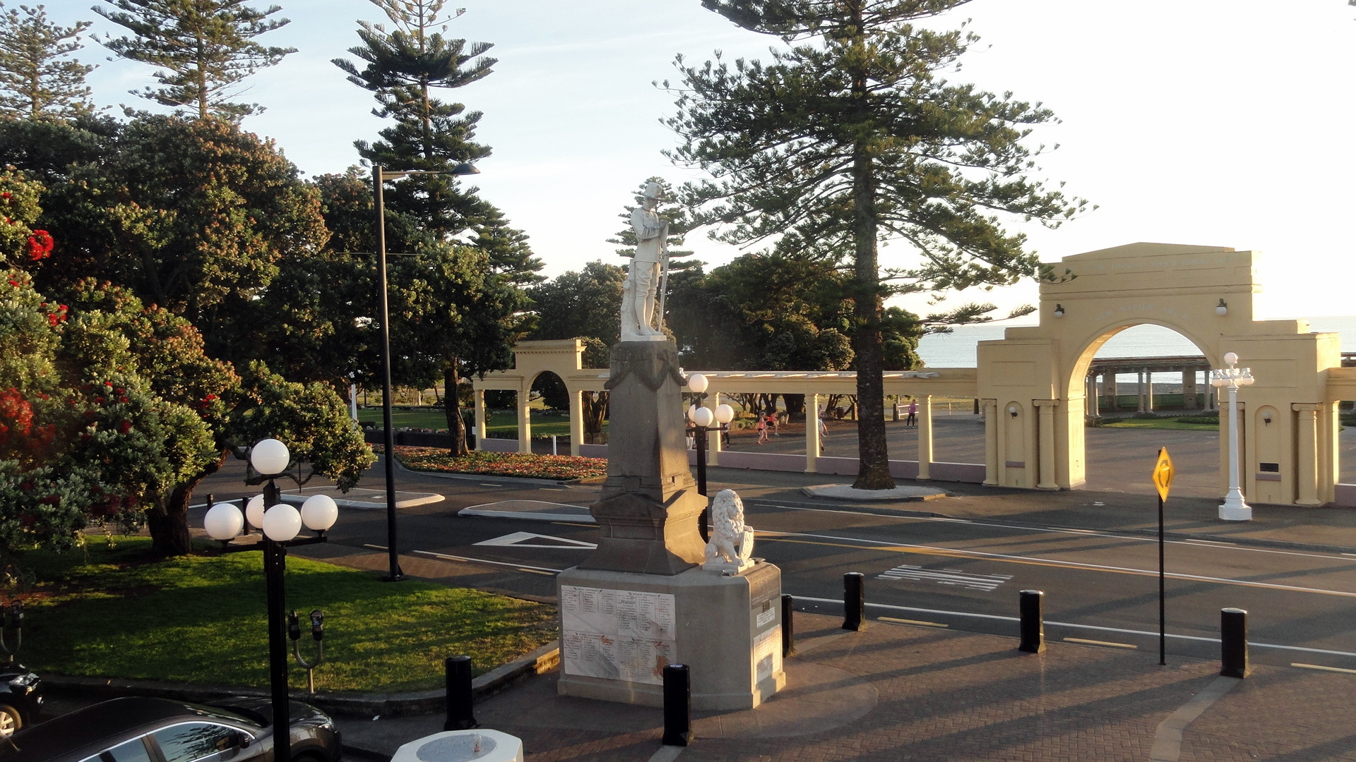
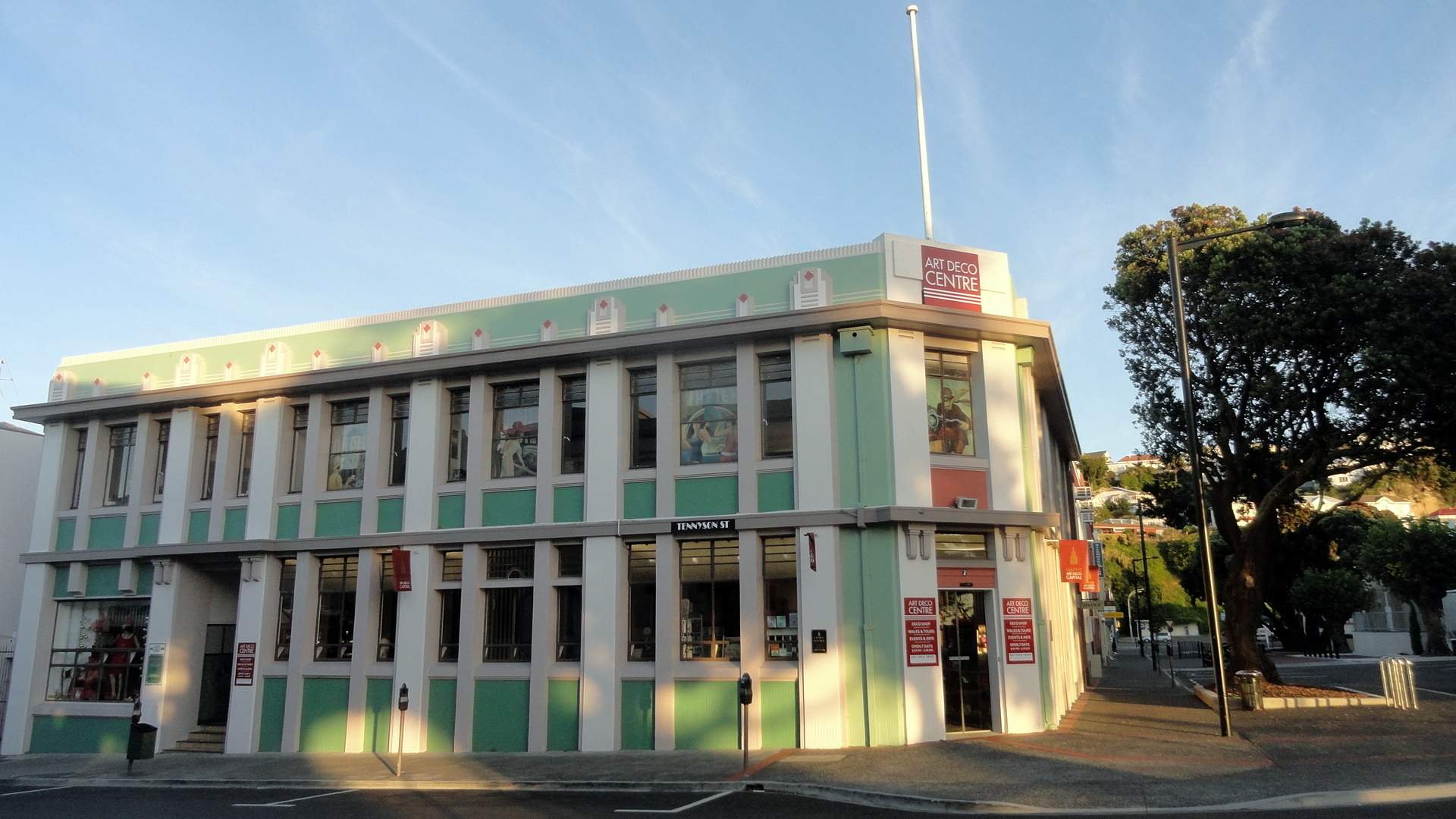
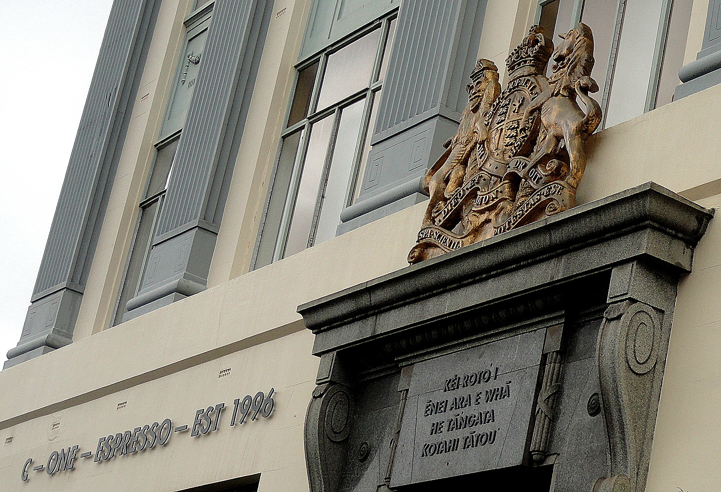
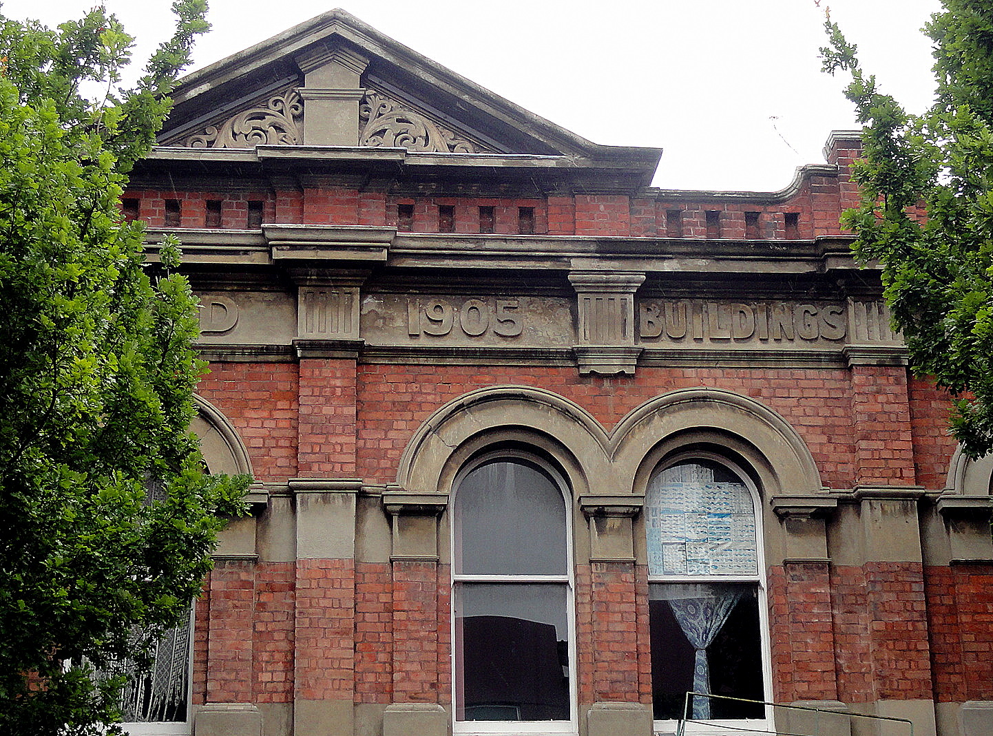
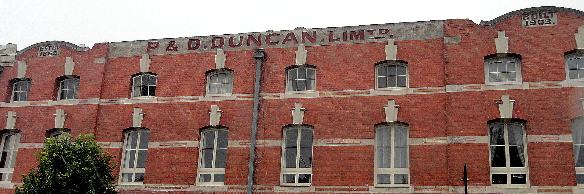
 Napier, a lovely town situated in the heart of one of NZ’s main wine regions, has become a major tourist center thanks to a general realization that it’s got one of the world’s most concentrated collections of excellent art deco architecture. This is a bit of historical happenstance related to the town’s near-total destruction in a major earthquake in 1931, after which they decided that art deco would be the best combination of both style and cost efficiency, given the need for a lot of rebuilding real fast. One of the only pre-earthquake buildings still standing is the public trust office, on which lives the coat of arms shown at left, and which is depicted in its full glory down below. As you see below, the streets were still full of christmas decorations when we were there for a too-brief stay. I’d happily go back to Napier for a longer stay, and drink lots of wine :-).


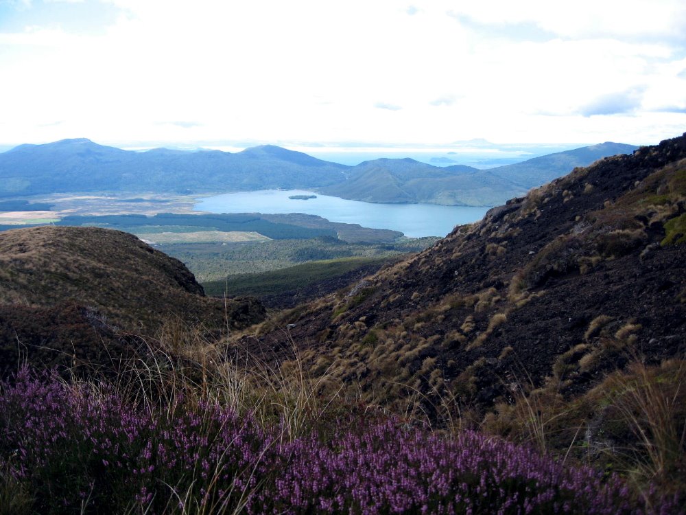
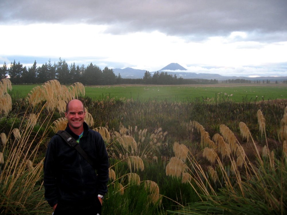
The Many Moods of Mt Ruapehu
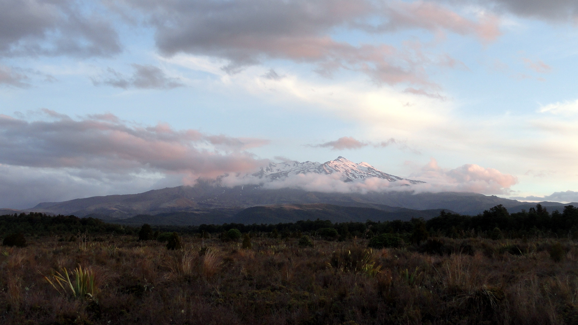
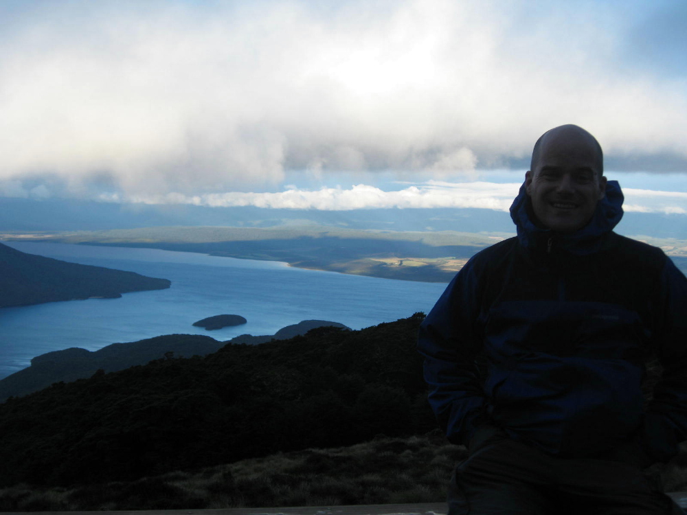
…and other views from Tongariro National Park, a place which can truly and safely be described as otherworldly. One factor that makes it a world heritage site is the presence of three volcanoes right next to each other. You will see more than you want of these three, in this post…sorry. The moods and clouds, the light and colors just change so often that when one is there one just can’t stop! I am blessed now to have visited New Zealand three times, and I am going to work my way through the (too) many photos I took there roughly in chronological order: this was the first major place our group visited as part of the big Howard’s-turning-50 tour. What a great start! (Btw if you’d like to see Tongariro in other moods, and more shots from the top part of the Tongariro Crossing day hike, check out the post from my last visit, which is here: https://somuchworldsolittletime.wordpress.com/2009/03/05/tongariro-crossing-the-summit-of-mt-doom/)
I won’t say much here. NZ is so lovely and so endlessly various and fascinating that the photos better speak for themselves or I’m not doing my job right. For those curious, I’m back and settled in the bay area, in great health thanks, and trying to put down some roots here in the this intermezzo before the start of my next assignment…about which more, when the time is right :-). Peace. Oh, and btw: linger on the shots below: it’s a slide show of Ruapehu, which is sort of currently the biggest, though not the oldest, of these three volcanoes – and one that I explored in more detail this time than when I was last there, from up close. (More on that further down.) All the photos have names which pretty well identify them.


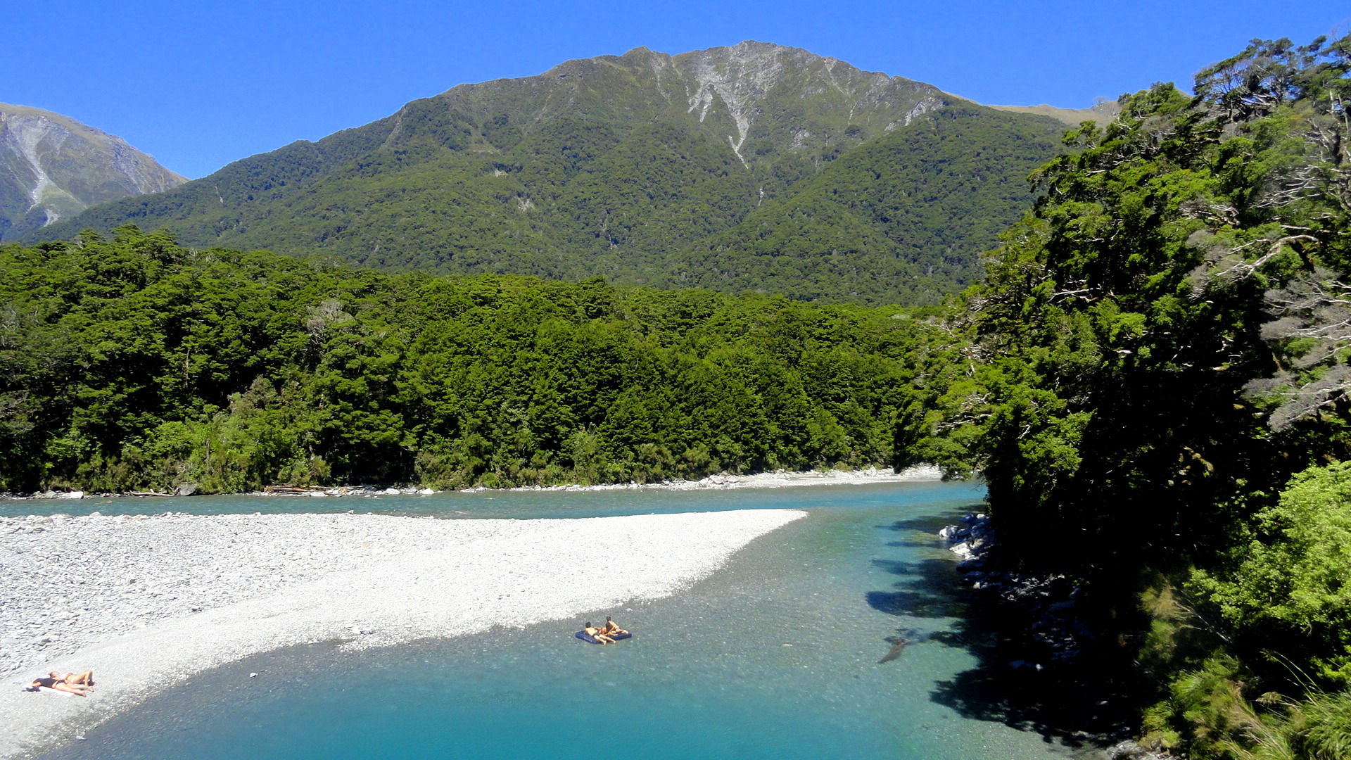
Mountains, Rivers, Sounds, Rainbows…and Vineyards


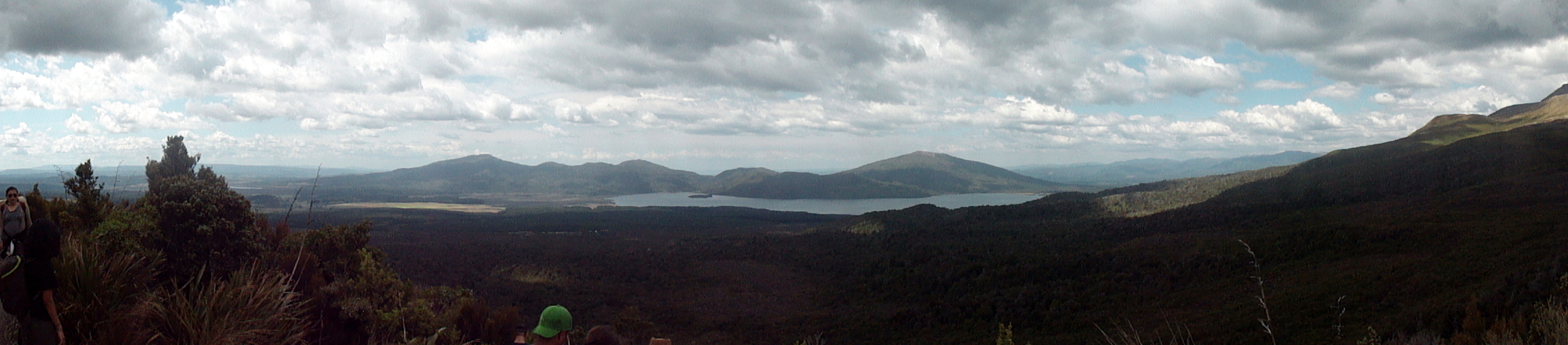
This is where we spent the last few quiet, peaceful, absolutely blessed nights on South Island, there at the tail end of 2013 with my mother and brother. These are the Marlborough Sounds; if you’re so inclined, google ‘linkwater marlborough’ and you will see exactly where on the map of the world the shots above were taken: at the base of the Grove Arm. With Howard and Gene, five years ago, we drove fairly rapidly through this area en route from Nelson to our Kaikoura Coast Trek, but I remembered it as a lovely spot well worth revisiting. Now I’ll remember it as one of those places on earth I could very happily live, or retire, if I could ever afford it. 🙂 A lovely mix of pastoral, agricultural, maritime, small-town, outdoor-adventure…you name it, you got it there from milk cows to fantastic kayaking and world class wines. (Wonder if NZ tourism will give me a cut for the referrals here…) Btw below are the panoramas giving you about a 280-degree view from the pier on which the above photo was shot.

At the moment, a soft rain is falling on a Port Moresby Sunday morning, and I expect only to wake up in Port Moresby (or PNG more generally) on only seven more Sunday mornings. After having done precisely that for most of the past 104 Sundays, this comes not as a shock, but as awareness of imminent change. Friends on the email list have already started hearing from me about the plans, and in the months after March this space will feature more of North America and Europe than the South Pacific. And I’ll hopefully spend a lot of time on my bike and in the yoga studio. For now, my goal is stay focused and keep things on a steady course as we head into the home stretch. That’s all I shall say now: enjoy these shots of the Marlborough Sounds and Marlborough wine region, and some of the west coast and central South Island mountainy areas we drove through getting from Christchurch up to Linkwater. Peace, out, more at some point…


 All of these initial shots, up until the last photo of the bay with the green boat and the tree, which comes just after the display of mailbox pride in the Marlborough Sounds, are from the basic Linkwater area. If this appears correctly, below you see a rainbow and if you look closely you’ll note that it’s actually double rainbow. It was, in fact, the fullest, clearest and sharpest full double rainbow either Steve or I had ever seen. (Mom was napping.) After the mailboxes, you’ll see various photos taken of the mountains, rivers, and vineyards that extend around the middle of the island south of the Grove Arm and north-northwest of Christchurch, through which we drove on…the rainy 29th of December, to be quite accurate. Enjoy! Happy new year!


-

- Cutout Bird Mailbox
-

- Fish & Seaweed Mailbox
-
- Songbird Mailbox
-

- Udderly Moolbox


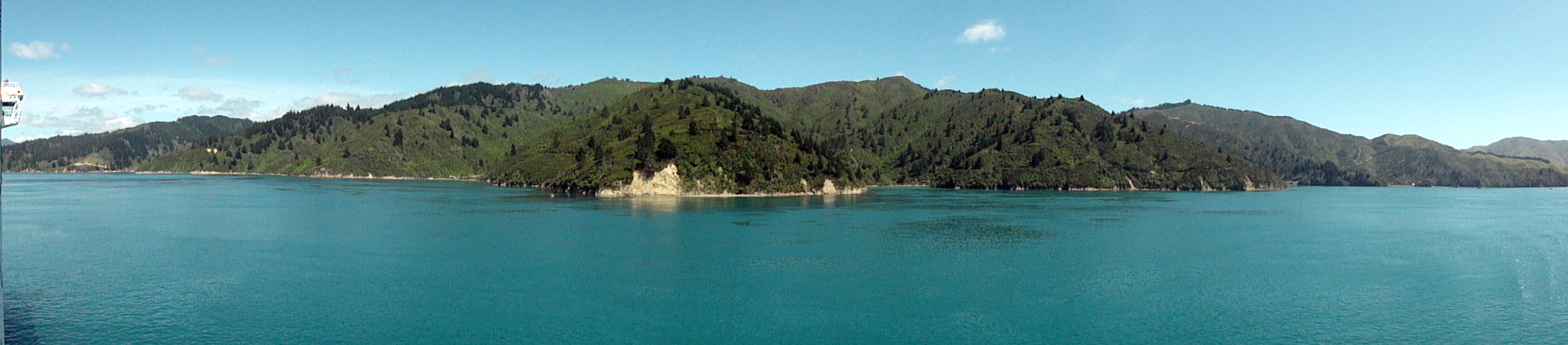
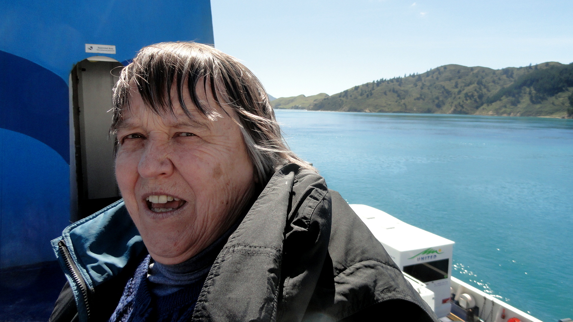
 And here some shots again of the Cook Strait as we departed South Island and headed back to North Island: below, Picton Harbor from on board; and a few shots below the exit from Tory Channel into Cook Strait with North Island in the distance; and further down a panorama shot in which you see both North and South Islands from the boat in Cook Strait.


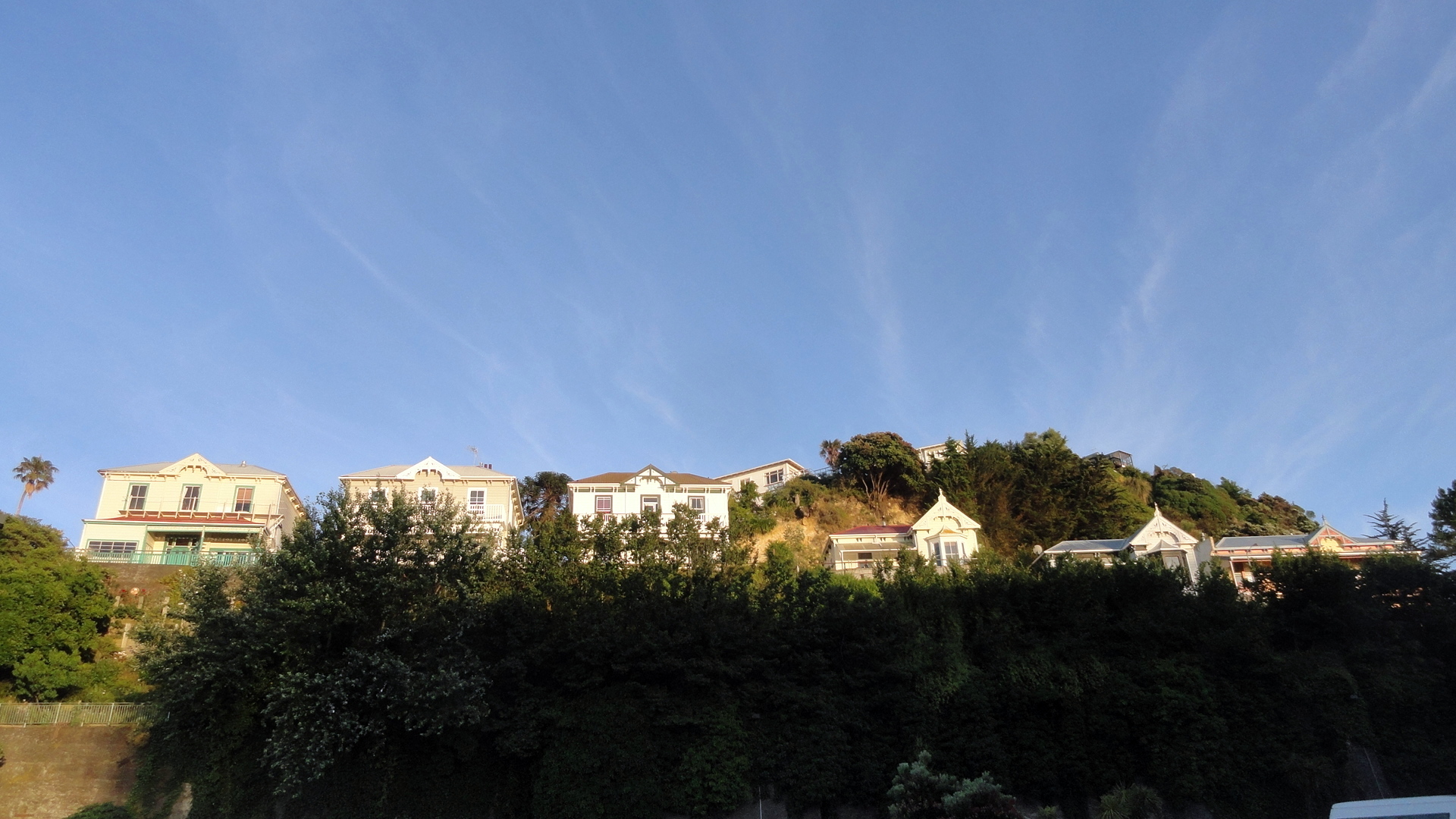
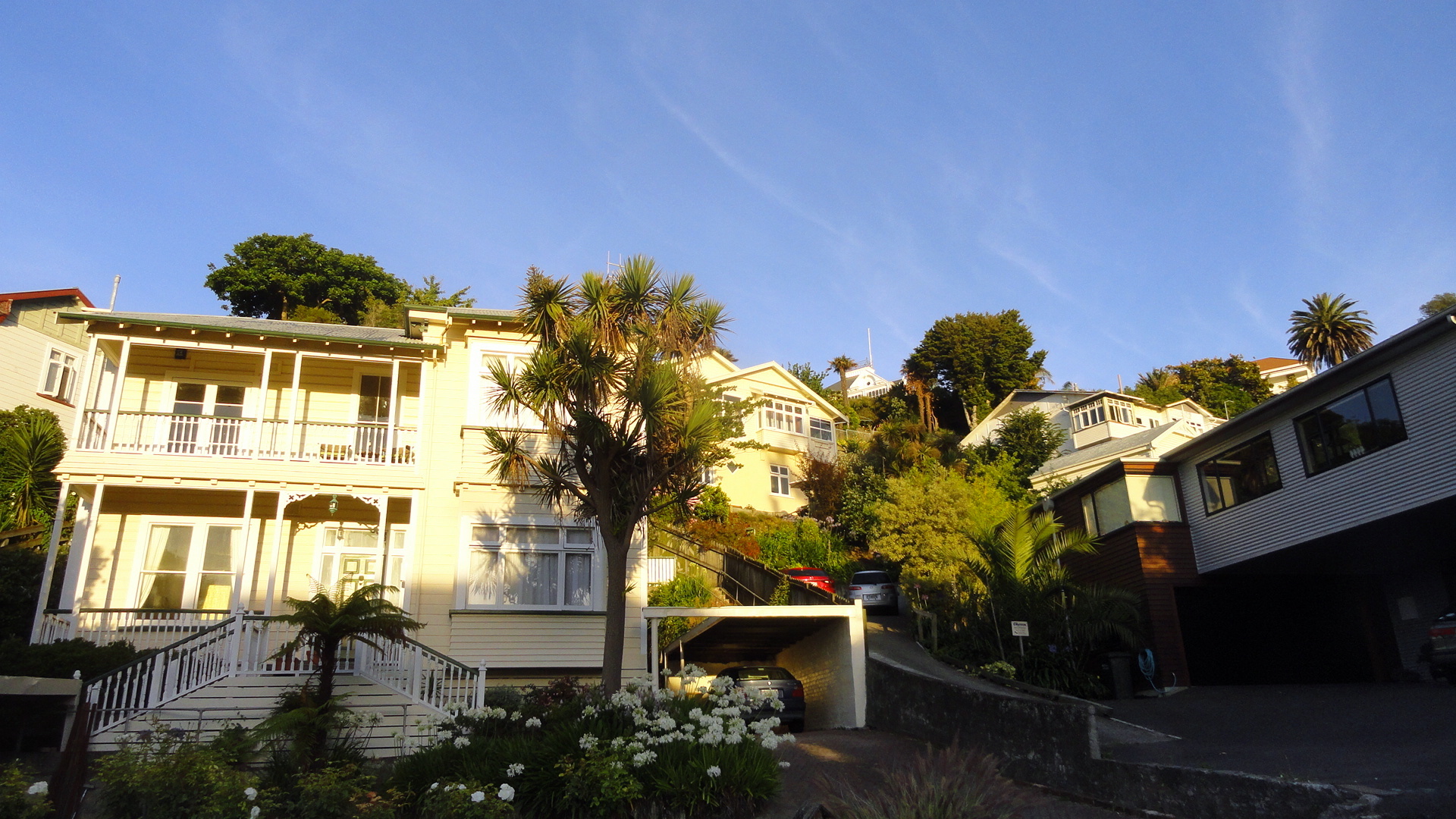
Central Christchurch, Climbing Back
It’s a gray and wet Sunday morning up in the highlands, at Tari, where I sit as I load up these photos and think about what to write. Two weeks ago – shocking, that fact – I was driving with Mom and Steve from Christchurch up to the Marlborough Sounds area, via the longer & very scenic inland route through the mountains and along the rivers, rather than straight up the east coast. Having now been back at work for (only) ten days, that long and lovely drives feels ages ago, but reviewing these shots taken during a few rainy, sombre and emotionally-rich walks around Christchurch brings a lot of it back.
After celebrating Christmas in Queenstown, we headed up to Christchurch which I’d chosen to visit for two main reason: 1) because I felt Mom would really love the wildlife of the Banks Peninsula (and indeed, as attested by comments from Steve on one of the other posts, they did have a remarkable boating day out there), and 2) We needed to break up the drive back to the north somewhere, and this seemed a reasonable stopping point which I’d not previously visited — well, other than one afternoon in town when a plane from Dunedin–>Wellington got rerouted due to weather. I knew Christchurch had been hammered by one major earthquake and many substantial but less damaging ones in recent years. The major destructive earthquake happened in February, 2011 — so nearly three years ago.

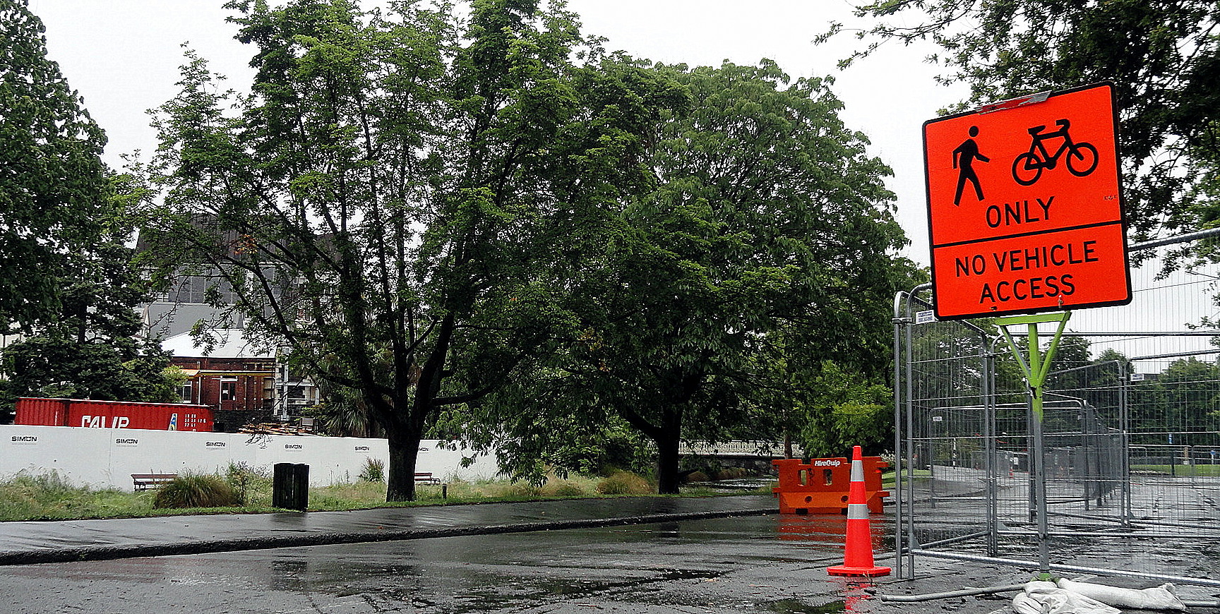
Being tired from the drives, needing respite from responsibility so that I could recharge a bit prior to returning to work here, I convinced Mom and Steve to tour on their own for our two days in Christchurch, which left me free to wander aimlessly about the city…which happens, when left to my own devices, to be one of my very favorite pastimes nearly anywhere I can get away with it in reasonable safety, especially when I’ve just left a field location where it’s not especially encouraged. Although the days were gray and mostly rainy, I hope & think I’ve still managed to show you a bit of what’s going on in the city now. It’s coming slowly back together – but it seems as though the city and its inhabitants – and its government – were in fairly major denial about the fact that they’re situated in an earthquake zone. There weren’t very strict building codes, lots of high buildings were allowed to be constructed on swampy ground which we’ve all known for years can basically liquefy in certain types of earthquakes…and generally, everyone seemed to have lived, until that fateful day, in blissful oblivion to the fact that they’re … well, in the Pacific Ring of Fire with all that entails.
This fact caused me to consider, again, governance and its value and importance in societies. Lunatics who periodically hijack the government in my home country (they name themselves after an excellent hot beverage of Asian origin) like to delude themselves that government, as a concept, is by and large bad. I would so love those pampered and spoiled folks to live in some of the places I’ve worked over the years, places where government really and truly does not work, by and large does not functionally exist for citizens. In NZ, it does – and I’ve always thought of NZanders and practical, egalitarian, pragmatic and above all fairly realistic. Thus it came as rather a surprise to me that the society and government hadn’t determined, prior to this disastrous event, that strong building codes and earthquake retrofits were in order. Still and all, they didn’t – and now the city and the sense of shattered elegance, of confidence lost, brought some tears to my eyes. It’s a very sad and shocking city now, but it’s also an inspiring city in the ways in which people are getting on with business, building codes and zoning are now being strengthened, and slowly but surely Christchurch and its inhabitants are determining what sort of city they will be in the future. I’m glad I visited and I wish them well with their efforts.

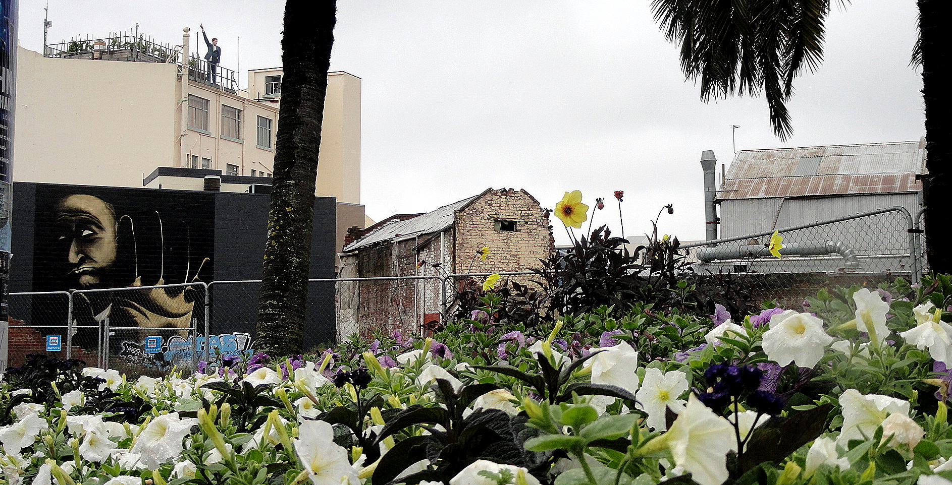
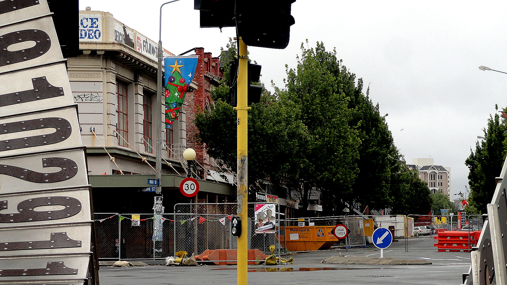
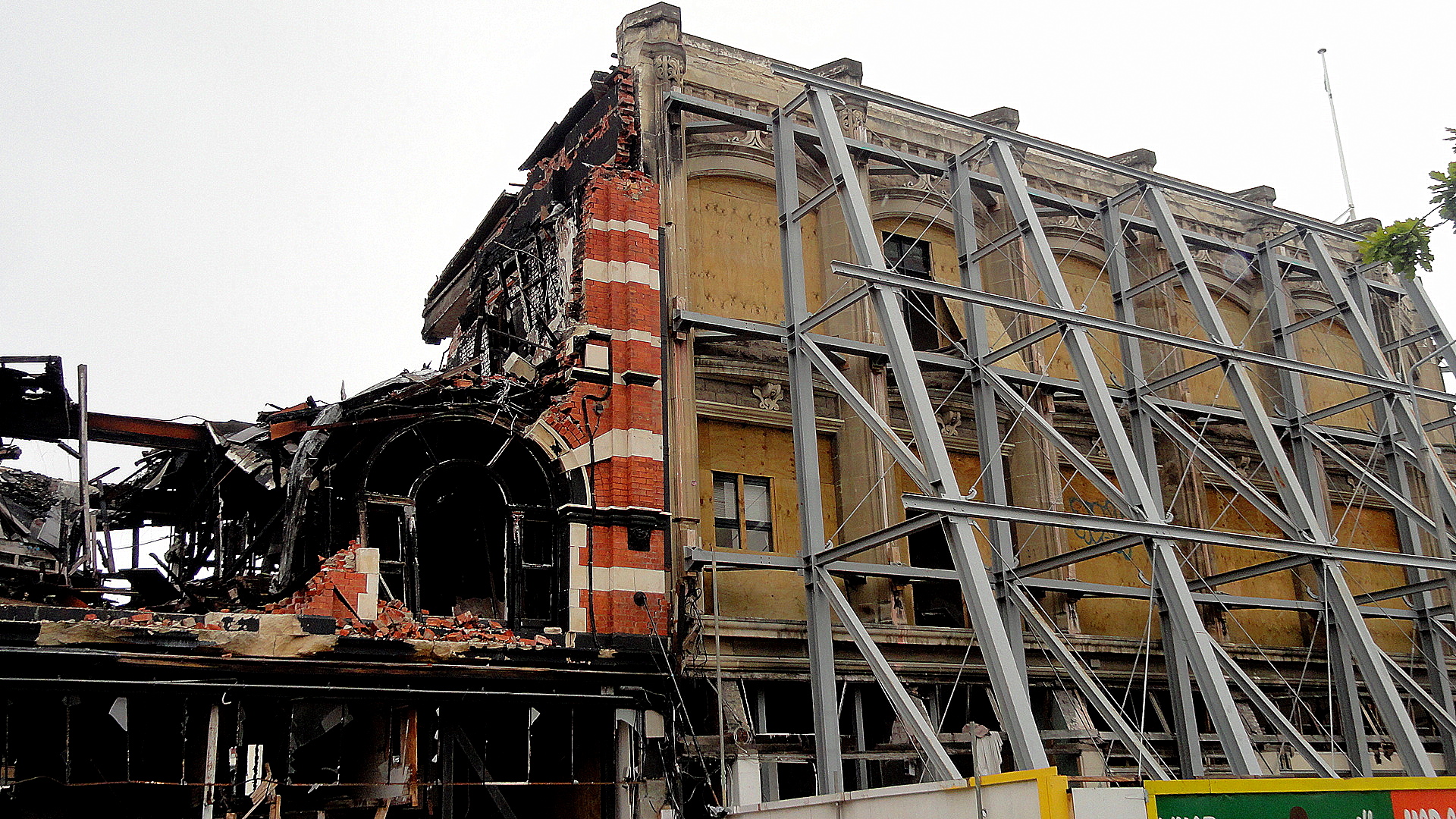
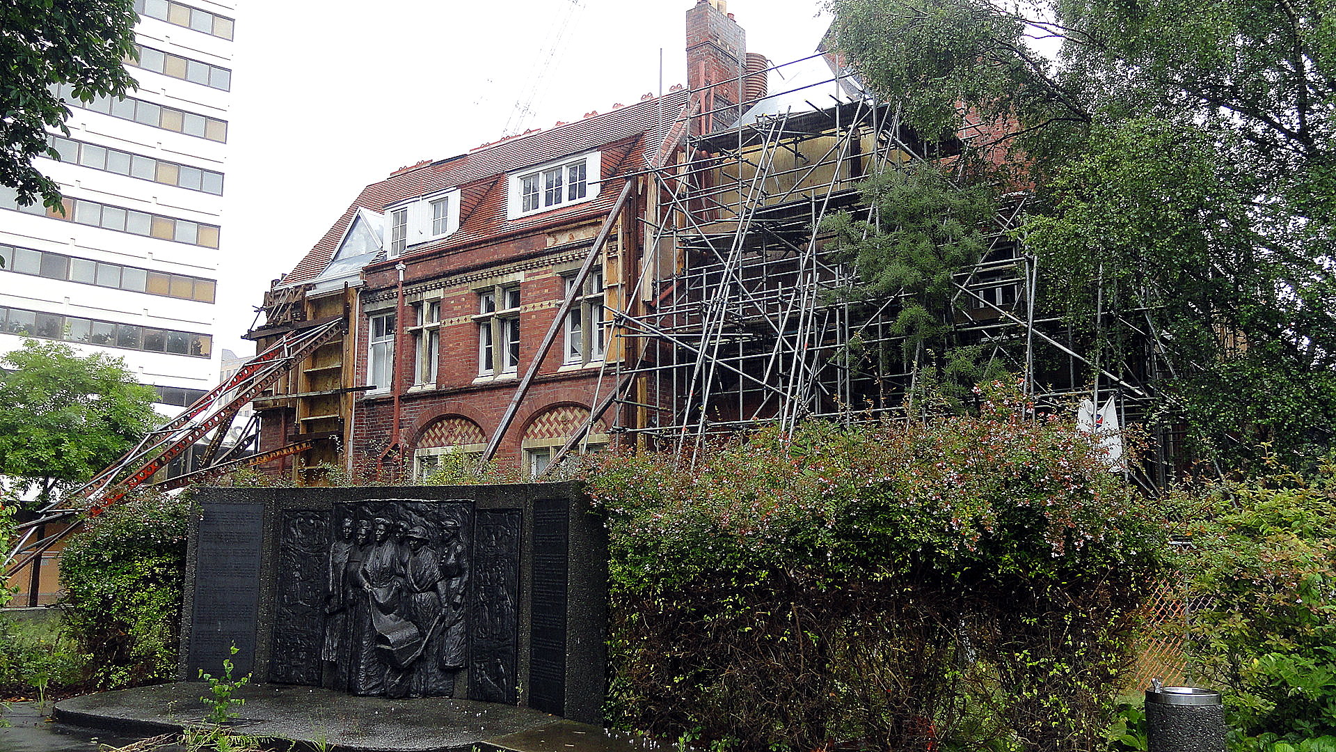
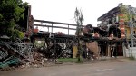
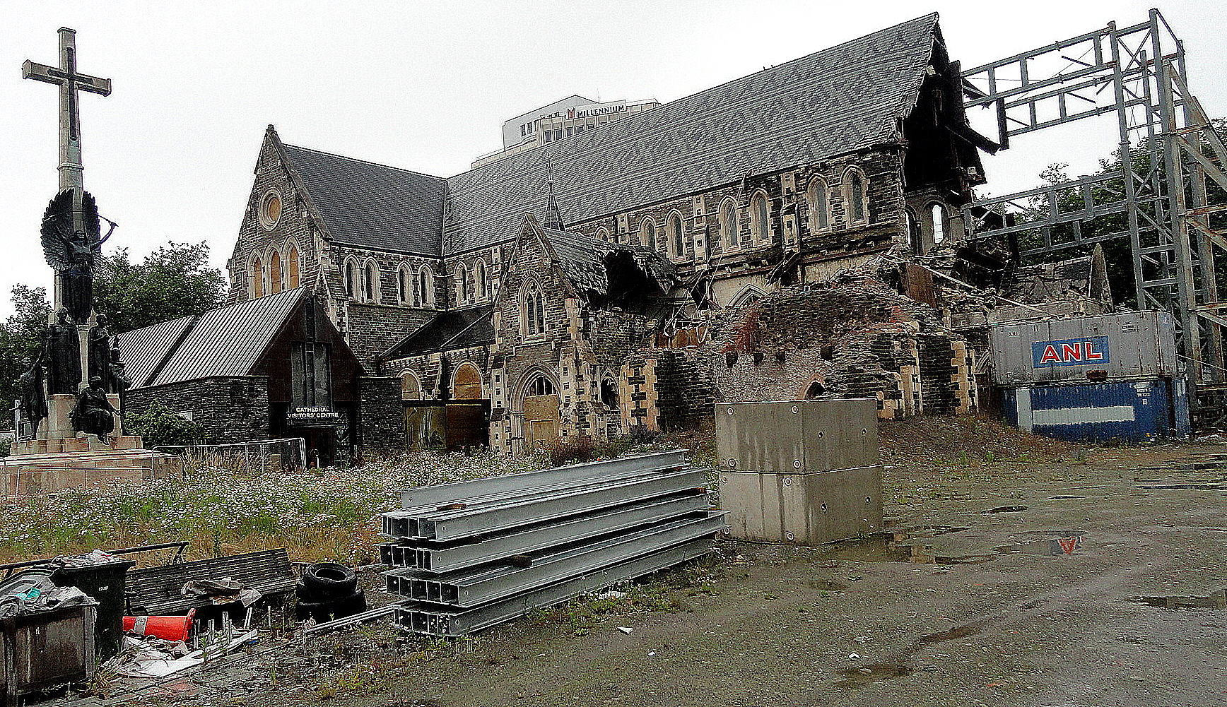
 …every shot so far has been taken in the same small area along High Street near our hotel. Immediately above, with flowers at the bottom and wrecked buildings behind, you’re seeing the back side of the buildings whose fronts are lined up along the (now closed to vehicular traffic, as are many streets all over central Chch) along High Streeet — which make up the shot below and many others; and the start of which is framed by sculpture in the two shots from slightly different angles up above. High Street runs from the southeast edge of central Chch right up to Cathedral Square, the heart of the city as it has been until at least now. (With new building codes there are areas where, I am told, they have determined no longer to build: doubt this is one for emotional-pride reasons, but don’t know.) The coffee shop whose lintel I show here is literally the one building standing tall amidst these ruins, and it was jam-packed with customers coming from and going to the gym when I visited; the Man in the Sky (my name for him – no idea what he is other than interesting art) whom you’ll see a few times is on top of that very building: all of these shots are from really a quite condensed area in the heart of downtown Chch, which was the area most dramatically affected.
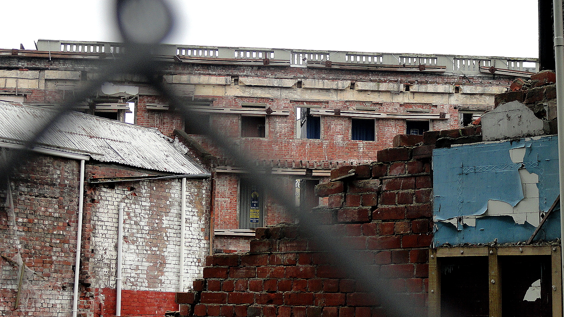
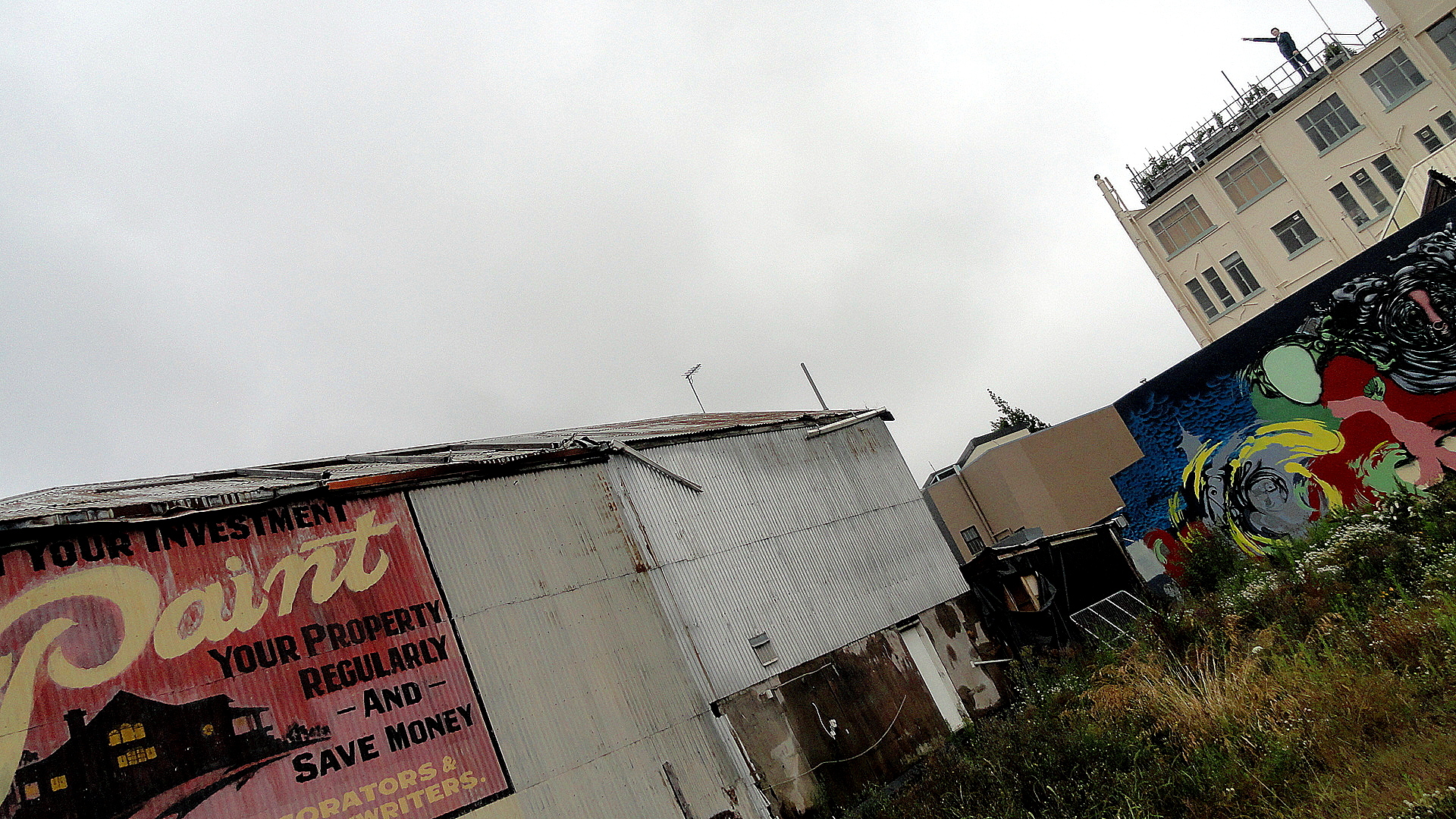 “Protect Your Investment” — looks old enough that it may mean this lot next to it was vacant even before the earthquake, but it’s also possible it was just an old ad protected by the building next to it for years and exposed when the building next to it came down. Said one guide: central Chch used to have a serious shortage of parking; not any more. In that, I was reminded of SF after the Loma Prieta quake. You can see a less artsy view of this ad, the graffiti next to it, and the building housing the cafe and supporting the Man in the Sky in the gallery of smaller images, down below.
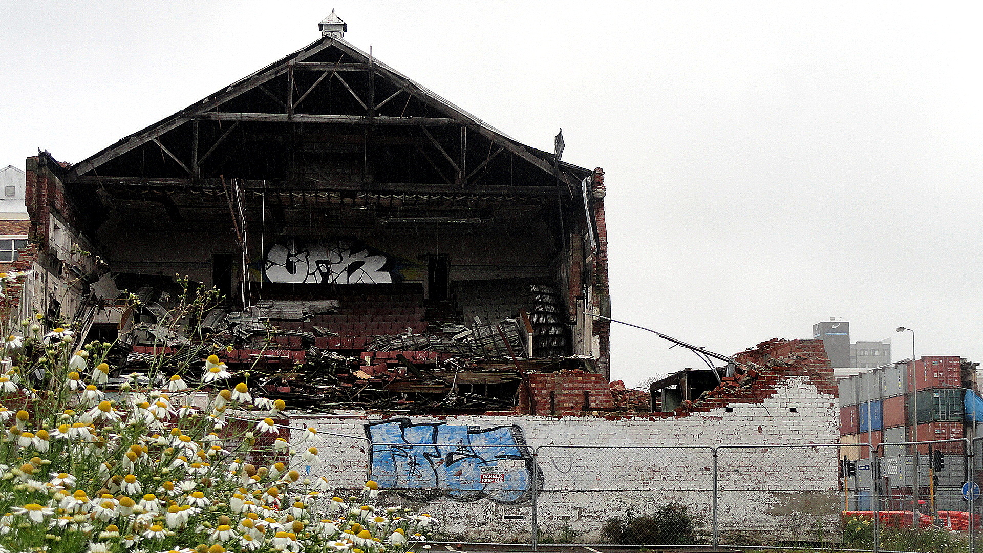
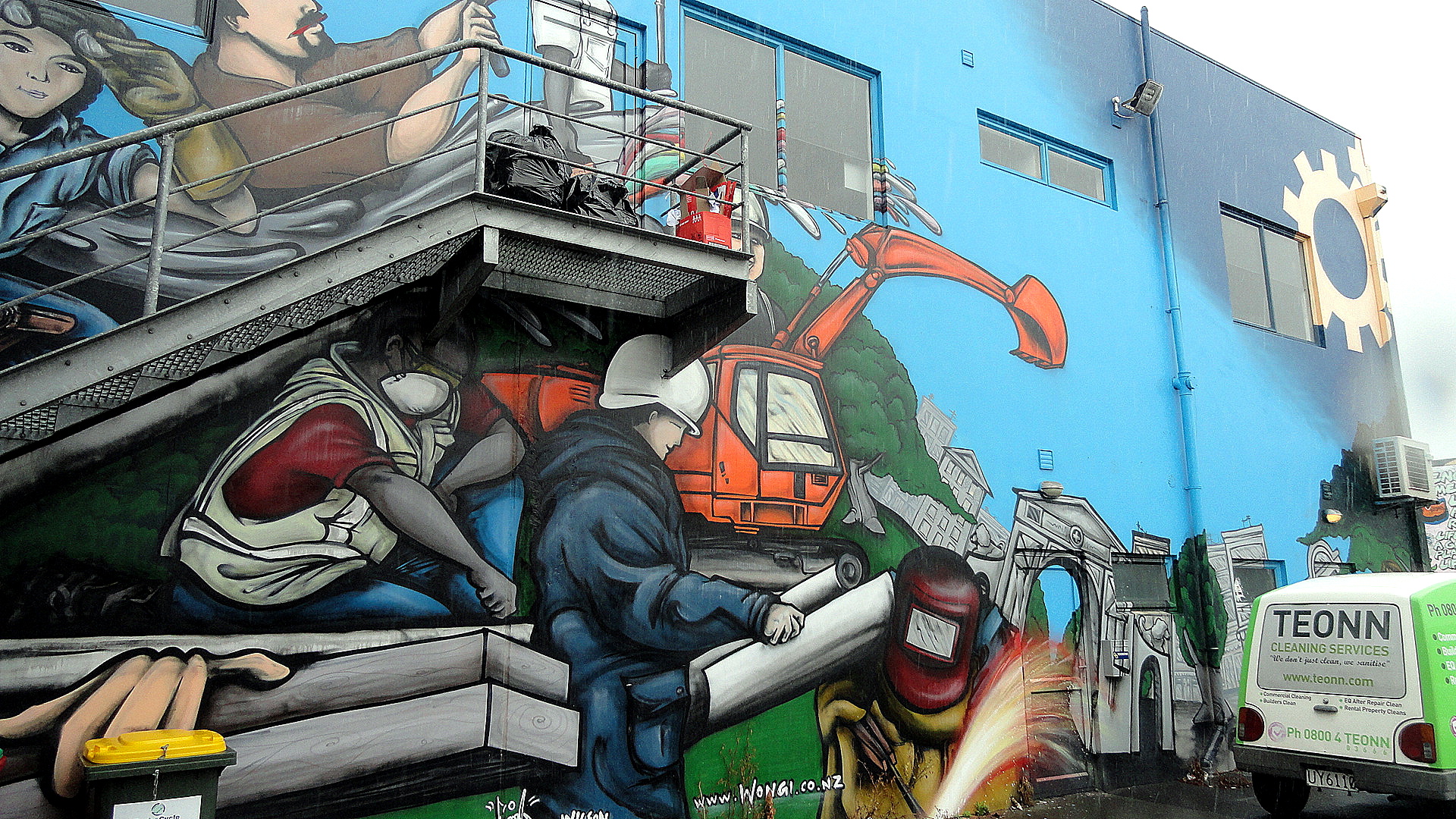
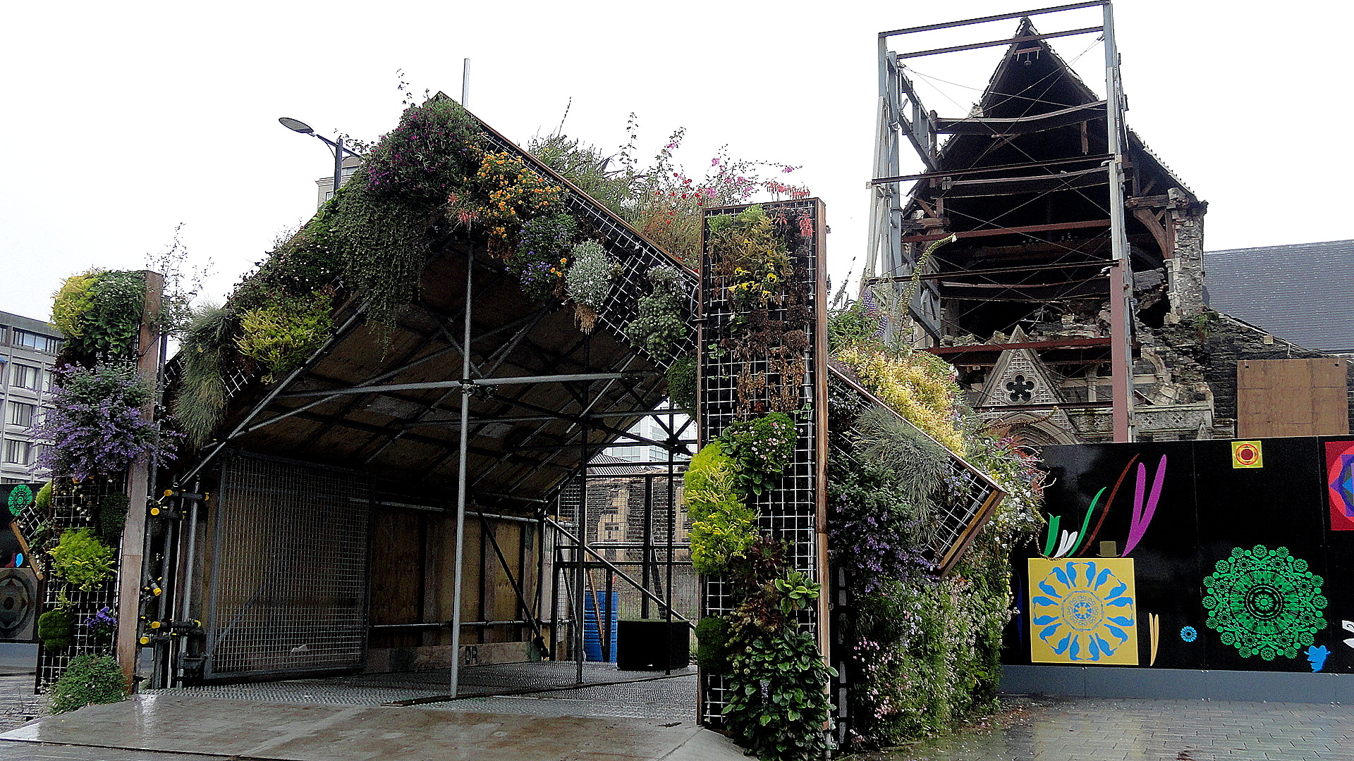
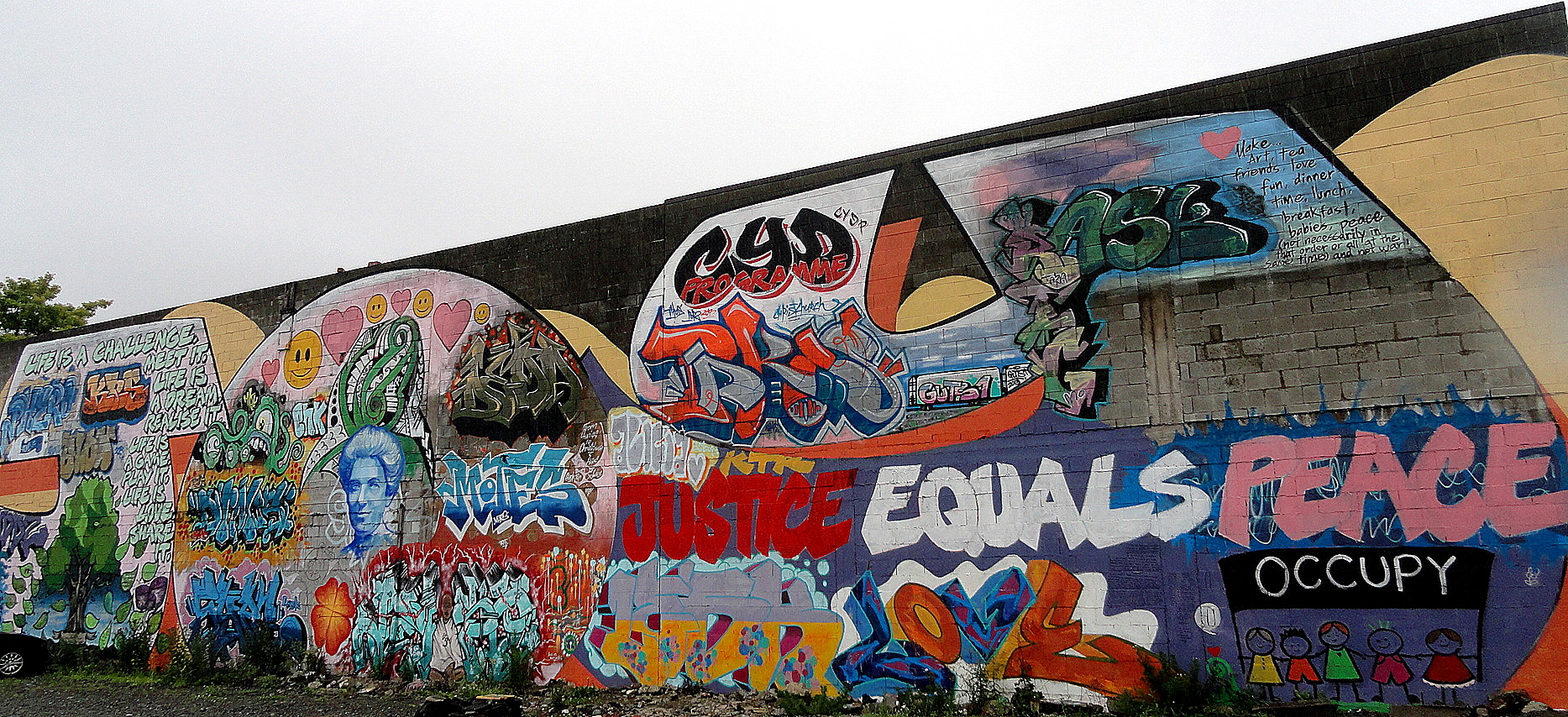 The more upbeat street art, above, is painted on a city-government rebuild or jobs office of some sort. Immediately next door is the more political occupy-movement street art: sort of dueling street art, eh? One thing that vacant lots present is many such opportunities for artists. Just below I’m showing you how they’ve used rock-filled containers to form retaining protective walls in front of structurally-unsound buildings whose fate has not yet been determined or carried out, so that passing pedestrians or vehicles won’t be harmed if they crumble further in a subsequent earthquake etc. Btw, this building below is the theatre you saw with wildflowers, above. And it’s catty-corner across from the “Protect Your Investment” lot.


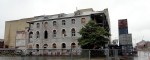
Above: the Re: START mall, on one of the most destroyed blocks of commercial central Christchurch they’ve established shops and cafes in containers. Immediately below: three photos all taken from the same spot, just turning my head to look in a different direction (well, the one with the monument I had to reach the camera up to shoot over a fence…)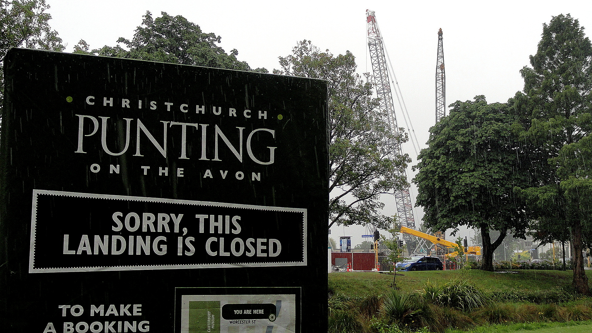


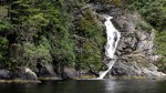
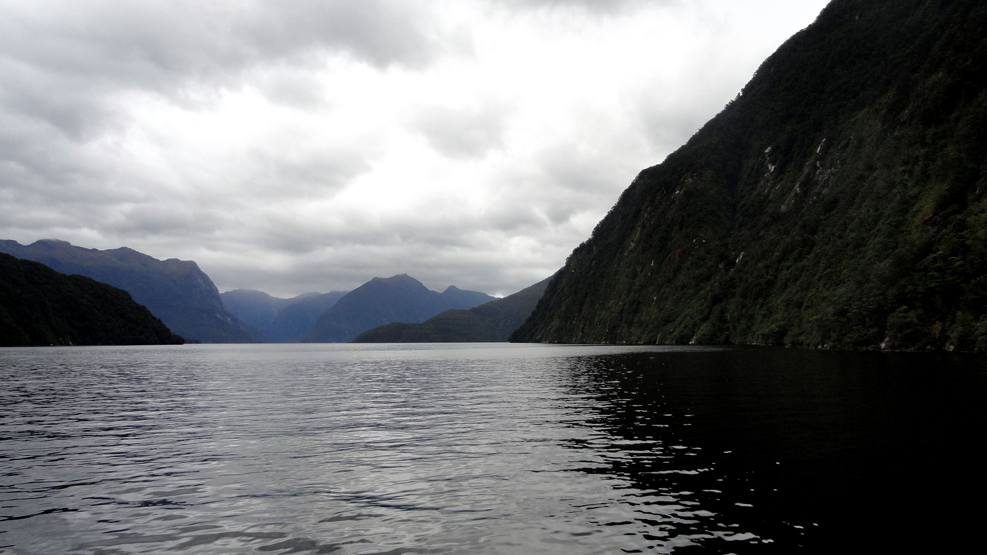
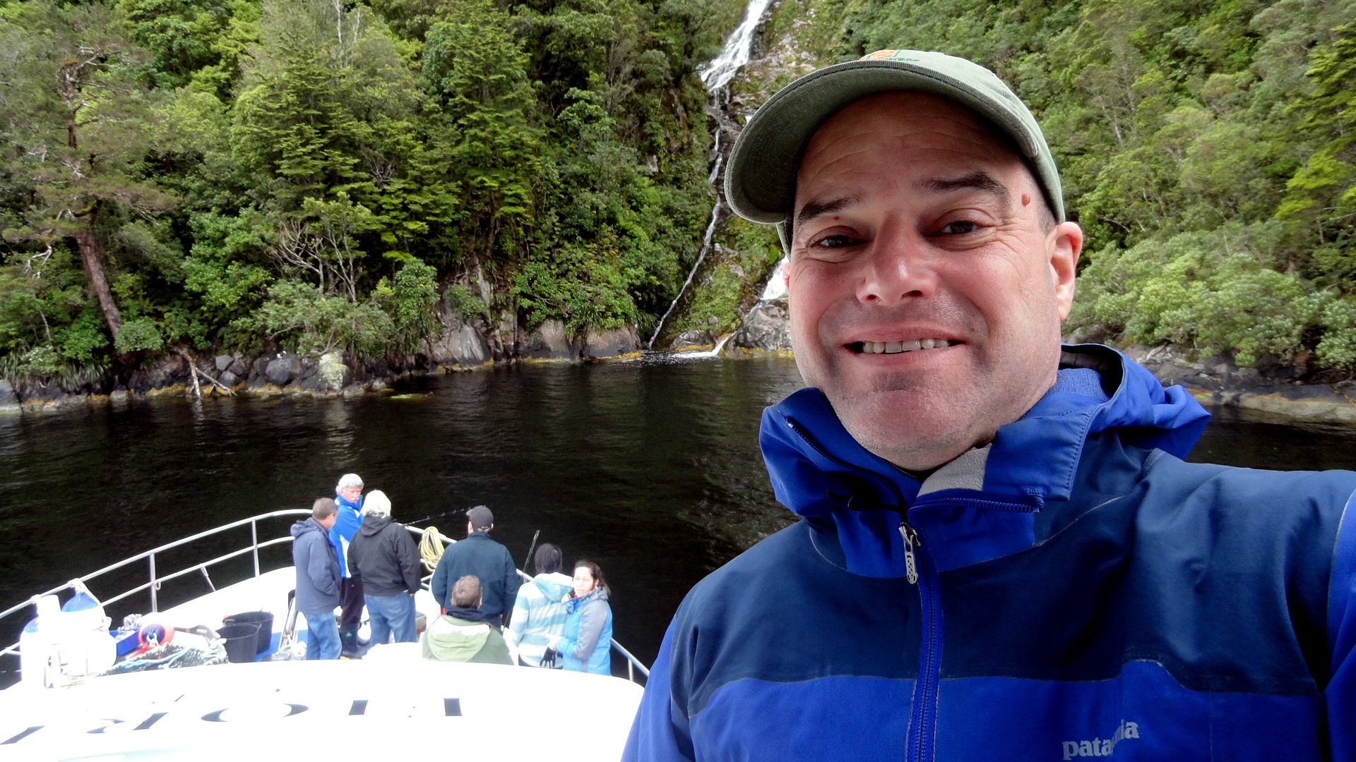
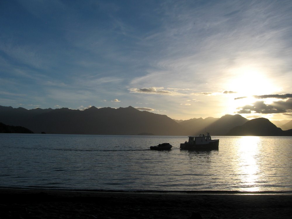
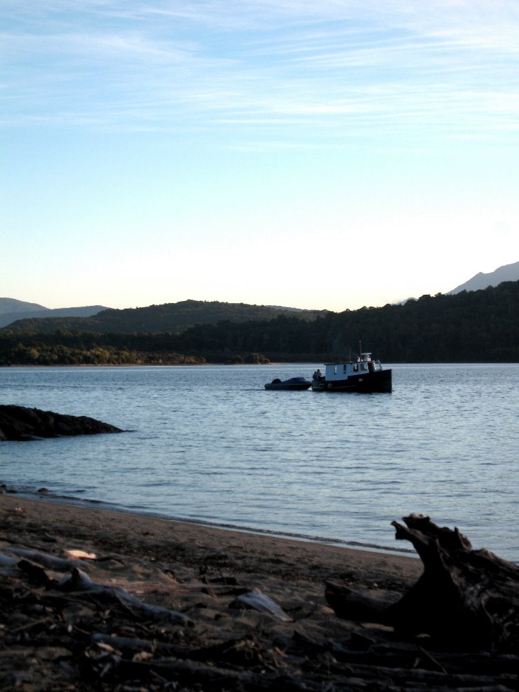
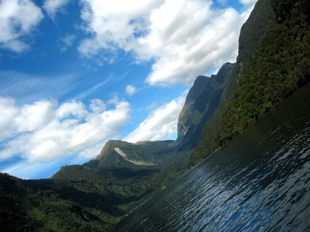
Of Christmas Dinners & Misty Mountains

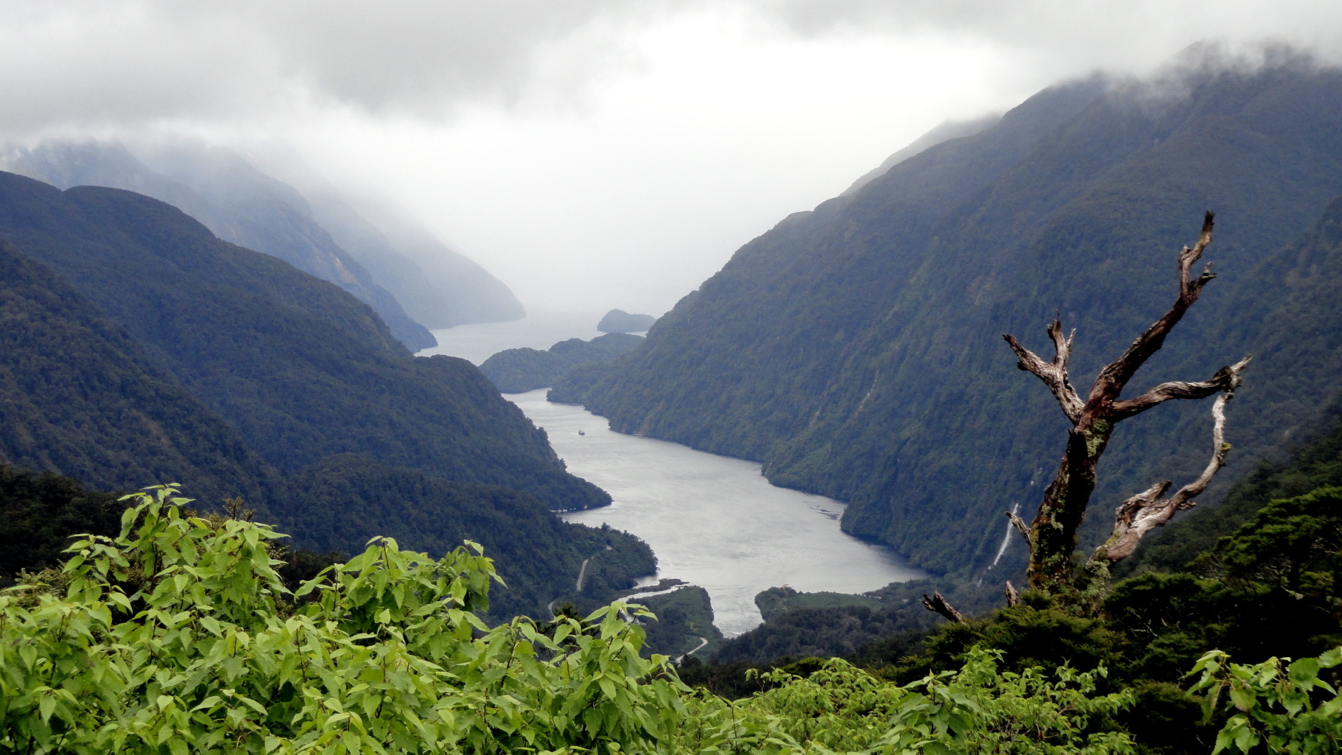

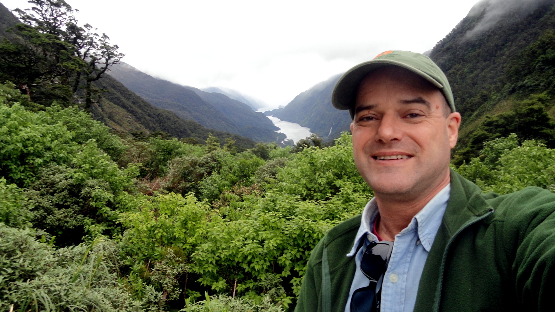
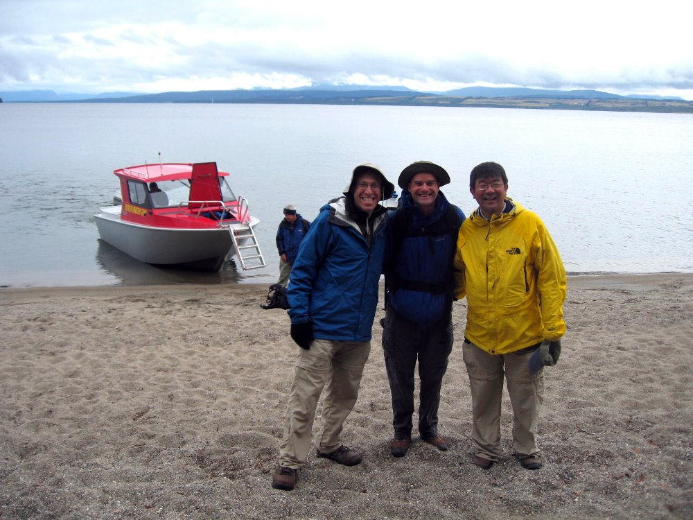
When last I myself visited the wild, entirely rug, very wet & green & remote & spectacular southwestern expanse of South Island that’s known as Fiordland National Park, I managed to squeeze in a day trip on Doubtful Sound. (Which is so named because, in the days of sailing ships, captains usually doubted they’d find the offshore wind which would allow them ever to escape from the narrow, deep sound.) This time around, knowing a multi-day hike such as we undertook last time was out of the question, I thought I could still get Mom and my brother out for an overnight – and so we spent the night of 23rd December snugged into a little anchorage in the midst of, probably, the most remote and wild place any of us had ever spent a night…and we’ve been a few places, so that’s saying a bit of something. Our little boat had eleven passengers and three wonderful crew, and despite omnipresent rain and mist, it was simply an extraordinary experience which left us all feeling quite privileged.
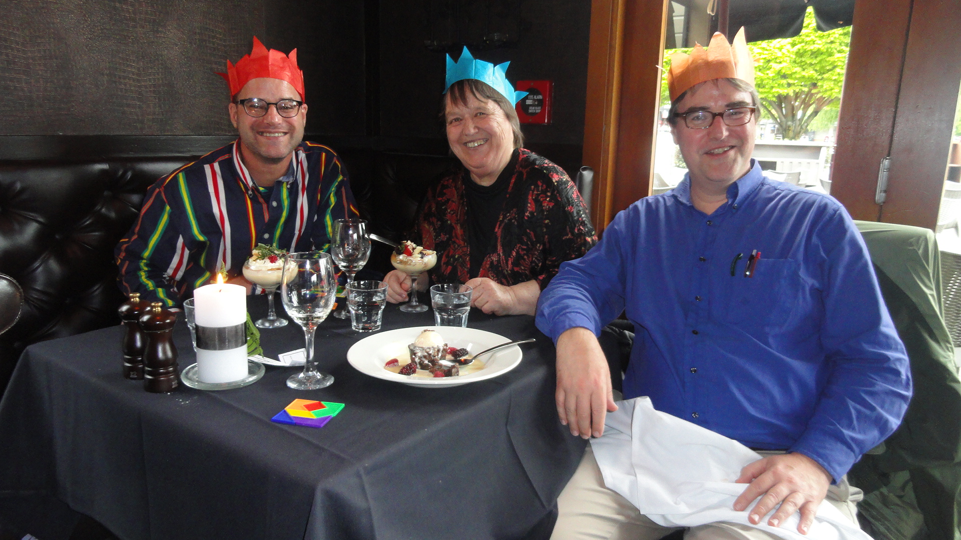
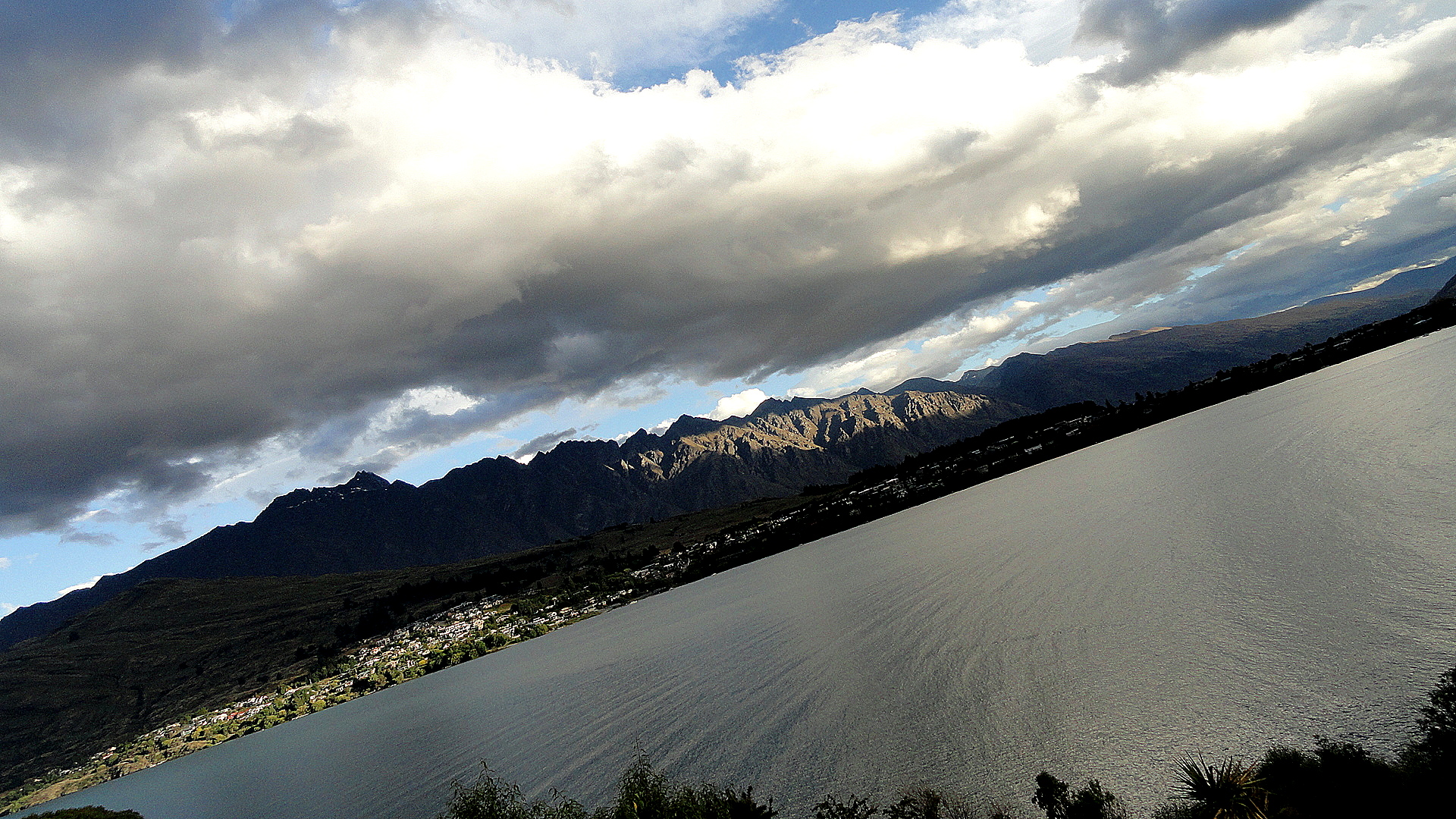
Thence we drove on up to Queenstown, on Christmas Eve, where we had the lovely dinner whose dessert course you see having its five minutes of fame above. I’m popping these photos up on the blog at the start of New Year’s Eve, here, knowing that tomorrow we all fly back to our current home countries – me to PNG, they back to North America – and that the first weeks of 2014 will be full and hectic for me. Happy new year & lots of love to all my readers, known and unknown.
And for anyone interested in other, often sunnier, photos of the Fiordland region, check out these entries:
https://somuchworldsolittletime.wordpress.com/2009/03/05/kepler-track-fiordland-national-park/
or
https://somuchworldsolittletime.wordpress.com/2009/03/05/definitely-doubtful-sound/ in which you can see how Doubtful looks when the sun’s shining a bit, and another shot remarkably like the top photo here…and with blue sky. Ah well, don’t tell my family. Cheers.


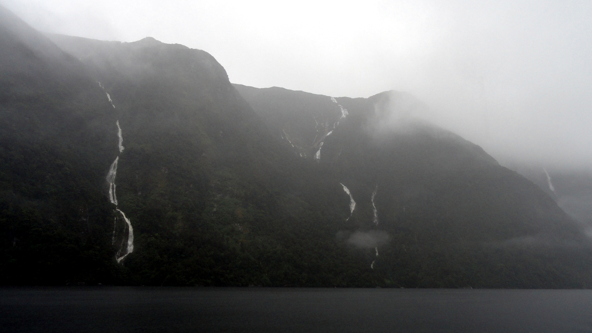
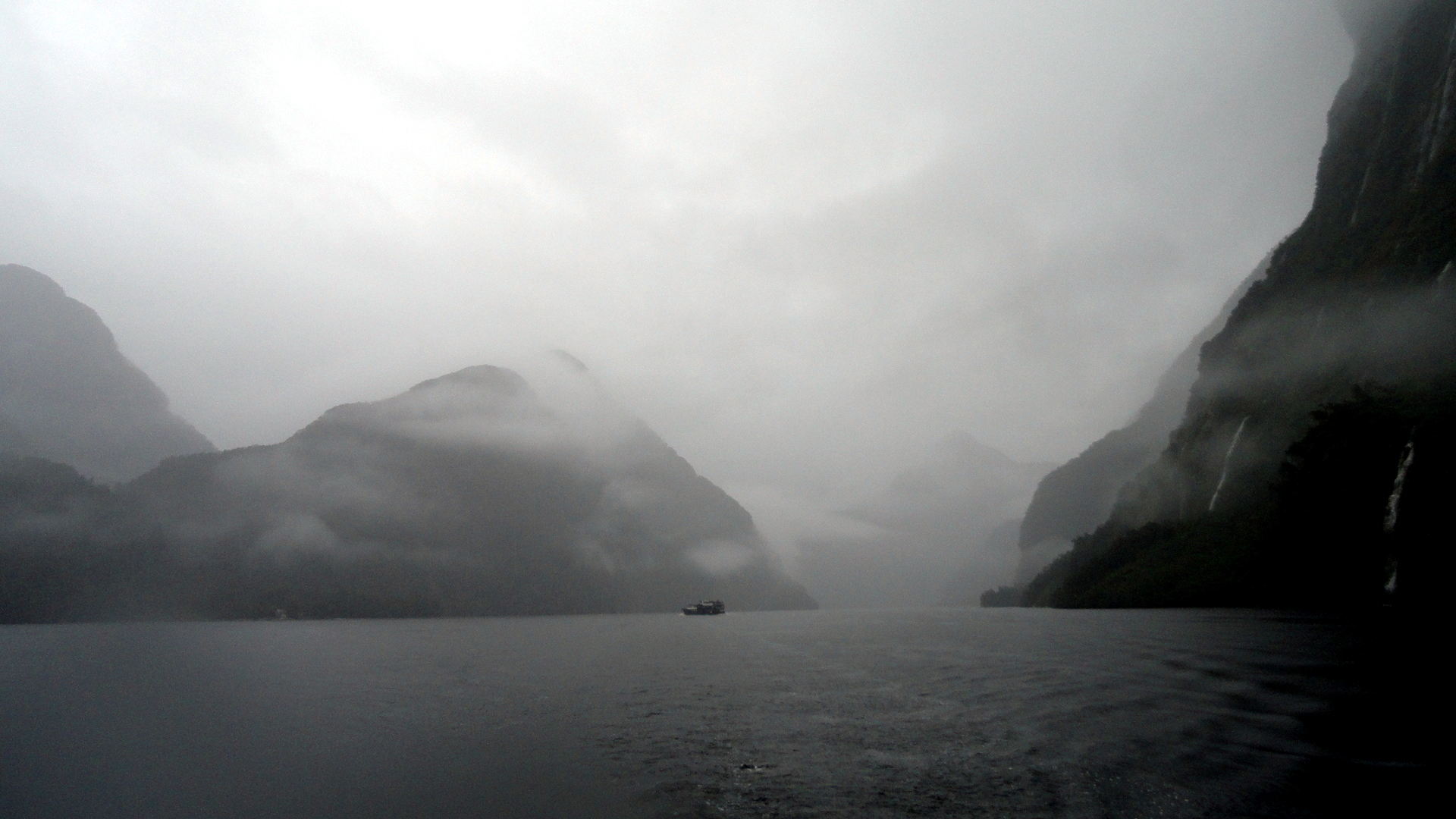
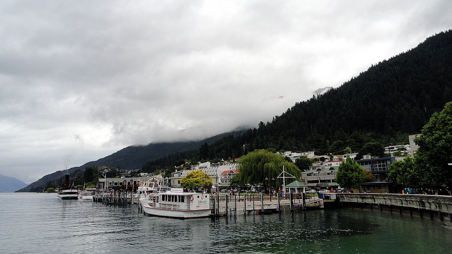
Since I figure many of you will only be interested in a few of the atmospheric, misty-foggy-rainy waterfall shots, I’ve plugged several of them into a gallery, below, where you can either skip over the thumbnails or click to see the full-sized shot if you’d like. Below the gallery are a few more full-sized foggy-misty shots for the atmosphere and then a shot of Lake Te Anau from the southern shore, and then a few from Queenstown and the shores of Lake Wakatipu.


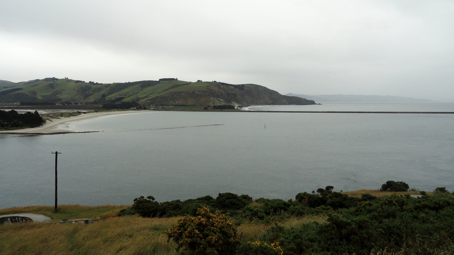
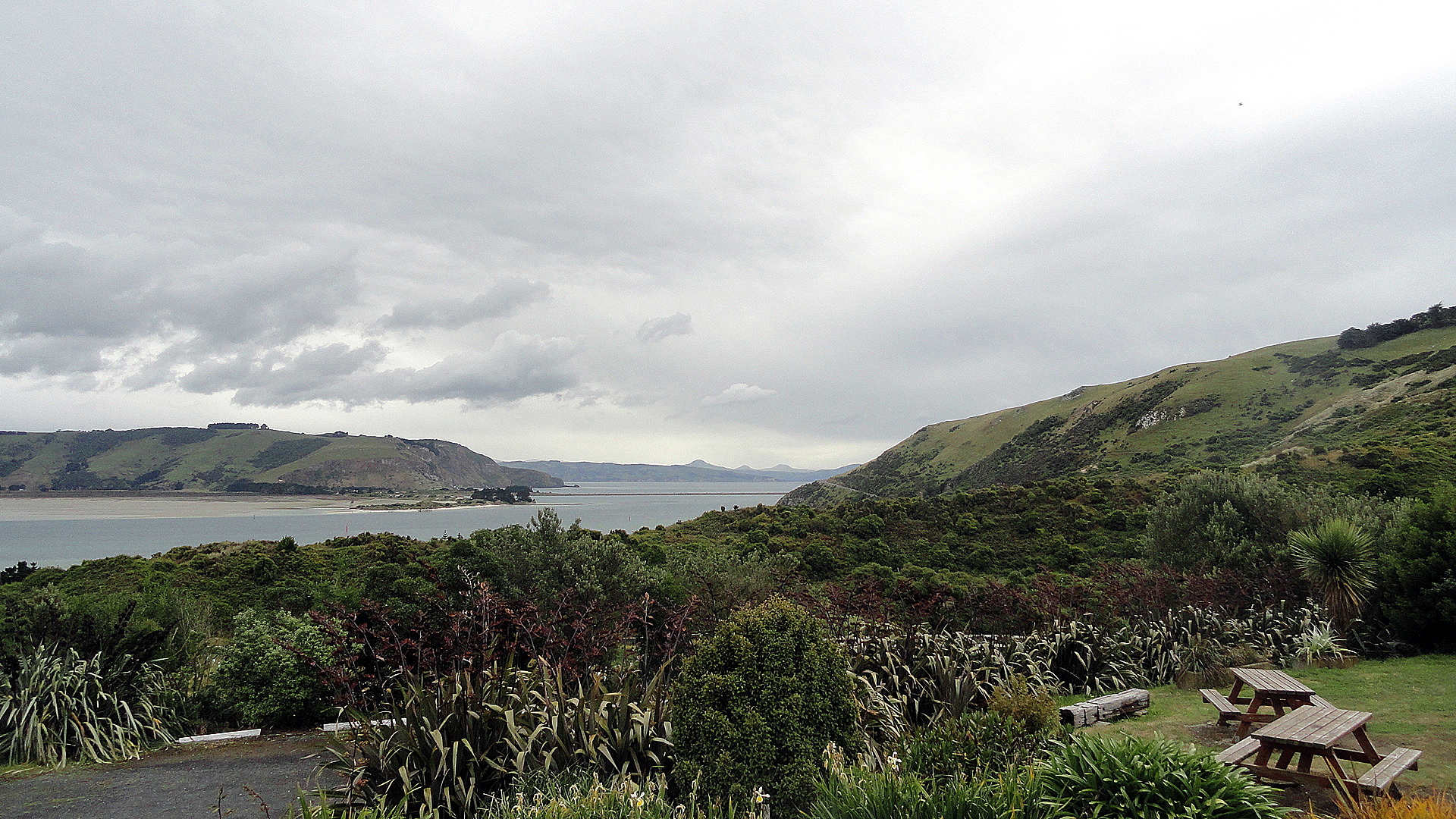
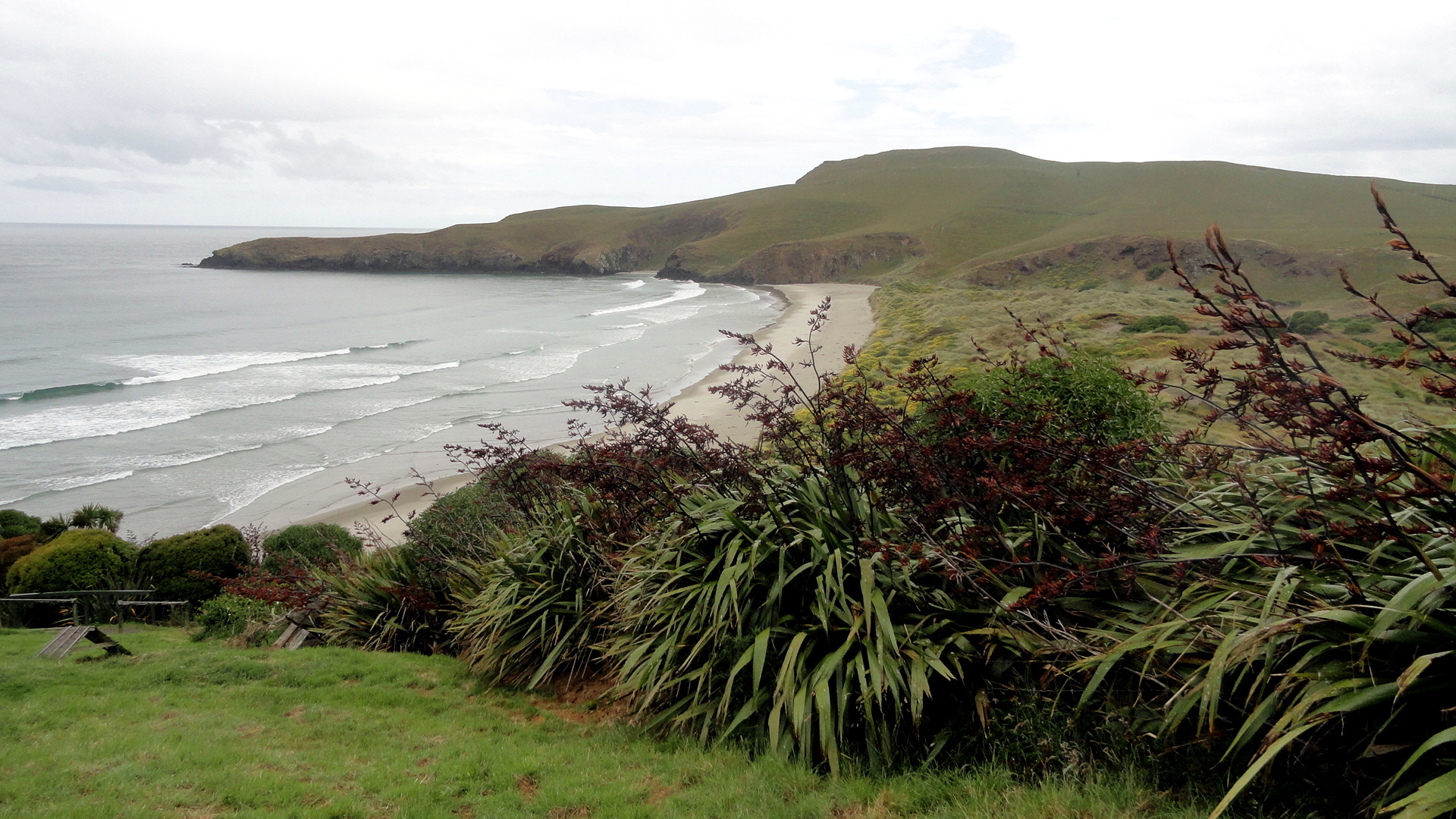
Many Penguins Nesting & Other Dunedin Scenes

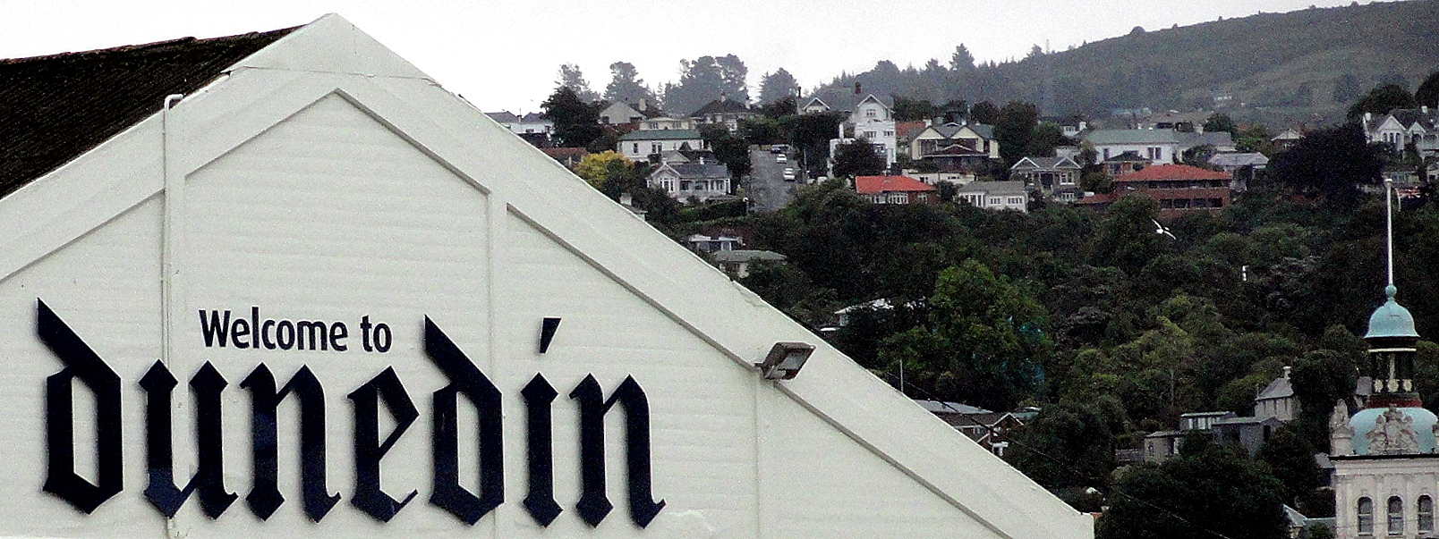
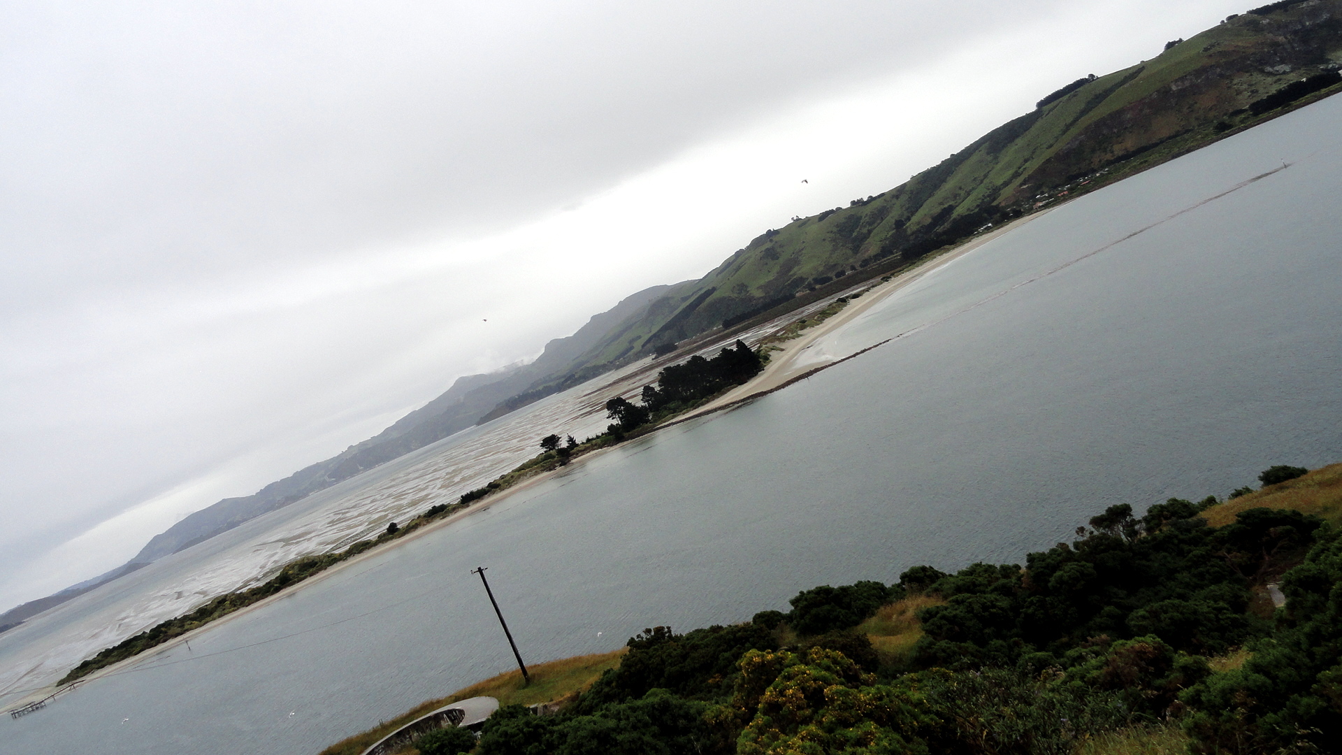
Looking at the opening shot from Dunedin’s lovely town center, called The Octagon for clear reasons, I am reminded how lovely blue skies can be. As you will see in subsequent posts from Doubtful Sound and here in Christchurch where we’ve been now for two days, this semi-clear day in Dunedin earlier this week was, roughly, the last bit of blue sky and sunshine we’ve had. Ah, for the sunny blue skies of our Cook Strait crossing!
That said, the Northern Royal Albatross, perhaps the most iconic fauna of Dunedin’s gorgeous if wet Otago Peninsula, only flies when it’s windy and seems to prefer the wet to the dry. Thus we were able to really enjoy seeing quite a few of the adolescents on the wing during out time around Taiaroa Head at the tip of said peninsula. Below is one shot of such a bird in flight, but no still image, not even something on film, could really capture the remarkable grace and perfection – for their evolved purpose of circumnavigating Antarctica in the roaring 40’s 80% of their time – of these creatures of the air. Their wings are multiply hinged, so that they unfold in sequence to reach a much greater length than you might think, if you saw one nesting on the ground as we did from the hilltop perch whence we first viewed them.
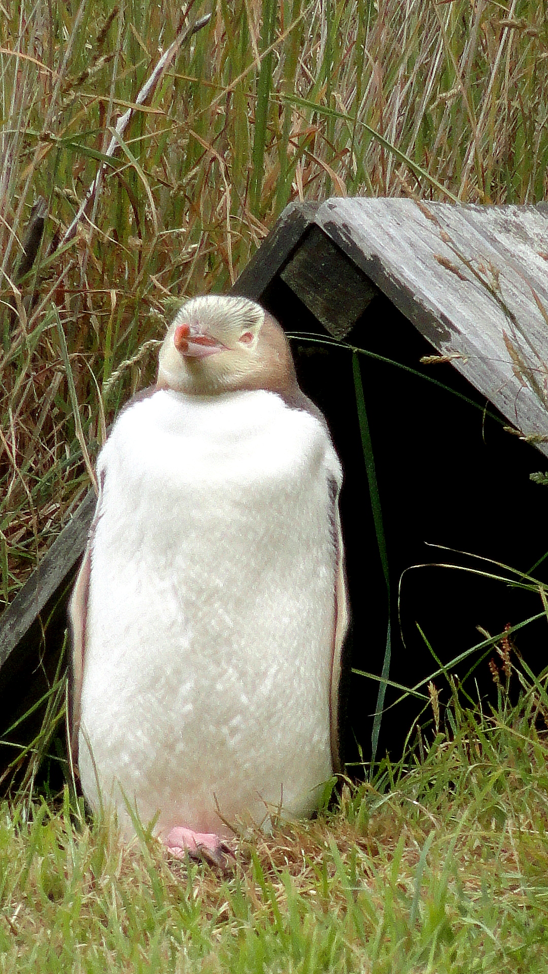
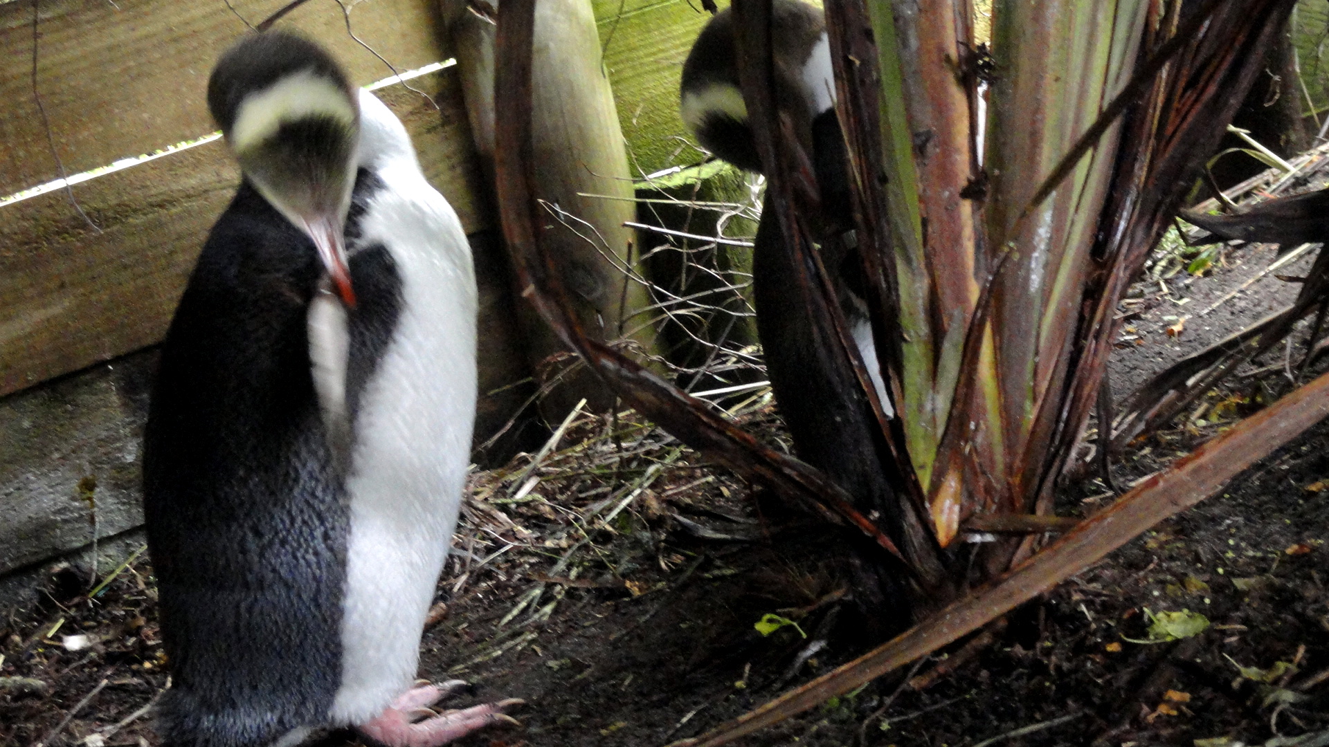
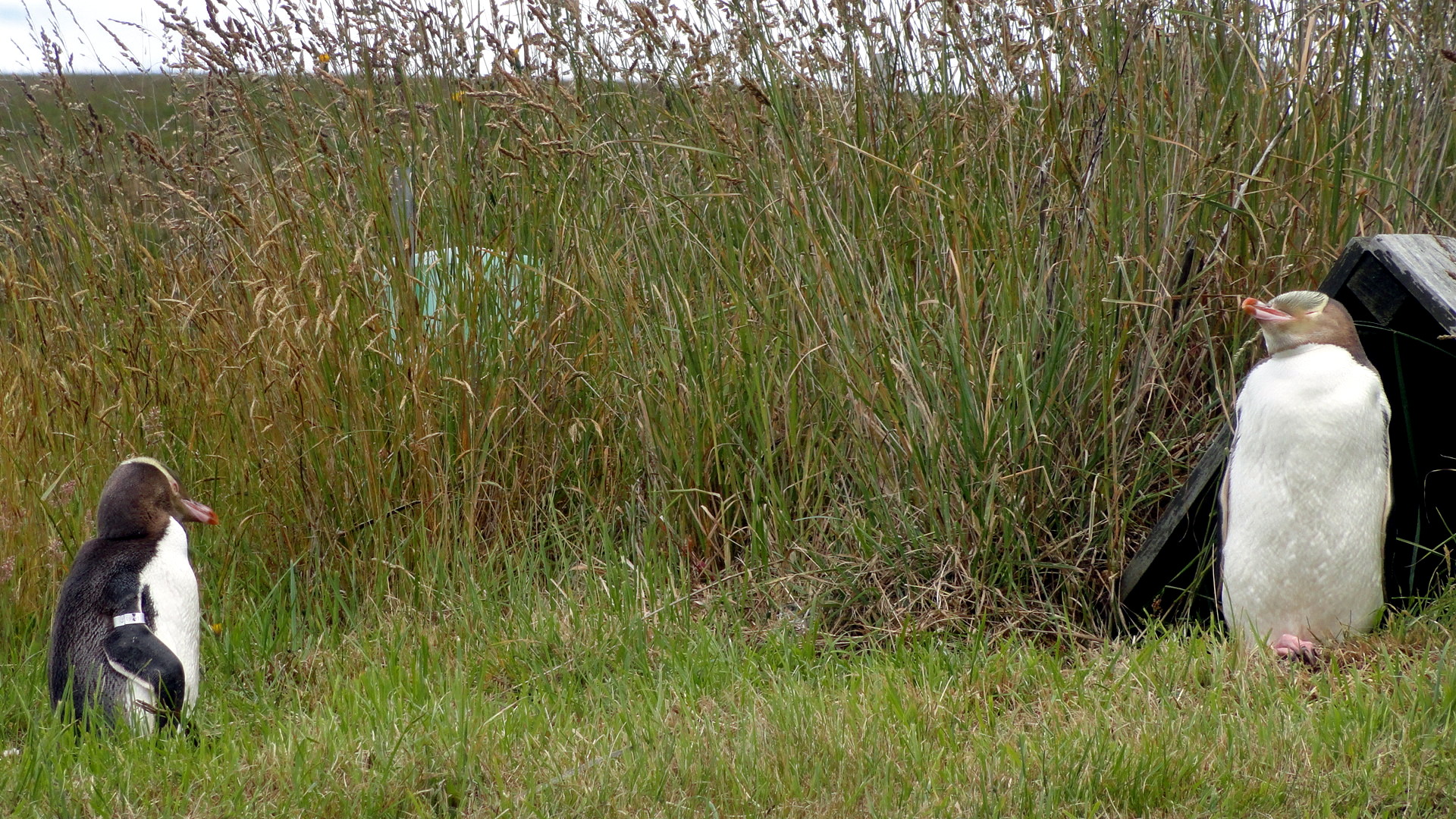
On the same remarkable day we saw all the yellow-eyed penguins, some of them up rather close and personal. They’re (one of?) the most endangered penguin species in the world. And, a correction to those whose imaginations have been over-stimulated by Happy Feet etc., most of the 18 extant penguin species are NOT ice-dwellers, but nest on beaches and, yes as seen here, in coastal-adjacent grasslands. What makes the yellow-eyed ones so rare? They’re the only anti-social penguin species. They won’t nest in sight of other penguins! So when Euros showed up here and started cutting down the coastal trees and scrub, these guys’ nesting habitat was greatly reduced. They also won’t nest if they see humans around – they’re very habit-driven creatures and do not like the size of humans. So on this working sheep farm, the owner a few decades ago decided to start tunneling down under camouflage nets that he’d erected to hide himself. These underground paths lead to what are now basically viewing blinds scattered over the acres of headland where the yellows come back now every year to nest and lay their one egg and hope it hatches and rears well. If you look closely in in the shot that should be more or less at the end of this block of text, you’ll see gray ball of fluff which is a several-week-old chick, the only one who’s hatched on this patch this year of about a dozen or so nesting pairs. Yellows are something like the third-tallest species of penguin. We also saw some little blues, aka fairy penguins (yay!), in the water, but they’re too small to capture well. (If you’re curious, there’s this from my last visit in Dunedin: https://somuchworldsolittletime.com/wp-content/uploads/2009/03/littlebluepenguin.jpg) — these guys are more numerous but they’re truly a bite-sized morsel for many an airborne or seaborne predator, so they try to camouflage well from both below and above and thus are hard to capture well on film. Because we so rarely get to see truly wild and natural penguins in their own habitat, I went a bit shutter-crazy, but to spare those of you without so much interest, I’ve tucked most of the penguin shots into a small thumbnail gallery below; the penguin-lovers among you can click on the individual shots to see them in fuller size; there’s another shot of the chick w/parent in there as well.
Anyhoo: I hope you enjoy these wildlife shots. Despite its Scottish weather, I find Dunedin – this time as last – a surprisingly appealing and magnetic town that I can somehow imagine living in. Who knows, maybe some day. Especially if I meet the right reason, as it were… Cheers and happy new year, one and all.


 …a northern royal albatross in flight, above; and a fur seal at rest below. There were tons of fur seals and even a few adorable, squeaky little pups hidden in the rocks and among their protective elders, but I didn’t get many good shots of the seals, either here or later in Fiordland where we again saw quite a few in the water and hauled out on land. They’re show-offs in the water, when a boat goes by, I can tell you that for sure. 🙂


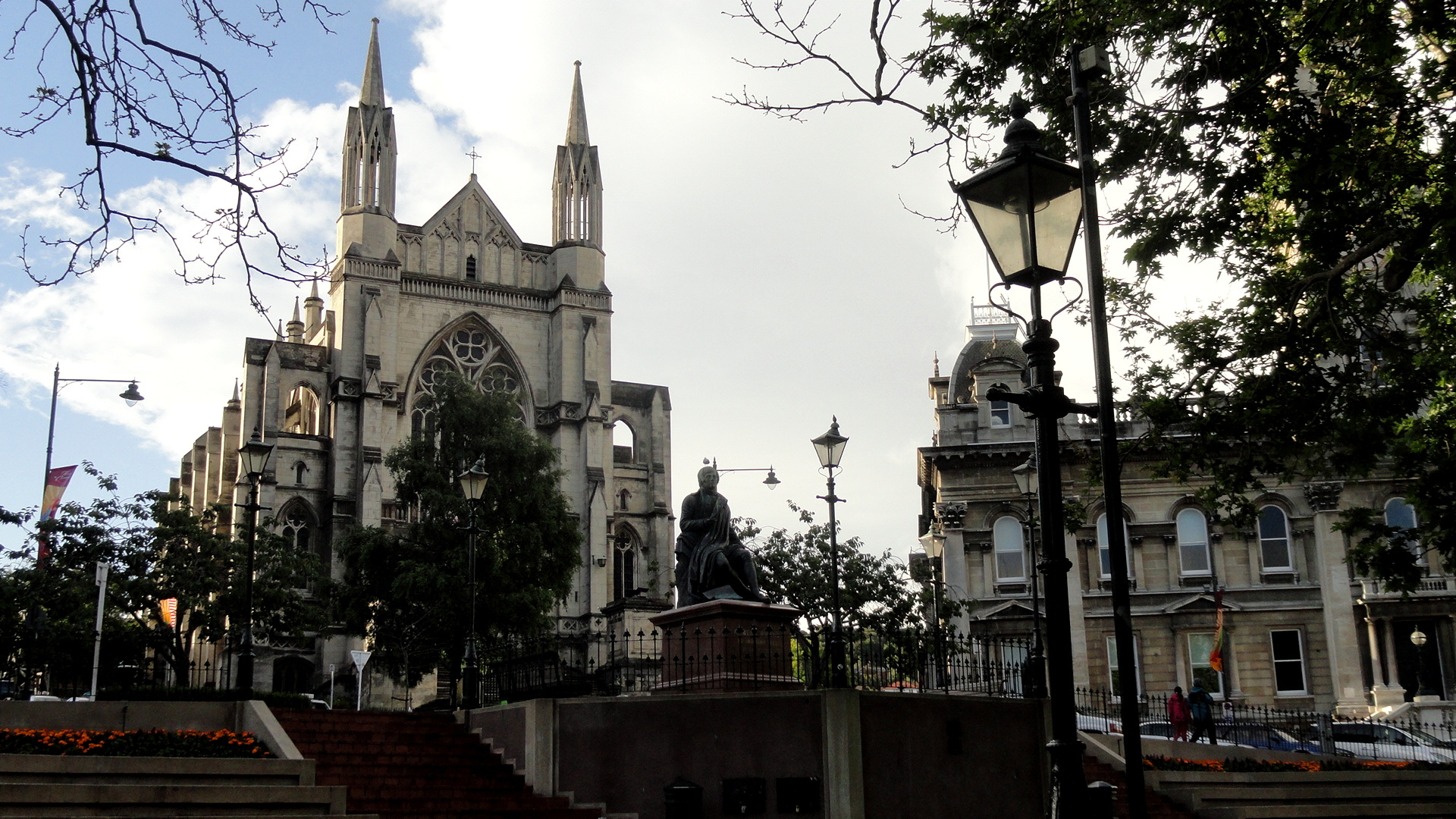
 In the shot above, you’re looking down from the Octagon toward the train station in Dunedin, a grand building erected during Dunedin’s reign as wealthiest town in NZ (late 1800s or so, due to gold finds around inner Otago region) which they claim is now the most-photographed building in NZ. Having not photographed it last visit, I figured I’d do so in my usual off-angle way this time around :p)
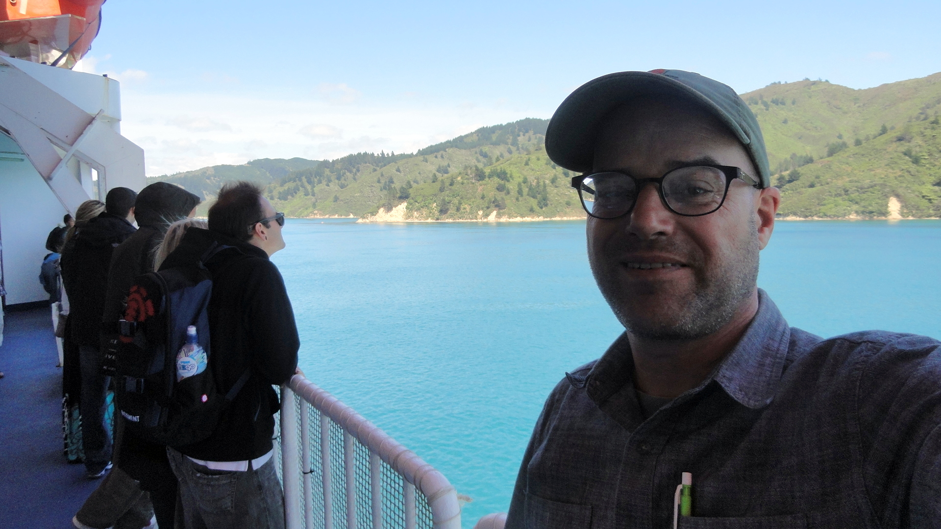
Ferrying Across the Cook Strait


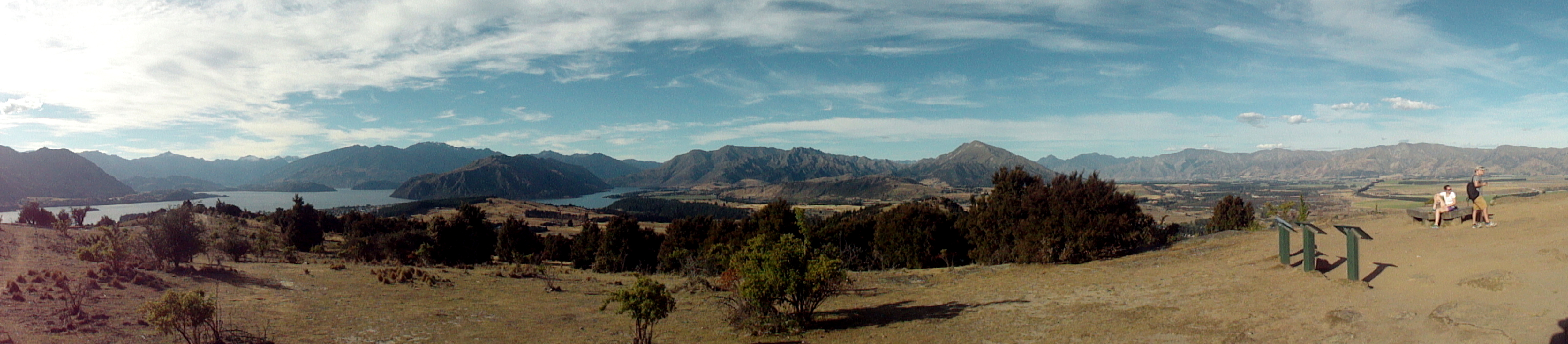
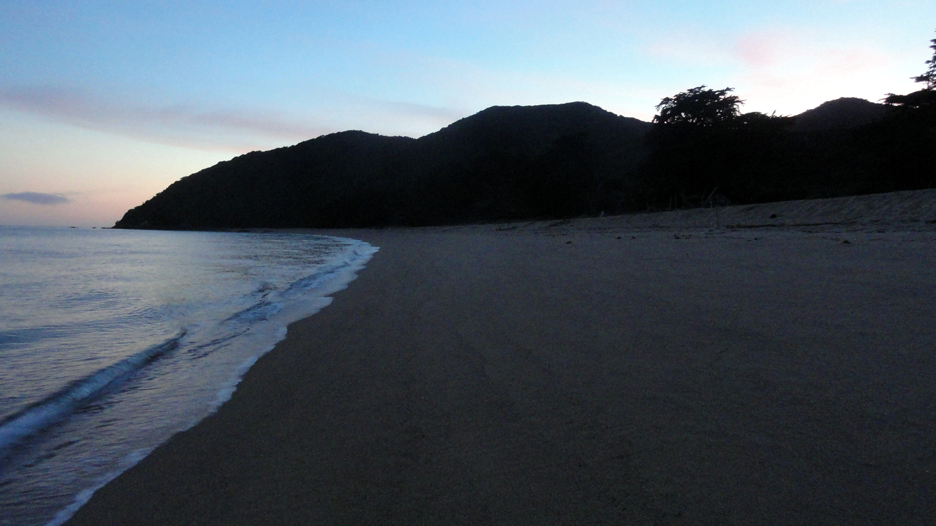
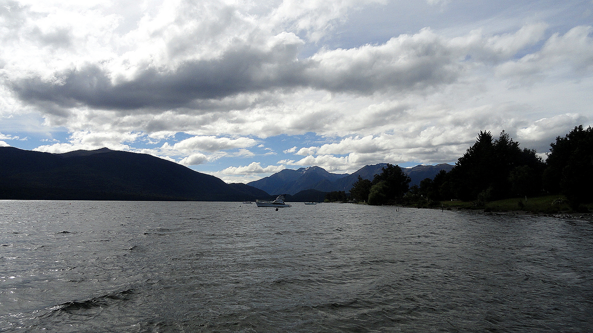
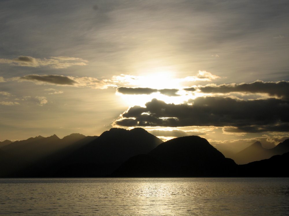
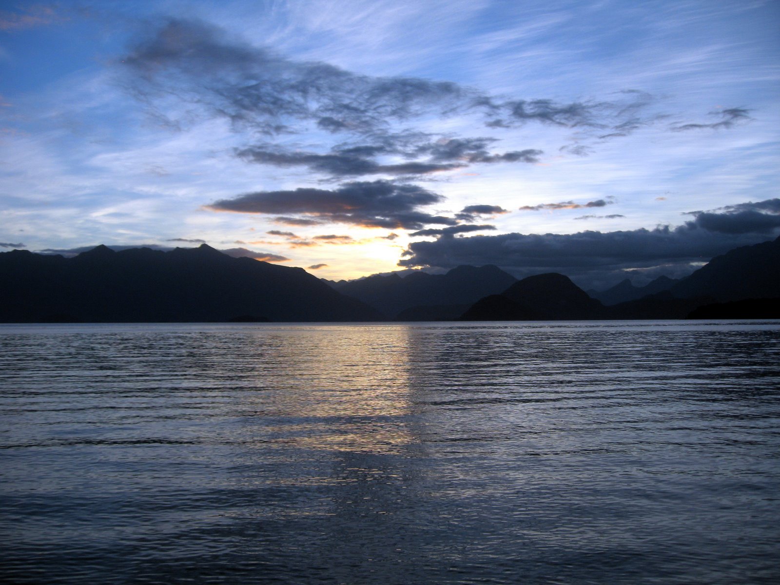
smw, slt is spending the end-of-year holidays (solstichristmakwanzakkah, you know) in the company of my mother and one of my brothers, along the shores of lovely lake Wakatipu here in Queenstown, south-central South Island in the lovely nation of New Zealand. NZ rocks: I first visited here four years ago and l o v e d it; I’d move here in a flash if I met the right reason and/or if nearly everyone else I know in the world didn’t live at least a 12-hour flight away. NZ is very nearly the same size as Colorado in land mass — one key difference, of course, being that NZ is composed of a handful of big islands and hundreds of littler ones floating in the South Pacific, where poor Colorado remains firmly landlocked until global warming truly does its worst to us all — and has roughly 20% fewer inhabitants than Colorado. It has mountains as high, but unlike CO it also has fiordlands and tons of interesting glacial lakes, volcanic cones, a sub-tropical north, world-class wine regions, two species of indigenous penguin and the only mainland-based colony of ablbatross in the world (mainland meaning a large island with a big human population), and a LOT of fur seals. All of this adds up to many choices of wonderful places to visit in a short two-week holiday, which is all we have time for now. We started out in Wellington, capital of the this kewl little country showcased above and below; thence we hopped the ferry across the Cook Strait to the northern end of South Island. It’s this journey which is documented in this first post from my end-of-year holiday.
I apologize that these NZ posts will, of necessity, be broken up over several entries. I’ve got tons of shots of penguins, a few of flying albatross; I’ve got photos of waterfalls and fiords still to be sorted and color-corrected, and I really do ditch more than 75% of the shots I start out with. So there’s much sorting to do before I come up with another post for everyone. With luck I can post those as a new-year card to everyone. At the moment, it’s Christmas morning here and it’s lovely to be with family again. The news break is just carrying the update on South Sudan, which had started to look worrying before I left PNG for holiday. Since I’ve many friends working there, and in Central African Republic where tens of thousands continue to be affected by insecurity and violence, I find myself as usual a bit conflicted this Christmas morning: grateful that I can sit in luxury and comfort, surrounded by family, by the lovely shores of Lake Wakatipu (say that, slowly, out loud, a few times to start your day: it’s great fun, and yes rather juvenile)…and at the same time rather heavy of heart at how the world is so sorely and sadly divided into zones of privilege and comfort whose inhabitants tend to be unaware and unappreciative of how very lucky they are, and too much of the rest of the world where families struggle to stay alive, secure, healthy and well fed. I wish for us all in this sadly fractured world, as always, a bit more peace, health, and security in the year to come. Hugs, one and all.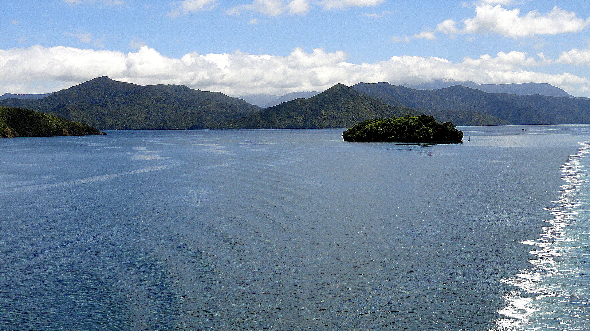
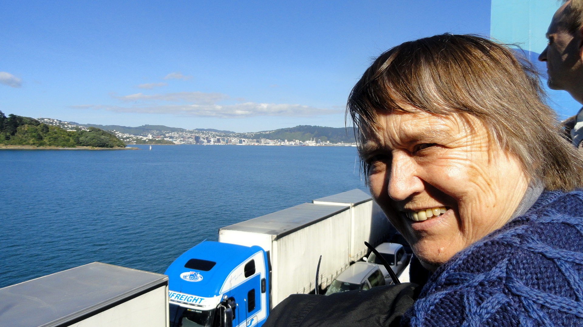
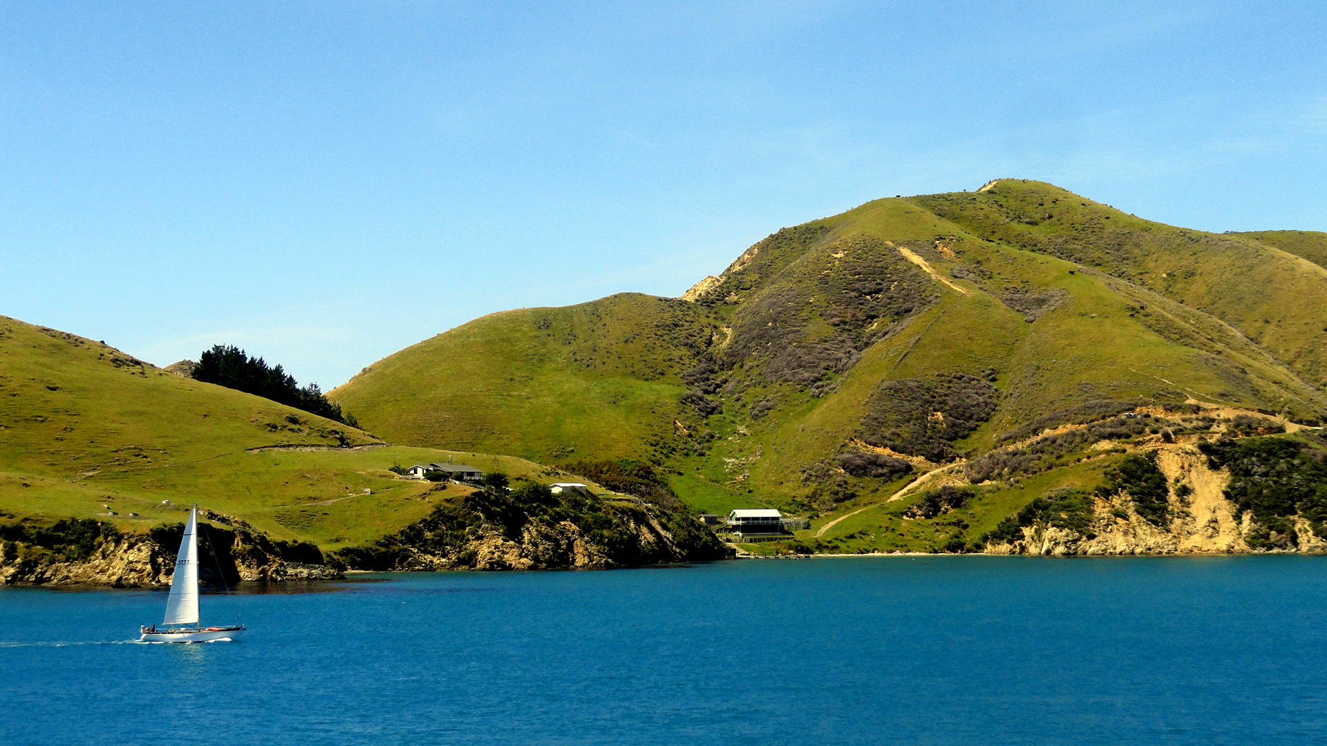
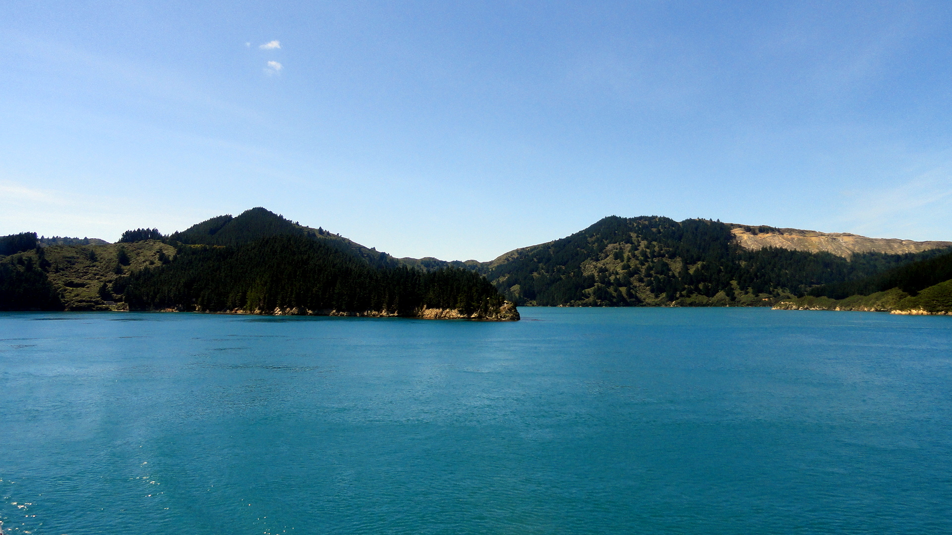
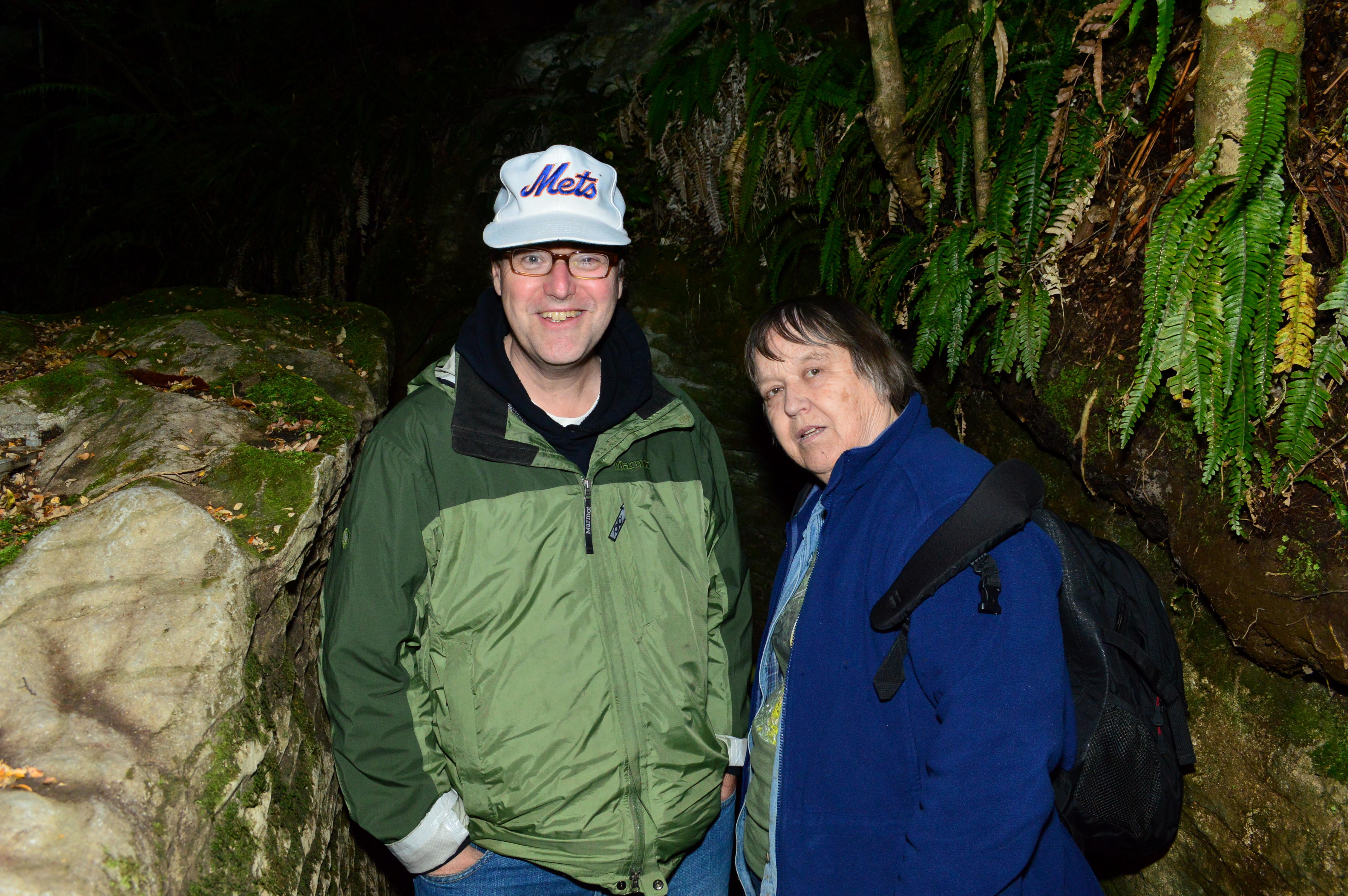
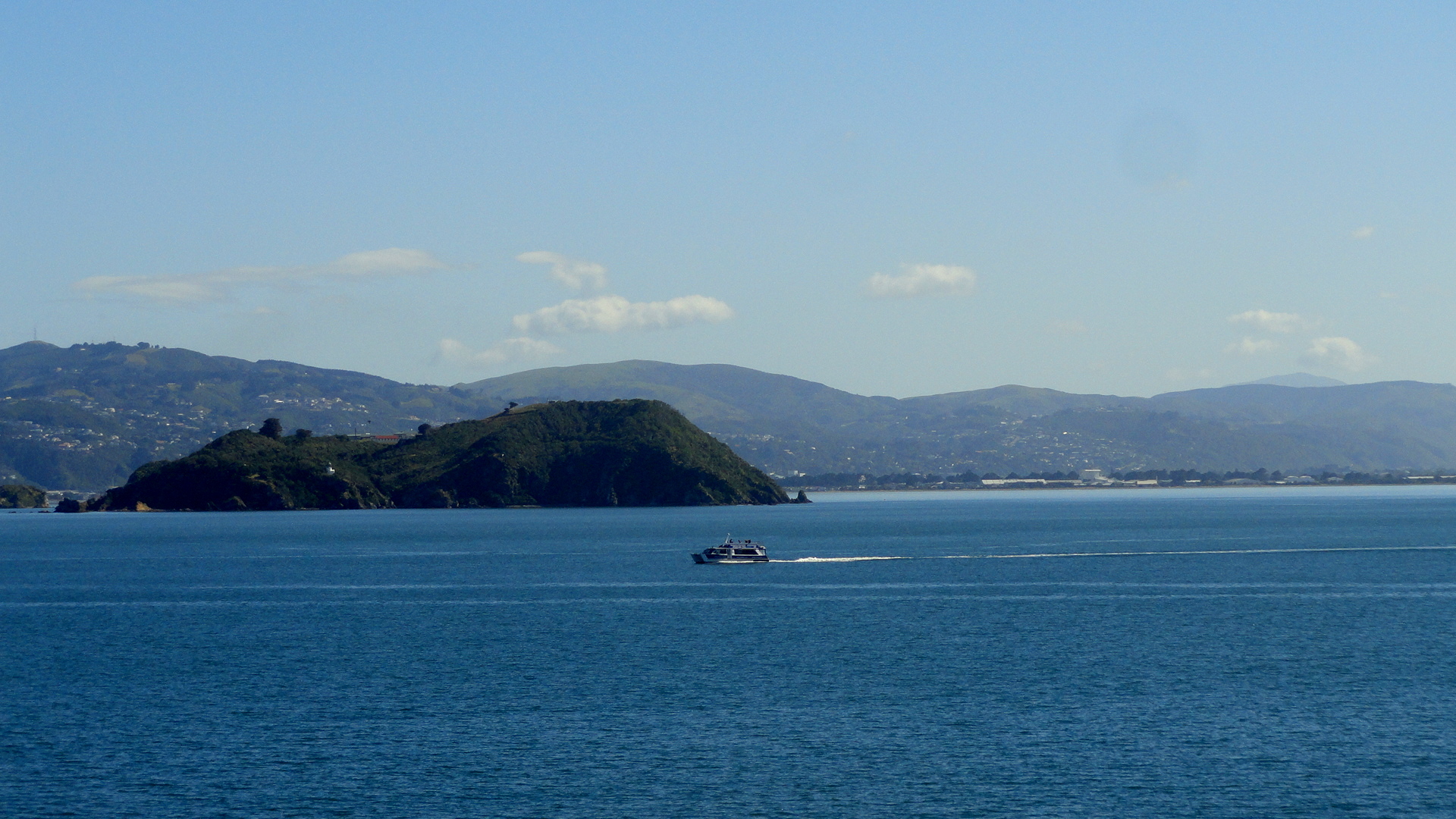 Above are some of the shots exiting the complicated harbor at Wellington, whence one crosses the Cook Strait and tucks into Tory Channel, one of the many inundated valleys that form the Marlborough Sounds region on the northeastern coast of South Island. If it lays out as hoped, below you’ll see a shot where we’ve entered the Marlborough Sounds and left the rough choppy waters of Cook Strait behind; and a few shots of the drier, pastoral hillsides along the sound. Then at the end you’ll see a bit of an opening where the ship turns sharply right to enter the main channel of Queen Charlotte Sound, then sharply left again to enter Picton harbor; I took a shot looking back at the curve of our wake as we bid adieu to Tory Channel. And then, at the end, the shot Steve & Mom got suckered into buying when they did their Glow-Worm Cave Tour at Te Anau in the Fiordlands — having done that tour a few years ago, I didn’t repeat it but instead cooked them dinner. Ah, such a tour host am I… 🙂
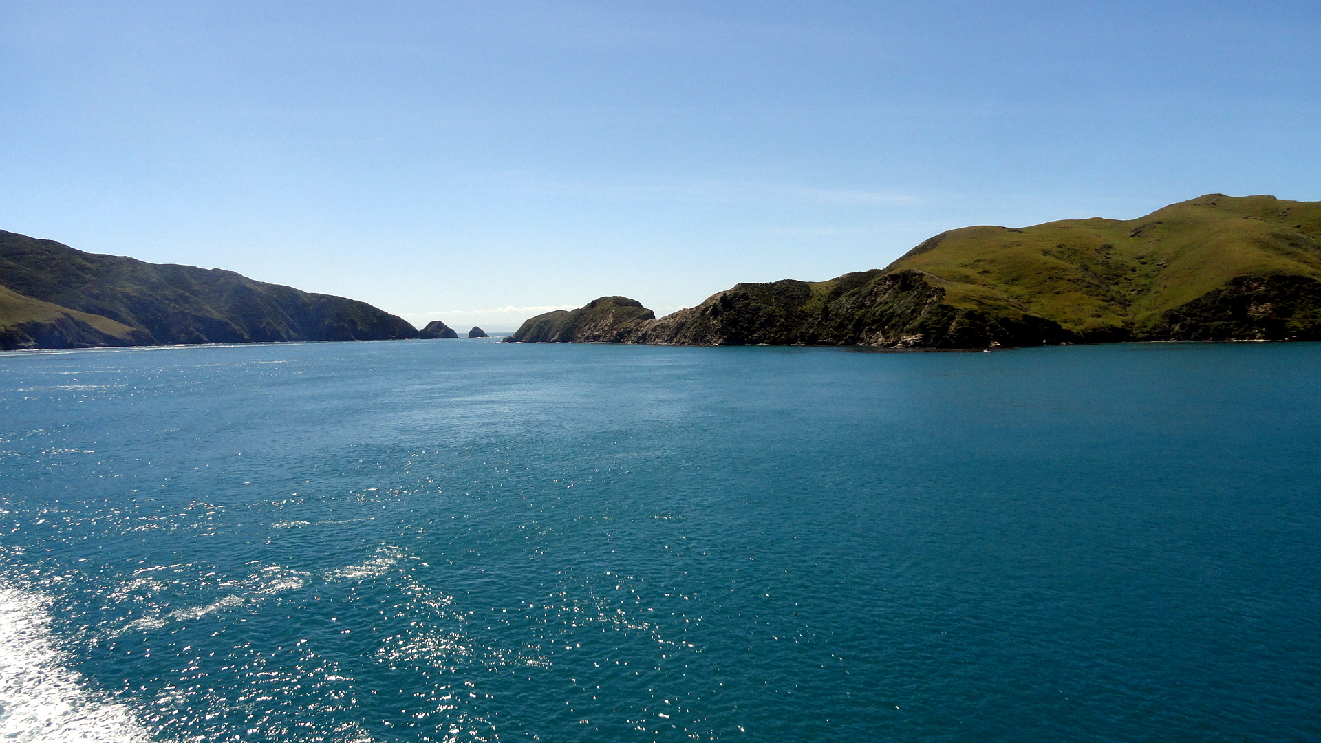


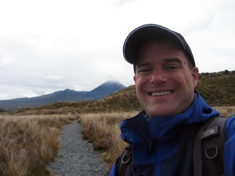
Tongariro Crossing – The Summit of Mt Doom :-)
 So that’s it, folks. Two months in Australia and New Zealand (plus the bonus couple nights on Tahiti) over and done with, back to the life I was leading last year in NYC and environs. Here are all the pics I’m gonna give you from New Zealand. (There were more, but you’re glad I’ve pared it down even this far, aren’t you?) I was gonna wax political, about carbon footprints and how even comparatively well-off Aussies and Kiwis hang their clothes to dry and don’t even own a dryer; about how it seems the whole world gets what too many Americans still don’t, that Obama is our best hope and we as a people really need to rise above the narrow commercialism and blind xenophobia (masquerading as patriotism) that’s come to dominate our culture and society, and rediscover some social and cultural values like caring for our world, community, and honesty and quality of life that don’t have to do with someone’s quarterly bottom line. But that’s boring. Or I was gonna explain what I’ve given up in order to save the money to do this kind of trip, rather than working a regular corporate job and doing the daily commute. But that’s even more boring. These pics are interesting, so I’ll leave you to them. May this year and many to come be full of more hope than we’ve had recently. I will, just by way of grandstanding, leave you with two quotes, below…they say it all better than I could. Peace, out.
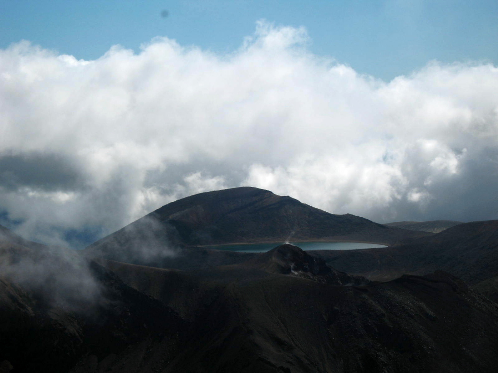 “…FlexPetz…rents out well-trained dogs to busy professionals in several California cities. [One] customer…feels like an uncle to the dog he borrows for $39.95 a day… Meanwhile, dog and cat owners who travel frequently now have another option for their pets… Posh digs for pets are available in airports… Amenities for dropped-off animals include piped-in music, individual suites, gourmet treats and Web cams so distant owners can check in on their pampered pets.” (High Country News)“Smallpox ravaged us quick, tuberculosis killed us slow, liquor made us stupid, religion meddled with our souls, but the bureaucracy did the worst and finally bored us to death… Along with rules, there came another affliction. Acquisition, the priests called it. Greed. There was no word in our language to describe this urge to own things we didn’t need. Where before we always had a reason for each object we kept, now the sole reason was wanting it. People traded away their land for pianos they couldn’t play and bought clothing too fancy for their own everyday use. They bought spoons made of silver when there wasn’t food…Where before we gave our things away and were admired for our generosity, now we grew stingy and admired ourselves for what we grabbed and held.” (Louise Erdrich, Four Souls)
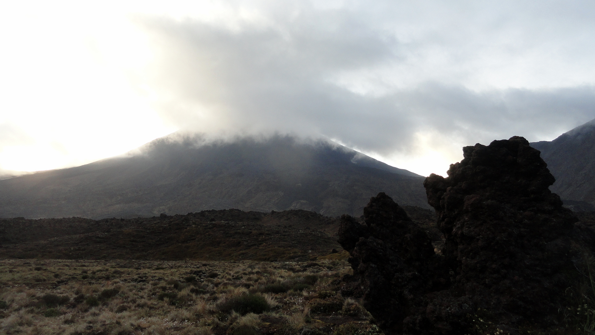
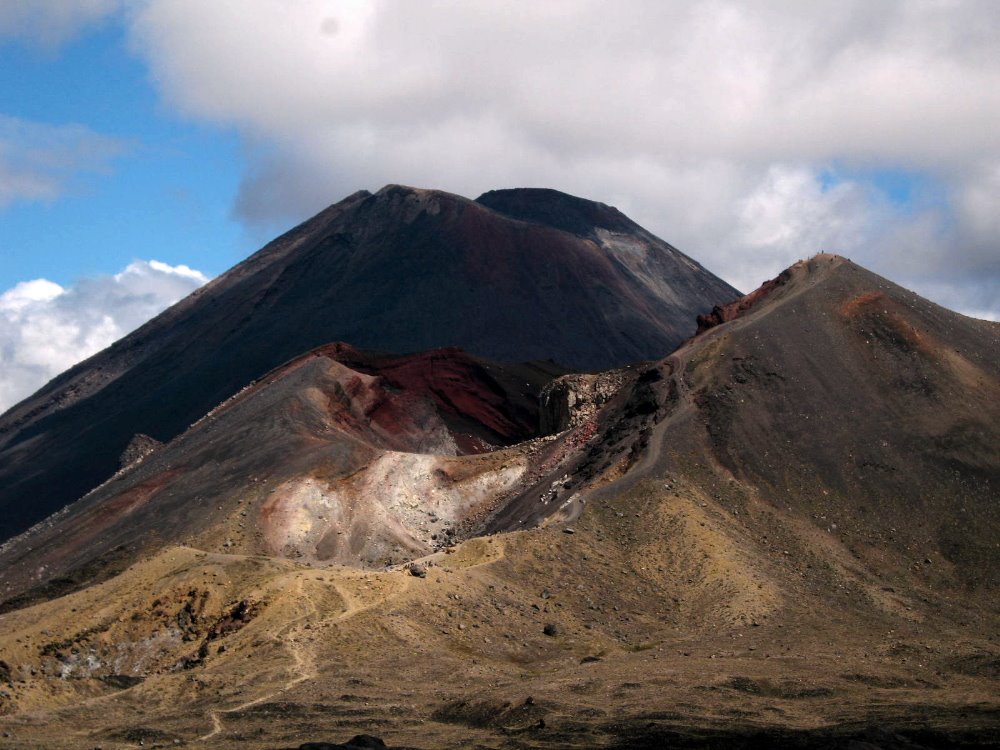
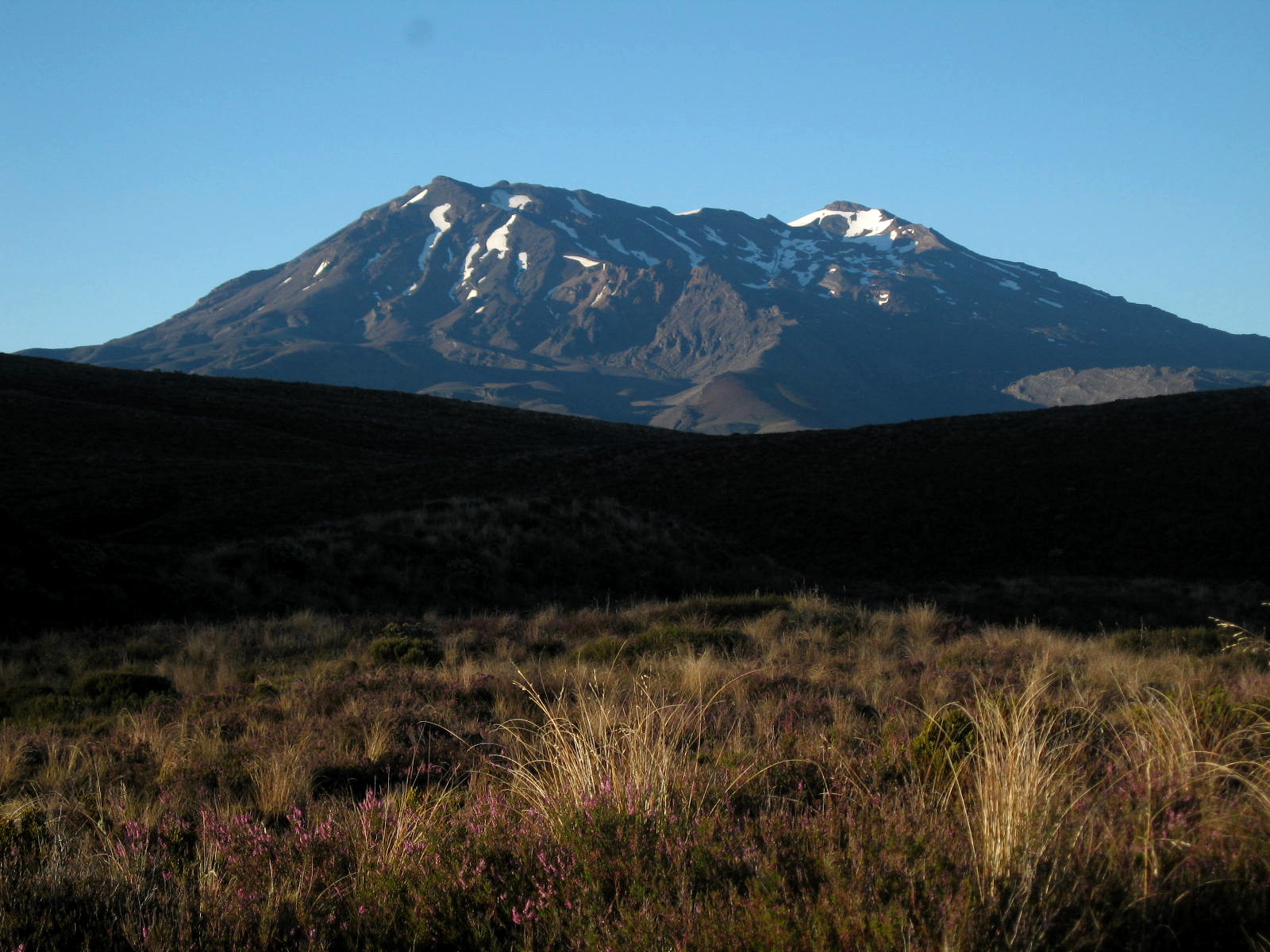
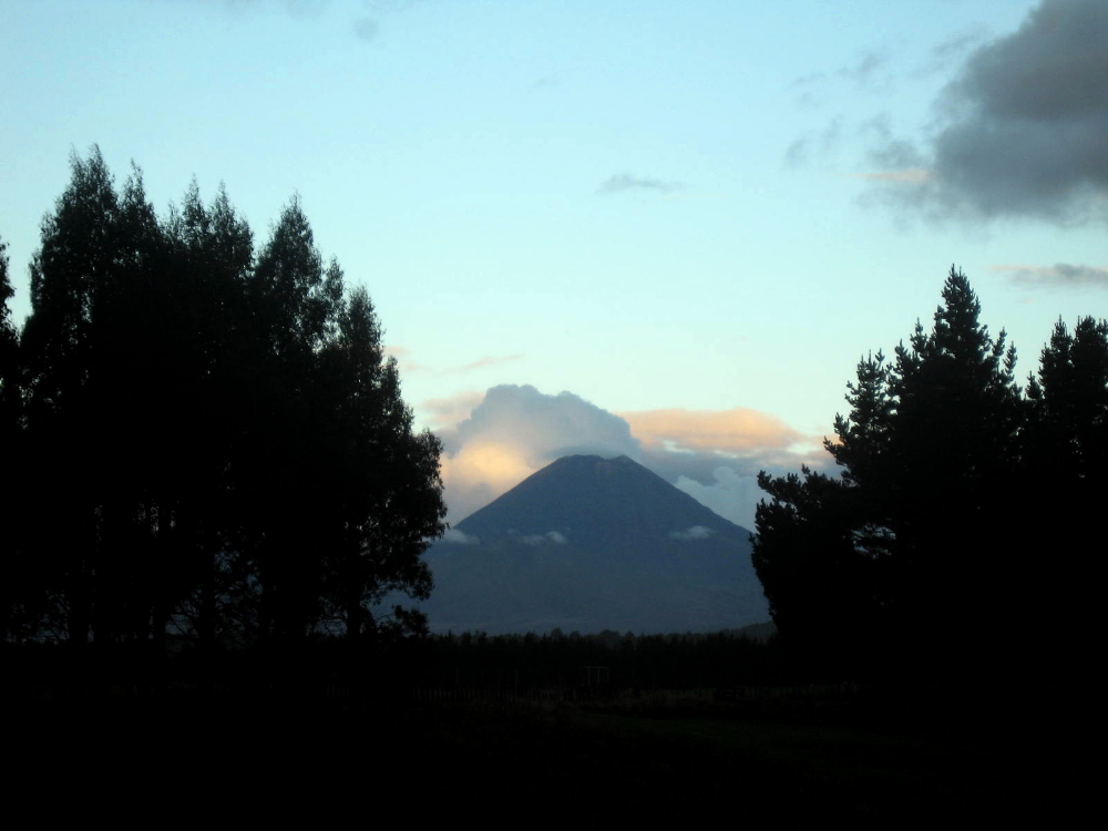
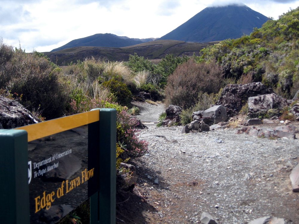
 Of the three active volcanoes in Tongariro National Park, Ngauruhoe is the second highest but by far the most classically-proportioned. It’s a pretty imposing sight, isn’t it? Imagine seeing it as I did: Climbing up a ridgeline from a bright-yellow stream (made yellow by all the minerals in the water, like at Yellowstone), suddenly at the top of the ridgeline I can look across a sparse scrubland of alpine plants to the towering even cone of Ngauruhoe, whose summit and cone are shrouded in cloud. Hearing the rotors of a helicopter clack-clacking away to my right, seemingly on the snowy slopes of tallest Mt Ruapehu, I look over and see that the helicopter is trailing some kind of long flat payload from a cable hanging below it. Has someone been evacuated after a fall while climbing to the 2800-meter summit of Ruapehu? Or is it something more mundane, like logs being dropped somewhere for trail maintenance? Then I look again ahead of me at the summit of Mt. Doom, no Orodruin, no Ngauruhoe (yes: a digitally-altered image of Ngauruhoe was indeed the image of Mt Doom/Orodruin the Lord of the Rings movies – small wonder, huh, seeing it in real life here!), and…wait a minute, the cloud has cleared a bit, but isn’t that a small trail of steam rising directly up out of the cone? Is that helicopter, perhaps, part of some general evacuation? Is all hell about to break loose with flowing lava and an explosion on the summit of one or all of these volcanoes? 🙂
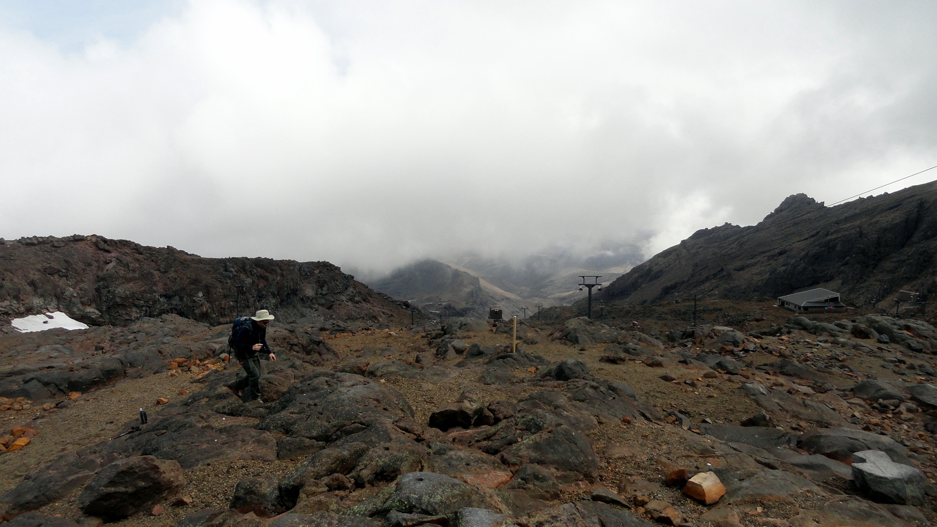
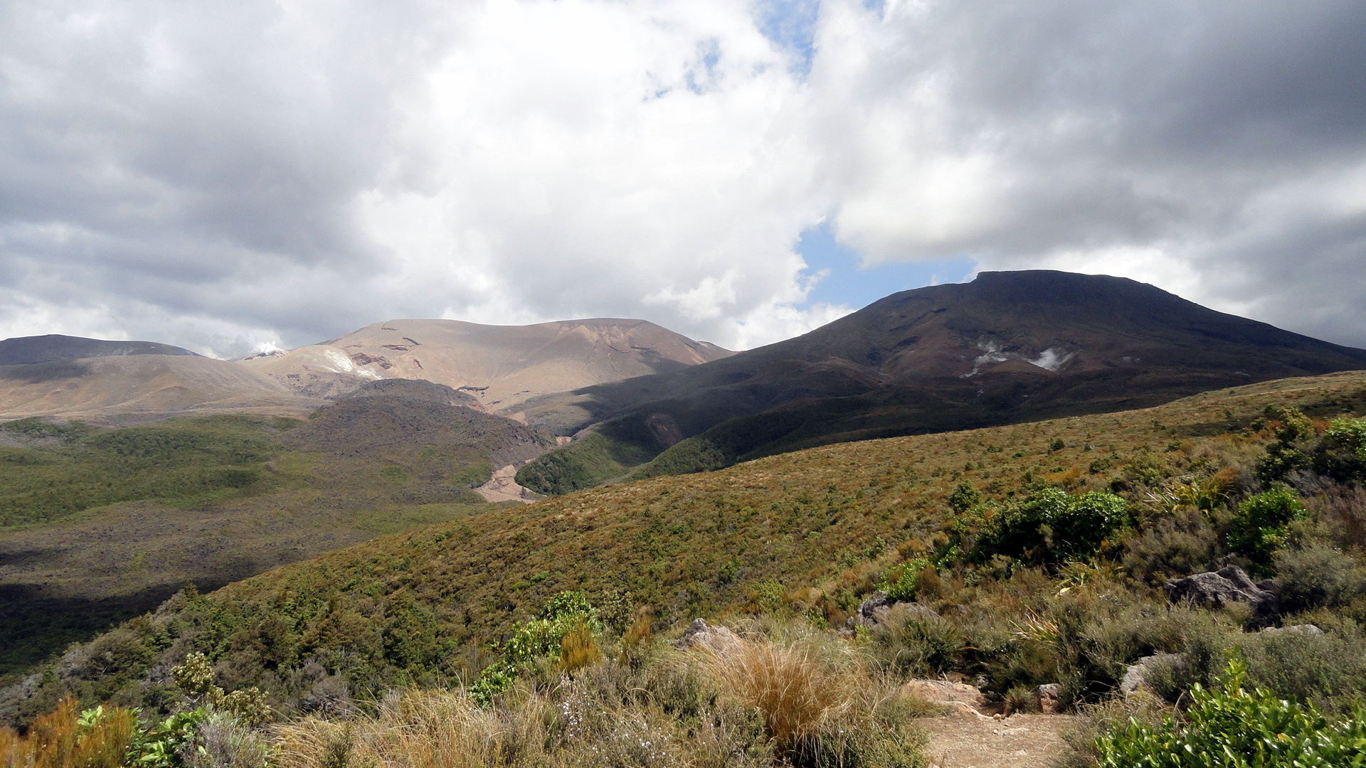
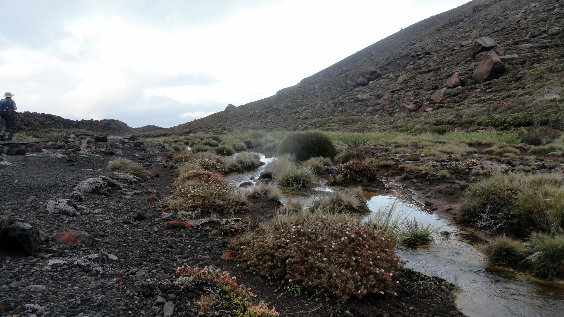
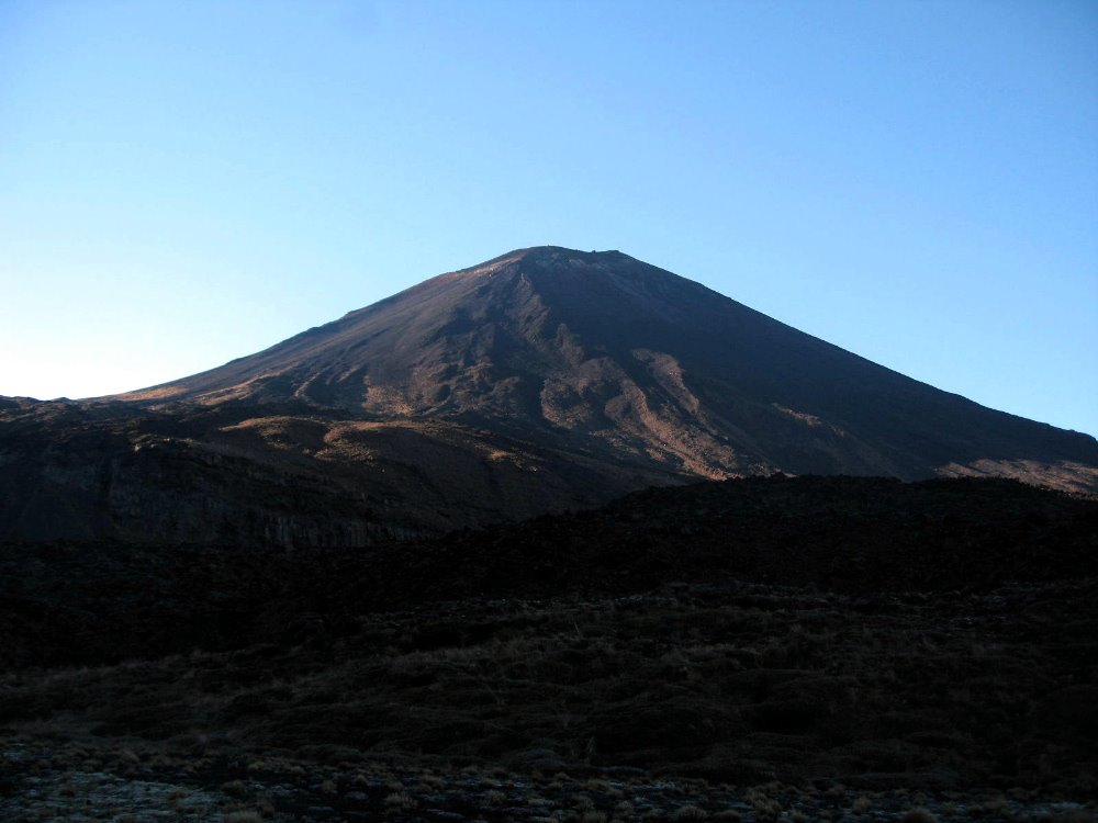
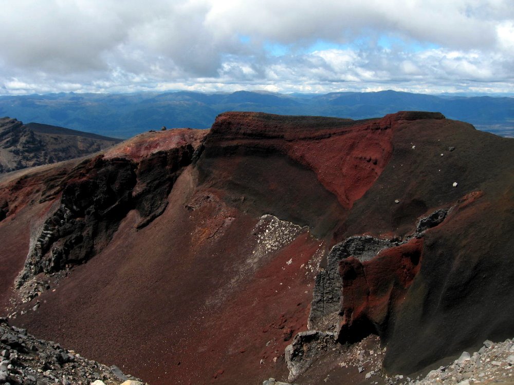
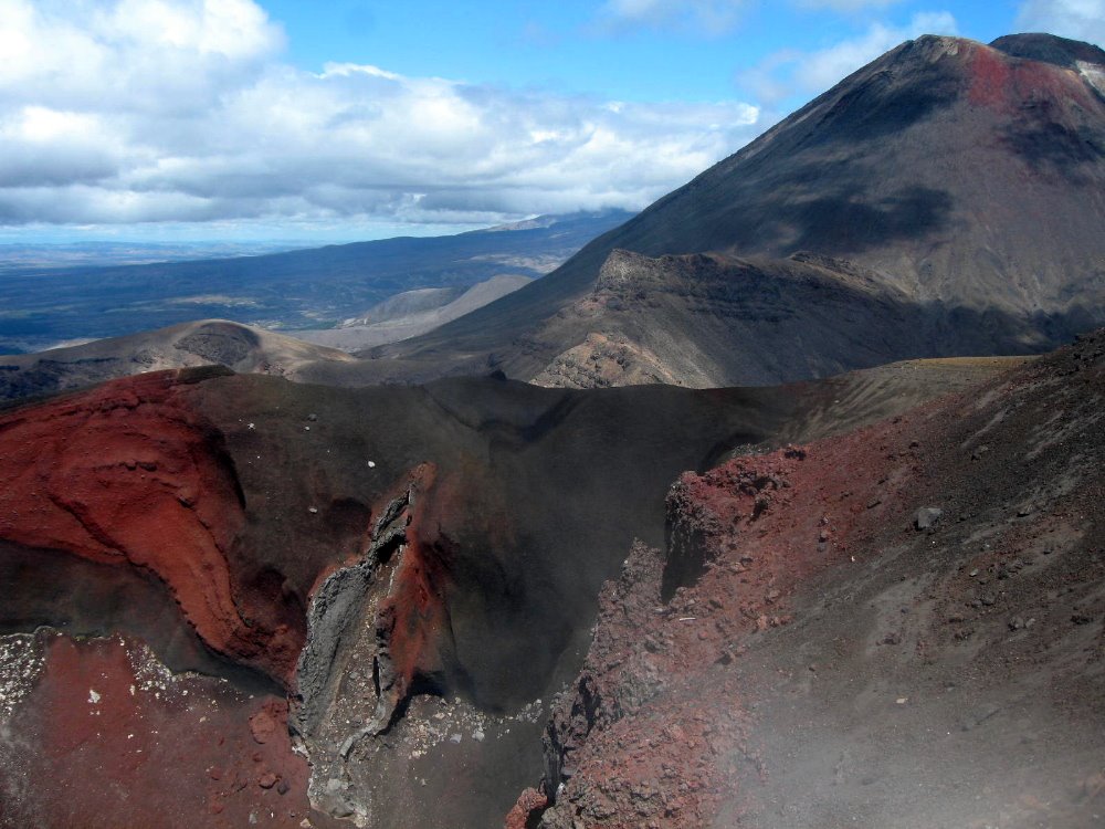
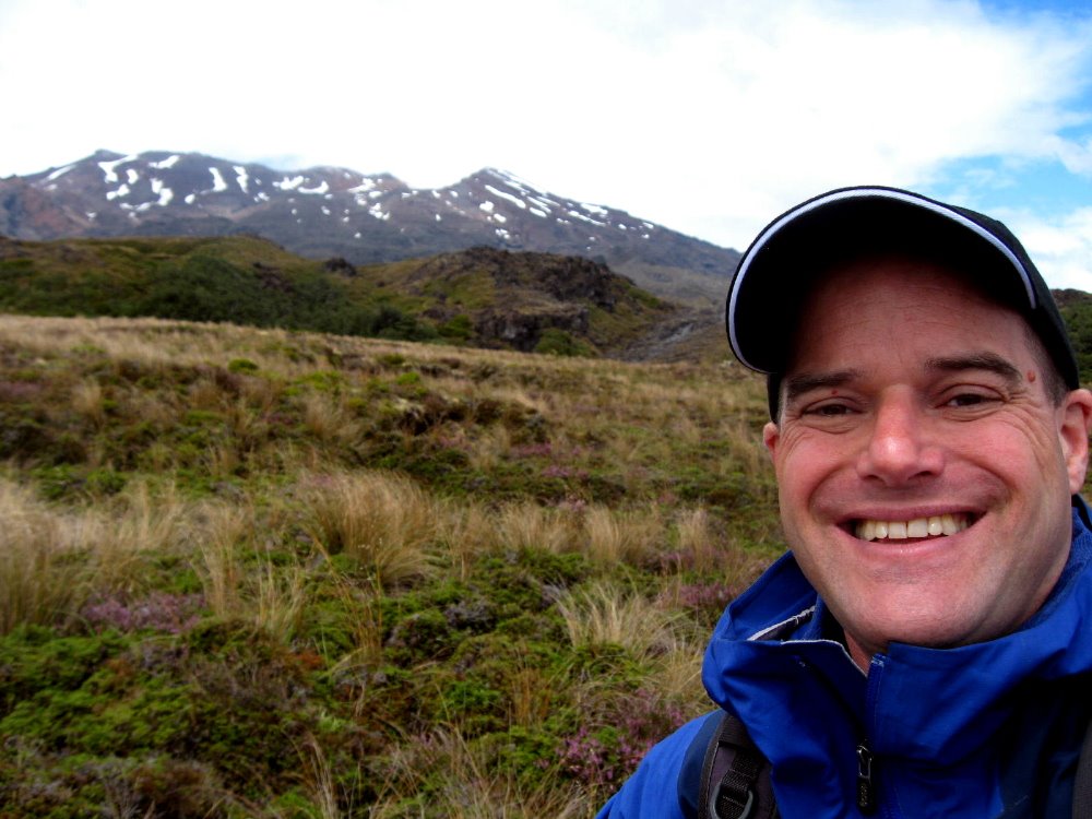
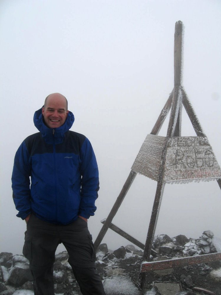
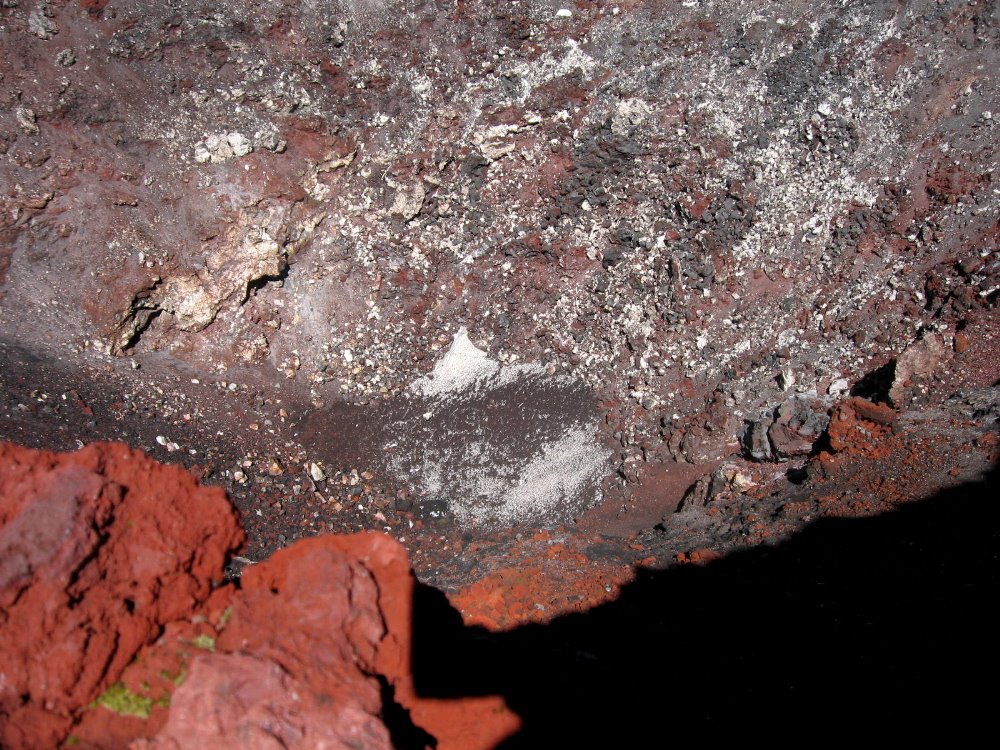 That there is looking down into the actual crater, from the summit. The text I wrote above is really about what I did on the rainy day before I did the official “Tongariro Crossing,” which is an almost 20km day hike almost all above tree line that goes from the west side of Mt Ngauruhoe up and over to the north side of Mt Tongariro; to clarify: Ruapehu, at about 2800m, is the southernmost, most active, and most snow-covered of the mountains; Ngauruhoe, at about 2200m, is in the middle and the most obviously volcanic, seen from a distance; and Tongariro, after which the whole park is named, is at about 1800m the shortest of the three but very large with several active craters over and around which we walked, and is the northernmost of the three.
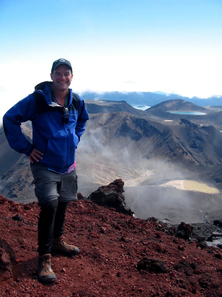 Indubitably the best decision I made in one month here was, upon arriving in National Park by train (lower down for that story) and learning that weather was forecast rainy the next day, to extend my stay by a day and do the hike on the following day, forecast mostly clear and sunny. Having done the alpine sections of the Kepler Track (next section down…) in snow and fog, I just wanted some clear views from these highest sections of North Island.
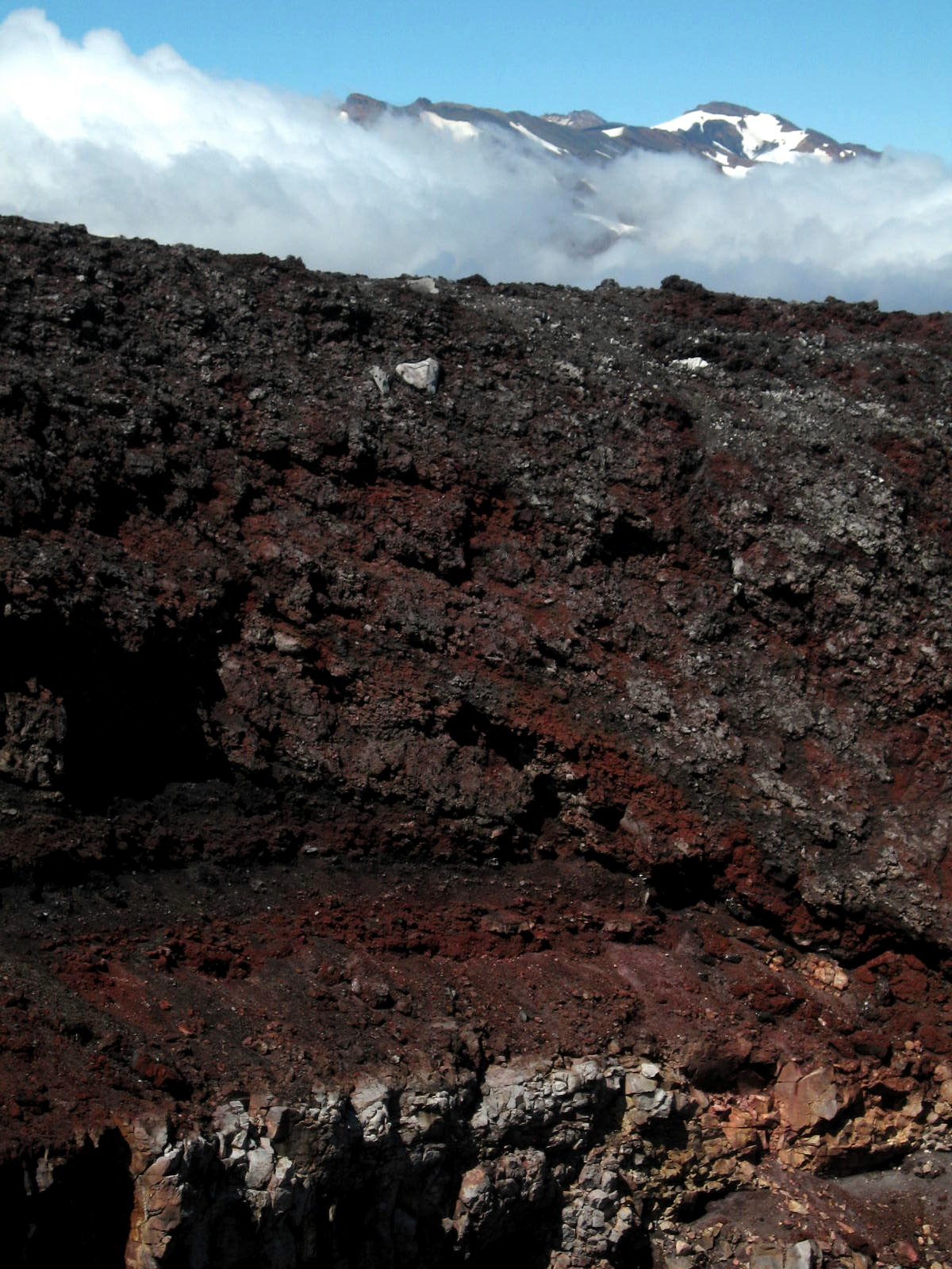 That’s snowy Ruapehu, highest peak on North Island, behind the crater of Ngauruhoe; and two shots down, look to the left of the crater, and you’ll see a plume of steam coming off. Atmospheric, no?
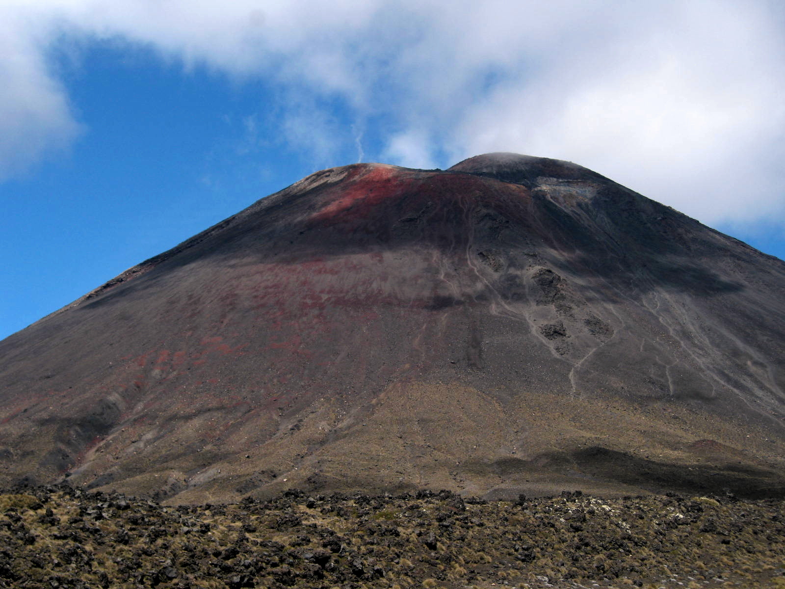
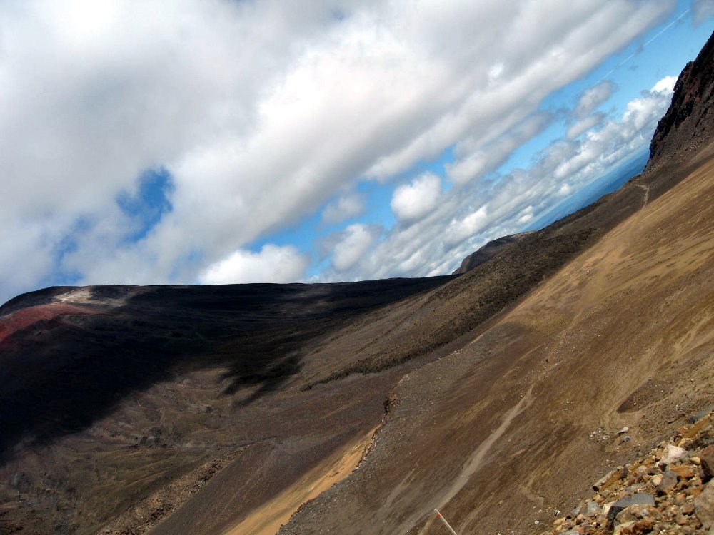
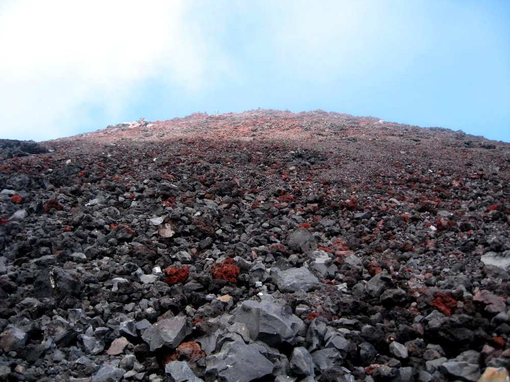
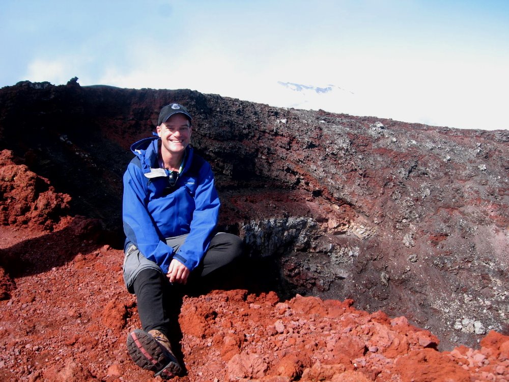
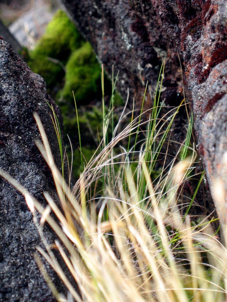 The main Crossing track doesn’t include ascending to the summit of Ngauruhoe — up which, in fact, there is no marked trail. All those little rocks with blue sky at the top of the photo, above? You wonder why they’re there? They’re the summit of Ngauruhoe. That’s the trail. It’s 1000m up, and then 1000m back down to the main trail – which itself includes some serious ups and downs for the recreational walker – and a lot of it is this slippery slidy stuff. The rest is sharp volcanic boulders — thank goodness I had my gloves to shred, or I’d have needed skin grafts afterwards. But, given the chance to ascent Mt Doom, could I really have said no? 🙂 Most of these plant shots are from the summit ascent on Ngauruhoe. The greenest one is from near Silica Rapids, lower on the slopes of Ruapehu and thus a bit greener.
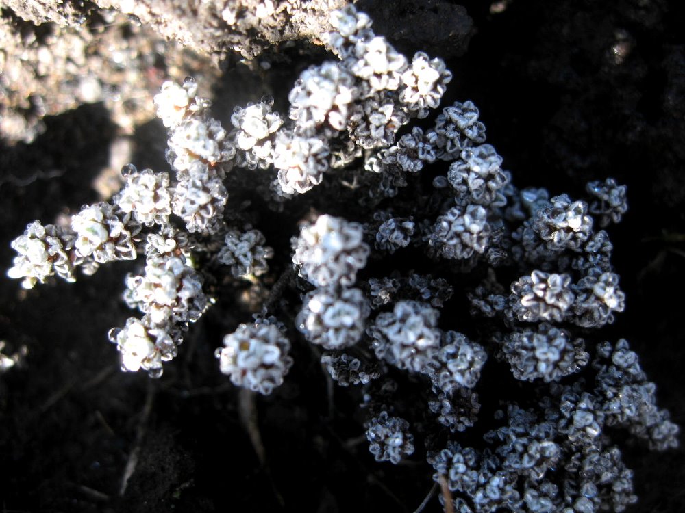
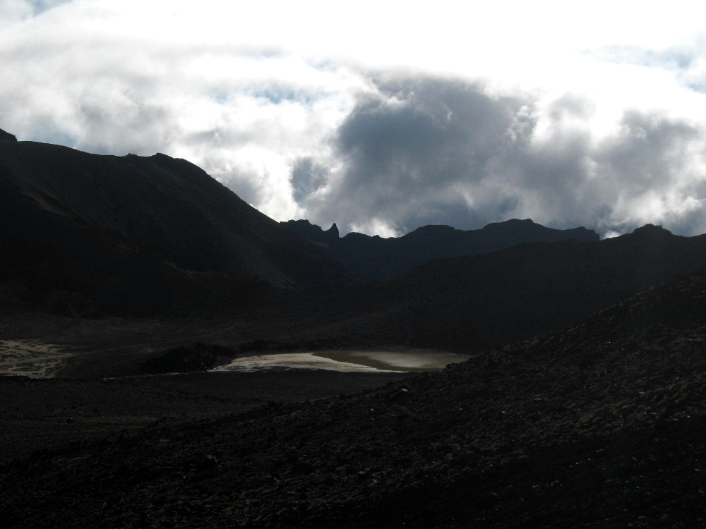
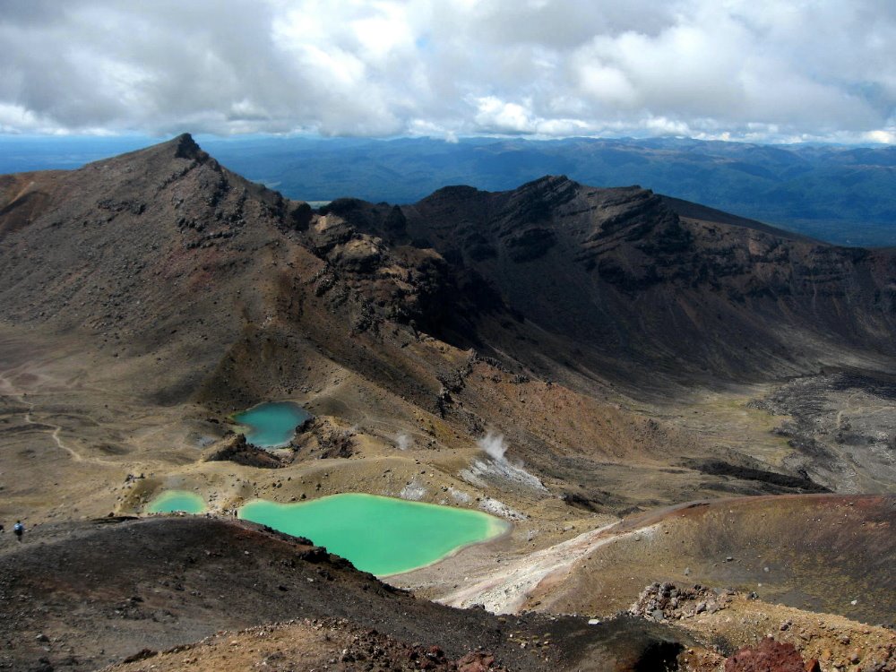 Emerald Lakes. Guess how they got their name? They smell as you might guess.
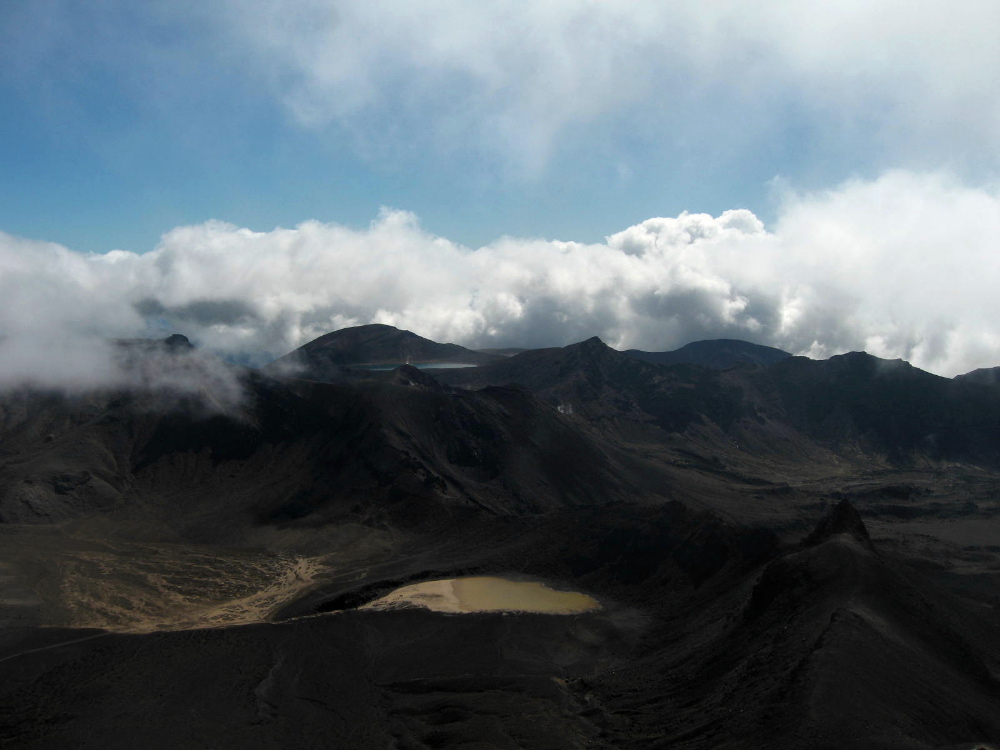
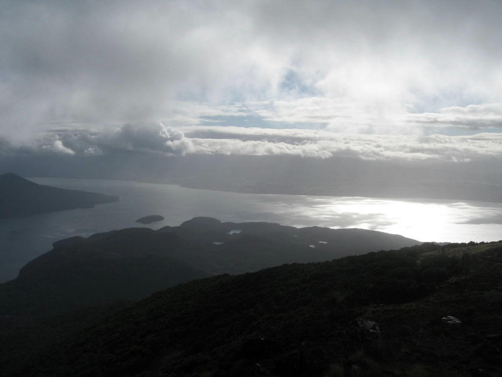
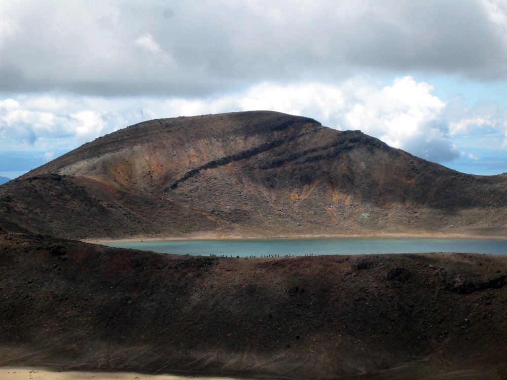 Look closely and you’ll see a lot of little figures along the trail silhouetted against the lake there: a large group of school kids on start-of-school-year camp, who spent days hiking, mountain biking, rock climbing and rafting around the area. Kids in NZ have a great life, it seems…
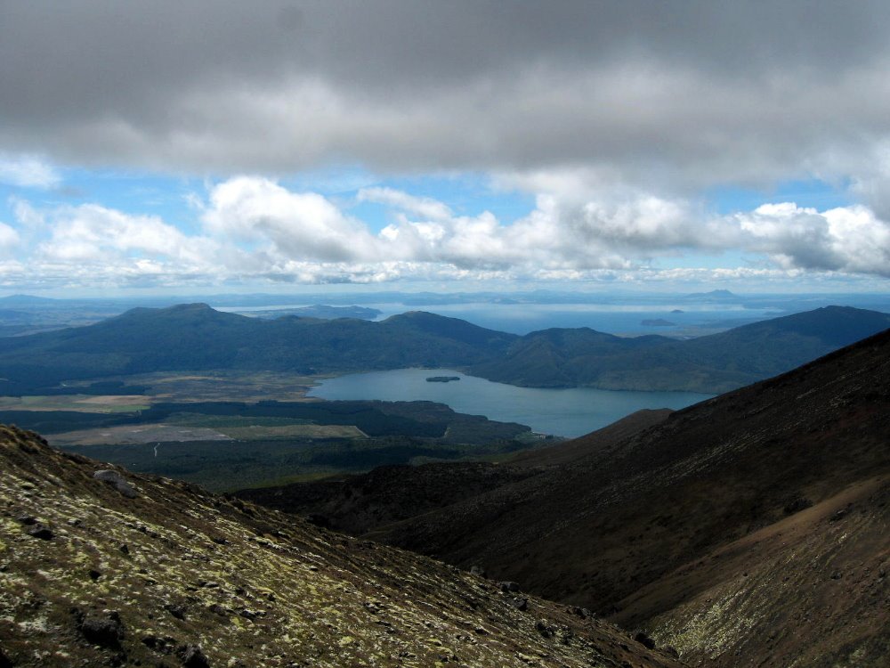 That’s Lake Taupo in the distance, the largest in New Zealand, apparently. No Lake Superior, that; but then NZ is two moderate-sized islands with spectacular variety and scenery, when you get right down to it.

 …have you noticed how captivated I was by Ngaurhoe’s cone? It’s my own xx Views of Mt Ngauruhoe ode to Hokusai. But seriously — I found Ngauruhoe as captivating as I find Half Dome — though not the tallest of the three, it ruled my imagination when I was in its range.
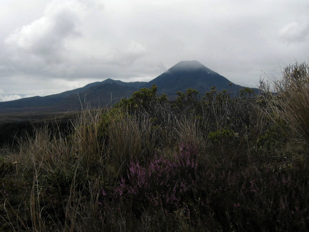

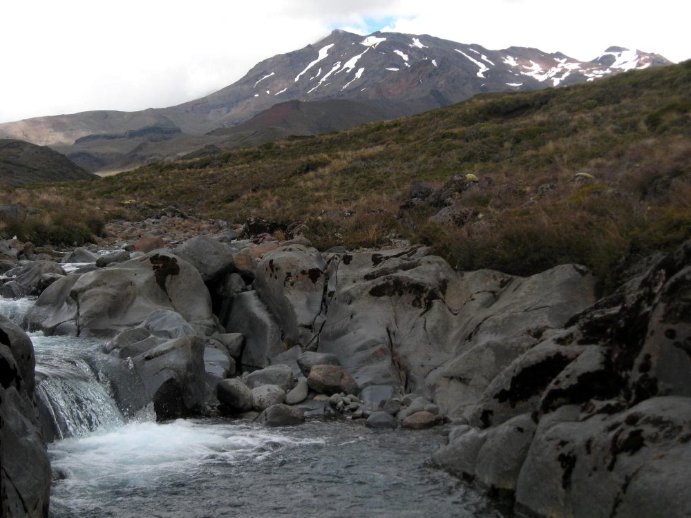

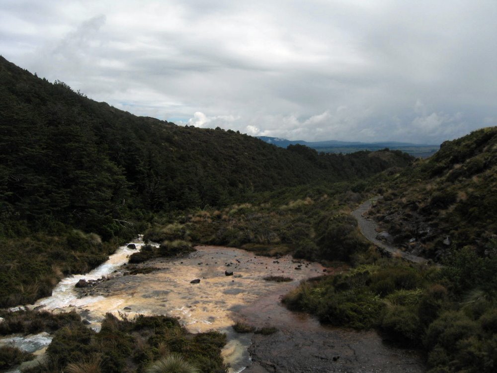 And that would be silica rapids, full of colorful minerals washed out of the stones solidified from the magma belched by Ruapehu, on whose slopes this was shot.
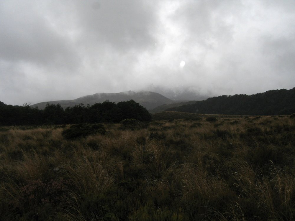
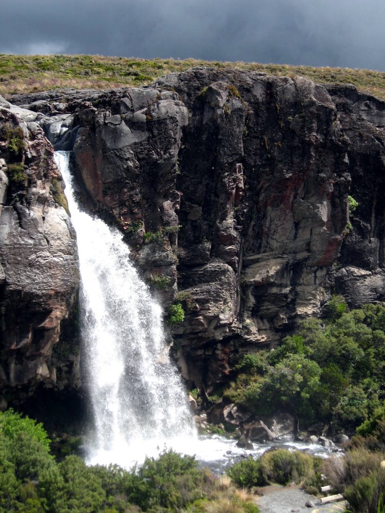
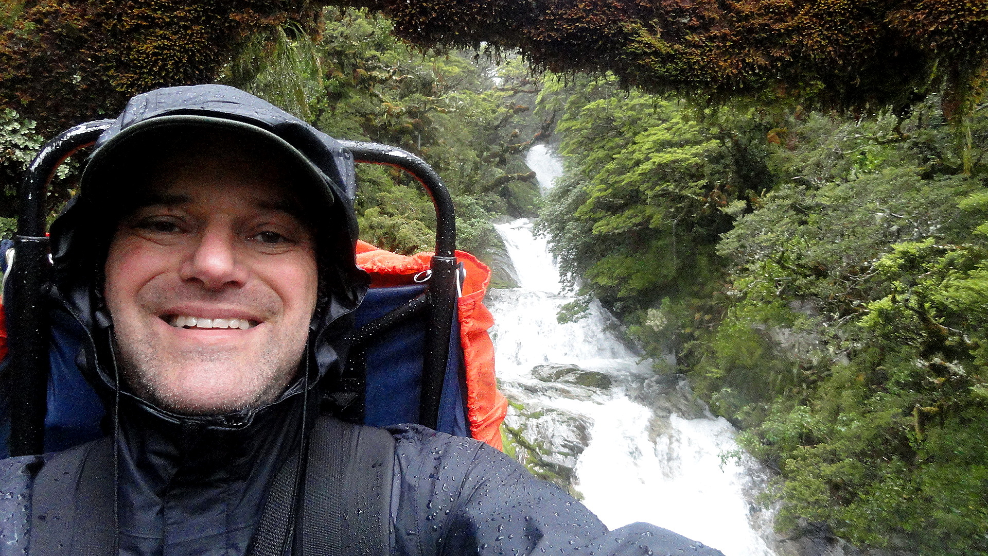
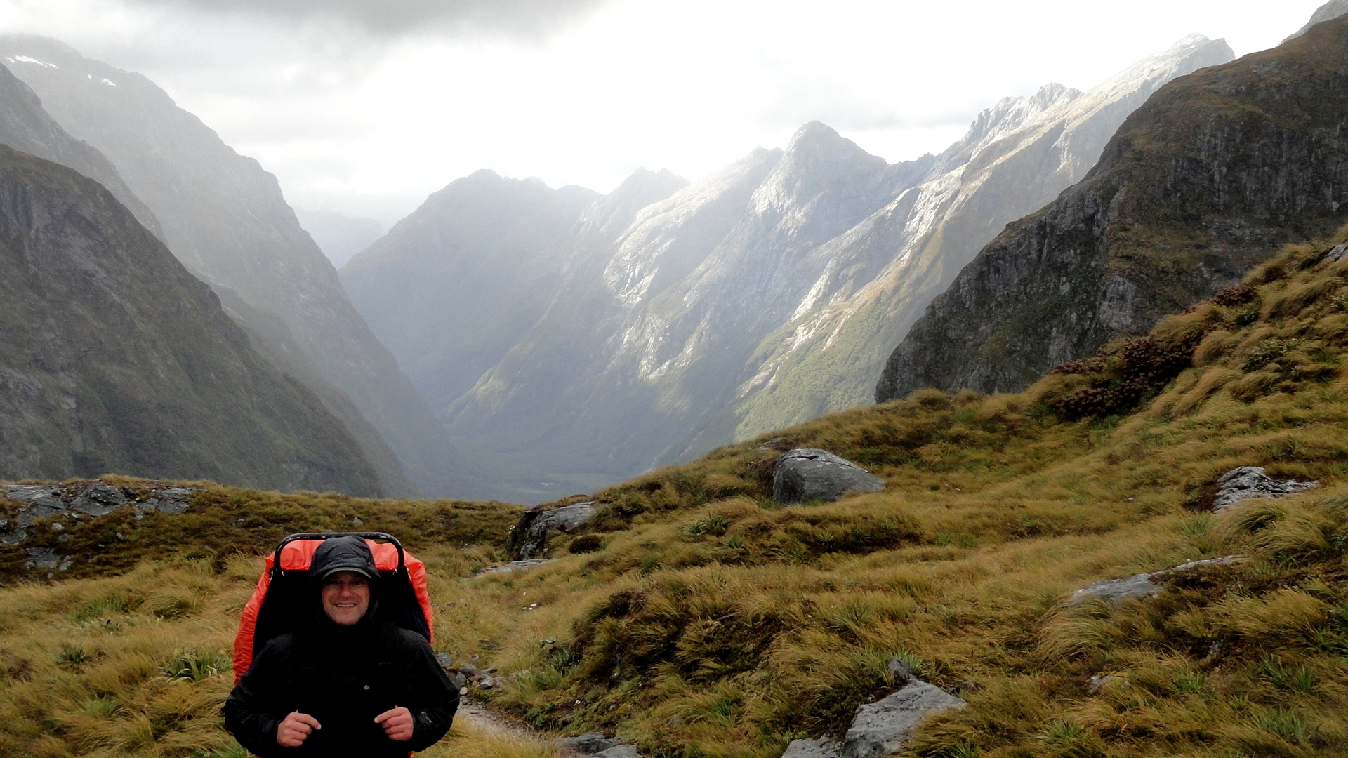
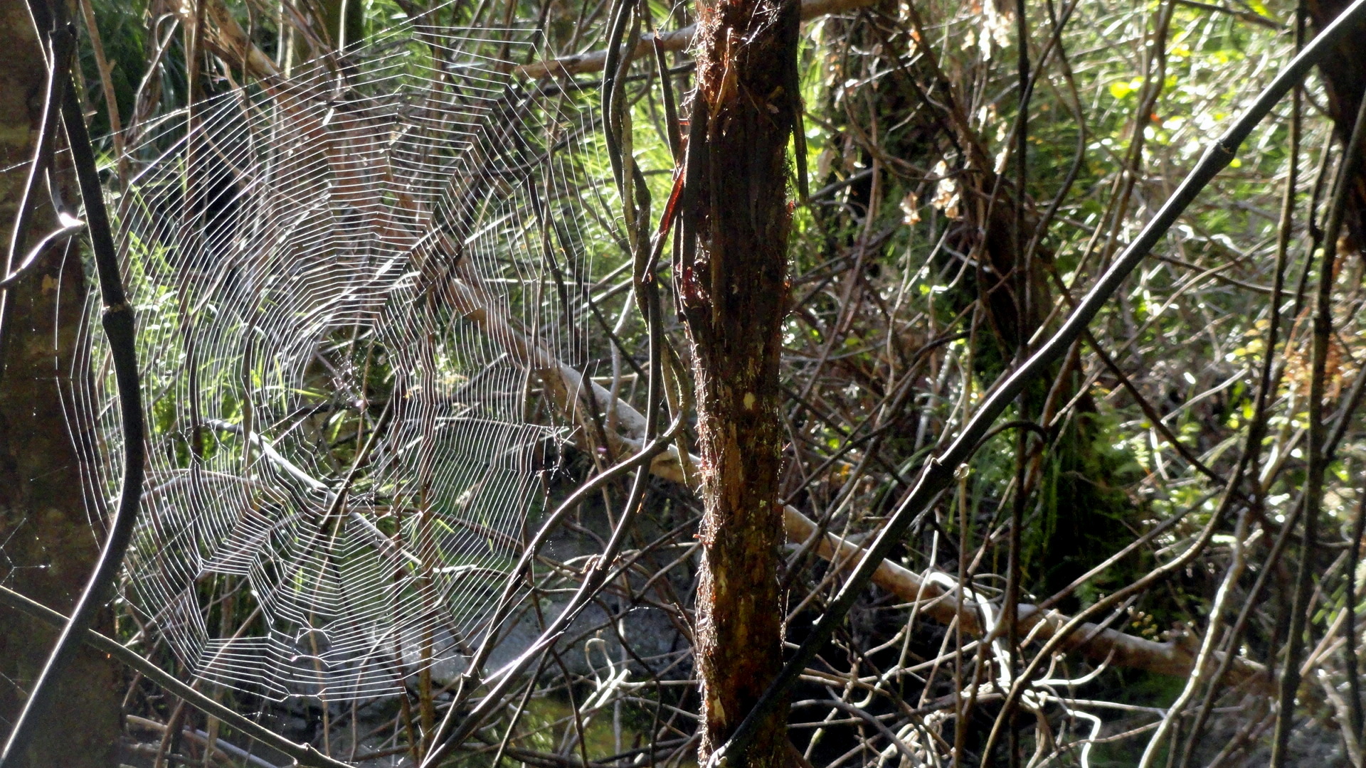
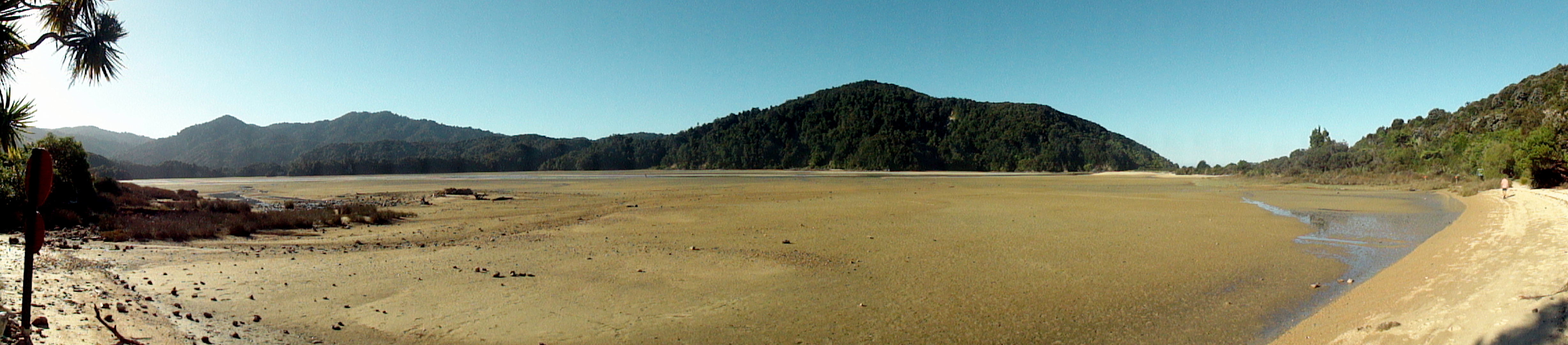
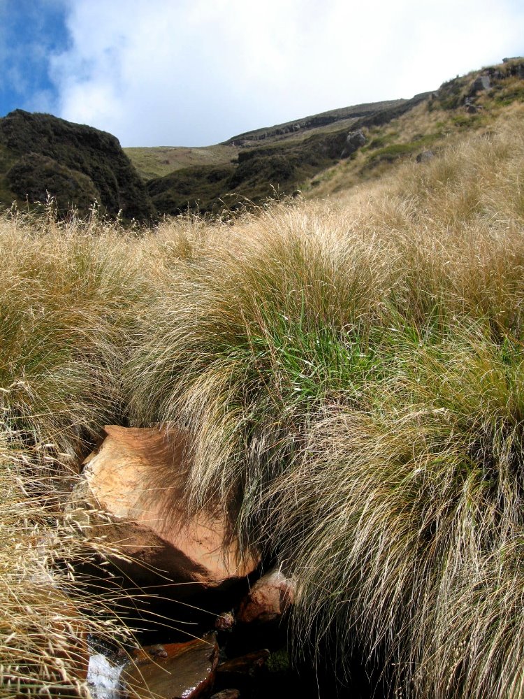
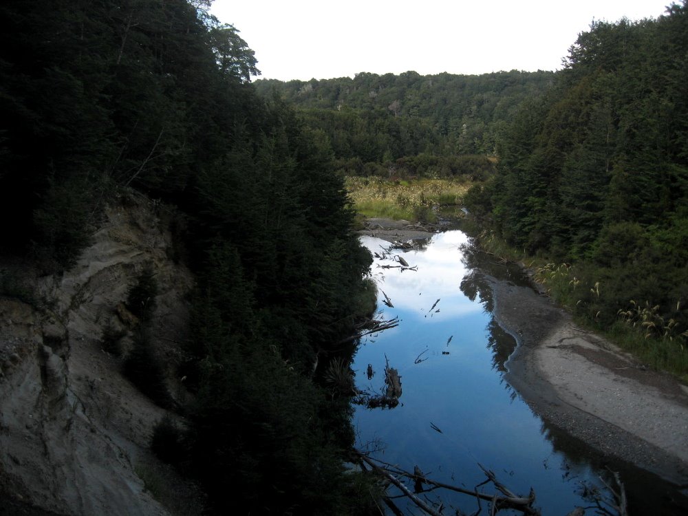
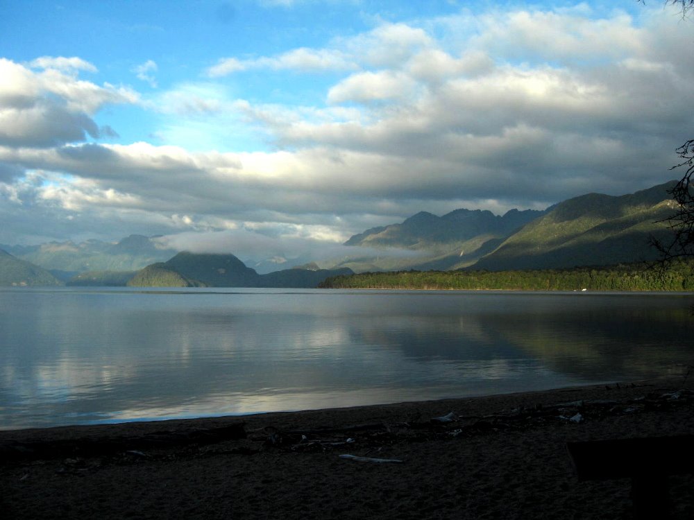
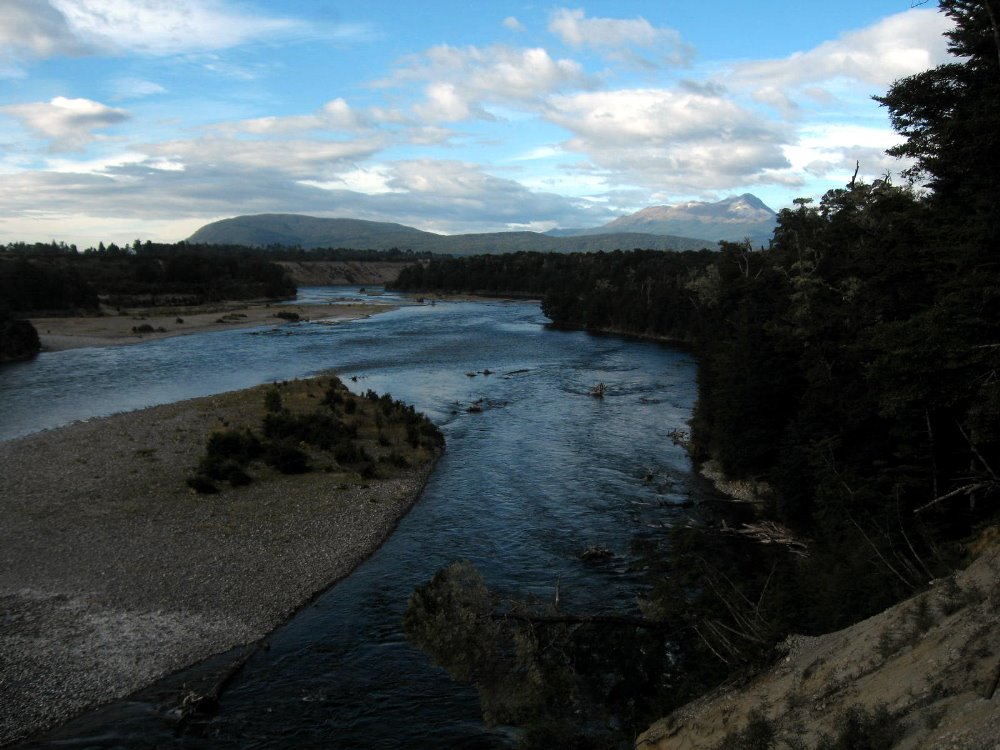
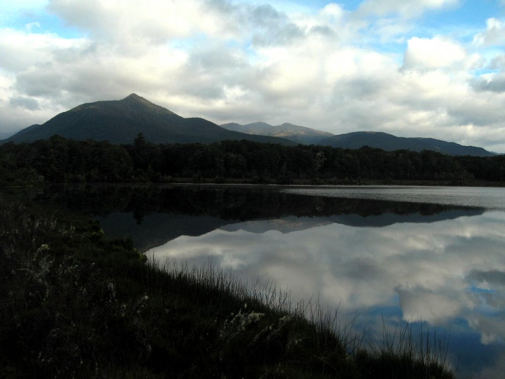
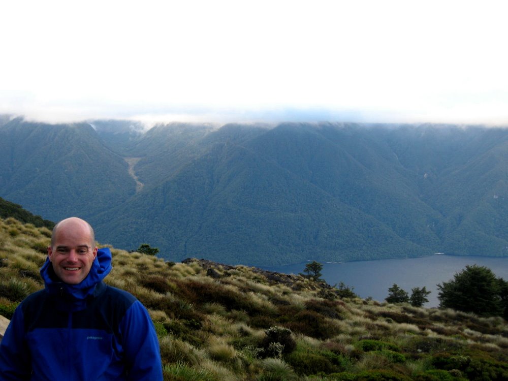
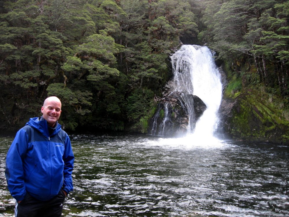
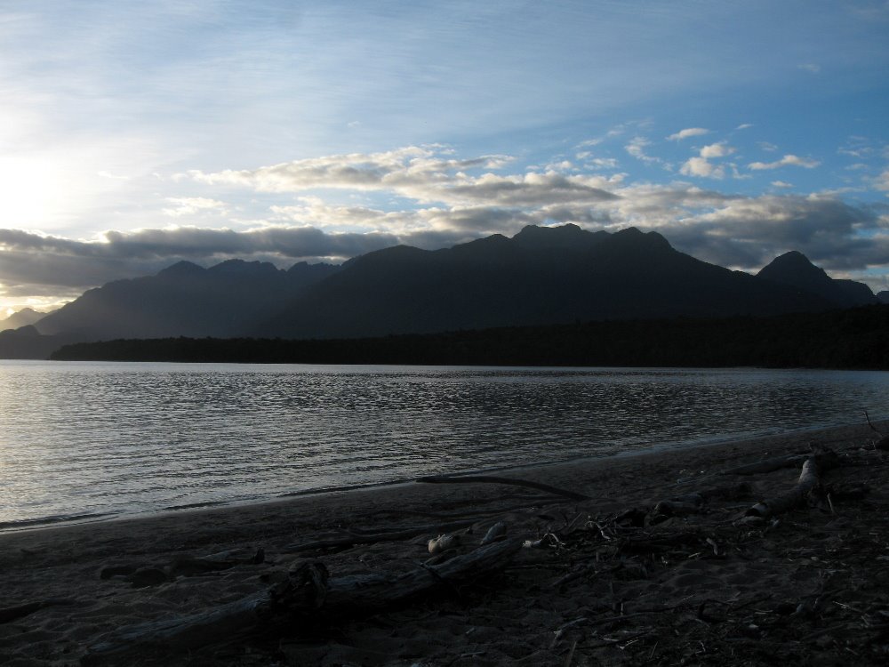
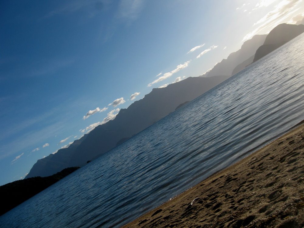
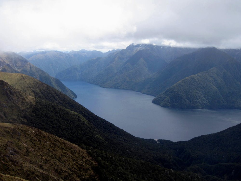
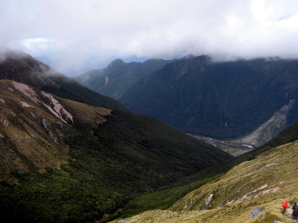
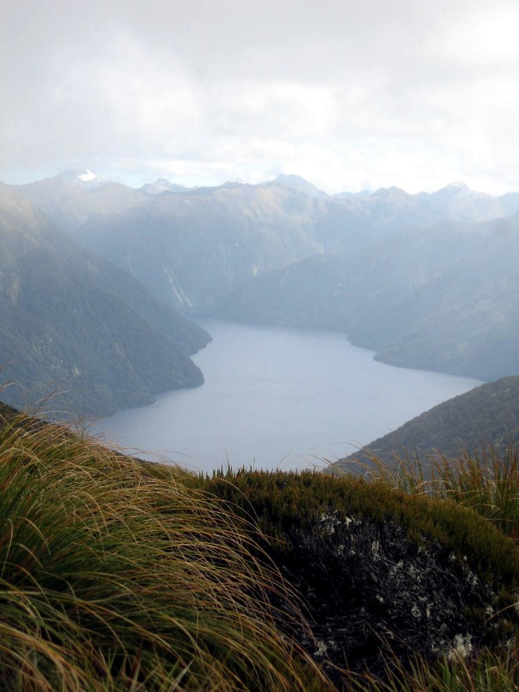
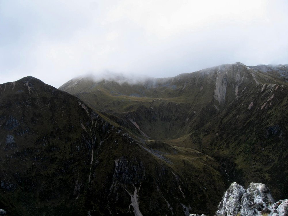
Kepler Track & Fiordland National Park

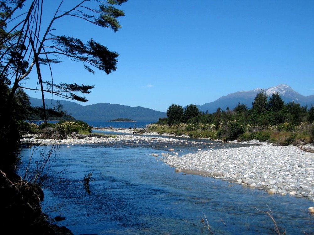
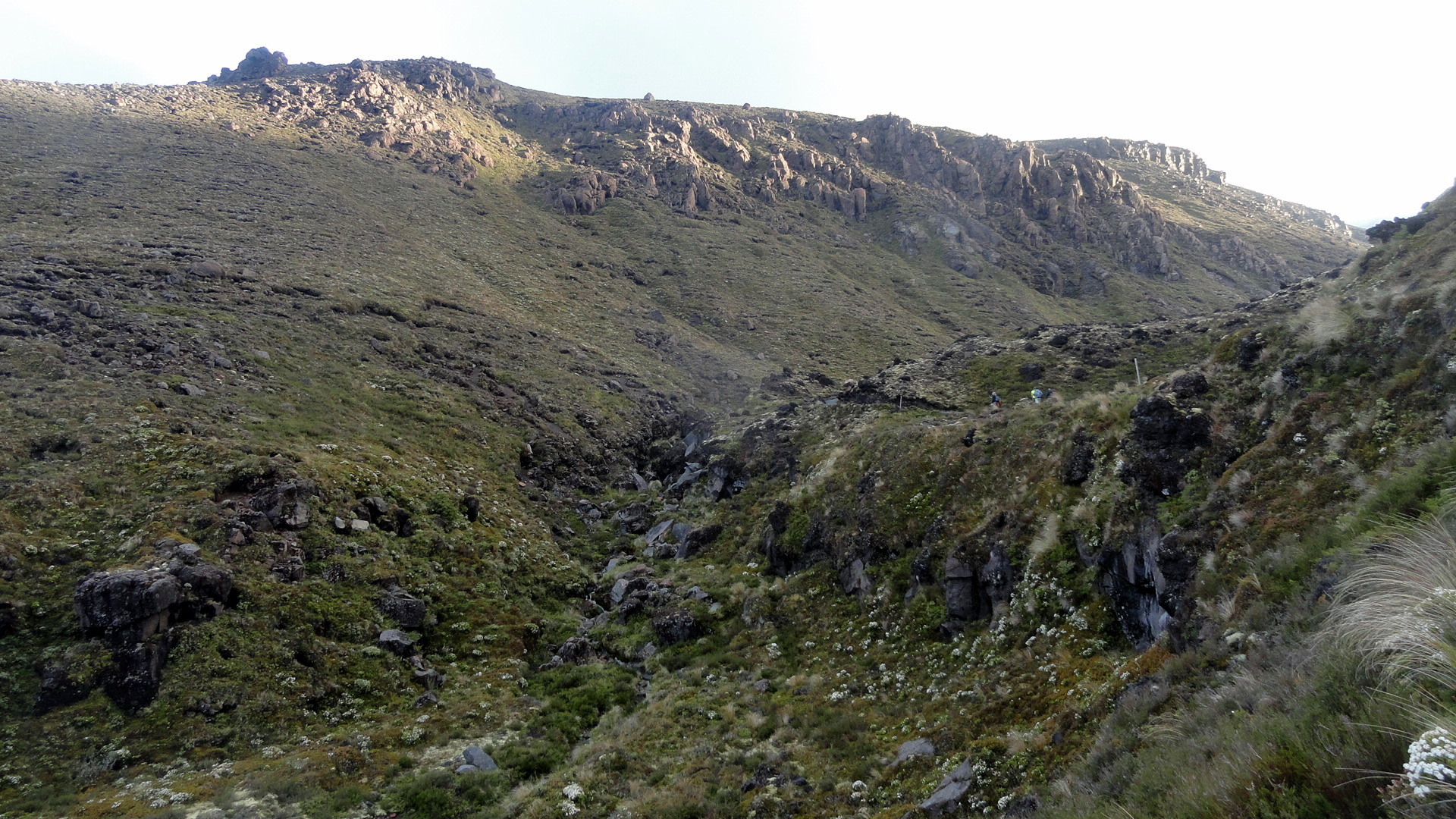
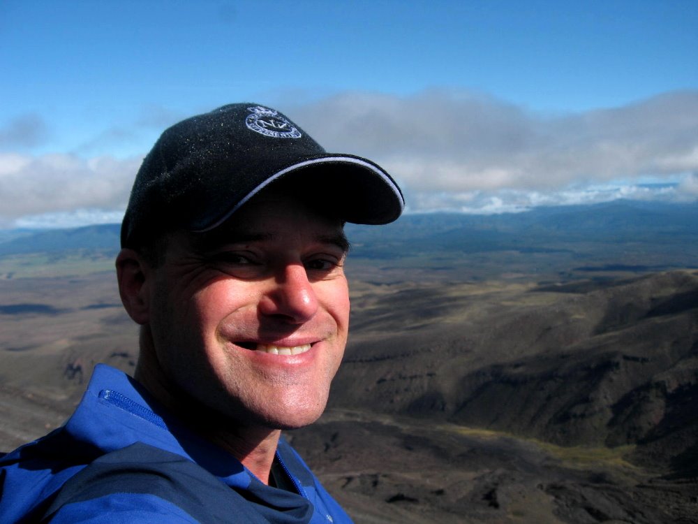
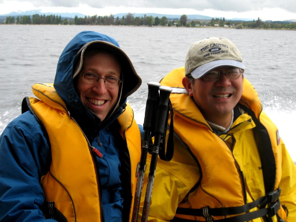
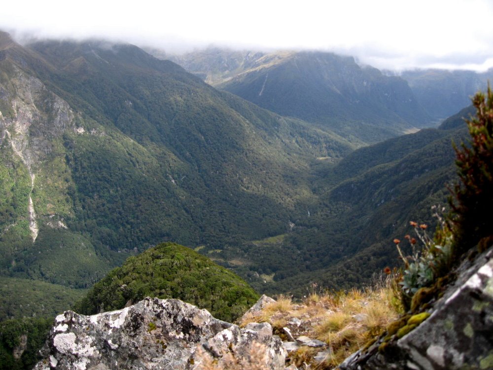
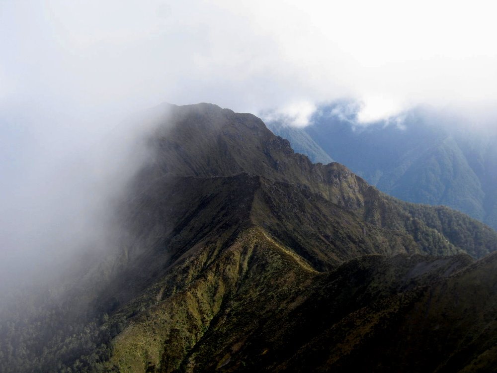 As Tongariro Crossing – and the summit of Ngauruhoe – was the literal and figurative peak of my personal experience in New Zealand, the Kepler Track was the climax of my first two weeks, which were spent with my dearest bestest friends Howard & Gene. This is a four-day, three night trek from hut to hut; in high season the huts have gas burners so you don’t have to carry your stove, just your cooking eqiupment; they have bunks so you just bring your sleeping bag and no tent; and they have – oh luxury – flush toilets! Day two, as we hiked it, is almost all above the tree line, while day one is hiking from the western shore of Lake Te Anau (a long and many-armed mountain lake of classical proportions) up a steady and well-made trail to the higher reaches of Mt Luxmore. Day three is along a verdant river valley, into which one looks at the very end of the alpine section before a steep and many-zigzagged descent; and day four is peaceful and pleasant stroll along the river which connects Lakes Manapouri and Te Anau. Even in clear weather, the alpine section would be otherworldly — much of it is along steep ridgelines with sharp drops on both sides, and if some of this looks like Middle Earth, it’s because various scenes from the LOTR films were shot in this area. For good reason, obviously. It was an extraordinary hike, and the fact that much of our alpine crossing was made in snow and ice, in high summer, made it even more extraordinary.


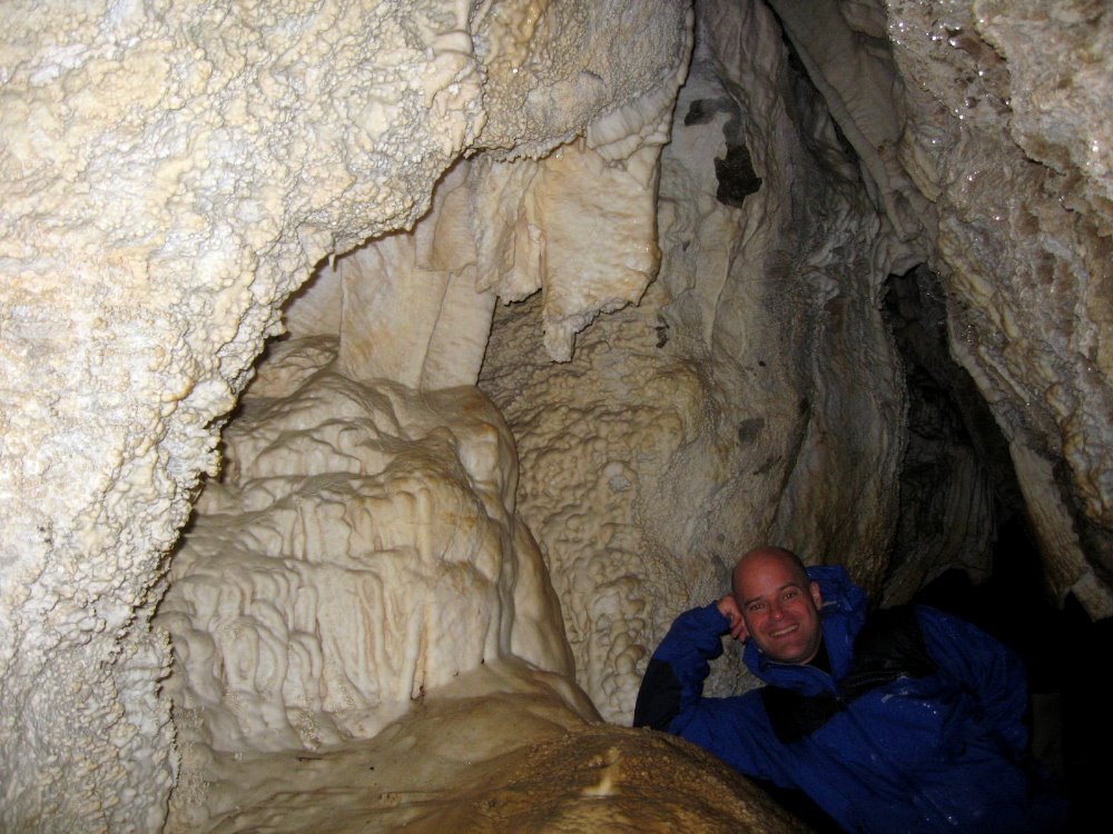
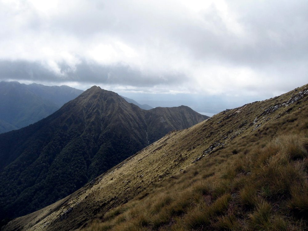
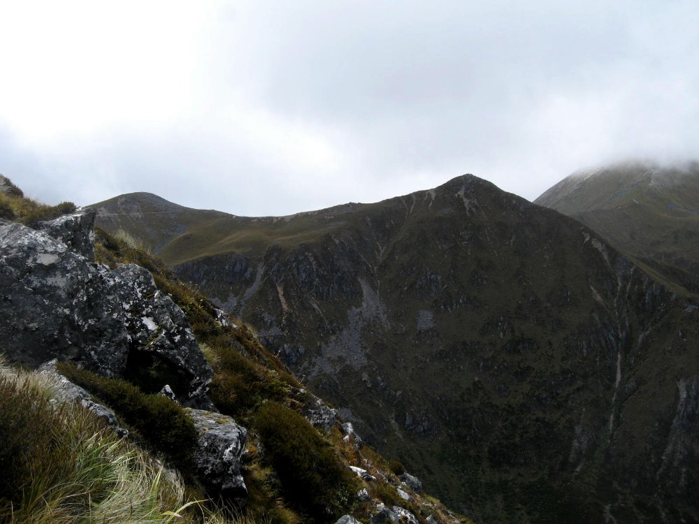
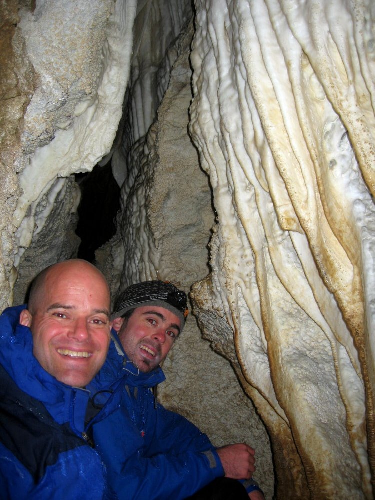 A ridge or two down from the summit of Mt Luxmore — which is only at about 1500m or so, not really that high, but it’s well above the tree line at this southern latitude — is a large system of caves which we explored along with two nice guys we met in the hut, Jamie (aka Luther, with me above, a mighty fine bass player also I might add) and Bob. The Luxmore Hut is situated on a ridge above the tree line, surrounded by small alpine ponds and stunning views over the lake and the Murchison Range to the north. I’m nearly certain this shot below captures the ridge on which Luxmore Hut sits, if you look at the tallest notch (that being summit of Mt Luxmore, where I’m photographed in snowy fog a few shots down) and just come down a bit. I took it from a boat on the lake the night after I finshed the track.
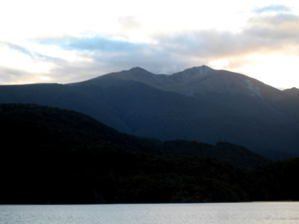

 Above and below, clearly the same view (south arm meets main body of Lake Te Anau, looking across from Mt Luxmore toward the Te Anau town side) and shot almost the same time but with very different fog or cloud cover, when Howard & I took a break from our card game with some of the folks at the hut to check out the apparent break in the clouds and nice sunset views. Throughout the day and a half or so of alpine (above tree line) crossing on this track, we’d have periods where dense clouds and fogs or snows would suddenly part to allow a glorious glimpse of just amazingly beautiful vistas on all sides…and we’d all rush our cameras out, knowing that soon it would be fogged over like the shot of me at the summit of Mt Luxmore, a few down from here.
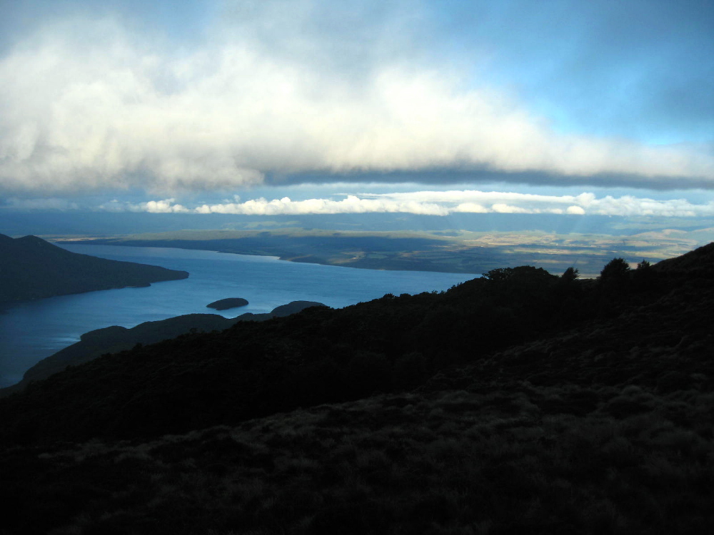
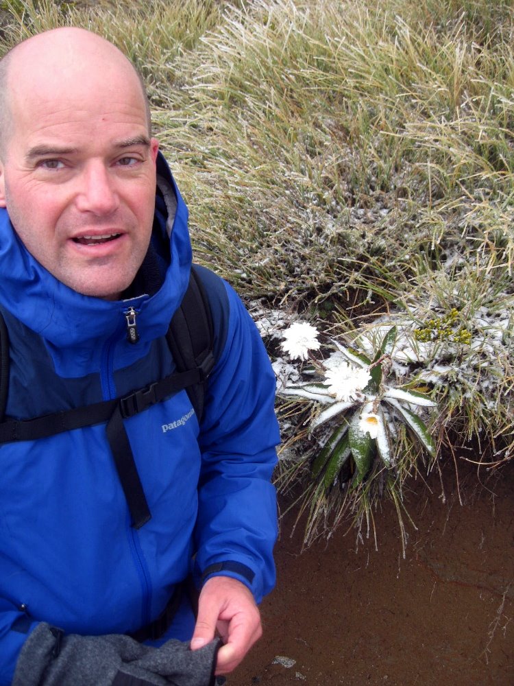
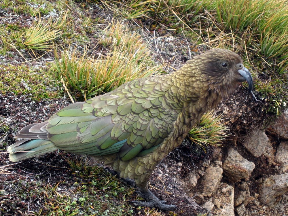
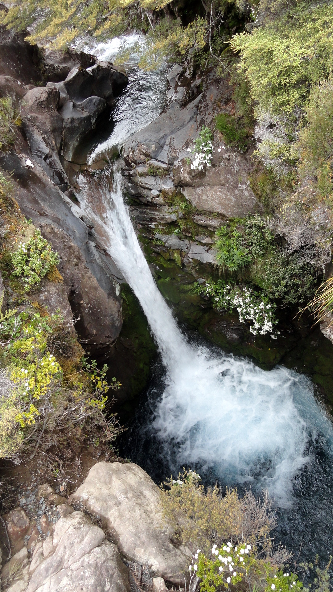
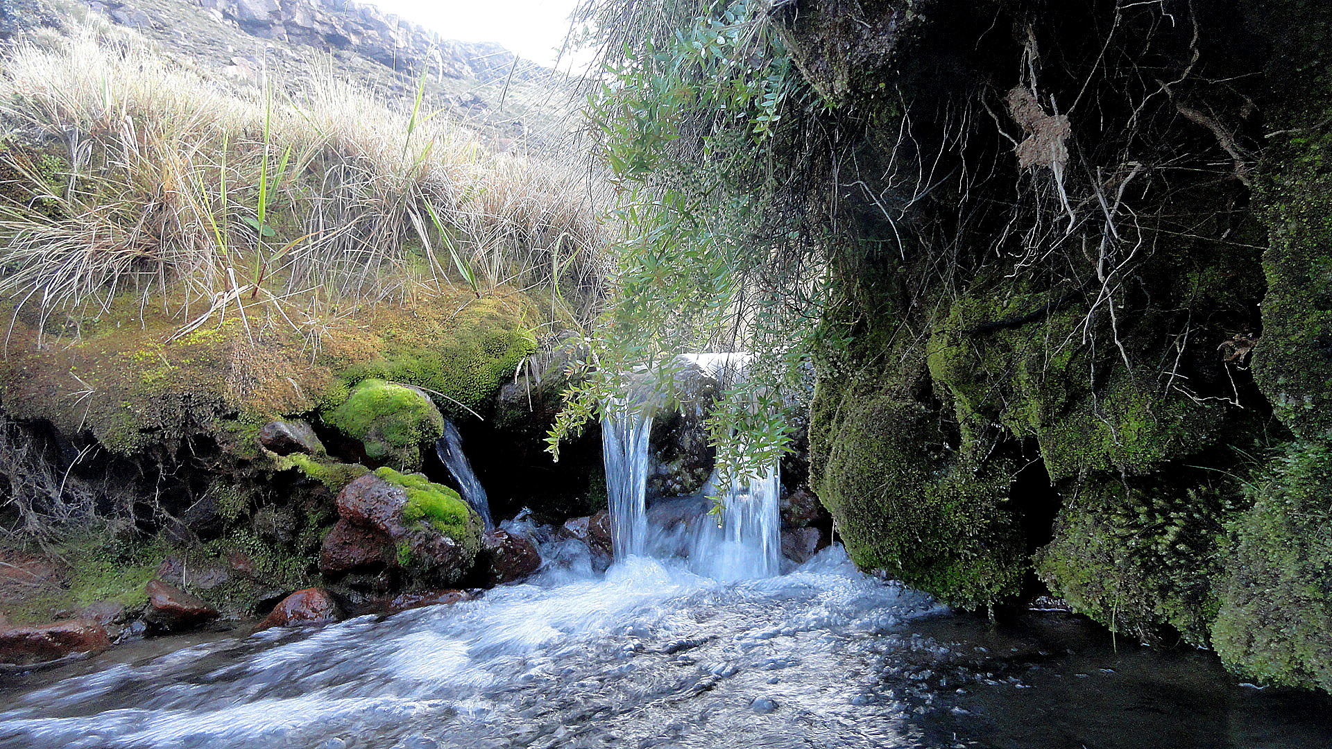
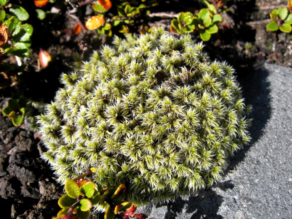
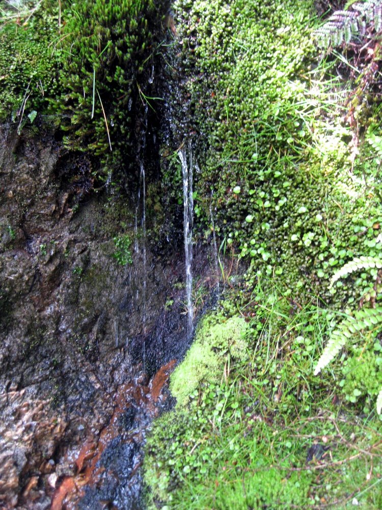
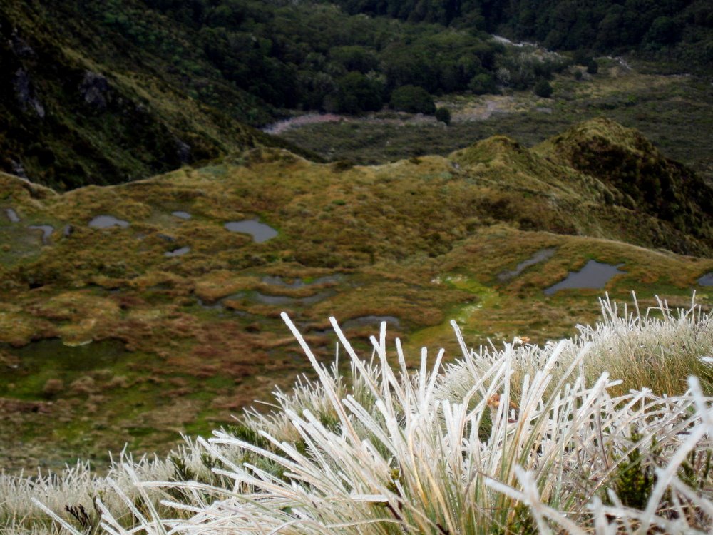
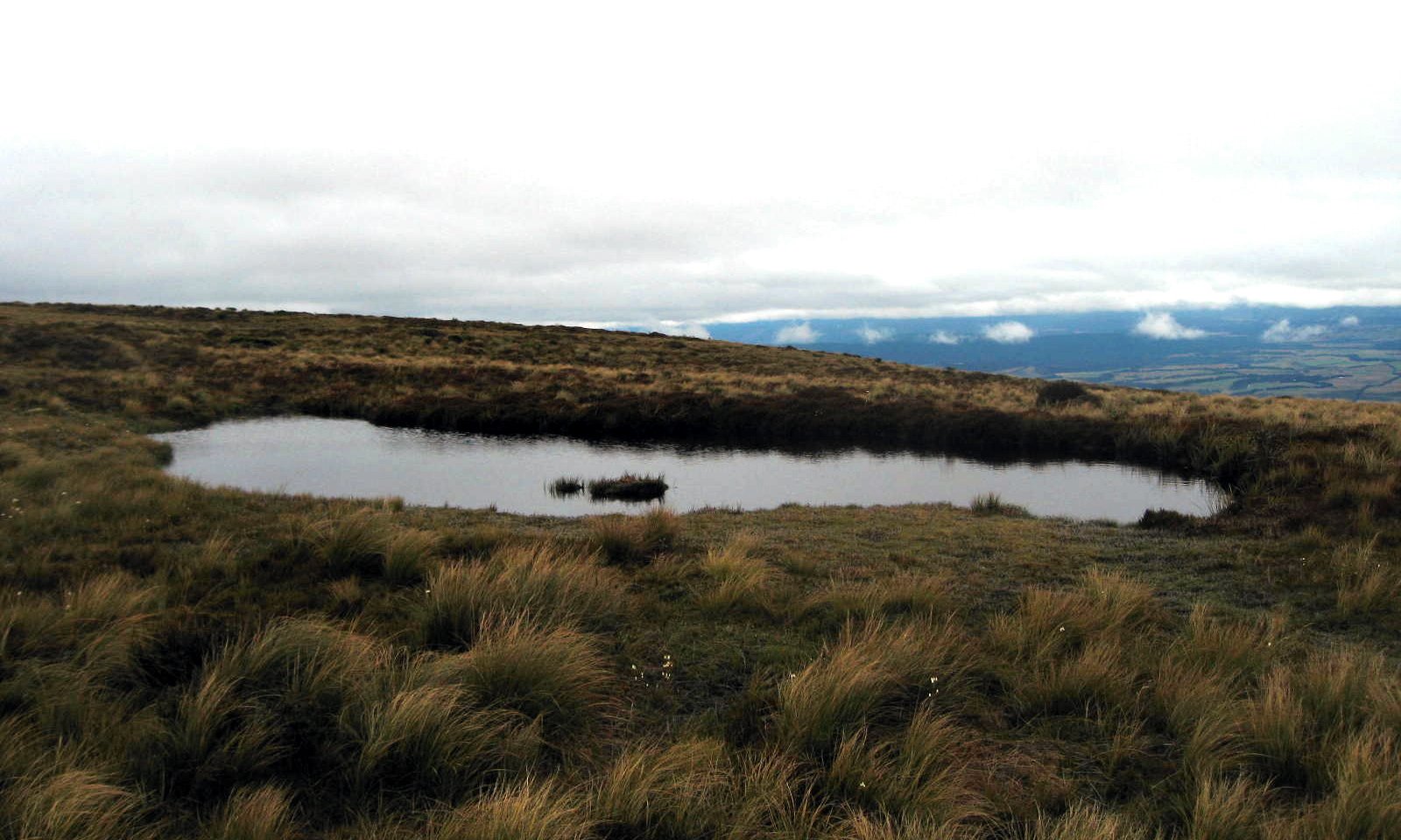
As you’ve seen, this track includes strolls through lovely verdant valleys and clambers along dramatic alpine ridgelines with sharp, breathtaking drops on either side. Since it’s quite far south and in an area of rapidly changing weather, small changes in exposure (the south face is the colder, darker side down here) or elevation can lead to radical changes in vegetation and micro-climate. Below, a small green mossy trickle on a hillside barely a hundred meters below the treeless alpine zone that, when I crossed it, was characterized by icy plants — and yes, these shots were taken within less than an hour of each other but at different elevations. That bird up there is one of the world’s few alpine parrots, the Kea: NOT people-shy and rather mischief-prone if one’s careless enough to leave a backpack lying around; and as you can imagine that beak is sharp. Mercifully I only heard stories and didn’t directly experience a Kea raid on my own pack.
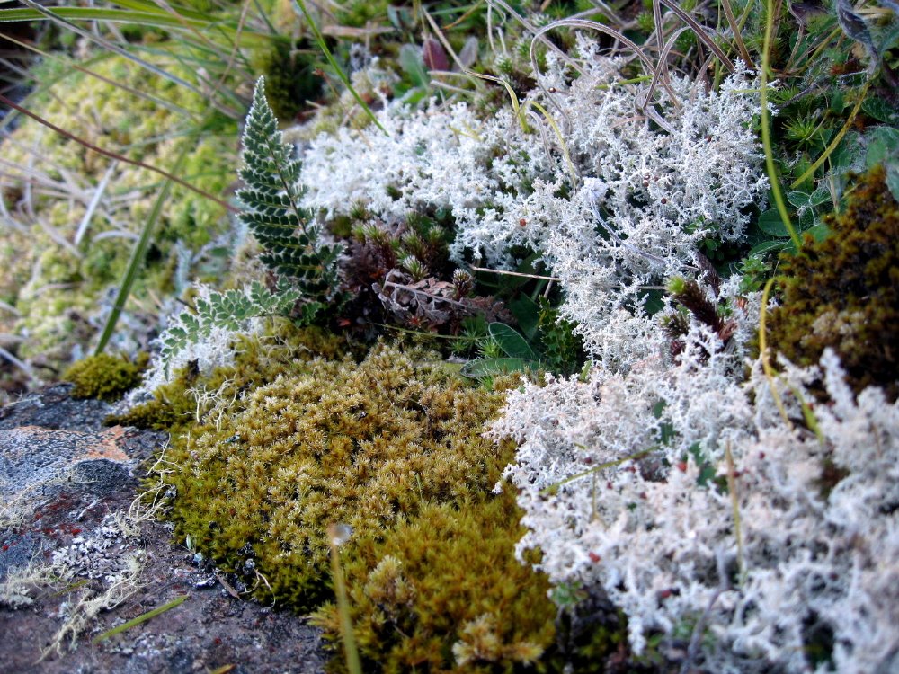 …the number of different mosses found in fiordland staggers the imagination. I heard the number — was it many dozen, or many hundred, I just can’t remember; but I do know they’re all mighty beautiful to look at and enjoy, and I’m sure they’re very enviornmentally beneficial.


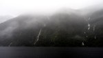
Definitely Doubtful Sound
 Doubtful Sound is so named because James Cook, when he first encountered it, doubted he could navigate his ship both in and out safely, past the swells and rocks at the ocean entrance to this very long and stunning fiord. (Our guide said that technically a sound is one thing, but this is a fiord, which is another thing, only when they named it the English language hadn’t yet adopted the term fiord.) Above, you see the inland-most end of the Sound, called Deep Cove, from Wilmot Pass; and you see Wilmot Pass from the Sound. East of Wimot pass is the west arm of Lake Manapouri, which you’ve already seen in my shots taken on the easternmost bay of Lake Manapouri, where the last night’s hut of the Kepler Track was located. I thought that was remote — and it was. But Doubtful Sound is across that lake, up and over a 4WD-0nly, unsealed (that means dirt, to Americans) road and back down to this awfully beatiful and very remote corner of the world. There is so much rain in this area (the figures boggled my mind: Te Anau sees something like 2, 3 or 4 meters a year [yes, they measure in meters! not centimeters], while this west side of the mountains can easily see NINE meters in a year!), running off all these incredibly steep mountains and down to the sound; and the sound, though definitely tidal and connected to the Tasman Sea, is protected enough by its narrow entrance from the churning tides of the open ocean, that the entire sound is covered, full time, by a deep layer of actually FRESH water — a meter or more, which – being lighter than salt water – floats above the surface of the sea water below it. The Sound is very deep so there’s tons of salt water there, but the surface is all fresh, it seems, and ocean animals often come in here to clean off since apparently fresh water is cleaner than saltwater, and helps kill things like barnacles. But I’m no marine biologist, I’m just reporting what I heard, and it all stuck me as new and fascinating.
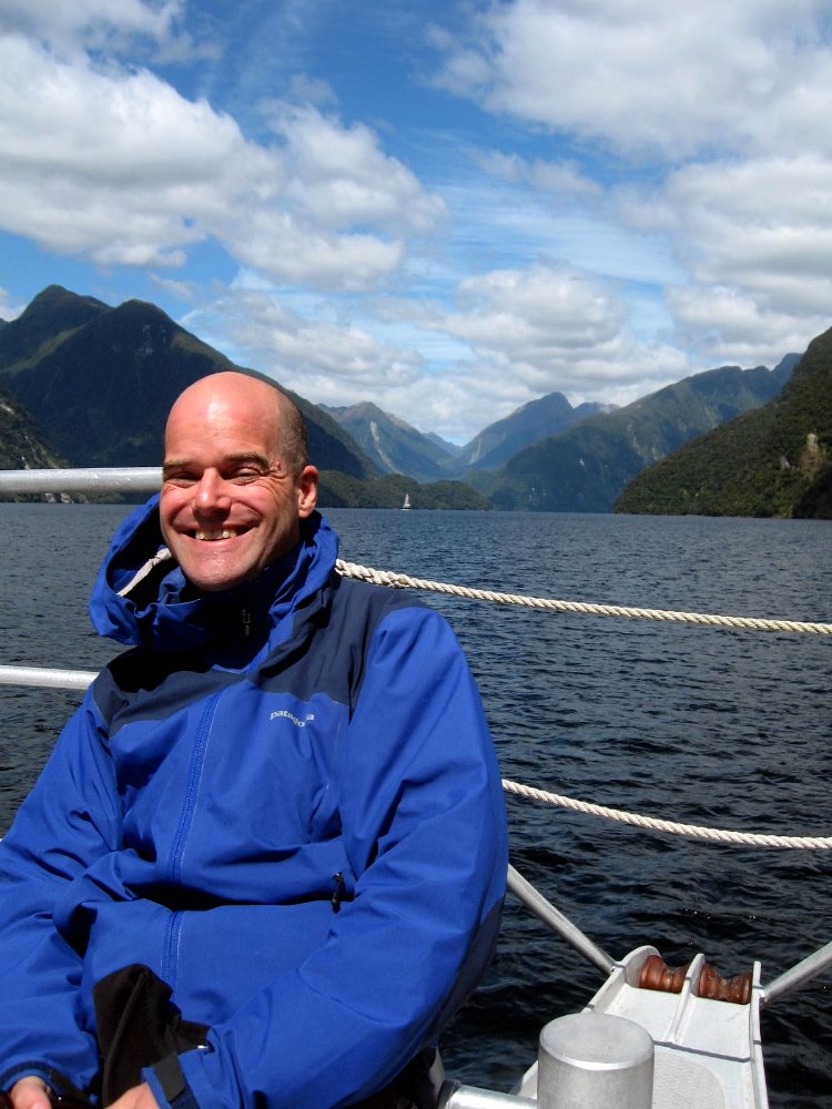
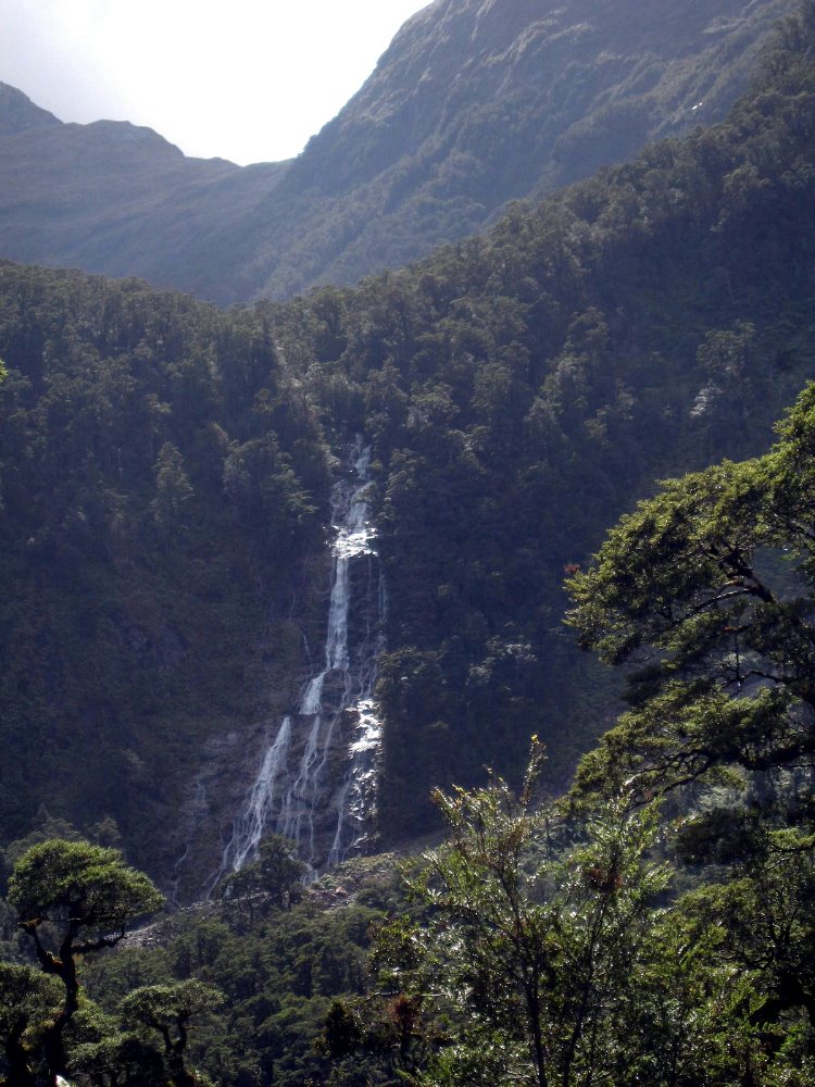

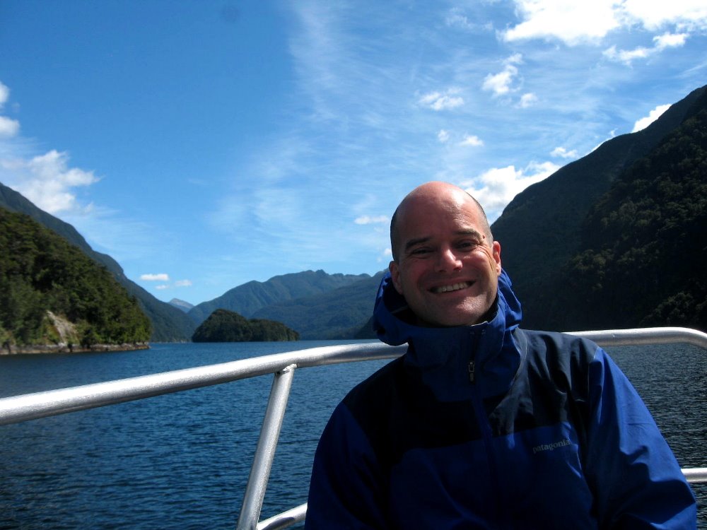
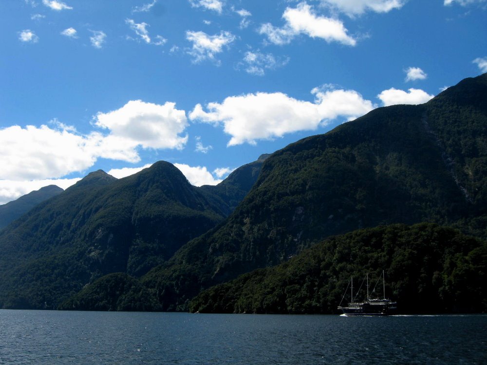
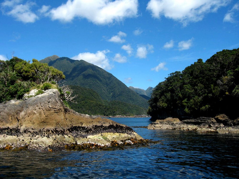
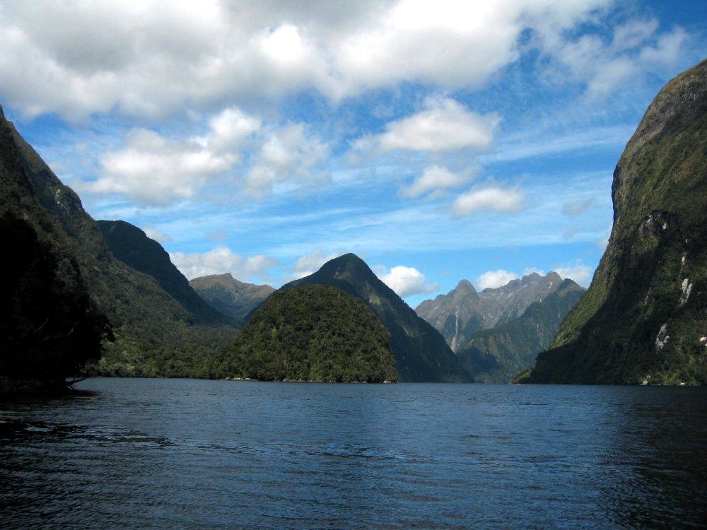
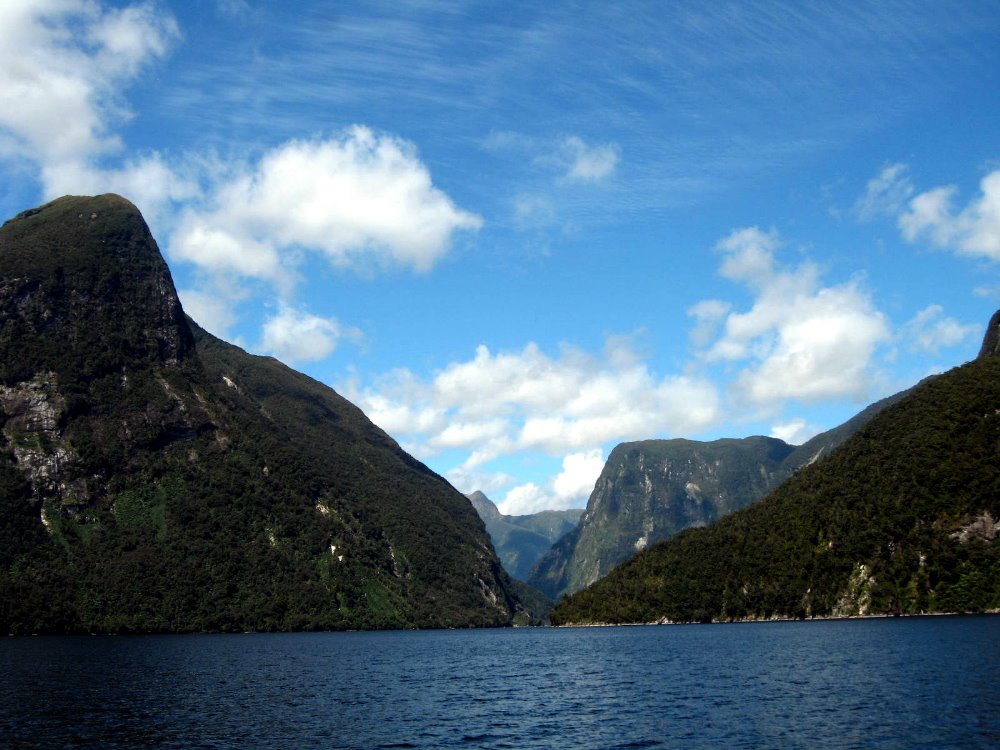
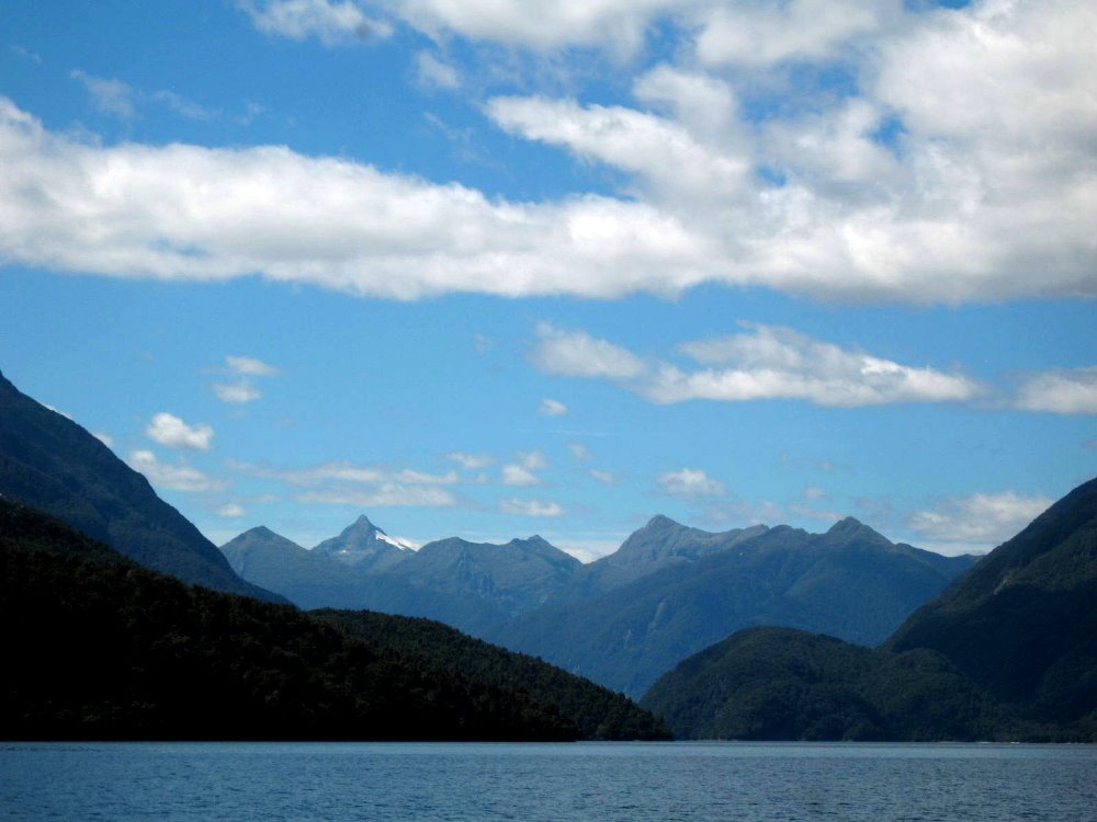
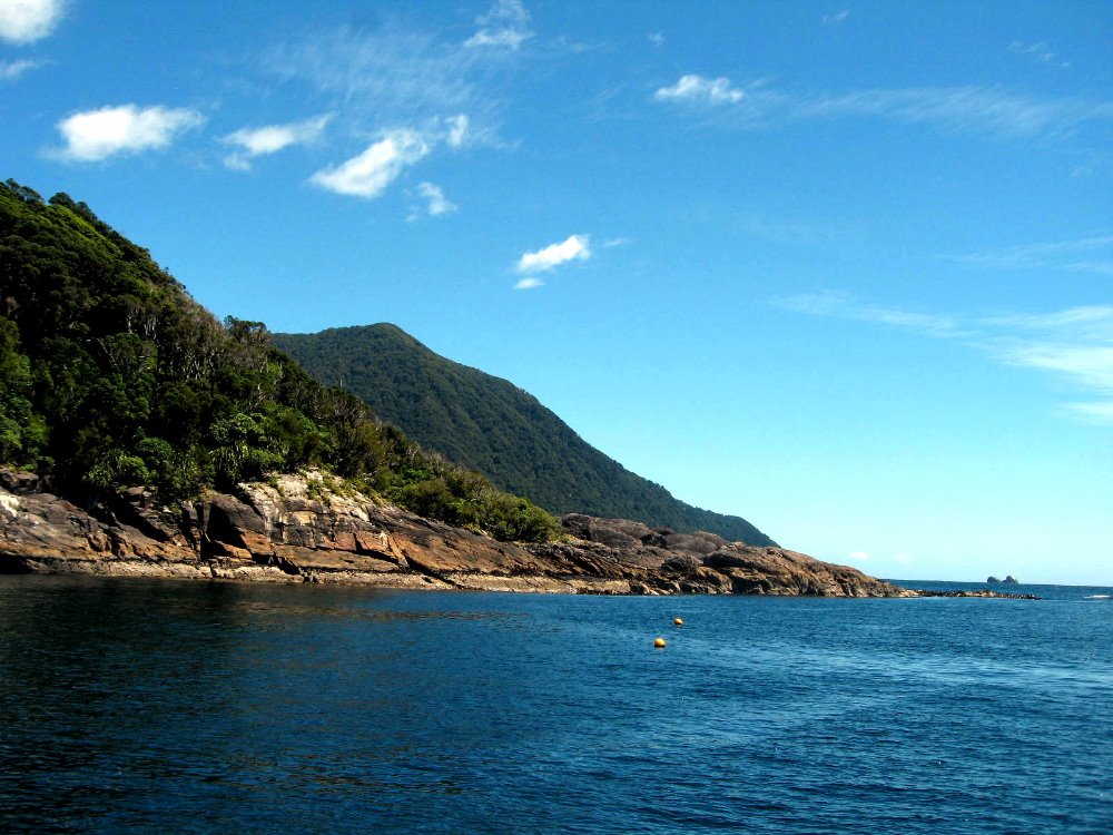
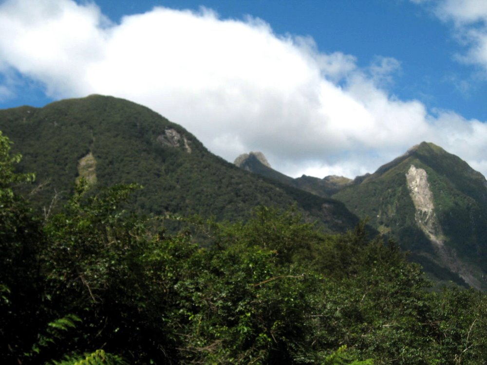 In the fiordland area, with all that rain, one has occasional tree-slides: when the thin ground cover gets so wet it just all slides down those steep slopes, leaving the solid rock face exposed, as above.
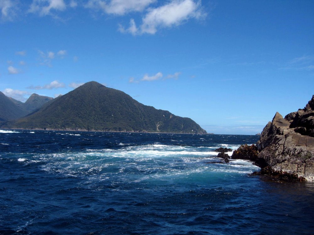 For many kilometers our cruise was very calm – until we got very close to the sea opening from the sound. There, the waves were pretty dramatic and reminded us how protected most of the fiord is.
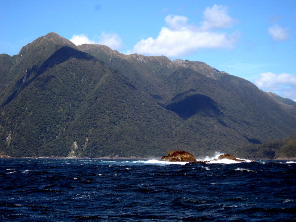
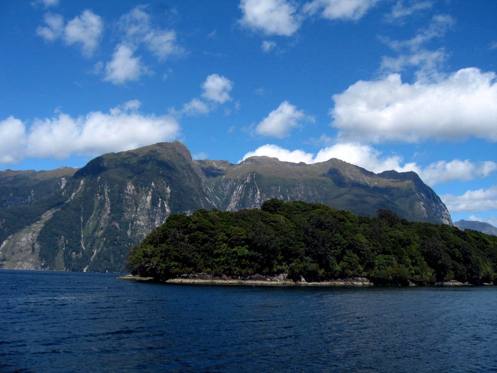
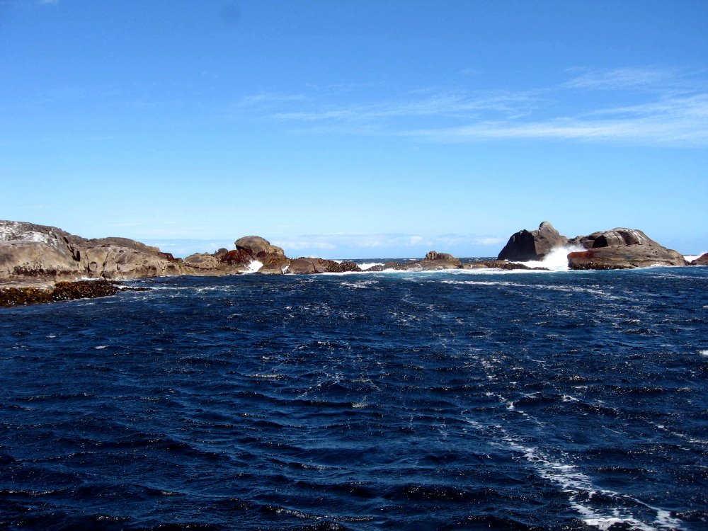

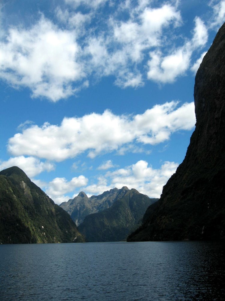


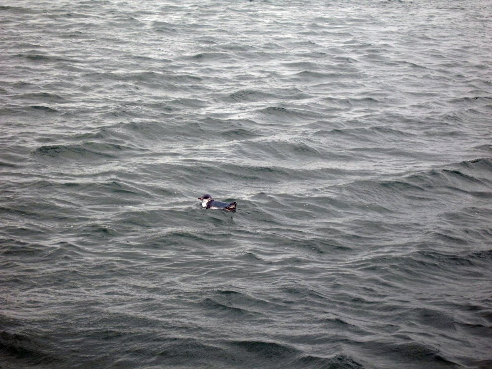