
City Views.229

Coasting.89
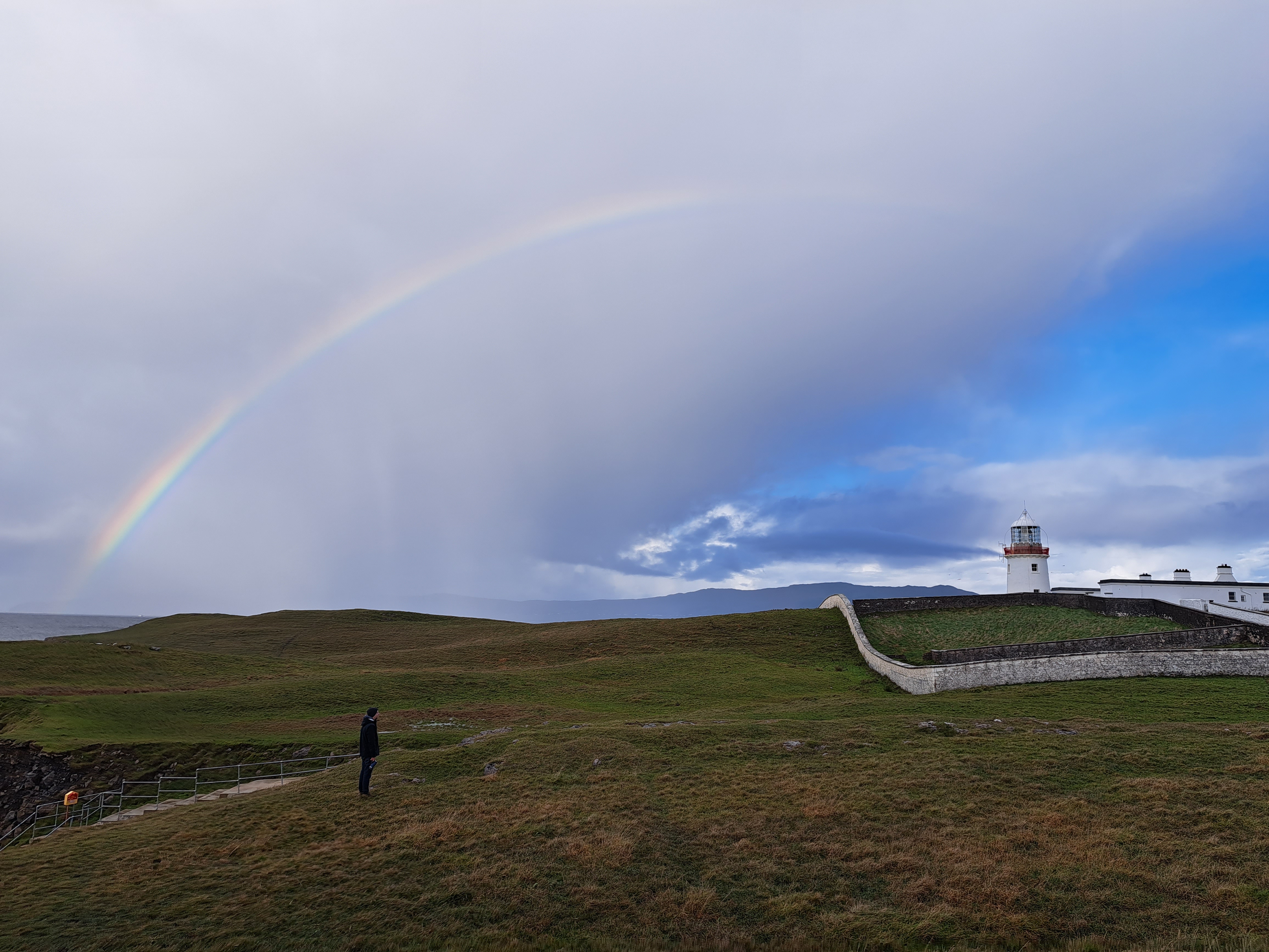
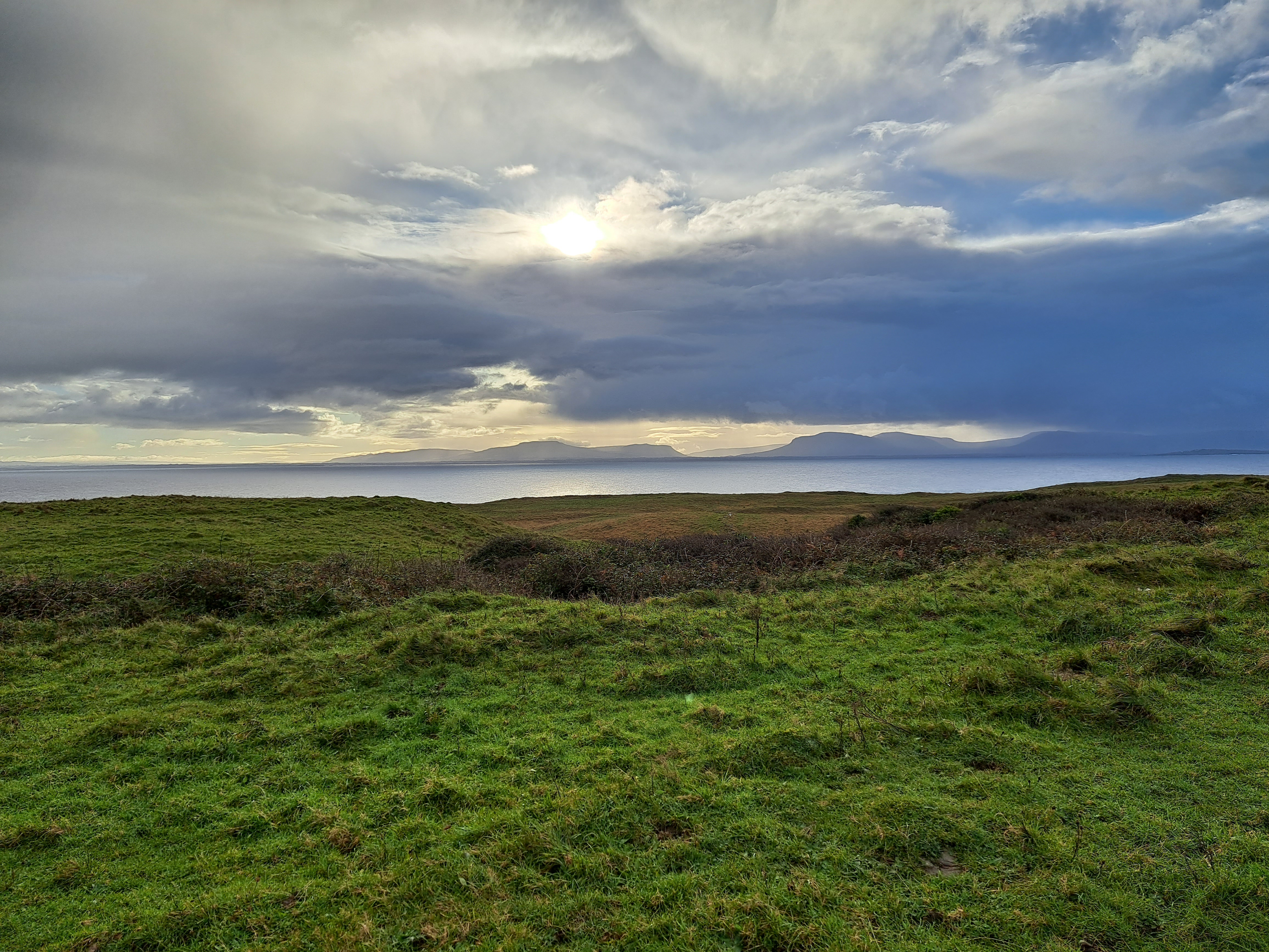
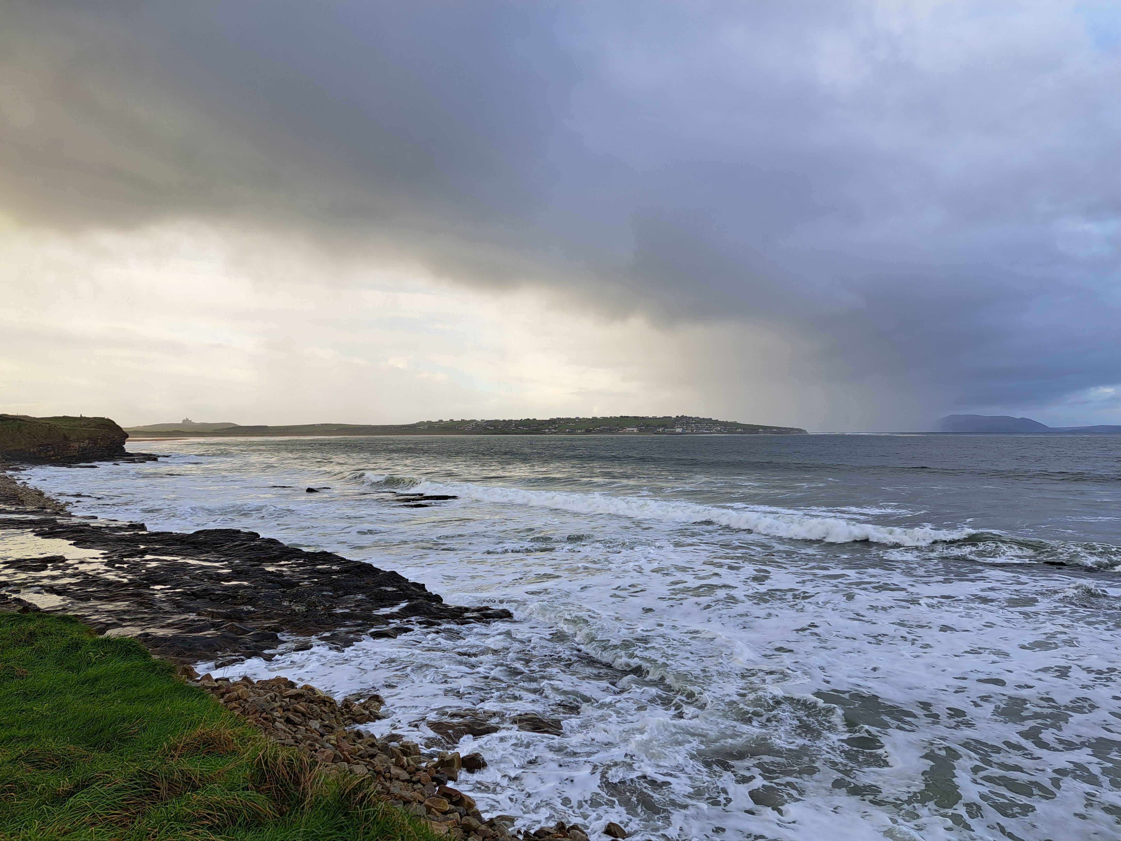
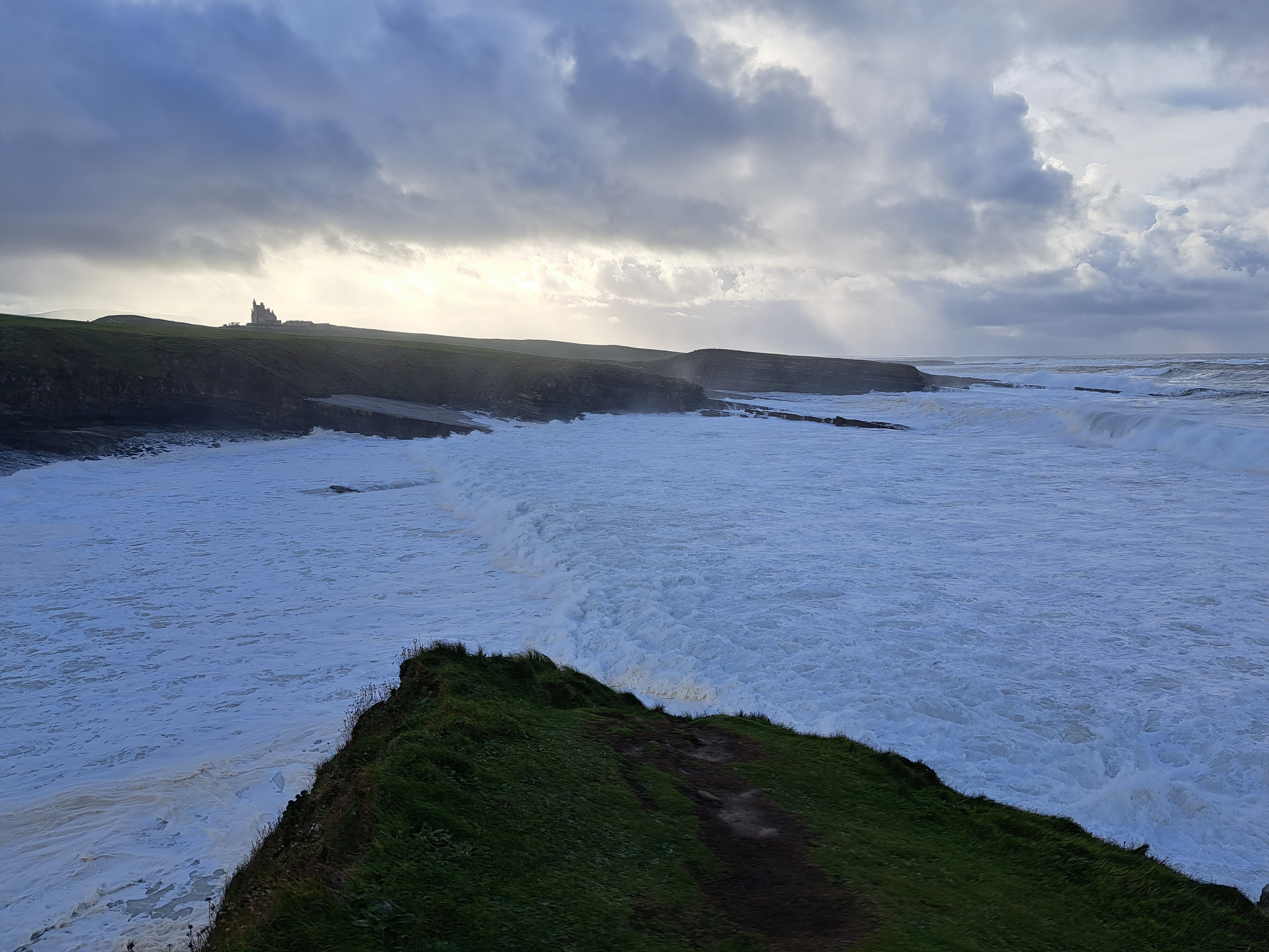
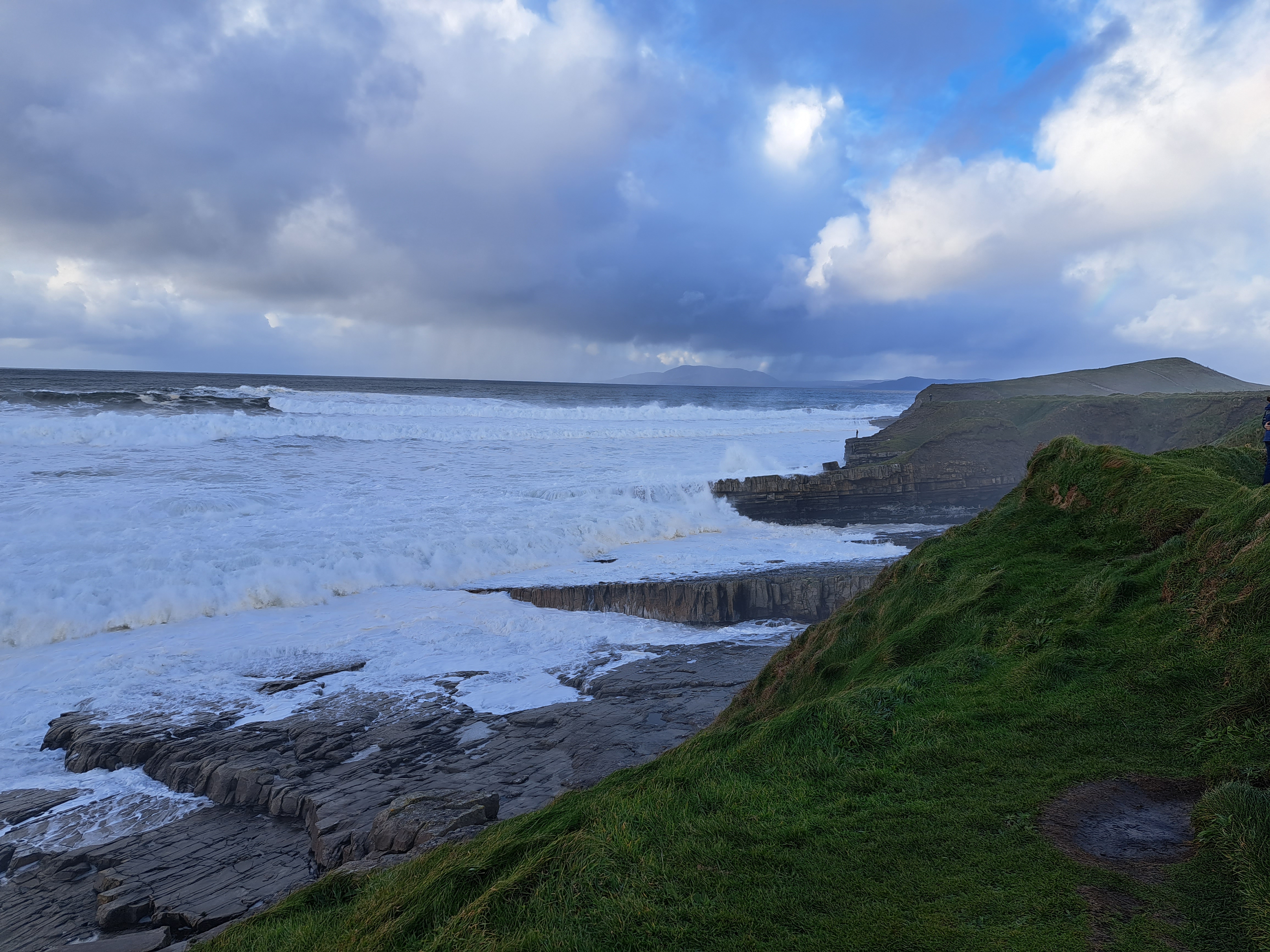
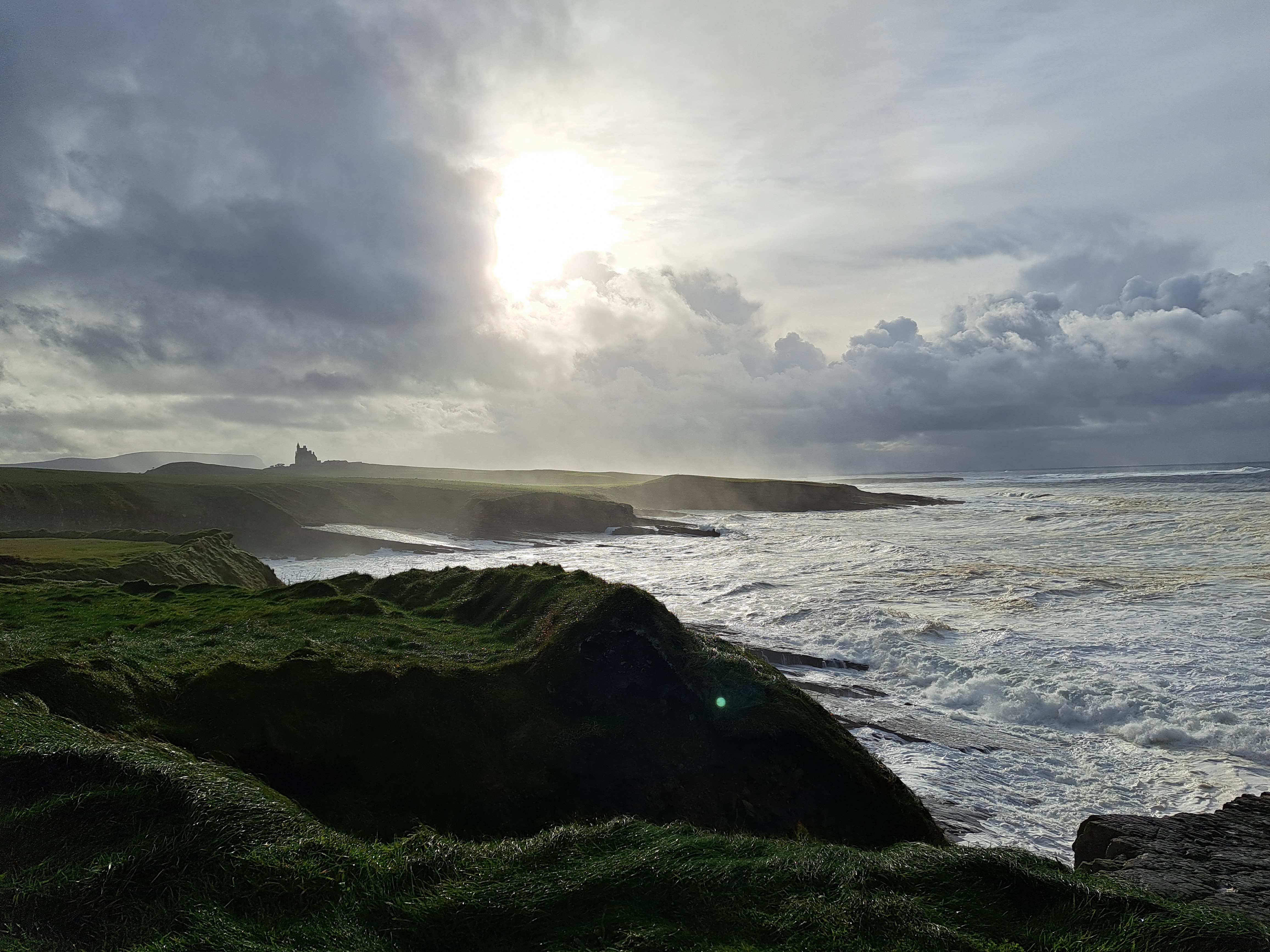
Yes, we’ve shown you this lighthouse in an earlier post :-). It’s St John’s Point Lighthouse, situated at the end of a long finger of a peninsula which drops south of the main arm of a wider and bigger peninsula which forms the north shore of a bay at the base of which sits the city of Donegal, aka Dún na nGall in Irish. To the south across the water from St John’s Point sits Mullaghmore, in County Sligo, and at the west end of the main stem of this particular part of Donegal rise the cliffs of Sliabh Liag. whose rainbow laden photos saw out 2023 on our blog.


County Views.129


Urban Canals.158
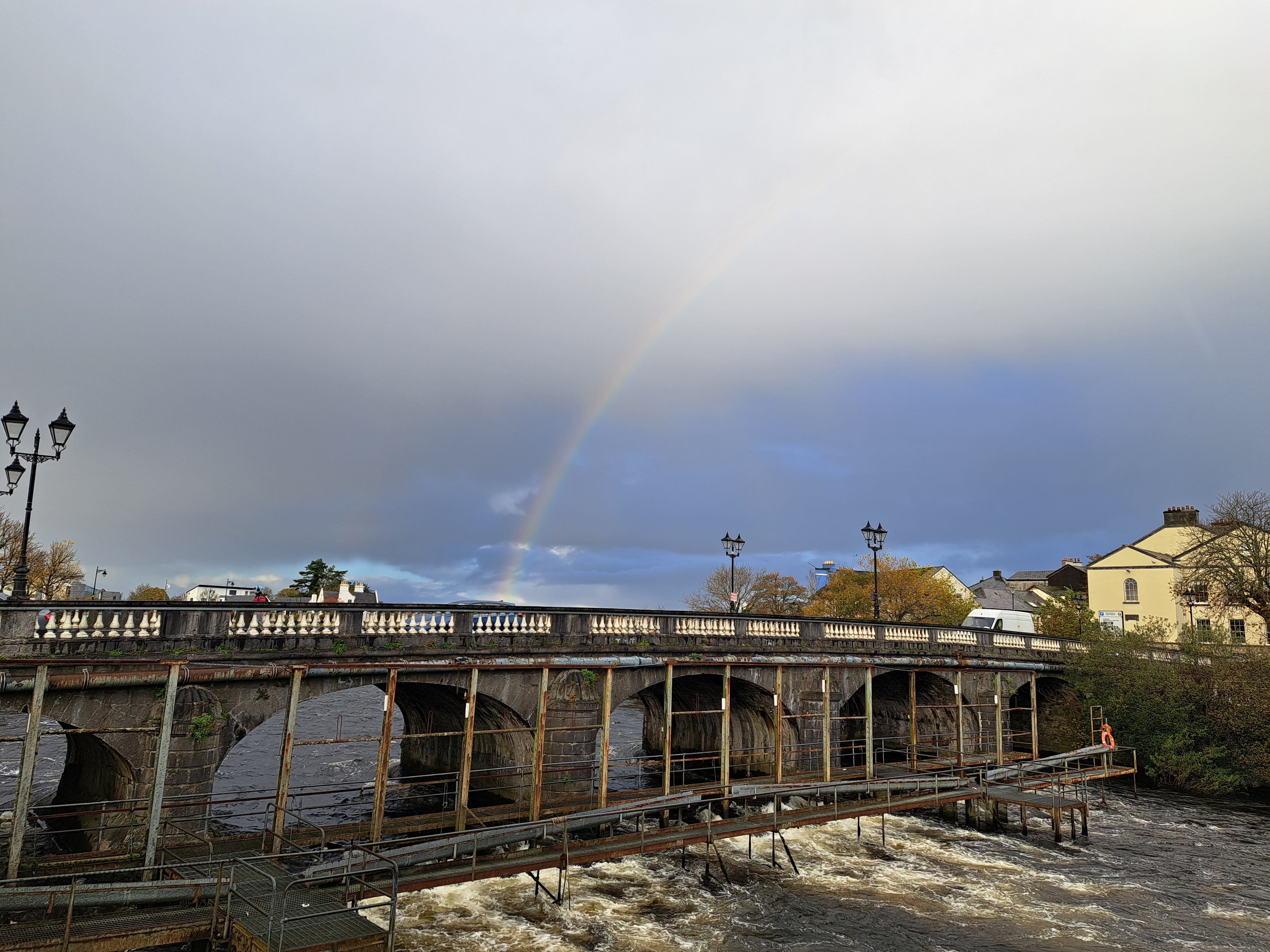
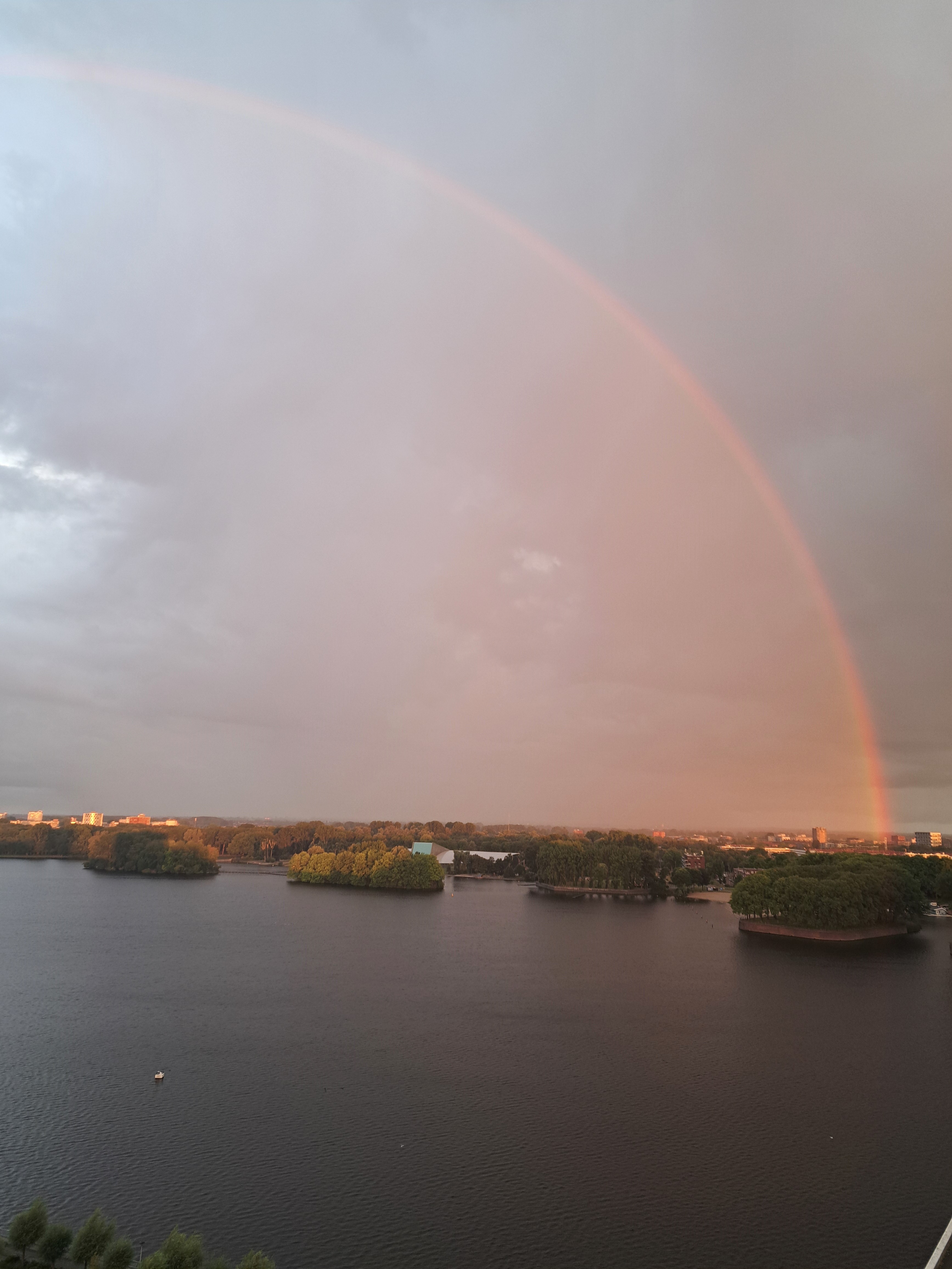
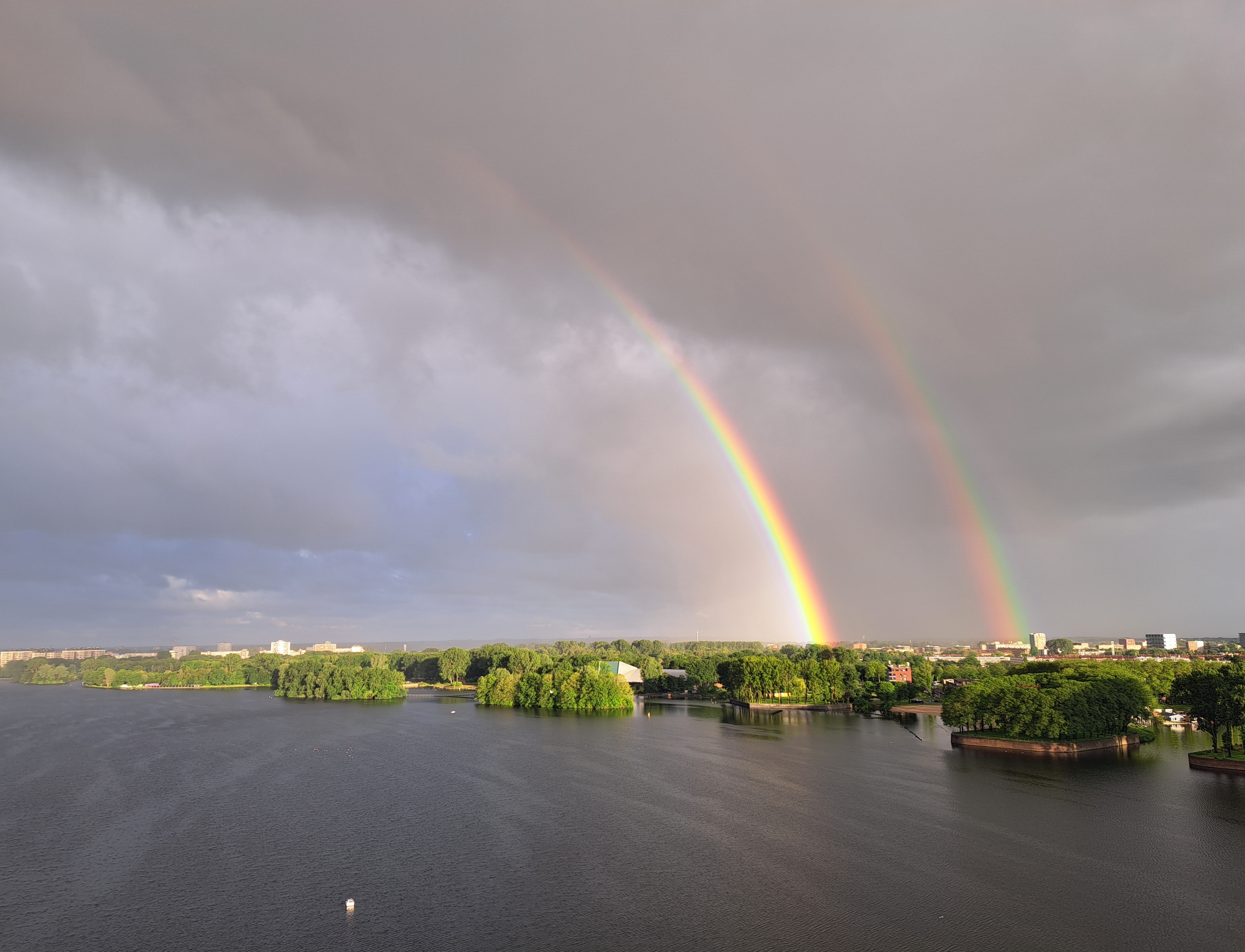
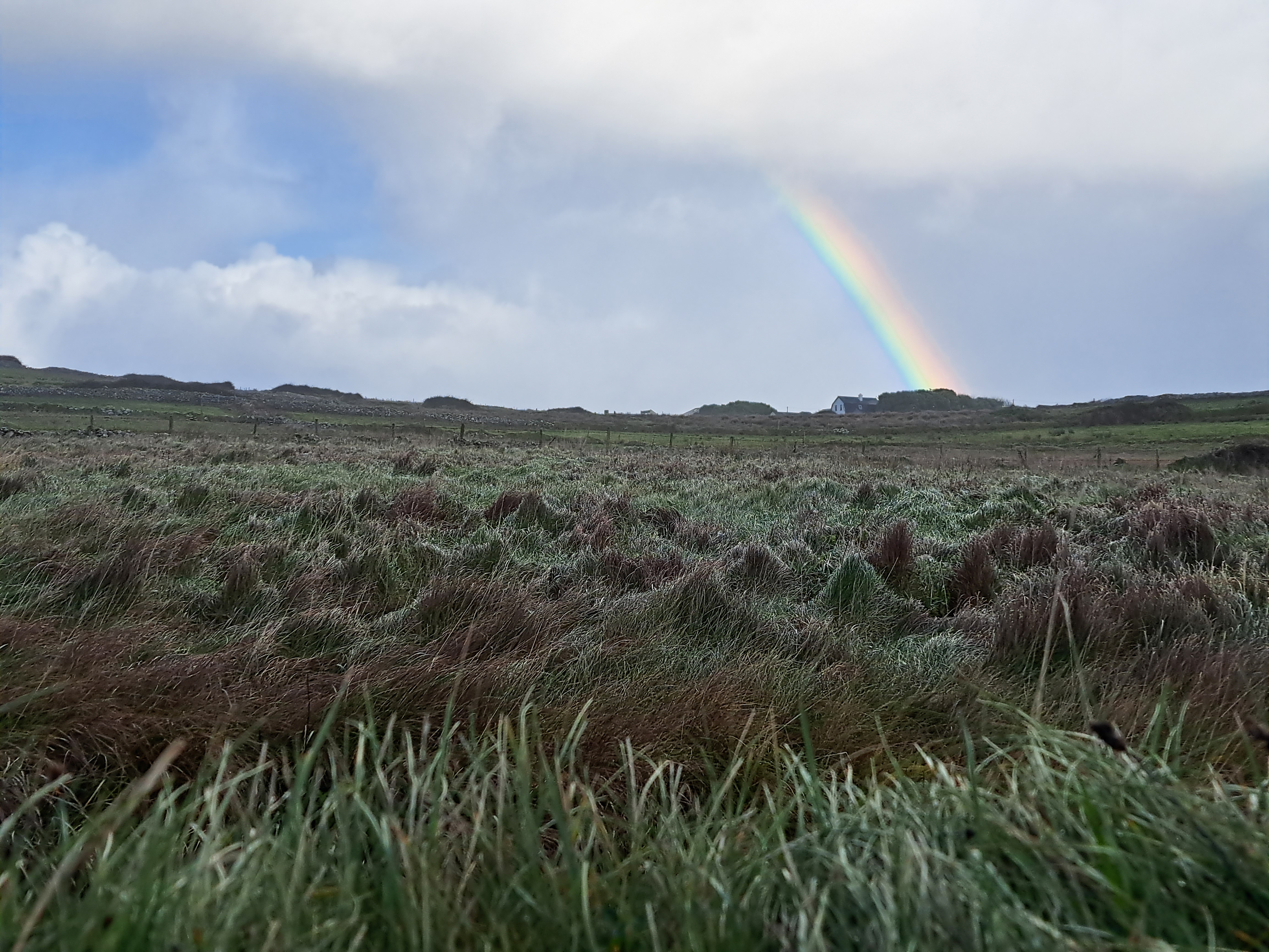
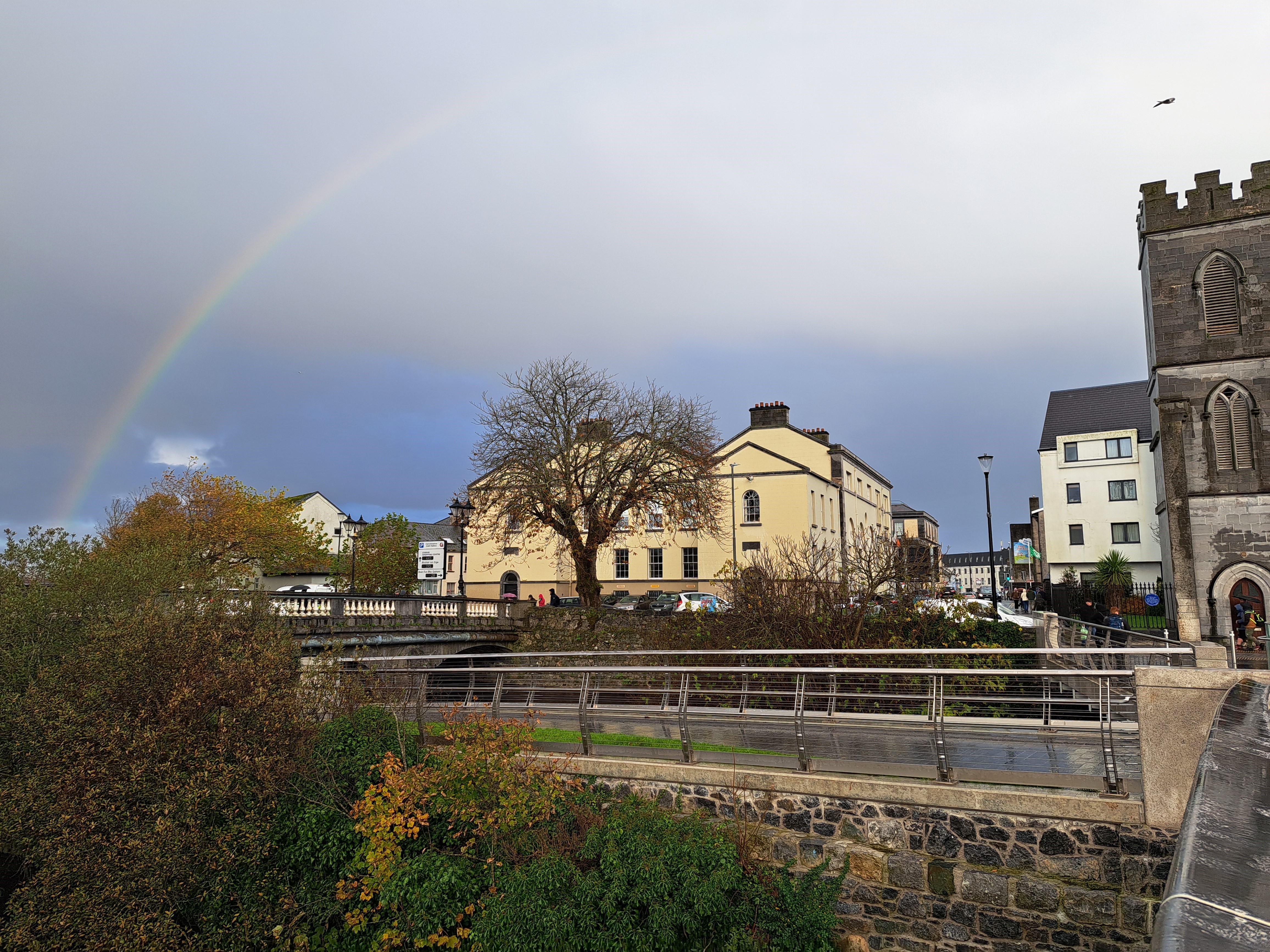
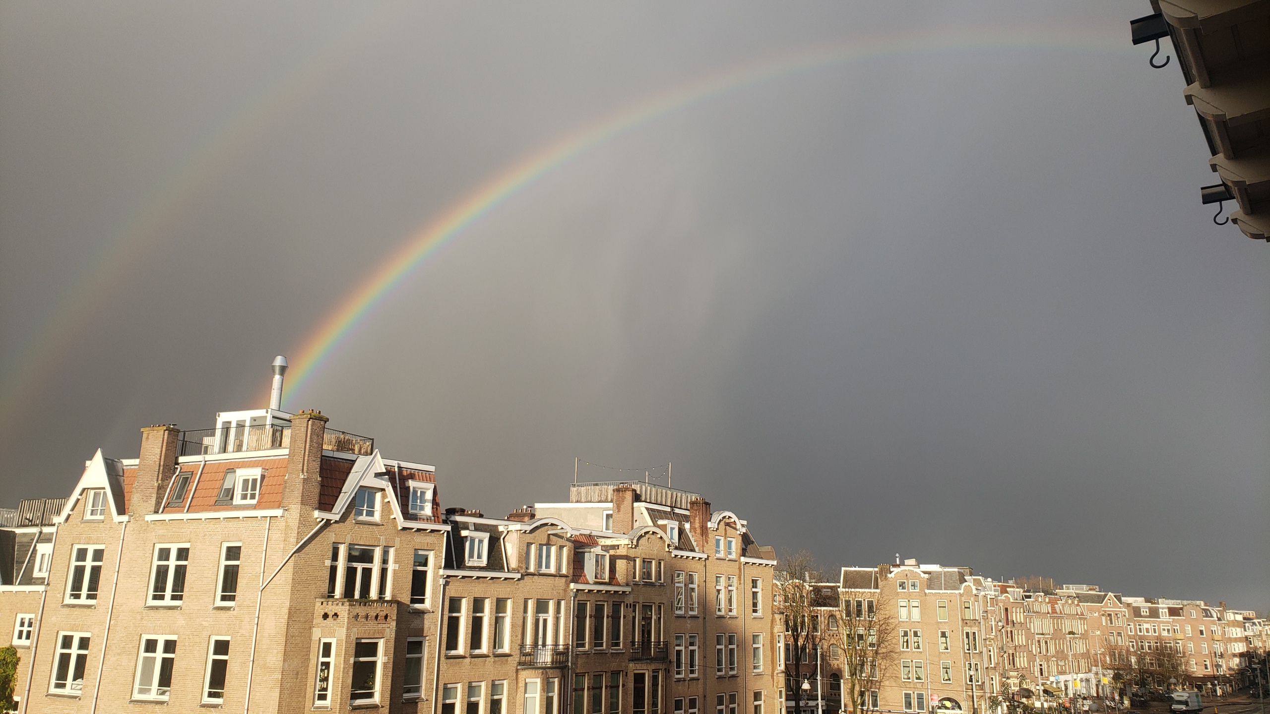
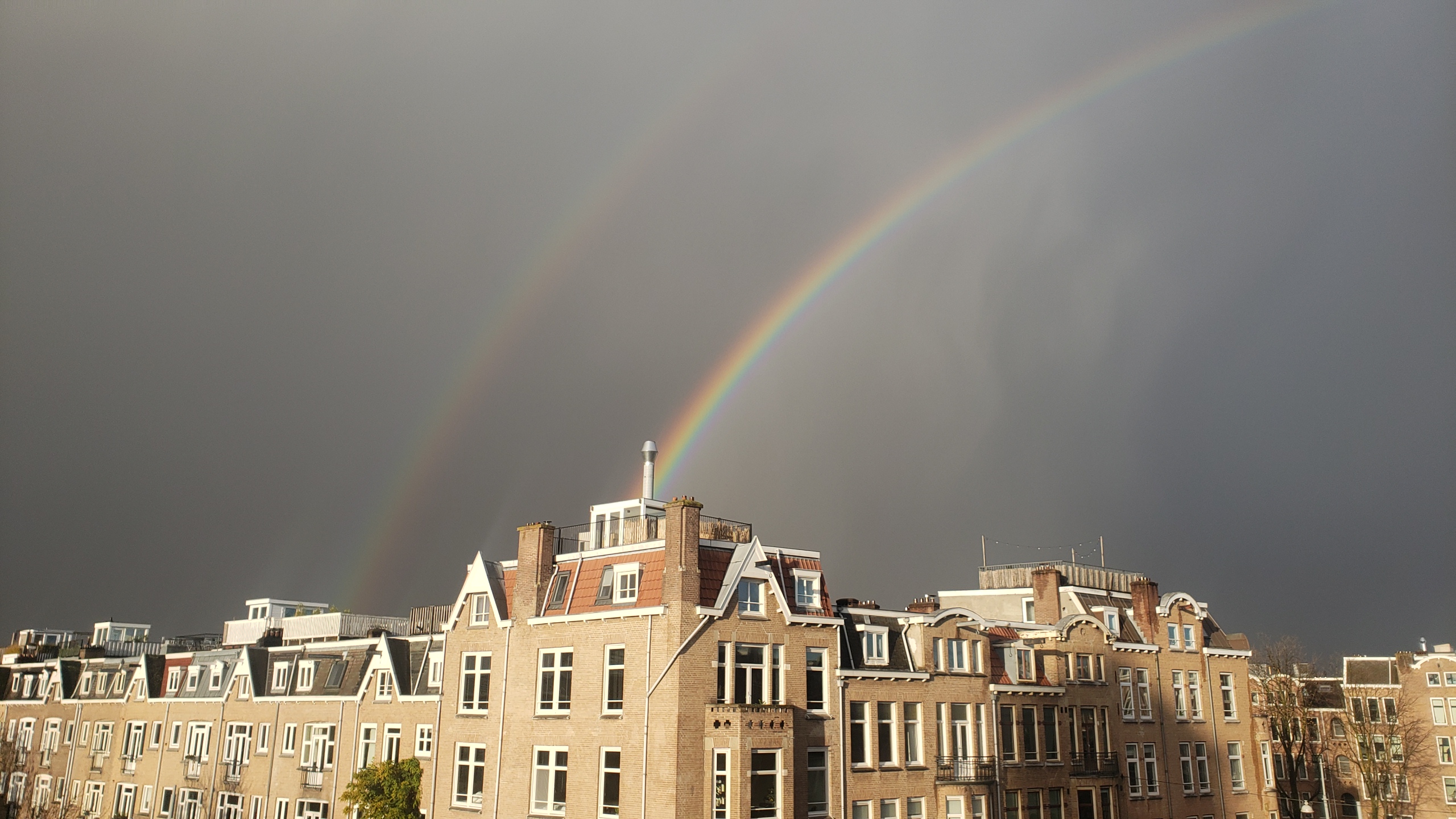
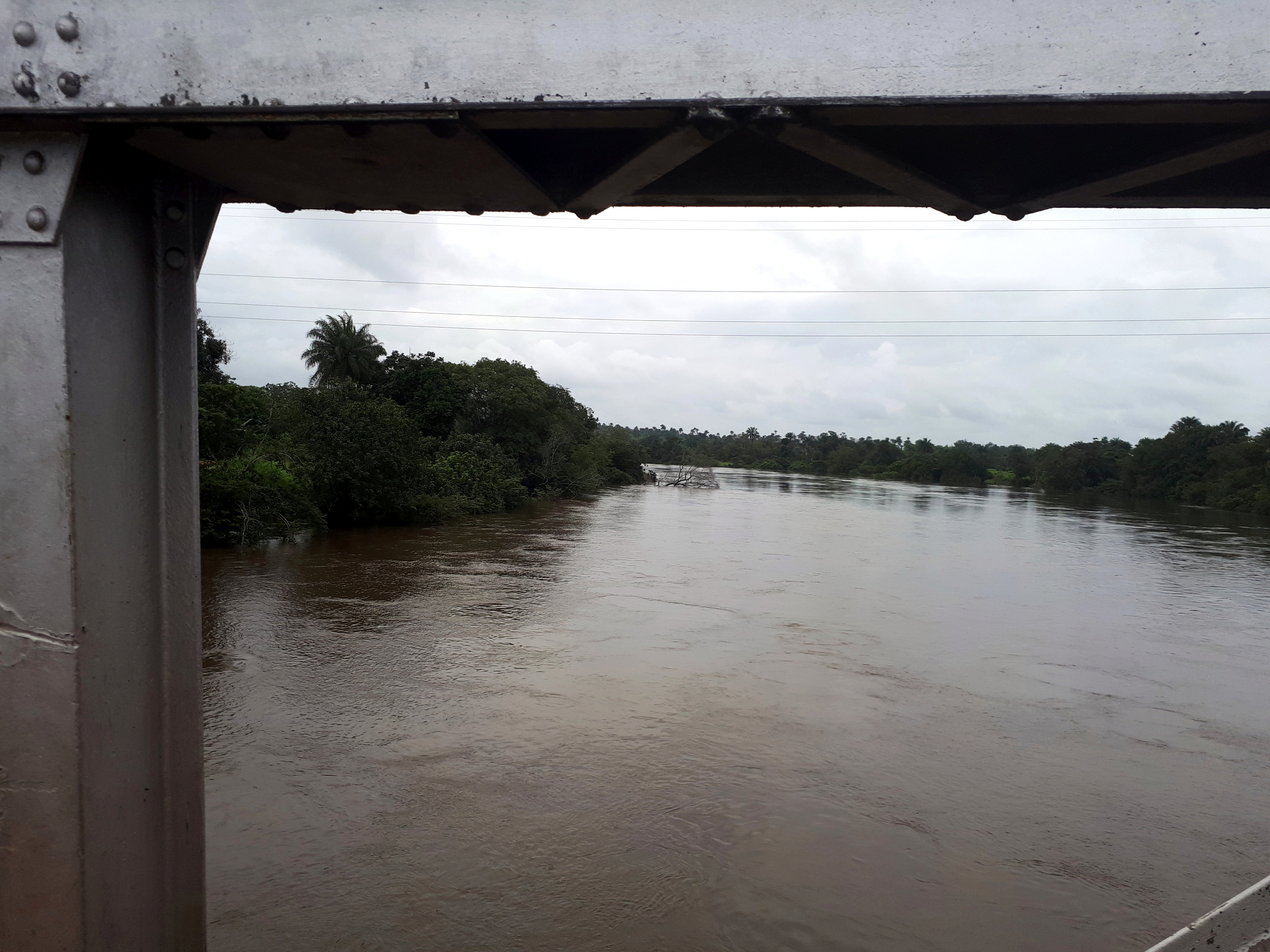
Sticking with our theme of rainbows to welcome 2024, I’ll share a few last photos of the Salmon Weir bridge & the River Corrib, which drains from Lough Corrib (largest lake fully inside the RoI, if I recall well) down to the ocean at Galway City.


City Views.216


Coasting.43


City Views.162
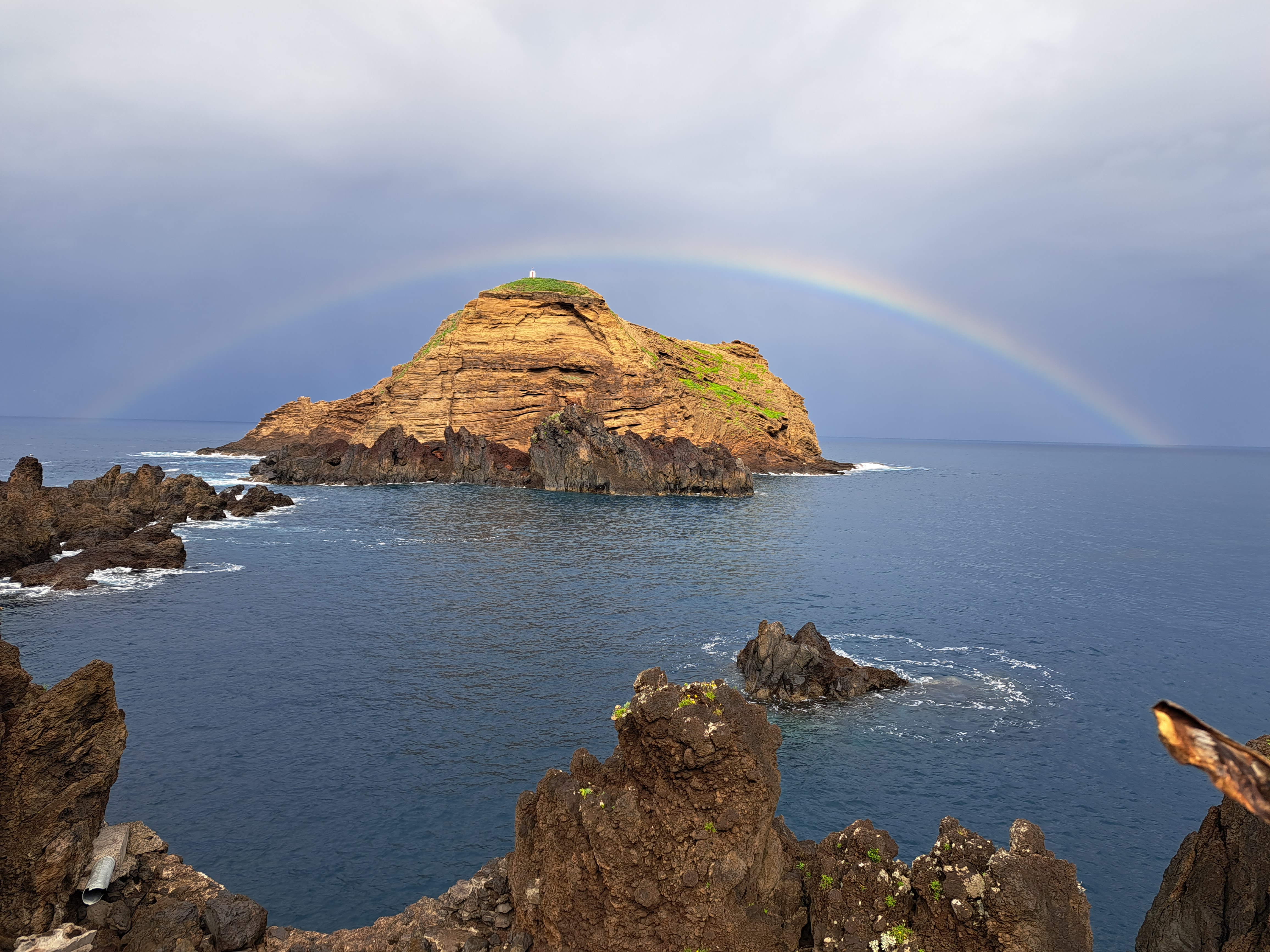
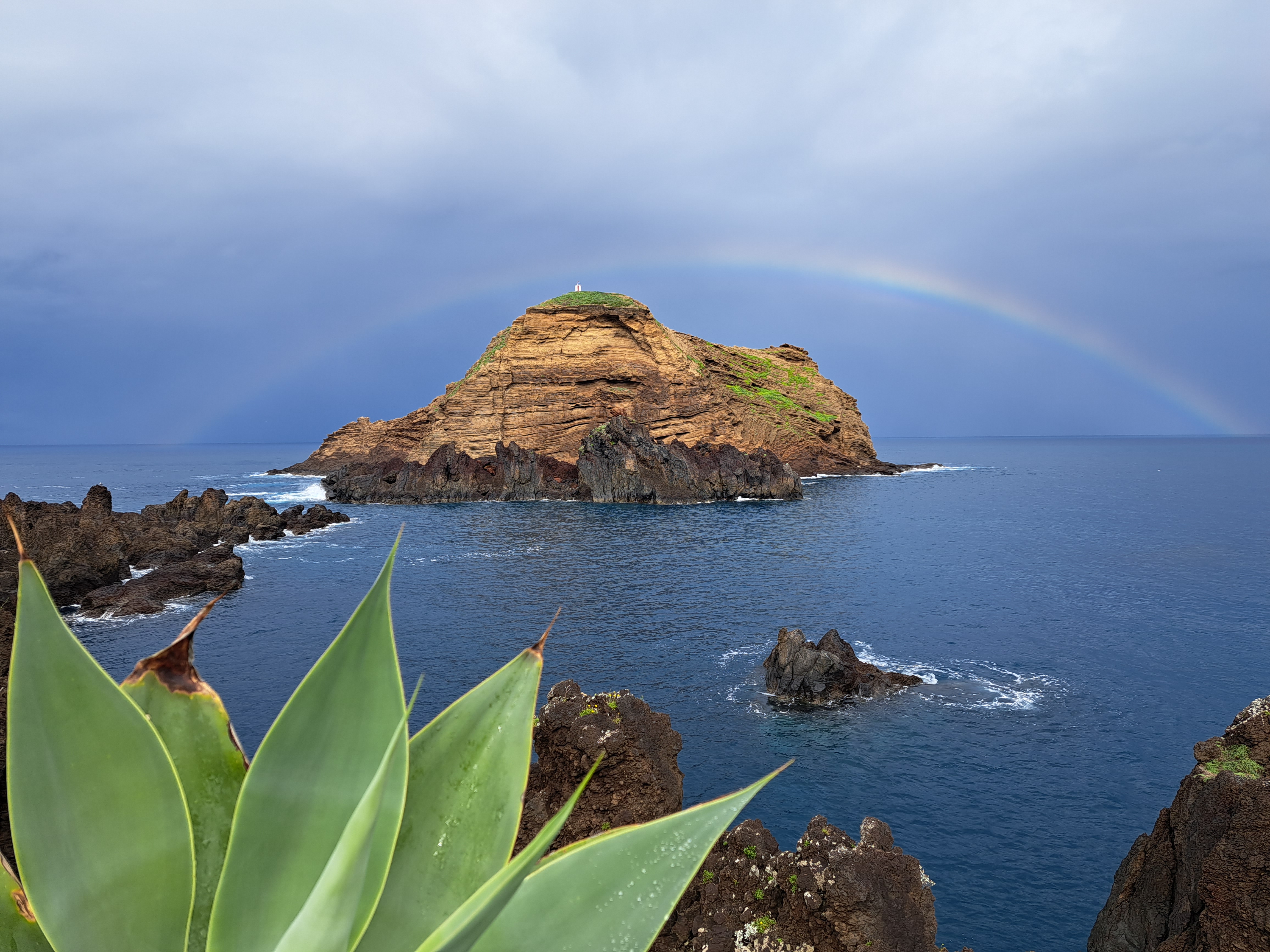
 My various images of Funchal city from before and after I went up to the Botanic Garden. A rainbow appeared near sunset. I wandered the outside of the Palácio de São Lourenço in the center of the seafront. (I’ve since learned that although its own signage talks about being fortified and having inland forts added due to some invasion during the Napoleonic wars, in fact the oldest portions of this structure shown a few times in this post were the first fortification on this island, whose slave-generated wealth did make it vulnerable to both pirate attacks and military invasion by enemy powers.) I strolled past the Christmas market with its folkloric village, just behind the Palácio — in one of the gallery photos, look closely and you’ll see a few interestingly-costumed folks heading down the staircase. I didn’t stay to see more of what they do, since the rain started up again at that moment and I was hungry. It’s really a very pleasant city to explore.


City Views.45


Rainbows & Red-Dirt Roads in Tonkolili


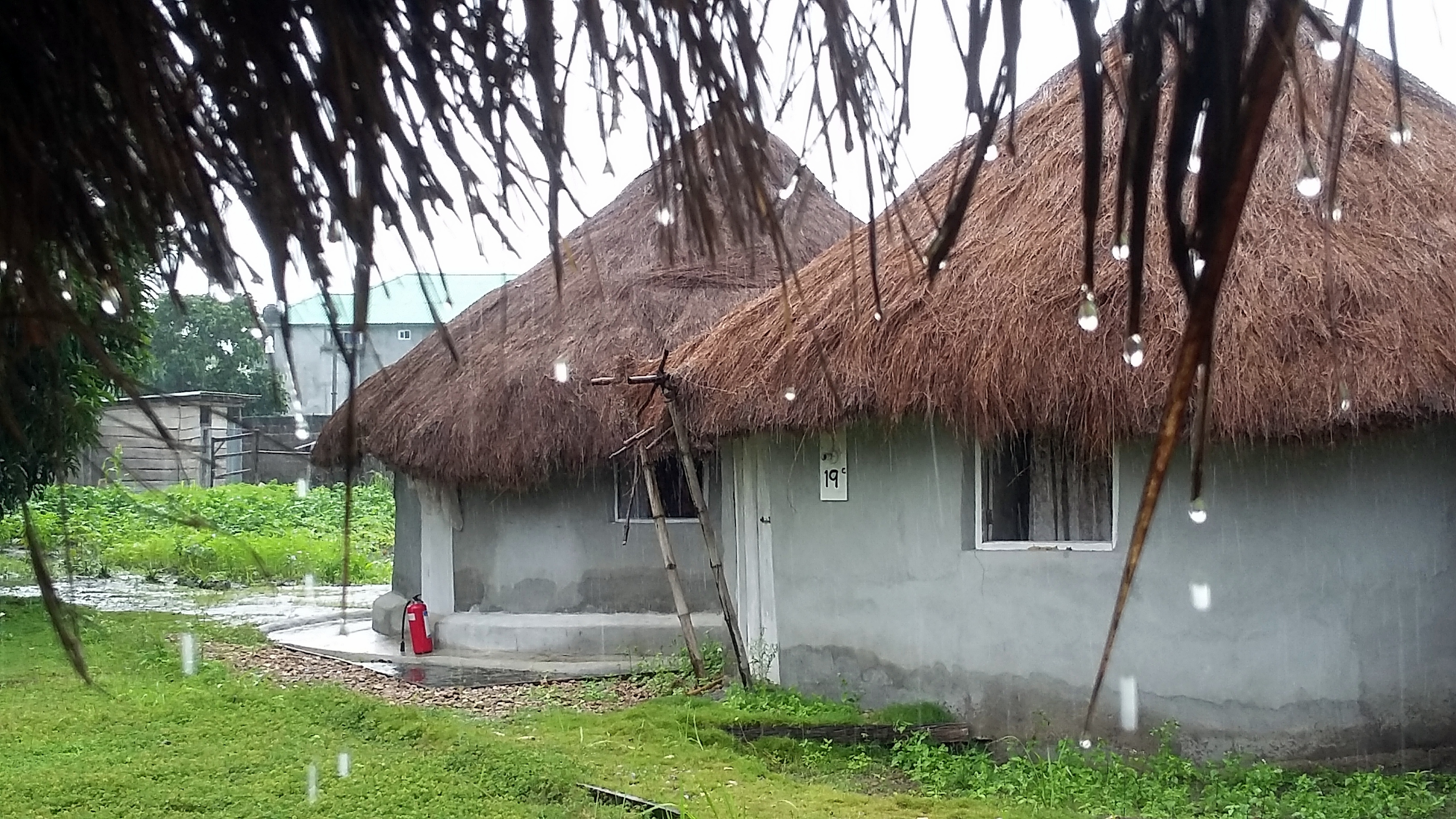 This post I’m sharing more photos from my seven or eight weeks back in Sierra Leone, July-September last year. These were all taken around my birthday, on a lovely trip to work with our project teams in Tonkolili district – green forested hills, red-dirt roads to small villages, lots of outreach to make sure folks got the care they needed and knew where and when and why to go for care. It was the first birthday in a few years I’ve been in small villages on health outreach, since I usually time vacations and a break from responsibility for my actual birthday — but what a great way to spend it, shaking hands with community members, seeing the rainbow from the very last photo in this post and the social weaver birds in their tree (just below, with some close-ups in the gallery below that), and reconnecting with small-town life in new places.


Many Muddy Misty Magnificent Miles on the Milford Track

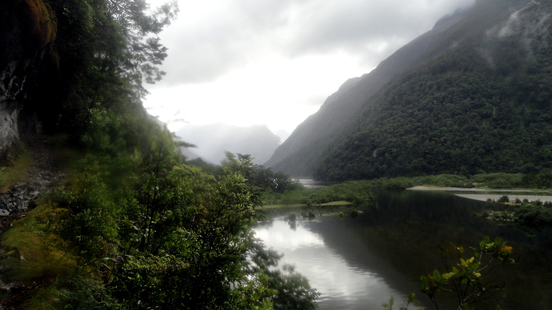
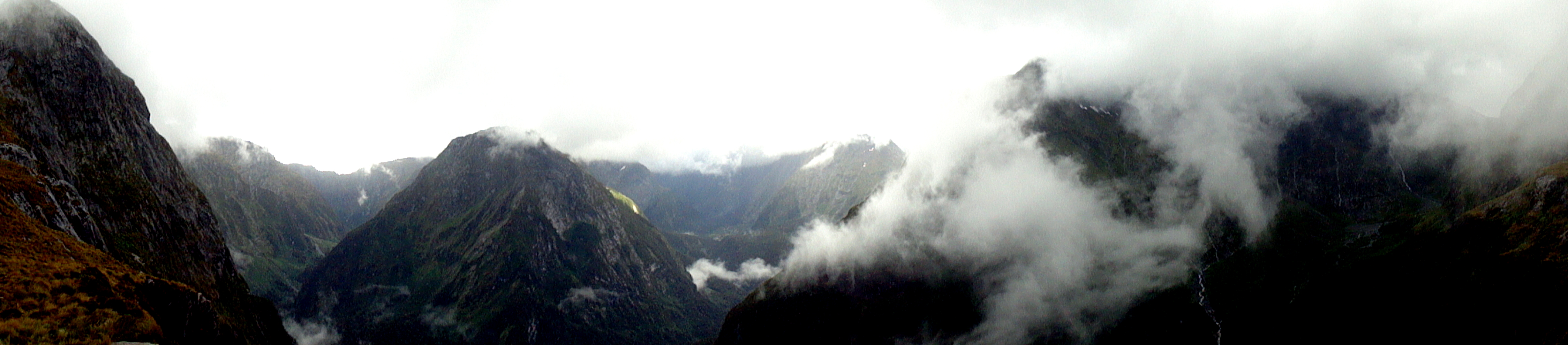
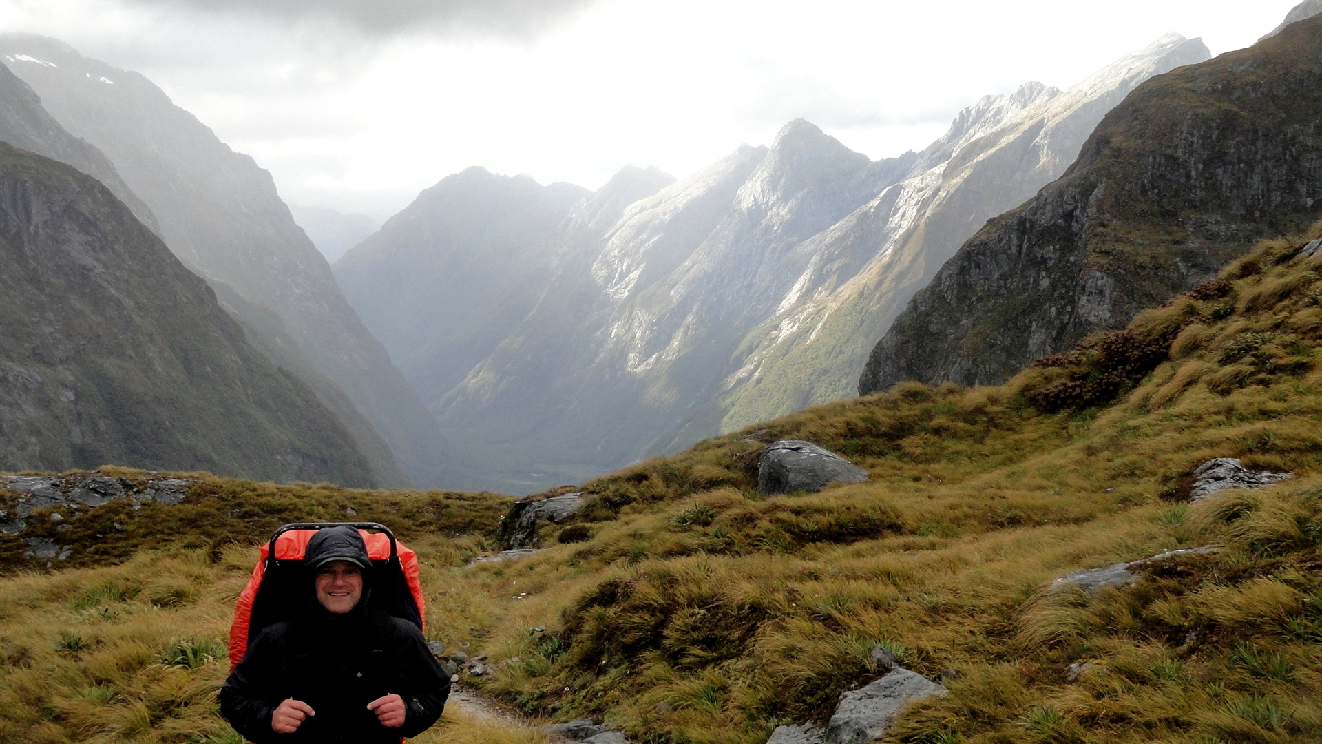
 The Milford Track is the most famous, and most popular, of the Great Walks. It starts at the bottom of the Clinton Valley, formed by the eponymous river which features a few times in the gallery of square photos further down. The first two nights of the three-night, four-day hike are spent within the Clinton Valley, hiking from the boat drop at the northernmost end of Lake Te Anau where the Clinton River feeds it, up to McKinnon Pass where the images above and the whole slide show below were taken. After the slide show, you’ll see a variety of views from other sections of the trail: rivers, waterfalls, dramatic valleys and trail segments snuggled into a rock face alongside the Arthur River at the end of the track, where it meets up with Milford Sound. Milford Sound has been cited by many magazines as one of the most beautiful places on earth; and Milford Track as has been cited as one of the most spectacular hikes on earth. I certainly found McKinnon pass to be one of the most spectacular places I’ve ever seen, and I found many of the miles along the Clinton Valley quite beautiful in an ever-changing, other-worldly manner that was different yet again from the other-worldliness of the glaciers featured in my last post.
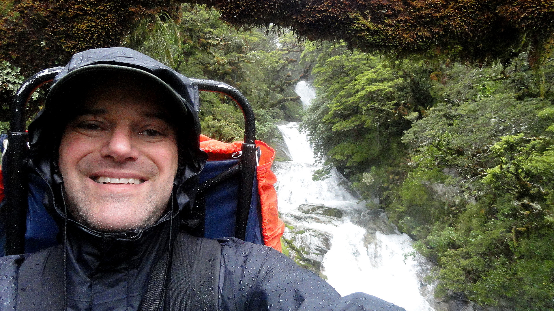
But allow me to say this, of the Milford Track: it is indescribably wet. We hiked it in the midst of the southern summer, during peak season. Peak season is also, strangely, the rainiest season; but even the driest season has plenty of rain. And the drier winter season is, we were told, the season of such landslides as the one just below where you see the trail marker placed to navigate walkers across the rubble field. I can imagine that a mostly-dry hike over this trail would be an unbelievably great experience. And I can certainly attest the truth of that oft-quoted adage that rain makes waterfalls, which are the joy of the trail. But can I just say that my own brain can only really appreciate xx-many waterfalls, and after a certain point both my feet and my soul wish to be dry, warm and comfortable again? So I ended this trail – which, indeed, gave me more spectacular scenery than most other hikes I’ve done – with the sense that it won’t likely call to me again…whereas the Abel Tasman, for all its comparatively mundane (hah!) scenery, is one I’d readily return to again and again – in part because it’s just so much more warm and comfortable as a hiking experience. (Even the Kepler, another Great Walk within the extraordinary Fiordland National Park, showcases a wider range of terrain with a lower preponderance of heavily rainy days — witness this post: https://somuchworldsolittletime.wordpress.com/2009/03/05/kepler-track-fiordland-national-park/
But don’t get me wrong: even the most amazing of these photos (some of which still give me vertigo) can’t convey the gift of being present to feel and hear the roar of wind and rain, marvel at the shifting windows of sunlight along a mountainside, or see a rainbow materialize above one of those windows…with the sense perhaps you’re the only human positioned so as to appreciate that particular ephemeral wonder. Whatever the case, I encourage anyone who loves the great outdoors and appreciates natural beauty to bump NZ up your must-visit list, if you’ve not done so already. Feel free to research on this blog (from 2009, 2013-14, and 2015!) some of the many wonders you might consider experiencing in person. Enjoy. 🙂
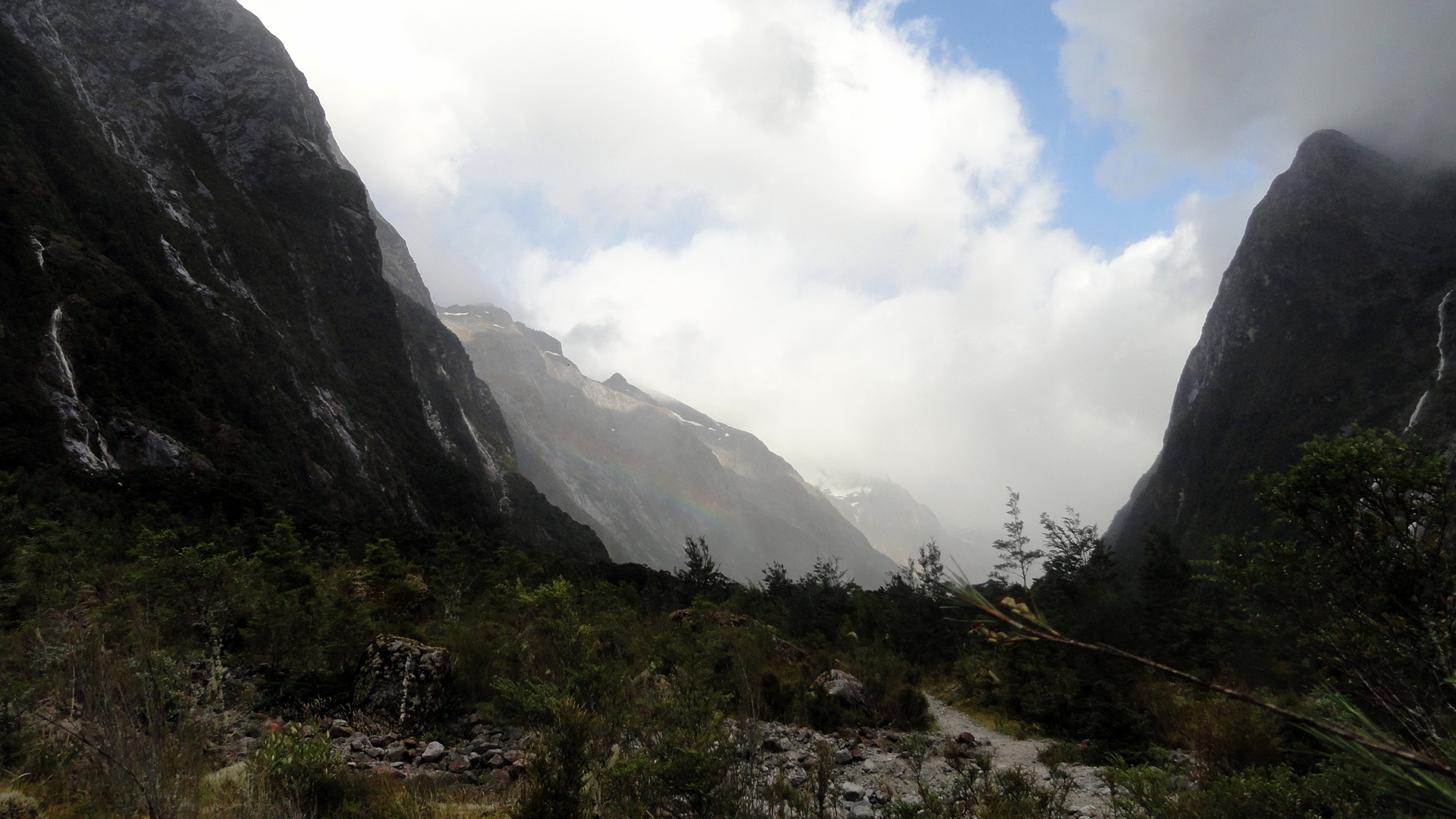
…about the blurry spots you’ll see in some of the rainier images: my camera has survived but there were days where the lens never really got dry. Most of the rain-splattered photos are deleted, but I felt some of these convey what words cannot about the omnipresence of water at times…