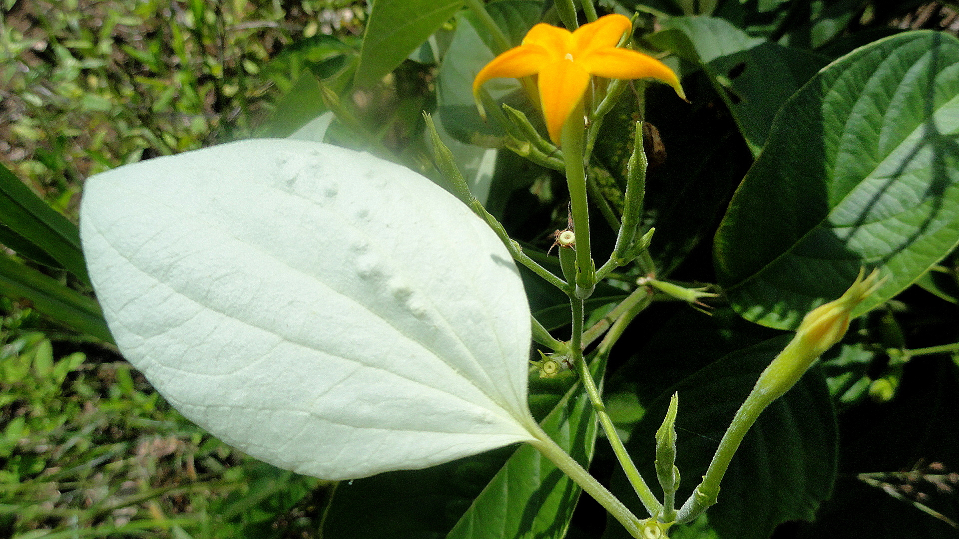
Video Bonus – Dusky Leaf Monkey Mother & Baby
She was having lunch at the same time and place as me, at the top of Penang Hill today during what ended up being a much longer, more strenuous and wonderful day of hiking than I expected when I set out at 9am with a small water bottle and my wallet. I just decided walking, steep hills and all, beat standing in long lines for the funicular, first at the bottom, then again at the top. 🙂
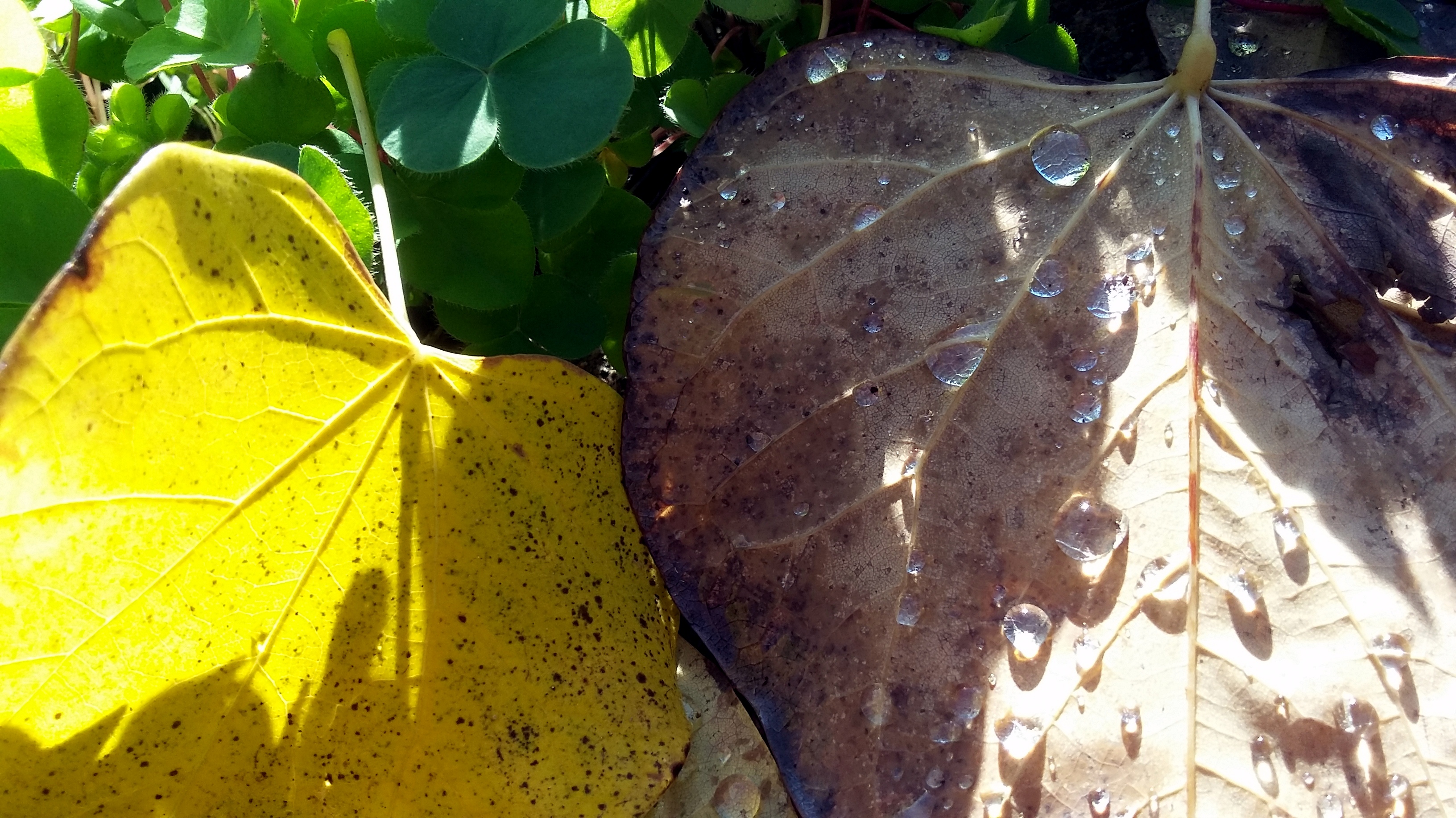
Art in Nature (Sonoma County)
 Do I need to spell it out? Or are the photos, all taken in the past two weeks, enough? More soon, I promise (almost). Hugs & happy holidays!


")
")

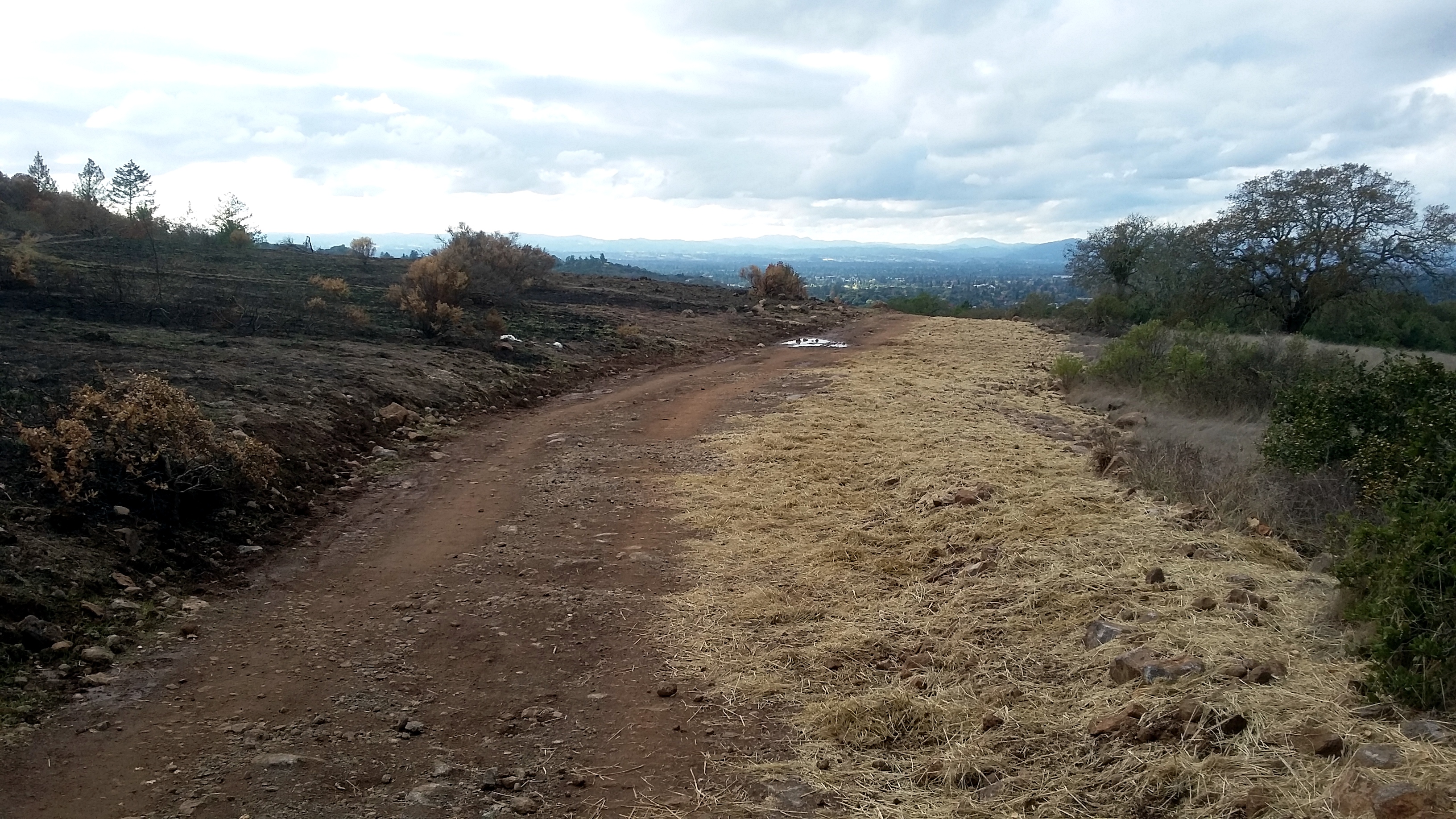
Walking The (Fire) Line in Annadel

The cal-fire site tells me that the Nuns fire complex ultimately burned 56,556 acres. The final report date on the site is November 6, which I suppose means it was 100% contained or fully extinguished on or before that date. Earlier, I’d assume, since the superintendent of Annadel State Park allowed parts of the park to reopen for hikers, bikers and runners on the 5th if I understood the signs well.
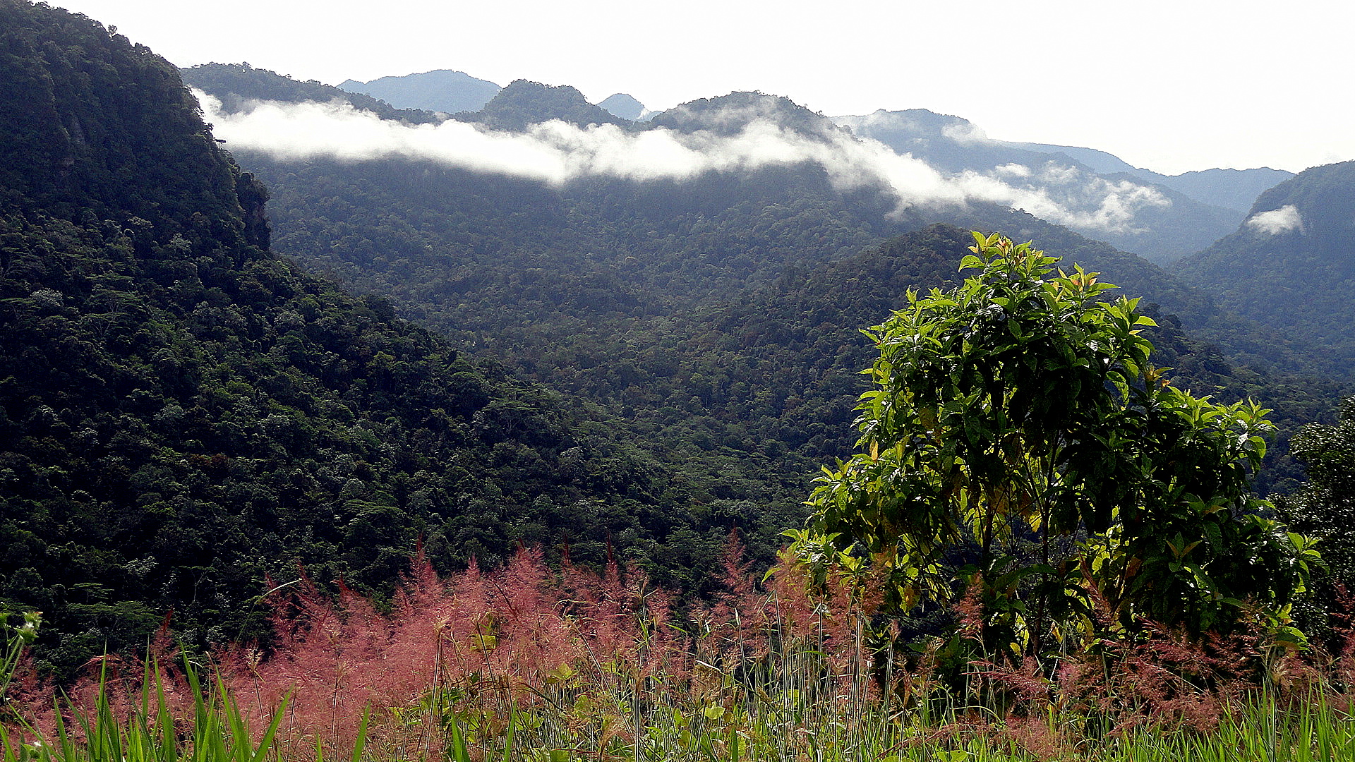
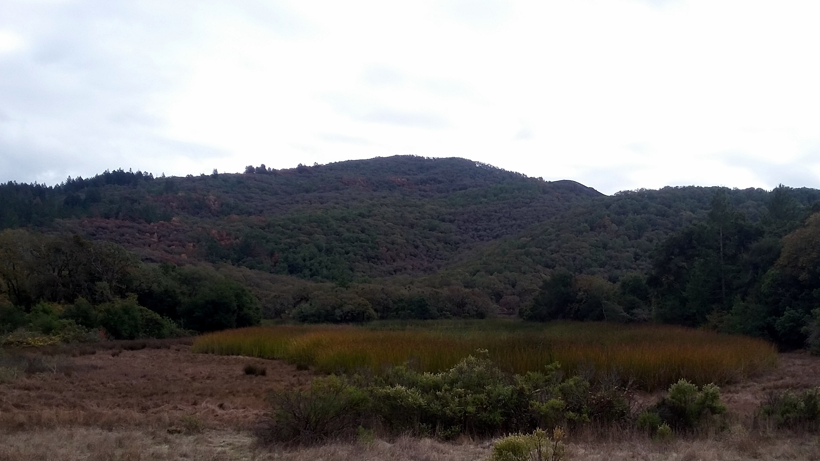
My last post contained all the photos I’d taken in Sonoma County between returning from Haiti (late April), and the day of the post. Today, I’m posting almost entirely photos taken yesterday in my beloved nearby State Park. Annadel is a gem on the eastern edge of Santa Rosa which has been a key source of recreation and mental-health management for me here in Santa Rosa. The fire burned through about 2/3 of it, and if the wonderful fire fighters (see thank you signs from my last post) hadn’t stopped it where they did, then it would have destroyed many homes near the park, and I guess there was a very real risk this fire complex would merge with the Tubbs complex, which had already destroyed so much to the north in Santa Rosa.
 With many of the trails open, I got out there again yesterday to appreciate the park and take stock of the damage. I try to find silver linings: that it WAS stopped here is a silver lining; that green shoots are already sprouting among the charred grasses is also good to see. (See the round gallery a little lower down.) The rainy season has come – it’s sprinkling as I type this – and so we must hope for enough rain to allow plants to re-grow strong…but not so much as to cause too many land slides in all the newly-vulnerable areas whose trees and grasses have been burned.
If you look closely, you will really see how rapidly the fire passed through (burned areas surrounding unburned patches), plus the stark line where they stopped the fire: trees charred on the south side, still green moss on the north side. Rocks the same way. Since I already wrote more in the last post, I’ll leave it here for now. Gratitude, shock, slow return to regular life, I guess. Peace, everyone. Most photos have titles that’ll tell you what they are or why I selected them.


Can you spot the photo in the gallery above is not taken in Anndel? It’s this entry’s tribute to our first-responders. 🙂
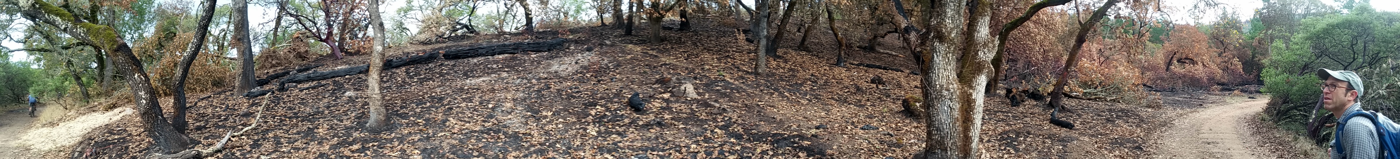
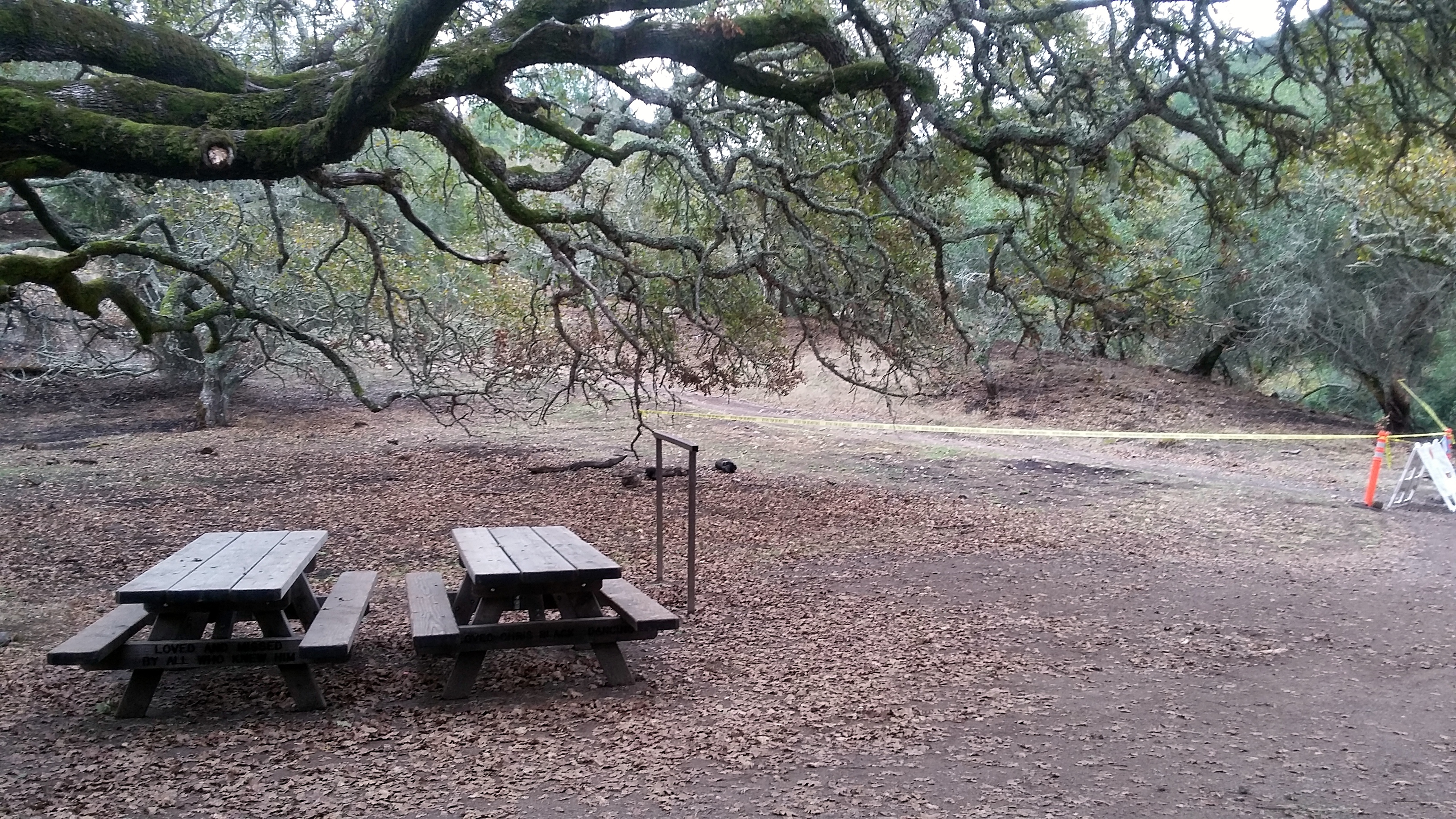 In a post last year, I did a selfie while taking a breakfast break lying on one of these two tables, at the junction of Marsh & Canyon trails. Canyon was the fire line through this portion of the park — the photo above, here, with straw over where fire fighters had widened the line is on Canyon trial, west of this point. To compare then and now, check this link or others labeled Annadel, or Sonoma County, or Napa & Sonoma (I need to work on my tags…) — https://somuchworldsolittletime.com/2016/08/19/dry-hillsides-live-oaks/
Back to the Mountains

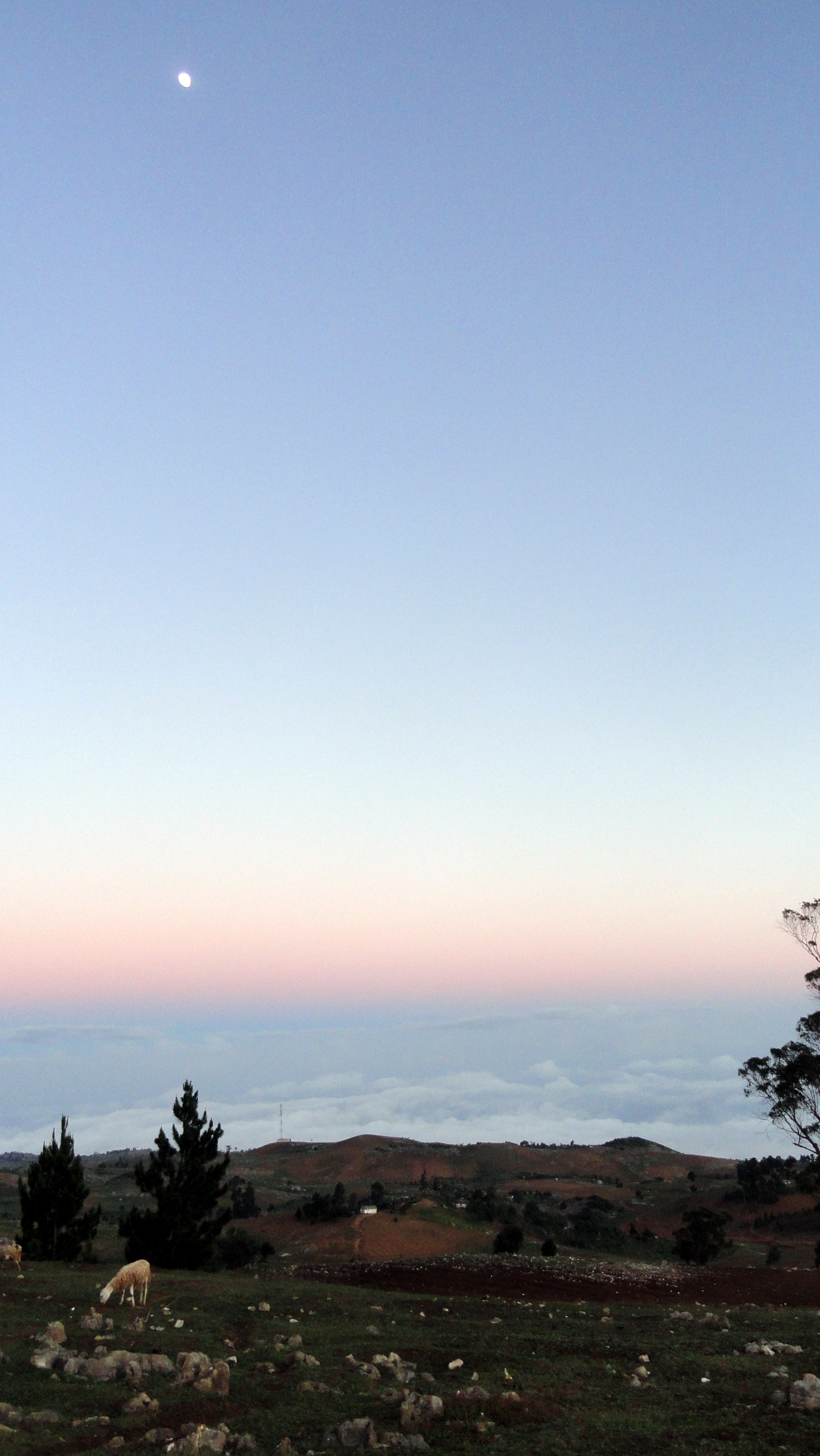
The year’s gotten off to a busy start – lots of work, long days and weeks, not quite the amount of free time that gives much chance to get out and about with a camera, or sort & post the photos once I’ve gotten out. Still and all, I did manage another hiking weekend back to the lovely Auberge la Visite, at Seguin. This really is a lovely if challenging hike. (Because it’s rolling, very steep ups and downs, and almost all in blazing sun unless you start really early or get a cloudy day…without rain: you would NOT want rain on this road). This time I walked again with a few work colleagues. We started really early, and in late January so the sun rose above the mountains too the east a bit later, and we actually walked in shade much of the time.


The stars at night were wonderfully clear and abundant – we spent time studying the milky way & deciding which were planets, which stars, and which satellites. On the way back we were actually surprised when we reached the end: if you look in some of these shots below, you’ll notice one can see the road most of the way – and we thought we had yet another village, and another down & up road segment, to cover before reaching our end-point. The end point, if you’re curious, is the last village that any regular 4-wheeled vehicles come to from the north. From the south, you can get to about where we spent the night and even a bit further – but the middle chunk of this road is so steep and rocky that it’s foot, mule, and motorbikes only. I, for one, would not have any wish at all to be on those motorbikes: it’s how I felt backpacking the grand canyon; I trust my own feet more than the mules (in the canyon) or the motorcycles.
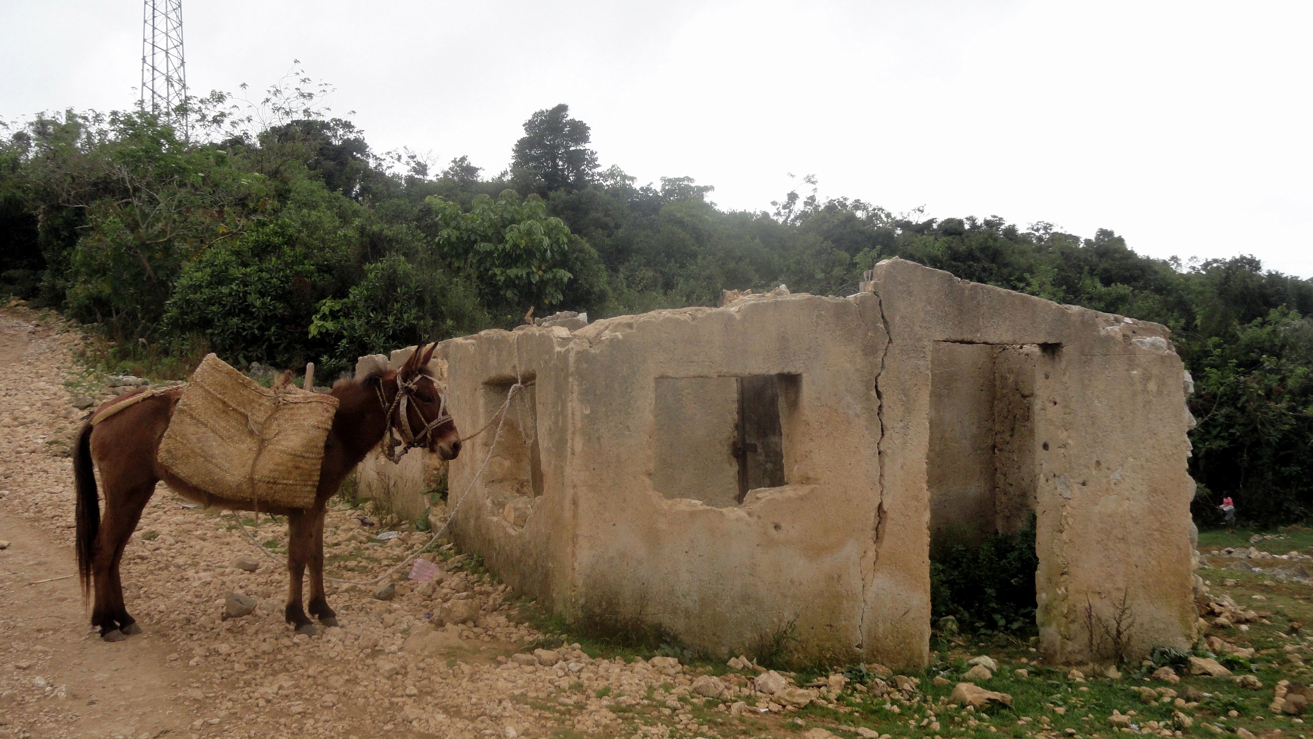
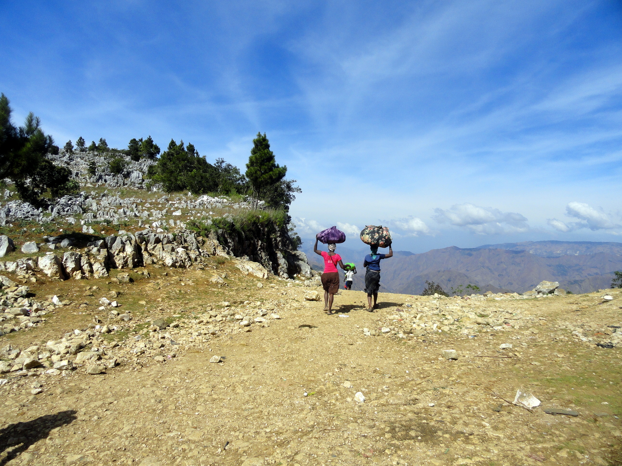
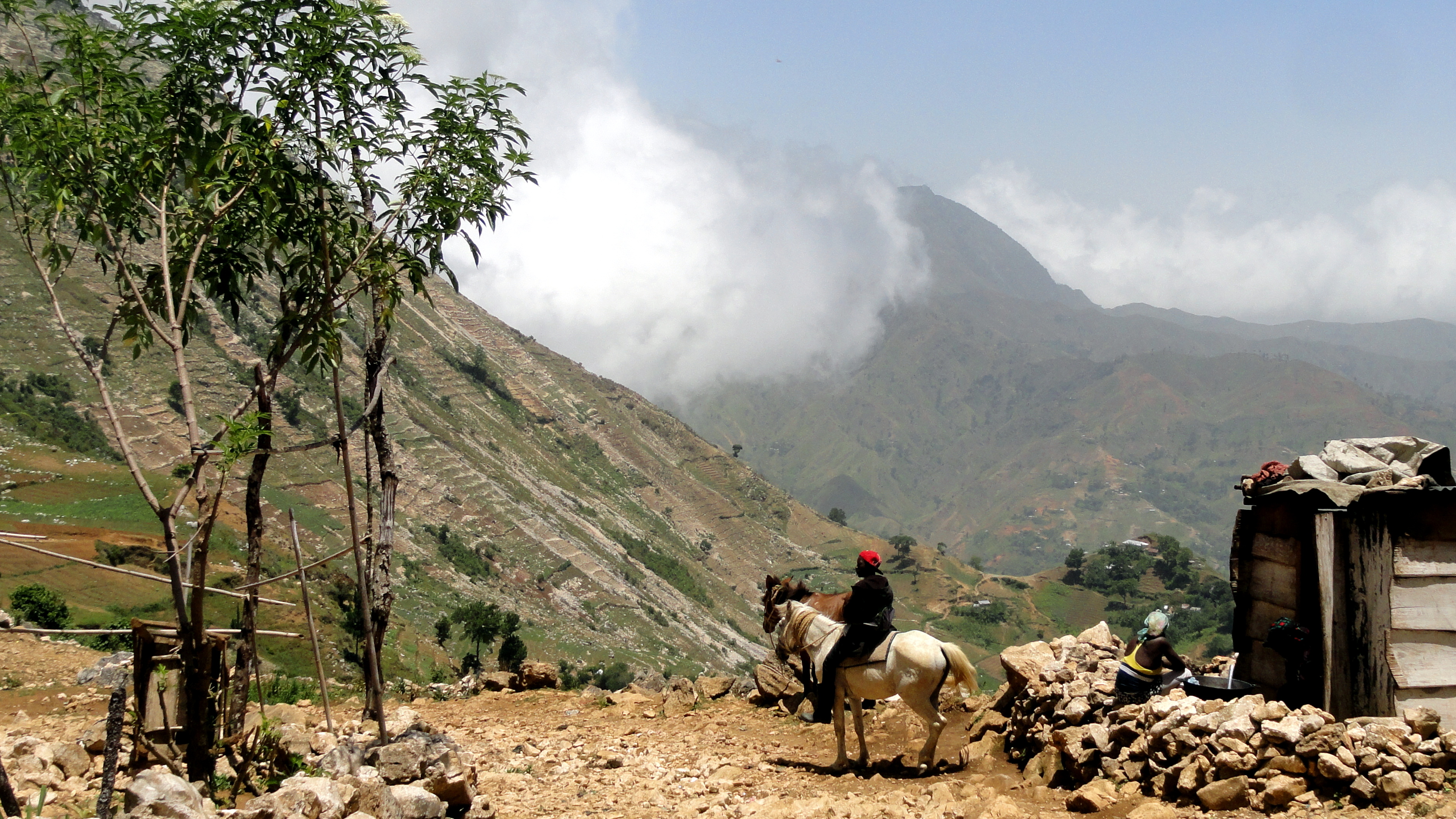
There are mules here but mostly as pack animals: very few were being ridden by people, though I suppose after they drop off their carrots or scallions at the market or transport towns, the folks may ride them back home… (I’m sort of assuming there are brokers or agents in the village where we start, who buy up what all these folks are carrying, then shuttle it the rest of the way into the PaP metro area…but I haven’t investigated further.) The only real downside to this time of year for a visit is that the waterfall is more of a lovely water trickle, not much of a fall. Oh well. Enjoy the shots, even though they’re probably quite repetitive with the ones I put up last summer…haven’t checked but I suppose I will shortly, just to see how repetitive I’m getting! Happy spring, to those of you in northern climes where spring has sprung.


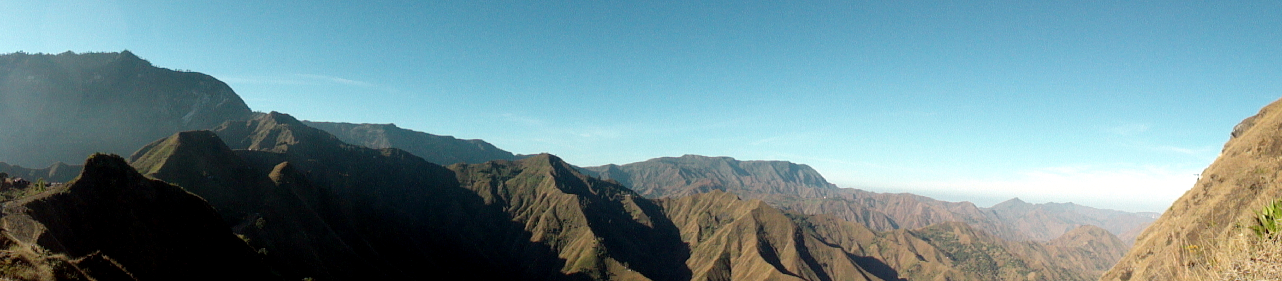
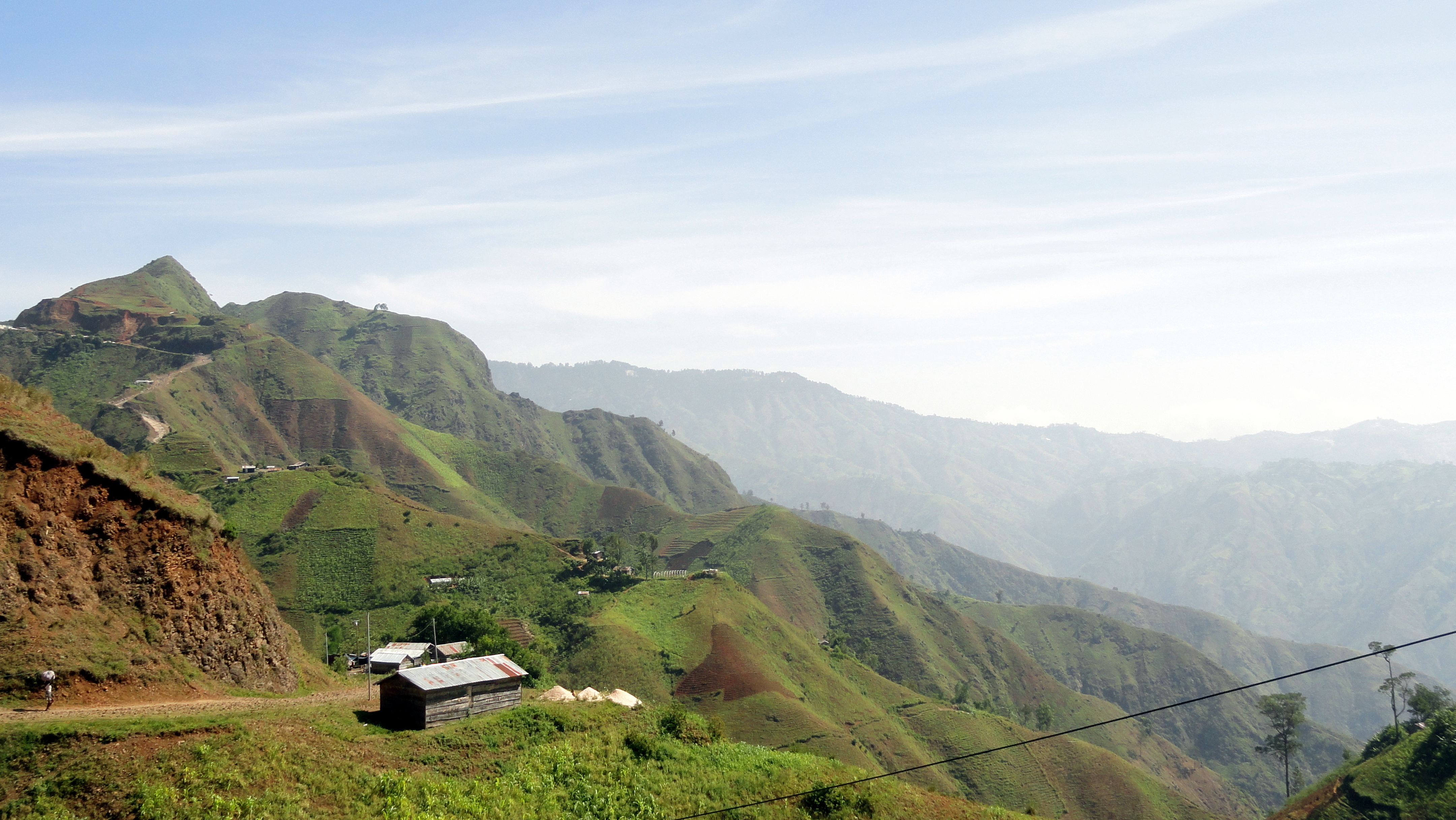
In this shot below, plus the one at the very end and a few others scattered through the post, you’ll see these rock-strewn hillsides. My current suspicion is that this is the result of erosion — deforestation, as we know, has led to a lot of Haiti’s topsoil being washed into the ocean. I figure these rocks may have become more and more exposed, as the topsoil has washed away…but again it’s something I’ve not checked into. They make for an interesting sight, though, eh?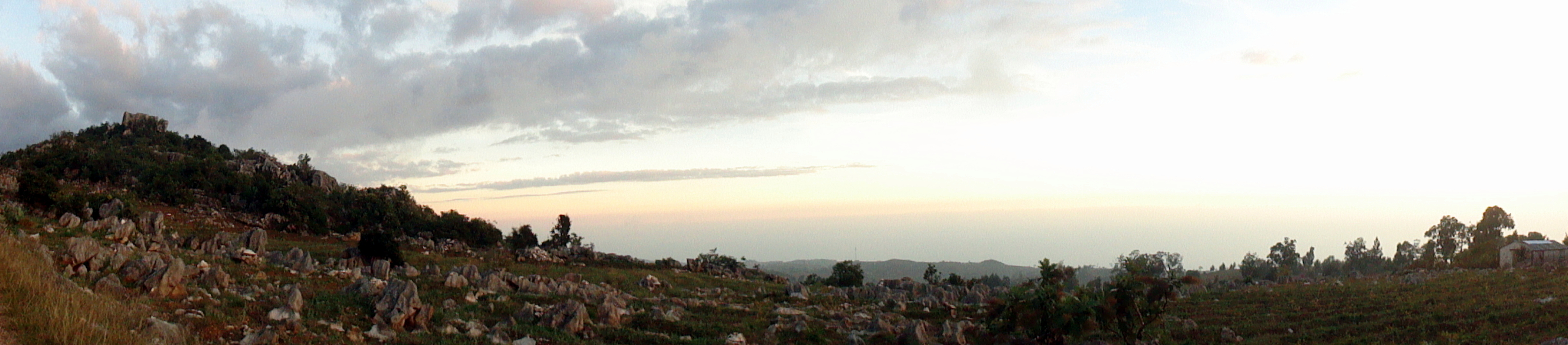


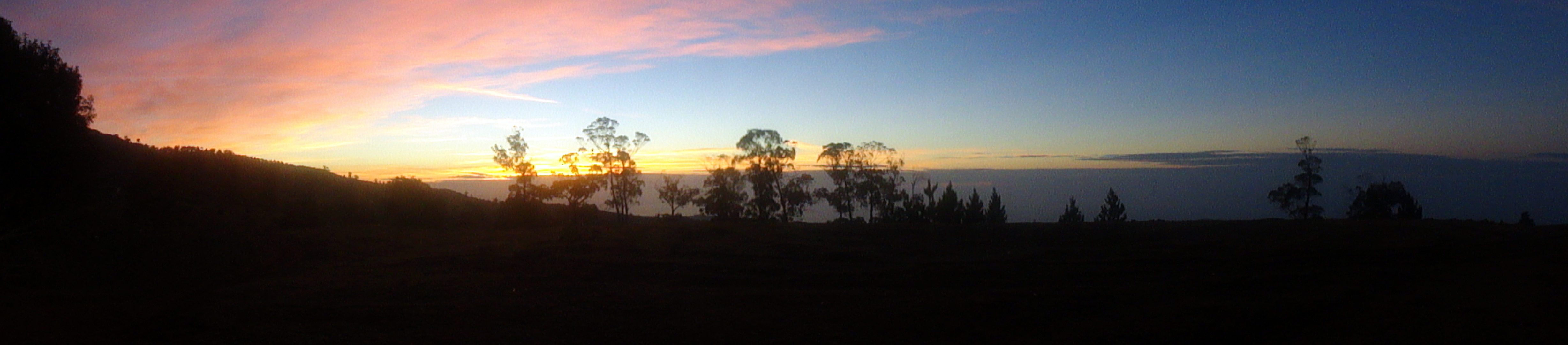

Walking to La Visite

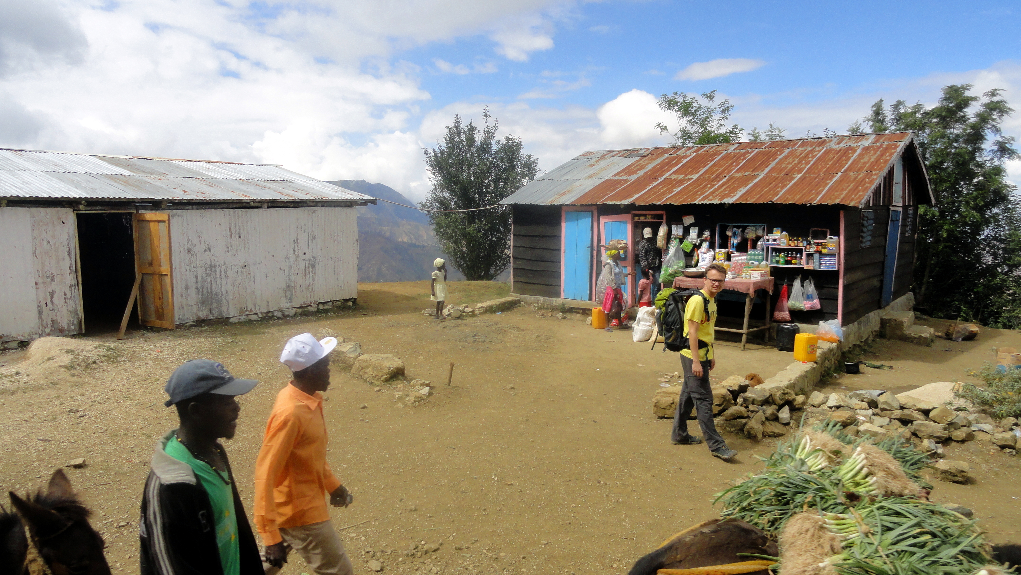
 A thing I learned long ago is that Haiti is almost entirely deforested. In the last post I put up, from a short trip I took up the coast to Arcahaie (about an hour north of PaP), you could see evidence of this fact in the hills I showed. And PaP too is nearly treeless – and full of cars, people, and dust at this time of year. Last weekend four colleagues and I drove to a town about an hour south of PaP, beyond Kenscoff village high in the mountains at the southern base of PaP, to a point where even a good 4wd vehicle really won’t be able to cover the road any more. (As we learned in our onward walk, motorcycles DO make the onward journey, though it’s not one I’d relish making that way.) In any case, the point of being deposited in this little town is that one can – and every weekend some handful of expats living in the capital, and apparently some straight-up tourists as well – do get dropped off in that town and start the walk further south, aiming to end up (after four or five hours of walking in hot sun on mostly shade-free road) and spend the night at what turns out to be quite a lovely little guesthouse set inside what’s now Parc Nationale La Visite. One reads, in a lovely coffee-table book available for sale at the guest house, that the national park is recently created, and that less than 2% of Haiti’s forest is protected. During the visit we played cards and chatted a bit with another American guy who’s part of a program to pay landowners to not cut down their trees for firewood or to sell for making charcoal, construction, etc.
As you’ll see in these shots, the deforested steep mountainsides can certainly be beautiful…but look closely and you’ll also see apparent evidence of erosion, and of rocks left behind in landslides. (Some of the rocks seemed to be eroded lava from more ancient flows, but I’m no geologist so I might be quite wrong.) We wondered how much longer before all the top soil washes into the sea…and without trees to rot and replace it, what will be left? Again, not my area of expertise, but when I consider the amount of agricultural products I saw being carried on people’s heads or panniers on mules, and which we ate during our short stay at the guest house, I hope enough is retained to keep providing PaP etc. with food to eat. (That handful of expats hiking the road weaves into a much larger stream of foot, mule and motorcycle traffic, much of which is clearly geared at getting nice fresh produce to market.) For us it was mainly a lovely 2 days of walking and enjoying beautiful vistas and some stretches of forest which, without realizing it, we’d all grown to miss during our weeks and months on the dusty, busy streets of PaP. I did edit the photos, but not enough, I acknowledge. Sorry – after weeks with little but buildings to look at, I got a bit shutter-happy.

You’ll notice these three shots in a row show the same things from different angles and perspectives. My attempt to give a sense of how things fit together in this steep mountainous zone of windy roads...


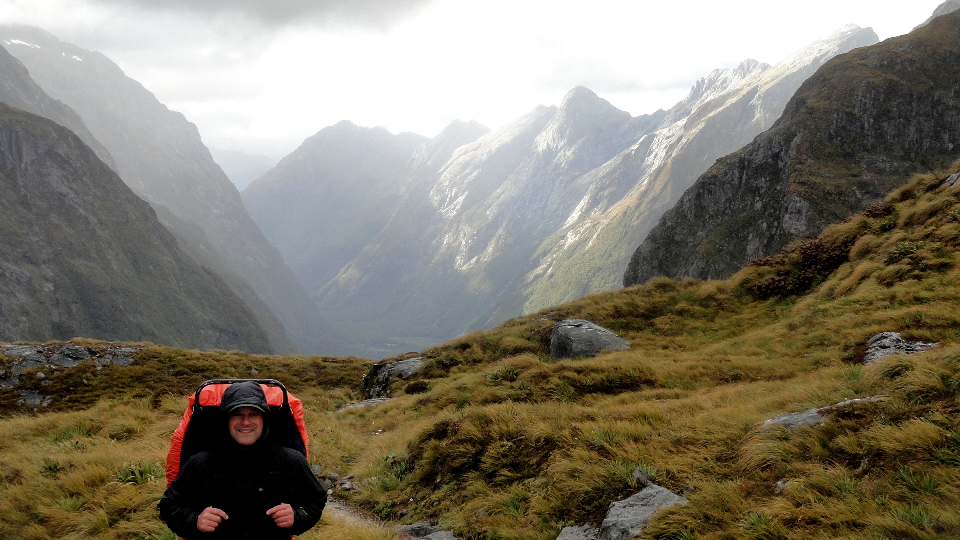
Many Muddy Misty Magnificent Miles on the Milford Track

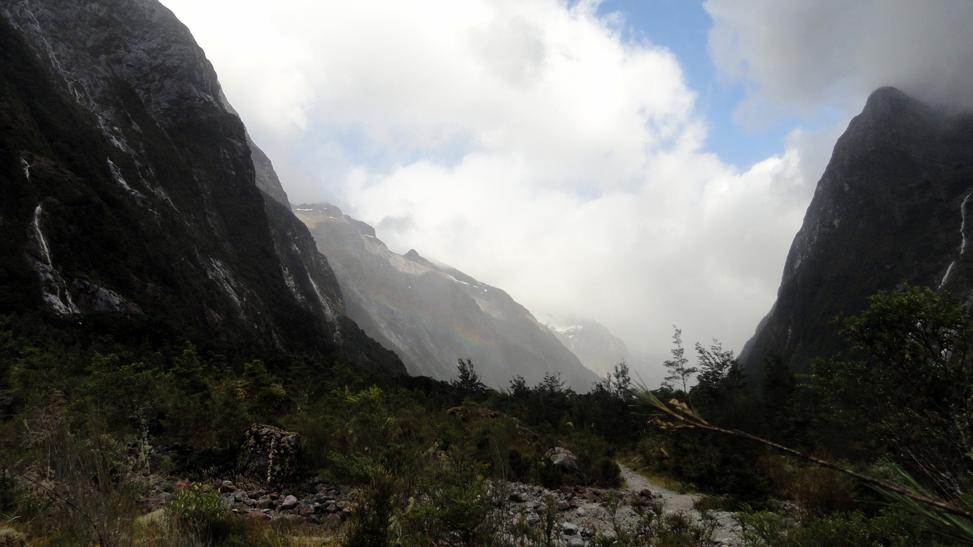
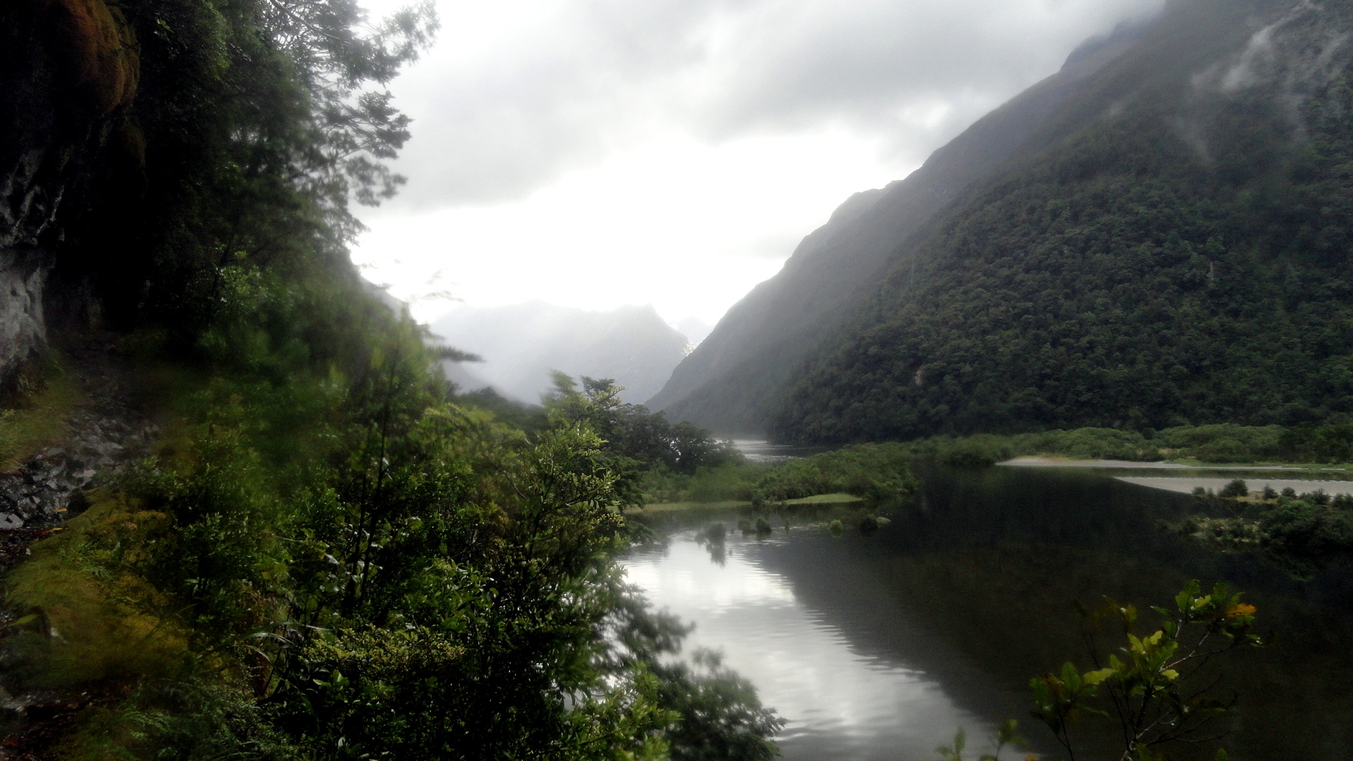
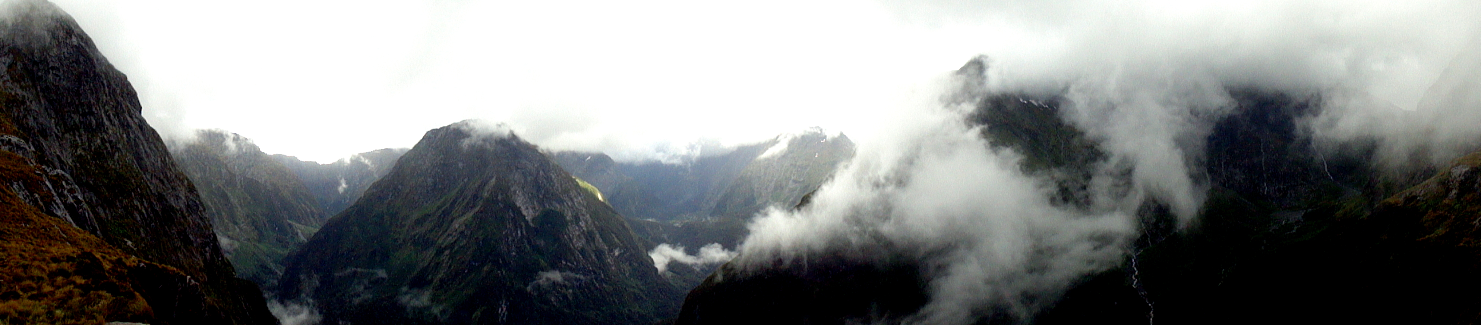
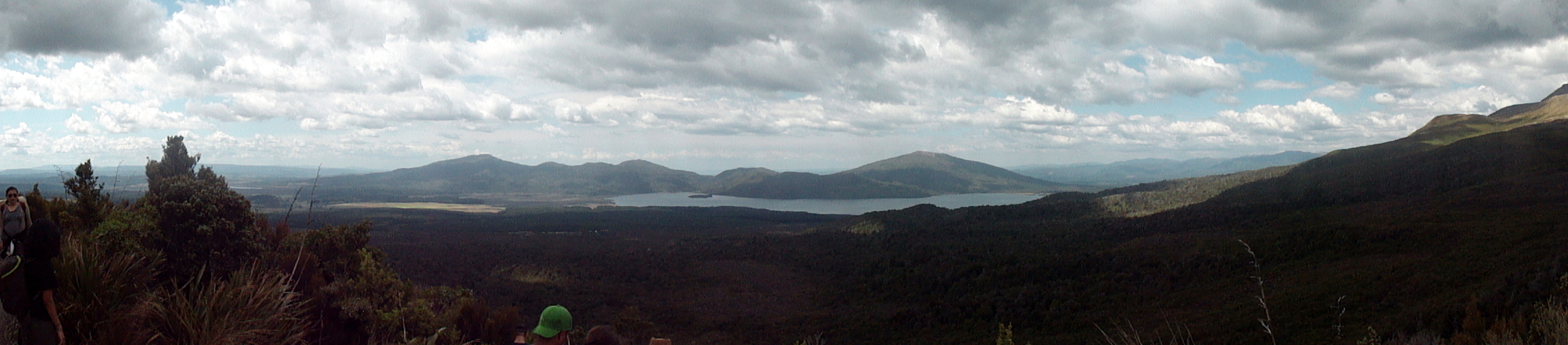
 The Milford Track is the most famous, and most popular, of the Great Walks. It starts at the bottom of the Clinton Valley, formed by the eponymous river which features a few times in the gallery of square photos further down. The first two nights of the three-night, four-day hike are spent within the Clinton Valley, hiking from the boat drop at the northernmost end of Lake Te Anau where the Clinton River feeds it, up to McKinnon Pass where the images above and the whole slide show below were taken. After the slide show, you’ll see a variety of views from other sections of the trail: rivers, waterfalls, dramatic valleys and trail segments snuggled into a rock face alongside the Arthur River at the end of the track, where it meets up with Milford Sound. Milford Sound has been cited by many magazines as one of the most beautiful places on earth; and Milford Track as has been cited as one of the most spectacular hikes on earth. I certainly found McKinnon pass to be one of the most spectacular places I’ve ever seen, and I found many of the miles along the Clinton Valley quite beautiful in an ever-changing, other-worldly manner that was different yet again from the other-worldliness of the glaciers featured in my last post.
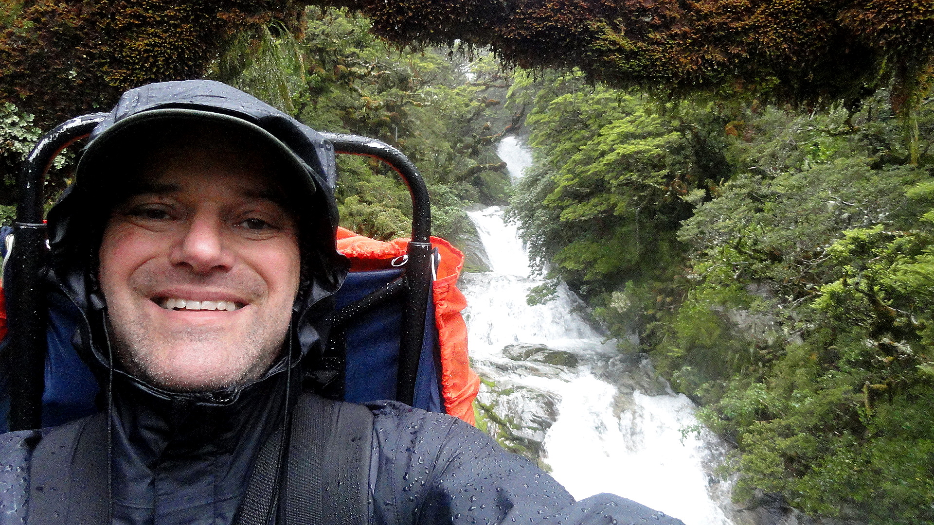
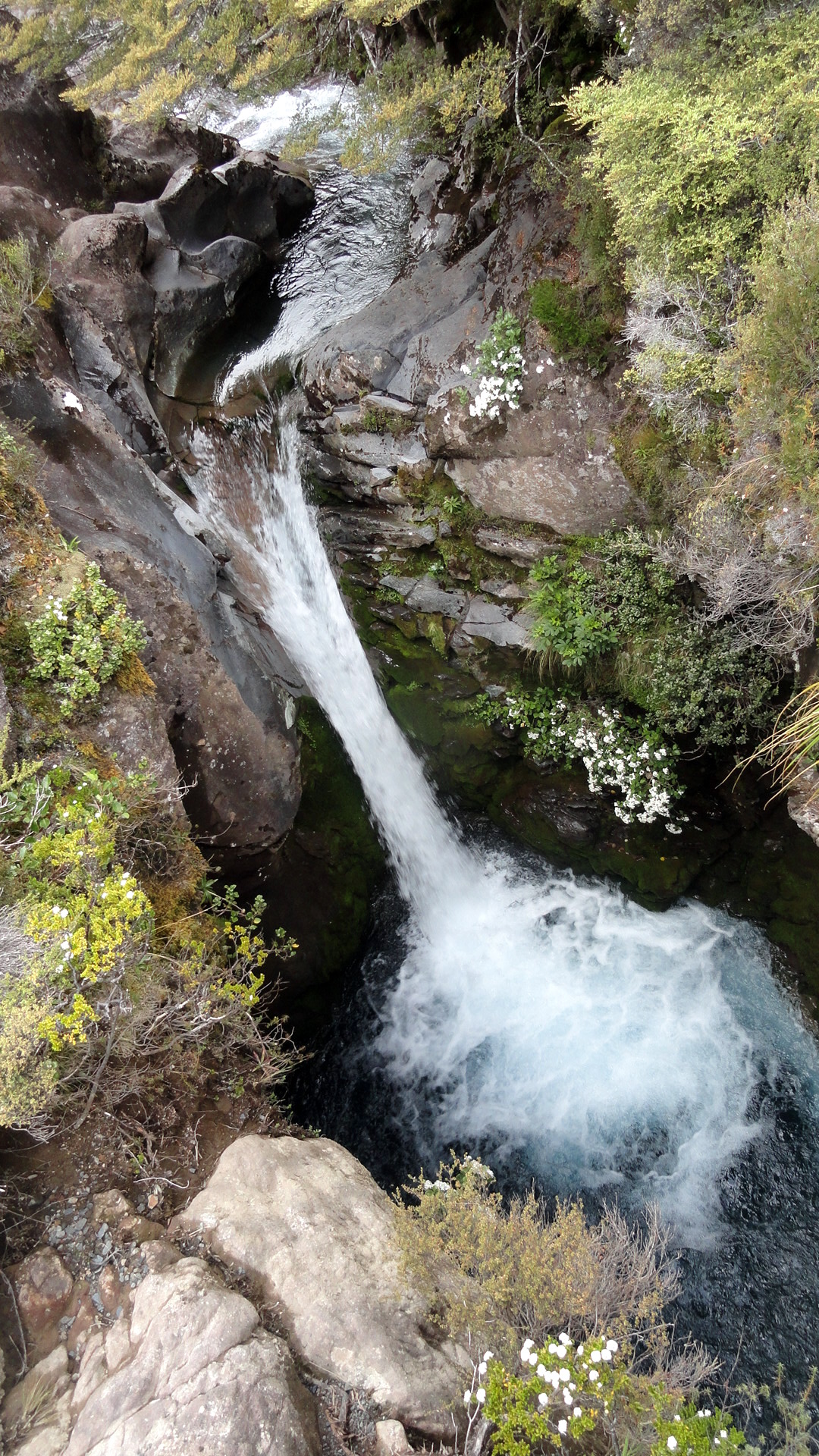
But allow me to say this, of the Milford Track: it is indescribably wet. We hiked it in the midst of the southern summer, during peak season. Peak season is also, strangely, the rainiest season; but even the driest season has plenty of rain. And the drier winter season is, we were told, the season of such landslides as the one just below where you see the trail marker placed to navigate walkers across the rubble field. I can imagine that a mostly-dry hike over this trail would be an unbelievably great experience. And I can certainly attest the truth of that oft-quoted adage that rain makes waterfalls, which are the joy of the trail. But can I just say that my own brain can only really appreciate xx-many waterfalls, and after a certain point both my feet and my soul wish to be dry, warm and comfortable again? So I ended this trail – which, indeed, gave me more spectacular scenery than most other hikes I’ve done – with the sense that it won’t likely call to me again…whereas the Abel Tasman, for all its comparatively mundane (hah!) scenery, is one I’d readily return to again and again – in part because it’s just so much more warm and comfortable as a hiking experience. (Even the Kepler, another Great Walk within the extraordinary Fiordland National Park, showcases a wider range of terrain with a lower preponderance of heavily rainy days — witness this post: https://somuchworldsolittletime.wordpress.com/2009/03/05/kepler-track-fiordland-national-park/
But don’t get me wrong: even the most amazing of these photos (some of which still give me vertigo) can’t convey the gift of being present to feel and hear the roar of wind and rain, marvel at the shifting windows of sunlight along a mountainside, or see a rainbow materialize above one of those windows…with the sense perhaps you’re the only human positioned so as to appreciate that particular ephemeral wonder. Whatever the case, I encourage anyone who loves the great outdoors and appreciates natural beauty to bump NZ up your must-visit list, if you’ve not done so already. Feel free to research on this blog (from 2009, 2013-14, and 2015!) some of the many wonders you might consider experiencing in person. Enjoy. 🙂
…about the blurry spots you’ll see in some of the rainier images: my camera has survived but there were days where the lens never really got dry. Most of the rain-splattered photos are deleted, but I felt some of these convey what words cannot about the omnipresence of water at times…


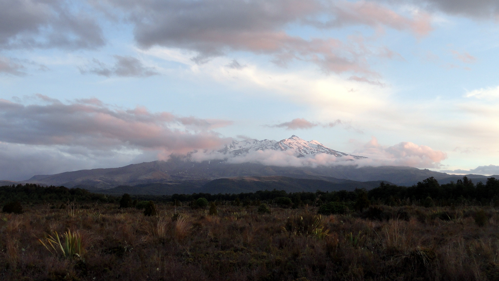
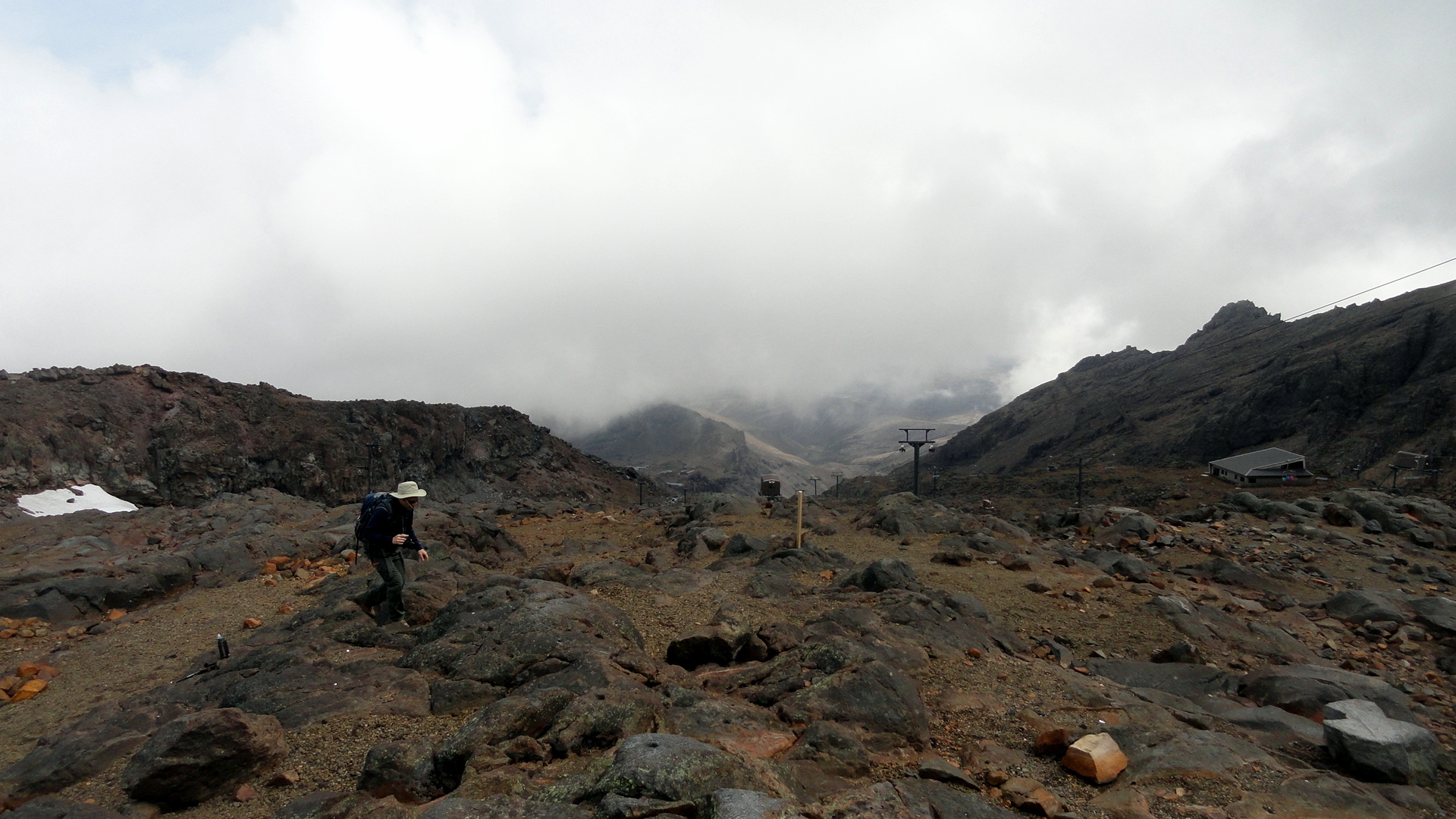
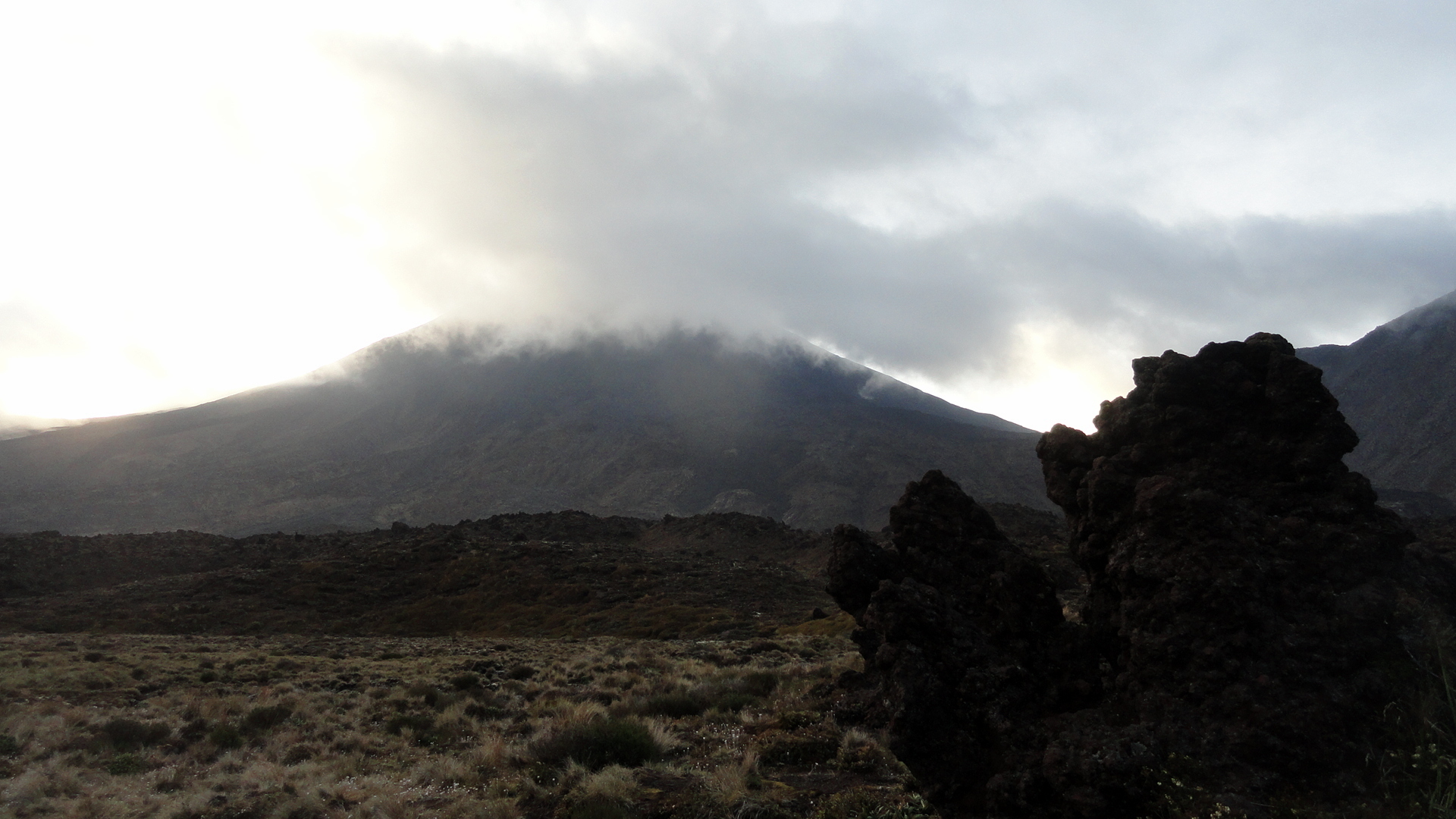
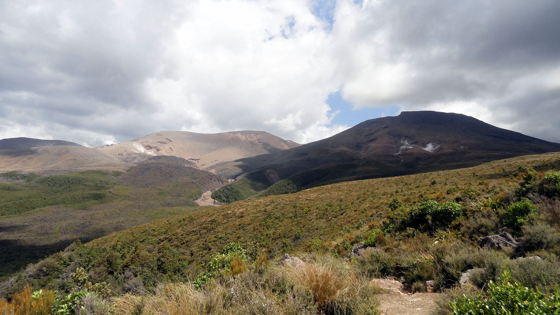
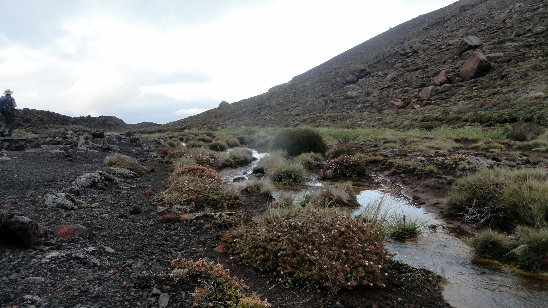
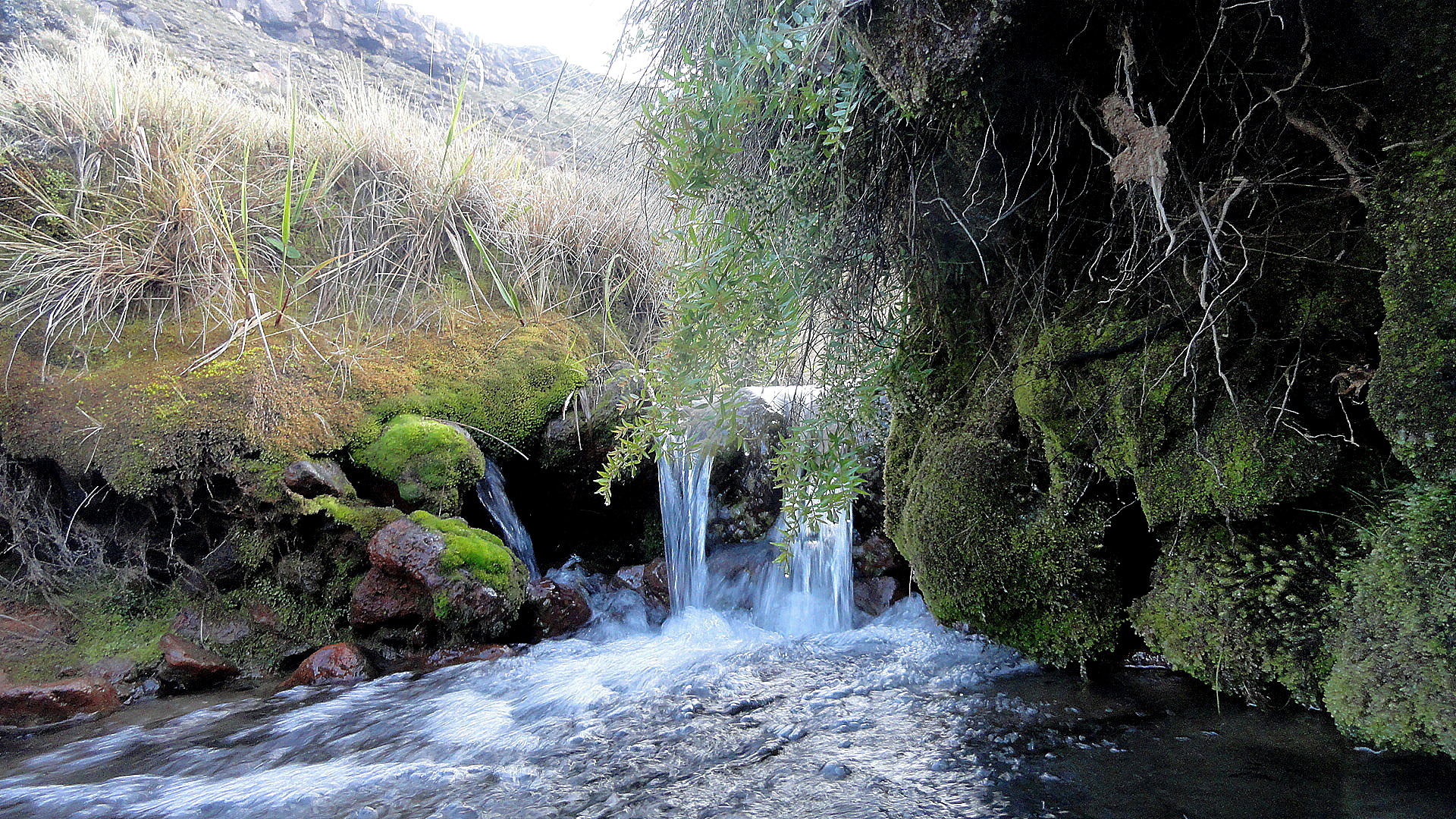
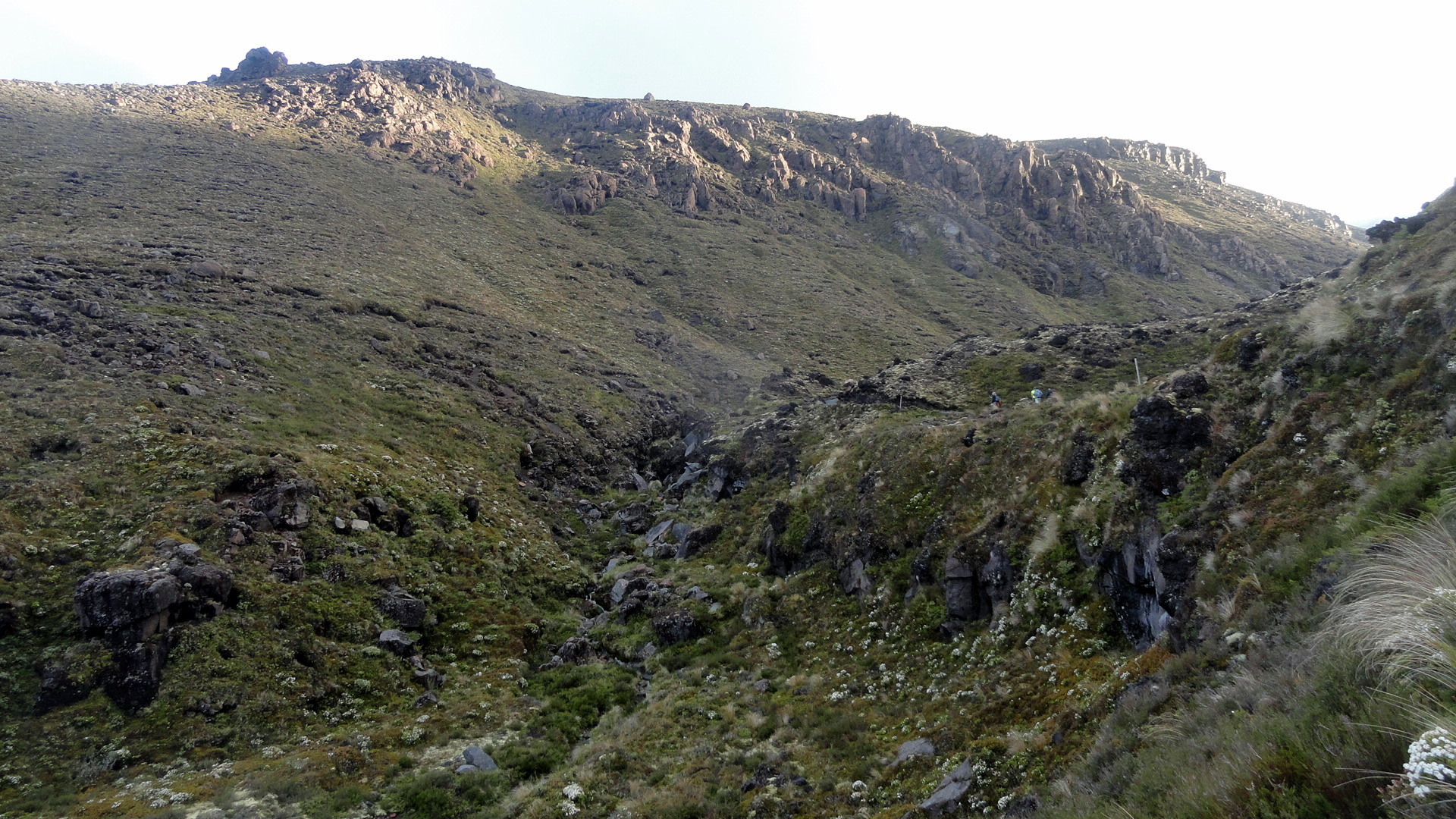
The Many Moods of Mt Ruapehu
…and other views from Tongariro National Park, a place which can truly and safely be described as otherworldly. One factor that makes it a world heritage site is the presence of three volcanoes right next to each other. You will see more than you want of these three, in this post…sorry. The moods and clouds, the light and colors just change so often that when one is there one just can’t stop! I am blessed now to have visited New Zealand three times, and I am going to work my way through the (too) many photos I took there roughly in chronological order: this was the first major place our group visited as part of the big Howard’s-turning-50 tour. What a great start! (Btw if you’d like to see Tongariro in other moods, and more shots from the top part of the Tongariro Crossing day hike, check out the post from my last visit, which is here: https://somuchworldsolittletime.wordpress.com/2009/03/05/tongariro-crossing-the-summit-of-mt-doom/)
I won’t say much here. NZ is so lovely and so endlessly various and fascinating that the photos better speak for themselves or I’m not doing my job right. For those curious, I’m back and settled in the bay area, in great health thanks, and trying to put down some roots here in the this intermezzo before the start of my next assignment…about which more, when the time is right :-). Peace. Oh, and btw: linger on the shots below: it’s a slide show of Ruapehu, which is sort of currently the biggest, though not the oldest, of these three volcanoes – and one that I explored in more detail this time than when I was last there, from up close. (More on that further down.) All the photos have names which pretty well identify them.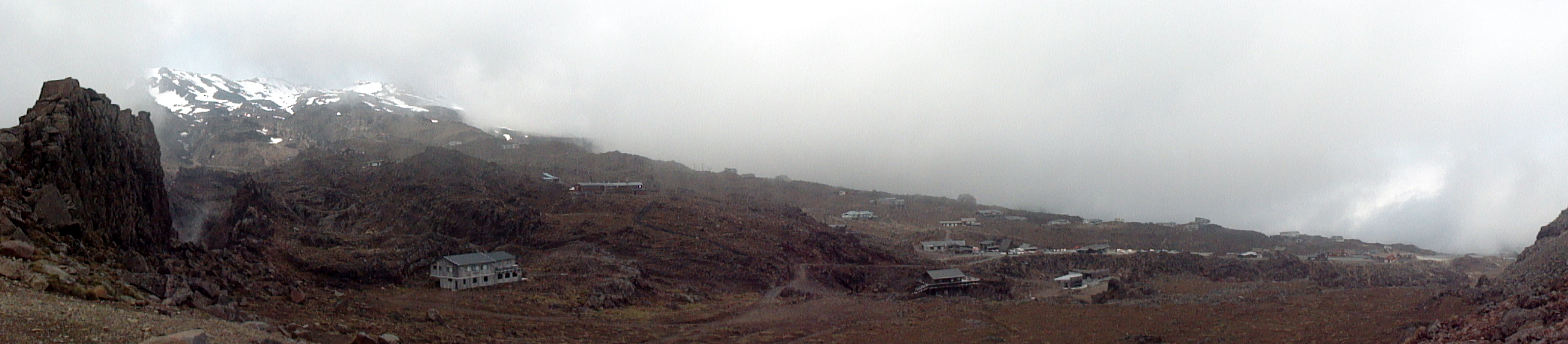


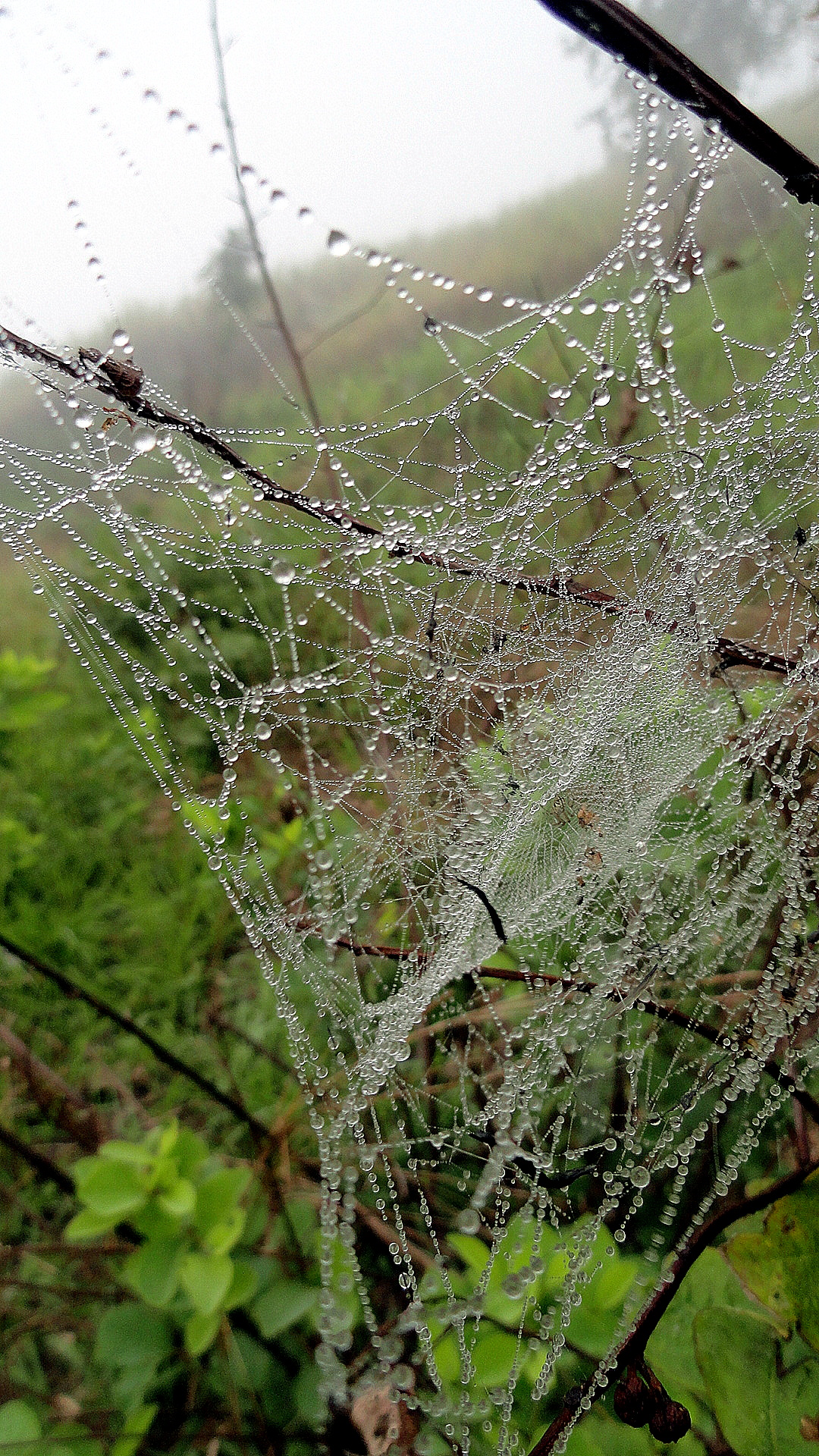
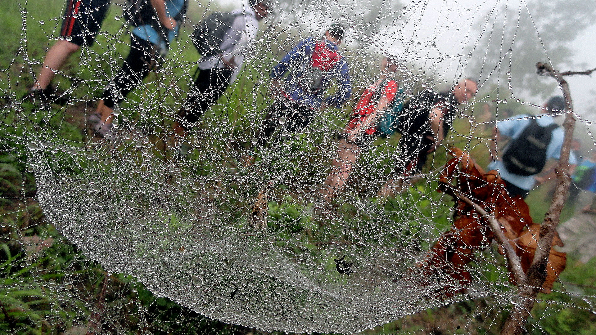
Spiderwebs on a Misty Hike…and One Dead Computer

Let me please begin by stating again that this is not a work blog, that this is my own personal photo-driven reflection of where I am, who I am now (how much or little fuzz there is on the top of my head or around my cheeks, etc.), so that my friends and family can keep track when I am away for long periods of time…as has been true most of the time quite a while.
Still and all, I am a person who works. A person for whom work occupies a tremendously large place in my life; a person who works for an organization whose accomplishments and principles make me proud. And a person who happens to be where he is, more often than not, because that’s where work has sent me. And let me just say, as I have a few times in recent months, that work has been filling my days quite full. My general rule is that if something about the work I’m engaged in has made the public media sphere, then I can share it on here.
So it’s known here in PNG that MSF’s first project responding to family & sexual violence in PNG, based in Lae, handed over back to the hospital within which it’s based. The handover ceremony was on 21st June, and I was nicely quoted in the media and received a few lovely gifts and very kind words of appreciation on behalf of our many hardworking colleagues. I also took a lot of pictures. The pictures showed wonderful cultural sights, dancers who danced along the road to the FSC (family support centre) where I handed over the key to the Deputy Secretary for Health…the dancers were made up and dressed beautifully, one presumes in the style of Morobe Province. The dancers sang “MSF” and various other things as they danced along the road. I have…had…wonderful pictures of these dancers! And of me posing with them!
…Until I needed to spend a few days in a new places here in POM, helping the project team for our new project settle into their new digs. You know, helping hand kind of thing. You can imagine, new place and new habits and your usual patterns fall apart and you do something F***ING idiotic like…put all your stuff from yoru overnight back in the bottom of the one wardrobe in your temporary bedroom and there’s no desk, but you want your wet tennis gear to dry overnight, so you hang it on the hangers in the … one wardrobe … where they drip … onto your computer … onto which you’ve transferred the photos from the Lae handover and, in a fit of organization deleted them from the SD card in the camera … and your computer fries, completely, battery eroded. I suspect the dripped sweat from the tennis gear was just the final straw after the humidity of PNG, but that’s one fine and expensive laptop down and dead, and one set of lovely photos sadly lost and no longer share-able. Sorry, folks.

I can, however, share with you a few more links to very public things we’ve been saying about our work, my colleagues and I. Links to quite a few of them are below, and do note that one of them has links to both TV and radio coverage.
http://www.abc.net.au/pm/content/2013/s3799424.htm
http://www.guardian.co.uk/world/2013/jul/05/papua-new-guinea-abuse-clinic
http://www.rnzi.com/pages/news.php?op=read&id=77420
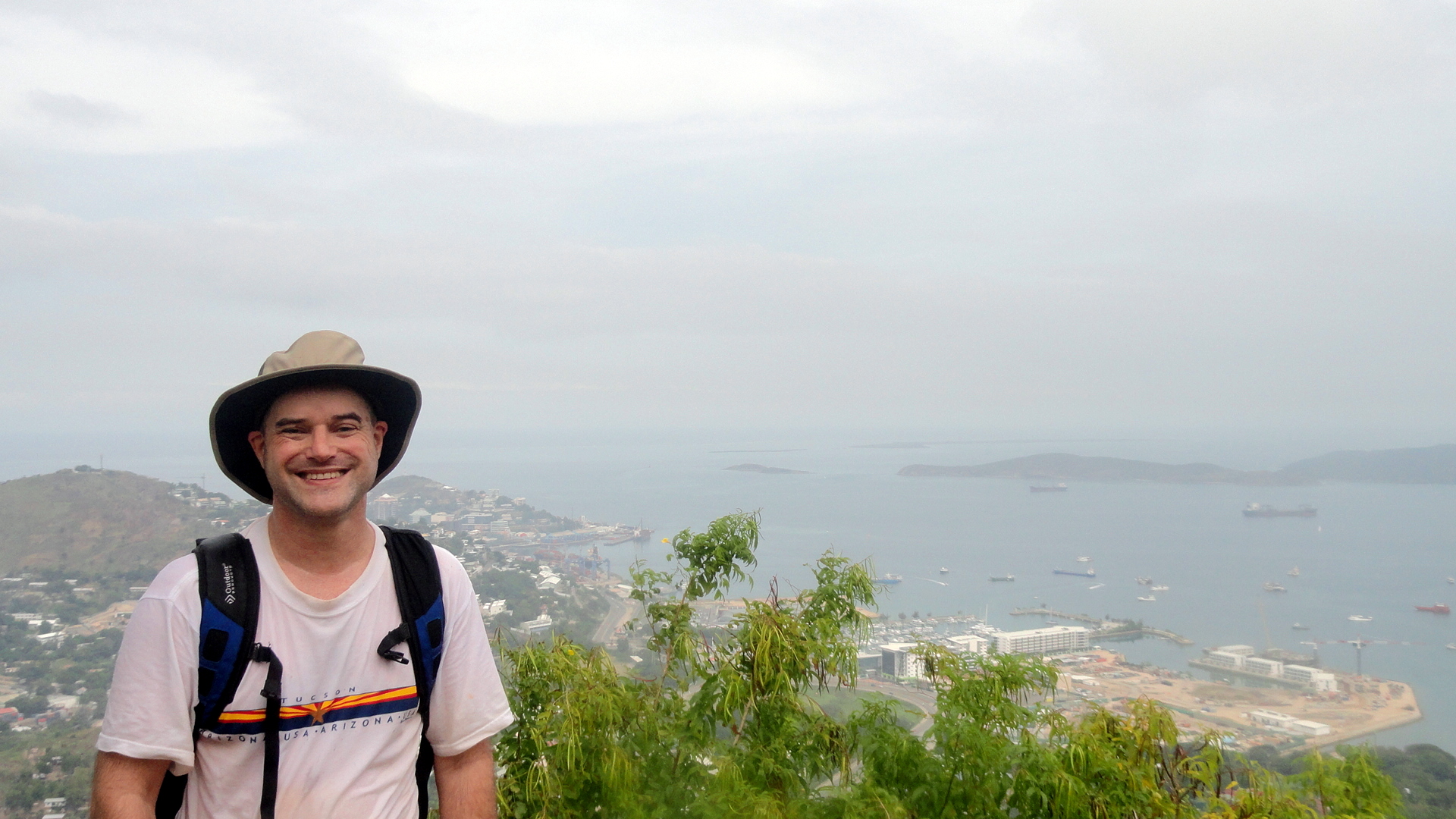
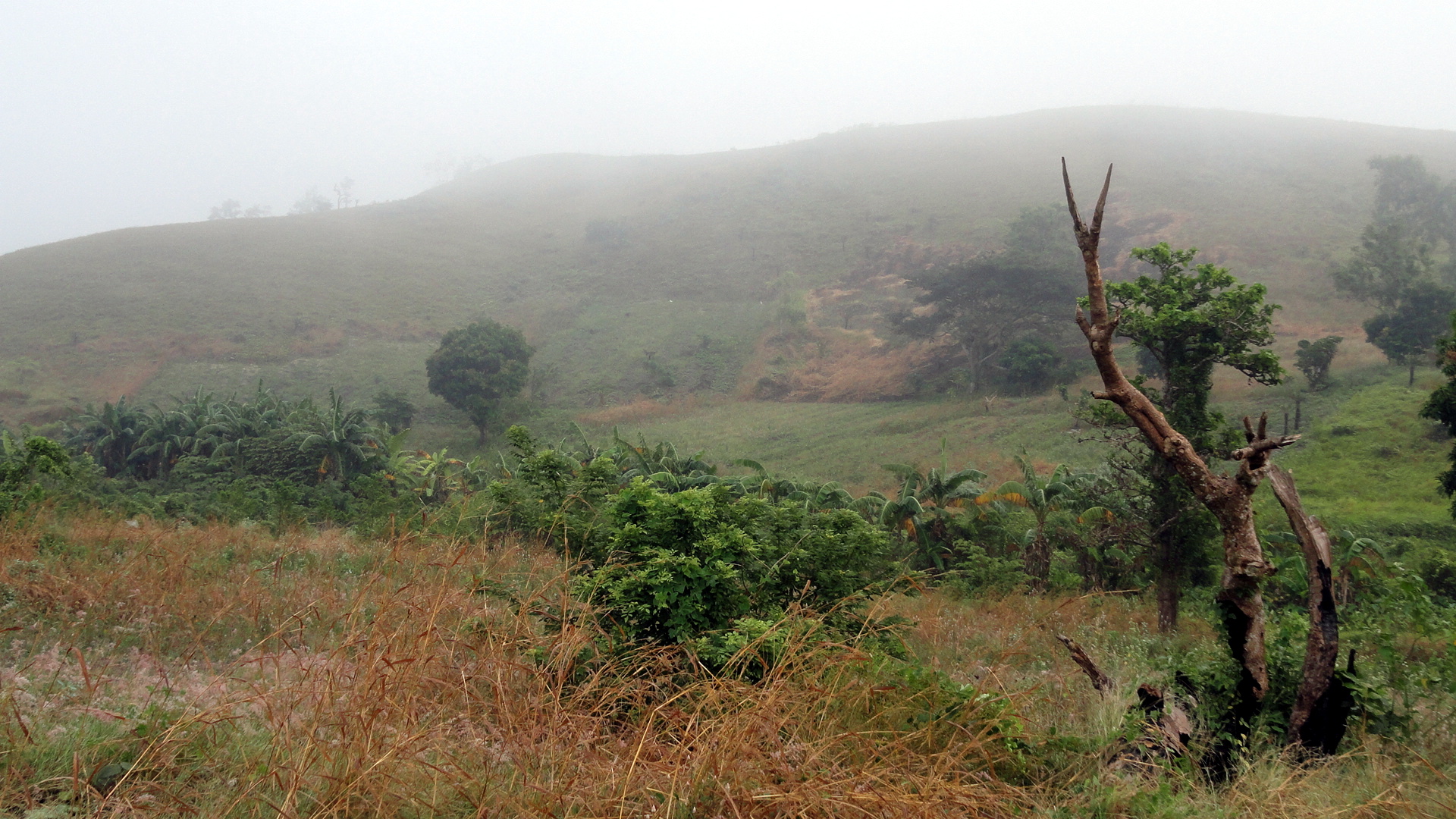
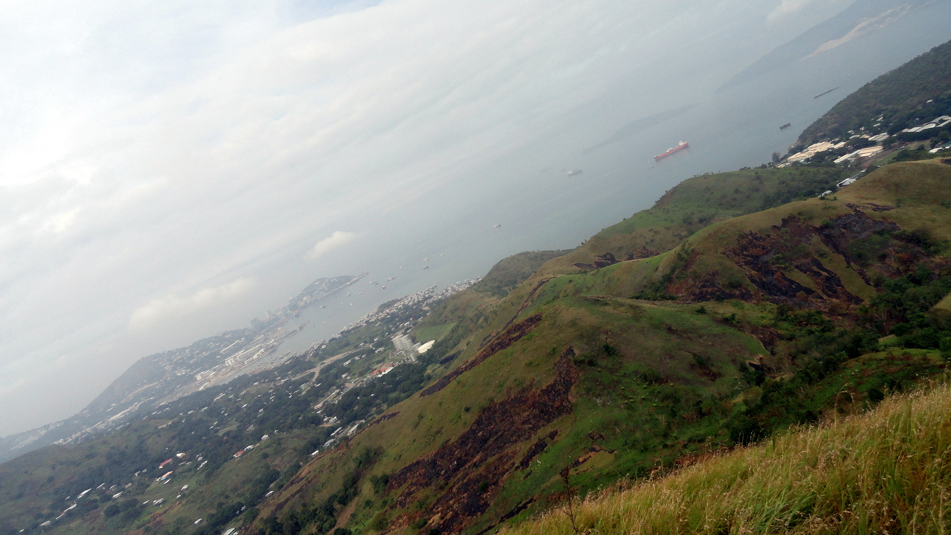
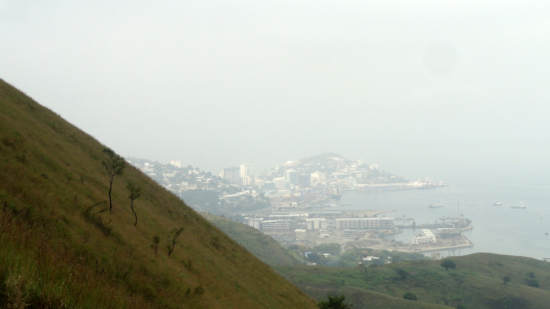
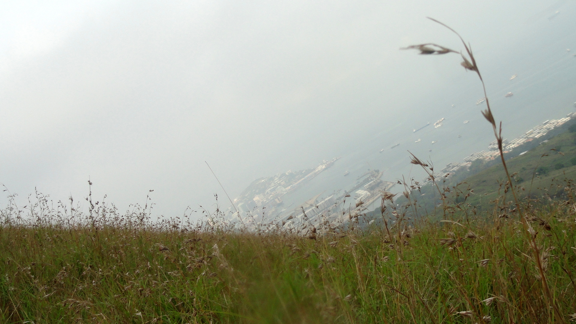
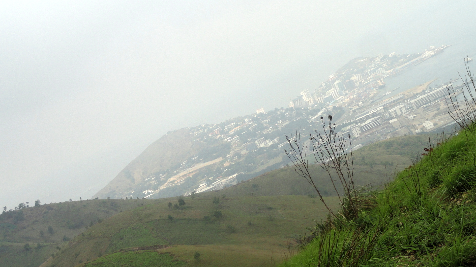
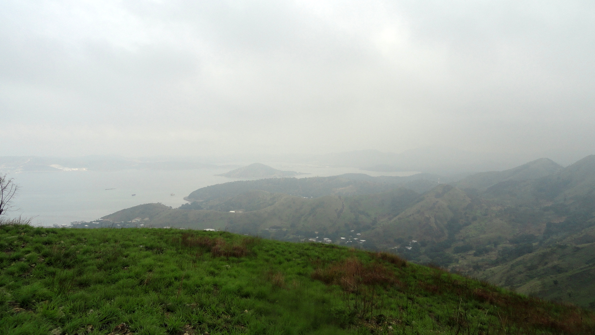
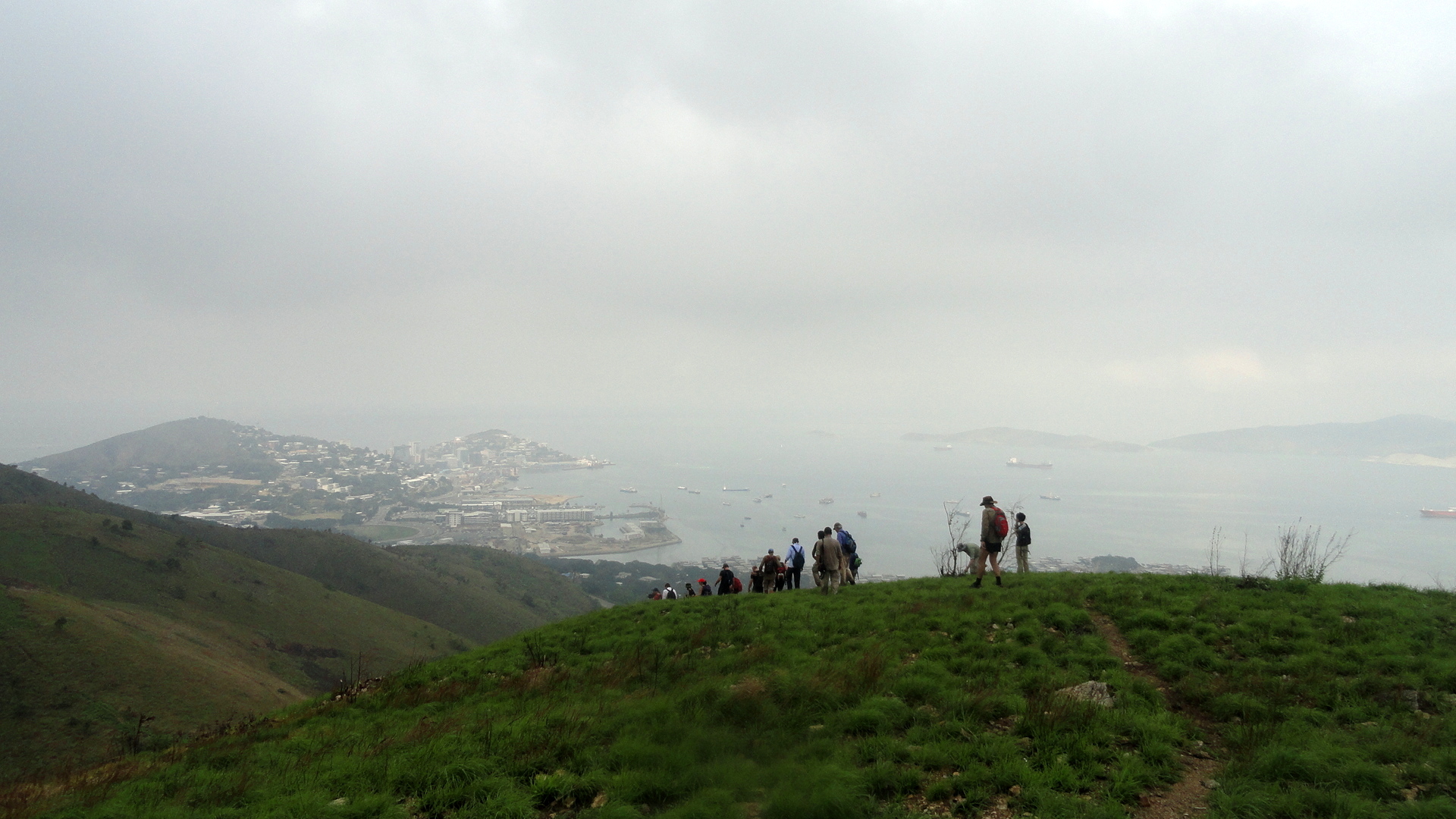
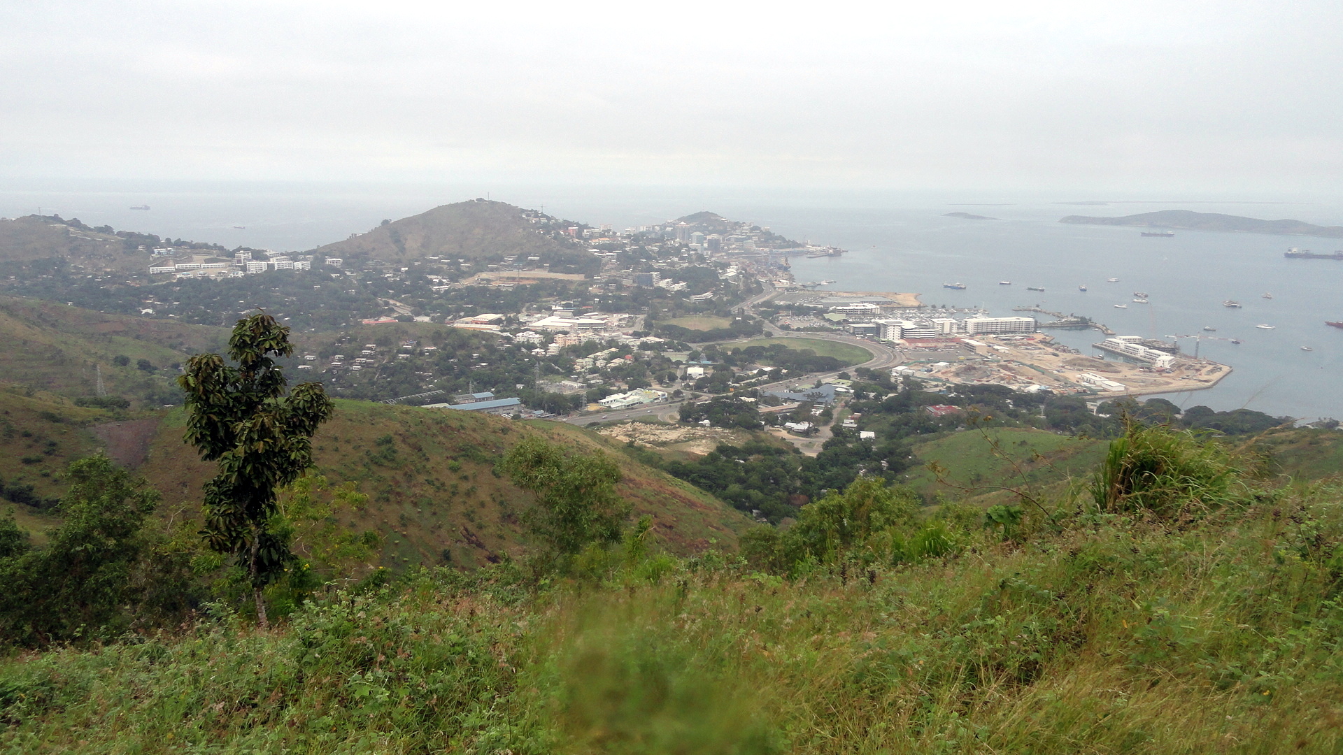
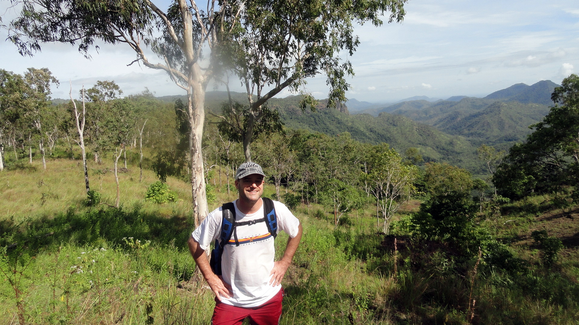
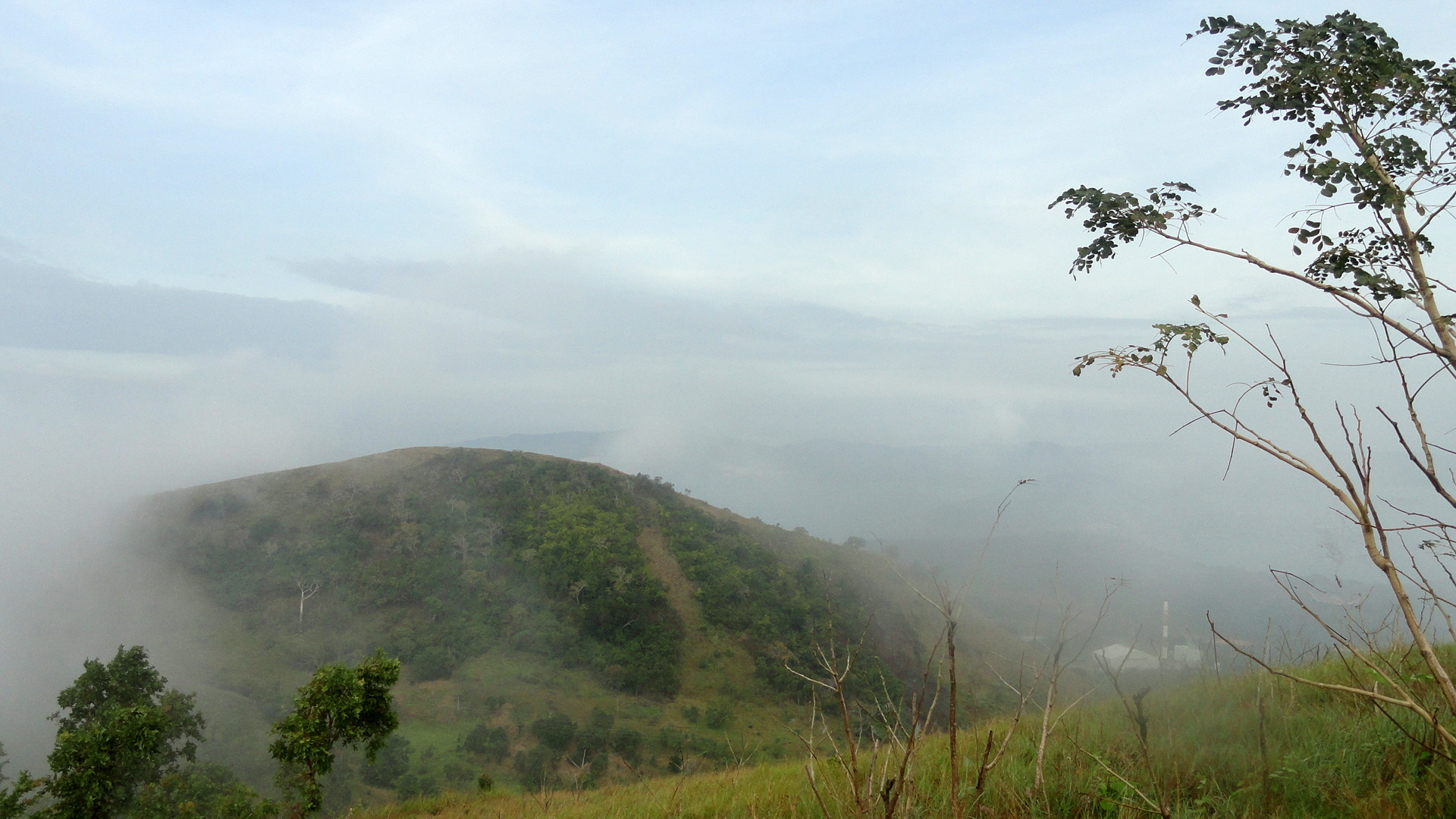 And I can share these new photos I made on last week’s POM Bushwalker hike: further view of Port Moresby, taken from a hike entirely within the greater POM area, from close to where I live up and over the ridges to Burns Peak at the edge of downtown. It’s from the road that goes through the pass next to Burns Peak that many of the lovely views of the harbor that appeared here a few weeks ago were taken. The start of the hike was wonderfully atmospheric because of the heaviest low-lying fog I’ve experienced here. It really made for a wonderful mood, although it made the views a bit less clear and spectacular. It also blocked the sun for which we were happy hiking up all those steep hills!


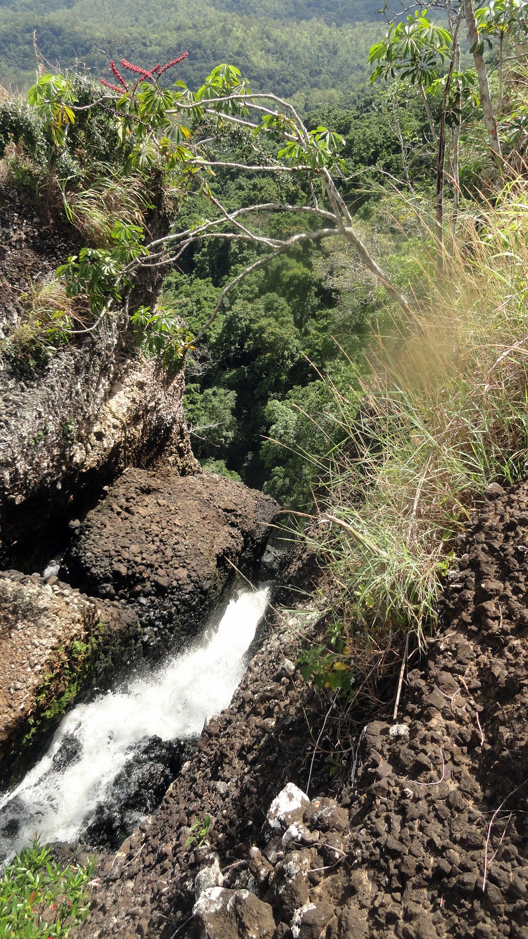
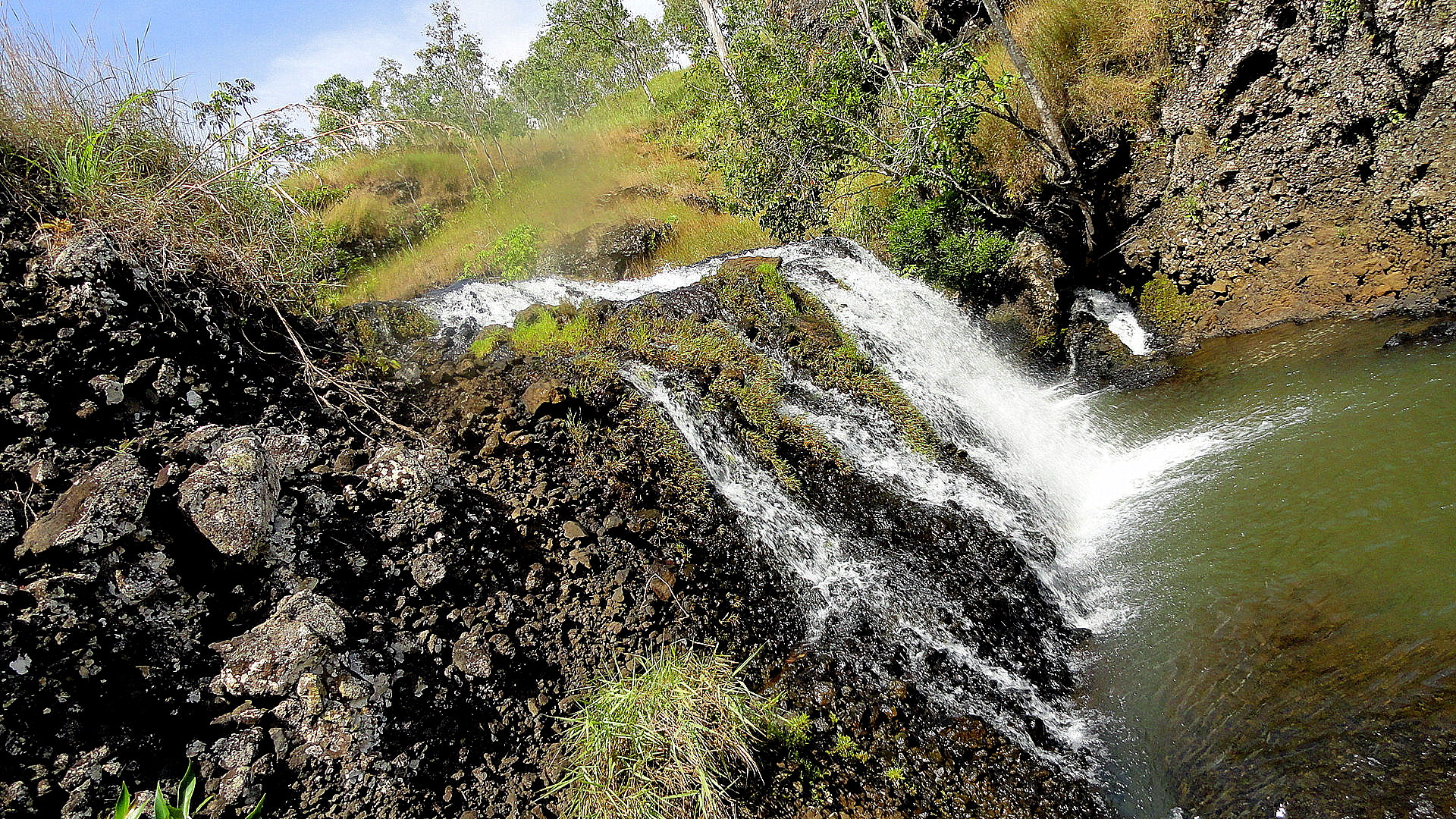
Wandering Past the Cliffs to the Waterfall
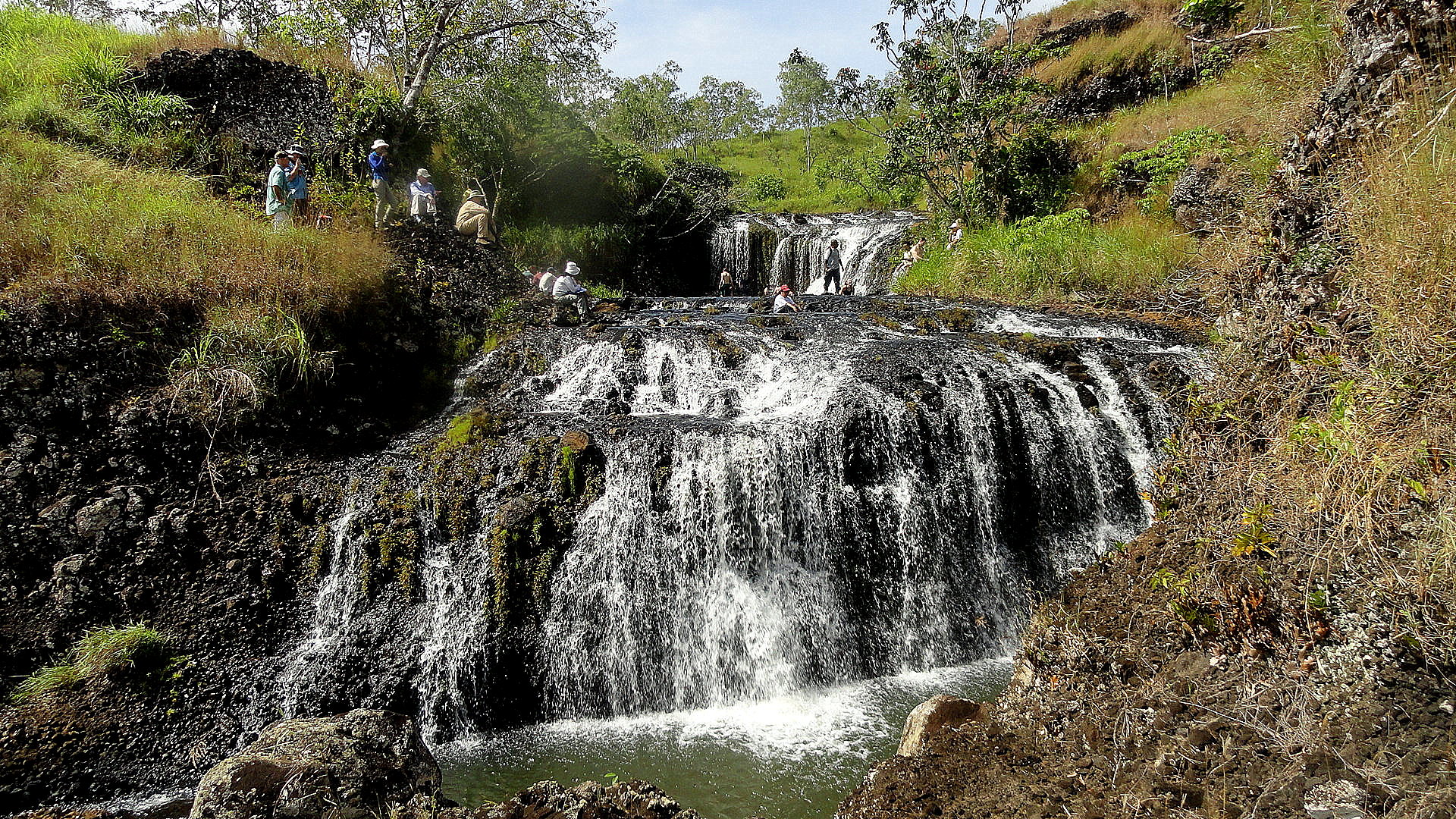
 smw, slt has been back in the hills, able for the first time in very nearly a month to get out and about. It was a gorgeous day – dry season has arrived, so it’s not too terribly hot…which was a real gift, since there was such an enormous group out for this popular hike through a rubber plantation near Port Moresby. With such a large group, after our brief stop at the waterfall you saw above, our group got a wee bit split up and I & some friends ended up with the group that didn’t follow the sanctioned path, and ended up doing a rather fun bit of bush-whacking – fun for some of us, not enjoyable for others who I think found it more than they’d gambled on. I’m glad of the good weather because I would not have enjoyed the bush-whacking in the wet, humid, hot season nearly as much…probably not at all in fact.
 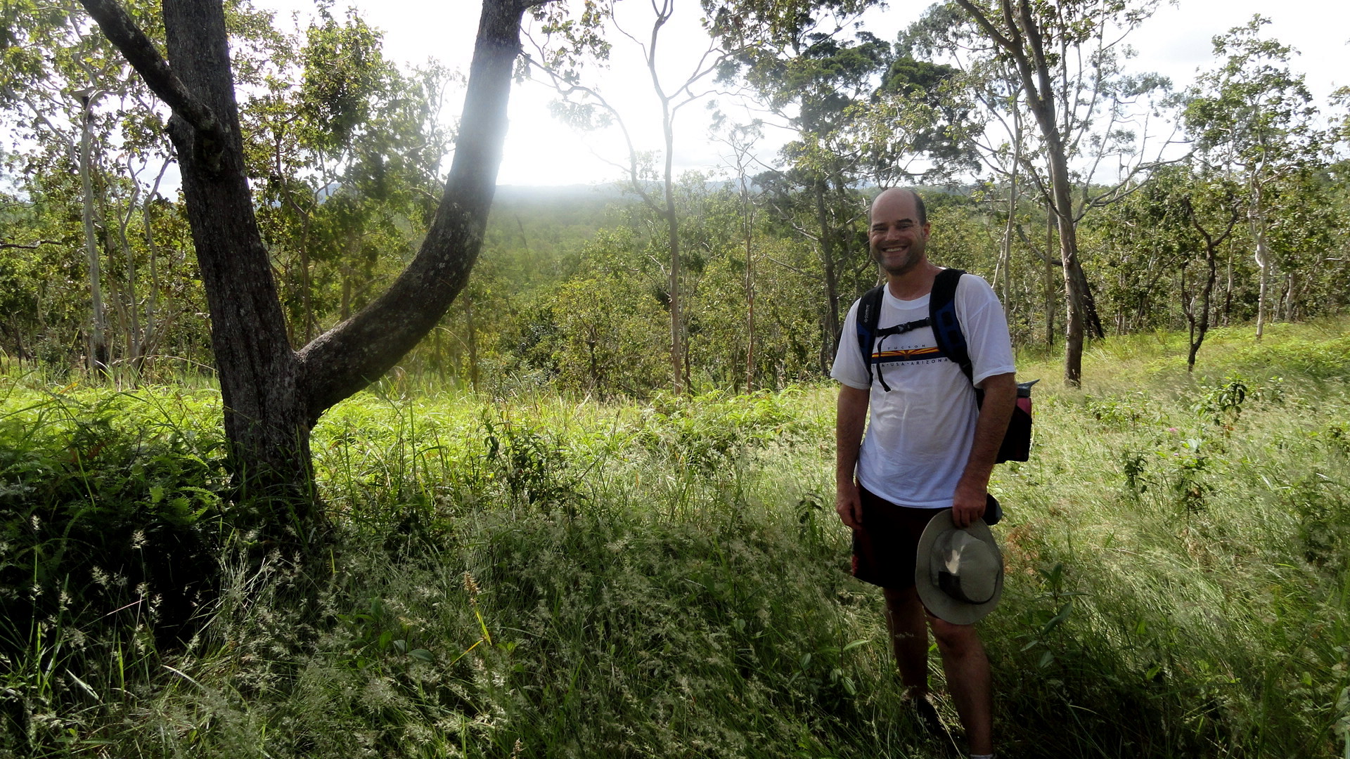 As an aside, I’m sorry I was too wrapped up in a great chat with a(nother) friend to get any photos of the rubber-tapping cups on the trees. But you can always go back here if you wanna see yours truly’s take on rubber trees being tapped: https://somuchworldsolittletime.wordpress.com/2006/08/20/rubber-trees/, from a stroll through another plantation in Malaysia some years ago. If that’s not enough, we’ll likely go to this plantation again and I’ll try to get some more rubber-tree shots for you then…I must also offer a FAR MORE important apology, right: turns out my lens had something on it, which I didn’t notice. I’m hoping it’s not a permanent scratch. I’ve decided most of the pics are still worth showing despite the fuzzy bit, and I hope you agree…this shot immediately below, taken during the up-and-down bushwhacking part that was not in the original plan, is an example. Cross your fingers with me that this is not something permanently on the lens…
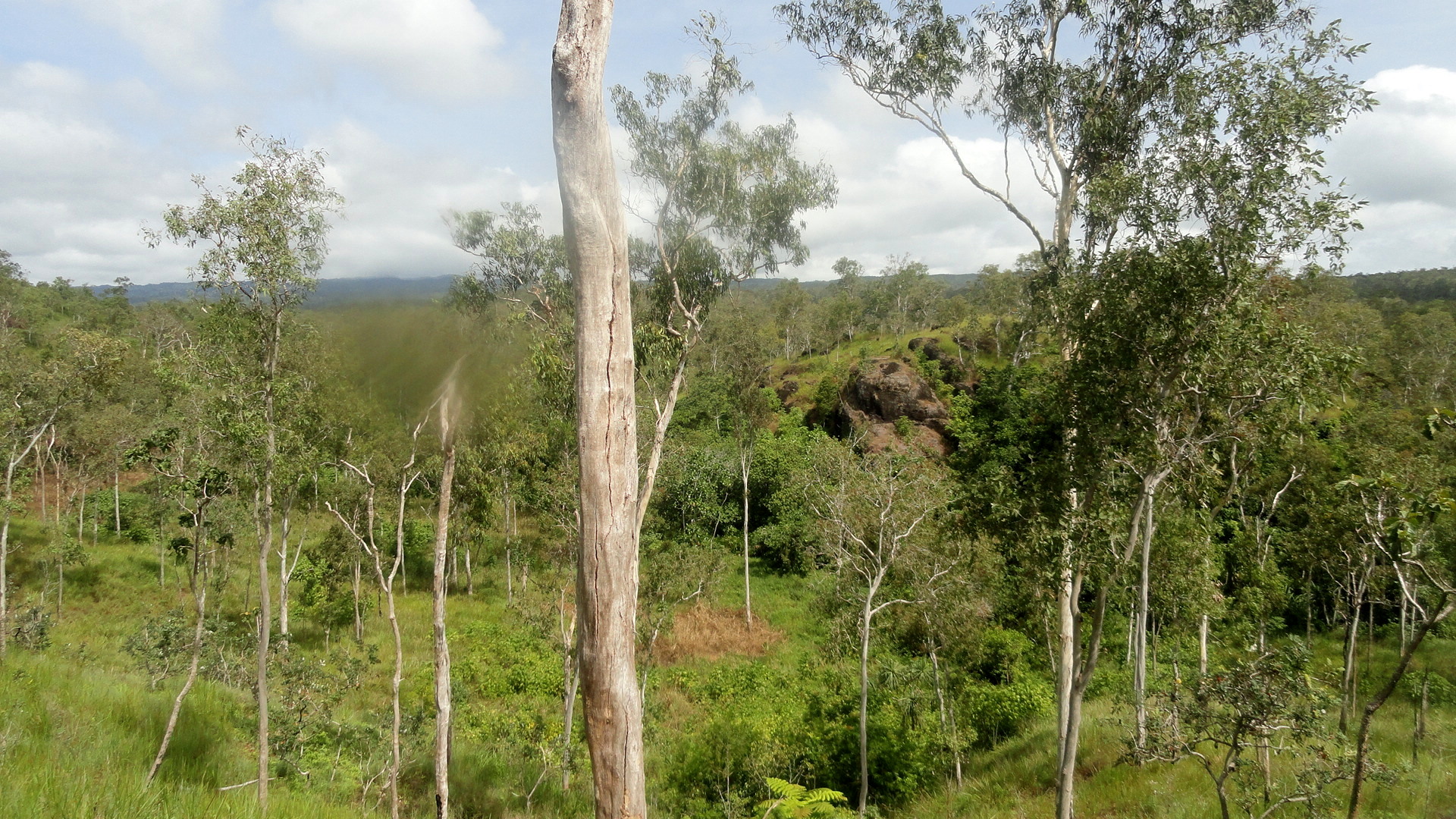
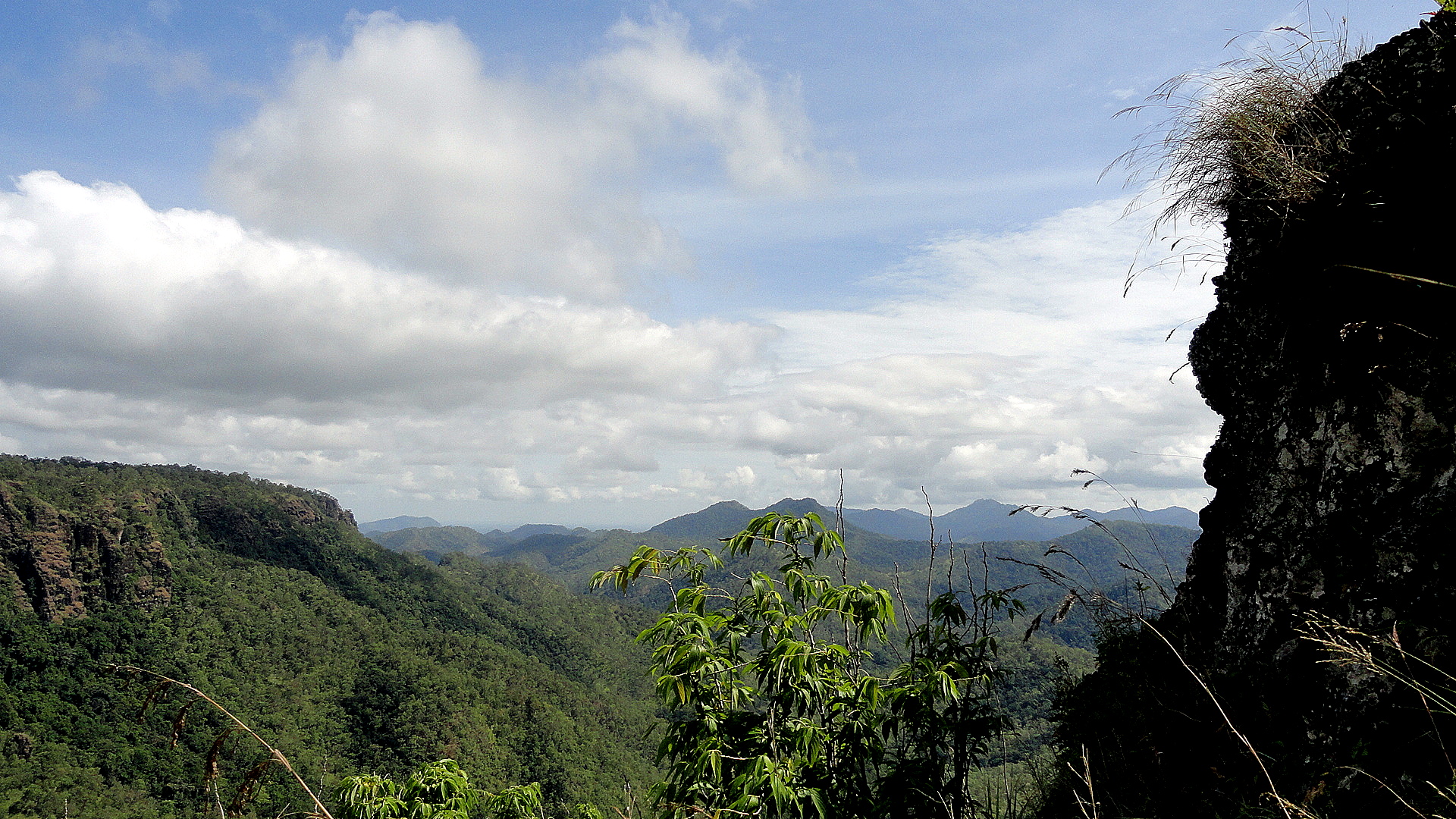
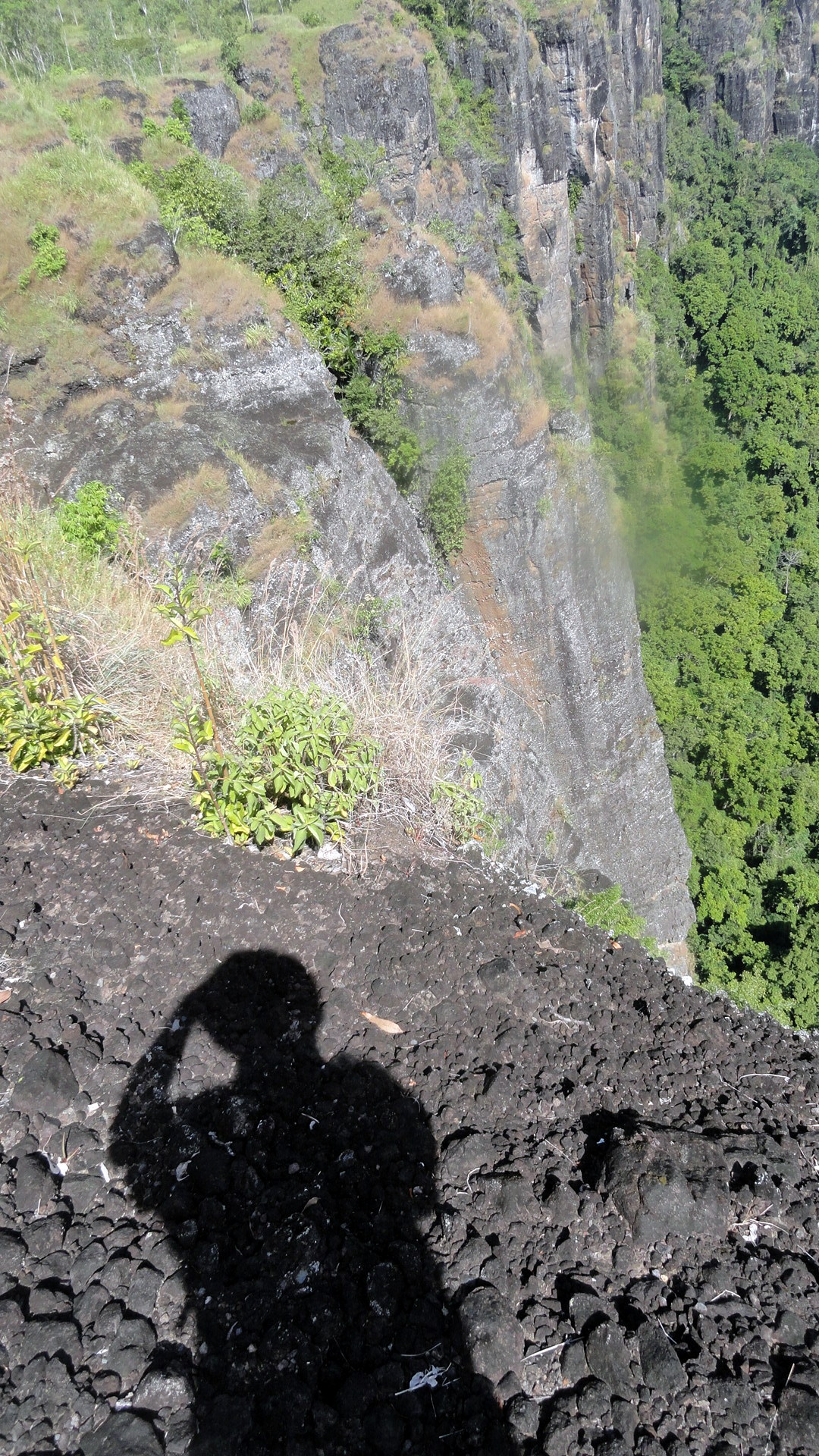
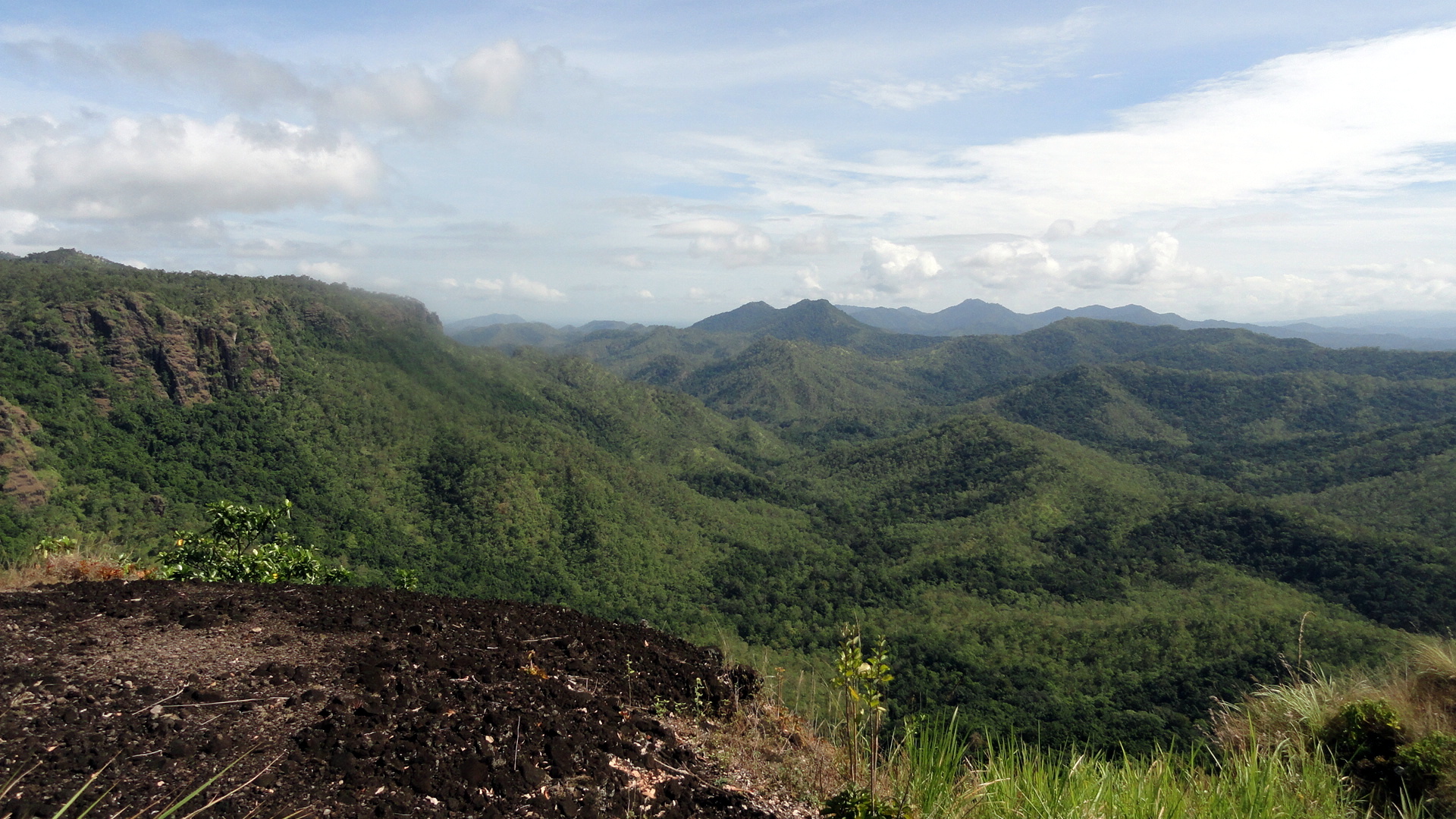
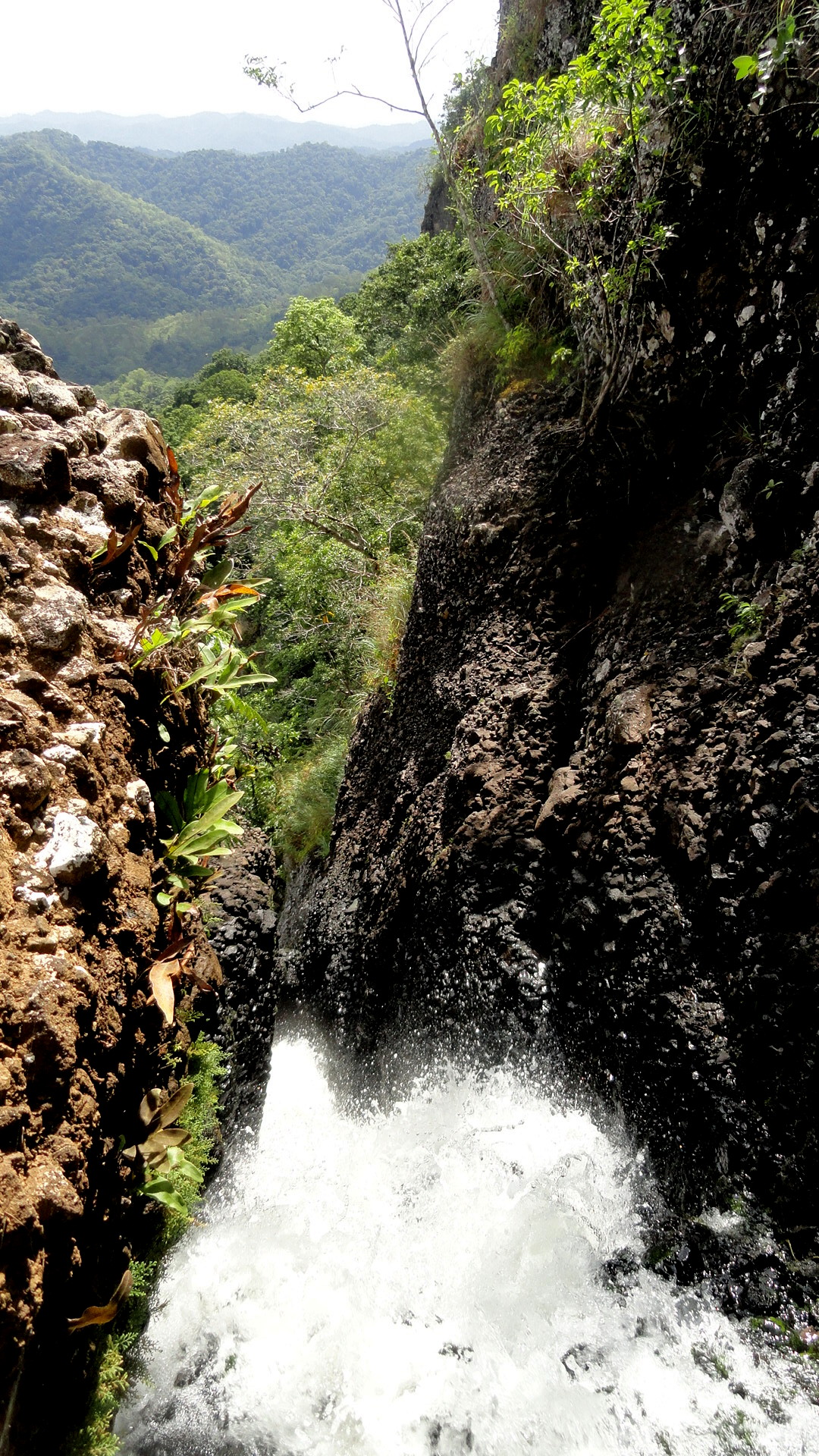
 Above and below, and then again several times, you see the extraordinarily sheer and steep cliff drop-off where the water fall was. It’s shocking, dramatic, scary, and very beautiful all at once. I’d been on this hike once before last year, and forgot my camera that time. This time I was determined to have it along so I could catalog the views for myself.
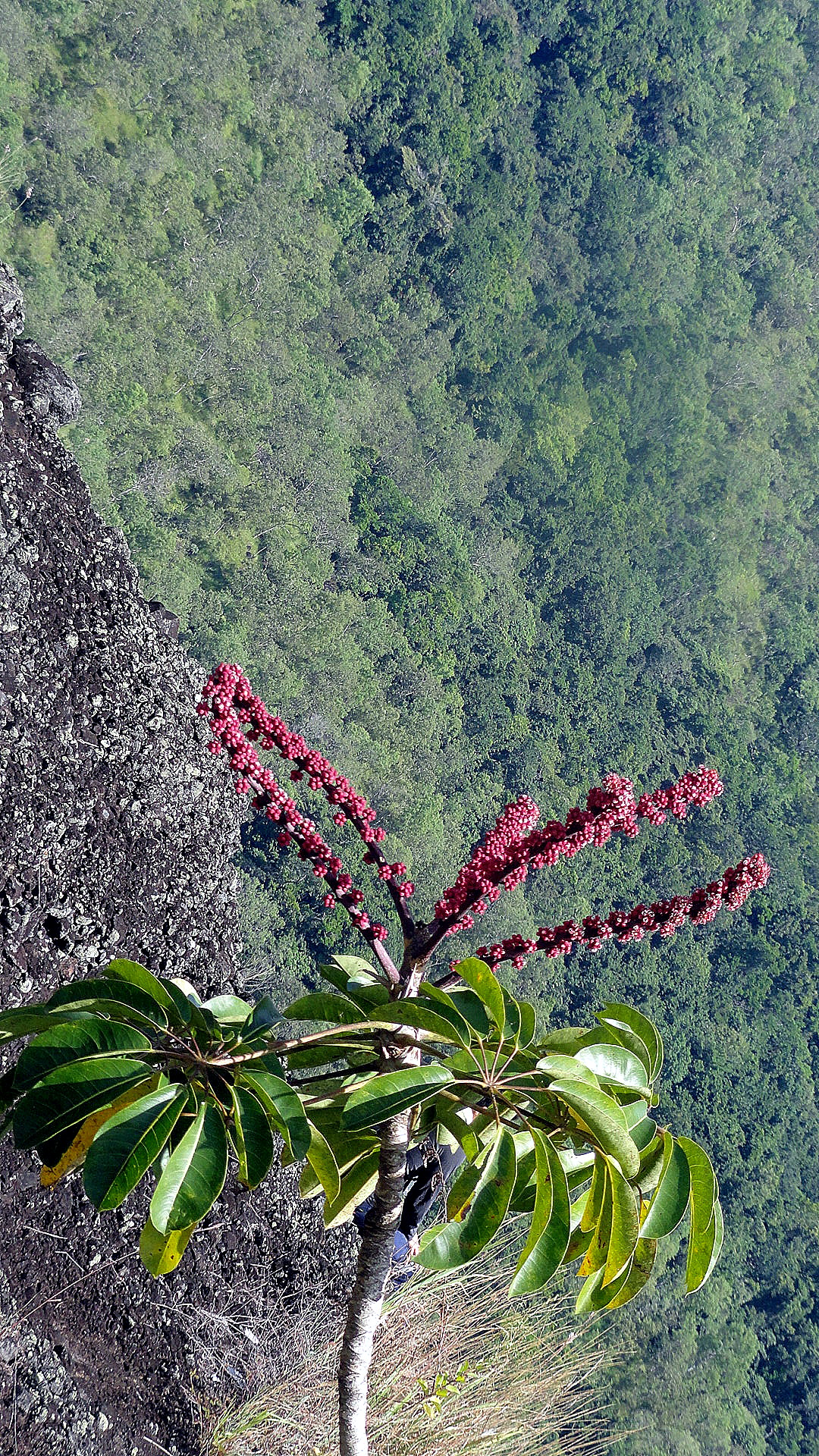


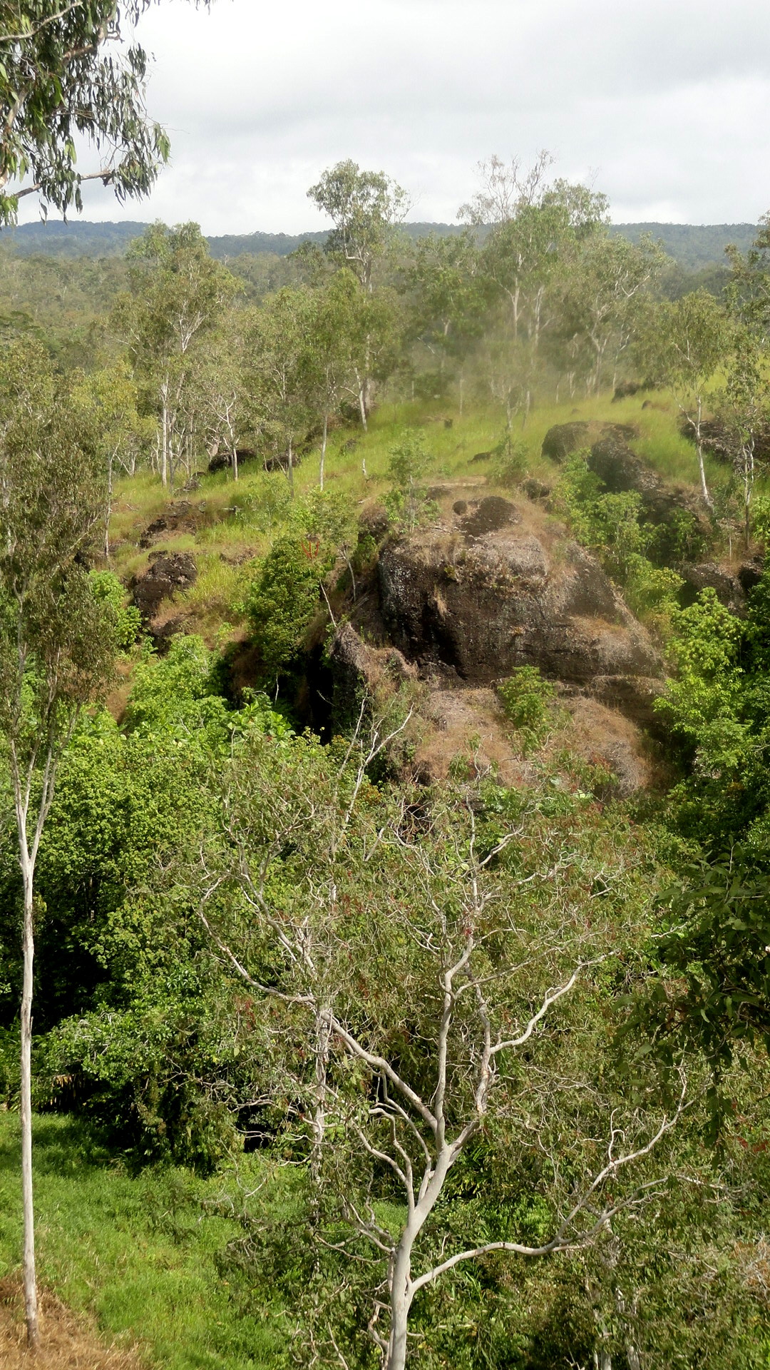
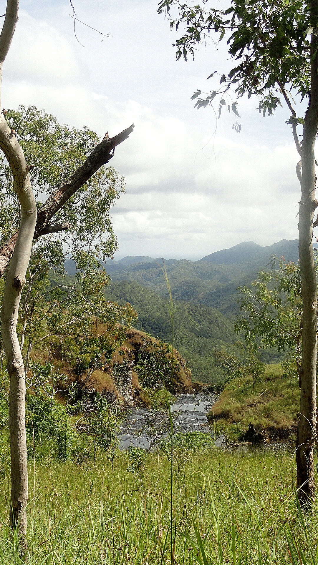
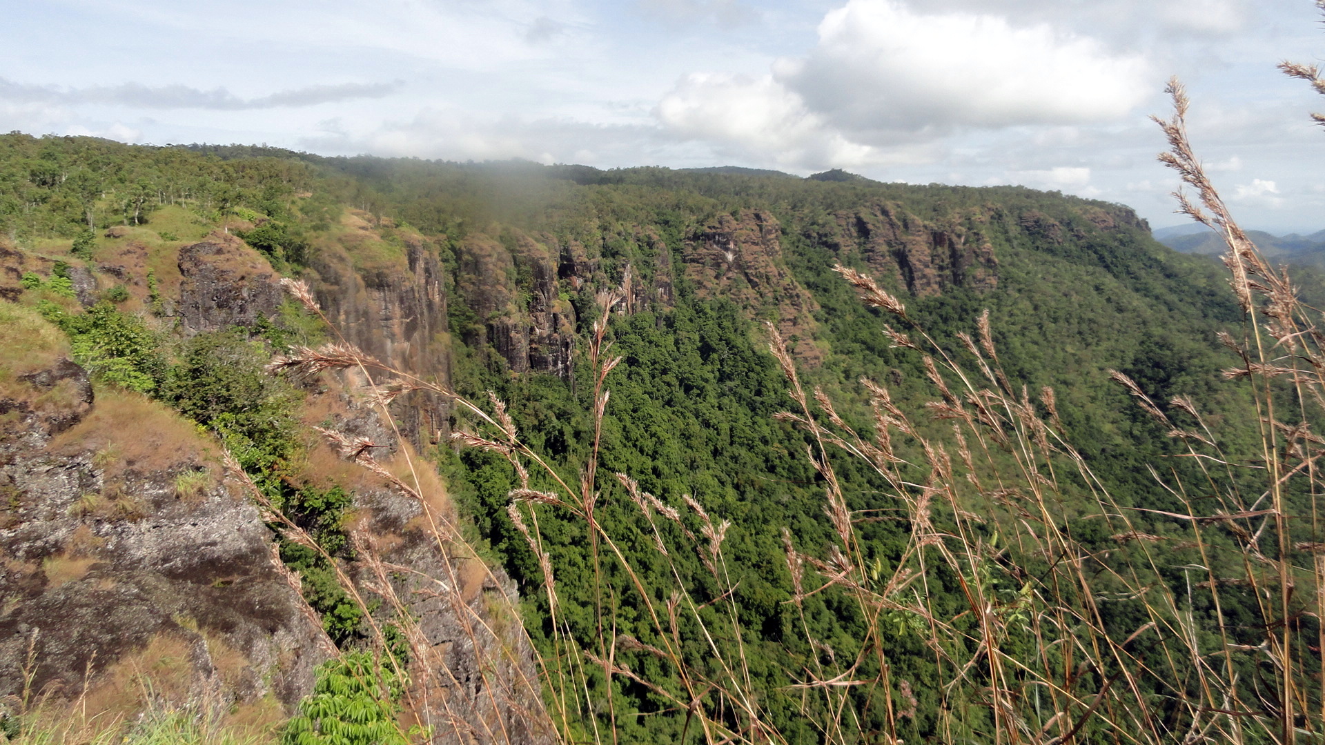 I suspect I’m overdoing the shots of the cliff and drop-off, but it truly is so startling and compelling that I kept snapping. And I’ve been selective about what I put up on here, honestly! As you see, the walk took in grasslands with gum trees, steep hills strewn with boulders as though a giant had gotten angry and started throwing them about, and lots more. It’s great hike – I just wish my camera didn’t have that obnoxious bit on the shots of some of my favorite parts!
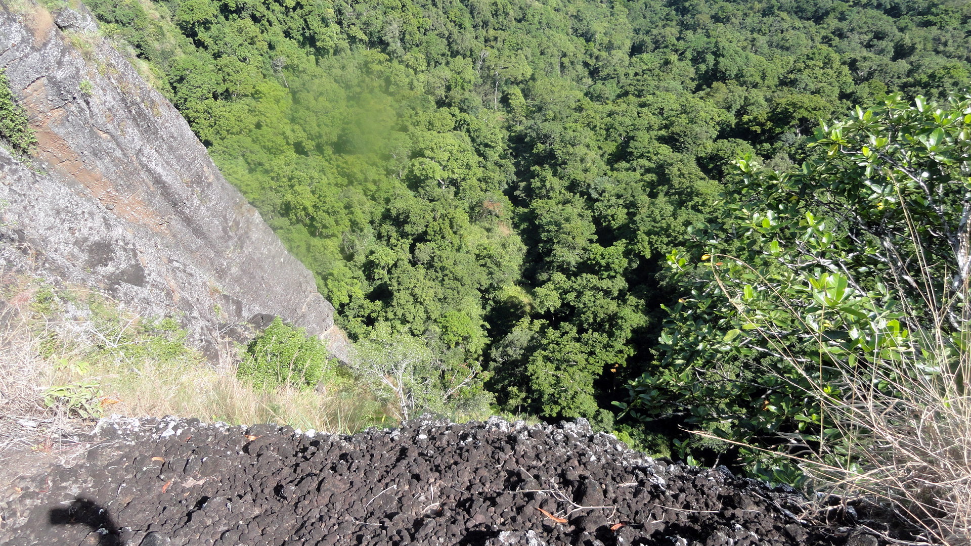


A Taste of the Trail

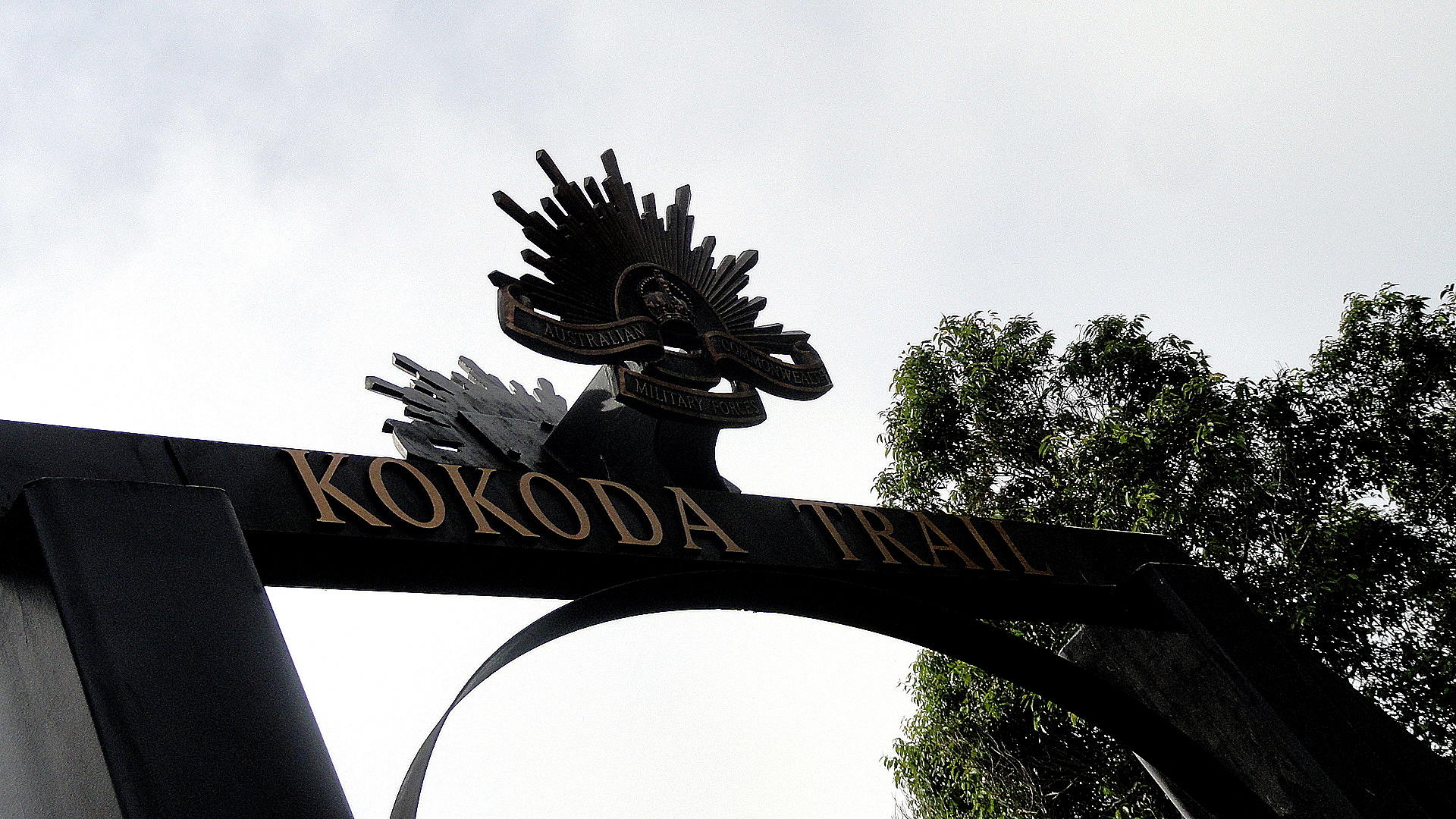
…the Kokoda Trail, that is. To quote beloved Wikipedia (do donate…where would we be without them??!!), “The Kokoda Trail or Track is a single-file foot thoroughfare that runs 96 kilometres (60 mi) overland — 60 kilometres (37 mi) in a straight line — through the Owen Stanley Range in Papua New Guinea. The track is the most famous in Papua New Guinea and is known for being the location of the World War II battle between Japanese and Australian forces in 1942.”
Last Sunday, the POM Bushwalking group (there’s a facebook page, you know?) dipped its toe into the first chunk of the Kokoda Trail, from Owers Corner down to the Goldie River. It is very beautiful, very muddy, intensely steep in many places, and if the sun is shining then downright brutal coming back uphill. I may be playing tennis a few hours a week in the evenings here, but I still felt like my little old heart would give out on the uphill return in the hot sun. One goes through that marker directly above and then steeply downhill past what you can see in the very first pic: notice how, behind the grass, all you see is the next range of hills — well, that’s on the other side of the Goldie River, I guess…and you notice it doesn’t look all that far away, meaning one goes very steeply down, then very steeply back up. And to do the whole trail, one does this many times in the space of the above-mentioned 96km. This may give some idea why, in WWII, the front line between Allied and Japanese forces ran along the mountains here.

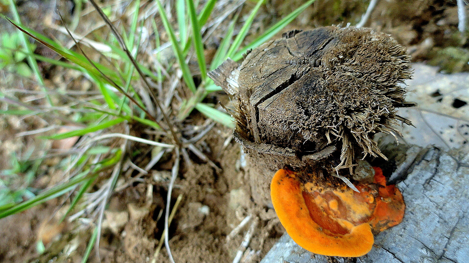
The orang mushroom photo is the “my heart was about to over-extend itself, so I had stop and drink and rest, so to look less like a wuss I took some photos to appear purposeful” shot.

…this is a short post. We’re intensely busy at work, but as you know, I don’t really do work on this blog. It’s about me and what I’m seeing here. So we’ll leave it at that for now and hope this small taste of the trail is interesting for y’all. Peace, out.