Definitely Mt St Helena top right corner – Mt Tam top left edge, and for anyone who doesn’t know the Bay Area, that’s the Bay Bridge connecting SF (left) to Oakland – Berkeley and the east bay then on to rest of the US. (That’s I-80, connecting from the GWB in NYC to the Bay Bridge right across the whole continent. Though, given how things are going in the US, one must consider that perhaps SF and the bay area might by next year prefer to not be so well connected to the rest of the US, which might make sense considering what so much of the rest of the US seems to think of our part of the country. Hmmm….any younger voters reading this who think there’s “no difference” between the two main choices you’ll have in November: please do not let the perfect be the enemy – and very possibly destroyer — of the good.)
Pacific Coast top left, SF bay above and below, city of SF skyline quite visible below, to the right of Mt Tam(alpais) which is on the other side of the Golden Gate Bridge. Both from my flight out on May 3rd.
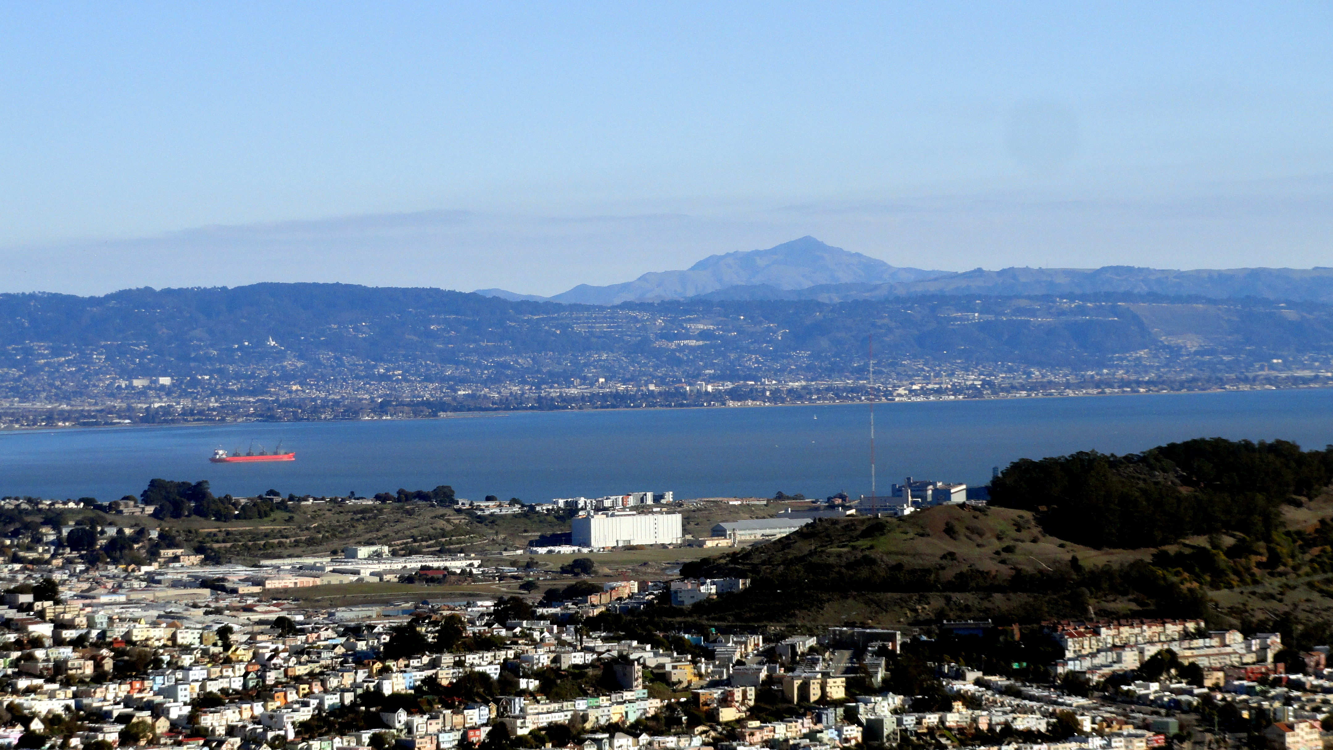
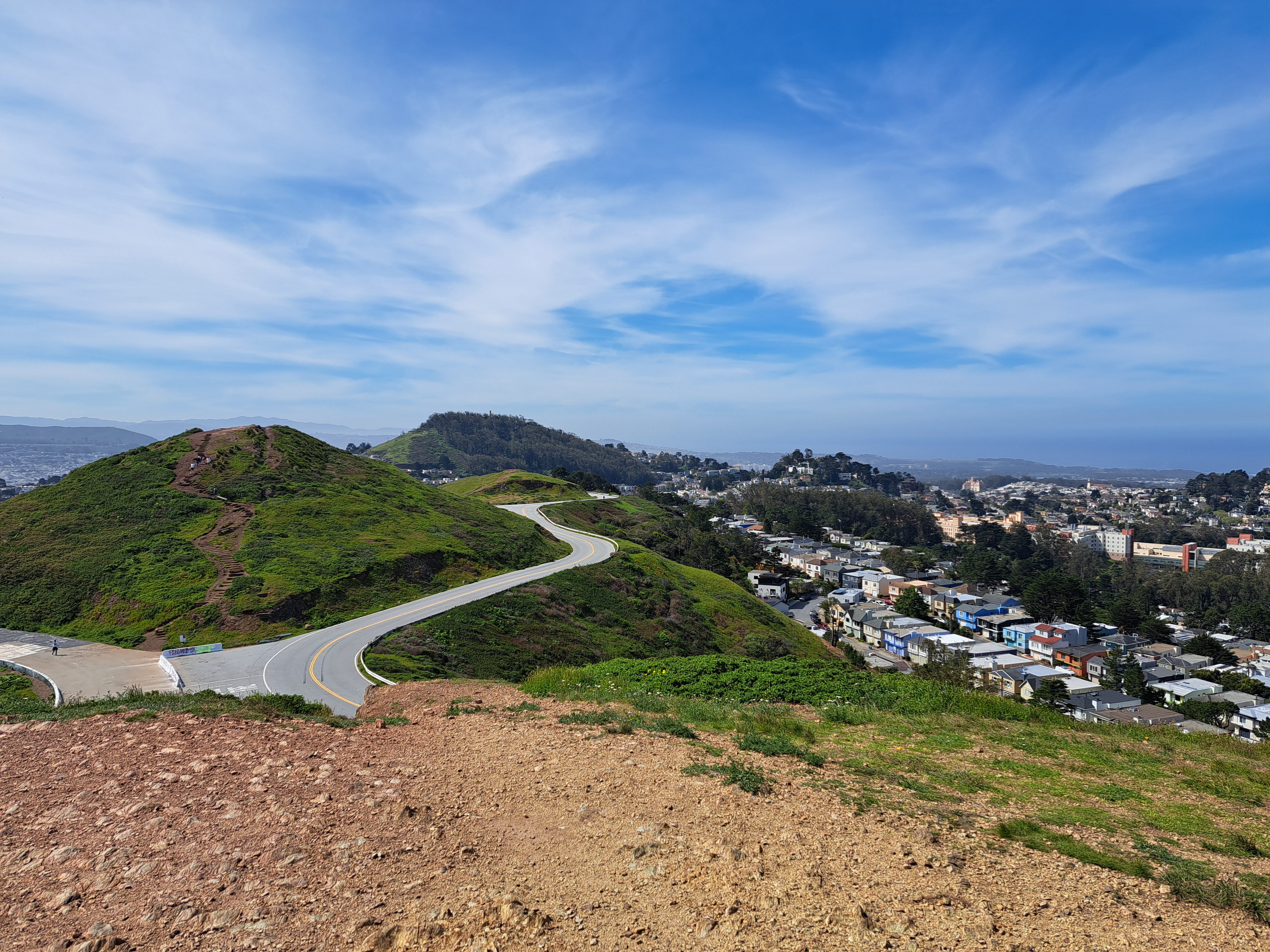
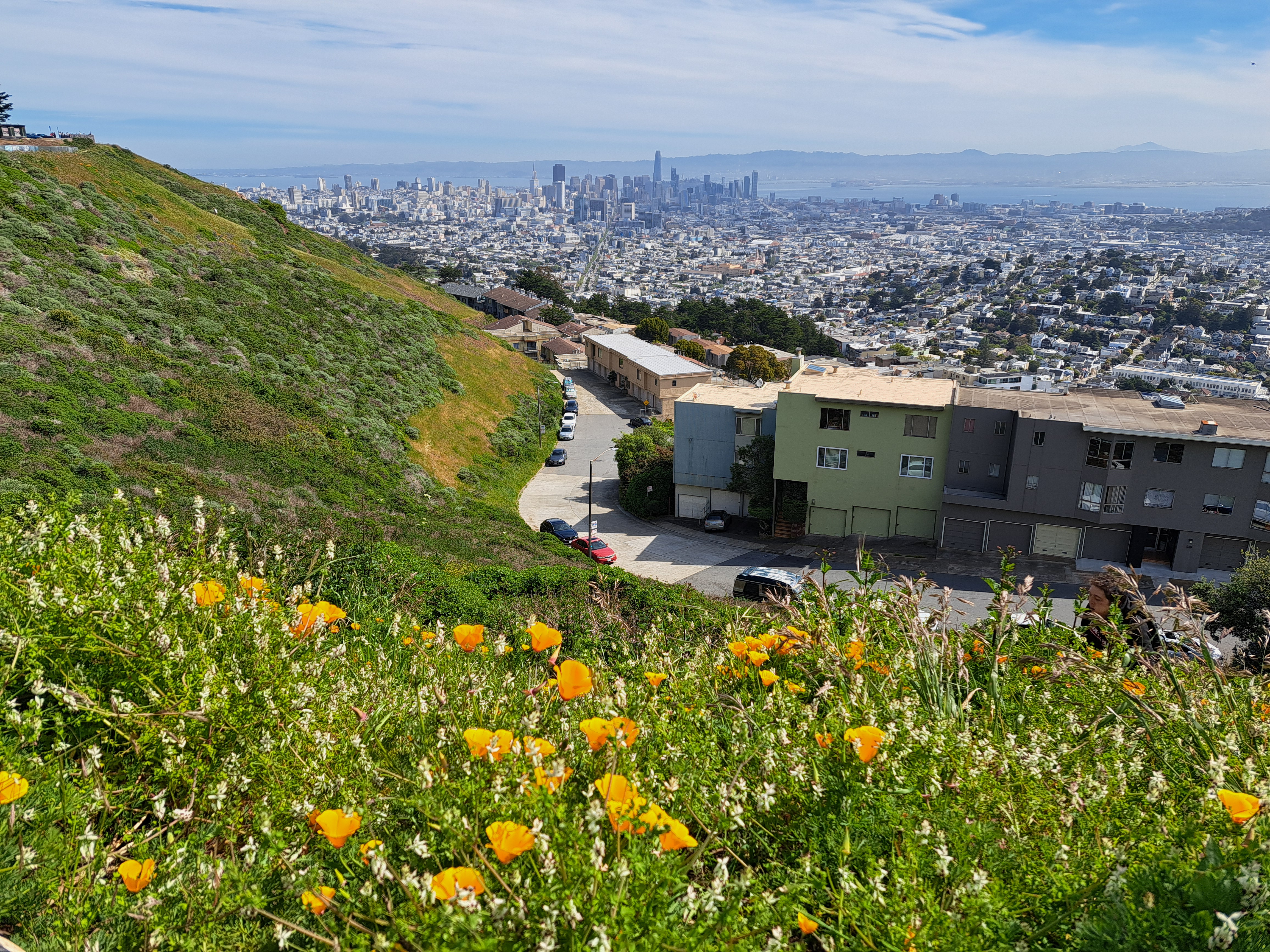
I took these two photos on my first full day back in SF (and the US) last month, near the top of Twin Peaks which contains three of the highest points in SF city itself, the higher of the twins clocking in at 282 meters (925 feet), making it nearly as high as the highest point in the Netherlands, to which I returned last week. The Vaalserberg’s peak is actually in Belgium (google “highest point in NL and see what you get – it’s a bit funny tbh), but before the hill crosses the border it becomes NL’s highest point at 322 meters. By comparison, at the top right above and top left below, you see the diamond-shaped top of Mt Diablo, second-highest point in the bay area (the counties which immediately border that bay you see down there). Diablo’s highest point is 1,173 meters. Later on I’ll share some lovely photos I took with Diablo as seen from the northwest in Sonoma County – very different profile, and we caught both Mt Tam and Mt Diablo in the frame :-). Anyhoo: lovely to be back in Amsterdam, but I do miss the mountains and the immediate proximity of open ocean.
San Bruno Mountain on the left, marking the southern border of SF City & County; the ridges in the middle right are Mt Tamalpais in Marin County just north; and of course the city of SF on the far right middle. From my flight out of SF to Pittsburgh a bit more than a week ago.
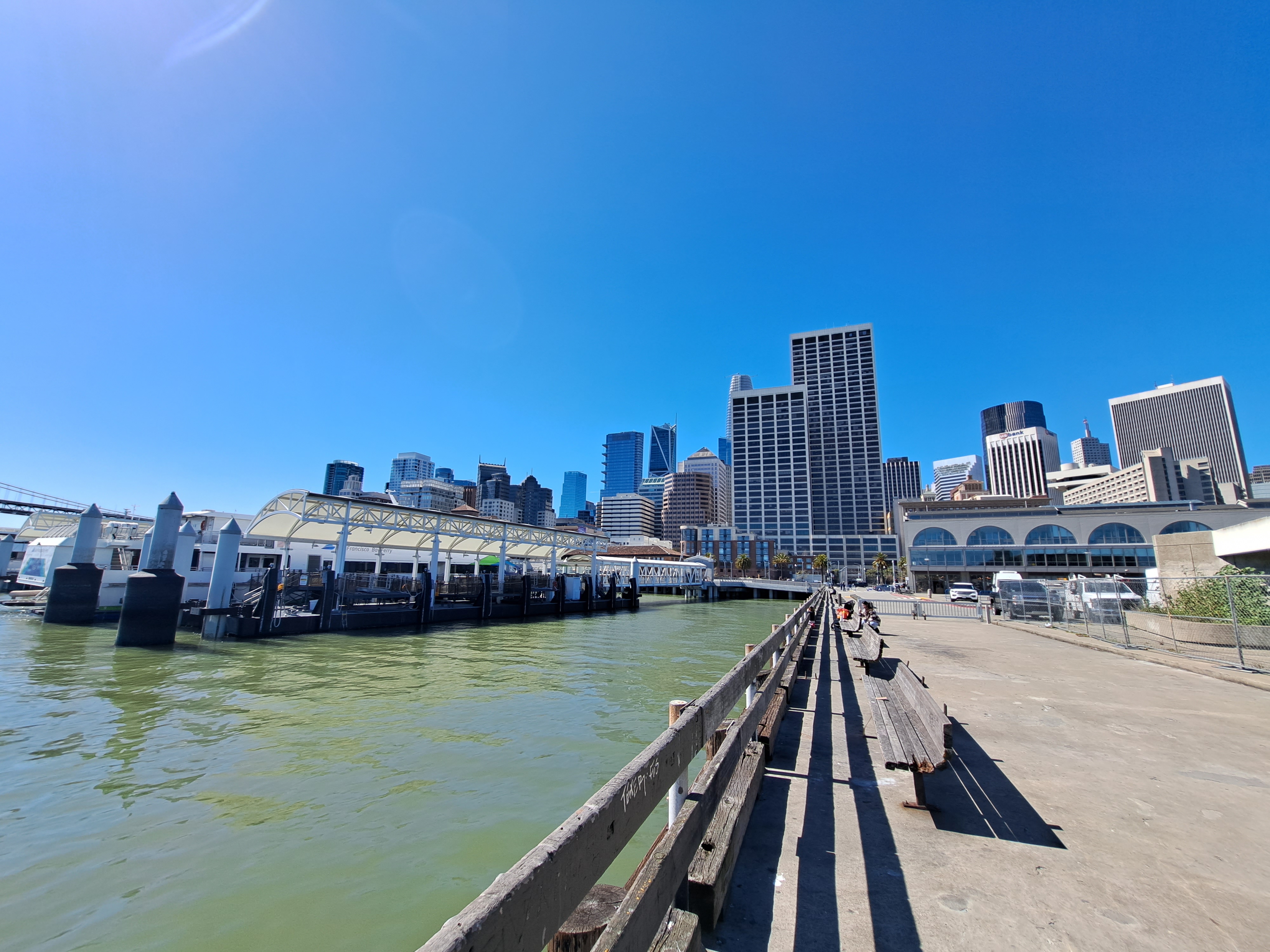
Yes, the wharves by SF’s ferry building can count as “coast” on my own blog if I decide they do. And yes, this means I’ve an urgent need to get to some “real” coastline again asap, or we may run dry on images for this series even sooner than the previously-noted country canals. Second to last post from that March – April US swing, already two months ago, goodness me but time flies when you’re chasing postable images. 🙂
These views of SF and the greater region are from the take-off ascent when we flew back to Amsterdam two weeks ago. The photos at top and bottom were selected as highlights for two reasons. First, because they both show the atmospheric effect of heat in the central valley (more than 100km east – right – of what you see here) pulling cool, moist air — aka fog — in from the vast, cold and wet Pacific directly through the Golden Gate (not the bridge, but the small gap in the coastal mountains which the bridge spans) and then inland, following the river that drains the valley then flows into the bay, in the process flowing over both the city of San Francisco, and some of the surrounding cities to the north and east. Second, because they both also show you the lovely north bay and – if I had that degree of resolution – they likely look right over Sonoma Mountain and the other coastal-range mountains to show Santa Rosa, in its little bowl about 65km north of the Golden Gate. FYI, the bridge you do see is the Bay Bridge, its two spans connecting SF with Oakland and the east bay, forming the western terminus of Interstate 80, just as the George Washington Bridge forms its eastern terminus at the Hudson between NYC & NJ. The Golden Gate Bridge, by that particular Monday afternoon, was already well-wrapped in the fog you see :-).
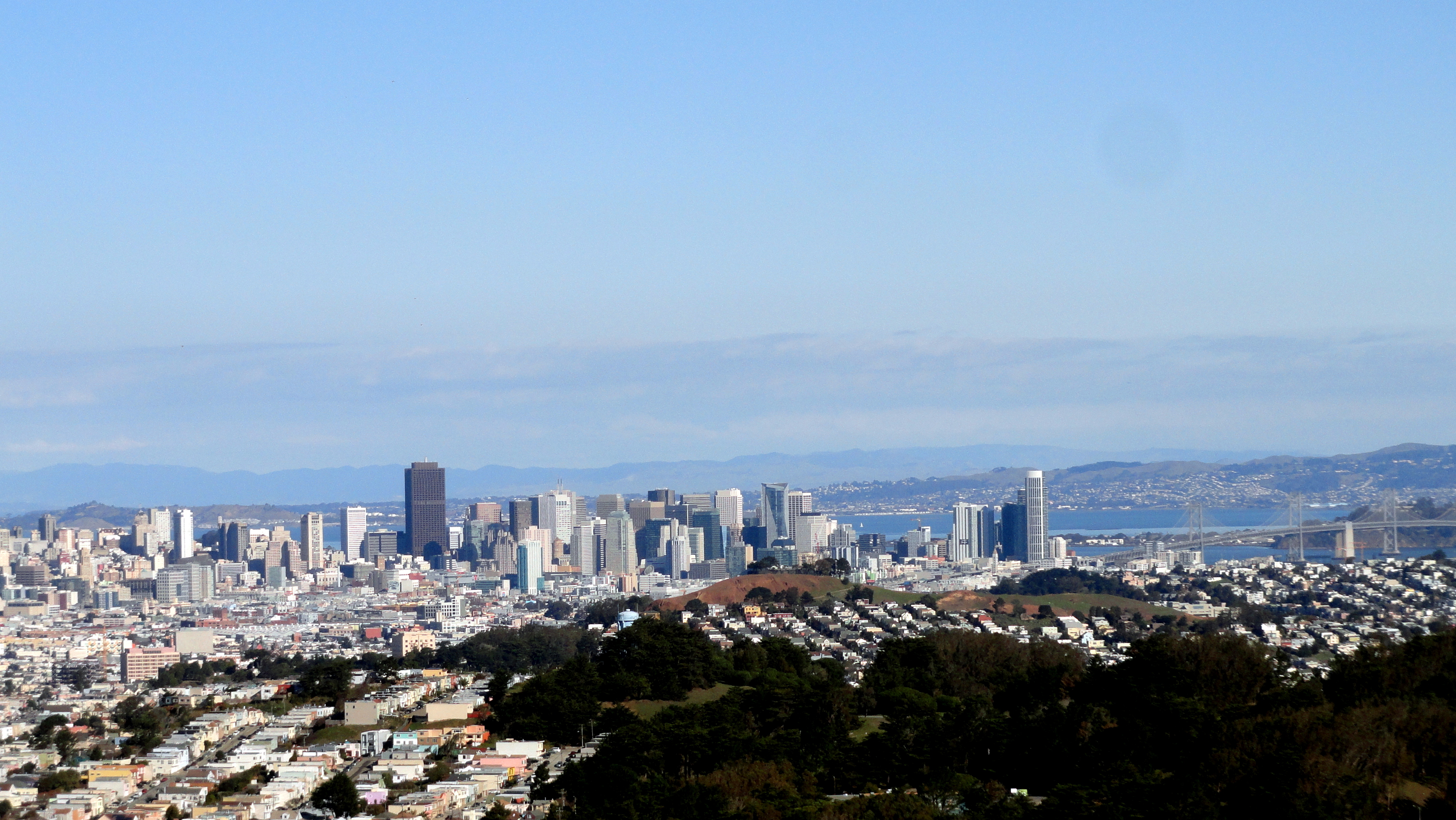
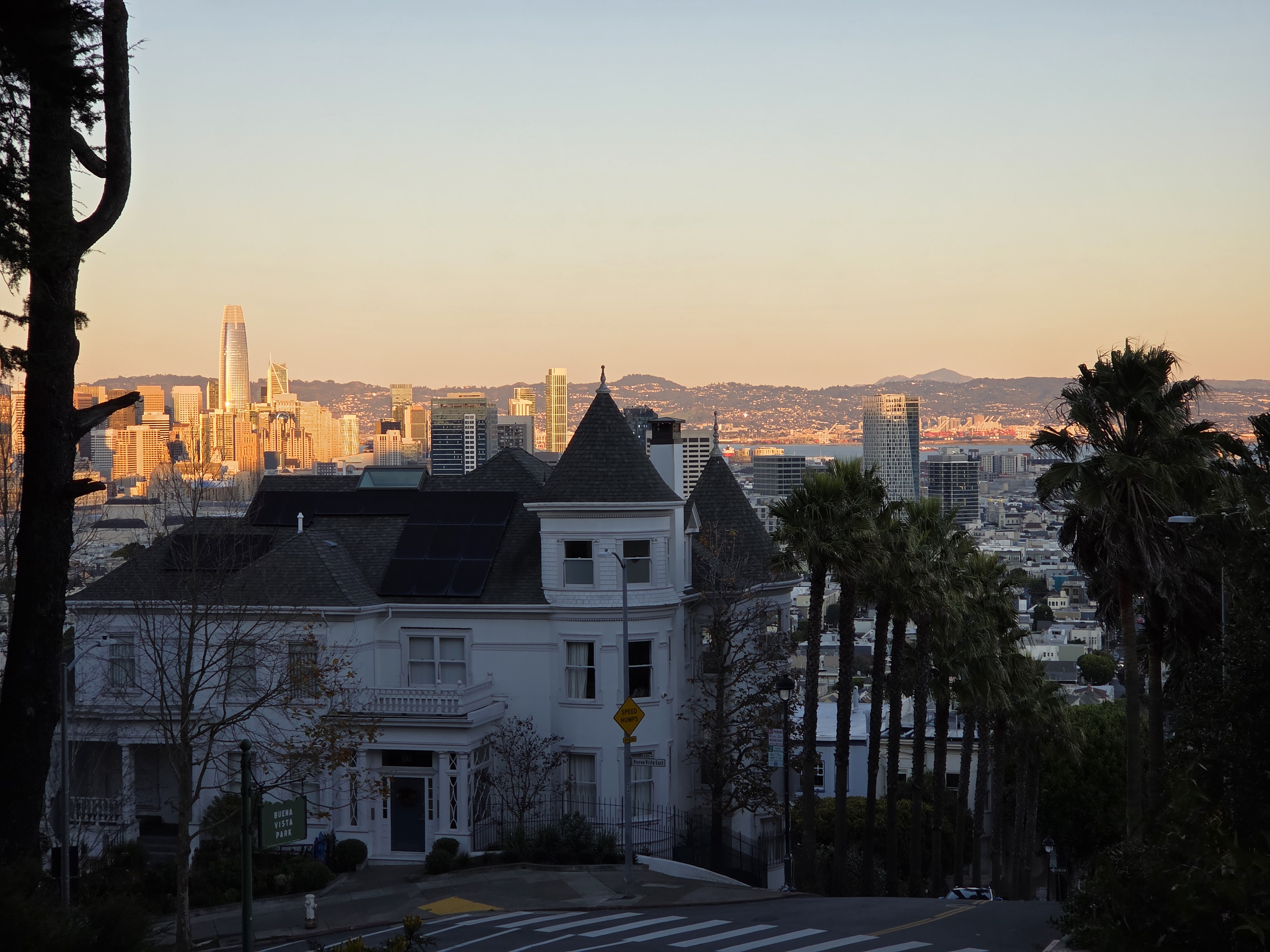
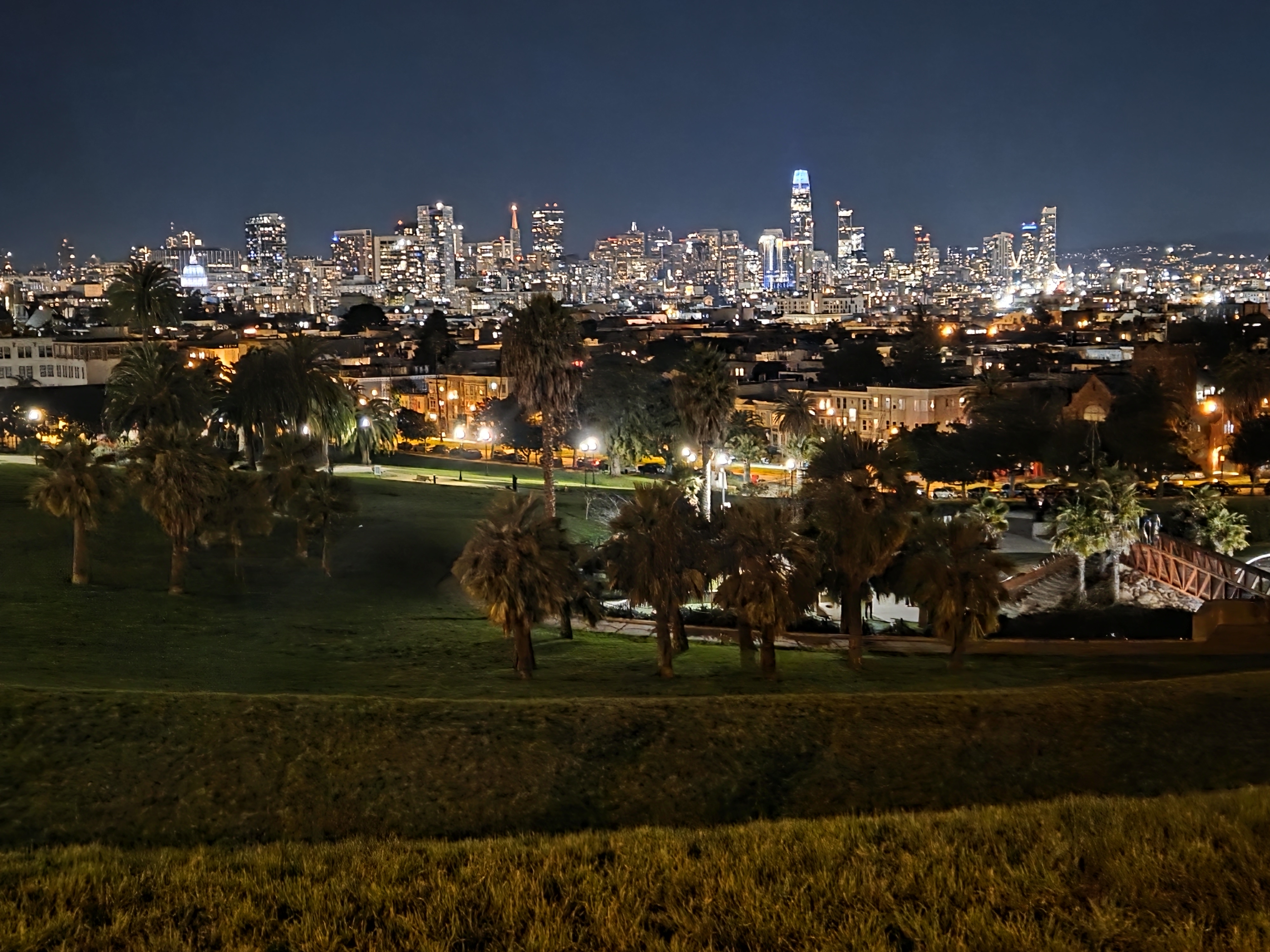
Normally I’d be in SF with friends and going to concerts or museums at least a few days every month. Such has not been the case since I returned home in July … because covid, duh. So I’ve been in the city precisely three times: when I returned from Bangladesh for a night since bus services are more limited now; and briefly in September linked to the flights to and from Wisconsin. These pics are from both trips and I’m mashing them all together to keep from falling even further behind in the backlog of photos I’ve not yet posted. Whenever travel becomes more appealing again…as you can see, SF’s a lovely city, so do think about visiting. And of the densely-crowded US cities, it’s so far done comparatively well at limiting the spread, in part due to measures you can see in a lot of these photos. The joys of a population which uses science and evidence as the foundation for its policies and politics… 🙂
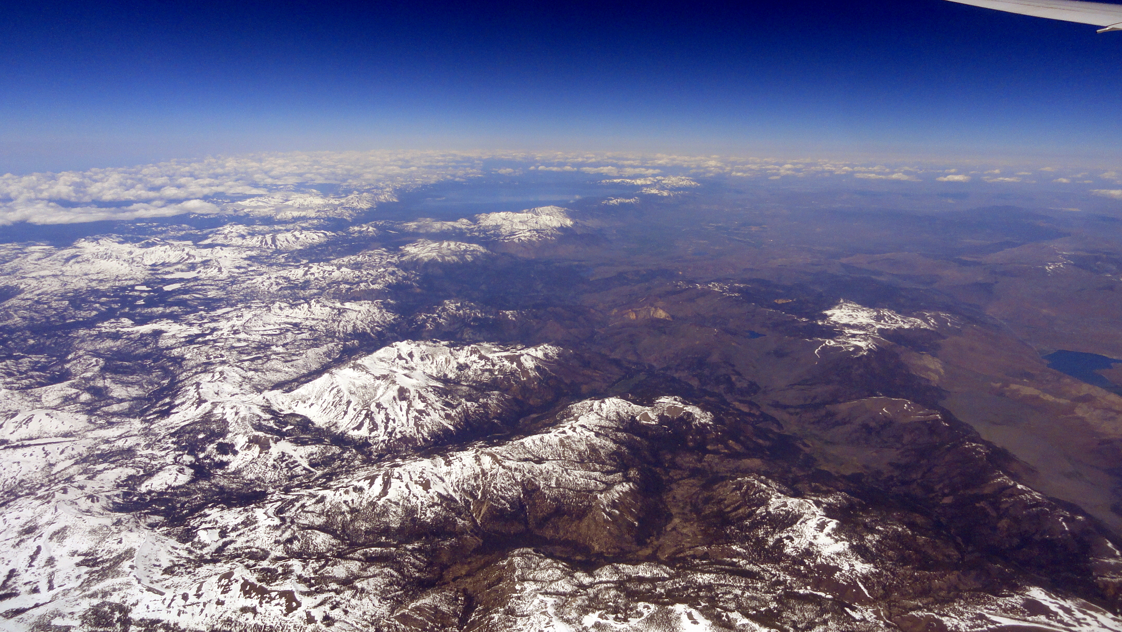
If you haven’t been to the San Francisco Bay Area yourself, and if you wonder why I’m always so happy to get home to it; or why visitors to SF and the bay area so often rave about it — a good place to start is to take in the photo just above. I’m still working my way through photos I took last year, before I headed over to Bangui, where I’ve been now for more than two months. I shot all of the photos in this post during a take-off from SFO en route to EWR last year, in May — but what I’m posting are just photos from the bay area and up til the time we reached the still snow-covered Sierra Nevadas. Since it was nearly a year ago, and this year hasn’t seen as much snow — just remember: it’s last year! Enjoy!
2016 dawned beautiful, bright and clear in and around San Francisco. And for the first time in many years, I saw my first sunrise of the new year in the bay area instead of out on another continent across a ocean or two. True, the next day I flew out again to head back to Haiti and my work here…which would be why it’s taken me nearly 1/6 of 2016 to get these put up: sorry! As you see, though – the view was clear enough to see easily and clearly all the way out to Mt Diablo, and all the way up to Point Reyes National Seashore. Enjoy these little views of my home region :-).


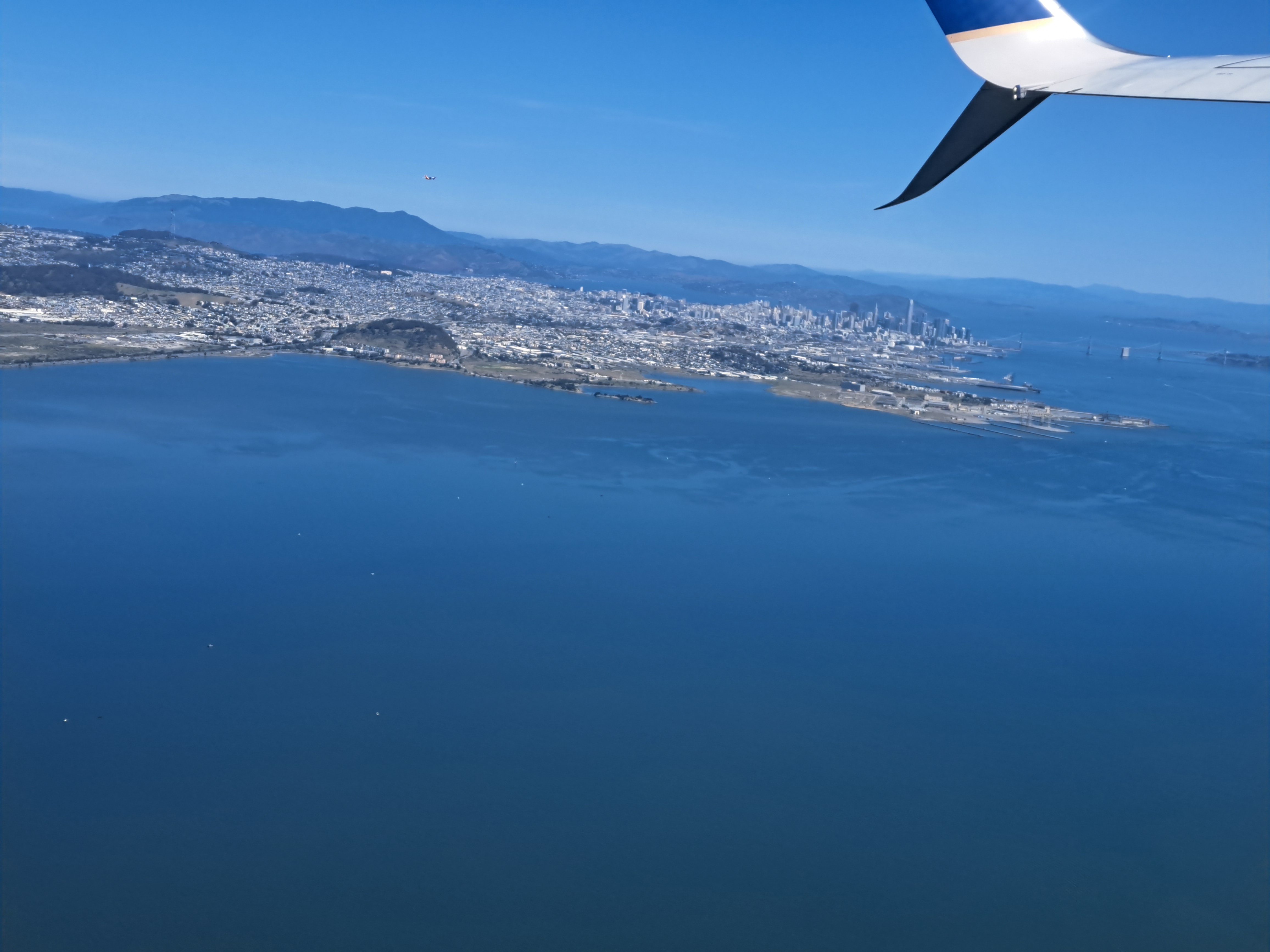


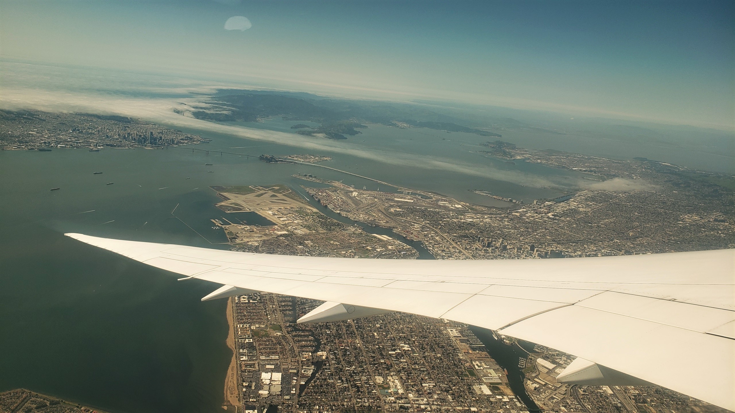 These views of SF and the greater region are from the take-off ascent when we flew back to Amsterdam two weeks ago. The photos at top and bottom were selected as highlights for two reasons. First, because they both show the atmospheric effect of heat in the central valley (more than 100km east – right – of what you see here) pulling cool, moist air — aka fog — in from the vast, cold and wet Pacific directly through the Golden Gate (not the bridge, but the small gap in the coastal mountains which the bridge spans) and then inland, following the river that drains the valley then flows into the bay, in the process flowing over both the city of San Francisco, and some of the surrounding cities to the north and east. Second, because they both also show you the lovely north bay and – if I had that degree of resolution – they likely look right over Sonoma Mountain and the other coastal-range mountains to show Santa Rosa, in its little bowl about 65km north of the Golden Gate. FYI, the bridge you do see is the Bay Bridge, its two spans connecting SF with Oakland and the east bay, forming the western terminus of Interstate 80, just as the George Washington Bridge forms its eastern terminus at the Hudson between NYC & NJ. The Golden Gate Bridge, by that particular Monday afternoon, was already well-wrapped in the fog you see :-).


 Normally I’d be in SF with friends and going to concerts or museums at least a few days every month. Such has not been the case since I returned home in July … because covid, duh. So I’ve been in the city precisely three times: when I returned from Bangladesh for a night since bus services are more limited now; and briefly in September linked to the flights to and from Wisconsin. These pics are from both trips and I’m mashing them all together to keep from falling even further behind in the backlog of photos I’ve not yet posted. Whenever travel becomes more appealing again…as you can see, SF’s a lovely city, so do think about visiting. And of the densely-crowded US cities, it’s so far done comparatively well at limiting the spread, in part due to measures you can see in a lot of these photos. The joys of a population which uses science and evidence as the foundation for its policies and politics… 🙂