Ah, Royalty.42
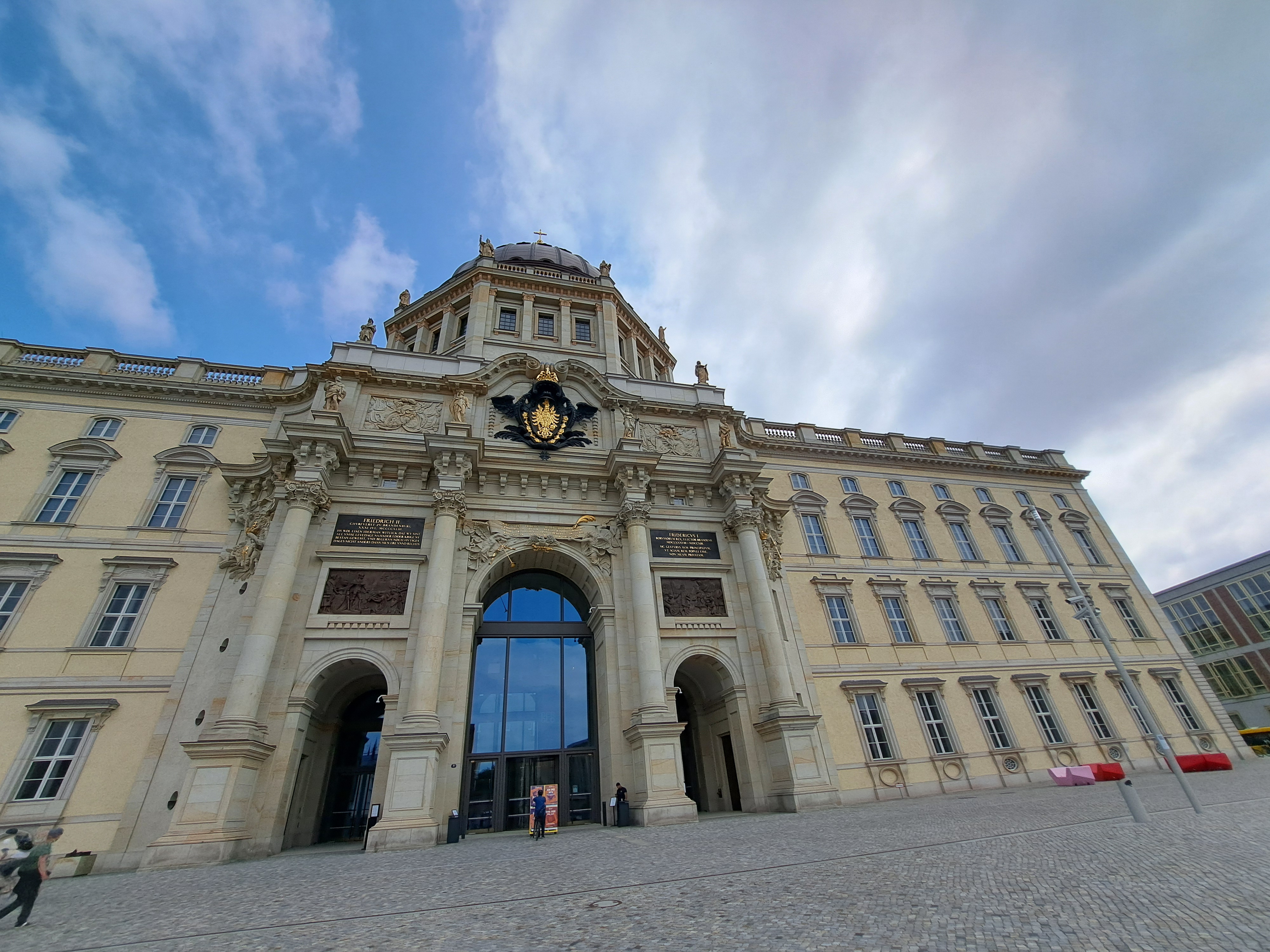
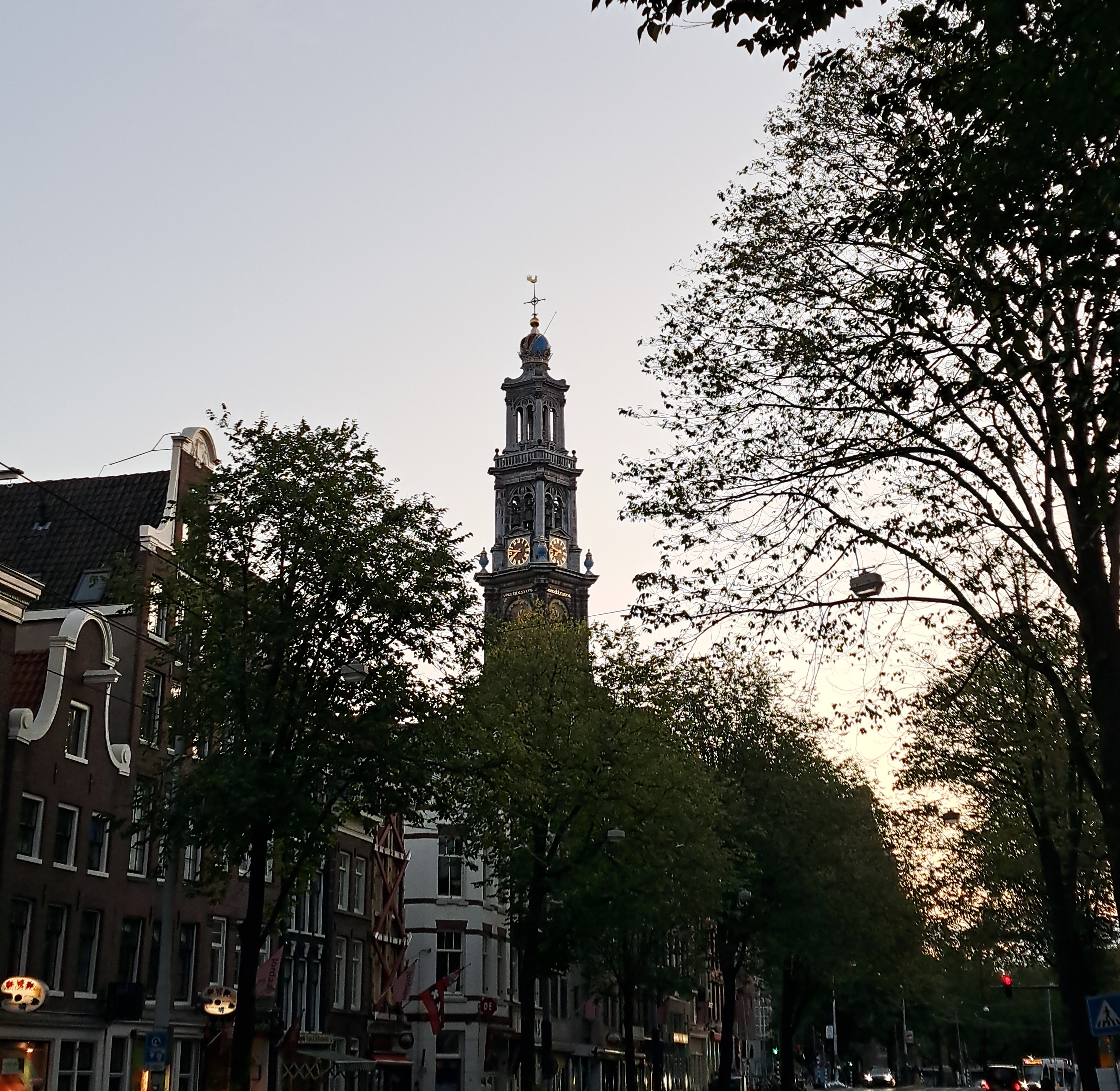
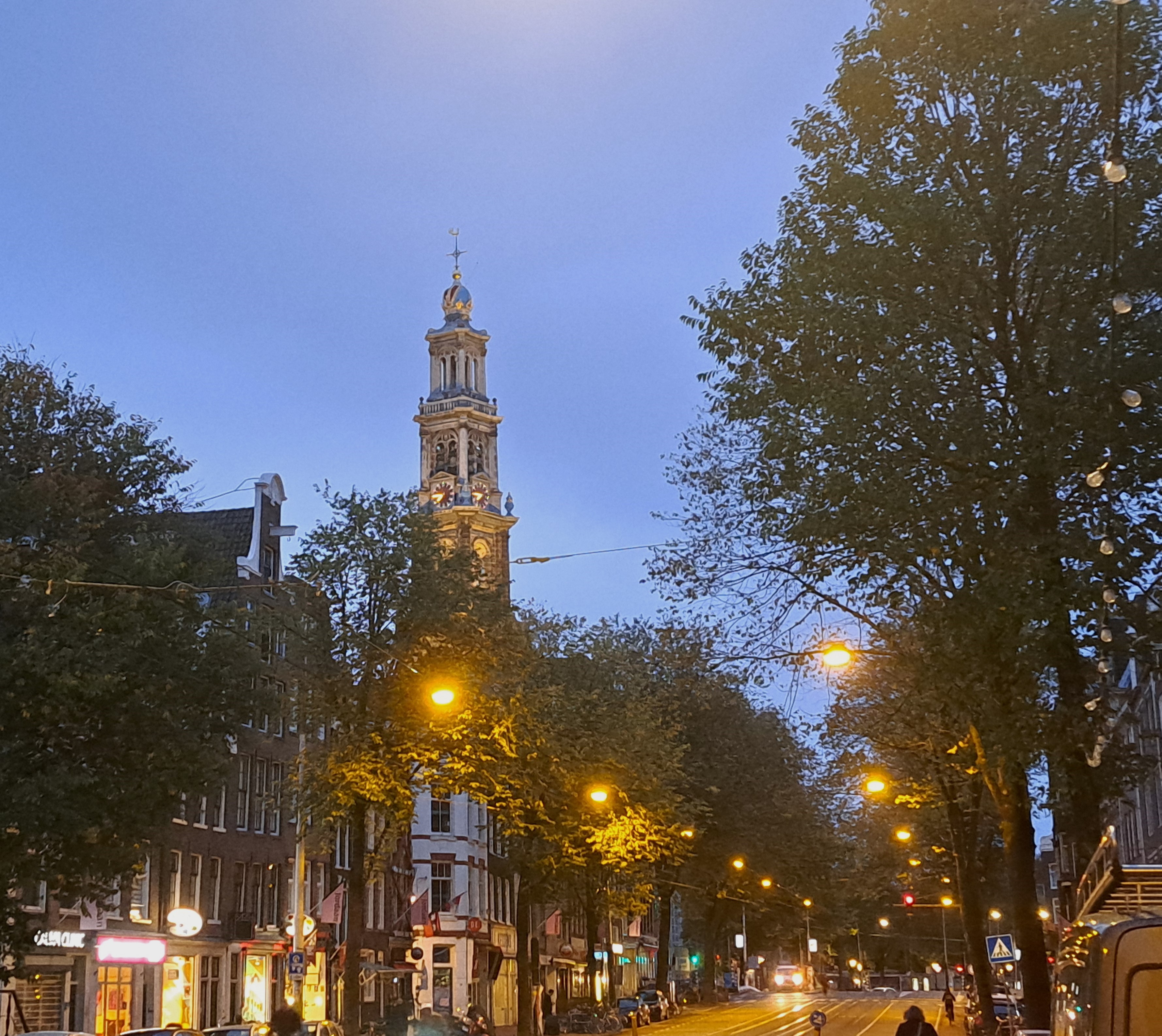
So after much debate – this piece of ground has seen much debate in the past century! – the city’s planners and tourist magnates decided that a rebuilt royal palace which looks from the outside like the old one, but which inside is a cultural forum calling itself the Humboldt Forum would be just the thing. It opened in 2020, so don’t let its grand looks fool you into thinking your looking at an actual old building – for that, check out A’dam’s “relatively new” Westerkerk a few posts ago! 🙂
I suspect there’s some tourist-sector envy of Buckingham and the throngs there to watch the changing of the guard, myself. But draw your own conclusions. Tip if you visit: excellent bathrooms in the basement that one didn’t have to pay for, when I myself was doing this walk with Steve at least :-).

City Lights.72
City Lights.58
City Views.195
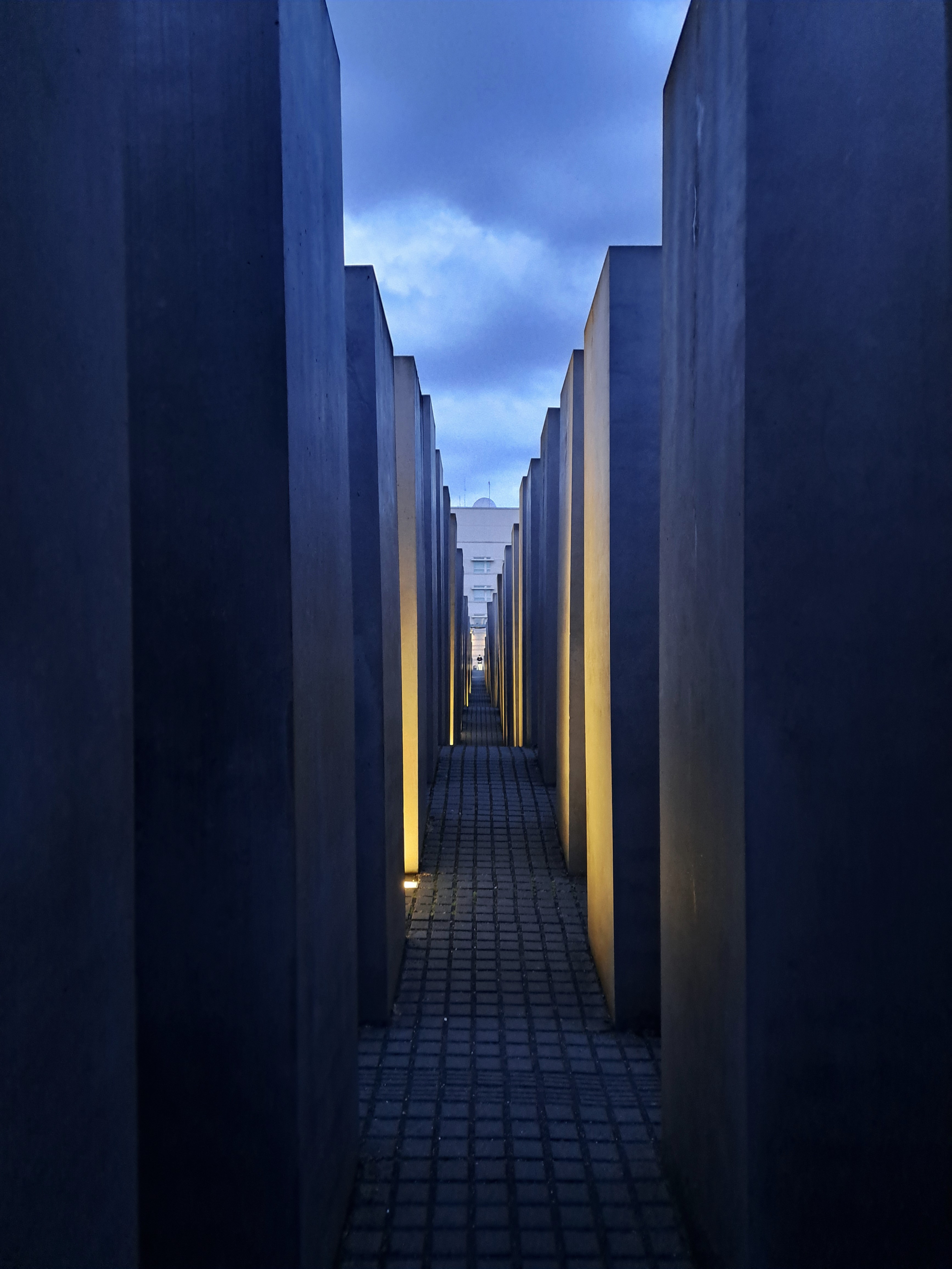
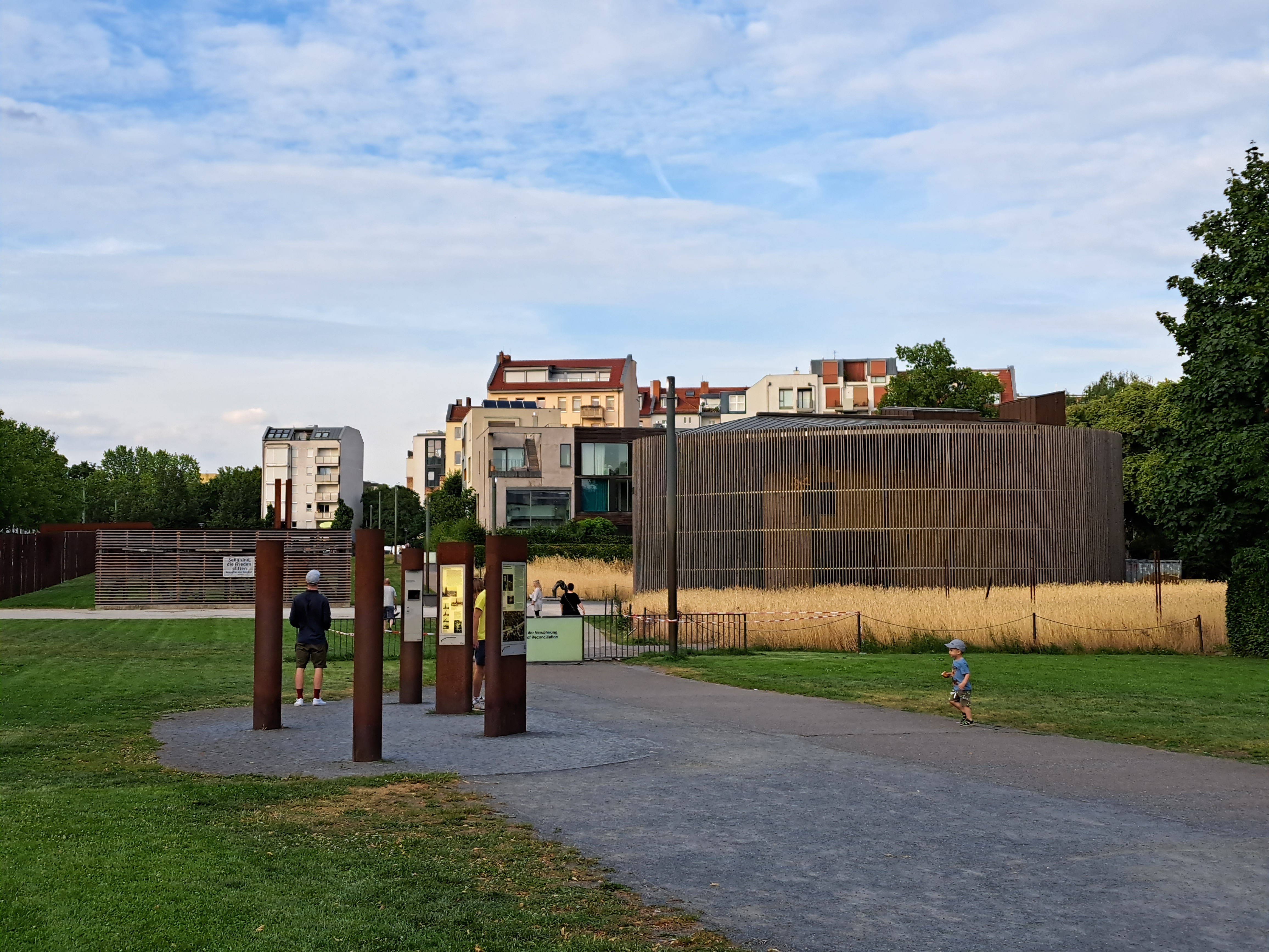
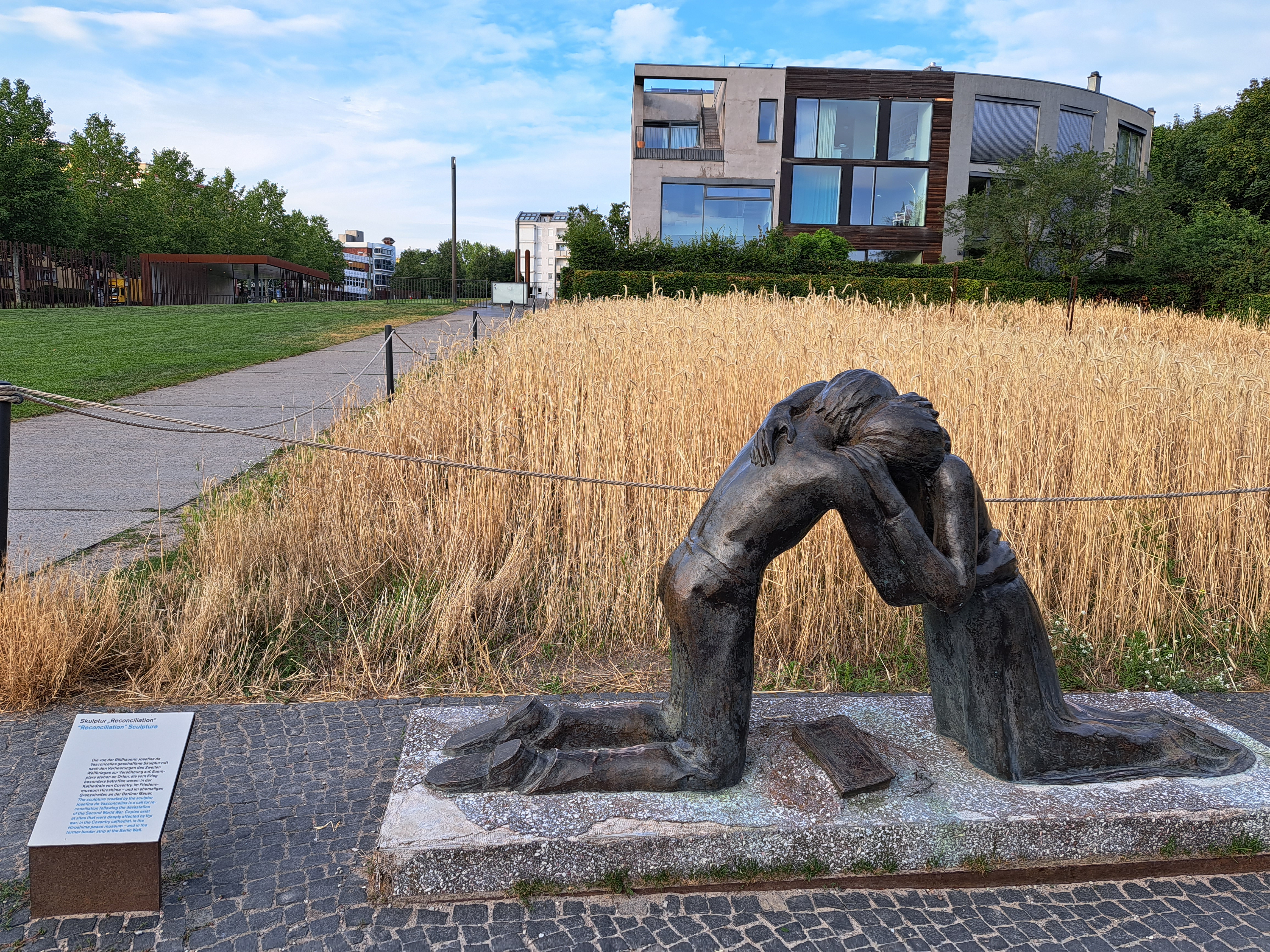 Returning to Berlin in July for those work meetings gave me a chance to visit neighborhoods where the city was once and is now no longer divided. Yes, I still cry when I walk past these places and remember my own crossings of that wall when it was really rather scary, because you knew armed border / wall guards were watching you. These photos are all from an evening walk in and around the Berlin Wall memorial park along Bernauer Strasse, one of the streets along which the wall itself once ran. The lovely murals in the gallery below were on an apartment building in what was then East Berlin…I’m fairly sure…my dear brother, for whose book on the period right after the wall was finally breached I will give an unabashed plug right here, might correct me if he sees fit.


Village Views.39

Urban Garden.104

City Views.131

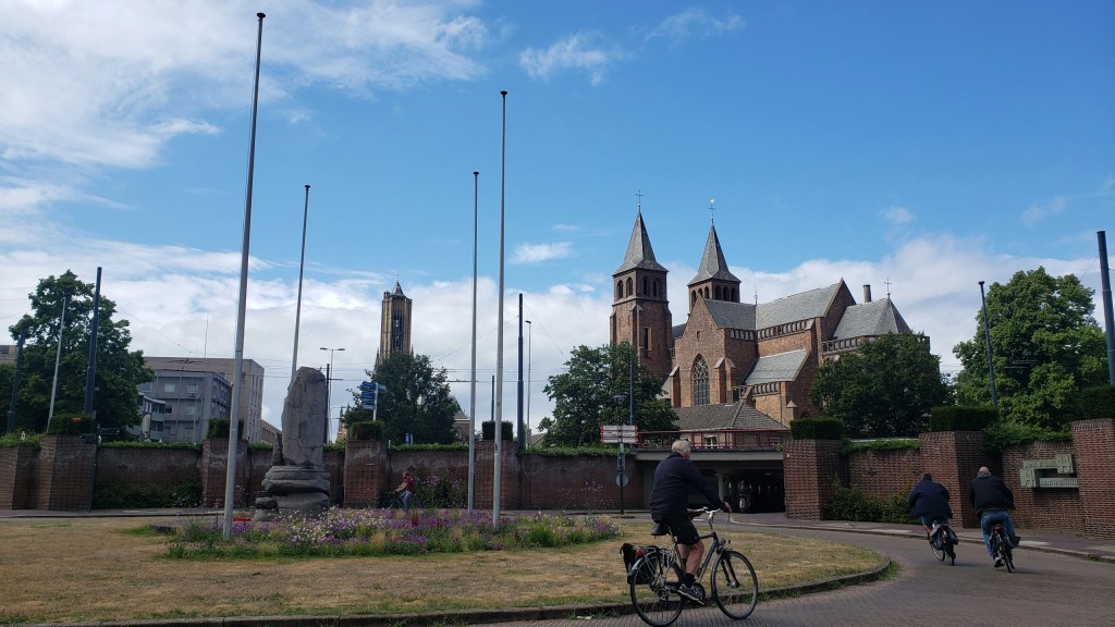
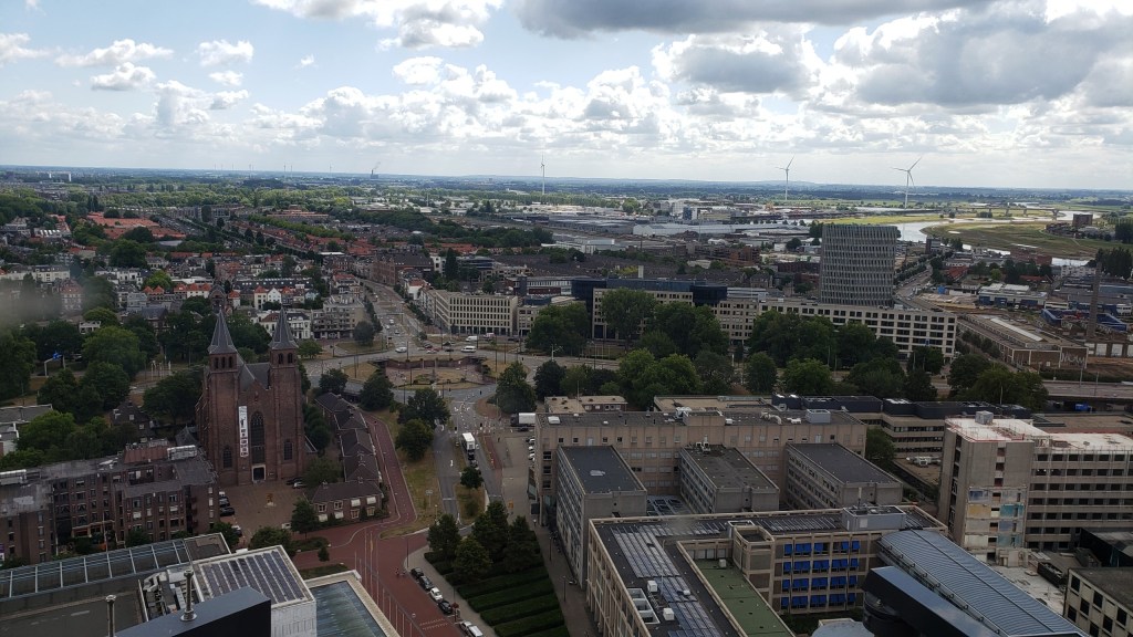
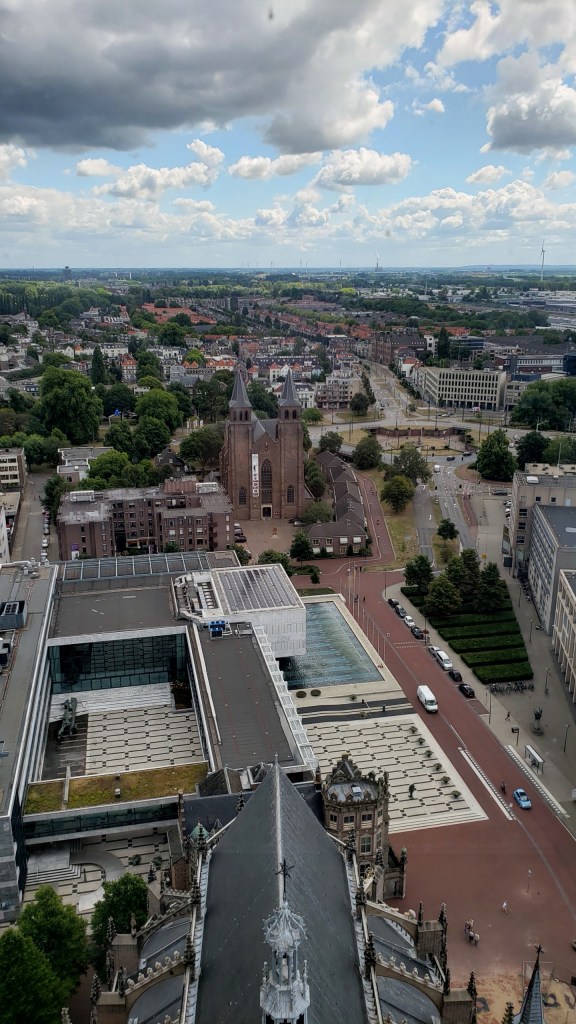
This is Eusebiuskerk (St Eusebius Church) in Arnhem, capital of Gelderland. I’ve just returned from spending five nights in Arnhem, while playing in the tennis competition portion of the EuroGames in nearby Nijmegen. Had a lot of fun exploring both cities and am trying to get some photos ready for posting while I’m on planned travels to a quite different location for most of the month ahead. Nijmegen is rich in Roman history, while Arnhem has a quite sad WWII history, for which many visit it. This church had to be rebuilt after the war, along with much of the rest of the city. Well worth a read, and friends who love classical history might add Nijmegen to the visit list; a day trip is perfectly feasible, though it might be a long day.
Honiara’s Lovely Harbor & A Bit o’ History
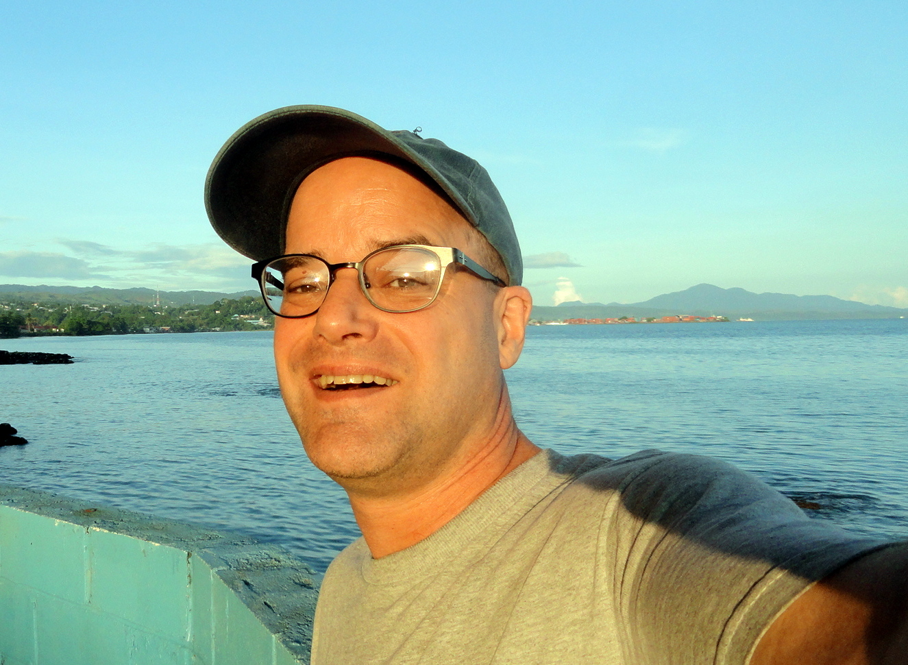

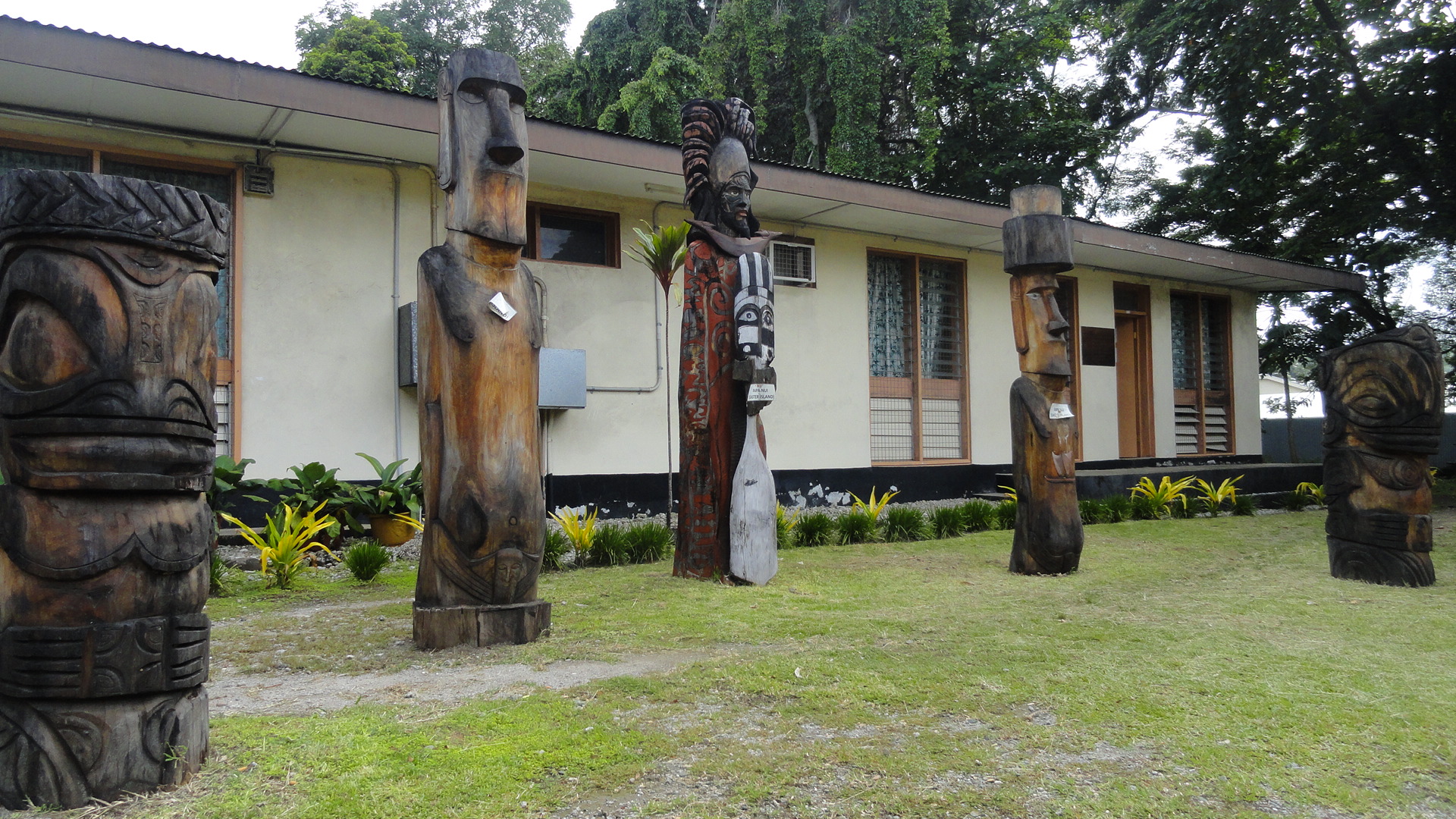
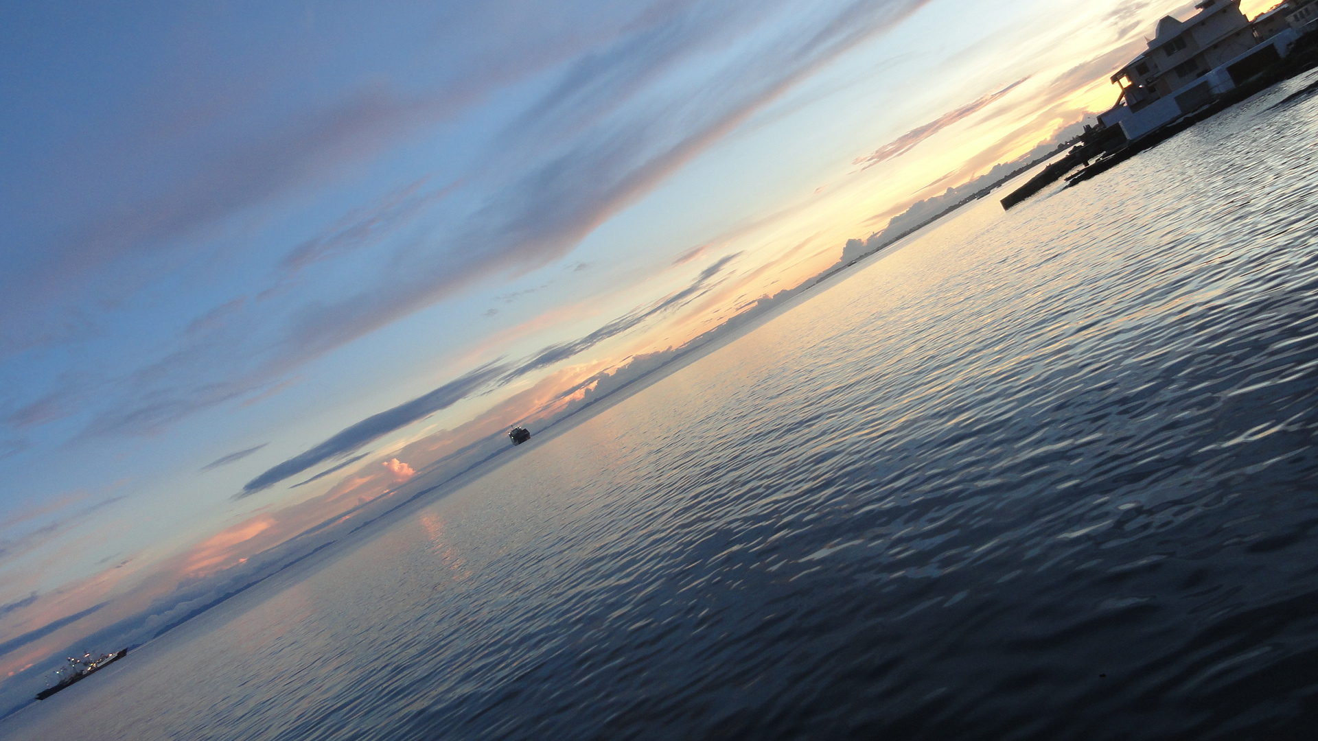
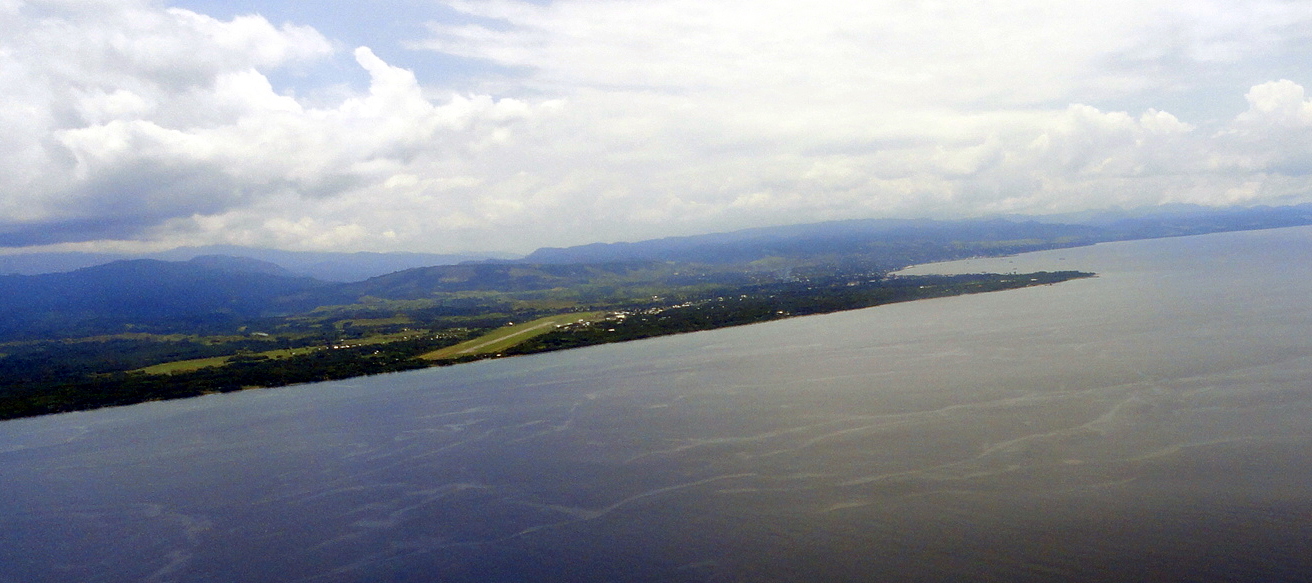
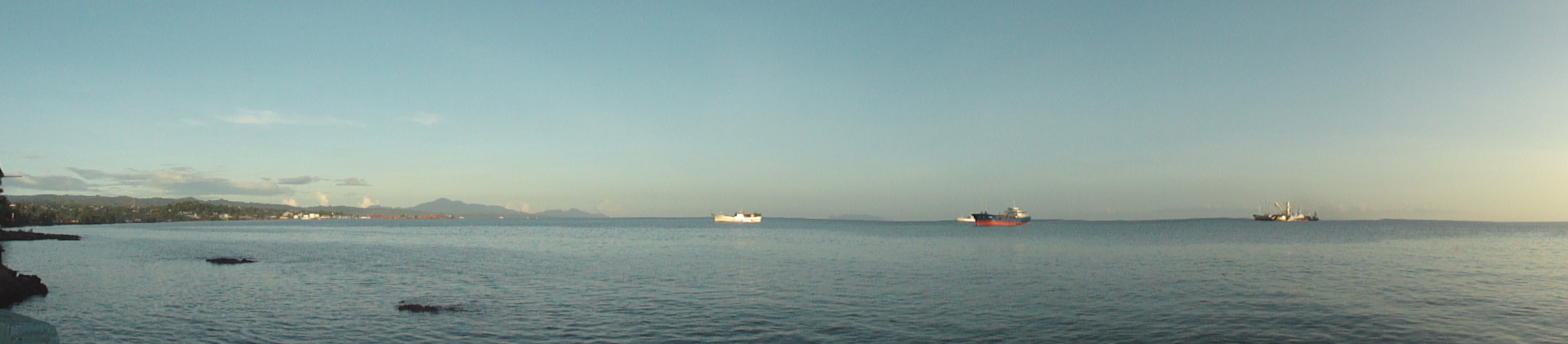
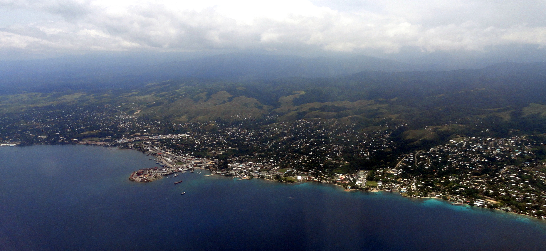 So four weeks ago today as I post this, I was flying from Port Moresby in PNG to the lovely hillside harbor you see in the photo just above: Honiara, capital of the Solomon Islands. We’re hoping to do some work there similar to the work we’ve been doing for years in PNG, and that of course would be the reason I was flying over. But since this remains as always the blog about my own personal observations of the places I find myself in around this world, we won’t talk about that. Instead, we’ll talk about all the lovely Pacific-Island sculpture to be seen in the National Museum’s courtyard, and about the importance of the airfield where I landed in the history of WWII. Yes indeed, 71 years before that shot above was taken, it would have been quite impossible for a non-military plane to fly past; and any plane flying past would have faced a scary battery of defenses set up by the US and Australian military when they landed here in August 1942. More about that a bit lower down. For now, isn’t it a lovely harbor? I found it to be quite a warm and friendly place – a bit more mellow and smaller than Port Moresby.
smt, slt reminds you that when we try to do nice things with photos such as make them smaller and larger or shift them left or right, this blog is best viewed in something other than firefox or i-explorer: we find chrome works best on windows-type machines.

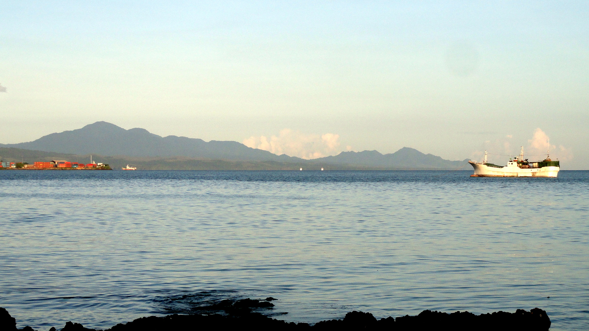

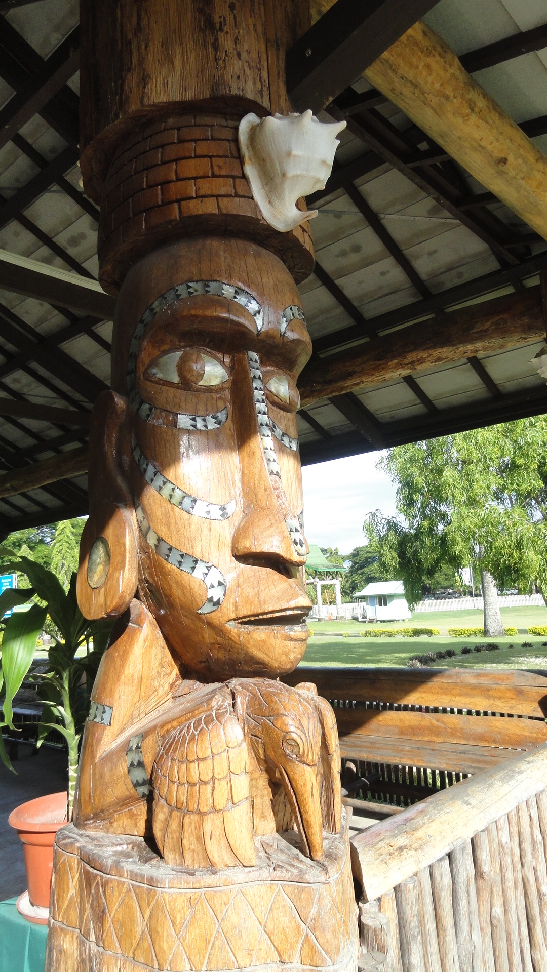
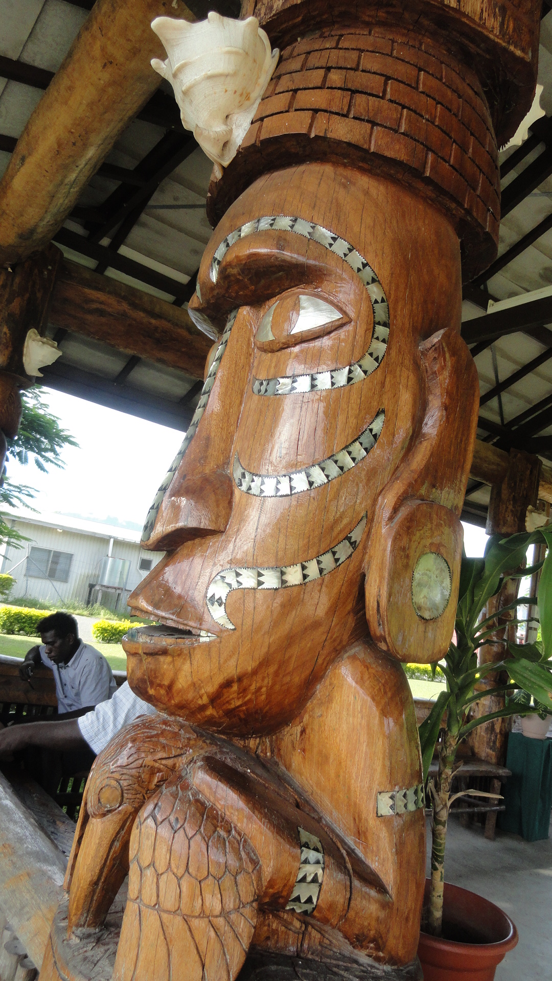
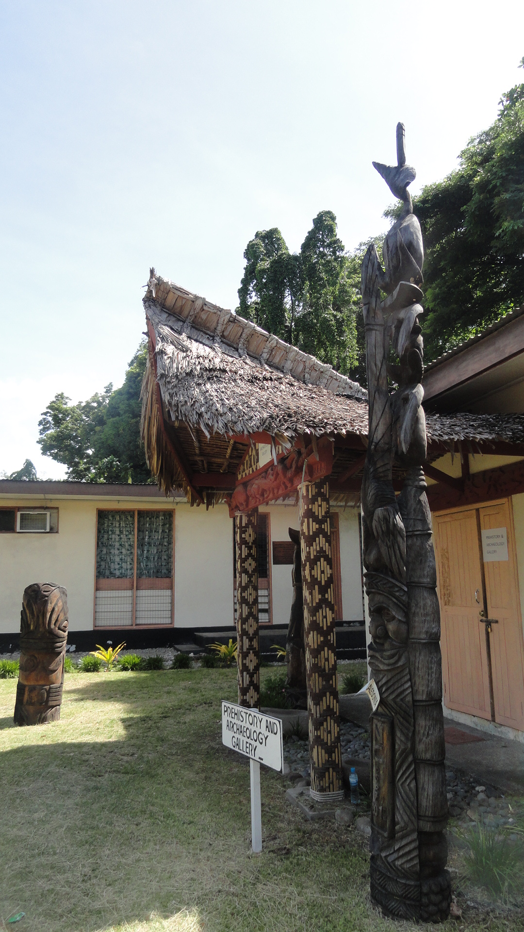
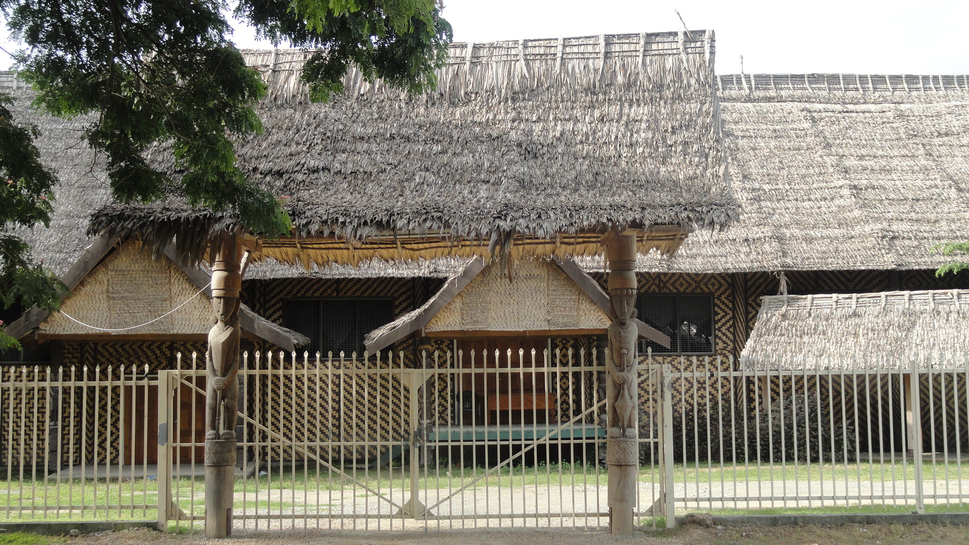
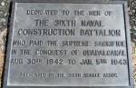
Above, sculptures in the courtyard of the National Museum in downtown Honiara; lots more further on. Also, above and below, shots of the harbor of Honiara at various times of day. This is one of the most wreck-strewn harbors in the world, I guess, with so many ships of both sides sunk during the many battles fought between 7 August 1942 and about 9 February 1943 when the front line decisively moved a bit further north.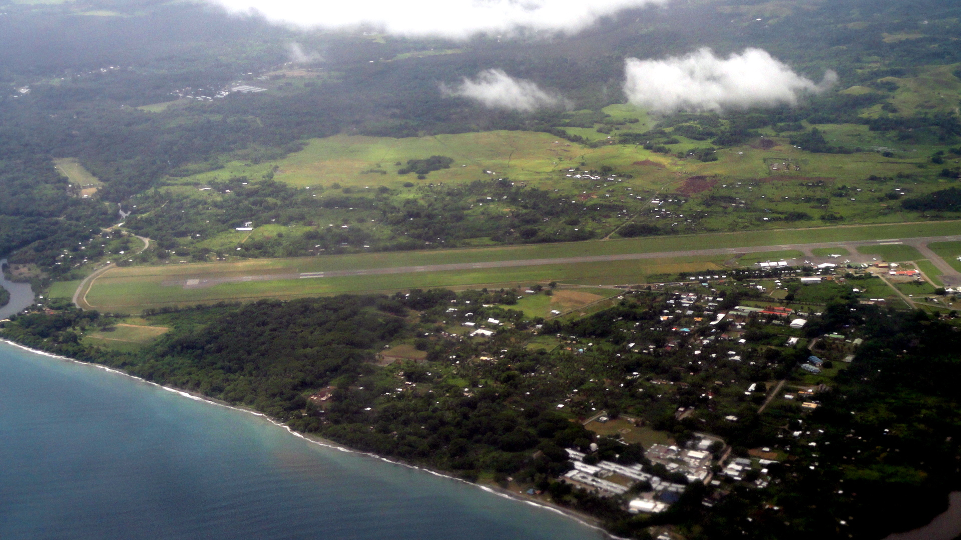

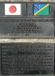
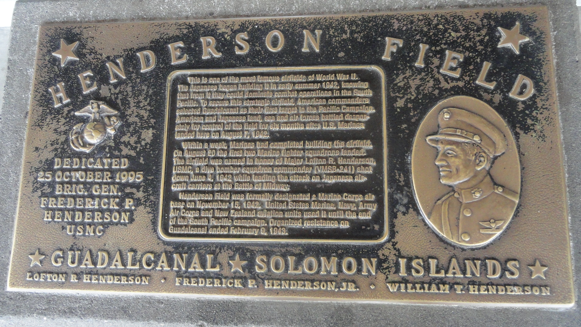 And it’s all about that air field: why the Australians and Americans decided this would be the first place they would decisively commit to holding a line and stopping the Japanese advance across the Pacific. Had Japan completed and maintained an airstrip here, their planes would have been able to attack the shipping between Australia and the US West Coast, something Australia particularly wanted to avoid. I know someone, an old family friend, who in her childhood at the family dinner table placed a pin on the map for Honiara when they learned her marine brother had been sent here. Who knows, maybe he was among those who set up or used the gun in the shot below, which I assume (didn’t verify) was actually used during that war. History can seem cold and stiff if you’re born after it happened, but it’s good to remember that it happened to real living, breathing people who experienced real living strong emotions of fear and joy, and though time dims the immediacy, it’s still wise to honor the gains, losses and lessons learned by our predecessors…
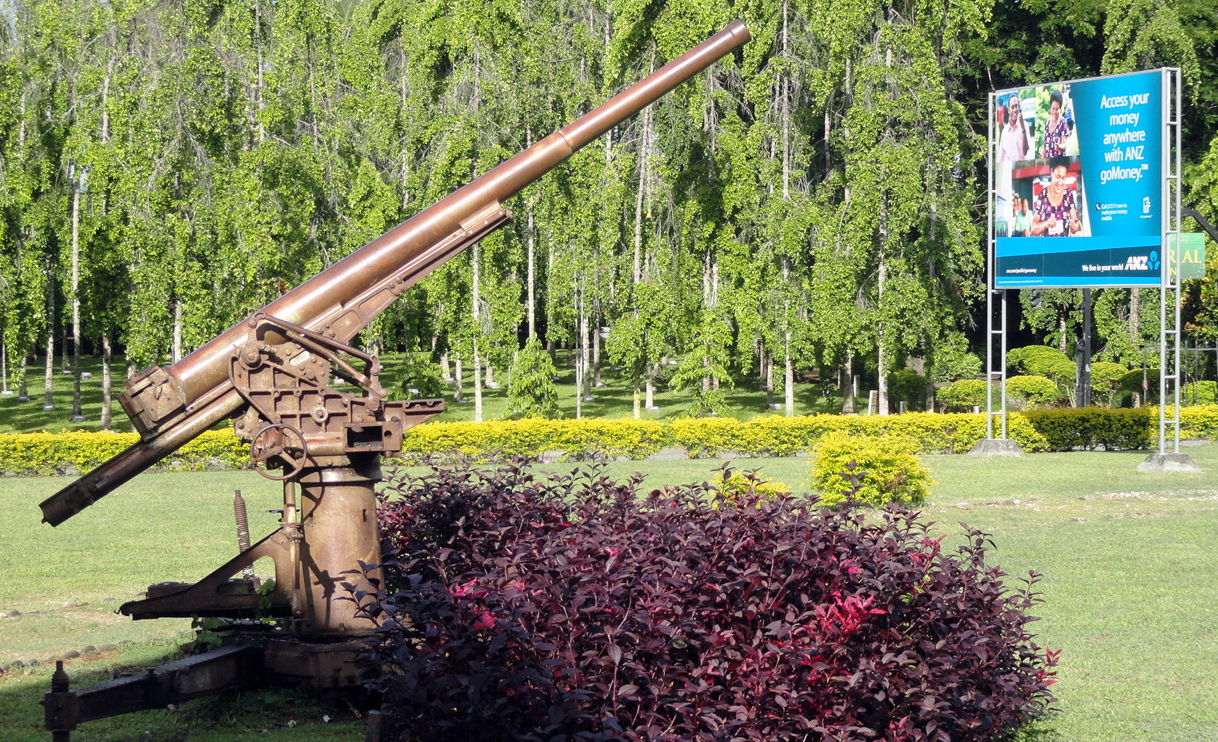
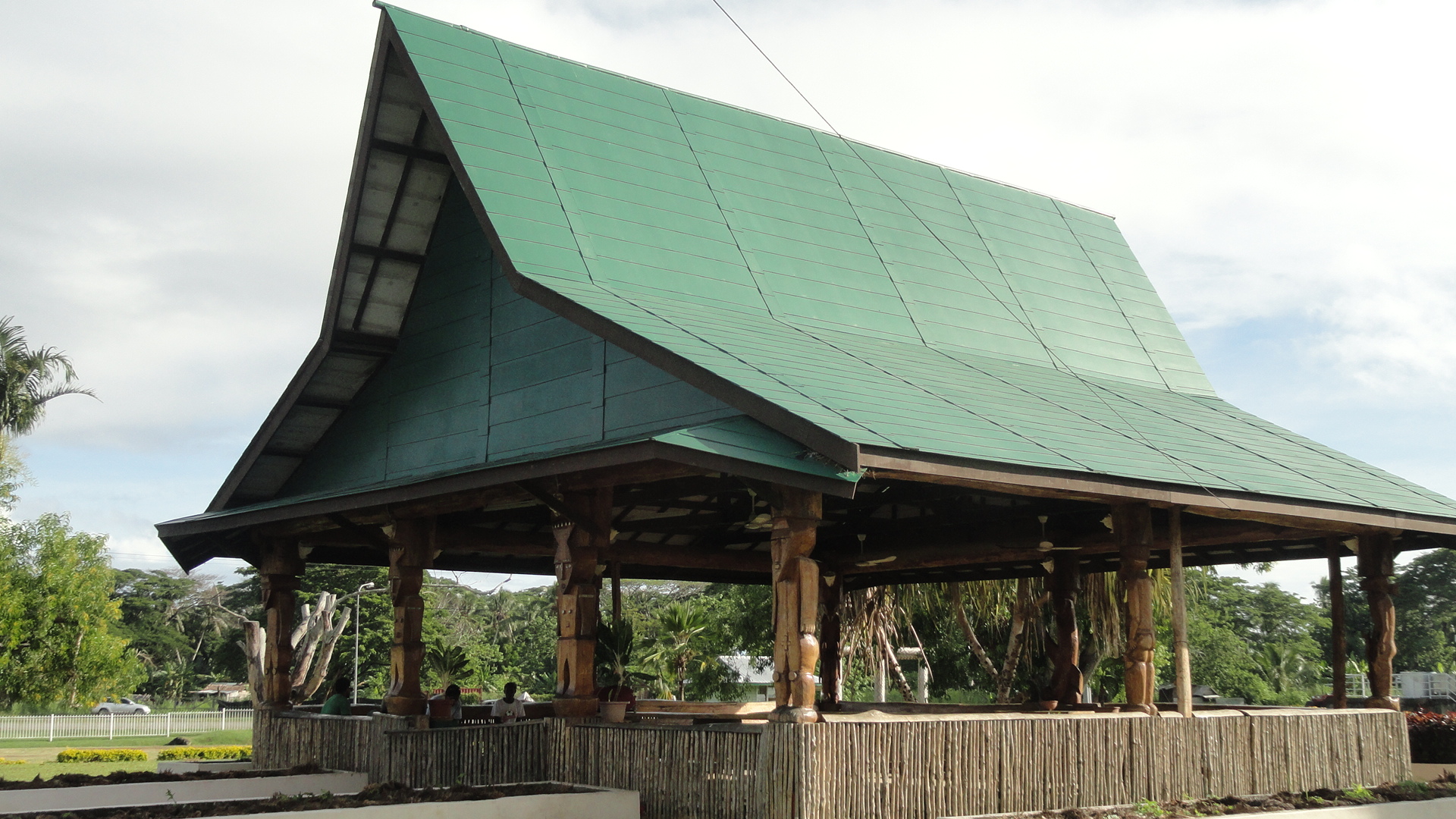
This lovely plein-air structure is one of two waiting rooms sitting in front of the concrete airport terminal. Naturally I spent most of my time here, until immigration opened and we were allowed through into the actual boarding area – though the modern terminal building has a cafe, it couldn’t compete with the views out of doors. Lower down, a view of a small island across the way from Honiara Harbor: that’s Savo Island. History tells us that the very night after the first US-Australian landing on Honiara, a Japanese naval force disabled or sank nearly all of the allied ships remaining nearby; and if they’d realized the aircraft carrier was already powering back to Fiji, they could have stayed and possibly turned the battle back their way. They didn’t, instead hustling back to their main base at Rabaul (PNG) to be under cover of their air squadrons…and the war played out as it did.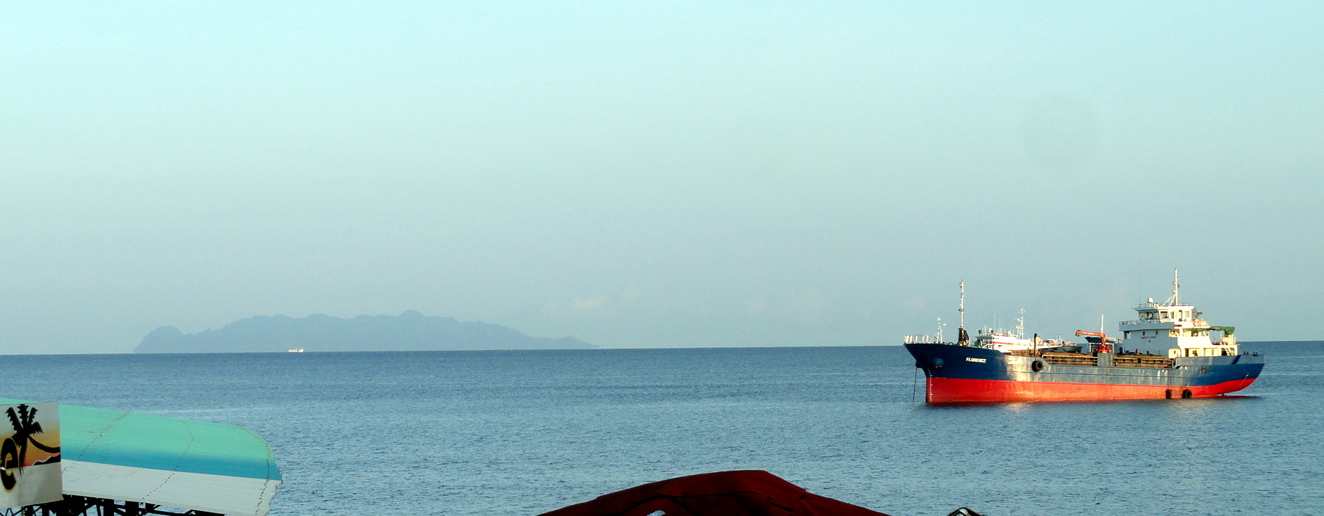
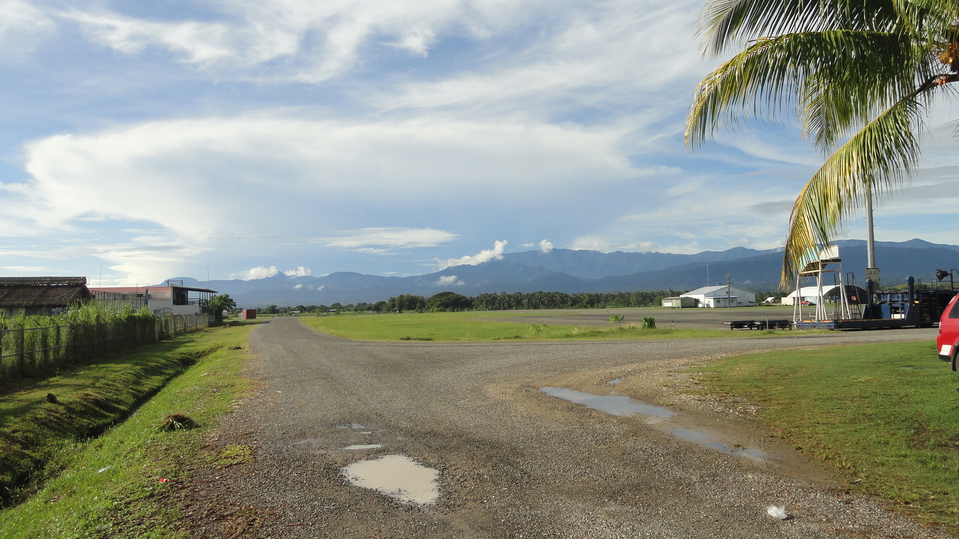
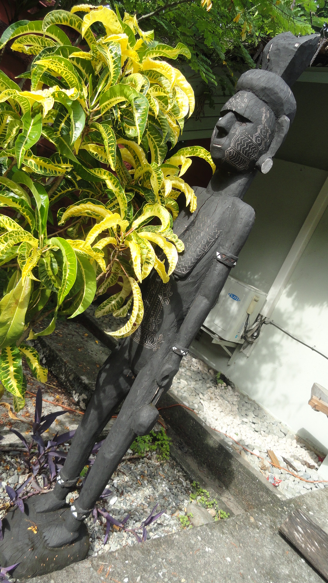
And it was all for that airstrip there, photographed as we approached for landing on the 16th of February, 71 years and 7 days after Wikipedia tells me that campaign was officially considered ended. And now we get to the great local culture stuff: I loved all the wooden sculpture in Honiara, as you’ve seen from the airport waiting shacks. Here’s more, below, from the National Museum.
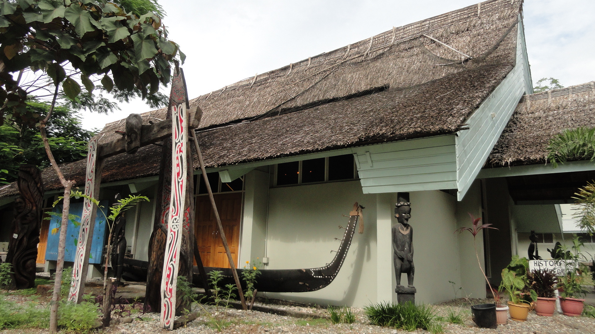
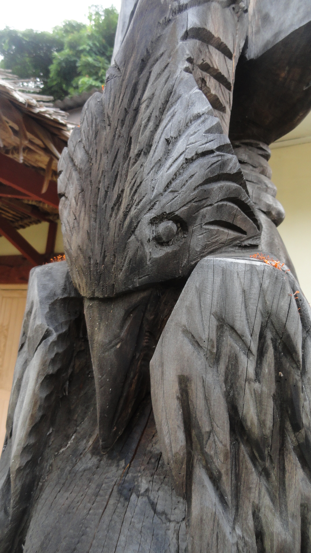 This is art from all over the Pacific islands, not just Solomons. There are three primary regions – Melanesia which includes both PNG and Solomons; Polynesia which is more famous in the US at least and stretches eastward to Hawaii and southward to Tahiti etc.; and Micronesia which is up north and includes, I think, Guam.


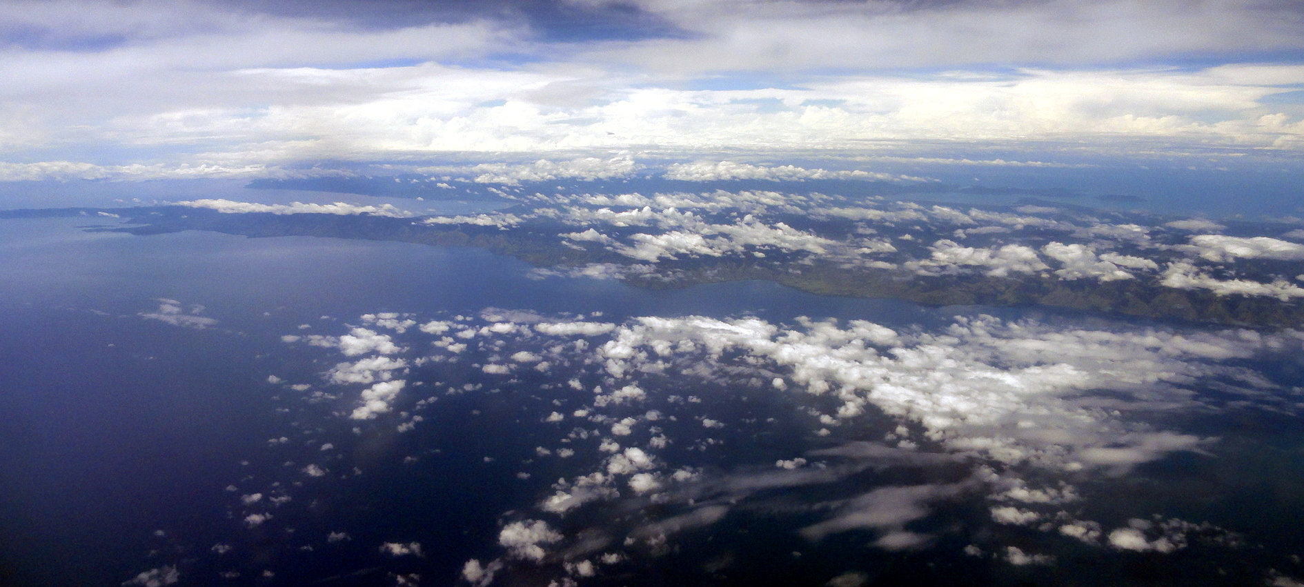
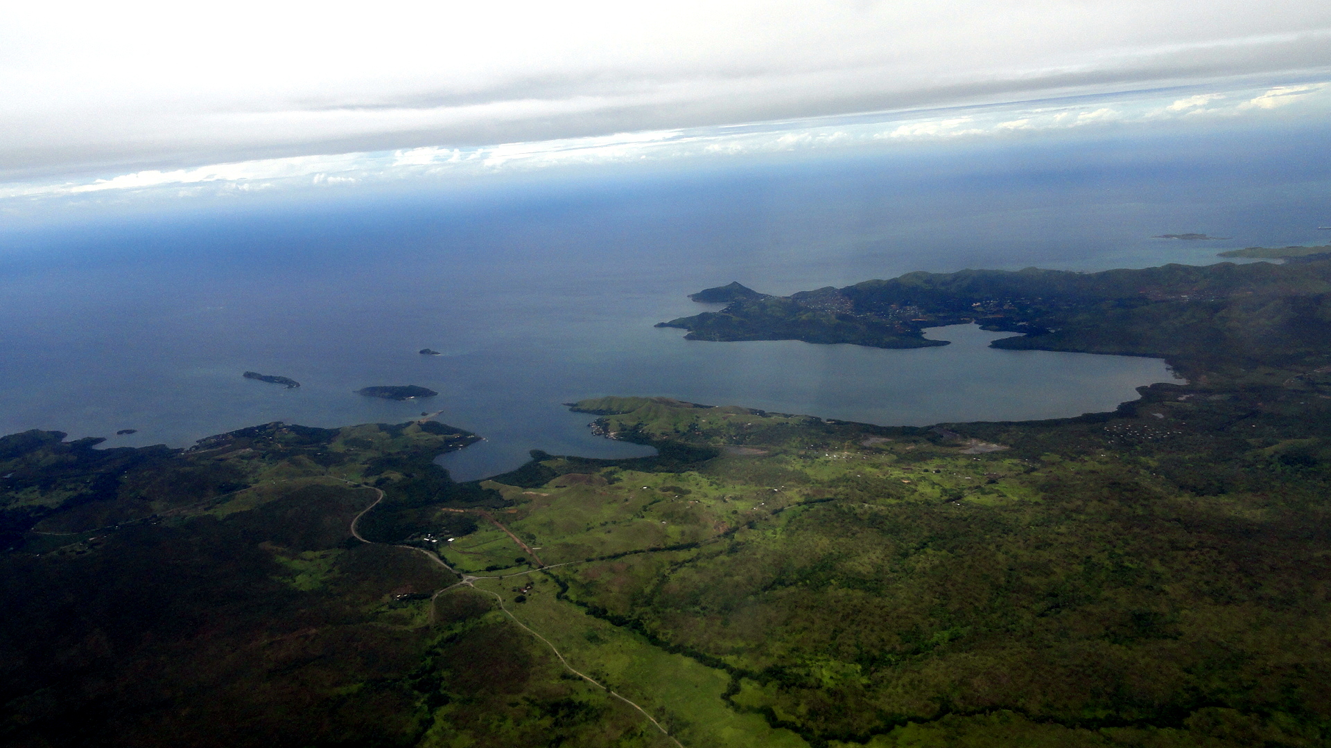
And with that little gallery, I wrap up the shots from Solomon Islands, and shift to more of my PNG pastime, aerial shots! Below, you see the following shots in the order listed: the bay on which I believe Alotau, at the eastern end of the island of New Guinea, is located; with a peninsula of land stretching east on the southern side of the bay. The next shot down, you see that peninsula ending in the sea, effectively pointing east towards Honiara more or less. And we end with a larger-area shot of Bootless Bay and Pyramid Peak on Pyramid Point, and then with one final shot of that personal-favorite landmark (Pyramid Peak, which you’ll find several other times in these entries…) just on the coast east of downtown Port Moresby. Since I’ve now left PNG for the last time (at least on this assignment), this is one of a few fond farewells likely to appear in these pages to a land that gave me meaningful work, a good home and very warm and welcoming friends and colleagues over the two years I was there. Tenk yu tru.