Beauty and the Burn.2


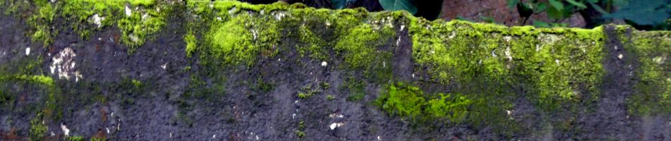
I’ve been showing you the view of the Mayacamas ridge as seen from ground level in our valley. Saturday we went for a hike on a few of the trails that have now reopened in Sugarloaf Ridge State Park. Driving up to the entrance, along a lovely narrow canyon road that I’d not visited since before the Tubbs fire first burned this area three years ago, it was hard not cry realizing how much damage the area has sustained. Our walk went for some time right along the fire line where they’d clearly managed to hold it. You can see see that fact in the photo of the tree with a burned trunk, surrounded by green: it must have been a small hotspot just on the southern edge of the fire line, with the rest of the fire barely maintained to the north at that particular spot. You can see more such fireline photos in another post from another park and yet a third recent fire in this post from three years ago: https://somuchworldsolittletime.com/2017/11/13/walking-the-fire-line-in-annadel/
I’ll post more of these in coming weeks, now that fire danger is again low for the moment thanks to just barely enough rain, and colder temperatures. As you’ll note, I’ve decided to just give them their own name as a series…a sub-genre of county views, I guess, albeit a sad sign-of-the-times sub-genre. Stay safe and healthy in this week which for the US is normally a celebratory holiday week. Love to my friends and family here and around the world.
County Views: Beauty & The Burn

 So we’re getting a bit more rain yesterday & today: Santa Rosa itself may reach the magic inch of rainfall before today is out. Thus, I’ve decided it may be safe for me to post these remaining photos I took in the days and weeks after the Glass Fire exploded into Santa Rosa over the Mayacamas Mountains. (Safe, in the sense that it’s less likely yet another fire will explode over the mountains. Though one really never knows, these days…) Somewhere in each of these photos you can see the burned ridges and eastern slopes of the range that separates us from Napa county, the view I see from my home, from my bike rides and hikes around most of this central part of the county. Most of it’s what I called twiced-burned, in a post not long ago.
I’ve recently been on many a hike, alone or with friends, where I know how to detect the marks from the Nuns and Tubbs fires three years ago. Things can grow back, so long as there’s time and enough rain to regrow. This landscape and ecosystem evolved with fire, but it did that evolving before our human pollution started tipping the balance and changing the atmosphere so very much. I wonder how much of this beauty our current childrens’ great-grandchildren will be able to see still. I wonder how many of our fellow citizens actually even care to ask themselves these questions and consider changing their habits and patterns to help preserve more for our future generations.


County Views.41
For those who’ve wanted more updates, a few photos from my biking excursions on a favorite road at then northern edge of our beloved local state park, which apparently became the fire line when the Glass Fire got closest to my home earlier this month. As I write this, we still haven’t had rain but seem to have made it intact through another week of high winds. I will not invite into the universe the words of the thing that high winds make us fear: use your imagination, please. And then, imagine rain and a world where scientific evidence drives public policy to build a future that our own future generations inhabit healthfully, in fruitful coexistence with all of world’s mysteries and species. These shots were all taken in a short stretch along Channel Drive on the north side of Annadel, where some private homes abut park land. The hills in the background, in the shot with the horses, are in the Mayacamas range, previously featured in the “twice burned” post. That particular property is less than 1/2-mile from where the bottle and burned brush are. Clearly, that house and all others in the area fell under emergency evacuation order the night the fire grew so fast.


County Views: Twice-Burned

The mountain ridge between Sonoma and Napa counties is part of the Mayacamas, one of the many ranges of coastal mountains that run roughly north-south around here. Santa Rosa sits mostly in a plain, with mountains on more or less three sides. Much of the mountain area is parkland – county, state and local parks where we hike, bike, camp and run. Major parts of Hood Mountain Regional Park, as well as Sugarloaf Ridge State Park with which it shares the mountains you see in all the photos above and below, have now been burned twice in three years — first in the Tubbs Fire (started October 8, 2017), and again this year in the Glass Fire (started September 27). CalFire’s website says February 9, 2018 was the final-containment date of the Tubbs, which burned 36,807 acres. For now, the same site says the Glass is 97% contained and has burned 67,484 acres. The state and county parks on the southern side of that valley (Spring Lake regional park and Annadel State Park) reopened last week, so I was able to get out and see how things look now. I’m overcoming reluctance to post these, so that folks can see the beauty and the destruction we’re living with now. Reluctance, because we don’t know when our first real rains will come and bring an end to this awful fire season. Reluctance, because even as I write this there is yet another red-flag warning from the weather service because of high winds expected in the mountain areas. But I do want to share, so here goes… We do love our parks and hope that some rain, and perhaps evidence-based acknowledgment of what we need to do to reduce the rapidly-accelerating pace of global warming, will help even our grandchildren and great-grandchildren enjoy them. The alternatives really do seem rather bleak.


County Views – Scorched Earth


The photos just above were all taken along Rte 1 (aka Pacific Coast Highway or Coast Highway, depending what part of the state you’re in) last Friday during my trip to Stillwater Cove on Sonoma County’s central coast. The first complex of fires to break out in Sonoma County (as well as Napa, Lake, Solano and Yolo counties) were sparked by a lovely but freaky overnight lightning storm in mid-August. Historically (before human-driven climate change), lightning in the summer doesn’t happen in coastal California. Nor does rain. This storm sparked lots of fires across our region which is always quite dry by this time in the year, since our rains typically all arrive between October and March.
Typically, our fires here in northern California don’t get serious until around October, but the many fires sparked by that August storm were all collectively named the “LNU Complex Fires” by CalFire, our wonderful state department of forestry and fire protection. The charred hills you see above are what’s left after the Meyers Fire, part of the LNU complex, which scorched a few thousand acres of mostly grassland on the hills right above the ocean, and which threatened a remarkable historic site at Fort Ross State Historic Park. (You can see a photo of its Russian-Orthodox Church at this link – https://somuchworldsolittletime.com/2017/11/29/vulnerable-and-grateful/#jp-carousel-8316)
The shots below show some of what I saw in my immediate neighborhood on Monday the 28th of September, the morning after the Glass Fire opened a new front in Santa Rosa & Sonoma county last week. I never expected to need to learn the names of one wildfire after another, and honestly before 2017 I don’t think Sonoma County had seen terribly destructive wildfires for many years. Now it’s one after another – four fire complexes affecting SoCo in three years — and we can name them all. Friends who’ve lost homes are warned to evacuate again, and friends who were evacuated before are evacuated again. And yet public policy at the national level continues to be driven by denial of reality. It’s all quite distressing, and so one heads to the Redwoods to be reminded of the greater realities that surround us. (E.g., in case you haven’t already seen it, https://somuchworldsolittletime.com/2020/10/03/if-i-were-a-redwood/) Since our corner of the world remains a blessed & beautiful place that I’m grateful to call home, I continue to take shots of the loveliness that surrounds me – at least when I can perceive it through the literal and figurative smoke. So you will also see me catching up with the always-present backlog of loveliness that my camera captures as I walk, bike or drive its paths, highways and byways :-). Thanks for your interest and your comments.


County Views – Obscured & Unobscured


It might not be immediately apparent, but all three photos above were taken from the same place on different mornings this week. Unlike most of my photos, I’ve not color-adjusted or shifted the contrast at all from what the phone-camera recorded when I tapped the screen. Depending on your screen, you should see a larger photo with a more clearly-defined dawn sky with perceptibly-blue upper levels and a nicely-orange horizon as the earth turns on its axis so as to allow Bennet Mountain to dip below the level of the sun…or, as we narcissistic humans with our limited perceptional abilities would normally put it, “for the sun to rise above Bennet Mountain.” (As though the sun could be troubled to move in relation to puny little earth lol.)
I took that one this morning. At left is a photo from Monday morning, taken roughly half an hour later than this morning’s photo, the first morning after the Glass Fire had exploded up and over the mountains from Napa into Sonoma county, much as the Tubbs fire did three years ago in October. The third photo in this little triptych was taken an hour or so later on Tuesday morning, when the sun was already well up in the sky…though, as you see, so thoroughly obscured by smoke from the fires that one could stare directly at it without any discomfort. And that just ain’t right. (You can click on the photos to see exact date and time in the phone’s format of yyyymmdd_hhmmss.)
Forecasts now give reason for hope of gradually better air quality and slowly clearing skies this week. But we all know we are also still in the early part of what’s our normal fire season — late in the dry period, before our seasonal heavy rains usually kick in. I don’t think Santa Rosa had been directly threatened or affected by significant wild fires in several decades until 2017, but since then we’ve seen four fires in three years.
We are hoping for rain. We are hoping for a national political dialogue that stops denying climate change and starts working again towards radically reduced carbon emissions as national public policy, to try to preserve some sort of livable planet and atmosphere for our children’s children’s children’s… But for now I think I’ll do what I can to revel in a day of fairly clean air and fairly cool temperatures :-).
