Mountains.44

Mountains.36

From the Air.44


Olompali – Views & History


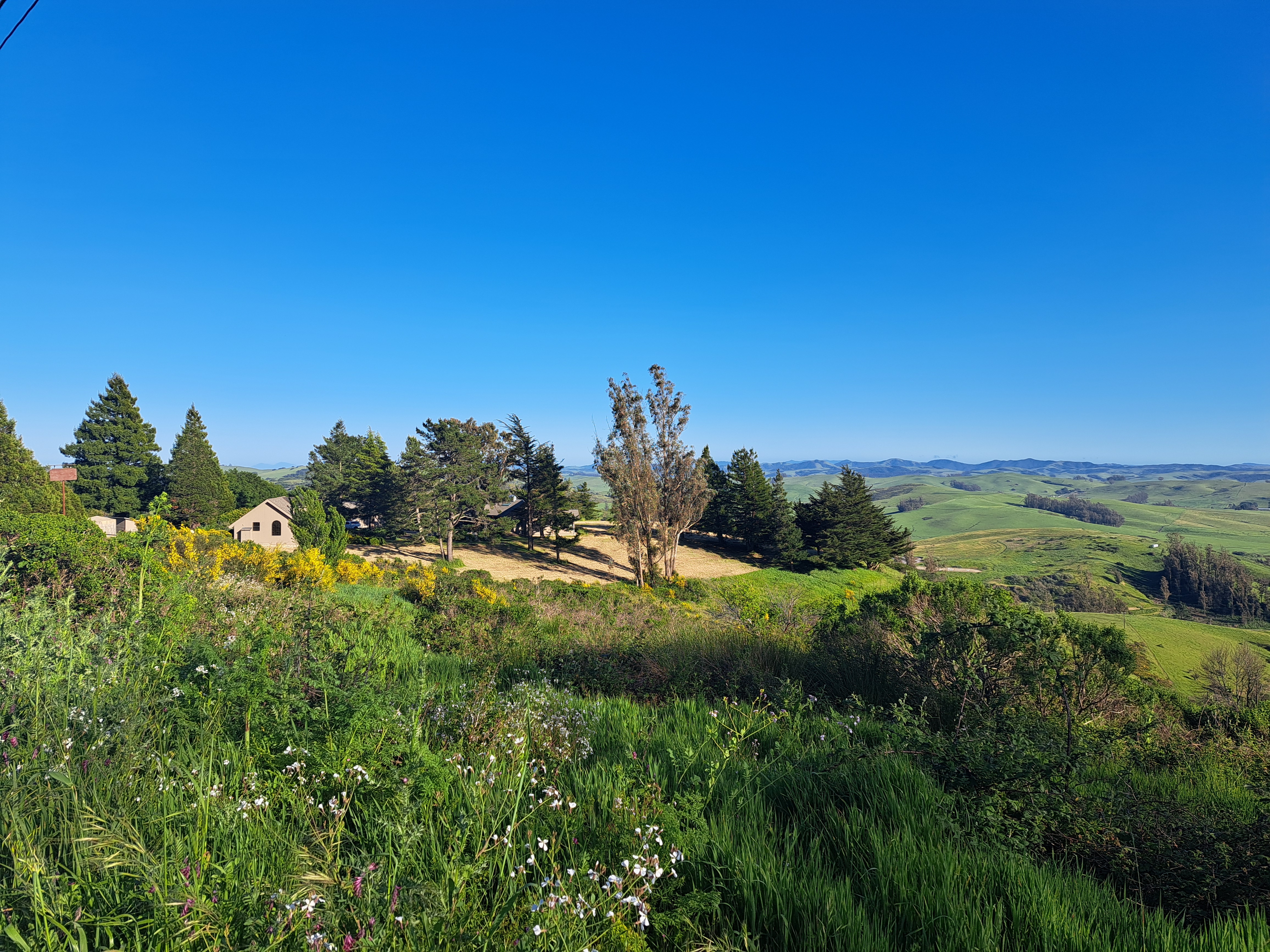
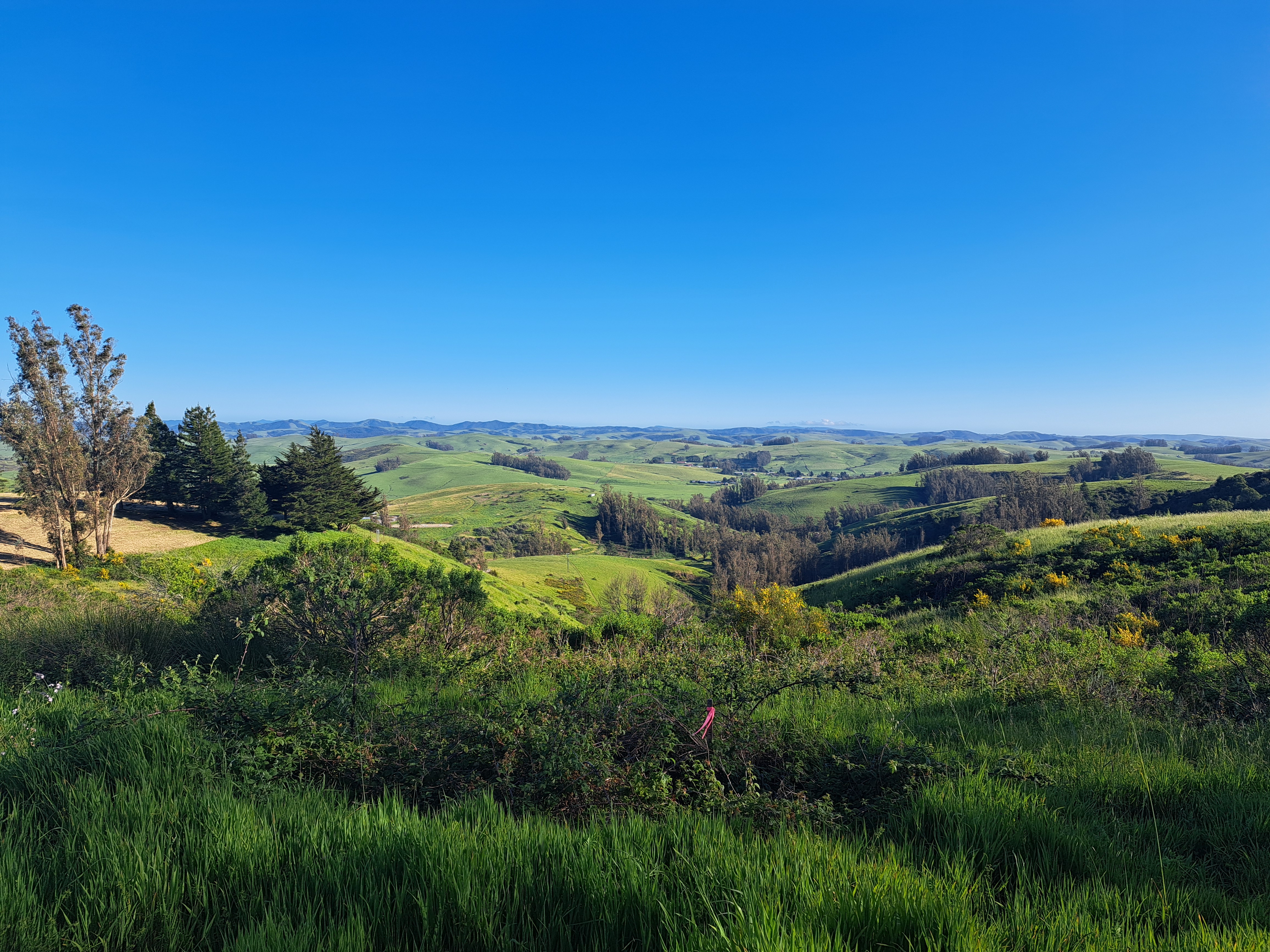
 Olompali State Historic Park fits into northerneasternmost Marin County where it meets Sonoma County, along Rte 101. North of the town of Novato, it’s a place I’ve driven past often whether in public buses or in private cars, but hadn’t ever explored until last month, when I and a friend in SF chose it as our park-in-the-middle to explore, so as to both see each other and remain relatively covid-safe through outdoor socializing. We went again earlier this week, along with a beloved member of the next generation, and I’m putting a lot of the larger-vista photos in this post. (You’ve already been seeing some close up shots from both trips in various other series.) Olompali is a place where California’s layers of history are present: farthest back, as an important local hub for the Coast Miwok, who were the indigenous first humans to settle in this region. Later on, it became the only place we know of in California where a Miwok received from the Spanish colonial government a land grand to stay on and work the land. Later still, it was the only place recorded where a Mexican solider died during the Bear-Republic conflict that was a local manifestation of the war that took control of modern-day California (plus a whole lot more of the current American west) away from Mexico. Later still – hey, the Grateful Dead hung out there for a while in the late 60s or early 70s.
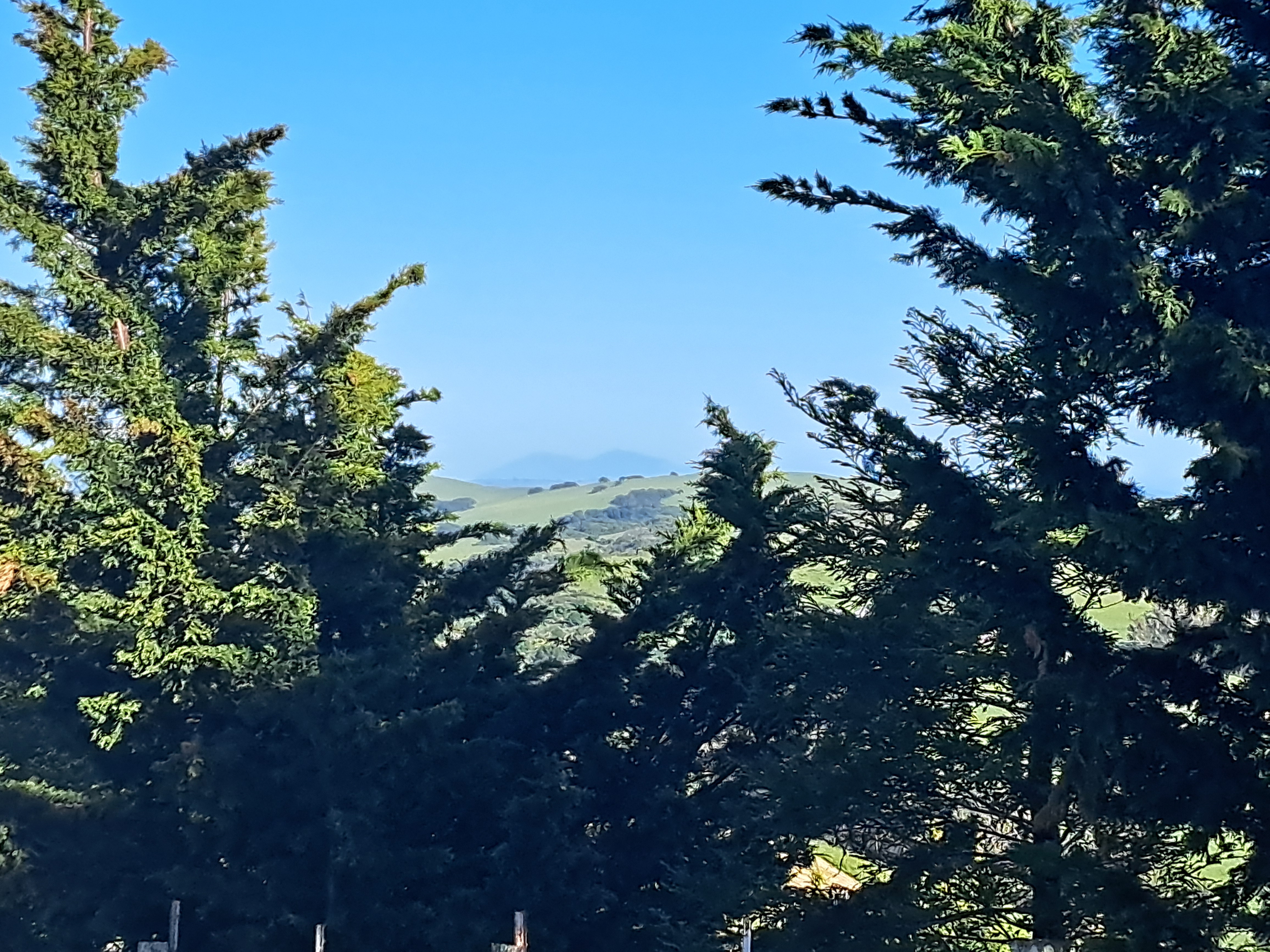
Fascinating place, and good to be reminded of the complex layers of human-habitation history that surround us here. For the moment though, enjoy the photos from one trip in late December, another in mid-January. Mid-January photos, though taken on a scary-warm day, are generally greener because at least some inches of rain fell between the two visits. From the heights, one can see several regionally-important peaks: Mt Diablo in the east bay; Mt Tamalpais in Marin (which you saw from the south, in the Hill 88 post recently); Mt St Helena peaking over a ridge in at least one of the shots. You can also catch a few of the highest towers in SF peeking over the Marin headlands behind the town of Novato in one or two shots, if you know where to look. Enjoy – and may all our vistas be clear, but with enough clouds to bring the rain we need to grow…


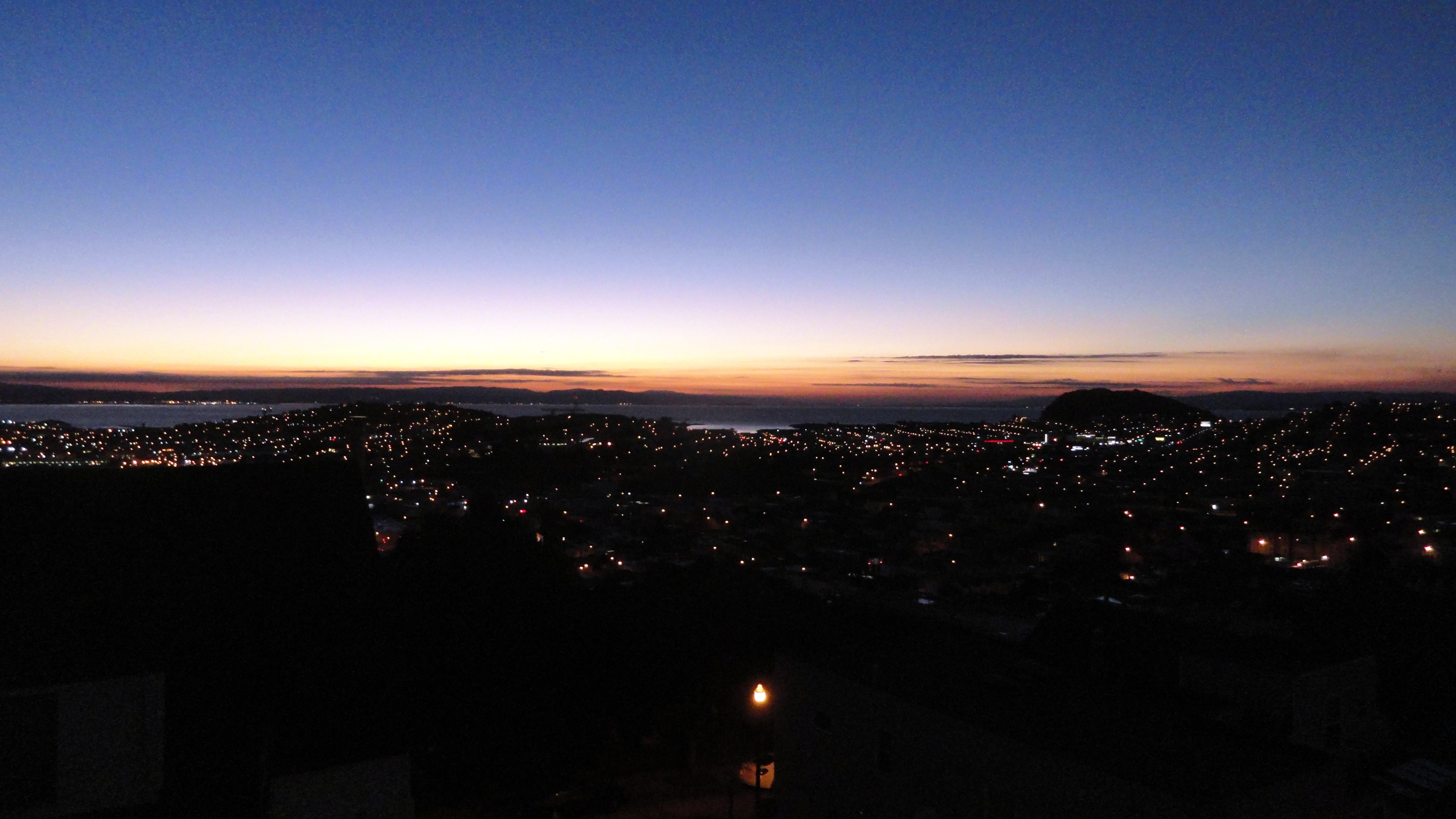
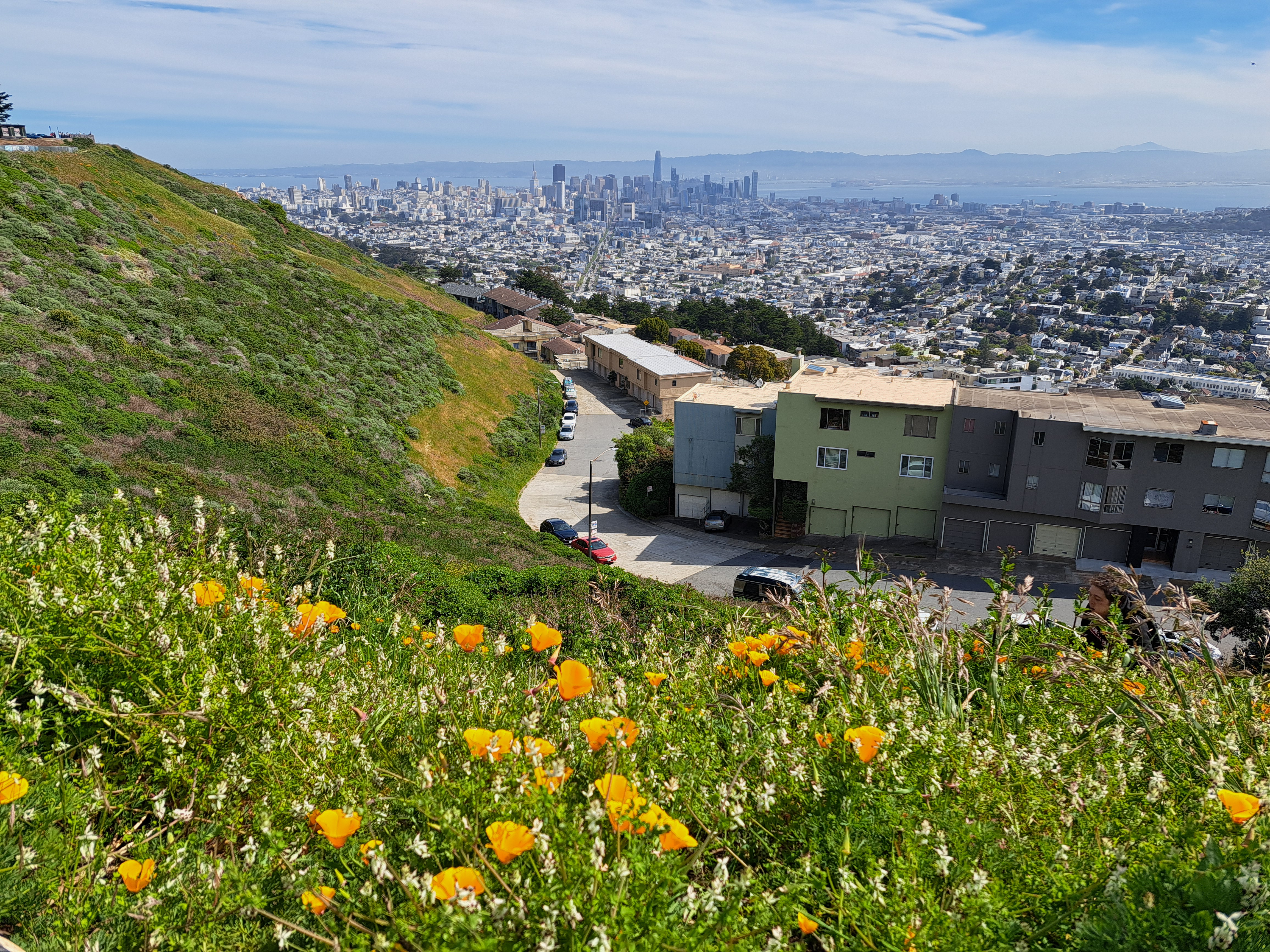
The View from Hill 88

In the midst of those beautiful hills & vistas I showcased to start our year yesterday sits Hill 88. On which sit these abandoned buildings from some past military radar or other installation about whose purpose I know nothing more. These buildings, while being slowly eaten by natural processes, for now provide ample canvases for graffiti artists. The first photo above, I must say, makes me think of Keith Haring and what things were like in NYC in the 1980s… (If his name is new to you, look him up.) To orient you, in the panorama just above you see – from left to right – the east bay with Mt Diablo (two bumps just to the right of the graffitied building), running to the SF skyline (including tops of the towers of the GGB, if you look closely enough) then the hills and Pacific Coastline along the peninsula.


Travel Memories, Known & Unknown
 Imagine, if you will, boarding a series of flights at pretty much midnight in one time zone, to make connections in two different cities and end up landing halfway around the world, quite literally, about 36 hours later. Especially during covid, with all the uncertainties that implies. (For the record: I’m too lazy to capitalize that disease correctly. I also don’t want to give it any more of my time or energy than it’s already taken, nor do I feel it deserves the respect of me spelling it entirely properly. So there.)
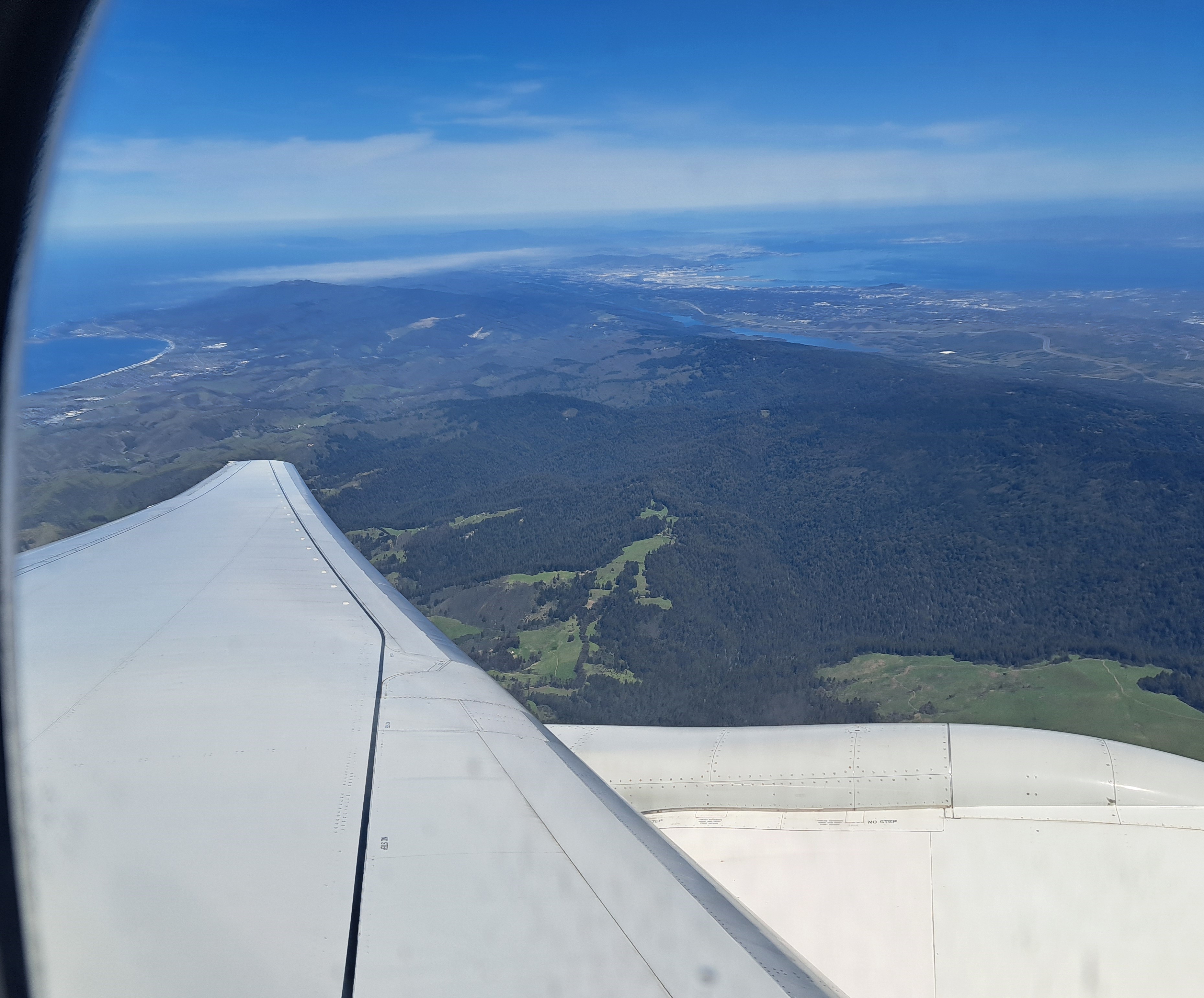
So anyway, one gets confused, and apparently one’s phone also gets confused! The phone believes the above photograph was taken before some of the ones below, which I know to be untrue because, well, it’s the only photo for which I have 100% certainty about what it shows: Mt. Diablo during a beautiful sunset on the evening of July 4th this year. Meaning it was taken as the last airplane I boarded that day was approaching the runway at SFO.


So with these three, I’m about 80% confident they all show the shores of Lake Michigan and the general sprawl of Chicago Metro, most likely as we made our approach to O’Hare earlier that same 4th of July. If you click the individual shots, you’ll see the phone’s time-stamp filenames. Which in this case means it looks like they were taken at nearly midnight, while the amount of natural daylight suggests otherwise. Ah, the confusions of time zones and international air travel…
And we finish with these two below, which I’m more than 50% confident were taken somewhere around the general shores-of-the-Black-Sea area, simply because I remember waking up, looking out the window to see a crumpled mountainous landscape, checking the flight-path screen to learn we were somewhere in the region of the Caucasus. That being a part of the world I’ve neither visited on-ground, nor flown over much, I thought “hey, let’s snap a shot or two.” And even though the camera thought it was middle of the day, my body sent me more or less immediately back to sleep and blissful forgetfulness.


It’s Raining in California!
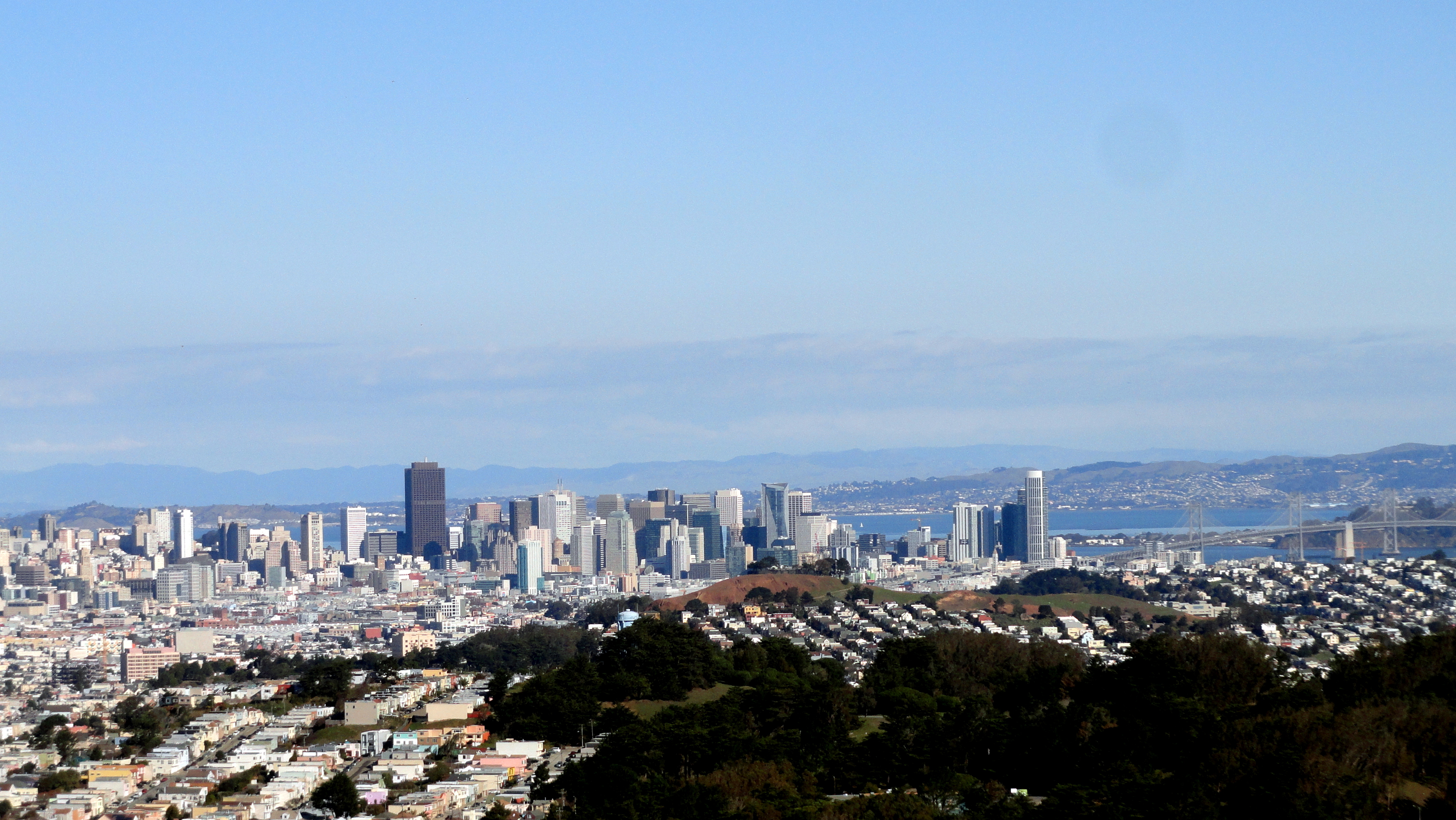
 The bay area, which I call home and return to between assignments or even on vacations during an assignment when possible, has its icons. There the golden gate bridge, which I cross every time I go to my own physical home after flying into SFO. There’s the corner of Castro & Market, with its massive rainbow flag as a statement to the world that the city’s LGBTQI (did I forget any of the currently-accepted letters?) population is proud and not about to creep back into some box just because some people don’t much like us. There’s Mt Diablo, forming a triangle across the bay as the highest peak in the immediate bay area — visible behind that rainbow flag, down below. There are vineyards…and this year, there’s rain in the vineyards! And snow in the mountains, though I’ve not yet been to see it myself. Perhaps I’ll make it to the mountains after this assignment, before it all melts. Something to keep in mind.
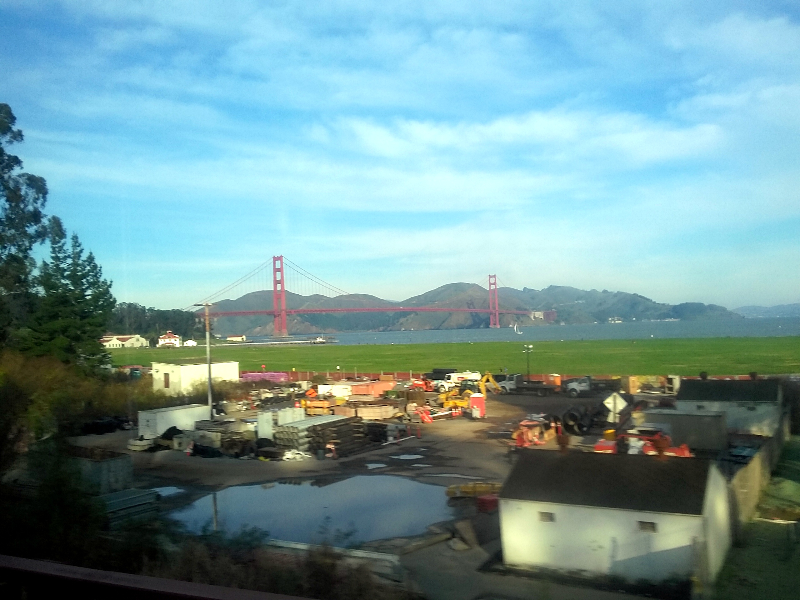
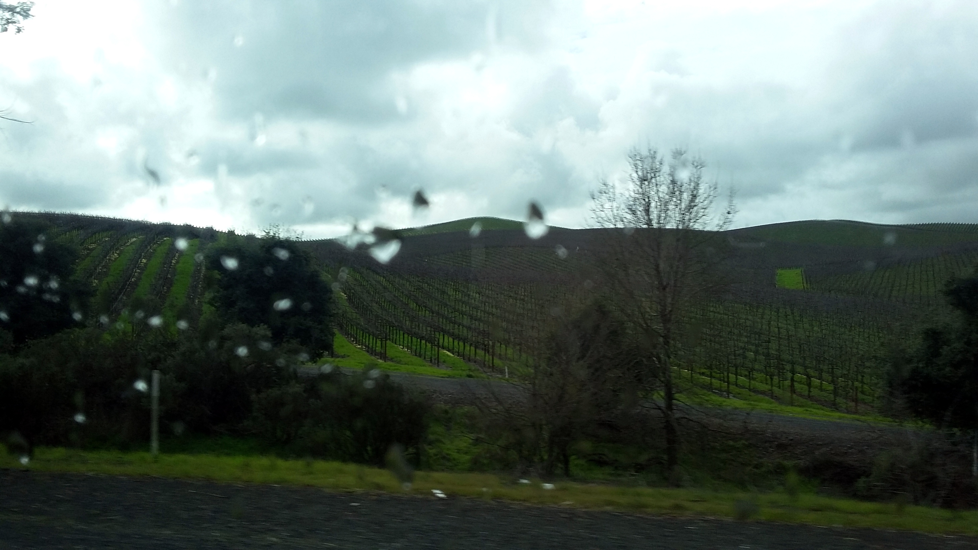
In any case, I was recently back amongst these icons for a final vacation during the current assignment. When the weather was sufficiently clear, I walked or biked around and appreciated the greenest vistas I’ve seen in years, since California’s been in a drought that’s grown more severe year by year for a decade or so. As it rained on my way back to the airport for the flight back to PaP, I photographed one of Sonoma County’s lovely hillside vineyards through the bus’s rainy window. On the way up, I photographed the GGB through the bus’s reasonably clear window. And I took as many photos of flowers as I could: so much was in bloom! I’ll admit I’ve been overworked at work, depressed in real life at home about what’s become of government and “civil” discourse in my native land, and generally rather tired. So I’ve not taken out my camera much. But I do usually have a phone with me and I’m now on instagram (paulbsrca) so every now and then I remember I can snap something with that, then pop it up on instagram. But I remain more of a long-form guy, so here I’m assembling stuff from both camera & phone, to share some of what I’ve seen and thought lately. It’s always lovely when I know folks read and appreciate what I share. Thanks…and let’s all try to add a wee bit more beauty and pleasure into the days and lives of those around us…if that’s not too bold a suggestion. Peace. 🙂


The Bay on New Year’s Day

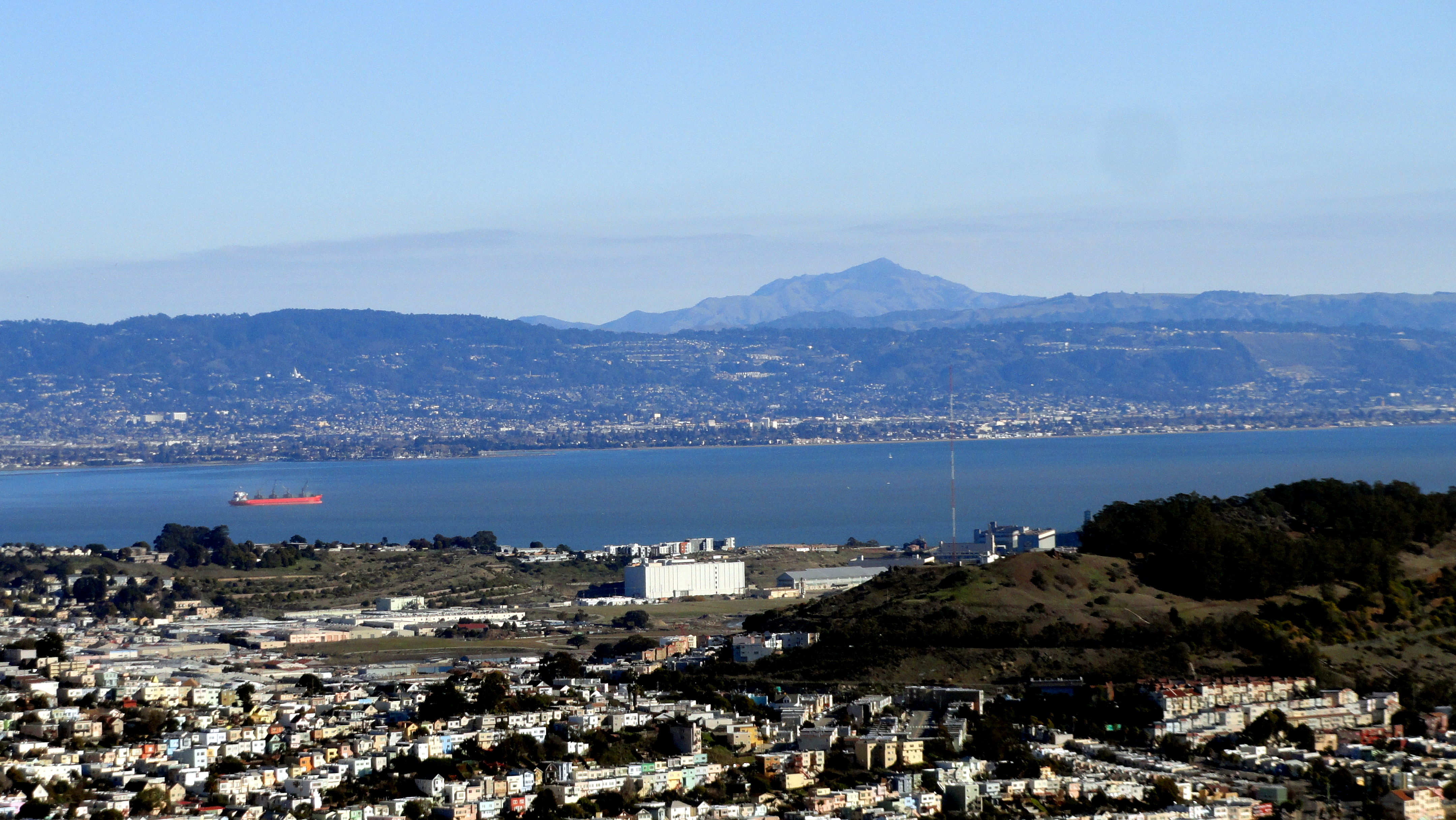
2016 dawned beautiful, bright and clear in and around San Francisco. And for the first time in many years, I saw my first sunrise of the new year in the bay area instead of out on another continent across a ocean or two. True, the next day I flew out again to head back to Haiti and my work here…which would be why it’s taken me nearly 1/6 of 2016 to get these put up: sorry! As you see, though – the view was clear enough to see easily and clearly all the way out to Mt Diablo, and all the way up to Point Reyes National Seashore. Enjoy these little views of my home region :-).