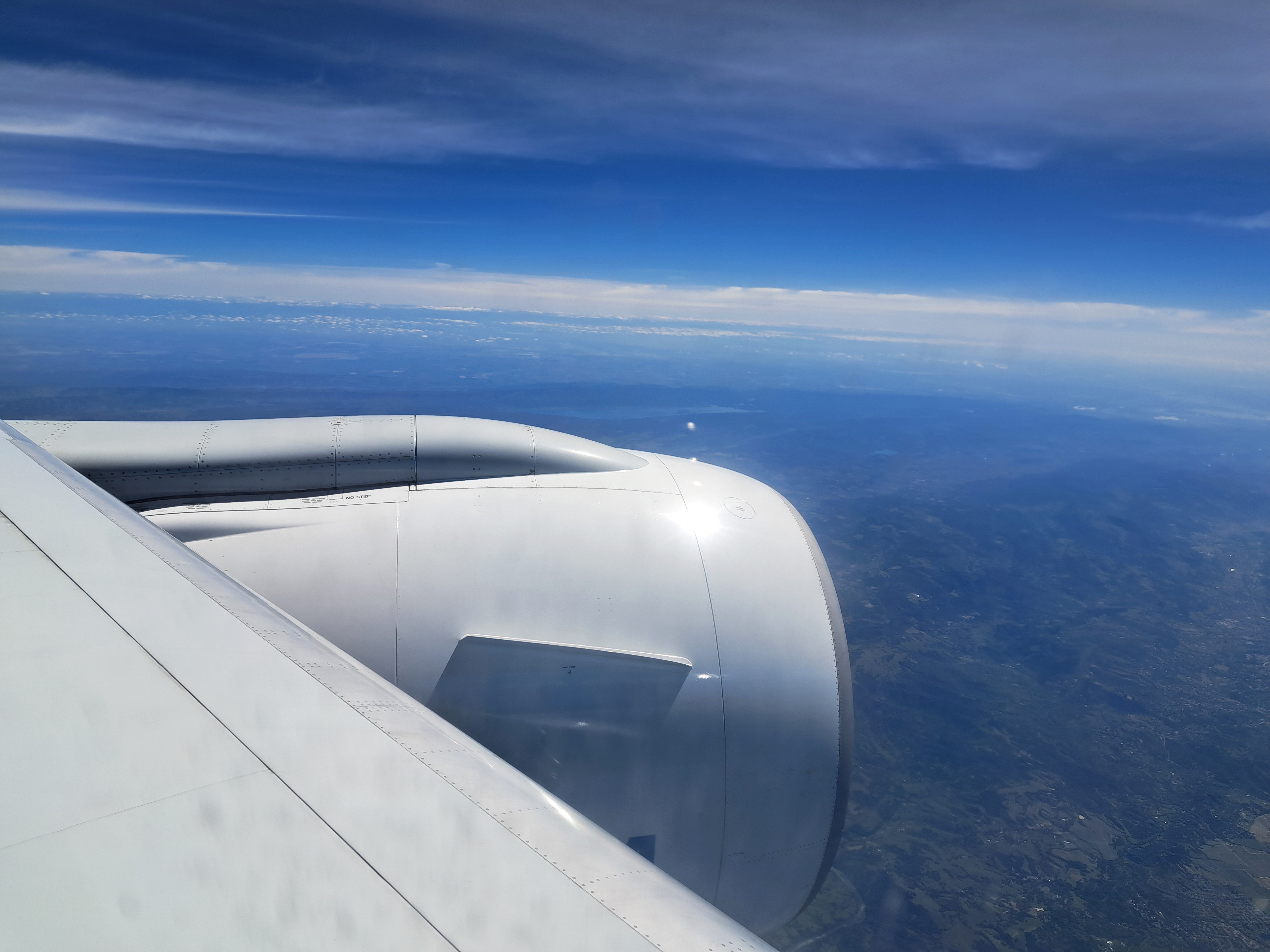
From The Air.52

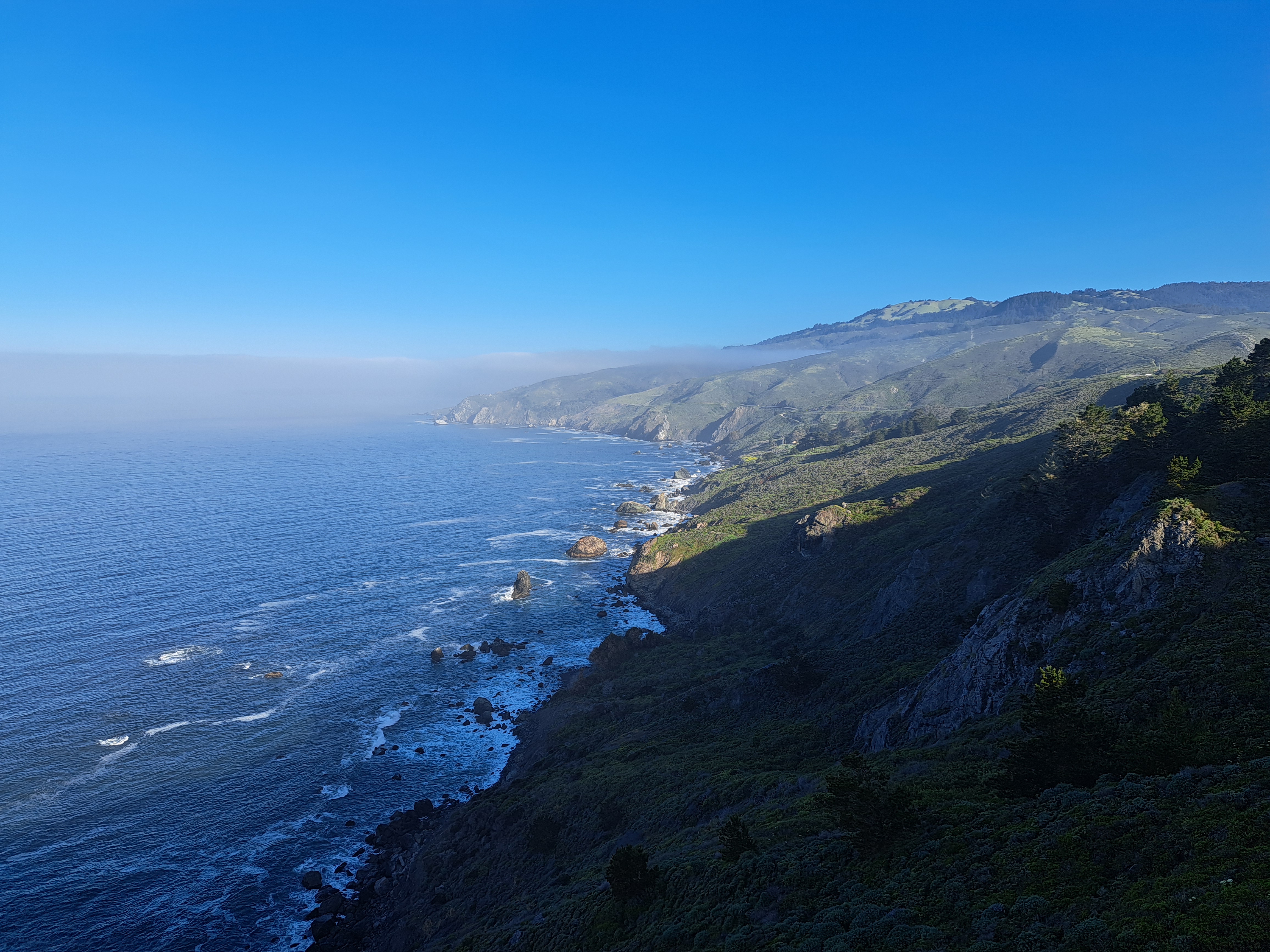
Coasting.100


Mountains.35

From the Air.43


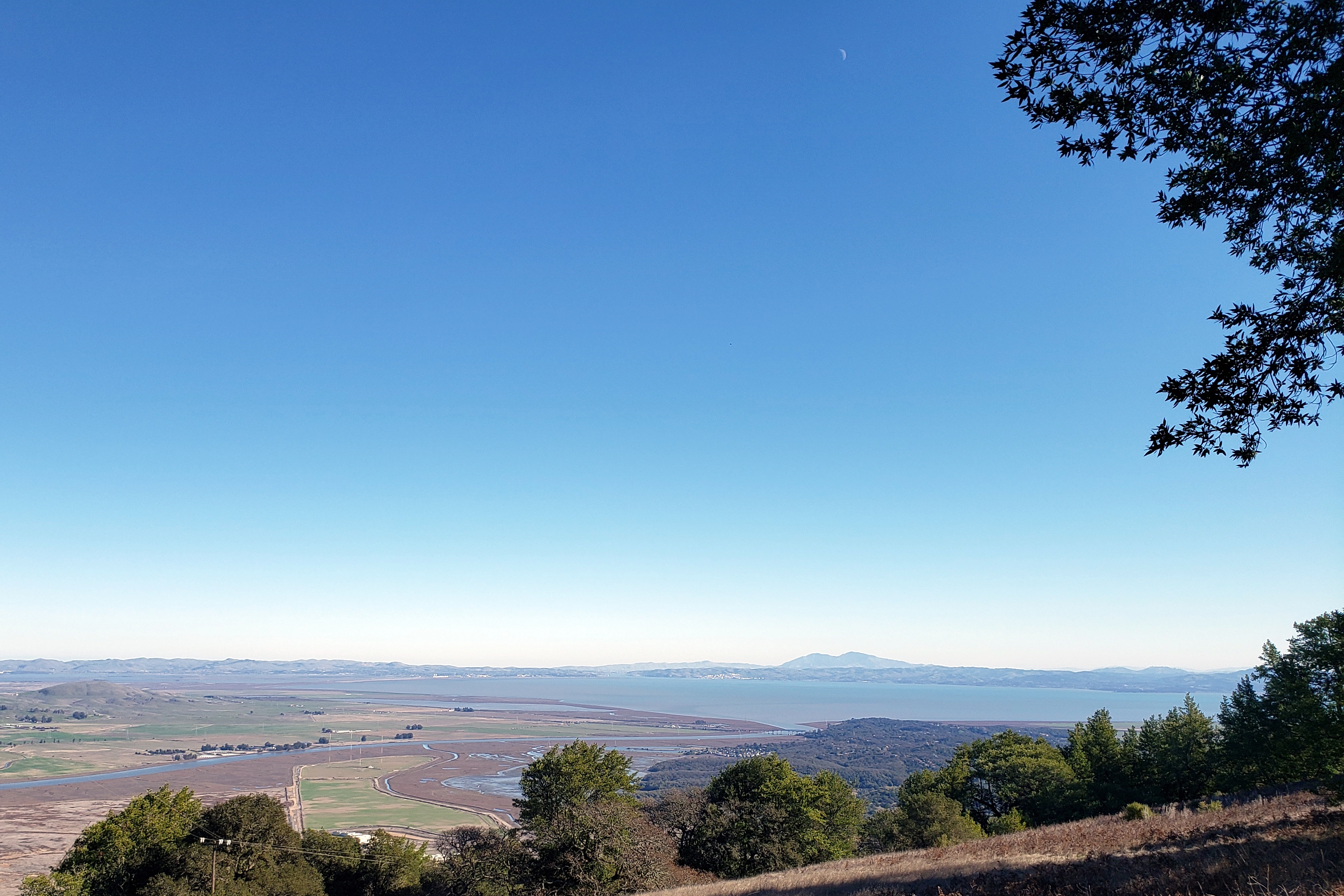
Olompali – Views & History


 Olompali State Historic Park fits into northerneasternmost Marin County where it meets Sonoma County, along Rte 101. North of the town of Novato, it’s a place I’ve driven past often whether in public buses or in private cars, but hadn’t ever explored until last month, when I and a friend in SF chose it as our park-in-the-middle to explore, so as to both see each other and remain relatively covid-safe through outdoor socializing. We went again earlier this week, along with a beloved member of the next generation, and I’m putting a lot of the larger-vista photos in this post. (You’ve already been seeing some close up shots from both trips in various other series.) Olompali is a place where California’s layers of history are present: farthest back, as an important local hub for the Coast Miwok, who were the indigenous first humans to settle in this region. Later on, it became the only place we know of in California where a Miwok received from the Spanish colonial government a land grand to stay on and work the land. Later still, it was the only place recorded where a Mexican solider died during the Bear-Republic conflict that was a local manifestation of the war that took control of modern-day California (plus a whole lot more of the current American west) away from Mexico. Later still – hey, the Grateful Dead hung out there for a while in the late 60s or early 70s.
Fascinating place, and good to be reminded of the complex layers of human-habitation history that surround us here. For the moment though, enjoy the photos from one trip in late December, another in mid-January. Mid-January photos, though taken on a scary-warm day, are generally greener because at least some inches of rain fell between the two visits. From the heights, one can see several regionally-important peaks: Mt Diablo in the east bay; Mt Tamalpais in Marin (which you saw from the south, in the Hill 88 post recently); Mt St Helena peaking over a ridge in at least one of the shots. You can also catch a few of the highest towers in SF peeking over the Marin headlands behind the town of Novato in one or two shots, if you know where to look. Enjoy – and may all our vistas be clear, but with enough clouds to bring the rain we need to grow…


The View from Hill 88

In the midst of those beautiful hills & vistas I showcased to start our year yesterday sits Hill 88. On which sit these abandoned buildings from some past military radar or other installation about whose purpose I know nothing more. These buildings, while being slowly eaten by natural processes, for now provide ample canvases for graffiti artists. The first photo above, I must say, makes me think of Keith Haring and what things were like in NYC in the 1980s… (If his name is new to you, look him up.) To orient you, in the panorama just above you see – from left to right – the east bay with Mt Diablo (two bumps just to the right of the graffitied building), running to the SF skyline (including tops of the towers of the GGB, if you look closely enough) then the hills and Pacific Coastline along the peninsula.