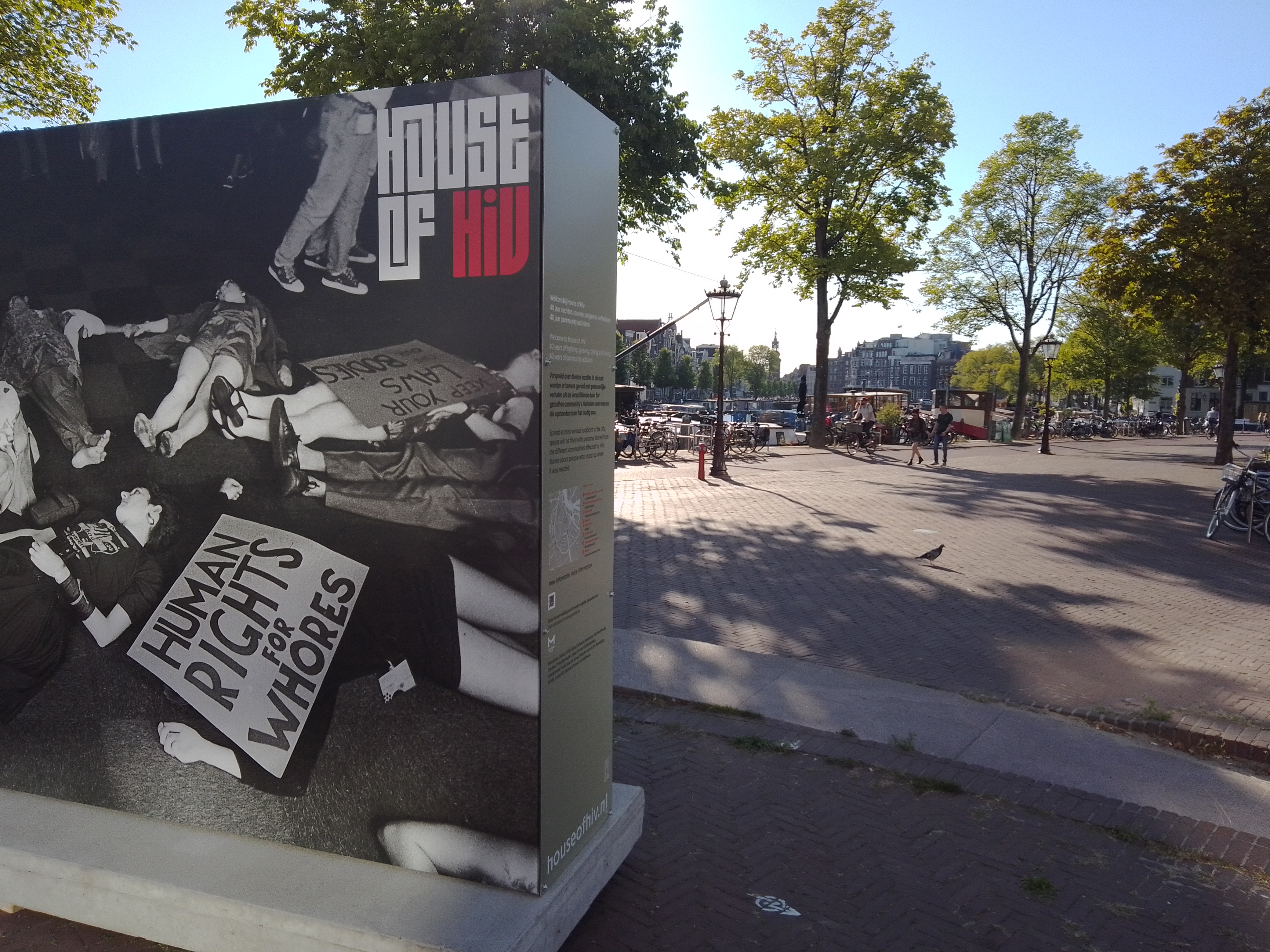
I need to post this — from an exhibit at city hall A’dam timed for LGBTQI+ Pride Month — before we get too much further away from said month, which here is in August 🙂
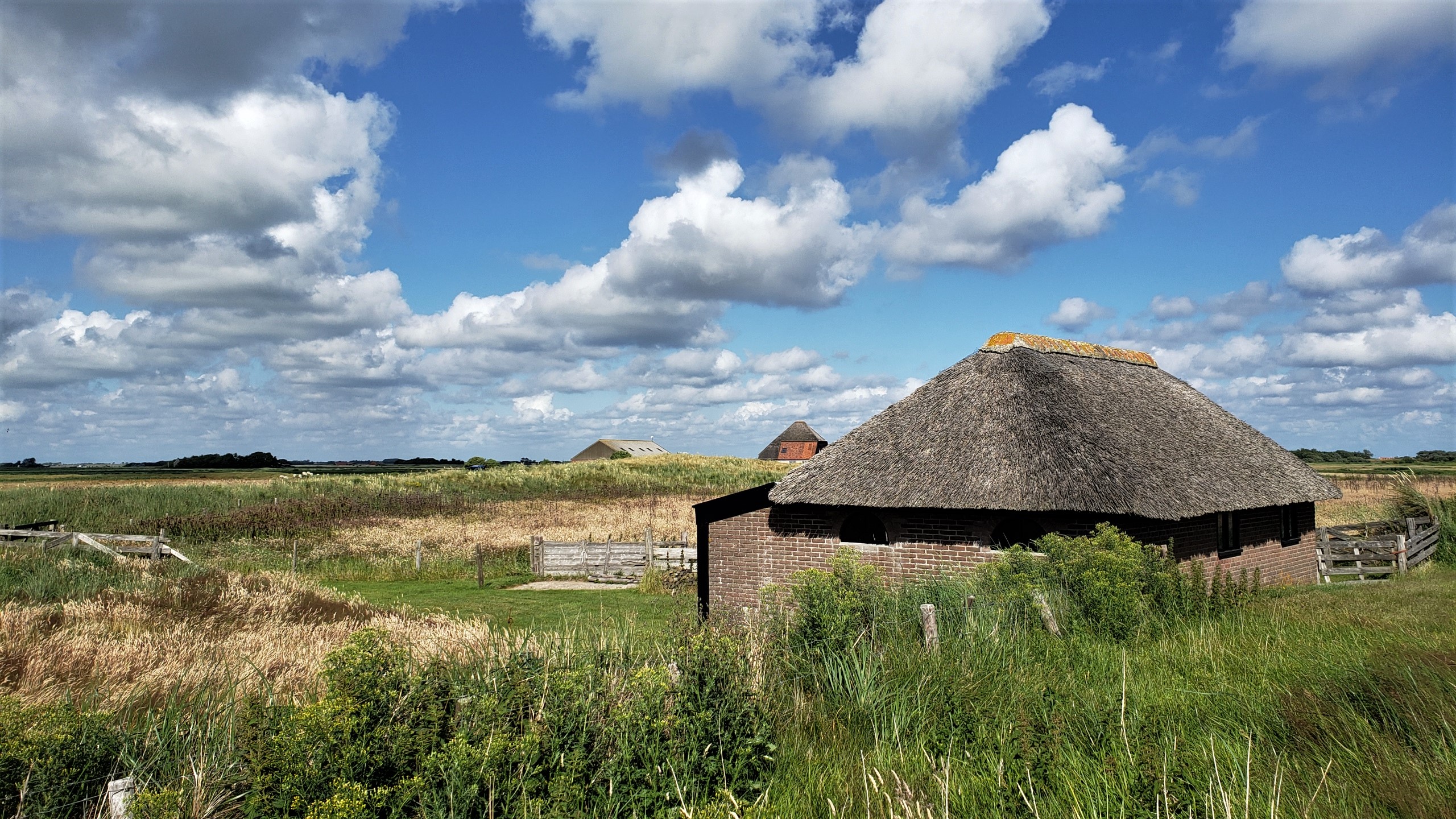
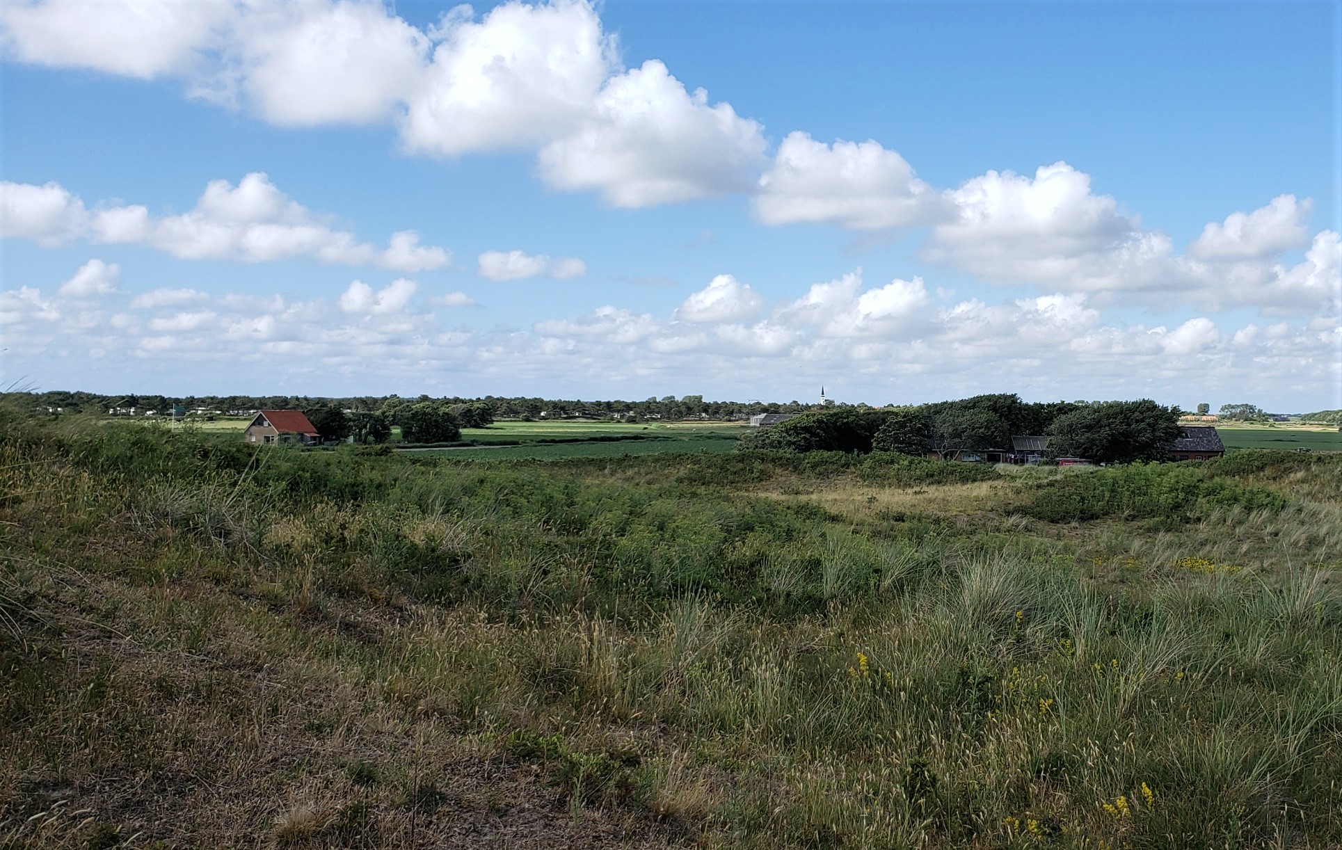
Farm buildings on the southern edge of the village of Den Hoorn, on Texel — with main village itself in the distance on the photo below. Hopefully this weekend, I’ll manage to figure out which Texel (pronounced “tessel,” it seems) photos I still haven’t posted, and get those ready for sharing in the day(s) ahead. I might have mentioned that I had a hard crash on my computer – mostly self-inflicted b/c there were some dialogues coming up which made me fear a virus had infected the computer, so I reinstalled everything, and thought I’d backed up up all the photos I’d already sorted and named…but turns out the backup was messed up and files didn’t open, so I’ve been recovering from my phone. At least one generally has several layers of backup in this digital world, eh? 🙂 Anyone coming to NL at a time when the weather is lovely should seriously consider a quiet day or two up on Texel. It’s really gorgeous 🙂
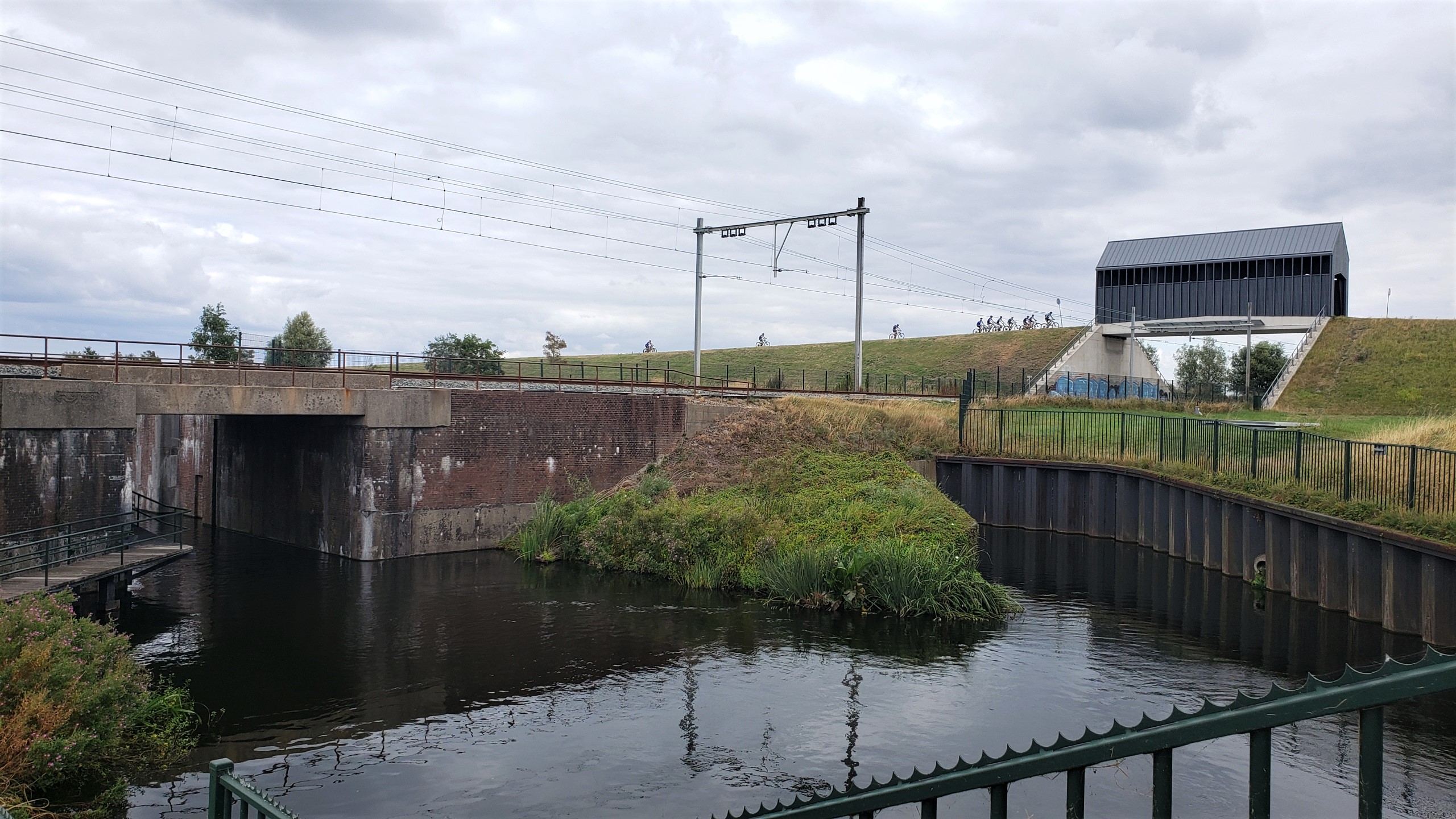
It’s my blog so I get to define what’s a “village” and what’s not. This is one of those uniquely Dutch views: railroad overpass covered-bridge which is mostly used by bikers, specifically small and large classes of kids taking mountain-biking classes on the natural and enhanced (since almost everything that touches upon elevation above or below sea level, flow of water and so on in NL are very much human-enhanced) hills and dunes and canals surrounding … the Maeslantkering, one of the world’s largest movable structures whose northern half sits perhaps 300 meters behind me as I took this photo on my first full day back from Myanmar. Photos of the Maeslantkering and other Hook-of-Holland area sites to come.
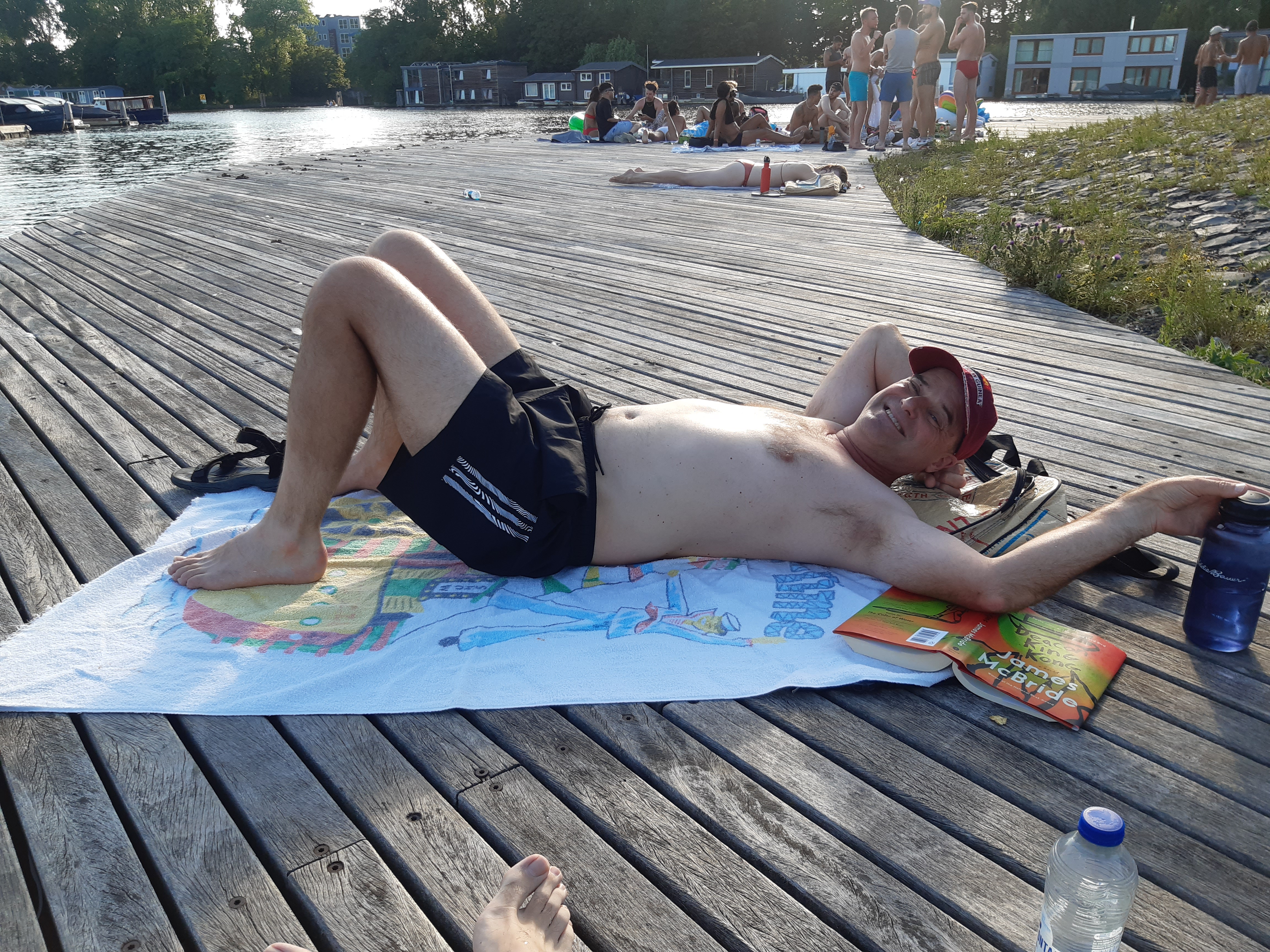
With warm weather, we’ve discovered that the canals of Amsterdam are wonderfully swimmable :-). At least one brother o’ mine will recognize both of these beach towels – ah, memories we bring with us from other times and places 🙂
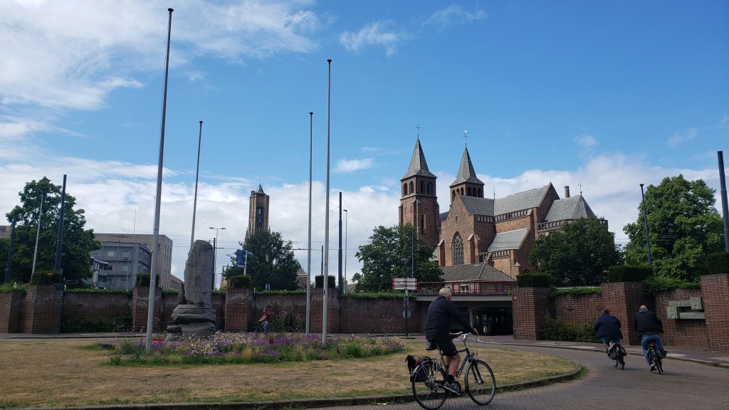
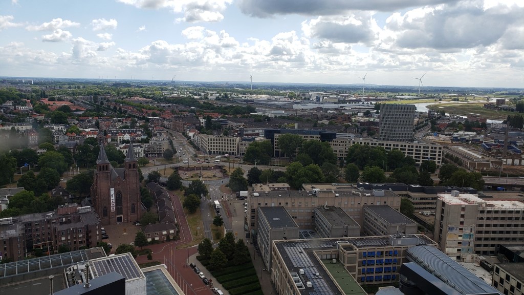
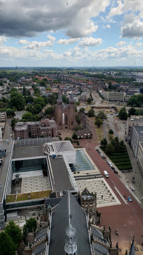
Above, the memorial garden and bike-roundabout commemorating the WWII events noted yesterday. Below, other views from both ground level and from high in the tower of Eusebiuskerk, about which we shared more in an earlier post….and will share still more in posts yet to come :-).
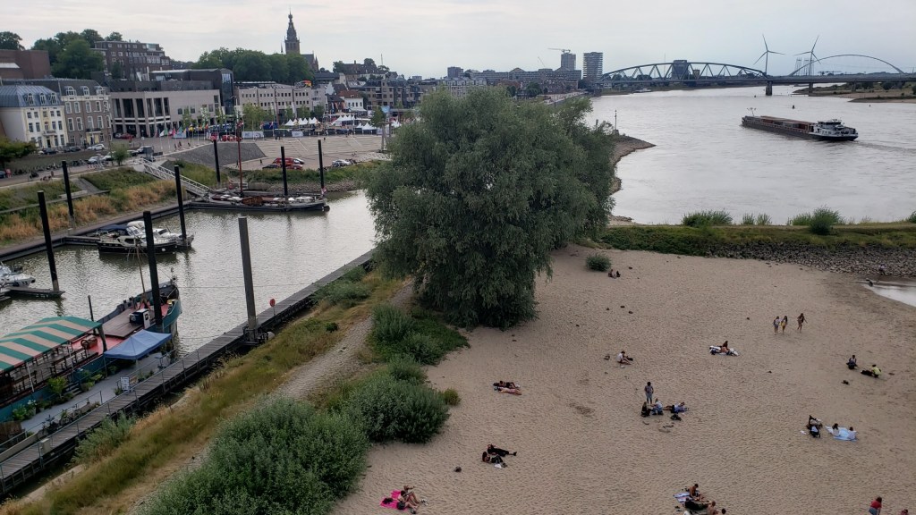
Compare the river traffic in yesterday’s post and today’s. This is the Nederrijn (“lower Rhine”) at Arnhem, just some 15km north of Nijmegen. My working hypothesis is the Dutch generally channel passenger boats and river cruises into this branch of the Rhine, versus commercial freight traffic onto the much larger Waal.
Fun-sad fact: in late 1944, the allies held (most of?) Belgium and areas of NL to the south of the Waal, at least this far east. Meaning allies held Nijmegen; Germans still held Arnhem, with no-one’s-land between. The rounded building with windows on the left is a fine museum commemorating and documenting a (individually) valiant but (tactically) disastrous effort in September 1944 to liberate Arnhem and free the road for an earlier advance on Berlin. One outcome of this failed operation was the premature exposure of many Dutch resistance fighters. Another was the (German-)forced mass evacuation of Arnhem – in winter – and the destruction of the bridge here, which is now named in commemoration of the British commander who tried valiantly but without success to hold the bridge for the allies.
The Waal at Nijmegen, which carries more than half the water which enters NL when the Rhine comes in from Germany. I’ve heard the Rhine in DE is now at dangerously low levels for commerce, and I’m sure the Rhine’s various branches are also lower than normal in NL The Dutch being the engineers of water that they are, though, I somehow assume they’re opening and closing flow controls to sustain volume in the various branches at viable levels for as long as possible.
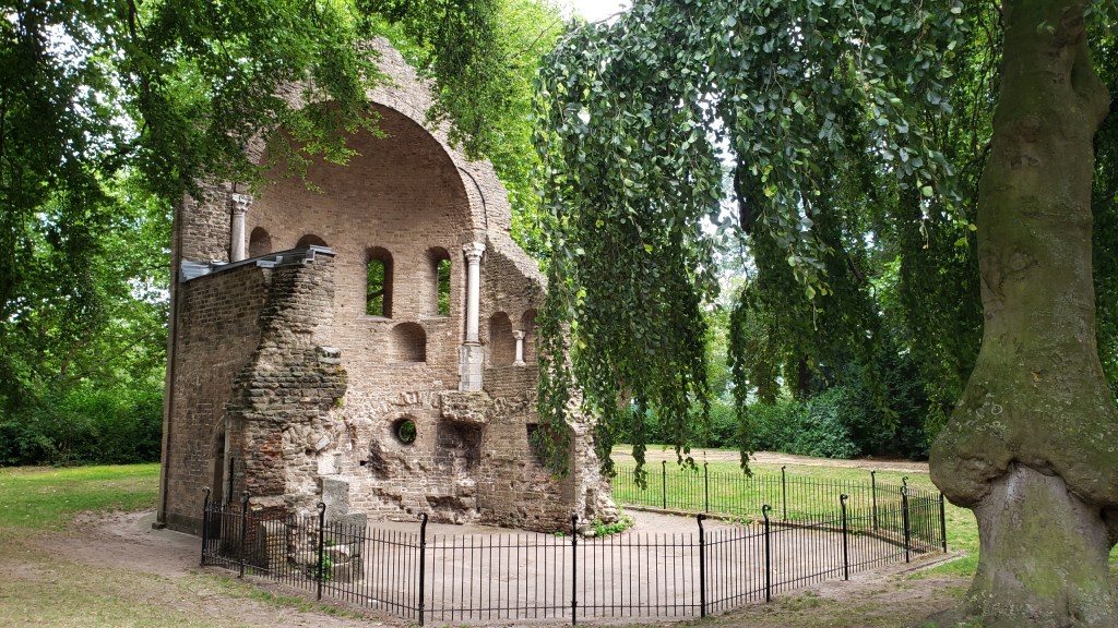
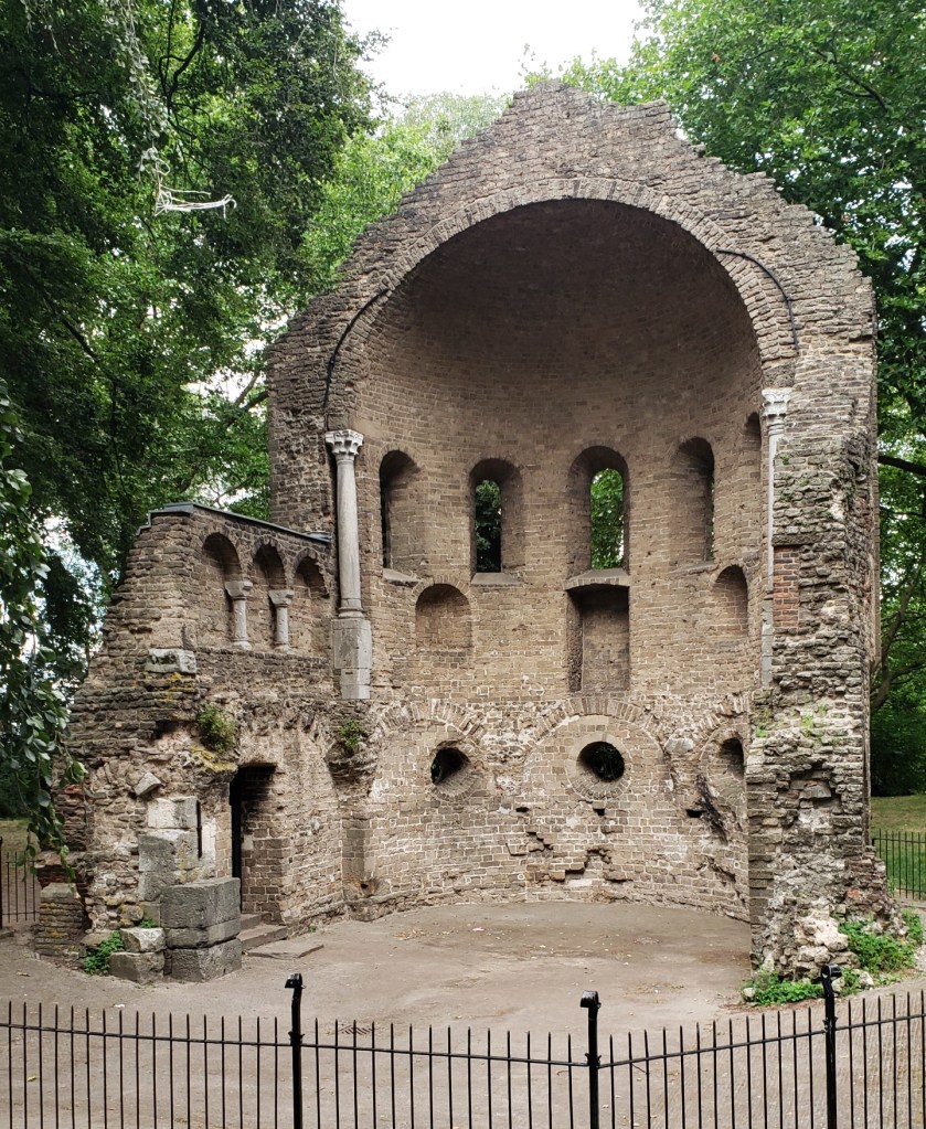
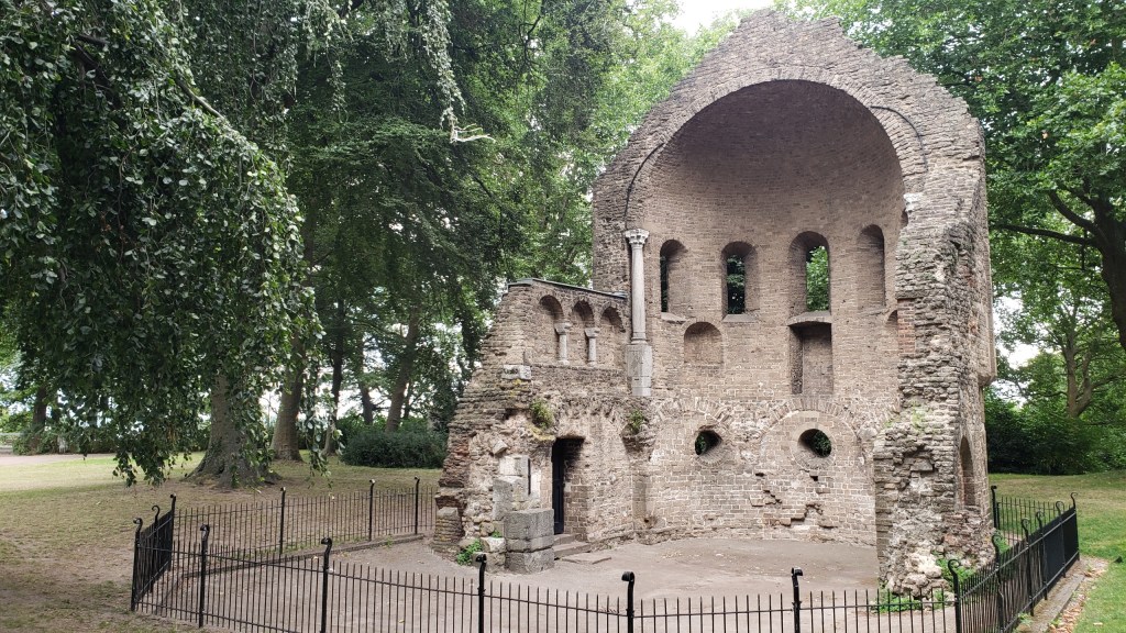
Fun fact: what you see right here was the northernmost edge of the Roman empire for some few hundred years, after they gave up trying to take even more territory away from the Germanic tribes still resisting on the other side of the Rhine.