Postcards from The Hague
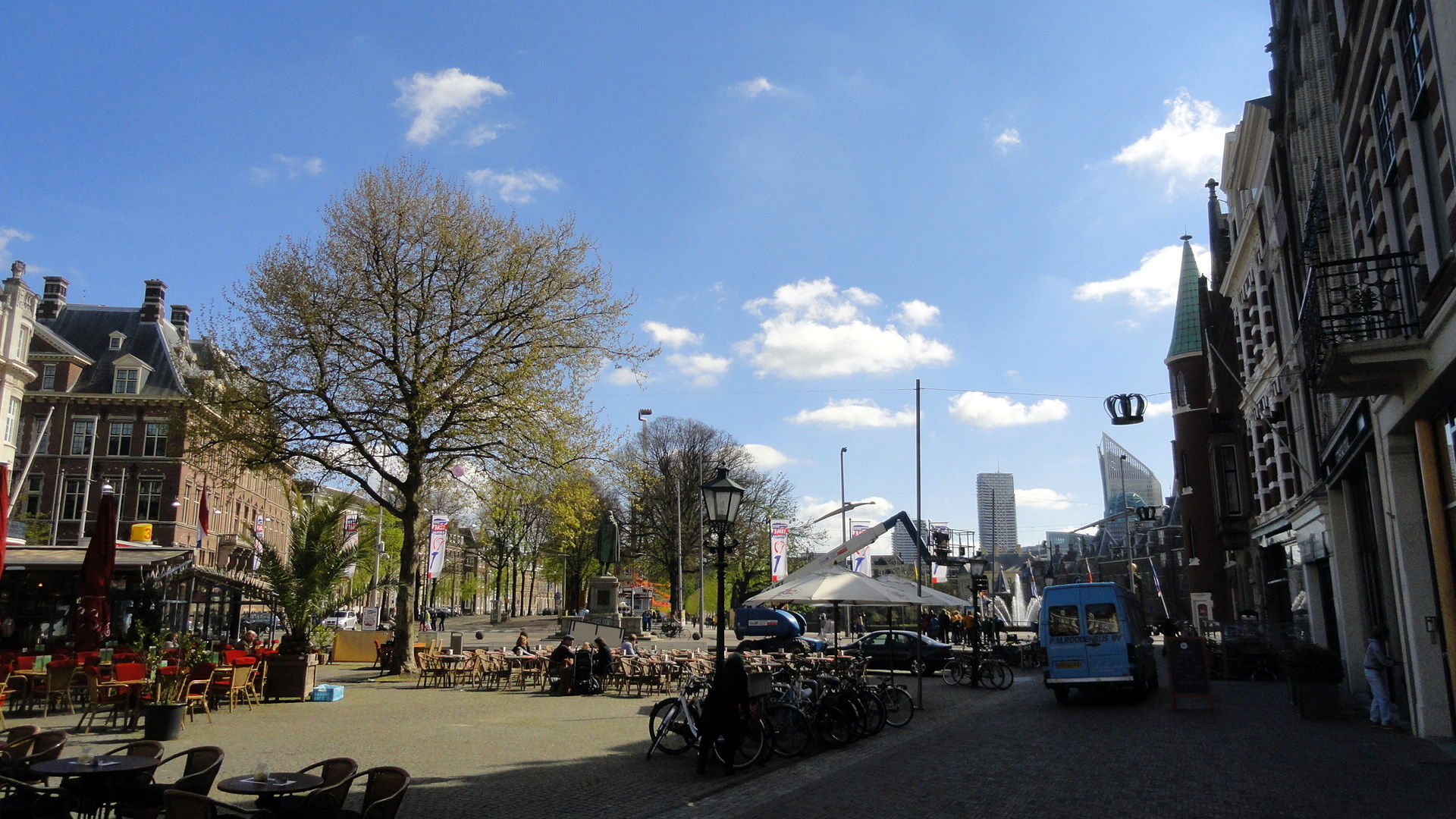
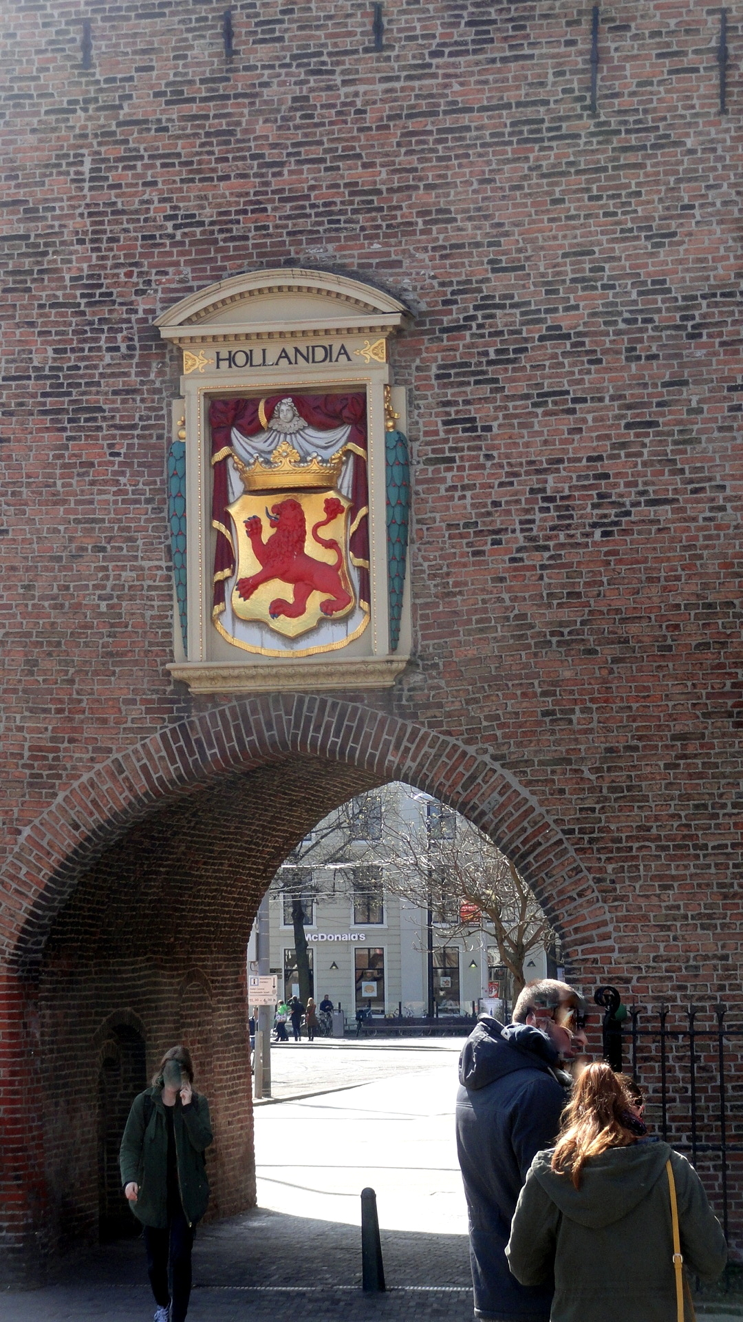
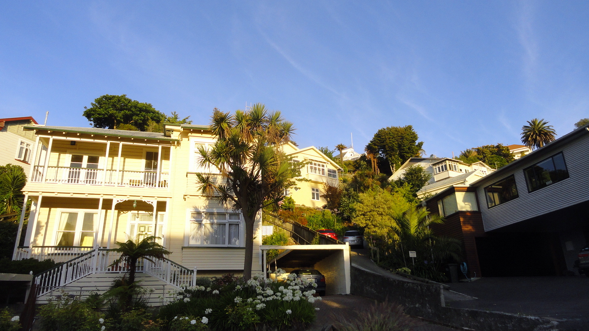
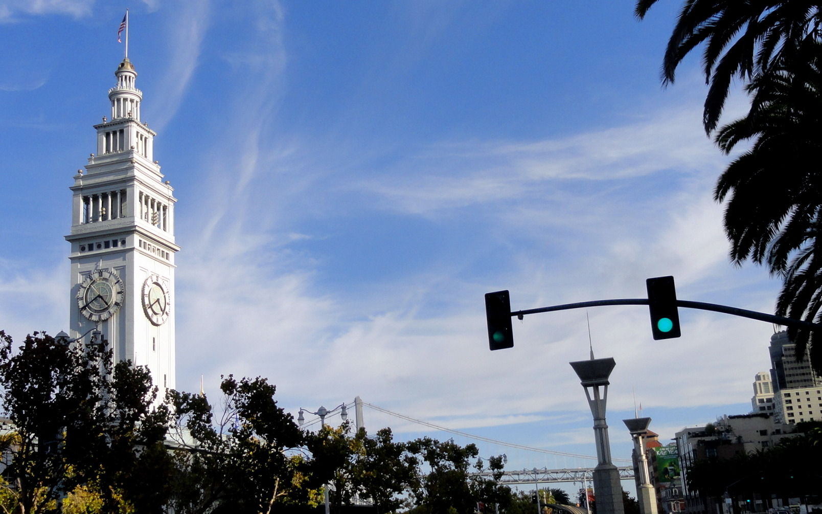
 During the briefings in NYC and Amsterdam for my new assignment, I had an extra weekend day in the Netherlands, and it being a holiday weekend there, Amsterdam’s hotels were even more than usually full and overpriced. After a quick online comparison, I concluded I could get twice the room for half the price in The Hague, a city I’d always been interested in – historic, reputed to be quite lovely, less than an hour’s train ride away. So I spent the extra night and day in The Hague, taking in museums and walking the old streets of this lovely city which has long been home to the royal family of the Netherlands. Hope you enjoy some of these views.
Today I’ll fly off to the new assignment, from which I’ll try to report a bit more whenever I get time and ability to take some photos, sort them, and share them with you. If you’re curious about where it is and what kind of work we’re doing, check out this link to a recent article covering one aspect of the mission’s work, including some quotes from the colleague whose role I’ll soon be trying to fill: http://www.reuters.com/article/2015/04/17/us-haiti-cholera-idUSKBN0N82O220150417
")


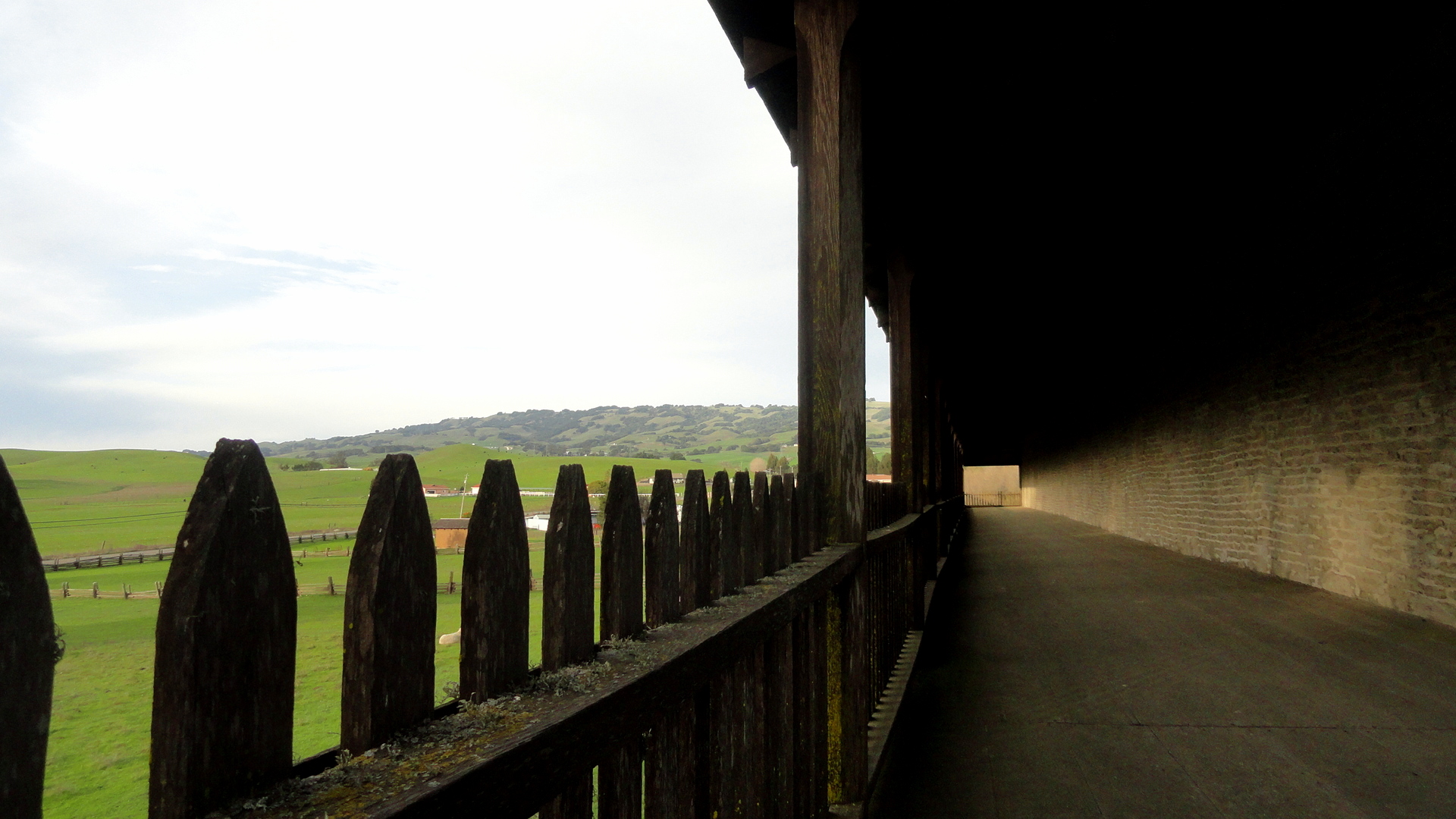
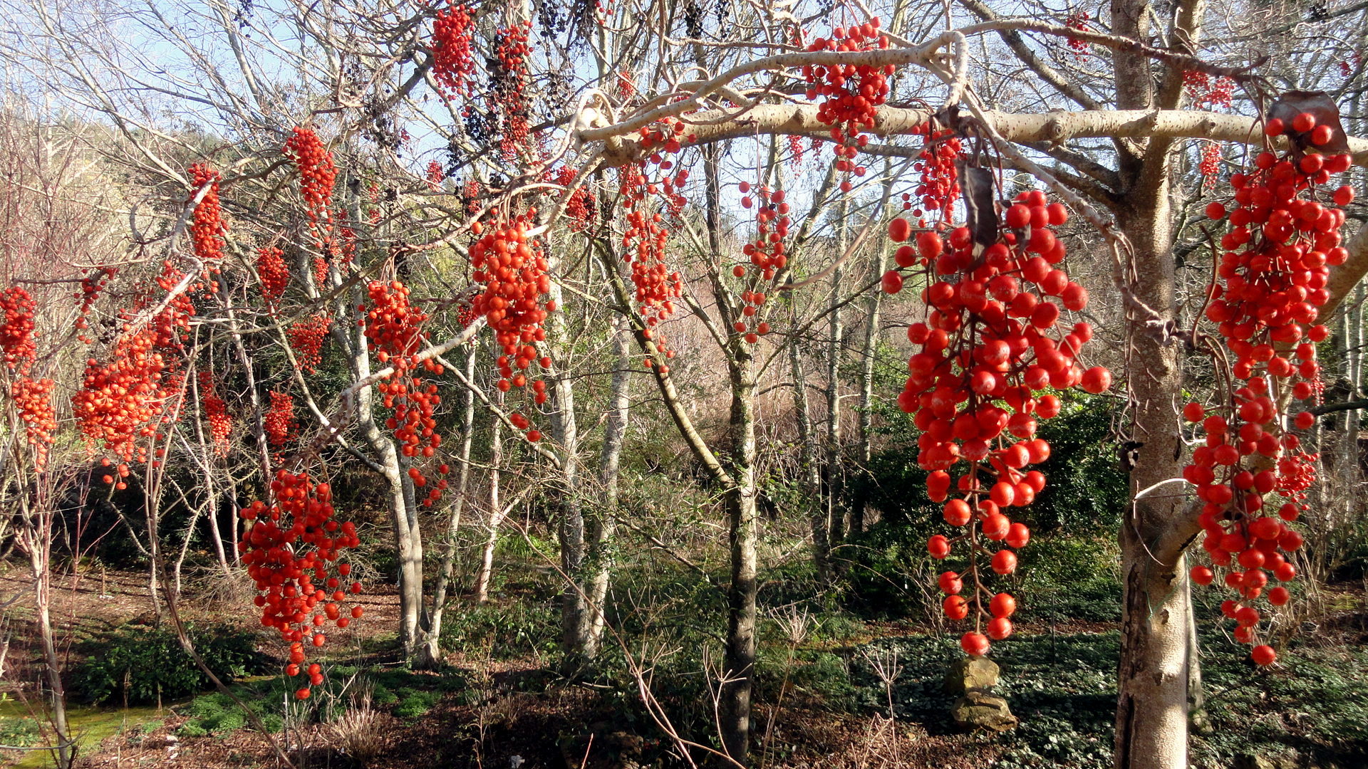
Springtime in Sonoma County
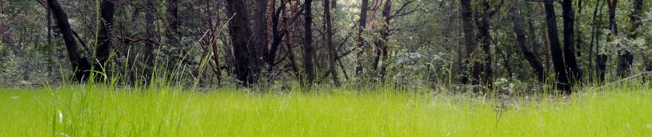
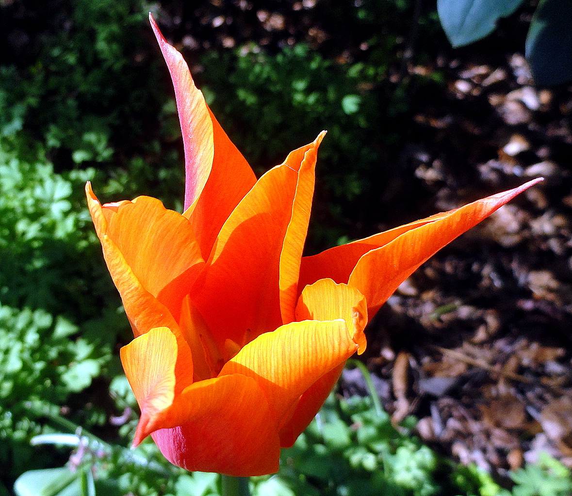
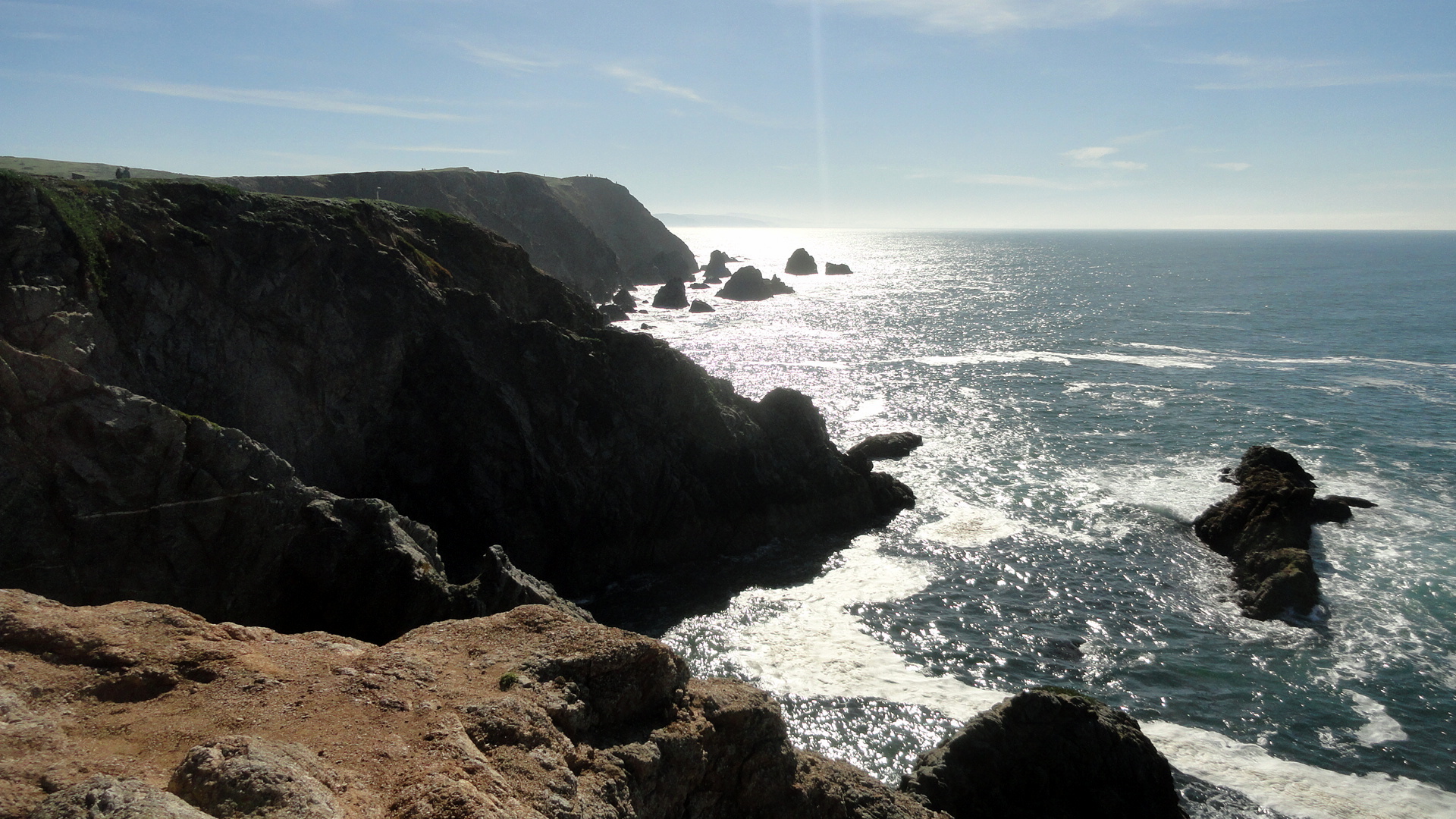
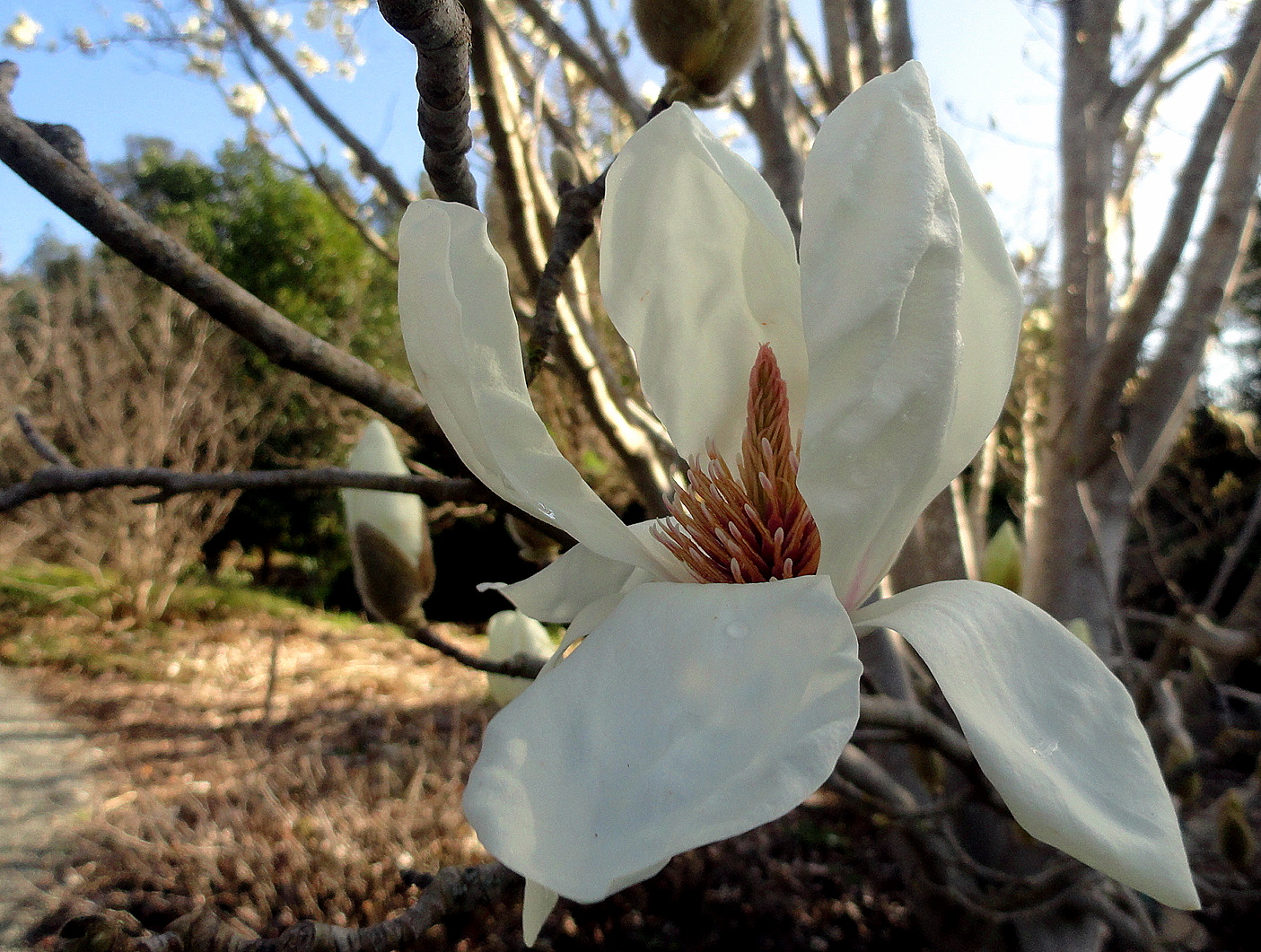
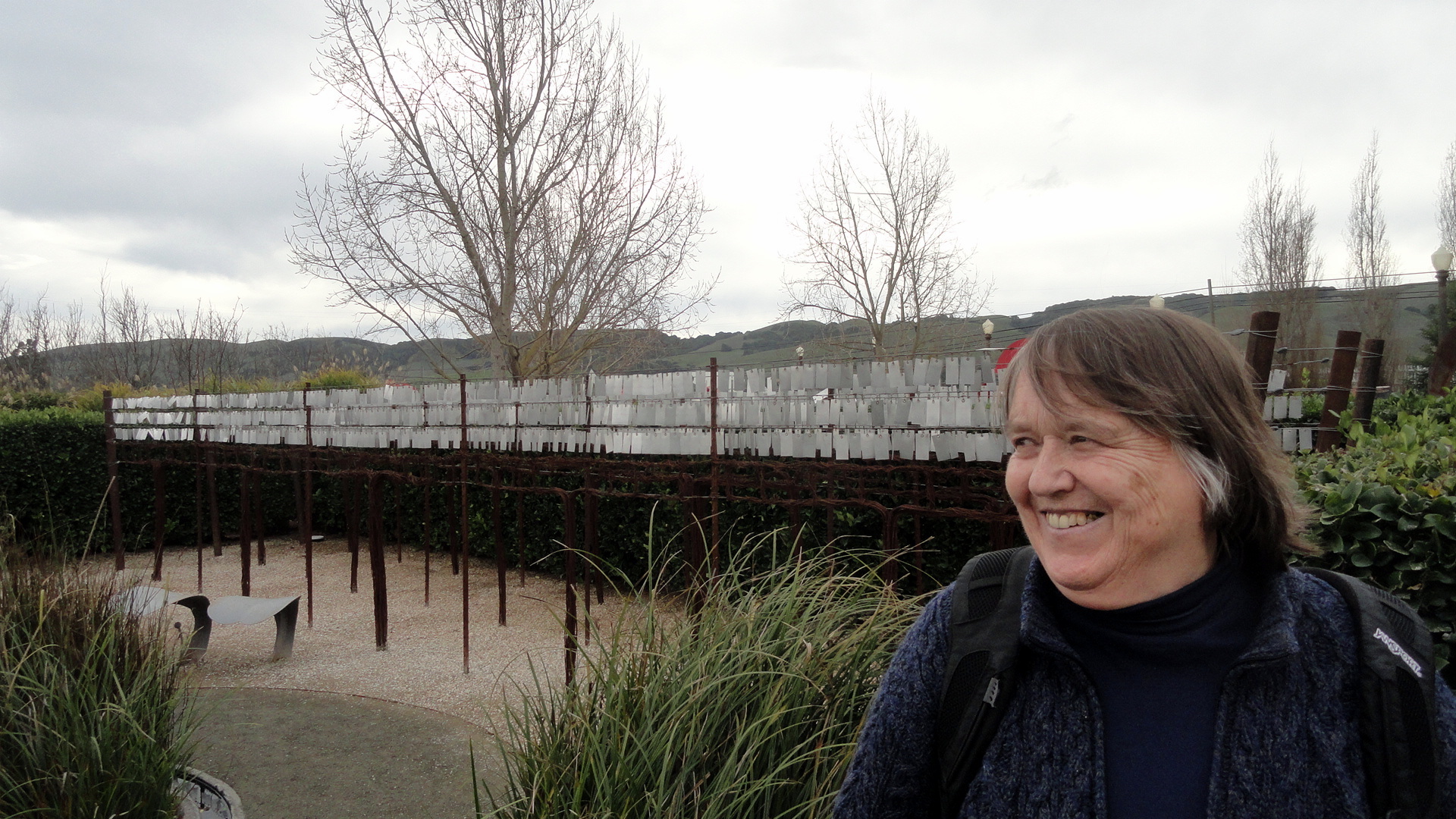
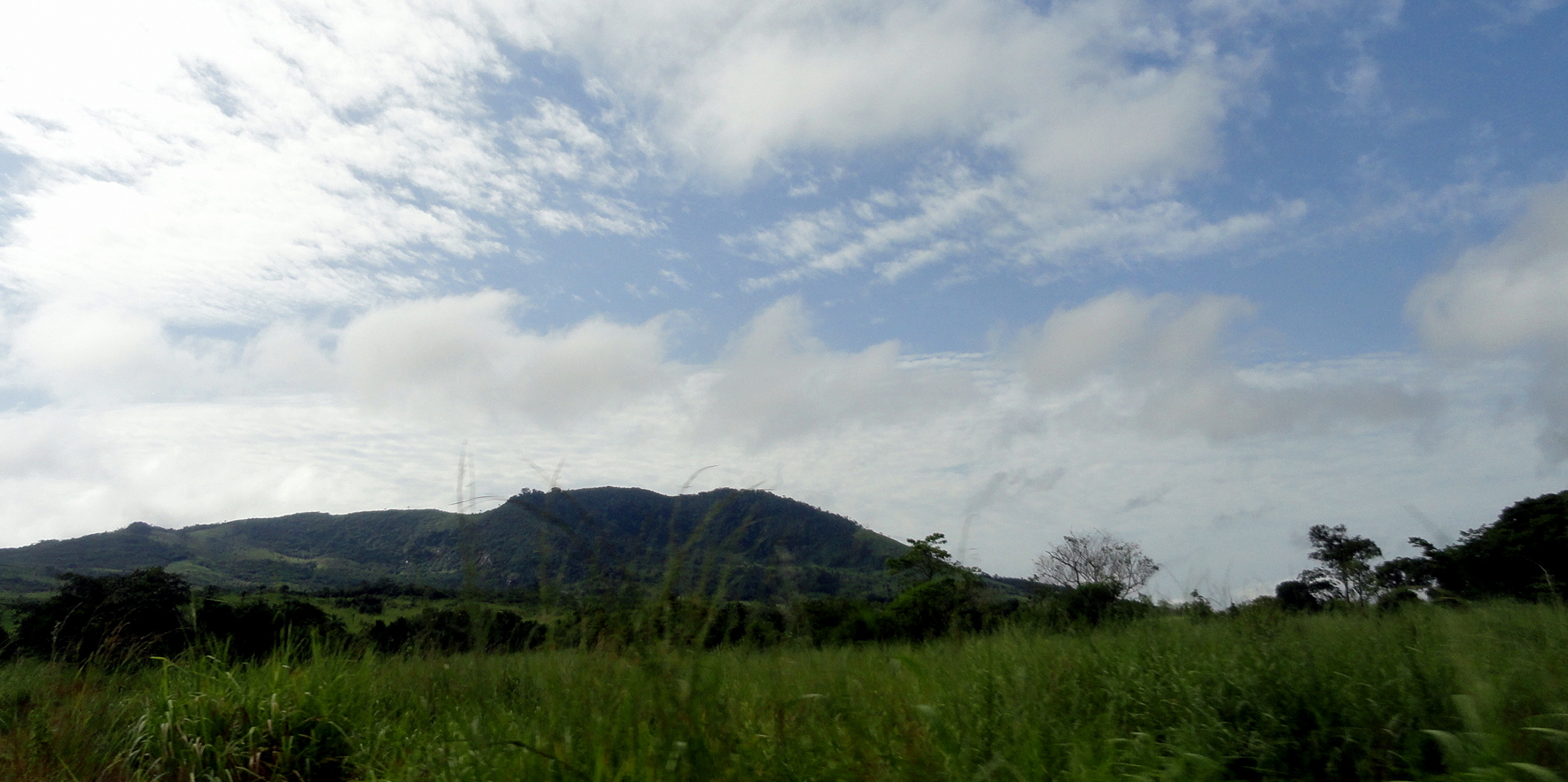
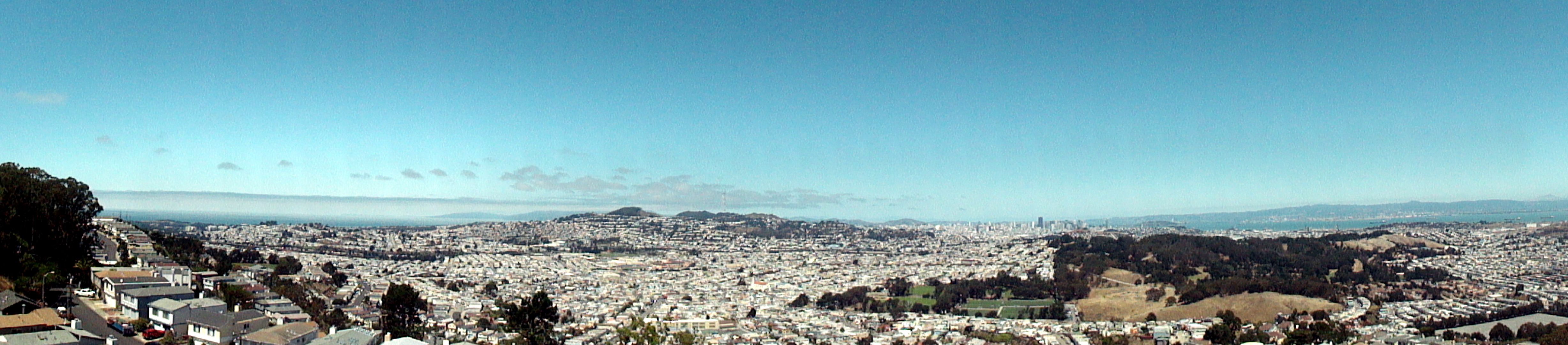
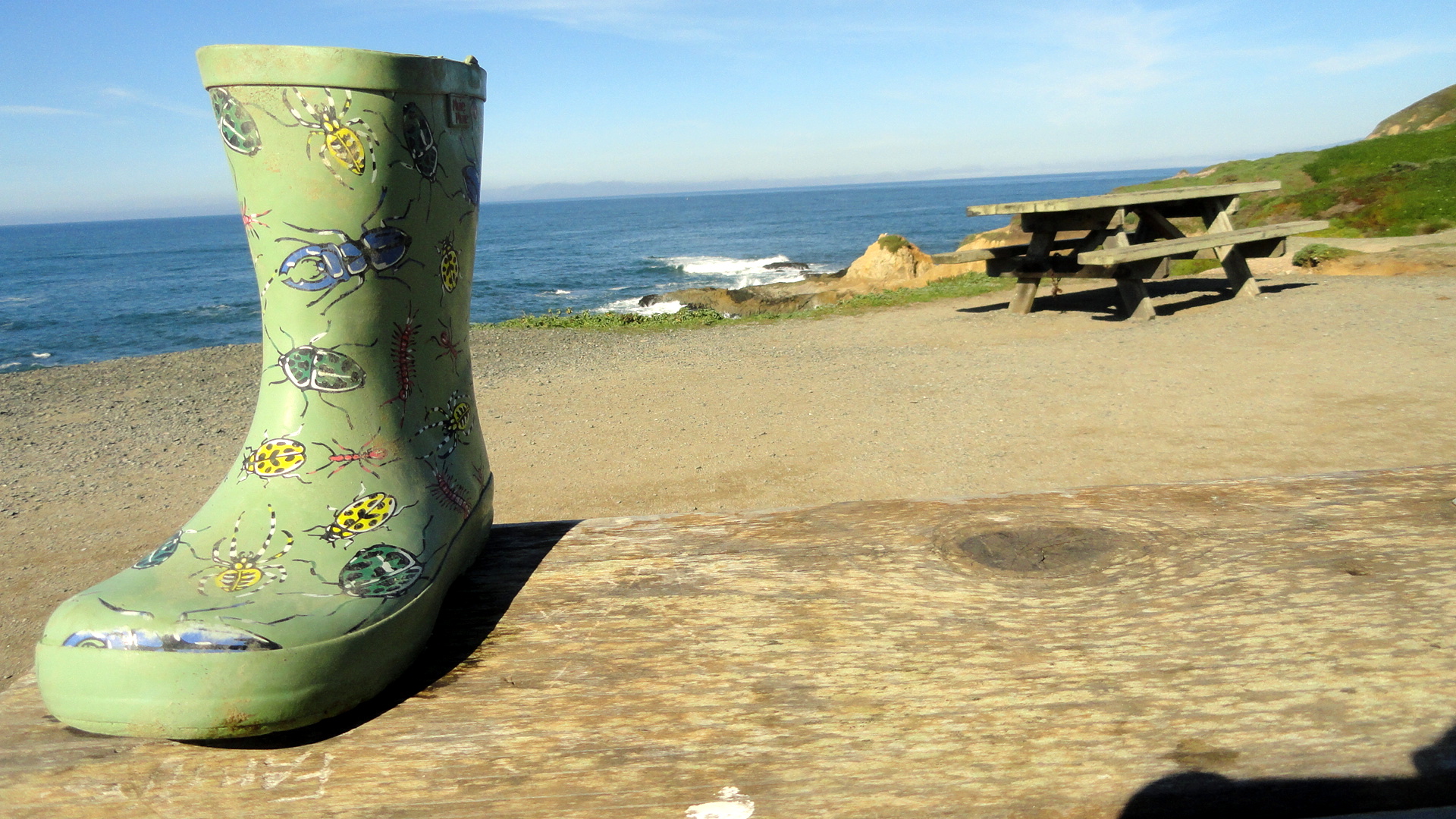 For several months now, smw slt has been calling Sonoma County, in the northern sector of California’s lovely Bay Area, home. It’s an area I’ve always loved and now hope to return to regularly in coming years…during breaks from the upcoming long assignment that’s about to begin. Yep, that’s right, after more than two glorious months of biking, hiking, cooking and quietly attending to the business of having and making friends and pursuing a relatively quiet life, I’m about to pack the bags and hit the airport circuit for more of my beloved work. But before I go, I figured I should pop a few of the scenes I’ve been enjoying these recent months up on the blog, both for myself to scan when I’m feeling homesick, and for anyone who wonders what life looks like an hour’s drive of the city of SF itself. These were all shot between January and March along the coast and in towns and spots around Sonoma County – sadly, I forgot my camera often when I went out by bike or in the car when my mother visited, so for example I have no photos of our lovely day at Fort Ross and at Jenner, where the Russian River meets the ocean. Oh well – that’s called down time for me, to forget the camera! Enjoy, and look for future updates when I get the chance. (And for the record, the painted boot was just sitting there on the picnic table; I did not stage that one. If you don’t see it, try launching this page in a different browser.) Thanks :-).


Goodbye, Uncle Bill
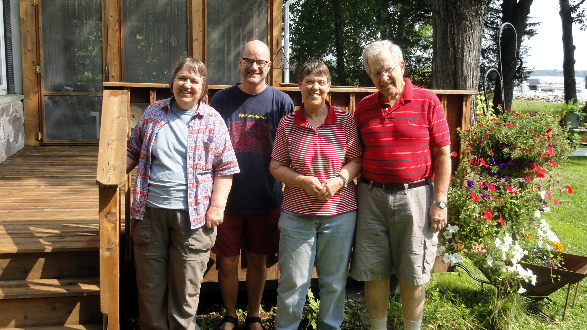 I’ve woken this morning, for the first time in my life, to a world in which I can’t visit, see or phone my uncle Bill. Having grown up without a father around & with both grandfathers passed before I was eleven, uncle Bill was the only adult male relative that I really felt close to, growing up. I always had the sense – once I grew up enough to take note – that he tried to step in and do what he could for me and my brothers whenever we were together: from miniature golf when I was a kid and we were all visiting our grandparents, to the summers that he and aunt Judy let me spend at their home when I was a teenager which were an opportunity to spend time with my cousins also, to more recent conversations about my humanitarian medical work, given his role as an eminent MD and medical researcher. I know that it’s one of those essential realities of being human, being organic life, that generations succeed each other and, yes, that generational succession means our elders will not always be with us. Since my work takes me so far away, so much of the time these days, this is one of my greatest fears: losing someone dear to me when I’m thousands of miles and many long flights away. I take slim consolation in my own loss this morning, from my very fond memories of the visits I was able to make to Bill and Judy at their lake house in Wisconsin just last summer, and the time spent at that wonderful family reunion (also known as my niece’s wedding) in New Mexico just weeks later. I haven’t seen Bill since, but with me on the continent we’ve talked by phone a few times. I know with time I’ll adapt to the idea that we won’t talk on the phone or see each other in person again, and that Bill will join my grandmother as one of the people with whom I wish I could share the moments when I’m living most richly — as I’ve done since that other sad family reunion nearly 30 years ago when she had left us all. I know that others feel this loss even more deeply than I, and I send my thoughts to all of my cherished extended family this morning, along with some photos I’ve scanned and pulled from my archives. Though I’ve rarely gotten so personal on this blog, uncle Bill absolutely merits special treatment and this review of my lifetime’s worth of memories of the closest uncle I’ll ever have is the best I can do right now. Good bye, uncle Bill…
Many Muddy Misty Magnificent Miles on the Milford Track

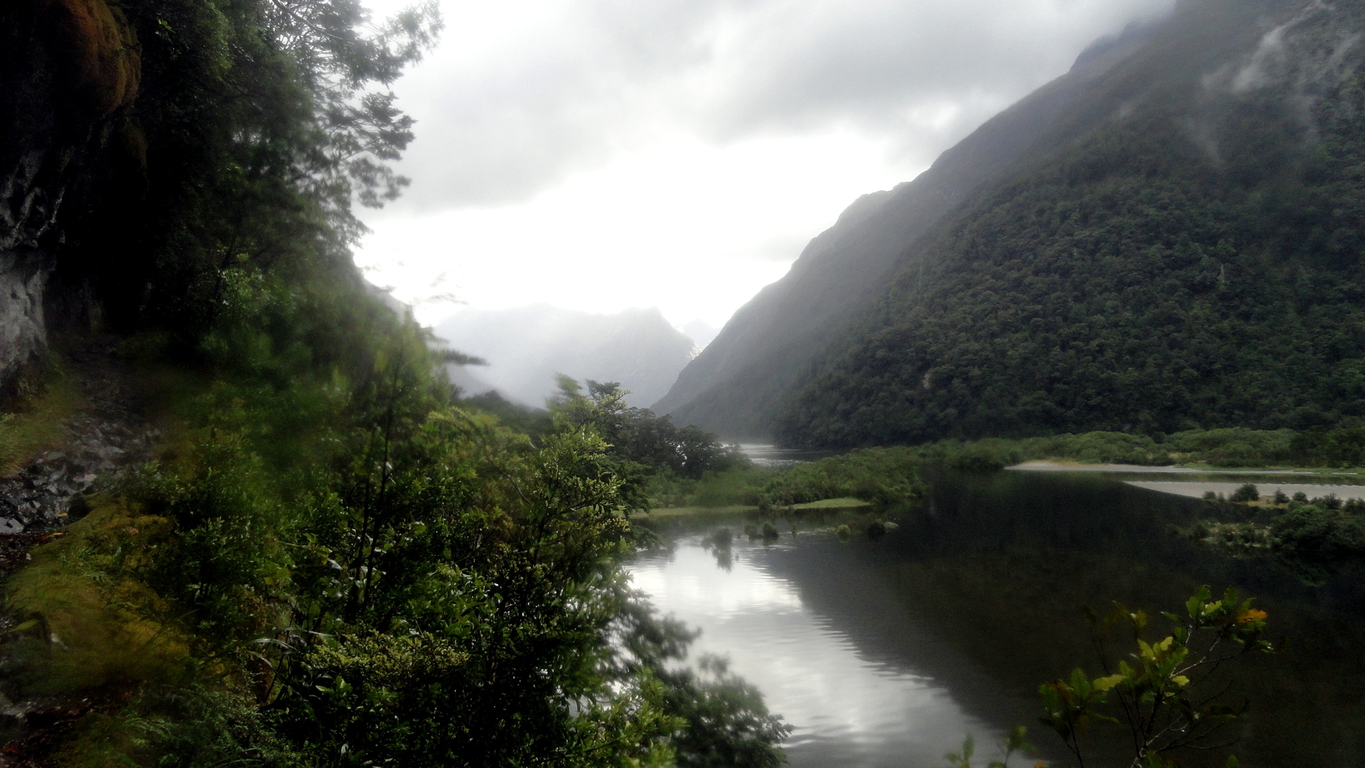
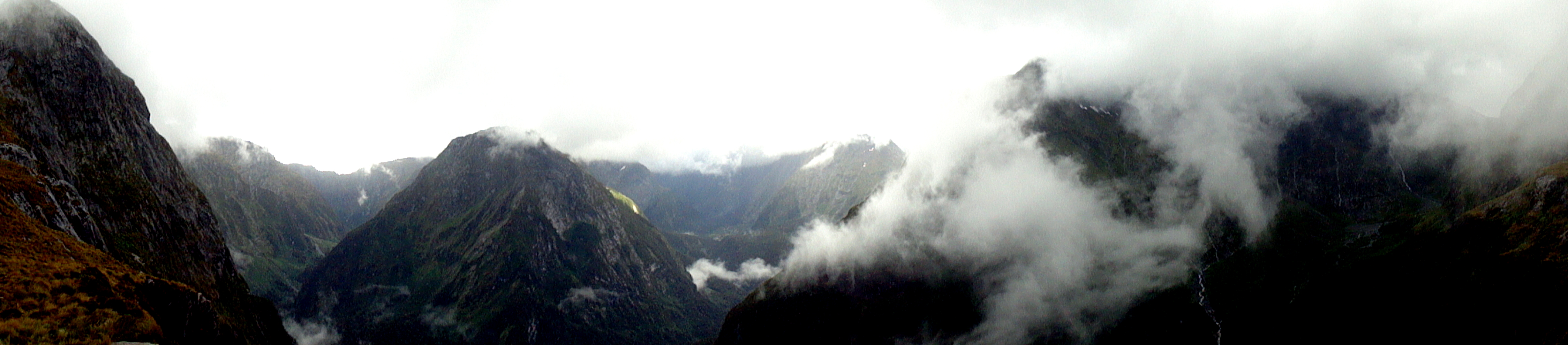
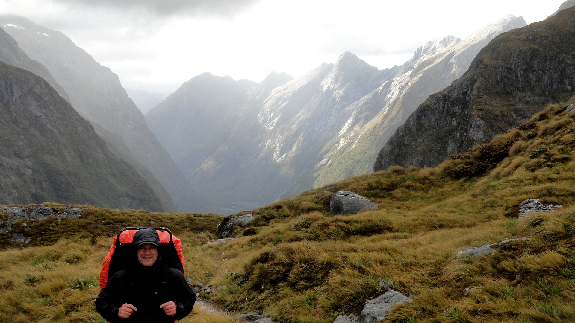
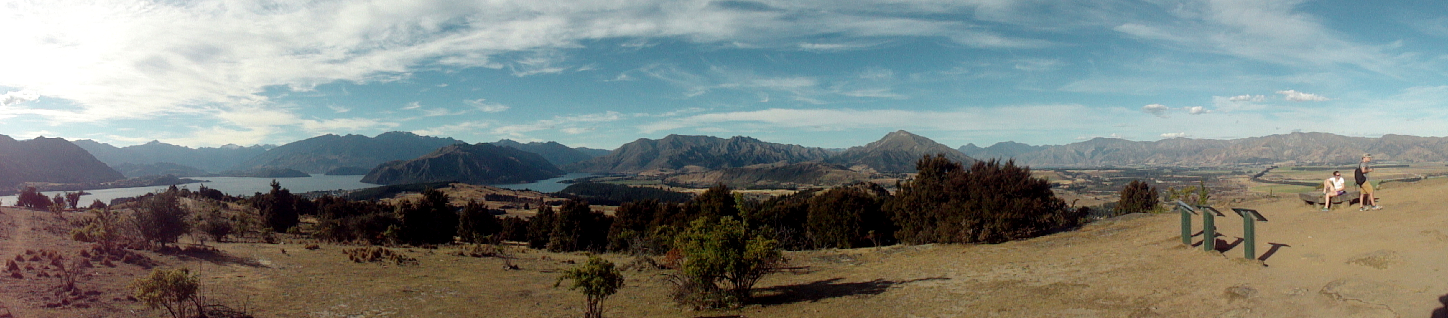
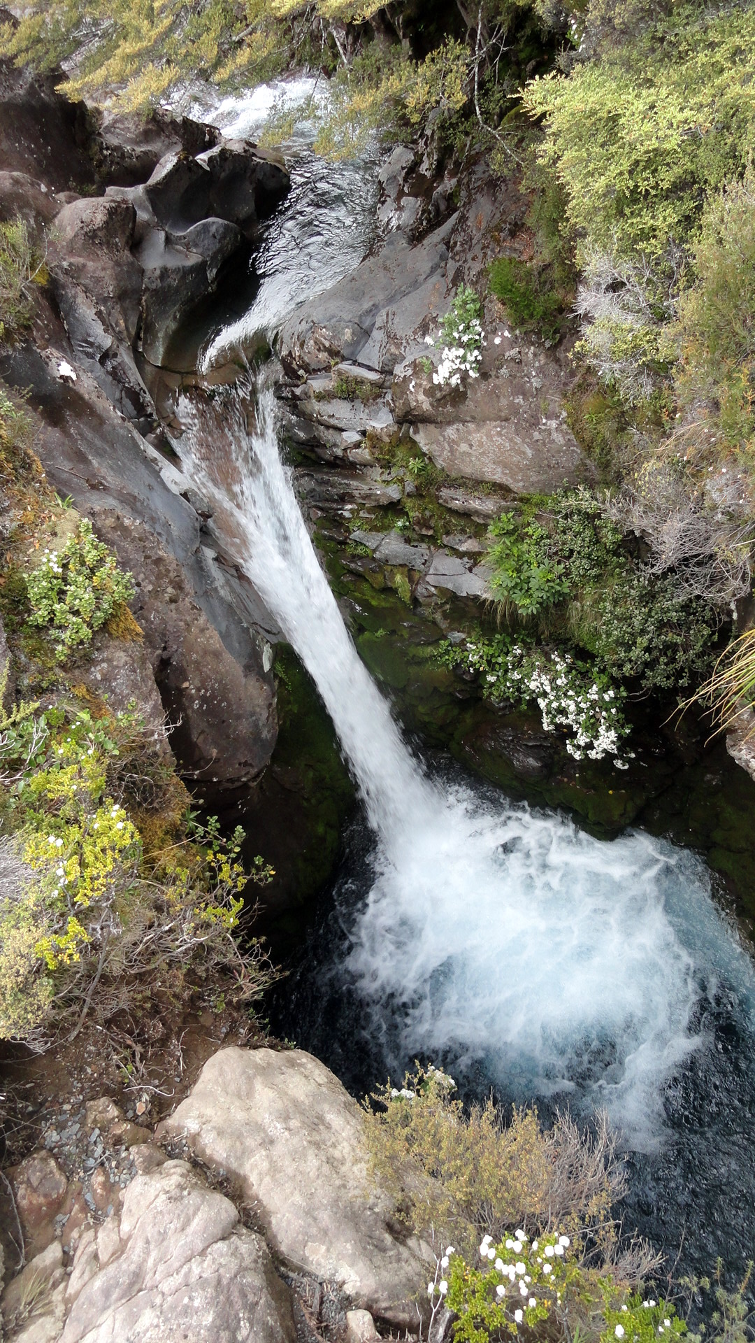
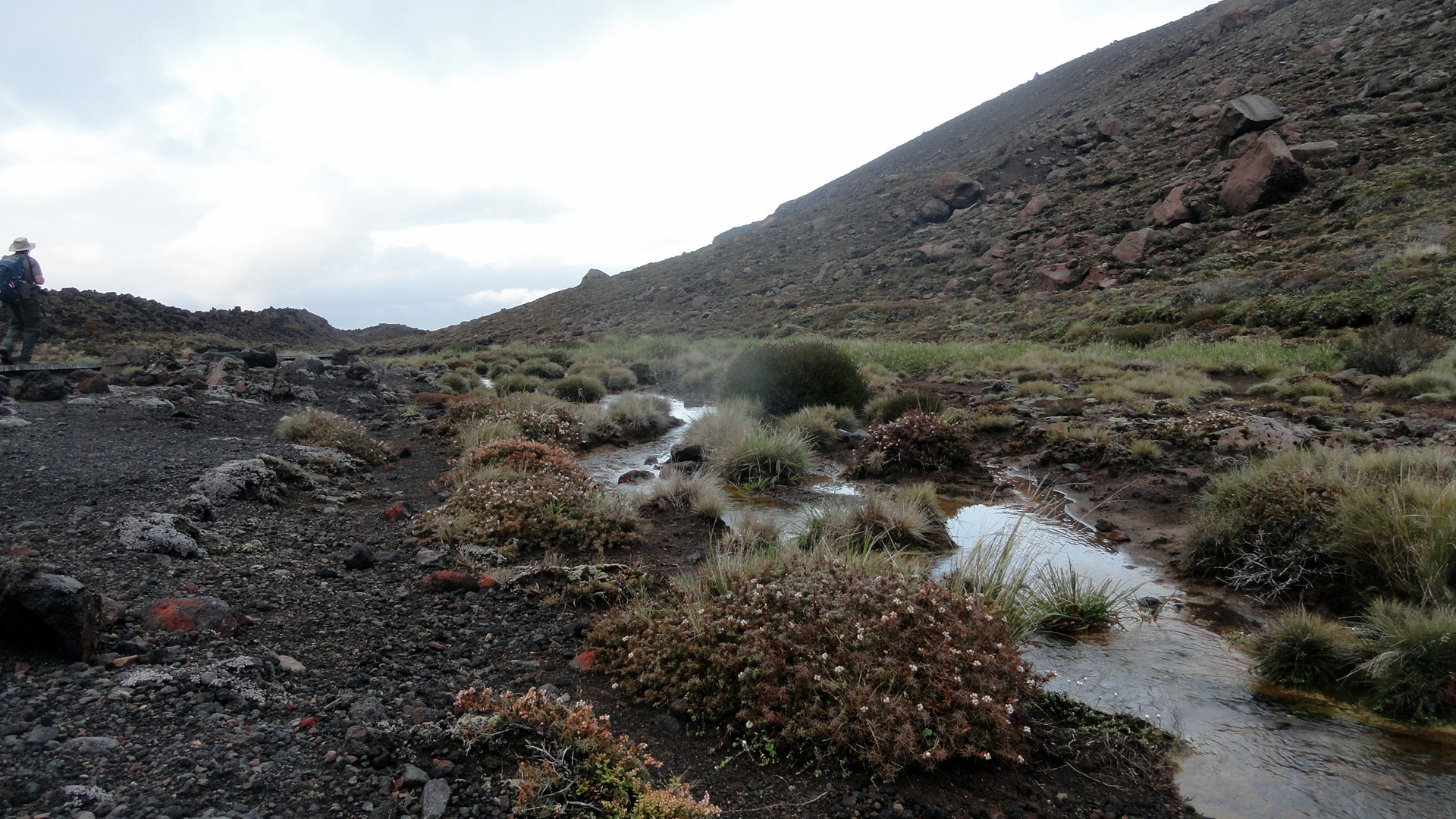
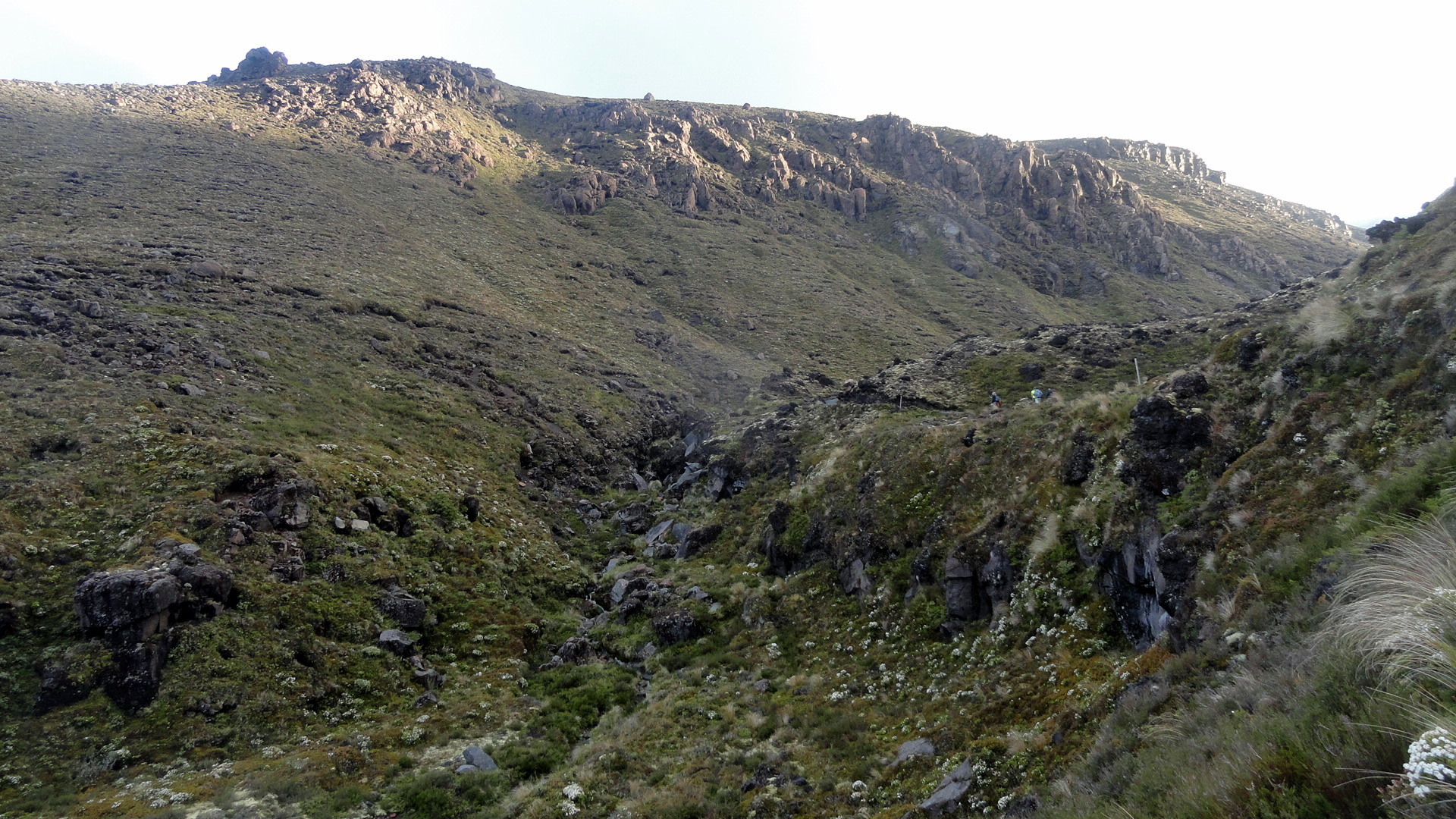
 The Milford Track is the most famous, and most popular, of the Great Walks. It starts at the bottom of the Clinton Valley, formed by the eponymous river which features a few times in the gallery of square photos further down. The first two nights of the three-night, four-day hike are spent within the Clinton Valley, hiking from the boat drop at the northernmost end of Lake Te Anau where the Clinton River feeds it, up to McKinnon Pass where the images above and the whole slide show below were taken. After the slide show, you’ll see a variety of views from other sections of the trail: rivers, waterfalls, dramatic valleys and trail segments snuggled into a rock face alongside the Arthur River at the end of the track, where it meets up with Milford Sound. Milford Sound has been cited by many magazines as one of the most beautiful places on earth; and Milford Track as has been cited as one of the most spectacular hikes on earth. I certainly found McKinnon pass to be one of the most spectacular places I’ve ever seen, and I found many of the miles along the Clinton Valley quite beautiful in an ever-changing, other-worldly manner that was different yet again from the other-worldliness of the glaciers featured in my last post.
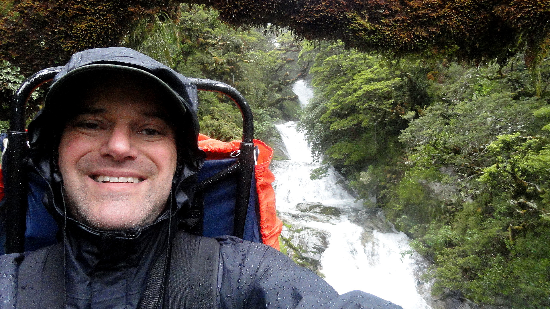
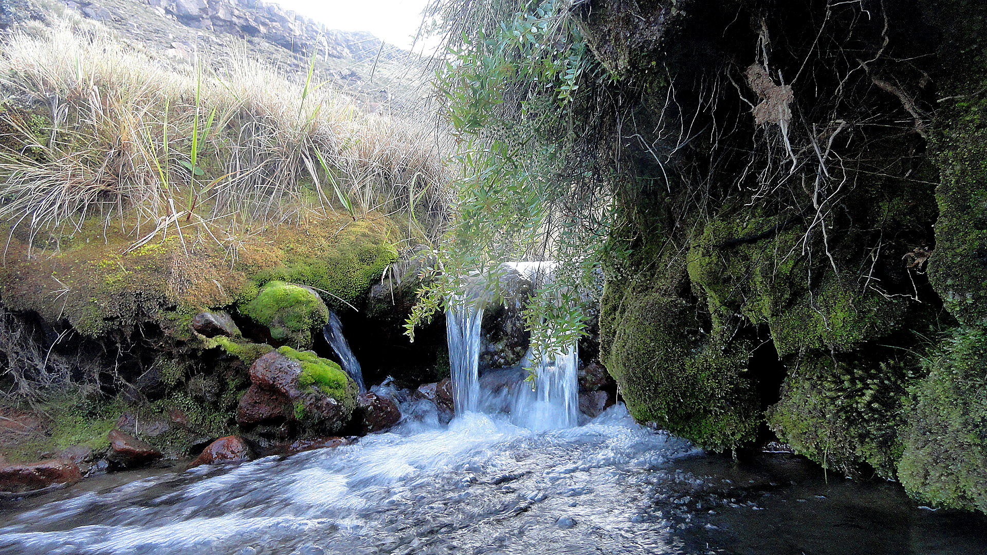
But allow me to say this, of the Milford Track: it is indescribably wet. We hiked it in the midst of the southern summer, during peak season. Peak season is also, strangely, the rainiest season; but even the driest season has plenty of rain. And the drier winter season is, we were told, the season of such landslides as the one just below where you see the trail marker placed to navigate walkers across the rubble field. I can imagine that a mostly-dry hike over this trail would be an unbelievably great experience. And I can certainly attest the truth of that oft-quoted adage that rain makes waterfalls, which are the joy of the trail. But can I just say that my own brain can only really appreciate xx-many waterfalls, and after a certain point both my feet and my soul wish to be dry, warm and comfortable again? So I ended this trail – which, indeed, gave me more spectacular scenery than most other hikes I’ve done – with the sense that it won’t likely call to me again…whereas the Abel Tasman, for all its comparatively mundane (hah!) scenery, is one I’d readily return to again and again – in part because it’s just so much more warm and comfortable as a hiking experience. (Even the Kepler, another Great Walk within the extraordinary Fiordland National Park, showcases a wider range of terrain with a lower preponderance of heavily rainy days — witness this post: https://somuchworldsolittletime.wordpress.com/2009/03/05/kepler-track-fiordland-national-park/
But don’t get me wrong: even the most amazing of these photos (some of which still give me vertigo) can’t convey the gift of being present to feel and hear the roar of wind and rain, marvel at the shifting windows of sunlight along a mountainside, or see a rainbow materialize above one of those windows…with the sense perhaps you’re the only human positioned so as to appreciate that particular ephemeral wonder. Whatever the case, I encourage anyone who loves the great outdoors and appreciates natural beauty to bump NZ up your must-visit list, if you’ve not done so already. Feel free to research on this blog (from 2009, 2013-14, and 2015!) some of the many wonders you might consider experiencing in person. Enjoy. 🙂
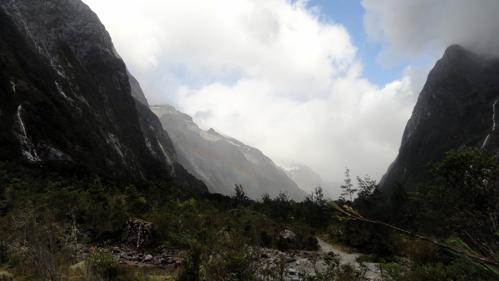
…about the blurry spots you’ll see in some of the rainier images: my camera has survived but there were days where the lens never really got dry. Most of the rain-splattered photos are deleted, but I felt some of these convey what words cannot about the omnipresence of water at times…


Two Glaciers, Many Streams & Towering White-Tipped Peaks…


 …must mean we’re on the wild southwestern coast of NZ! In this entry you’ll see photos from both Franz Josef & Fox Glaciers, as well as shots from the temperate rain forest to which these glaciers descend at their lowest, warmest level where they’re melting all too rapidly these days, what with holes in the ozone layer and global warming more generally. There are also views from the Haast Highway along the south coast, and up and over the Haast Pass alongside Mt Aspiring National Park into the town of Wanaka. They all have names that identify them. To put this in some perspective, think of the last entry (or scroll down to it) and understand that we did a fairly substantial last-morning hike along the nearly-tropical-seeming Abel Tasman Coast track, grabbed a water-taxi back to Motueka, hopped in the car and stopped for some berries and dinner along the drive south, then spent the night a short walk downriver from the ice cave at Franz Josef Glacier just below. It’s really quite unreal and surreal at the glaciers because, despite significant melt and receding up their canyons to higher ground, they still descend to the level where rich dense temperate rain forest grows and unusual-sounding birds call, and it just feels utterly other-worldly. Certainly this close to sea level, this far downhill from their main bodies, neither of these will stand out if side-by-side with other, bigger glaciers you might have seen…but the clear way they’ve affected the landscape and the simple fact that a short walk away one is enveloped in dense temperate rainforest is pretty amazing.


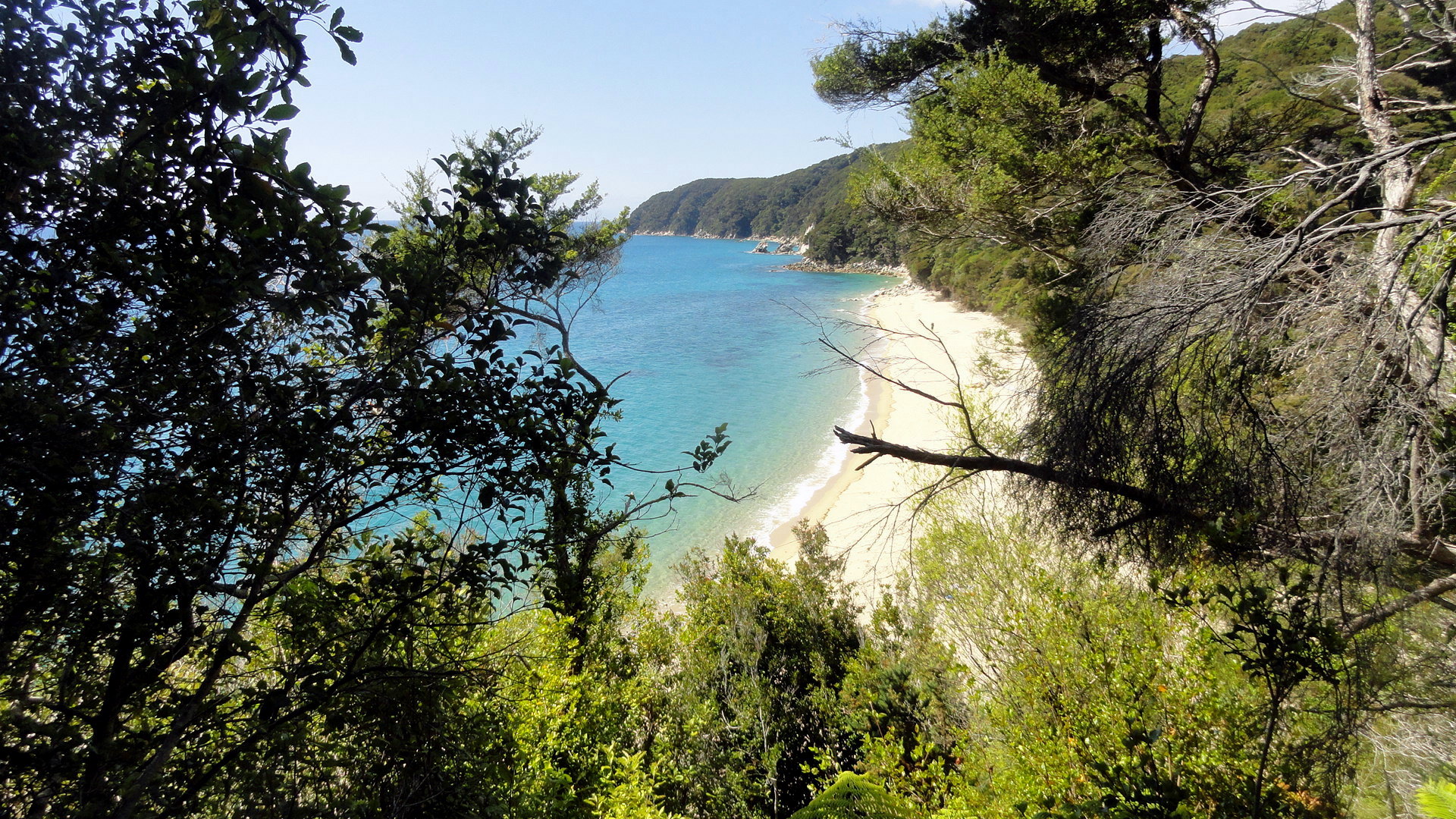
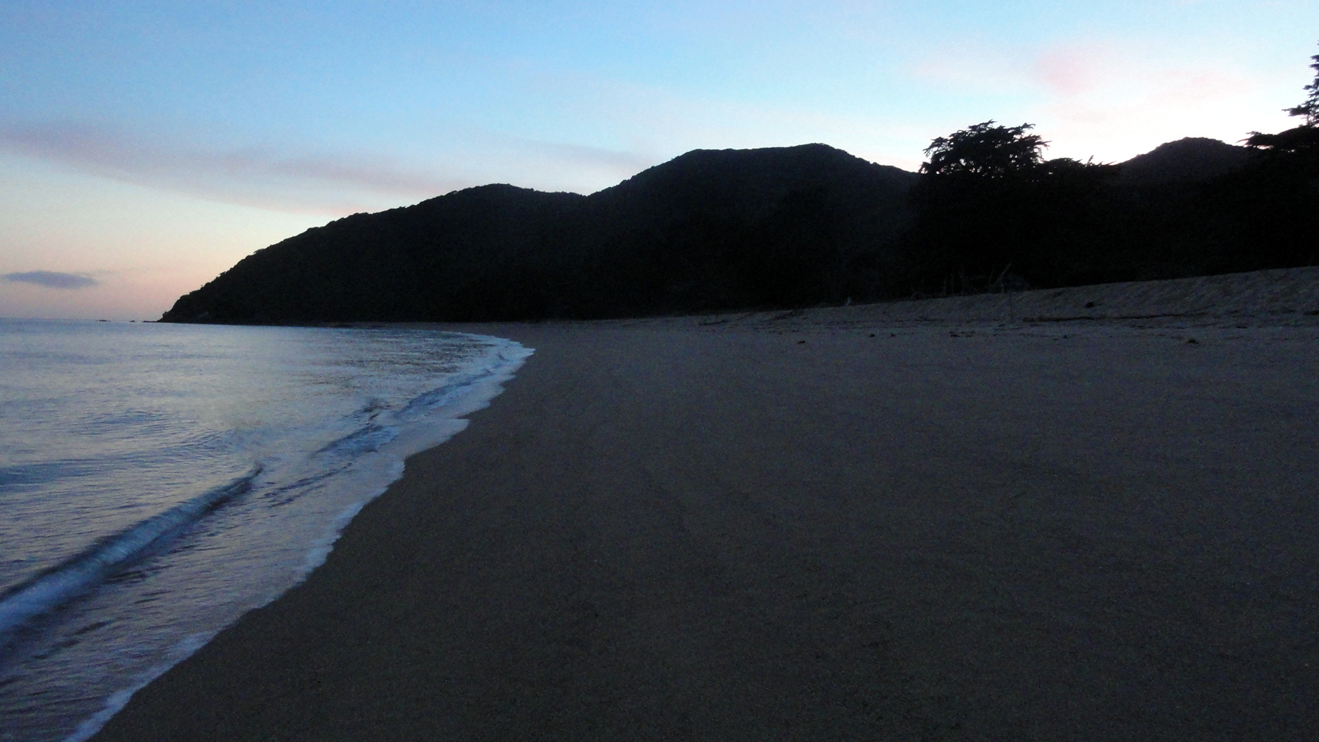
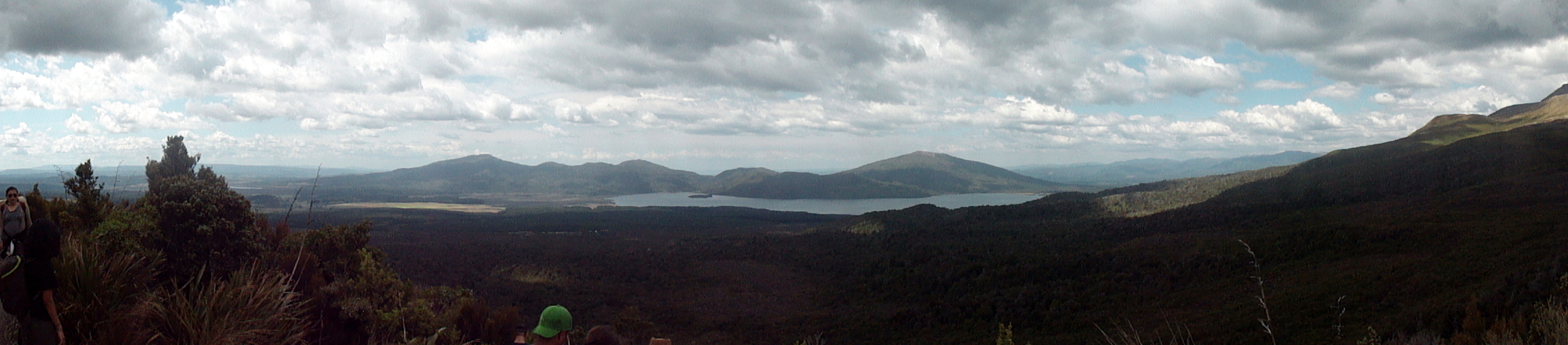
Hiking the Abel Tasman Coast Track

 With this third visit to New Zealand, I’ve grown more aware of how the country lives in the outside imagination. For many, it’s the middle earth of certain much-loved fantasy films. For me – and clearly many more – it’s probably the single best place on earth to get an amazing range of very well supported and managed backpacking options. Hut-to-hut hikes abound throughout North Island, South Island, and Rakiura/Stewart Island, meaning one can travel a bit lighter without a tent if one chooses, and – particularly important down in Fiordland – have a solid roof and walls around one when the rains fall and/or the temperatures plummet even in high summer. The best known and most popular of these hikes are managed as ‘Great Walks’ by the superb NZ Department of Conservation. When I first learned of them, while planning my very first trip to NZ more than six years ago, I think I read there were eight Great Walks at the time. Now it’s up to nine; and I’ve hiked three of them in their entirety, while touching on a fourth during both my first trip and the most recent one. Some friends have said they’re saving developed-world tourism for later, and focusing on less-developed cultural-adventure type travel now, while they’ve got the physical and mental energy and fitness to handle travel to relatively challenging locations without great tourist infrastructure or support. I fully understand that logic, and I’ve heard it applied also to the US by many European friends.
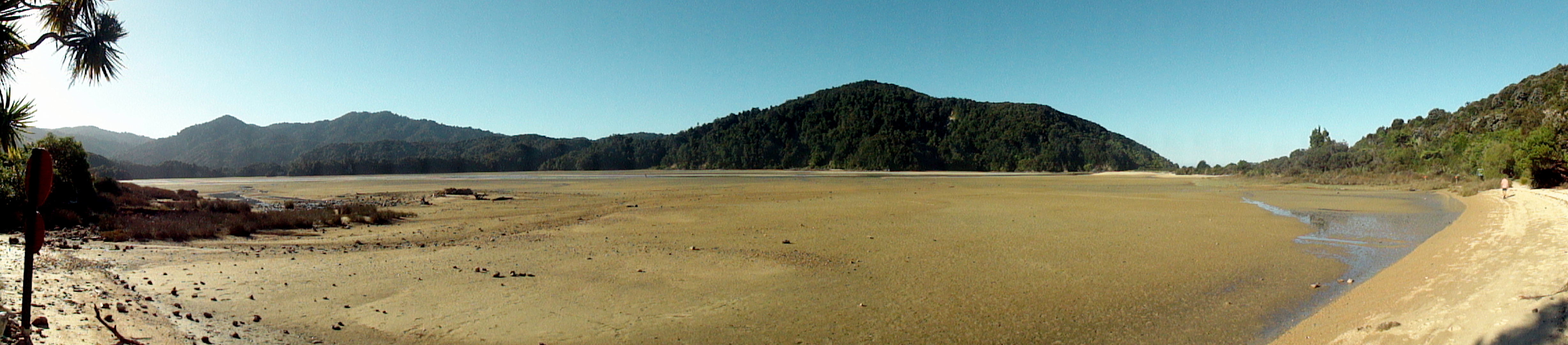
However, let me through some of these posts suggest that places like NZ, and the great national parks of the Western US, offer outdoor adventures which are more difficult when one’s body has lost the appetite for overnight camping and backpacking…and if you miss out on these places now, you might regret it when you visit them later and are limited to their cities and paved roads, unable to get off the highway and into the wilderness. Herewith a few too many shots of the Abel Tasman Coast Track, as support to my argument. This is an unbelievably beautiful place that I am incredibly happy to have hiked and would very gladly return to many times. By hiking it, and waking up early to cross certain estuaries at low tide with my shoes tied together and strung around my neck, I’ve had the unique opportunity to lay down the first set of footprints on the soft sand of those estuaries, to see the sun brighten the sky and rise above the horizon or the moon sink below it, to greet the sun with a mug of tea from my thermos while reveling in the absence of any sound other than waves or bird song…and generally to experience that mystical oneness with my universe that, sadly, I for one simply cannot quite achieve while behind my computer or the steering wheel of any motorized vehicle. Tasman is neither the most famous, nor the most over-subscribed of the Great Walks…but I’d definitely do this one again. Believe it or not, I really did cut out a TON of photos from this post but there are still a lot, for anyone interested in getting a more thorough feel for what it might mean if you were to lace up your boots, grab your walking stick, and step out onto this lovely trek. To reduce the length of the post, condensed two sets into galleries and one set into a slide show. (The gallery just below this focuses on tidal crossings and other cool visual and experiential effects of the tide’s action along this trail.) I hope you enjoy!


Nifty Buildings in Napier
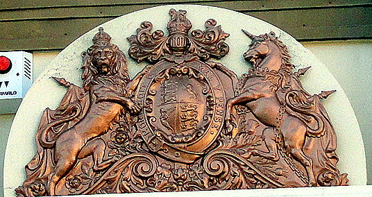
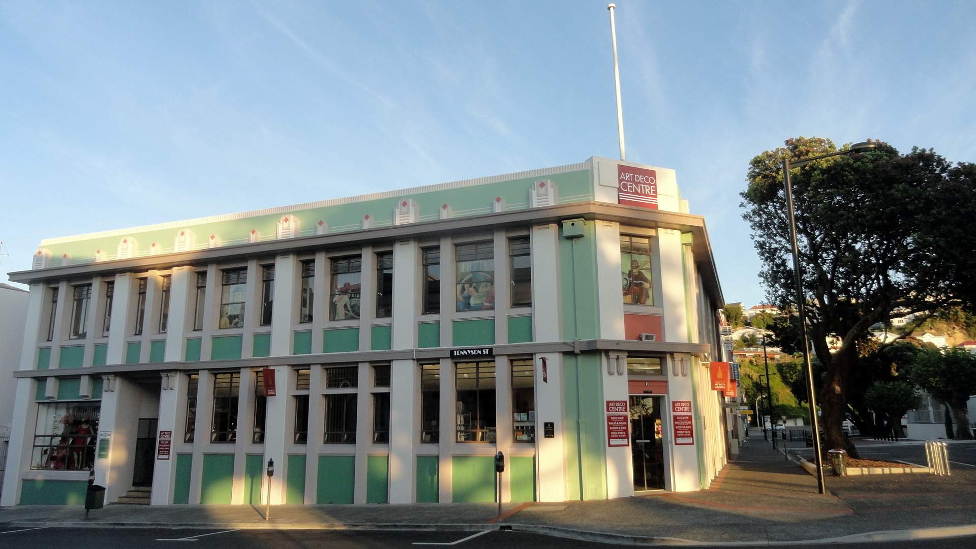
 Napier, a lovely town situated in the heart of one of NZ’s main wine regions, has become a major tourist center thanks to a general realization that it’s got one of the world’s most concentrated collections of excellent art deco architecture. This is a bit of historical happenstance related to the town’s near-total destruction in a major earthquake in 1931, after which they decided that art deco would be the best combination of both style and cost efficiency, given the need for a lot of rebuilding real fast. One of the only pre-earthquake buildings still standing is the public trust office, on which lives the coat of arms shown at left, and which is depicted in its full glory down below. As you see below, the streets were still full of christmas decorations when we were there for a too-brief stay. I’d happily go back to Napier for a longer stay, and drink lots of wine :-).


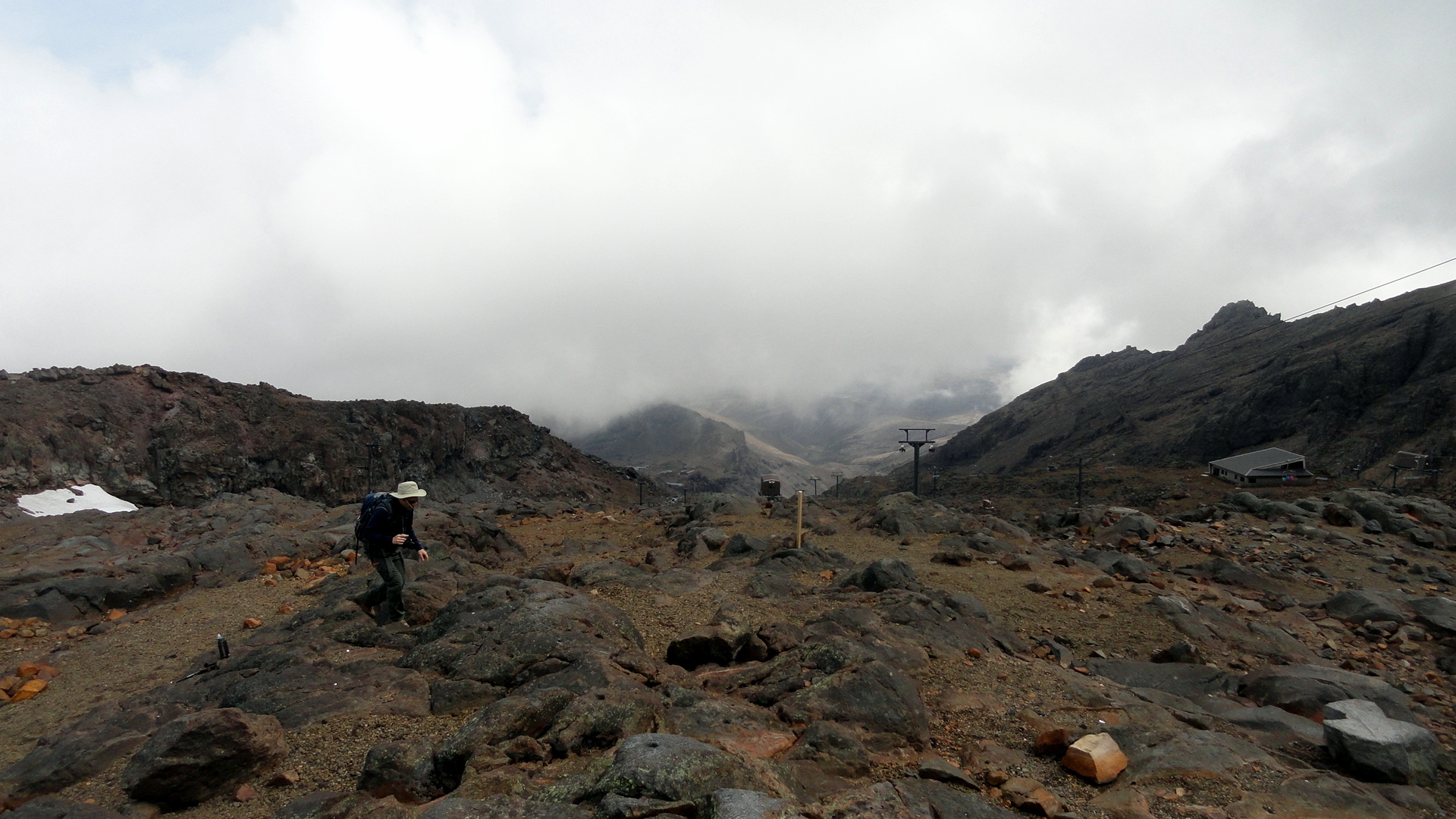
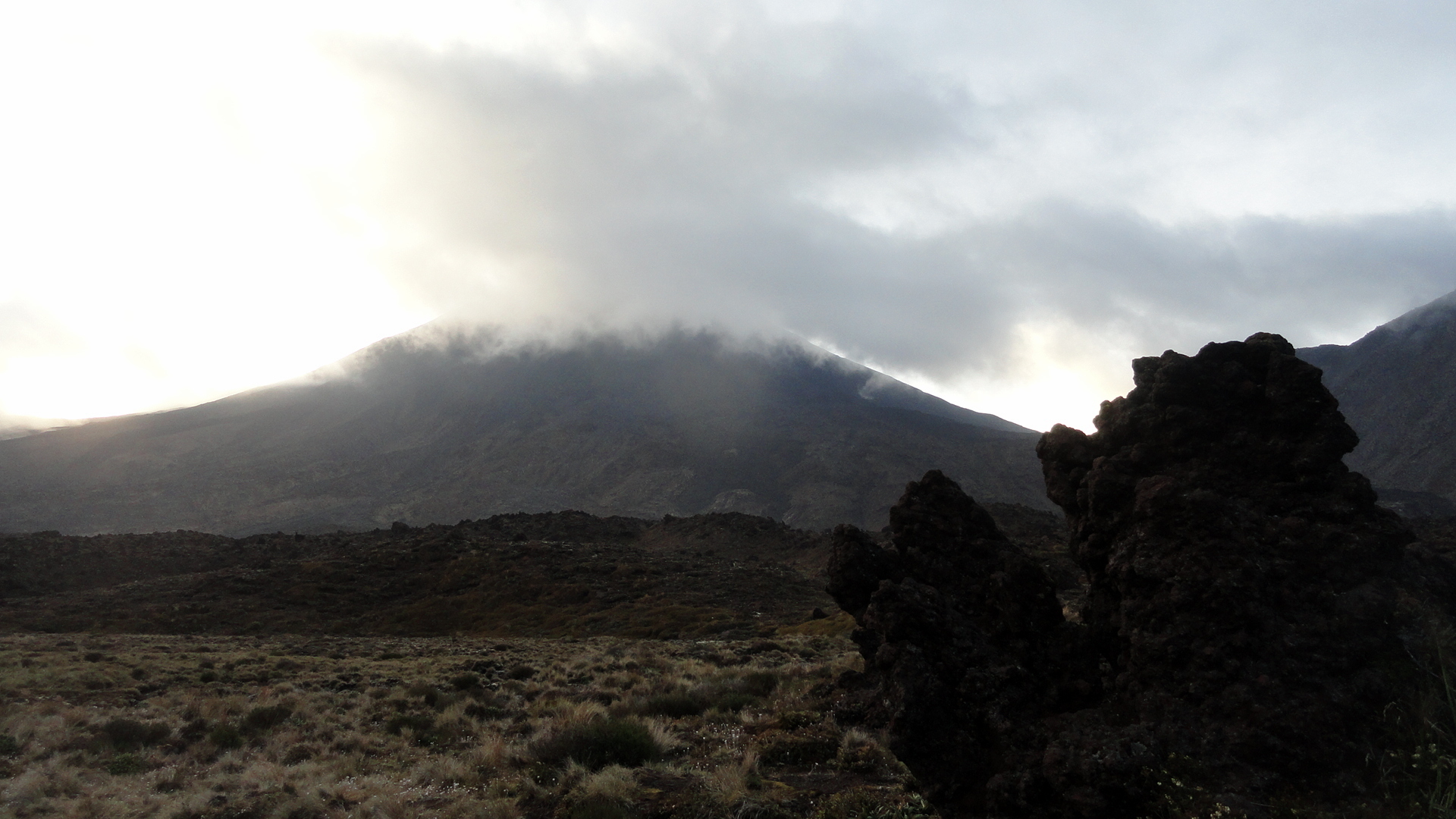
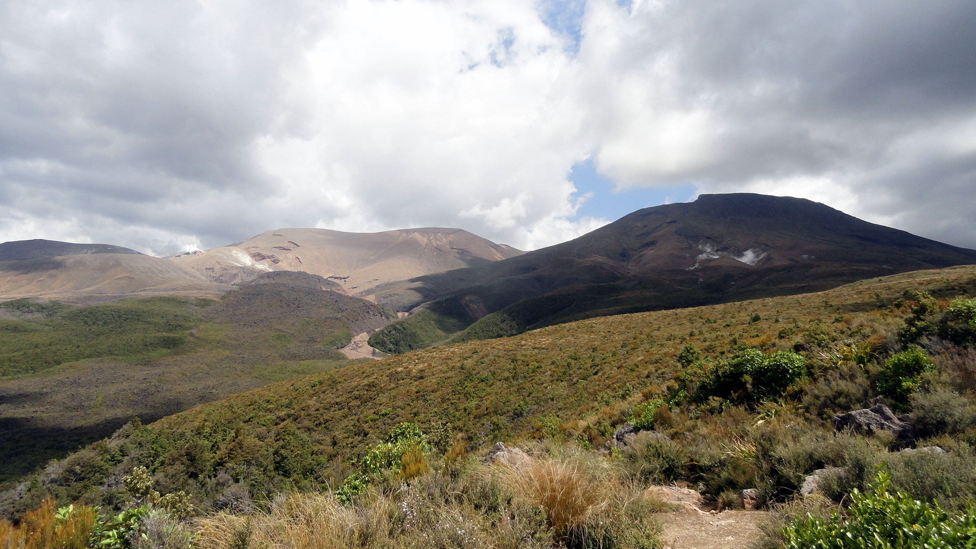
The Many Moods of Mt Ruapehu
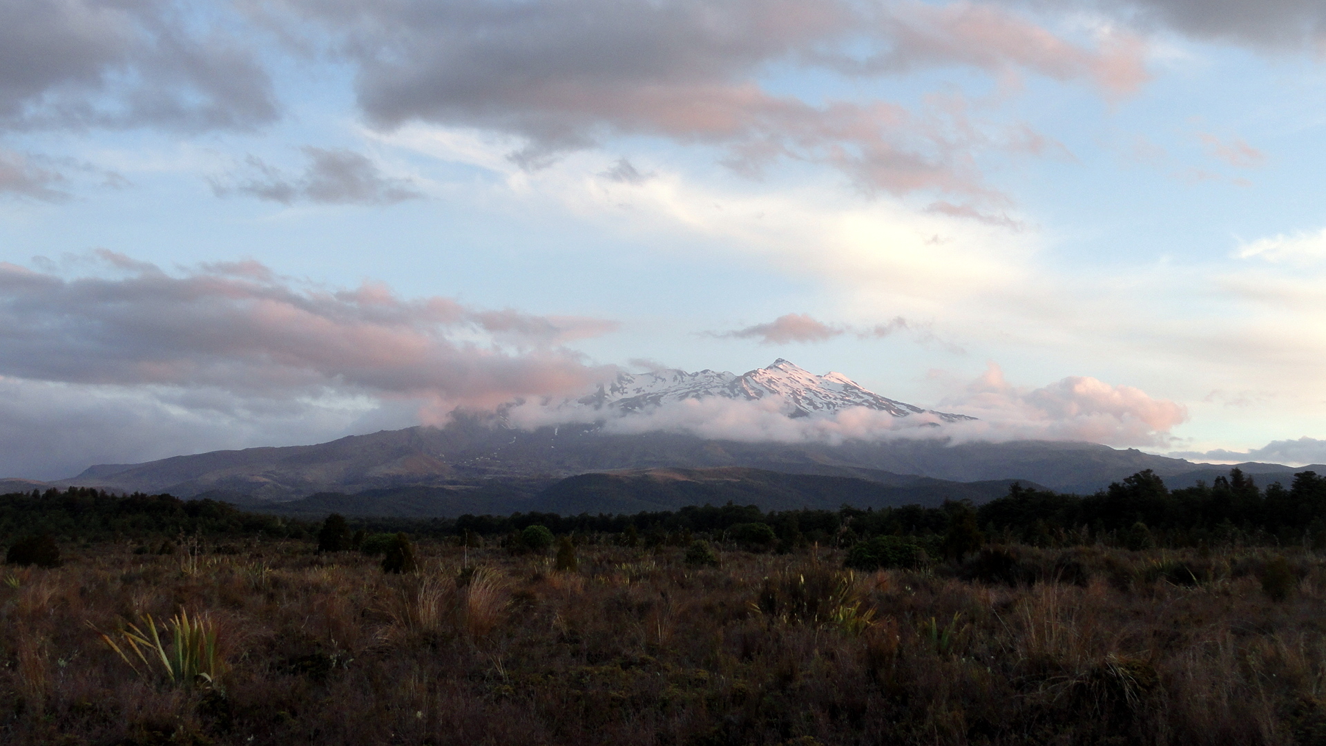
…and other views from Tongariro National Park, a place which can truly and safely be described as otherworldly. One factor that makes it a world heritage site is the presence of three volcanoes right next to each other. You will see more than you want of these three, in this post…sorry. The moods and clouds, the light and colors just change so often that when one is there one just can’t stop! I am blessed now to have visited New Zealand three times, and I am going to work my way through the (too) many photos I took there roughly in chronological order: this was the first major place our group visited as part of the big Howard’s-turning-50 tour. What a great start! (Btw if you’d like to see Tongariro in other moods, and more shots from the top part of the Tongariro Crossing day hike, check out the post from my last visit, which is here: https://somuchworldsolittletime.wordpress.com/2009/03/05/tongariro-crossing-the-summit-of-mt-doom/)
I won’t say much here. NZ is so lovely and so endlessly various and fascinating that the photos better speak for themselves or I’m not doing my job right. For those curious, I’m back and settled in the bay area, in great health thanks, and trying to put down some roots here in the this intermezzo before the start of my next assignment…about which more, when the time is right :-). Peace. Oh, and btw: linger on the shots below: it’s a slide show of Ruapehu, which is sort of currently the biggest, though not the oldest, of these three volcanoes – and one that I explored in more detail this time than when I was last there, from up close. (More on that further down.) All the photos have names which pretty well identify them.


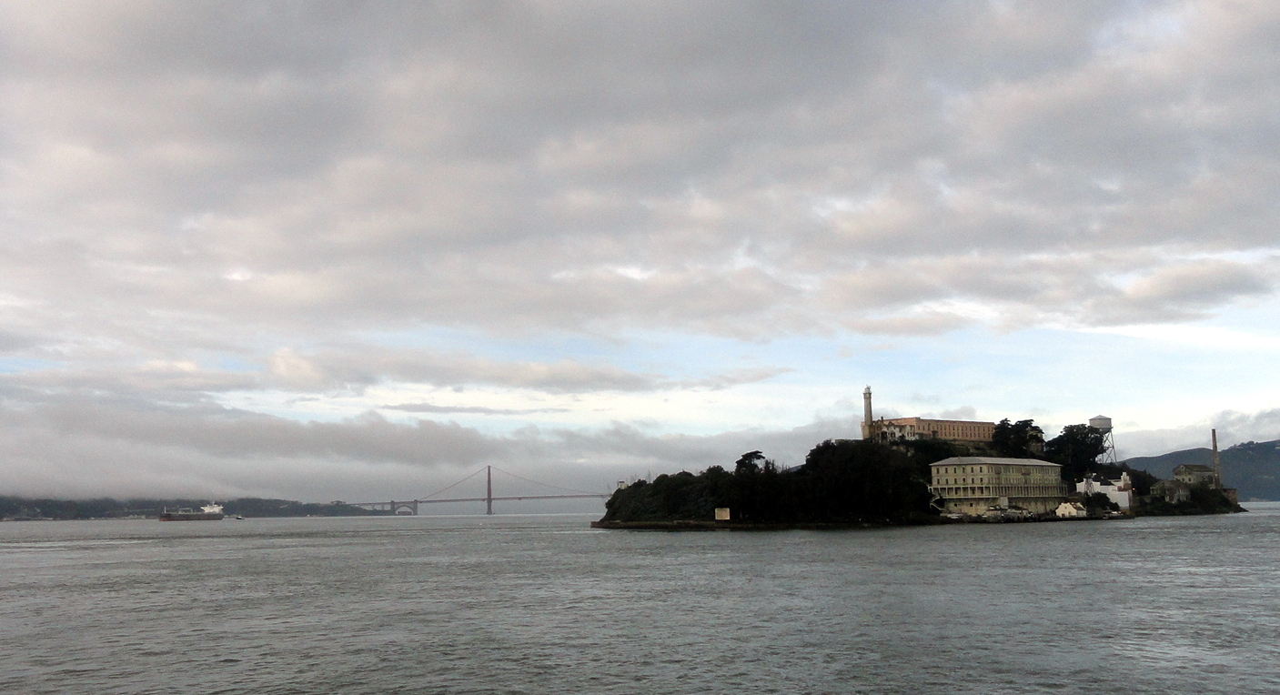
Art on Alcatraz

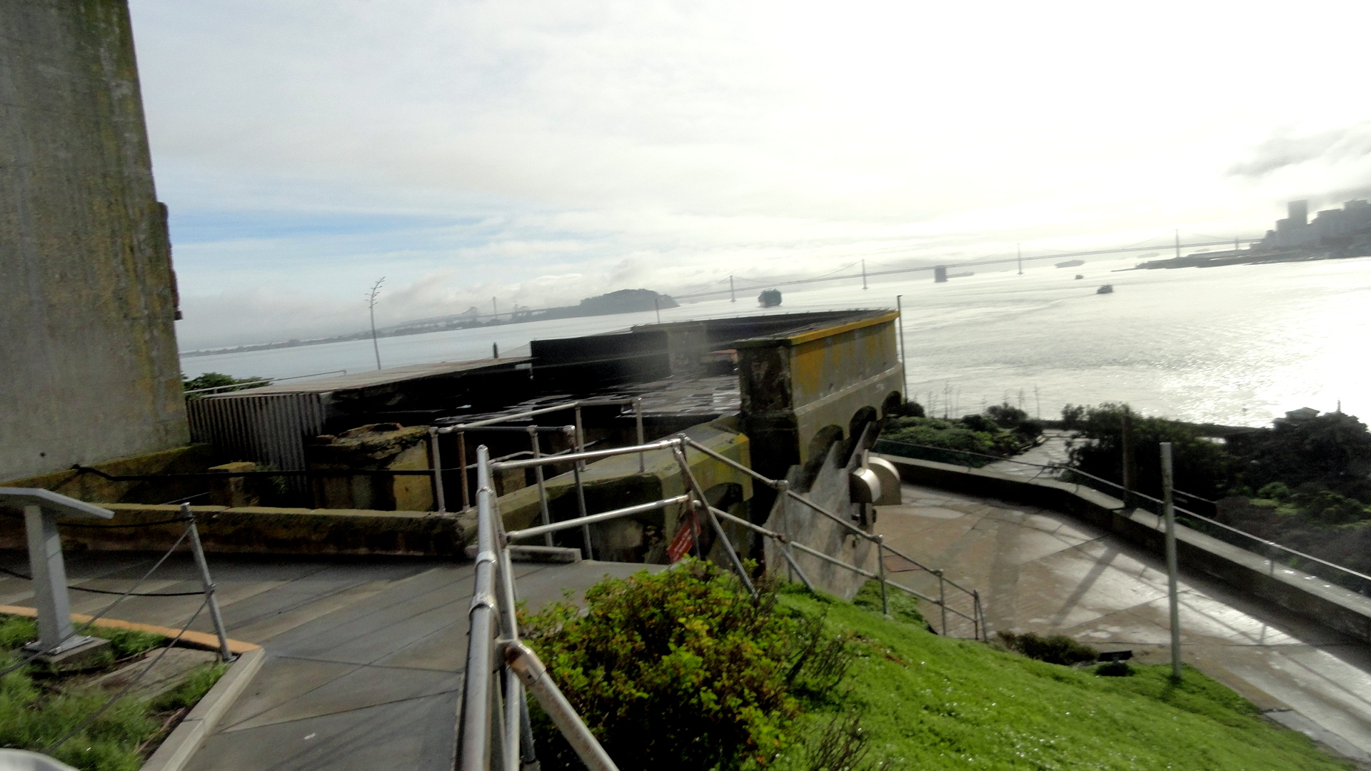
I’ve never been much for prisons. They’re scary, and being someone with an active imagination and a personal identity that leads to punishment or death in many places, I’ve always had a certain “there but for the grace” reaction. During a high-school social-action trip to Washington, DC our youth group visited a local medium-security federal prison and spoke with prisoners. It was an important experience, but I admit I felt far more in my element at the soup kitchen, to which I returned to help cook and serve on our choose-your-assignment day. I’d still make the same choice. So it’s probably not a surprise that – for all the time I spend in SF – I’d never set foot on the island of Alcatraz until a week ago when I was drawn there, in a group organized by my good friend Amy (thanks again!) to see a special installation of art created in absentia by Ai WeiWei specifically for this former prison location…indeed, for this location which is probably one of the most famous and certainly one of the most tourist-friendly former prisons in both the US and the world at large.
Indeed, it’s that very tourism-friendliness which has helped keep me away from Alcatraz: I’ve imagined that many visitors go with a sort of prisoner-theme-park idea in mind. I start out deeply uncomfortable with the basic statistics and facts about race, opportunity and incarceration in the US…then I add my uncomfortable awareness of how the US’s crime and punishment statistics measure up against other peer nations which pride themselves on openness, opportunity, and democracy for all (spoiler alert – do some research, but last I knew we don’t compare any better there than we do on gun violence per capita…), and in the end I’ve just never managed to get out to Alcatraz.
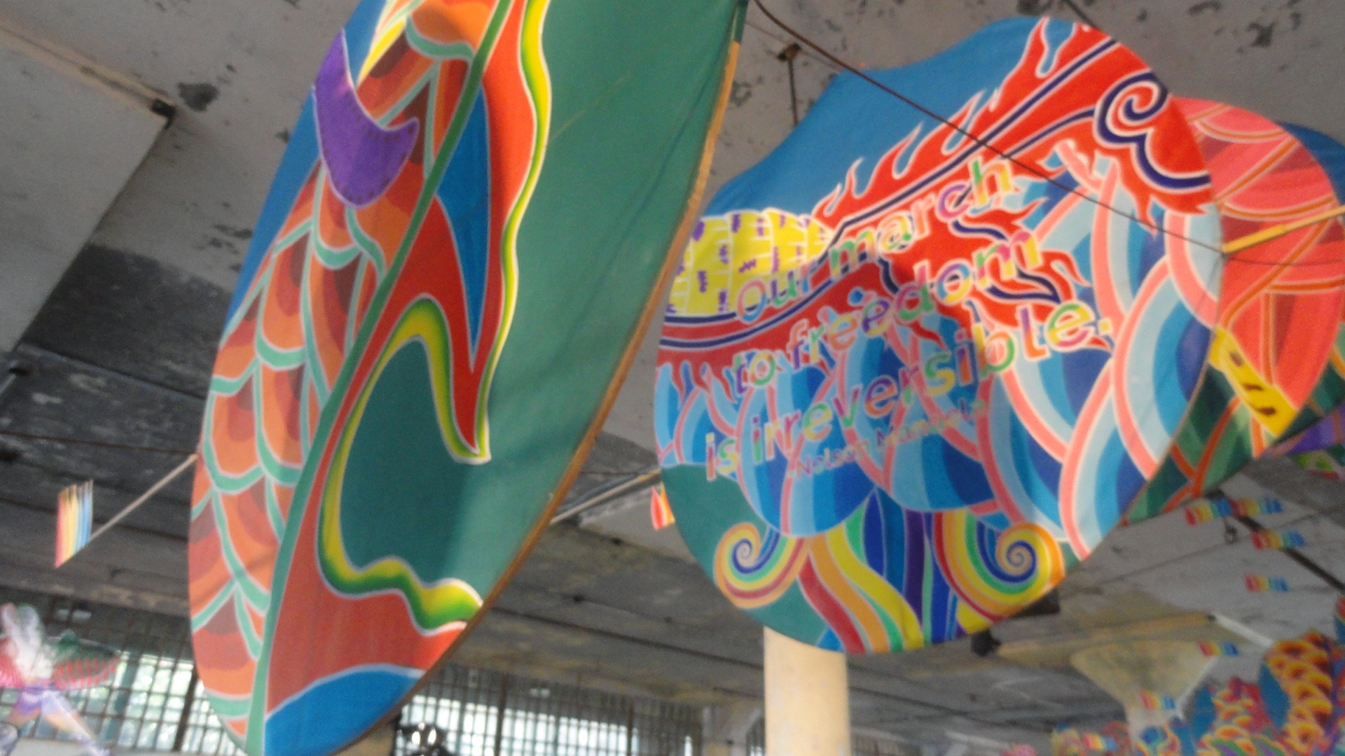
I’m so glad that Ai WeiWei and the creators of this exhibit gave me a good reason and impetus to visit. His work has made me think a great deal about freedom – freedom of mind, of body, of spirit. Freedom from as well as freedom to do, to think. There’s a range of installations – audio clips heard inside a small cell of famous prisoners of conscience from around the world, ranging from Martin Luther King, through the Robben Island Boys, to Pussy Riot. There’s an audio installation in the psychiatric observation cells, with a Hopi ceremony recorded. Through this I learned that among the earliest prisoners at Alcatraz in the 1890s were quite a few Hopi elders, who supported the parents of their tribe in refusing to enroll their children in the schools that were to “modernize” their children. (Translation: rip them from their homes & roots, and leave them confused about their place in this race- and class-driven world.) He’s got beautiful kites — dragon and other kites — with messages from fighters for freedom of conscience and ideas around the world. There’s a huge room whose floor is full of lego portraits of prisoners of politics and conscience around the world, and postcards where you can write you own message to some of these folks in many nations.
All in all it’s a very thought-provoking and educational exhibit. And being on Alcatraz, in the heart of one of the world’s most beautiful bays, it’s also a beautiful outing. Check it out if you’re in the area during the coming months. I believe and hope that posting these images is in line with the artist’s wishes but do hope someone will inform me if I’m wrong in which case I’ll gladly remove any that don’t fit. Peace, health, freedom to be happy sad or thoughtful in the new year to one and all.
 T
T he exhibit-installation had many parts. The one called “blossom,” of which there’s an example above, was installed in the hospital ward. It made me think of the hundred-flowers campaign, and also of the buddhist tradition that the lotus flower derives some of its spiritual power from the fact that it represents beauty arising from the muck. In another part of the main prison ward were many audio segments, each playing inside an individual cell and each representing music or speeches from people and groups imprisoned for their ideas or art. That’s hard to capture in film – but the shot to (I hope) the right, showing the three tiers of cells, and the photo of text from one of Martin Luther King’s later speeches are both from that section. The dragon kite is from a segment called “With Wind,” and if you look at some of the photos closely you will see quotes from people imprisoned or threatened with prison for their ideas.
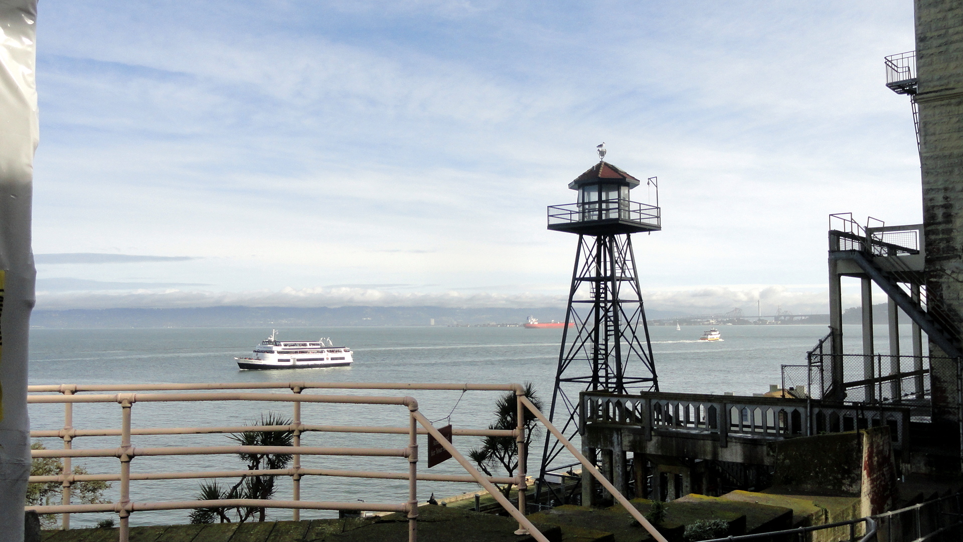


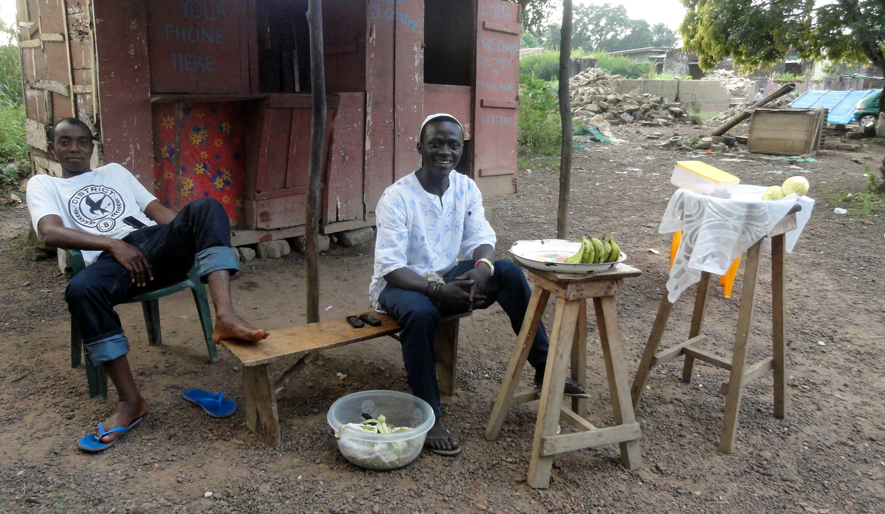
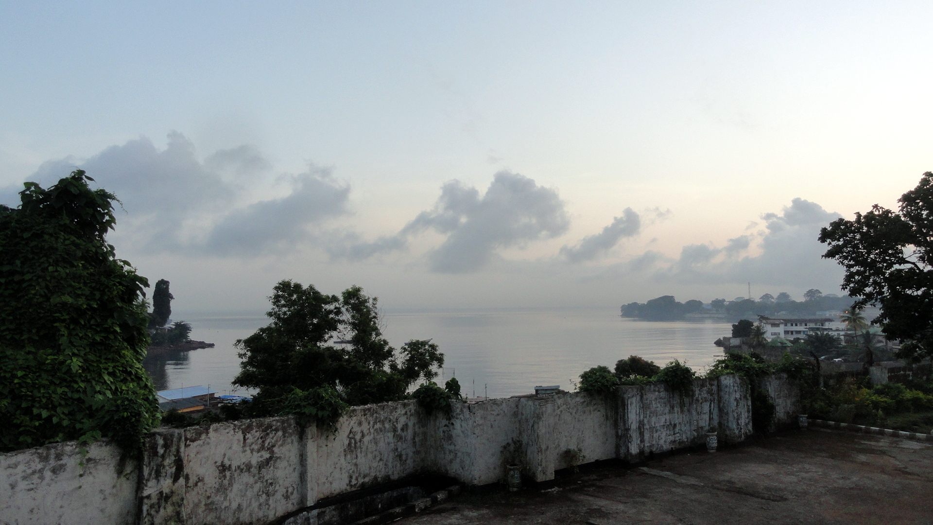
Green Hills & Smiling Faces in Sierra Leone


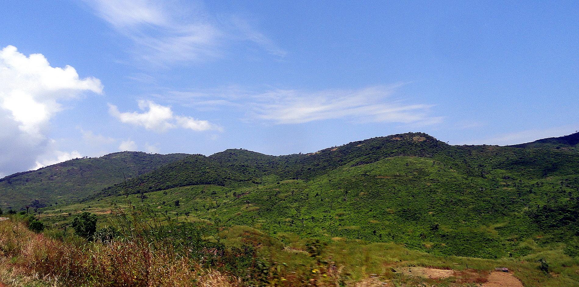
Human resilience, basic human interpersonal warmth and gut-level acknowledgement of our shared humanity and interdependence – these are things I’ve learned to respect, value and appreciate more and more each day, as I both age and accumulate more human working and interpersonal experiences in many varied points around this globe of ours. I’ve spent most of the past few months in Sierra Leone, a place which resonates for many developed-world folks in a sort of “walking wounded” state right now. But I found there, as I found living in NYC during the 1970s when most of the US was too scared to visit it for fear of being robbed (or so at least it seemed), what I’ve found pretty much any place humans seem to congregate. Which is that life goes on, that people care for their loved ones, look for a meal when they can and look for fun and friendship where possible. It’s remarkable, and a gift, to have a chance to get out of my bubble and experience more of the resilience, warmth and kindness of humanity everywhere. I won’t say more here – with all the media attention to what’s happening on the negative side of the register in SL just now, I wanted to just take a moment and tip my hat, as it were, to the colleagues, neighbors and partners who welcomed me and continue to make good work possible, sometimes rather against the odds. Happy holiday season, if you happen to be celebrating a holiday this season…J


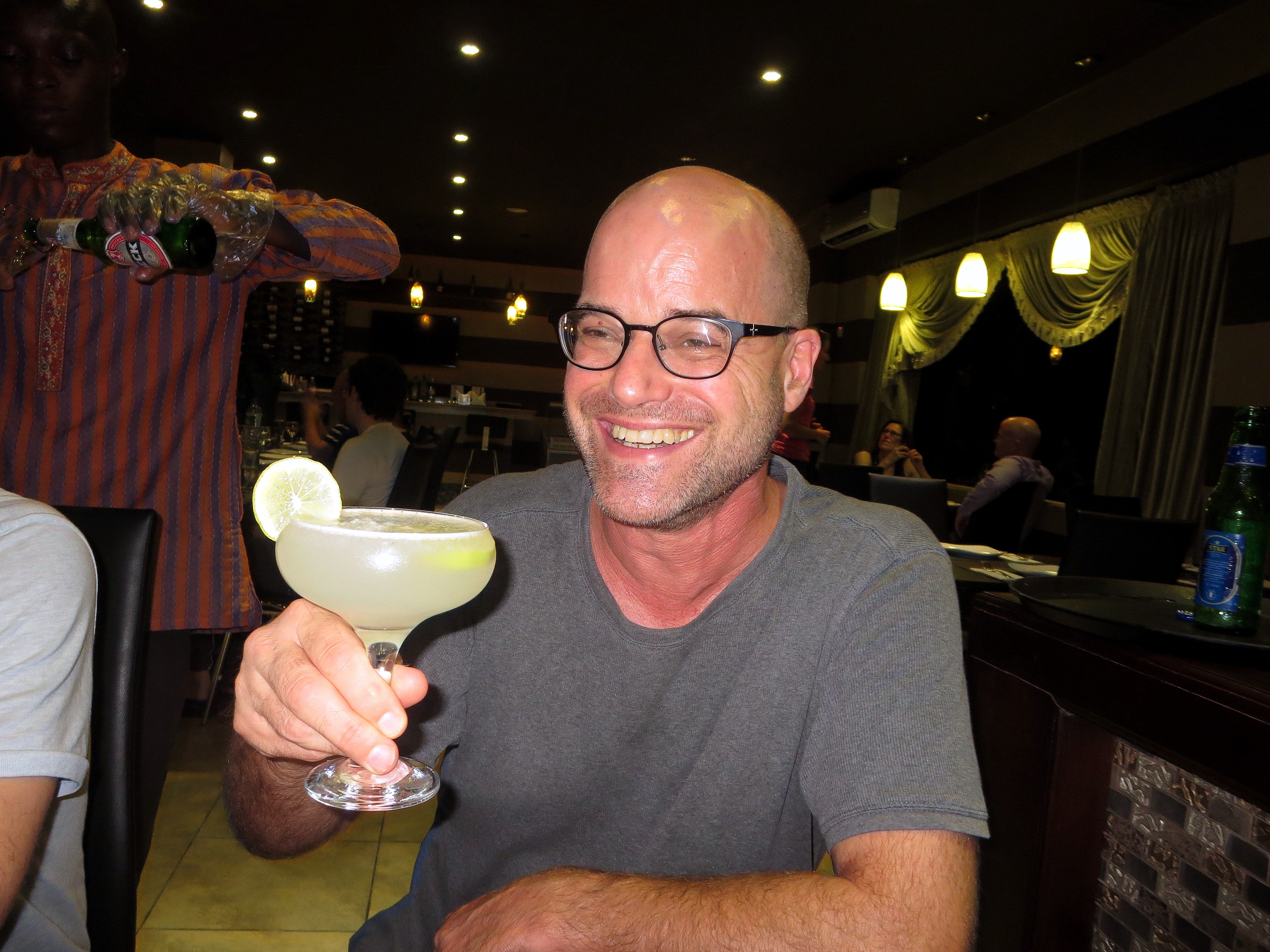 …final night dinner at a quite nice Indian restaurant in Freetown: first mixed drink I’d had in a very long time, nice way to relax and thank my colleagues before heading out :-).
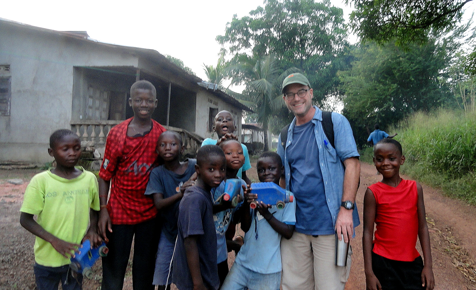
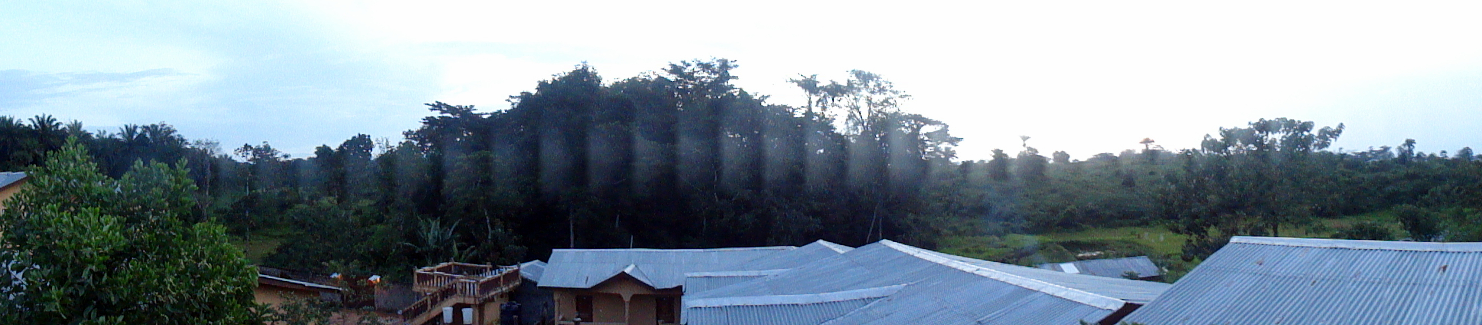
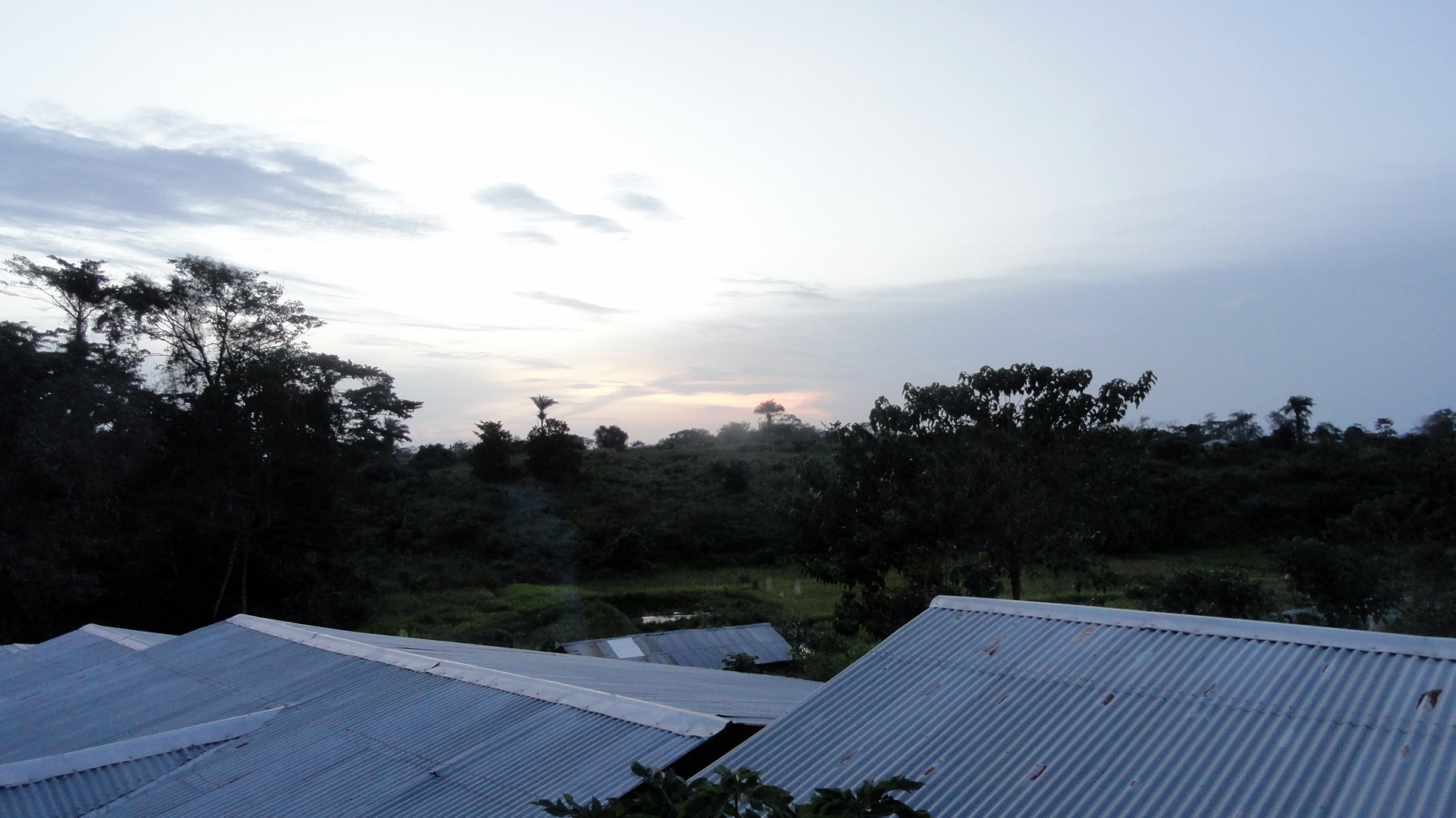
Juxtapositions & Transpositions

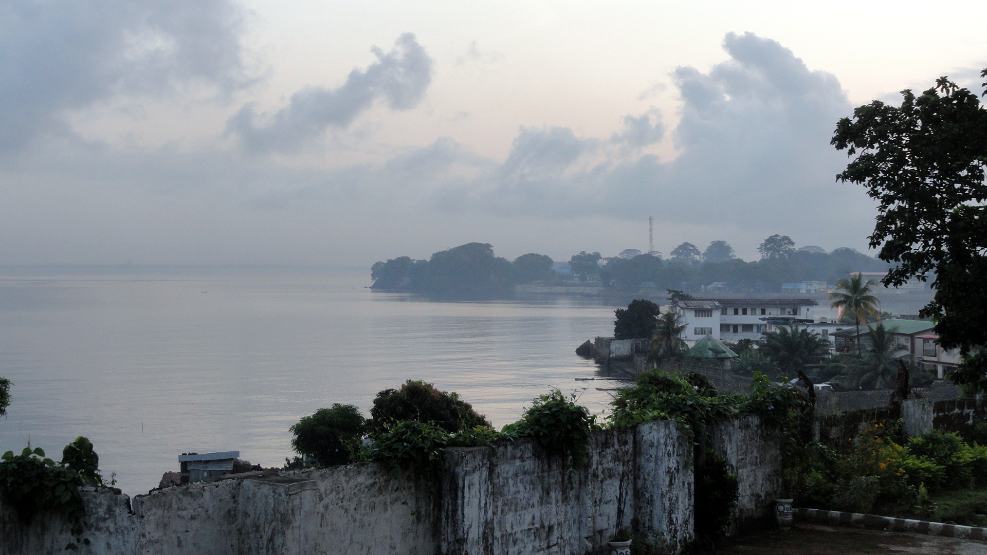
So like I said in the last entry, I’m in a place now where I will be a bit too busy and too sensitive about anything I see or do to want to post much in this…but I did pull some shots off my camera this morning and realized what an interesting juxtaposition there is between the photos I took while in Brussels for the introductory training about Ebola response, and the photos I took while here in Sierra Leone: and most of these shots were taken within the space of one week. So I’ve alternated shots in this entry – mostly because my friends and family have been curious what it looks like here, and all you find on the general media are shots of boots drying or people dressed in their PPEs. But meantime, of course, in a country of 5 or 6 million where (according to the latest UN figures) there have been 1500 confirmed deaths out of the 5235 total cases they report now), life does continue in the streets and homes of Sierra Leone, with all the warmth and smiles, play and hustle you’d expect, in amongst the reasonable concerns about family health and all the other daily cares and struggles, and of course sadness at the loss of so many in the communities and families already. (Side note: I think everyone acknowledges those numbers are probably lower than reality because of unreported cases etc.)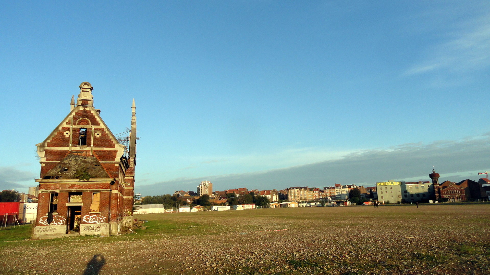

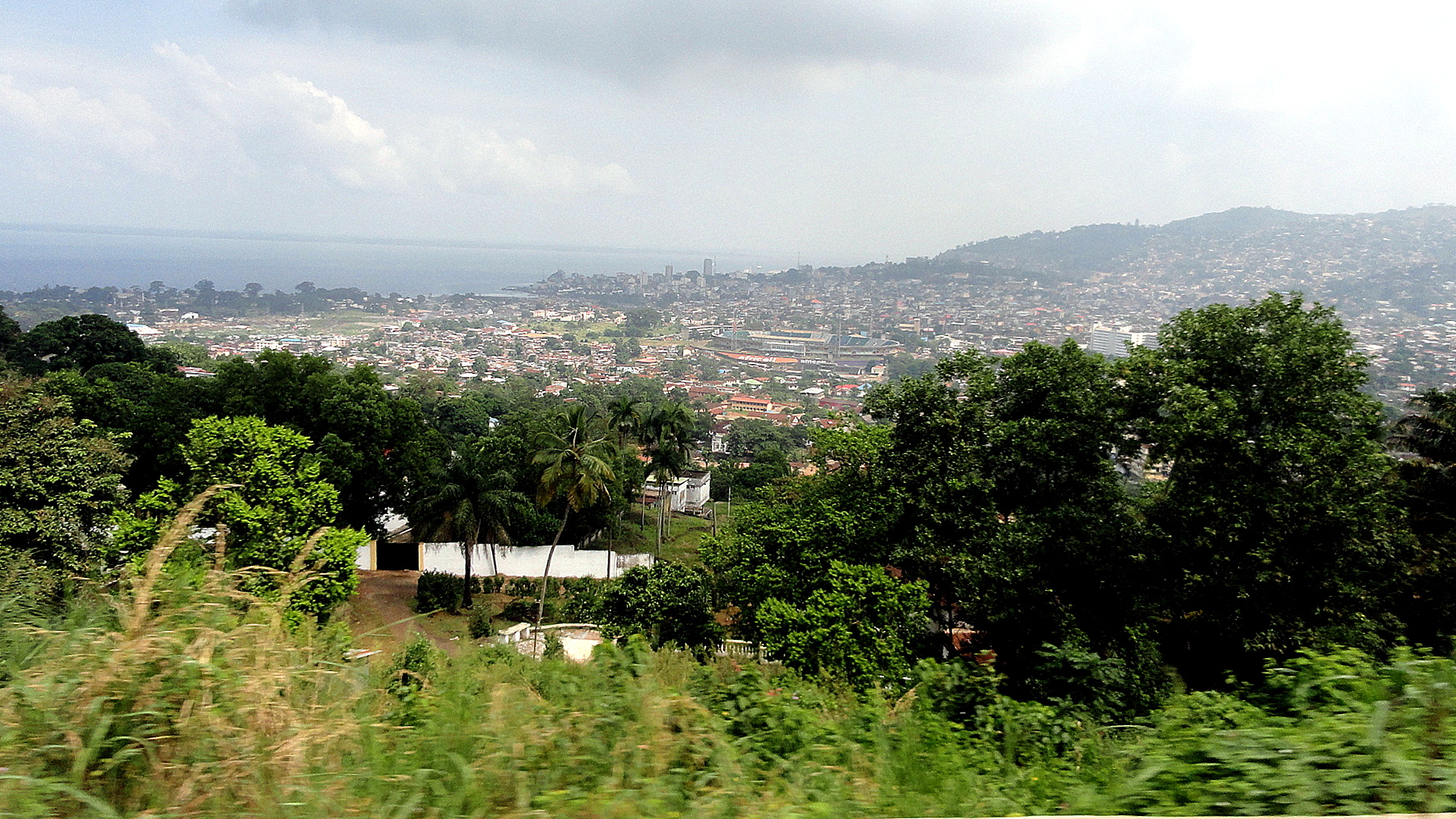
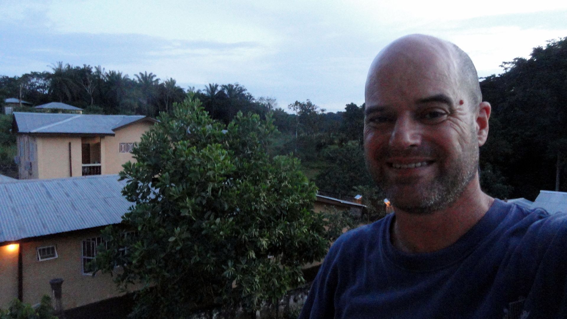
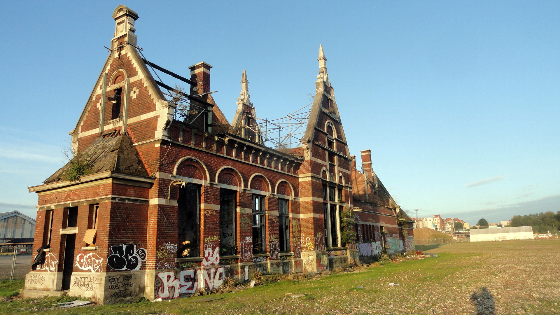
I also, while in Brussels, fell in love with a little run-down brick building just next to the training site for MSF, and how the rising sun warmed its bricks each morning as I walked into the site for training. (Look closely & you’ll see the MSF flag in the background on the wide-angle shot; you’ll also see my self-shadow-portrait in each.) I’m sorry that I’ve not gotten out more with my camera – I hope before I leave to do so, and perhaps engage in my usual fun pastime of sharing some of the faces of colleagues and people-on-the-street the way I usually do on assignments in (for me, and maybe you) new places. For now, I can only offer a small window to both Brussels and two towns in Sierra Leone: Kailahun, way out east; and Freetown, way out west — Kailhun nestled in its lovely lush green hills, and Freetown graced by dramatic bays and hills on all sides, and especially lovely at night when the town’s lights glitter like jewels strung up the hillsides. OK, yes, Freetown is also a bit too crowded and hustly-bustly, honk-happy and loud for me…and many of the streets are mighty muddy, rocky, bumpy. And maybe we should all pause to consider a world in which two national capitals can look so different, when the countries in question probably have access to a similar set of foundational natural and human resources…just sayin’, don’t ya know… All ye students of the human condition, go consider that juxtaposition and how it squares with the Universal Declaration of Human Rights‘ statement that “All human beings are born free and equal in dignity and rights. They are endowed with reason and conscience and should act towards one another in a spirit of brotherhood.” Peace, out, and remember this blog be very personal and in no way representative of anyone’s ideas or views but my very own.

California Scrapbook
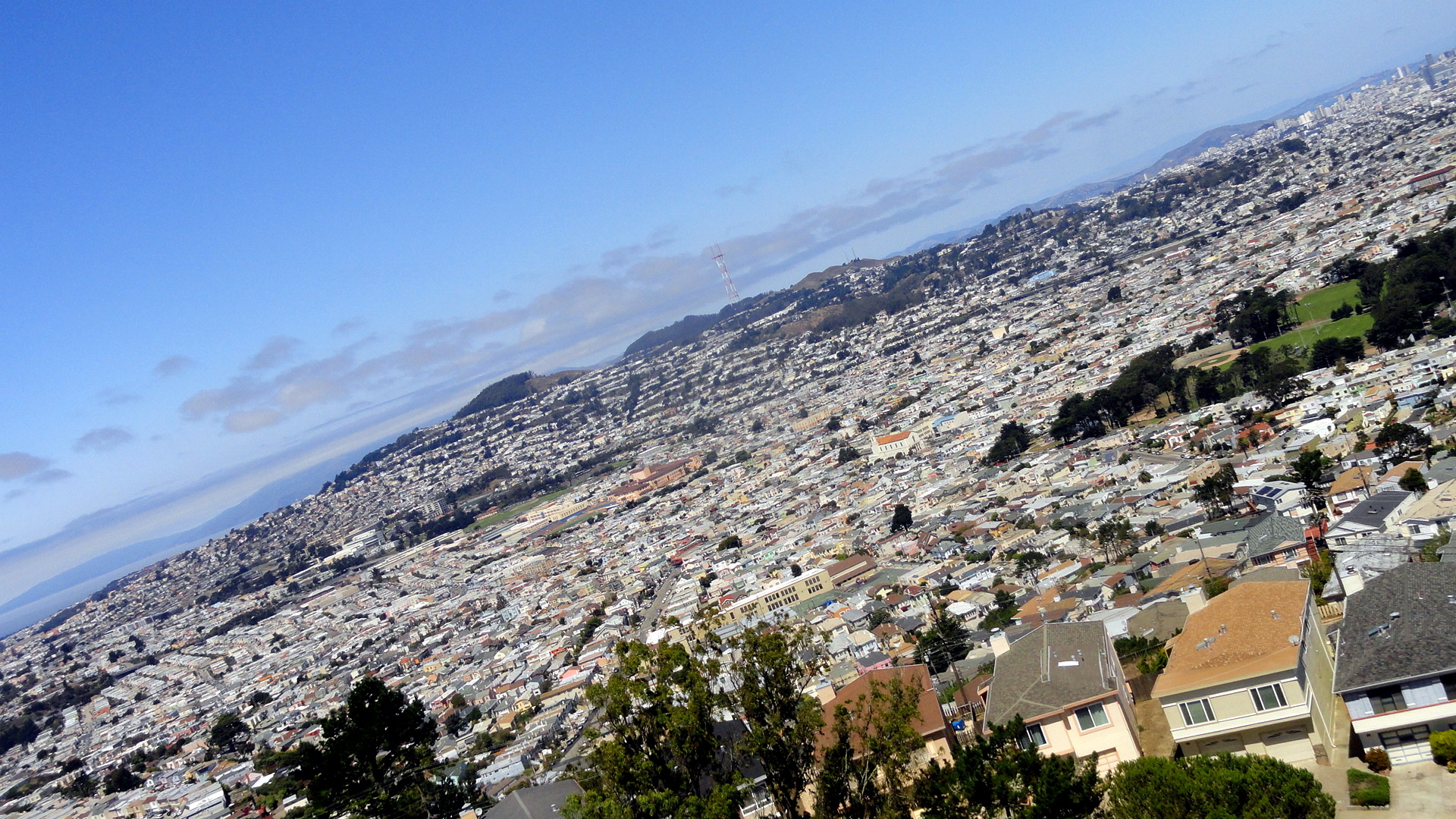


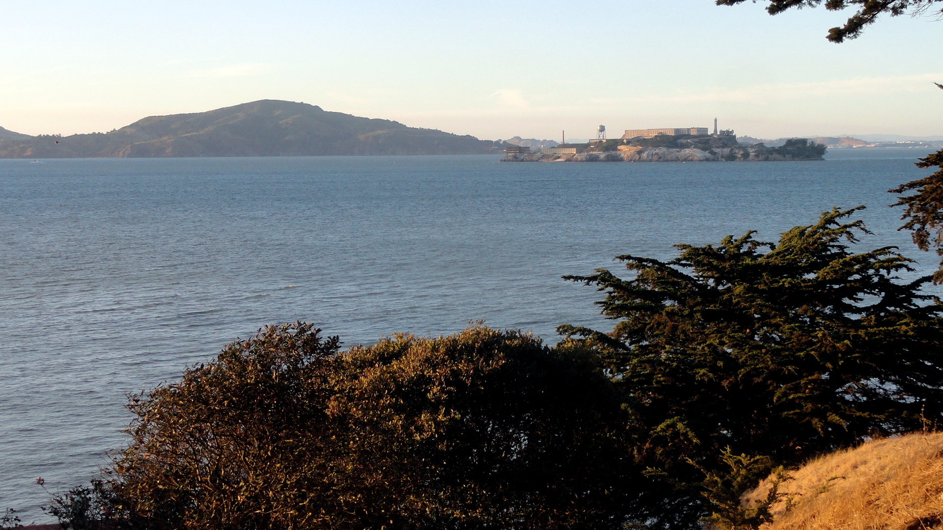
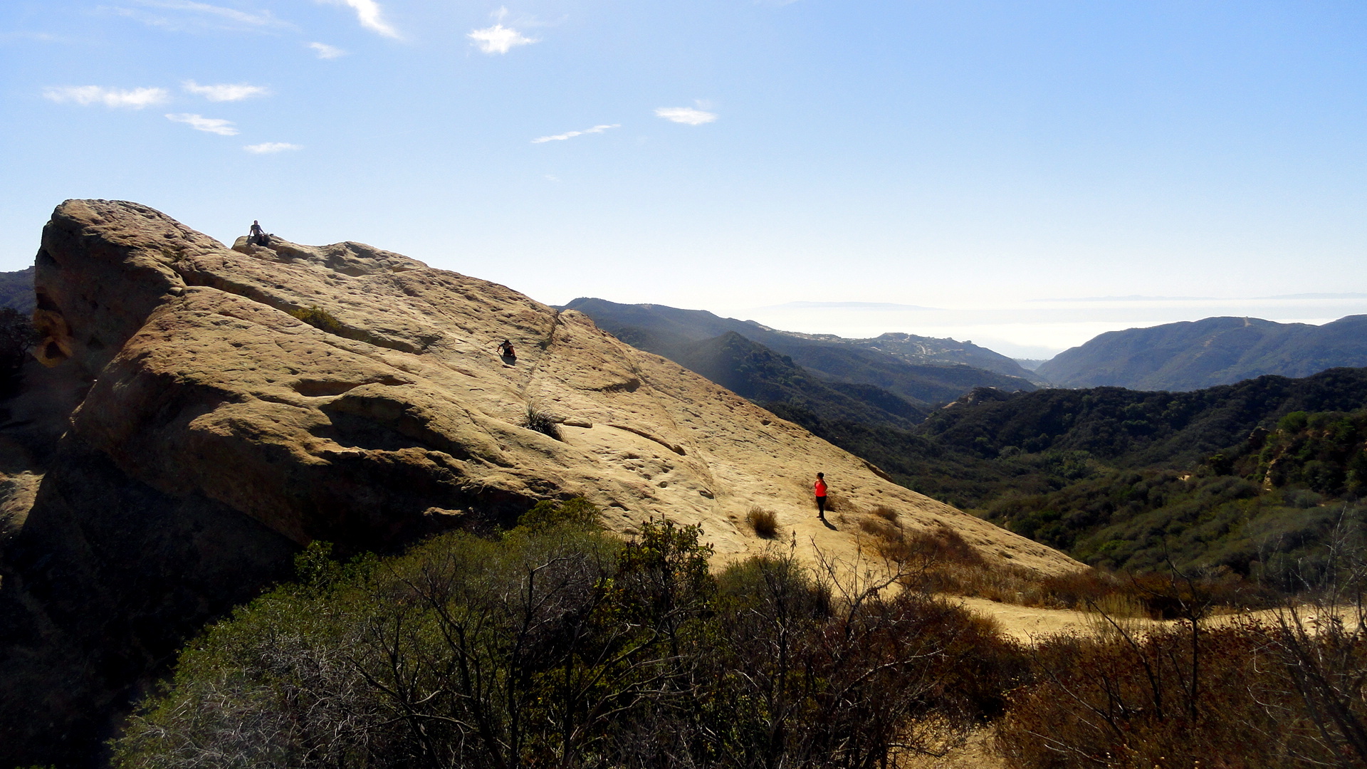
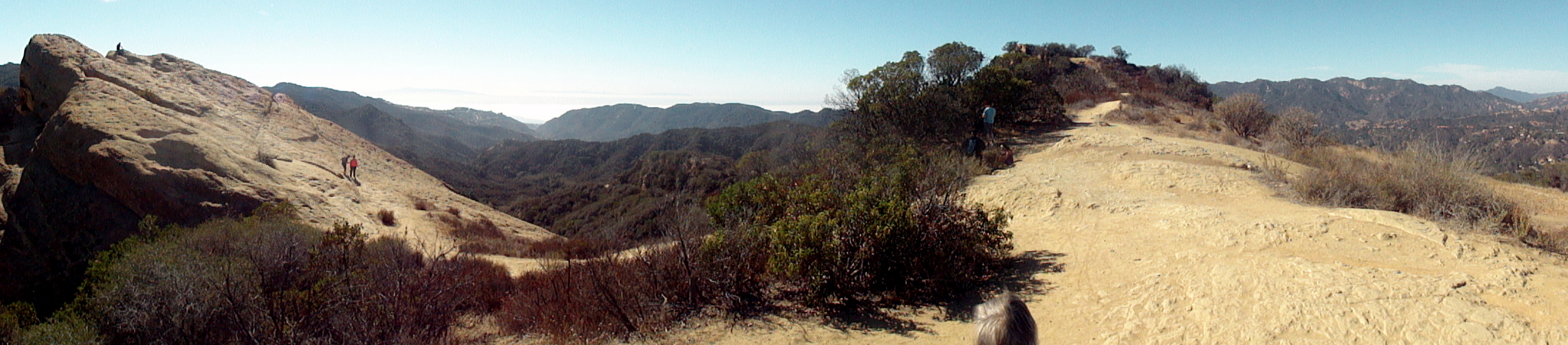
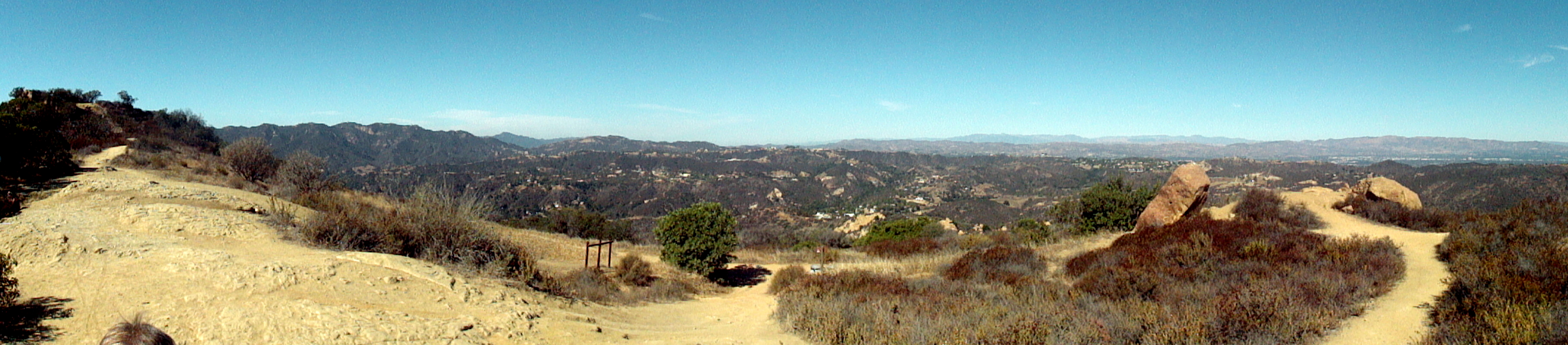
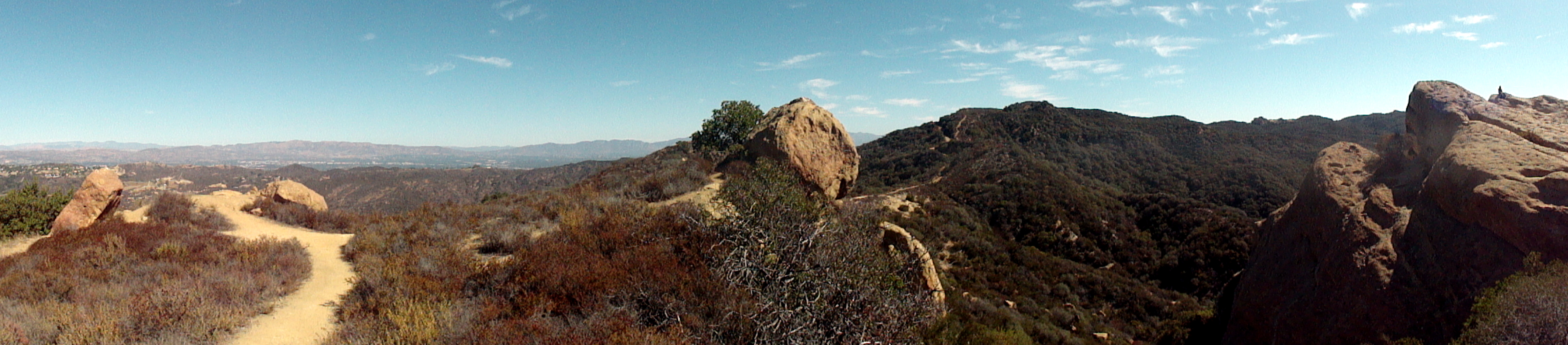
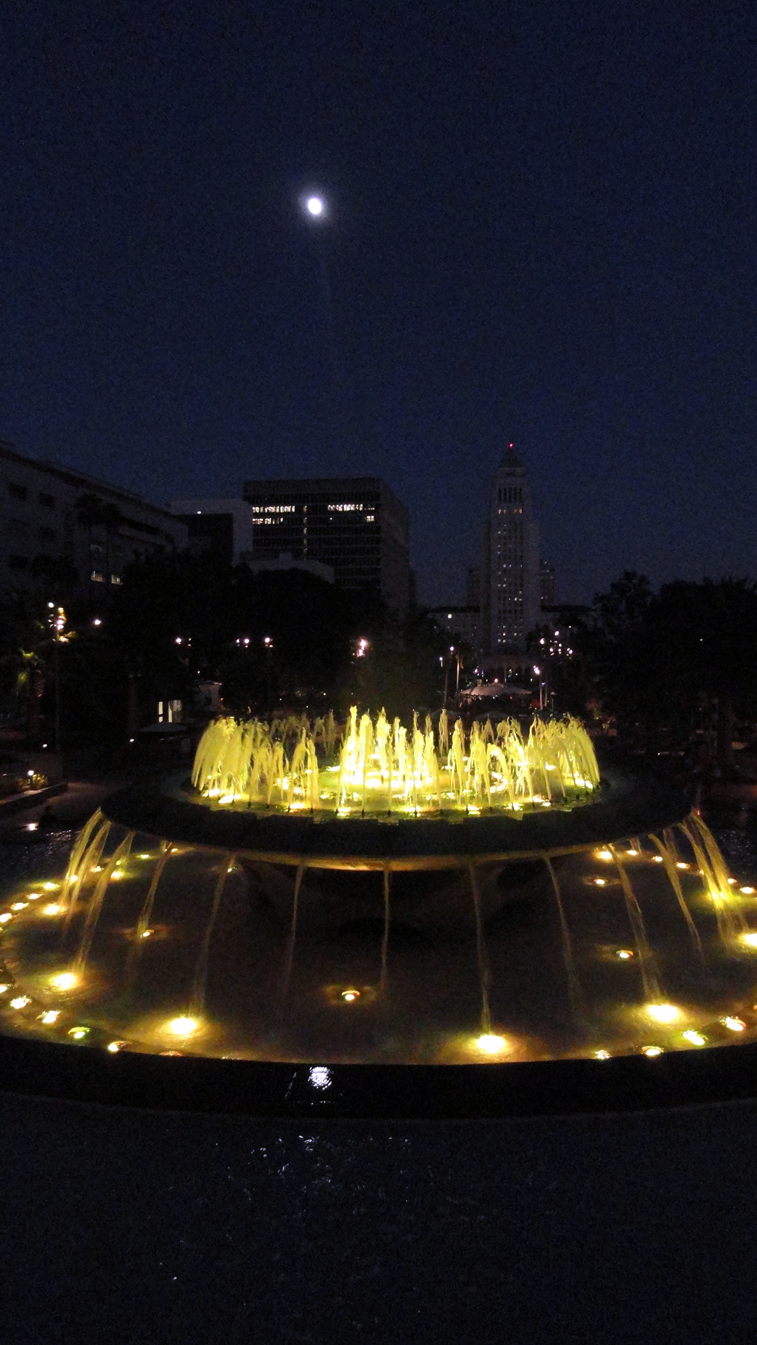
So smw, slt has again left the continent and headed off to work. This time our work really won’t be anything we document on here, so both to clear my own to-do list, and to leave my friends with a sense of how well-rested I’ve become from these past two months in my spiritual and now literal home of California (well, literal in the sense I actually have a home there waiting for my return, not in the sense I’m there at the moment or expect to be for the next few months…), I’m giving a you a scrapbook of shots that piled up since my return from the ABQ wedding in mid-August. The bay, the golden gate bridge and Marin headlands as seen from Fort Mason; various scenes of Napa and Sonoma counties as seen from hikes & bikes around new new home base; some shots from a couple days last week (!) in Los Angeles – back to Topanga Canyon & the fountain in Grand Park on a nearly-full-moon night (the next night, we stood out on my balcony up north to watch the lunar eclipse at 3AM, how cool was that?!)…and scenes of the bay’s wetlands around Palo Alto as seen when I had the privilege of riding along for some training with my friend Amy who’s getting herself trained to fly a small plane.
If you’re curious about the work, there was a PBS frontline documentary filmed in early August at that project where I’ll very soon be working; from Europe I’m unable to launch the link but I’m fairly sure if you’re in the US you can find it here: http://www.pbs.org/wgbh/pages/frontline/ebola-outbreak/
As the man says, be well, do good work, and keep in touch. It’s certainly what I plan to do! Cheers.


August in Albuquerque

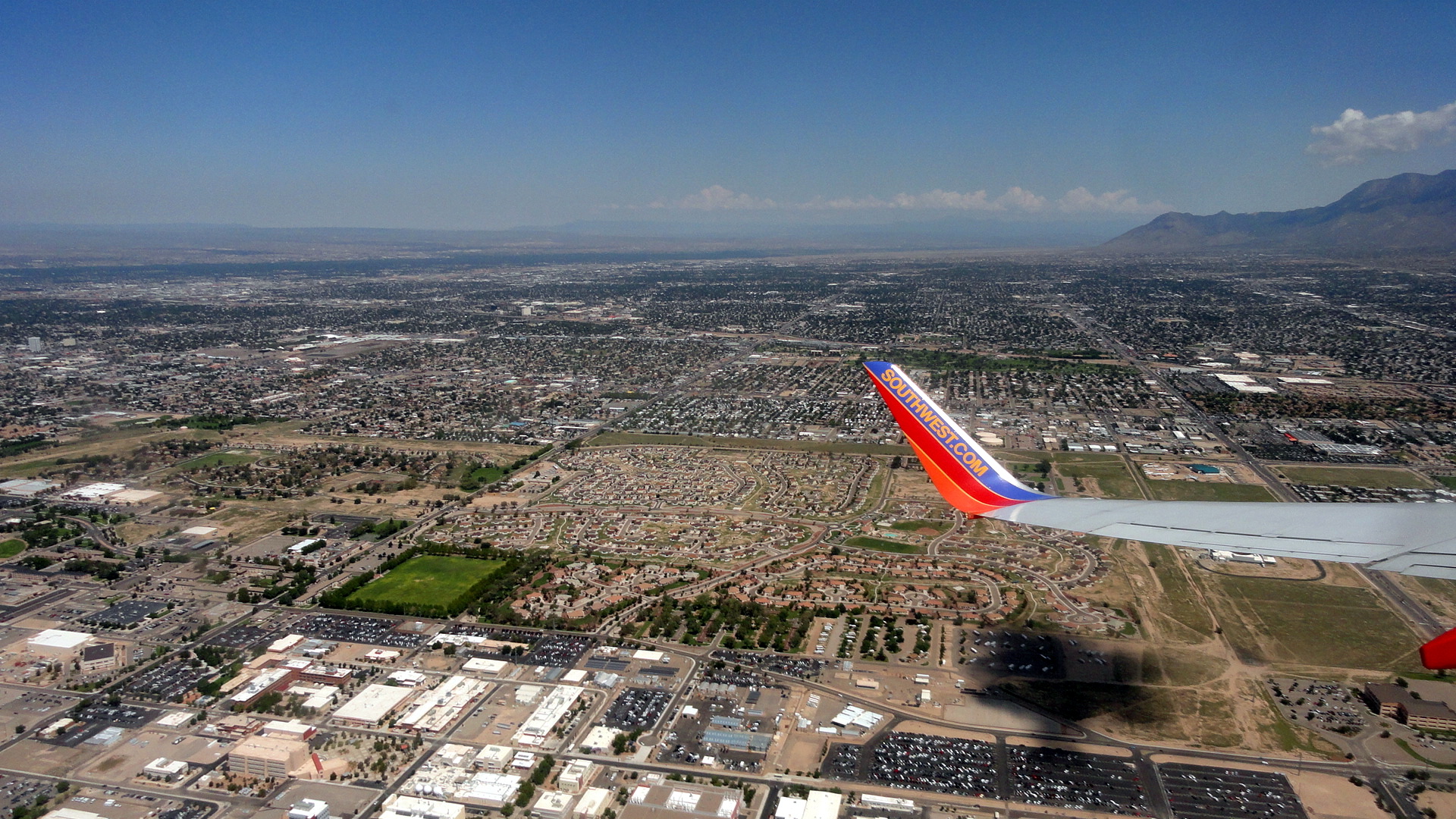
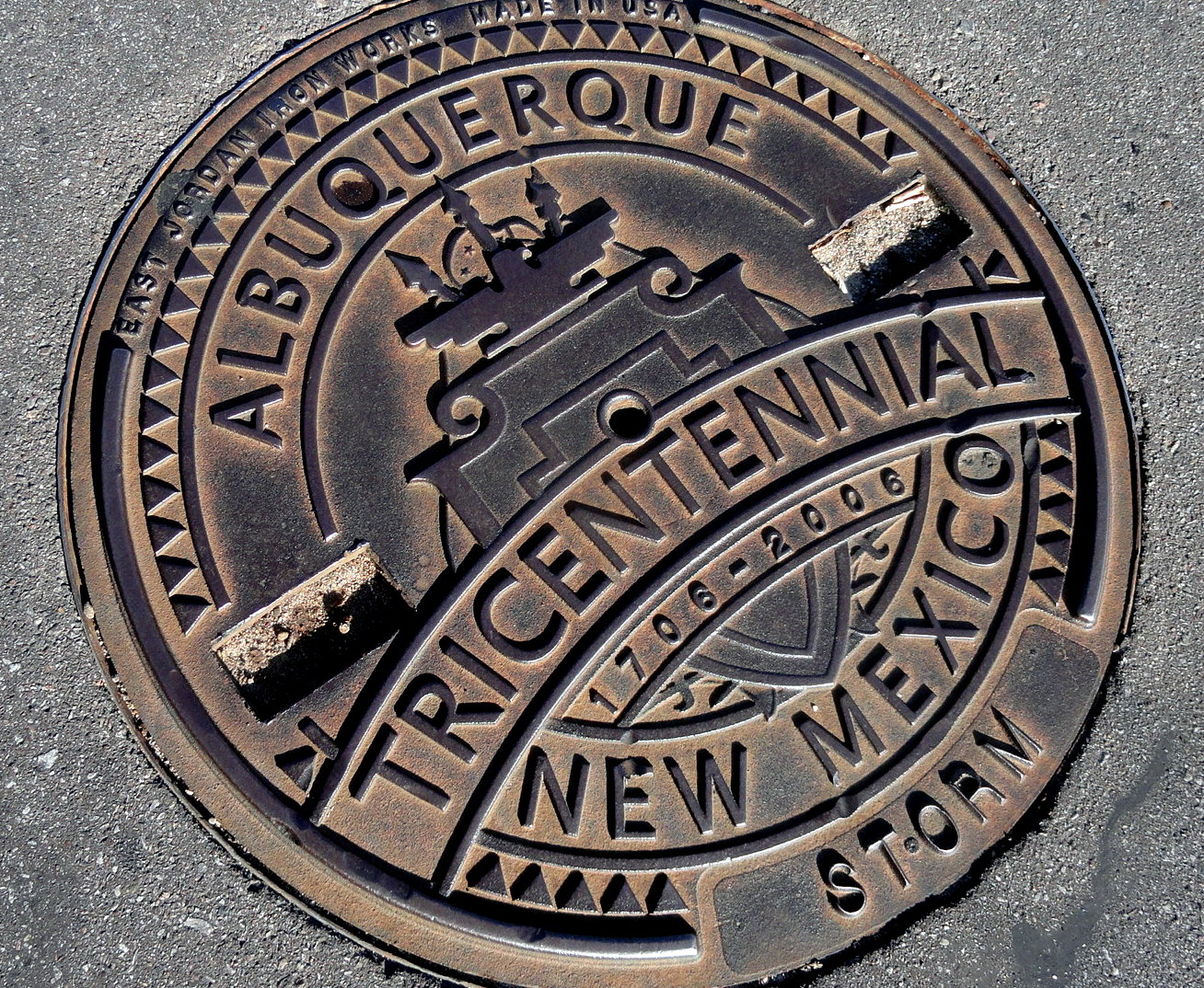 The grand road trip ended in Albuquerque, capital of the state of New Mexico. For those readers who aren’t from the U.S., this was the 47th state to join the union, in 1912. This happened, of course, several decades after the upstart revolutionary nation of the US declared war on Mexico, so far as I can tell essentially in order to take over most of what’s now our Southwest as well as my own adopted home state, California. Naturally, long before the Spanish-colonial creation Mexico declared governance and “ownership” of this parcel of beautiful desert, mountain and high plains, the area had been home to many native America tribes, both more nomadic and herder types, and more city-based agriculturalist-types. I believe one might think for example of the great difference in cultural habits and practices between the Apache, the Navajo, and the many different pueblo cultures such as Taos, Zuni, and the famous Hopi from what’s now Arizona (the 48th state to join the union, a month after New Mexico). Anyhoo, that’s enough about the past – in the present, New Mexico remains for me a place of beauty, cultural interest (its long history of human habitation and current highly visible and important presence of many Native-American tribes, but also of Hispanos whose ancestors were here long before the territory fell under US control), and … well, once simply can’t speak of New Mexico without pointing out its extraordinarily fine food! Inches were added to my waistline, which I’ve been working off by biking the hills of northern California. Enjoy these photos!
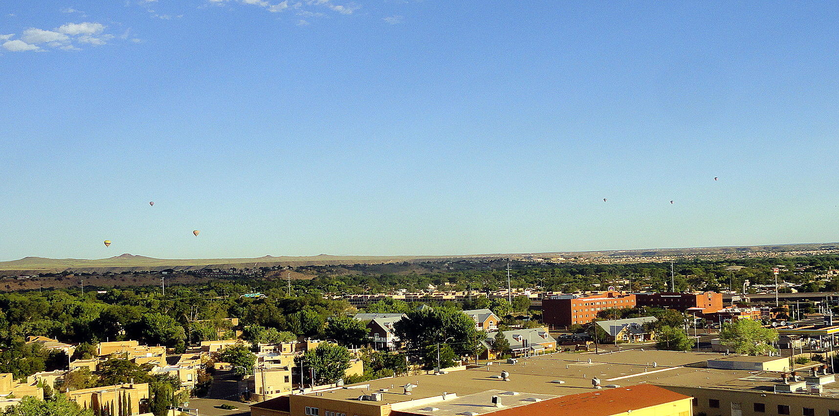
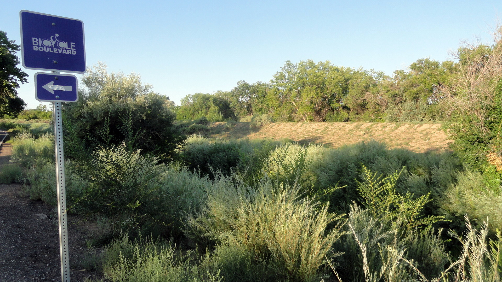
We were in New Mexico for my niece’s delightful wedding, which was on my own birthday. The best birthday present I’ve been given in years – a day surrounded by my family and getting to know the adult versions of my niece and nephew, and meeting her husband. Wonderful and pleasurable reason and occasion to get back to New Mexico for the first time since 2006. One thing (above) that I discovered is the city’s become more bike-commuter friendly than I recall from earlier decades. Yay!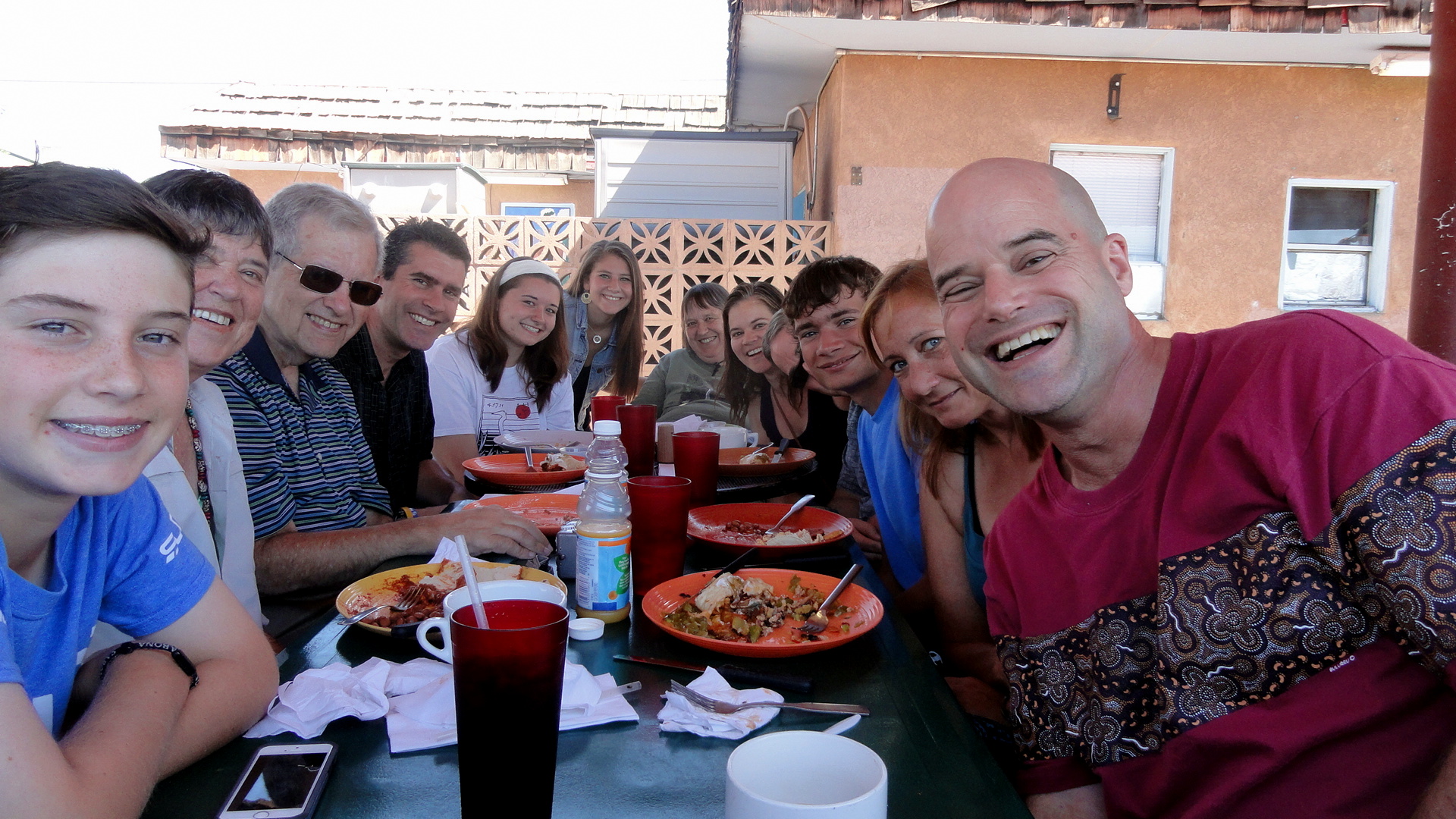
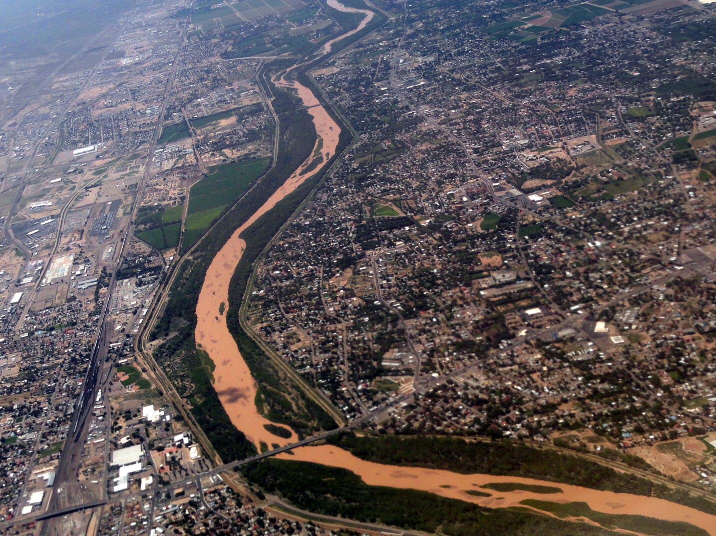
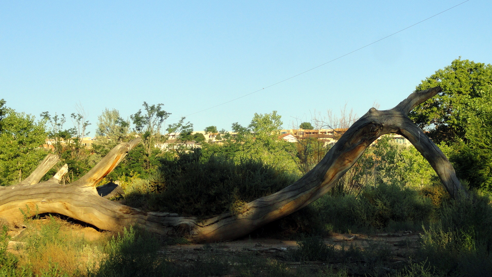 If you’re coming from an abundant-water region, the Rio Grande may not seem so very grande to you. But remember this is the Chihuahuan Desert so any river that carries water year-round is vital to all life nearby. Down below you’ll see one of many canals that channel water from the river to the fields nearby; this river’s water has been irrigating crops since the ancient native cultures, and northern New Mexico still abounds in centuries-old acequias, collectively-managed irrigation canals established under Spanish-colonial rule whose water rights have passed down through the generations and changes of government to support small-farmer descendants of the early colonial-era settlers today.


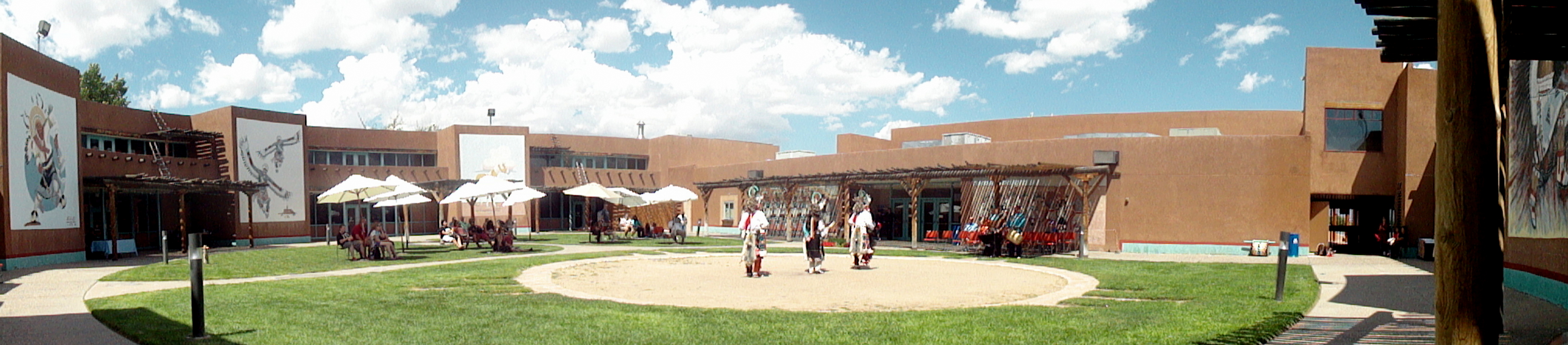
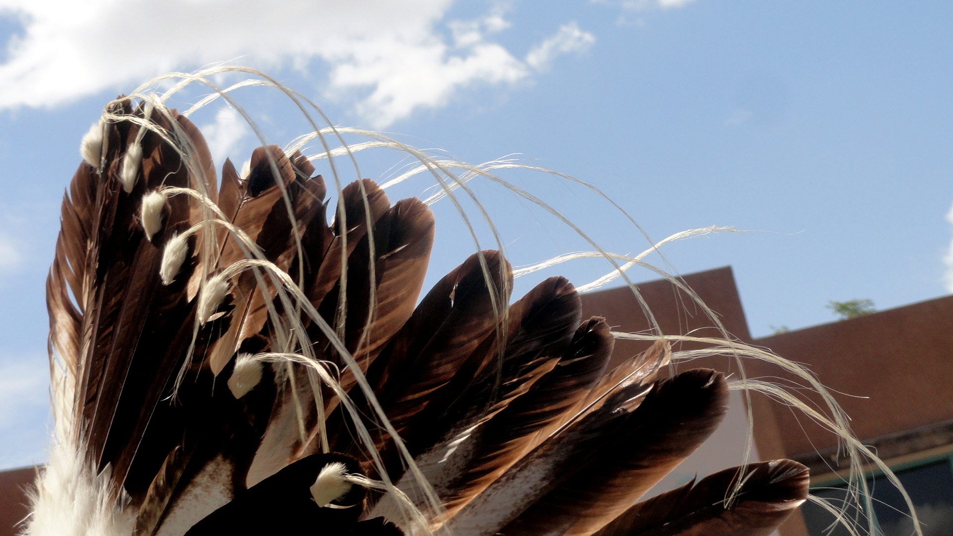
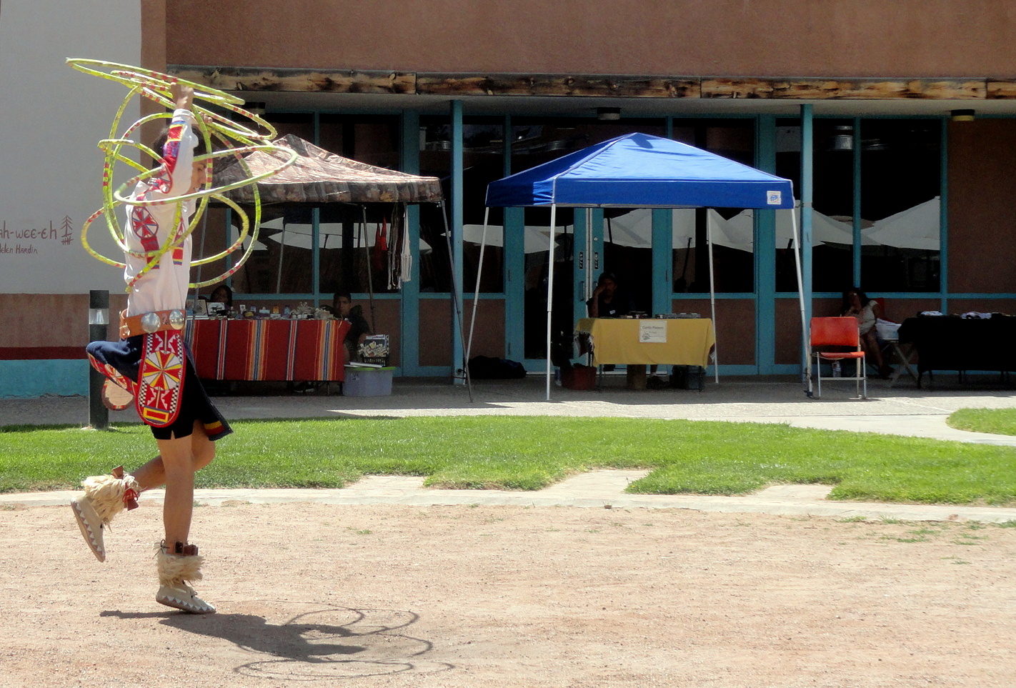
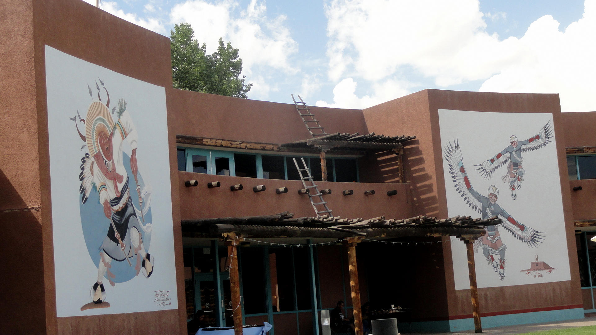
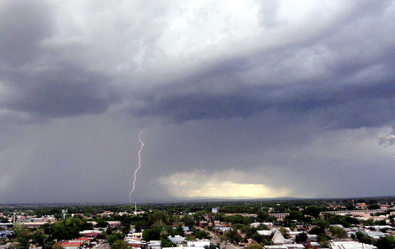
 And then, of course, there are both the myriad native cultures, as well as the desert and its storms. Following are some sequences of photos of dancers at the Pueblo Cultural Center, a wonderful cultural and history center with an excellent restaurant in the heart of Albuquerque which celebrates and documents the many Puebloan cultures native to New Mexico; I think and hope these photos are permissable under their policy and will certainly remove them if they’re not. Then there’s a desert storm which rolled in one morning while I was in my hotel room. I do encourage visitors to the US to consider time in New Mexico – it’s slightly off the usual touristic beaten path, and well worth the trip in my view. What I show here is just the tip of the iceberg.


From the River to the Plains

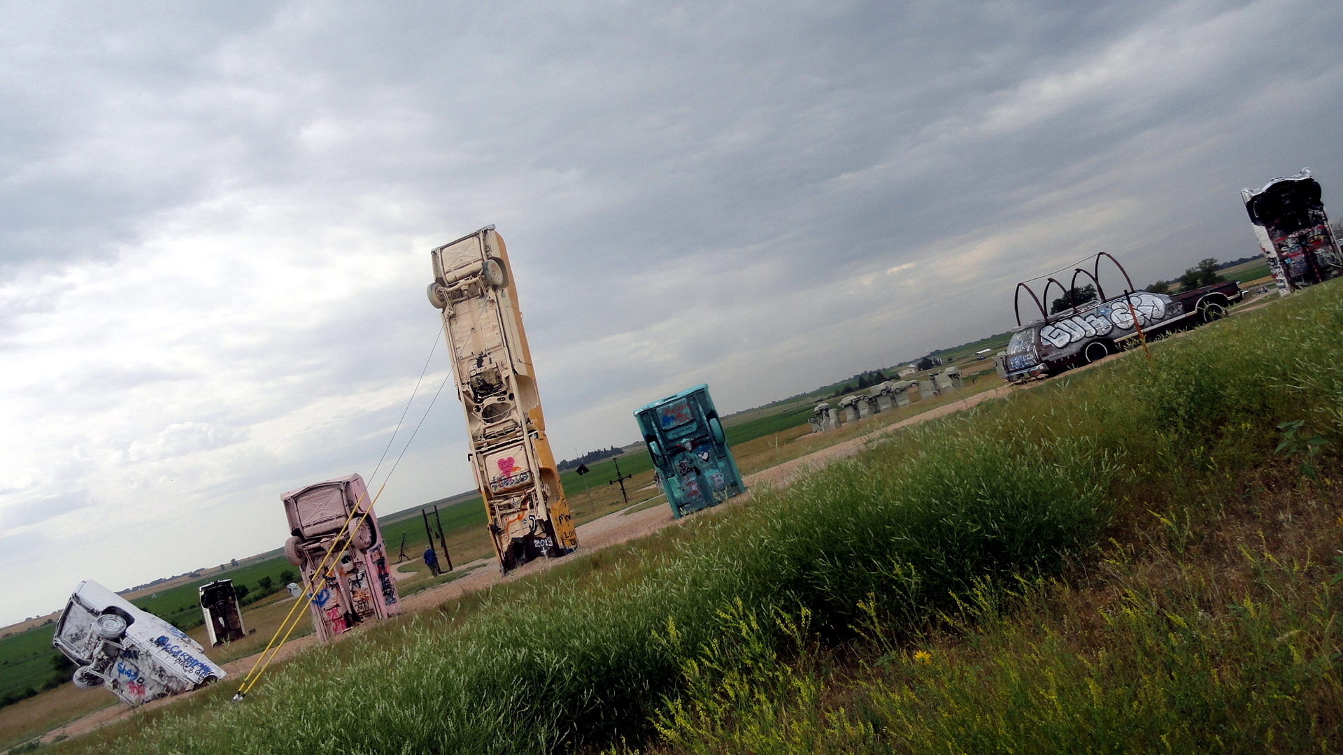
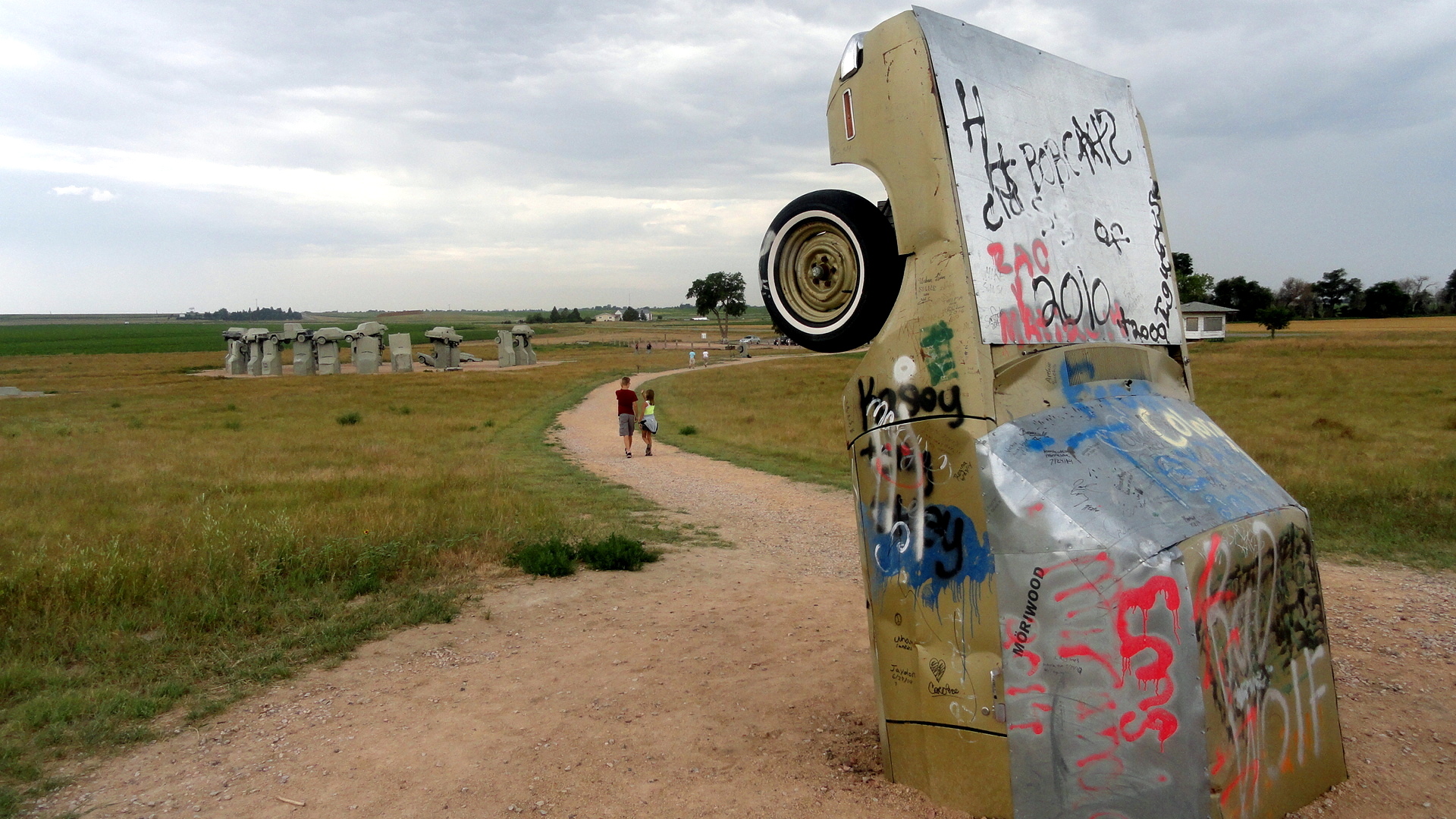
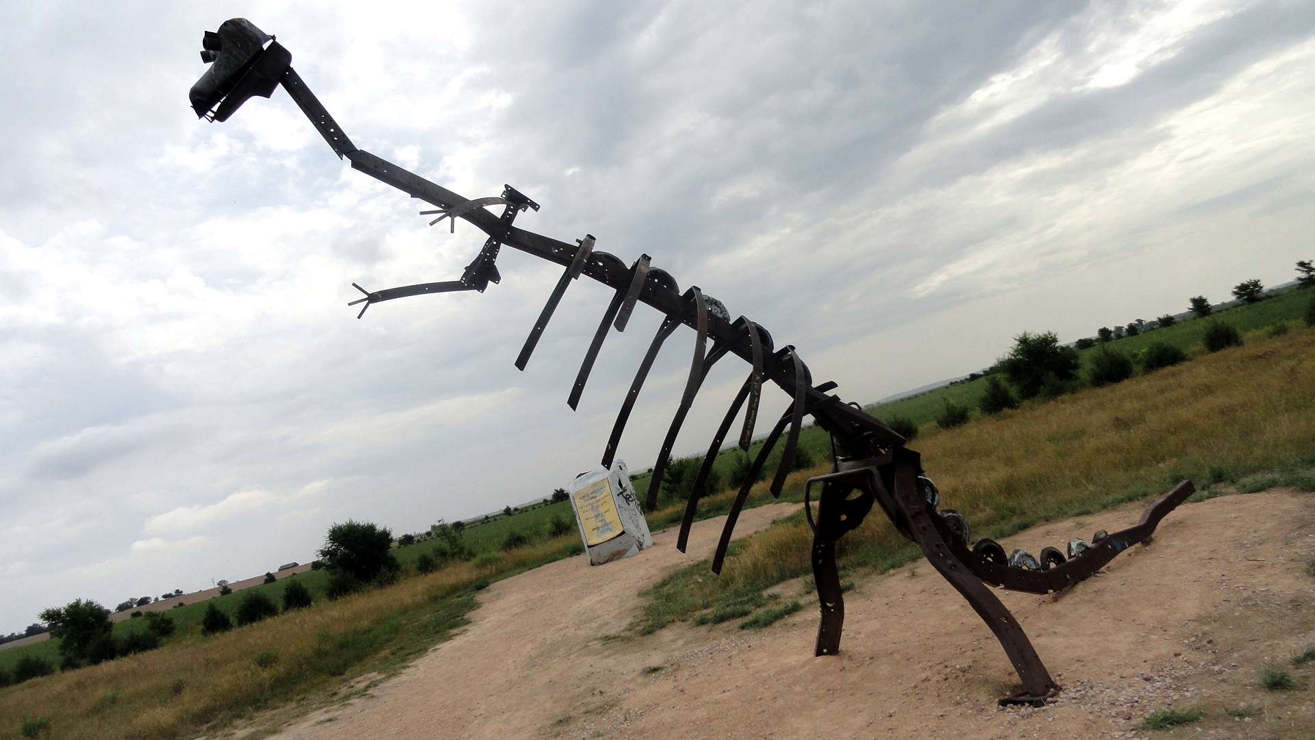
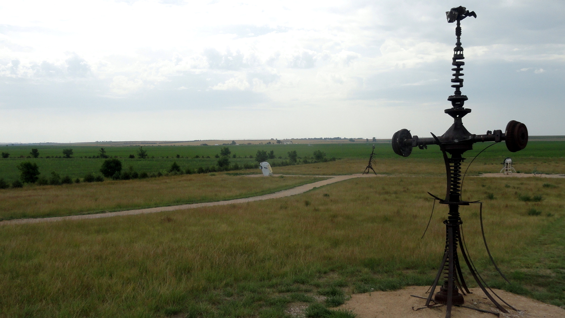
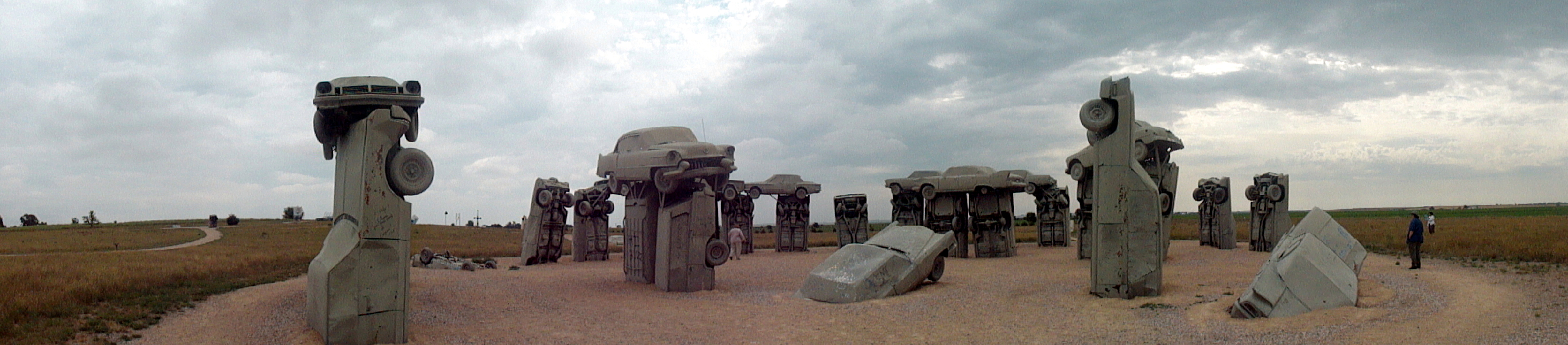
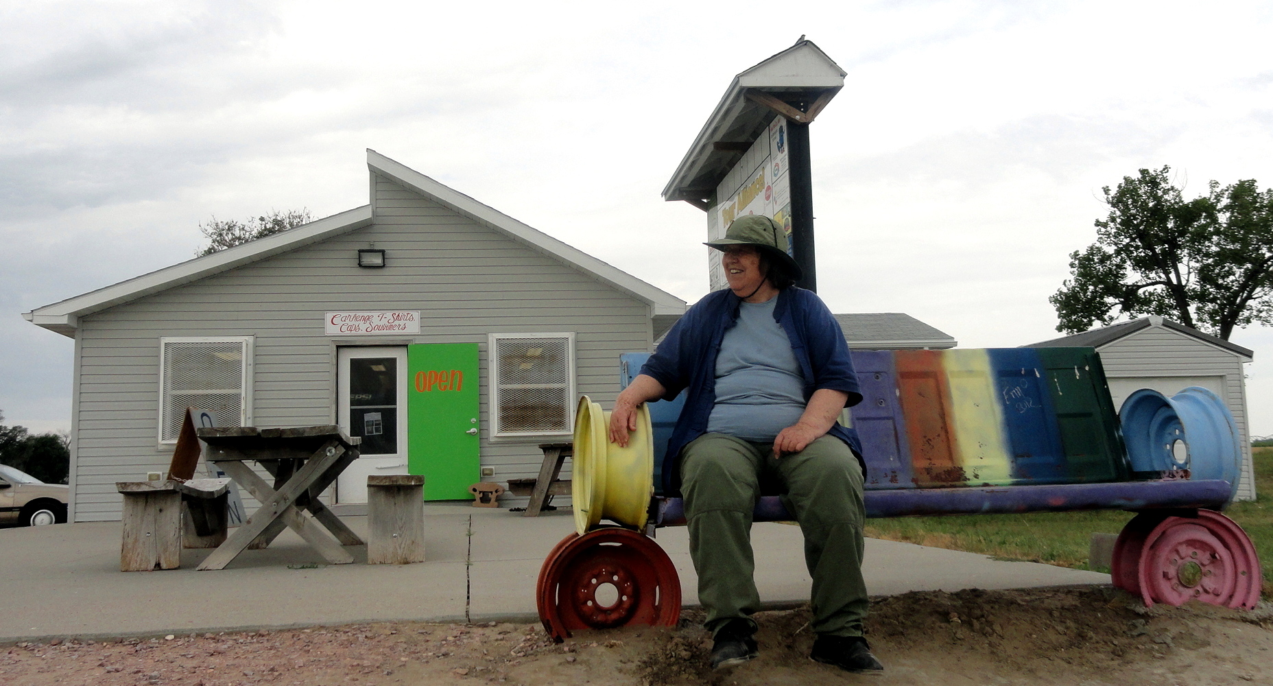
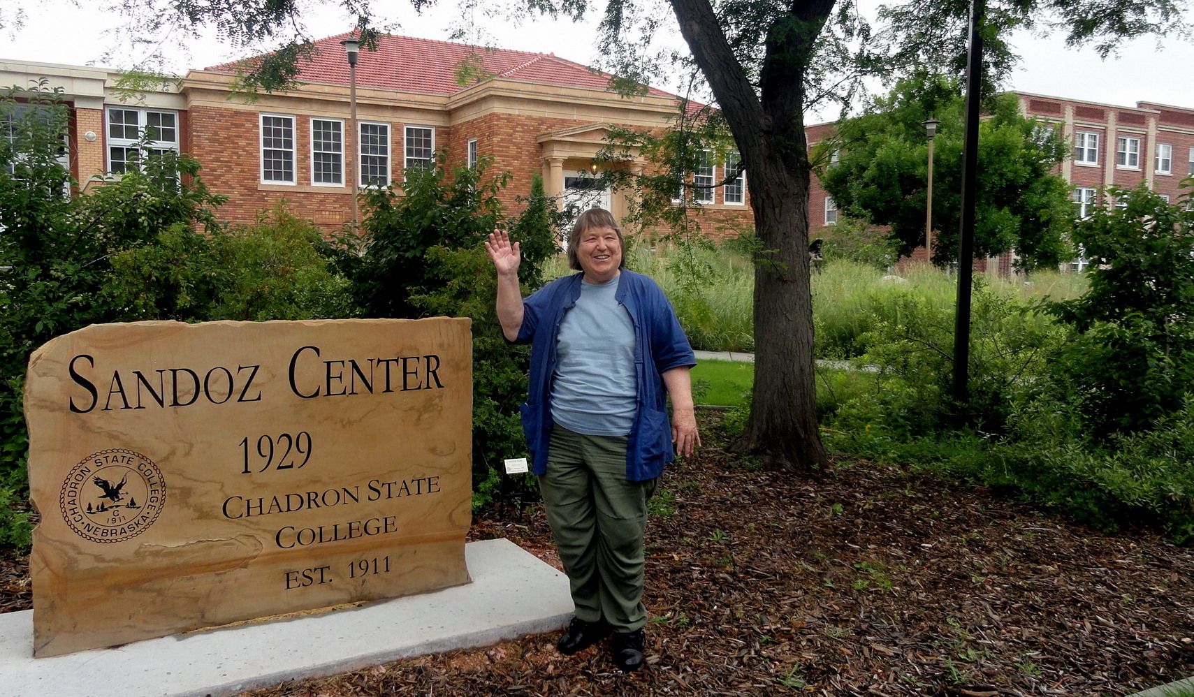
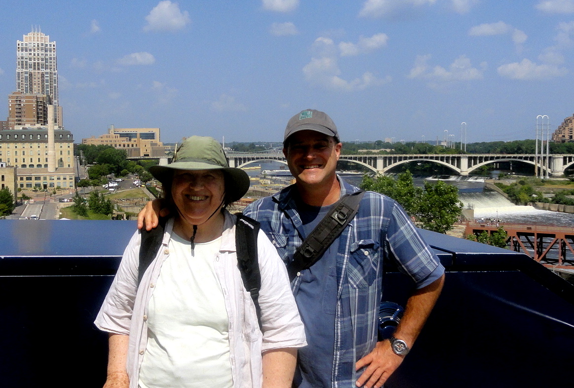
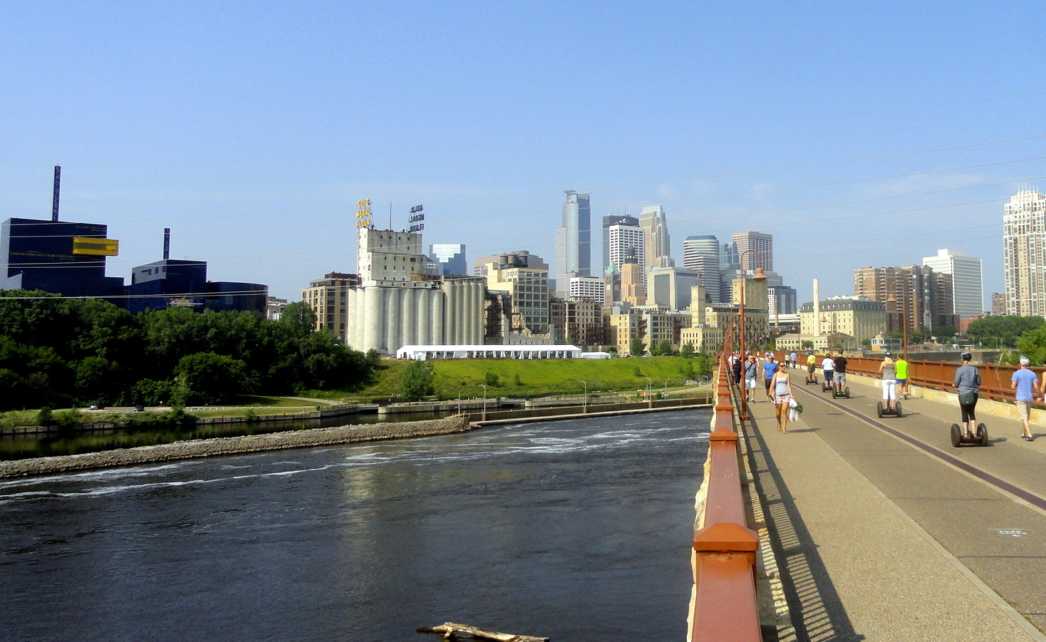
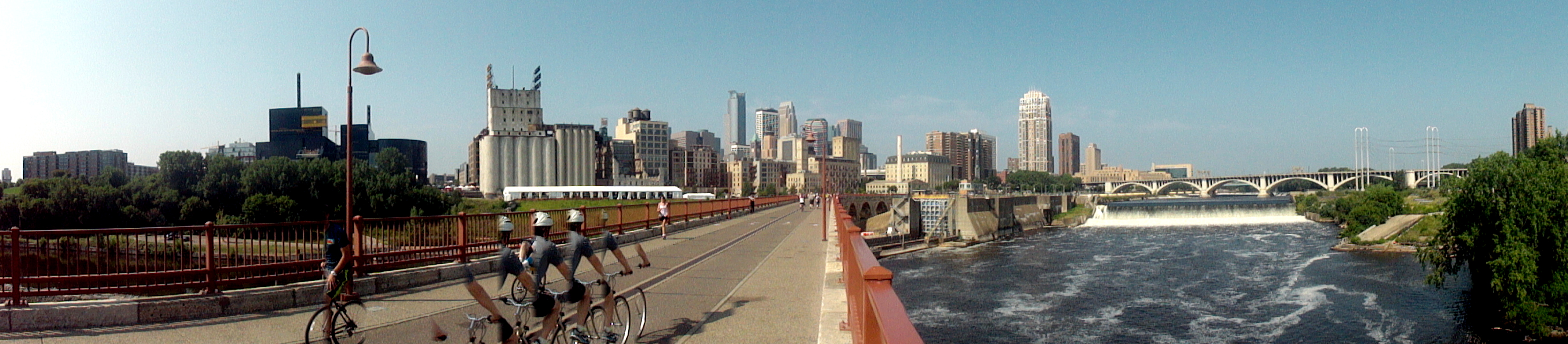
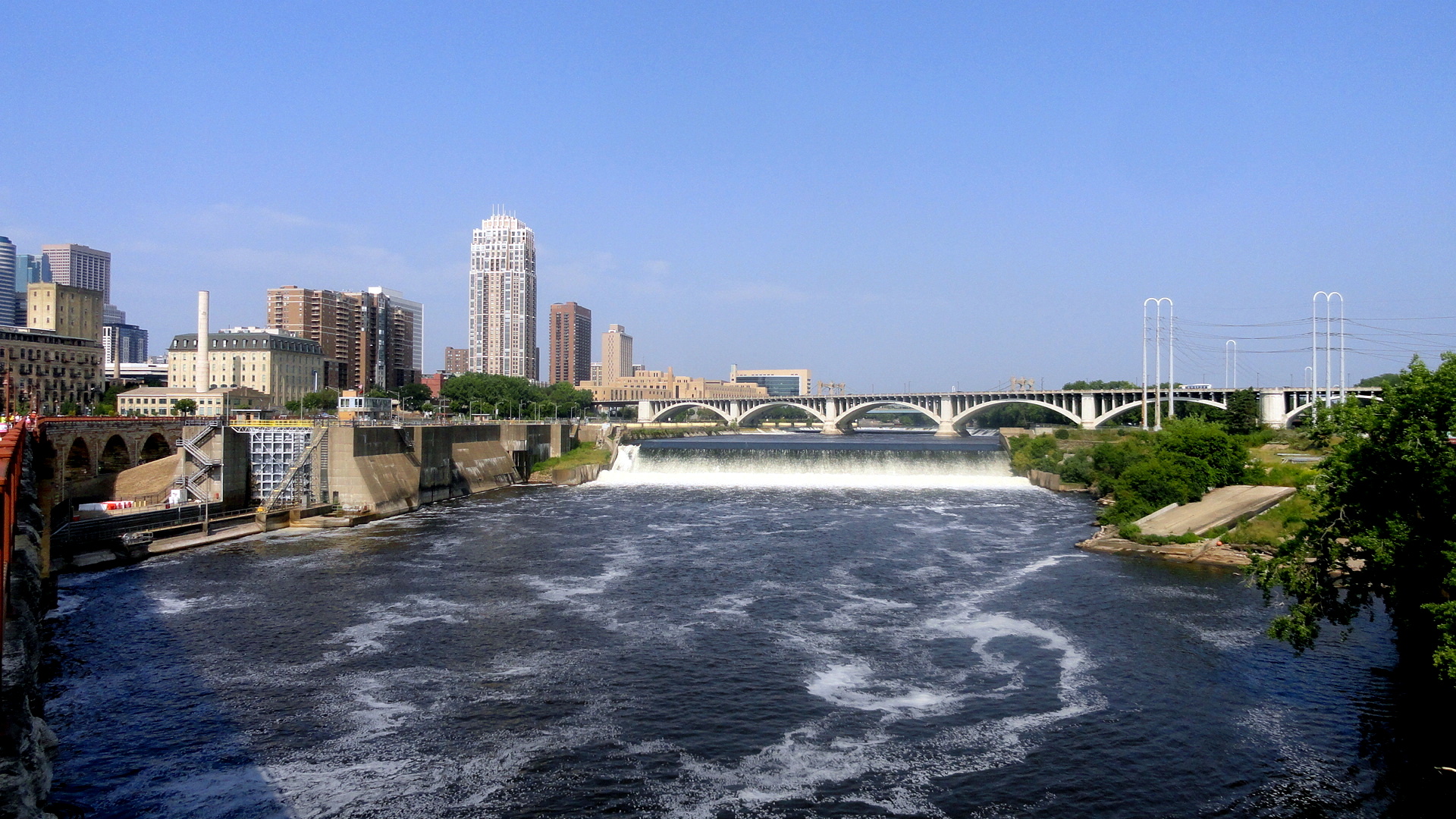
The photographic record of Mom & Paul’s excellent road trip continues with some images from the Minnesota-South Dakota-Nebraska leg of the journey. (And btw, for anyone growing weary of these rambles through the vast heartland of my homeland, fear not, there’s only one more entry due about the road trip, which wrapped up just two states south of where this entry concludes.) In Minnesota, we got to spend a few days being shown various lovely corners of the Twin Cities (Minneapolis & St. Paul) by my oldest friend, someone I’ve known as long as I can remember going back to elementary-school days. So what you’ll see here include shots taken on and around the Stone Arch Bridge over the Mississippi river, in the heart of downtown Minneapolis (including the cool panoramic shot below in which the nature of the camera’s panoramic-image compilation means that the cyclist who was biking past as I took the shot appears in a cool little stop-action sequence…), followed by the only photo I kept from our journey across most of South Dakota, taken at our lunch & rest stop just west of the Missouri River. From there, we kept driving onward toward Nebraska, where Mom had been looking forward to visiting Carhenge, an unusual outdoor sculpture park just north of the town of Alliance, Nebraska. This puts it also close to Chadron, where I’ve learned my grandfather attended college back in the day…hence the photo of Mom on the campus. Enjoy.
Having grown up in the US, I’ve always known a lot of our wheat seems to come from North Dakota. What never occurred to me was that, a hundred and more years ago as our Euro-immigrant ancestors spread across the continent and dispossessed the prior inhabitants, their wheat would need to be milled and their other farm products marketed. The twin cities, it appears, gained much of their early prosperity by dint of turning wheat kernels into flour…witness the many descendants of flour and milling companies still headquartered there.
…look closely above, and any water you see in the distance is the Missouri River which we’ve just crossed in central South Dakota. Below, a fish-eye view of the main Carhenge scultpure, with other items also on display at the Carhenge Sculpture Park. 🙂


Cruising Northern Shores

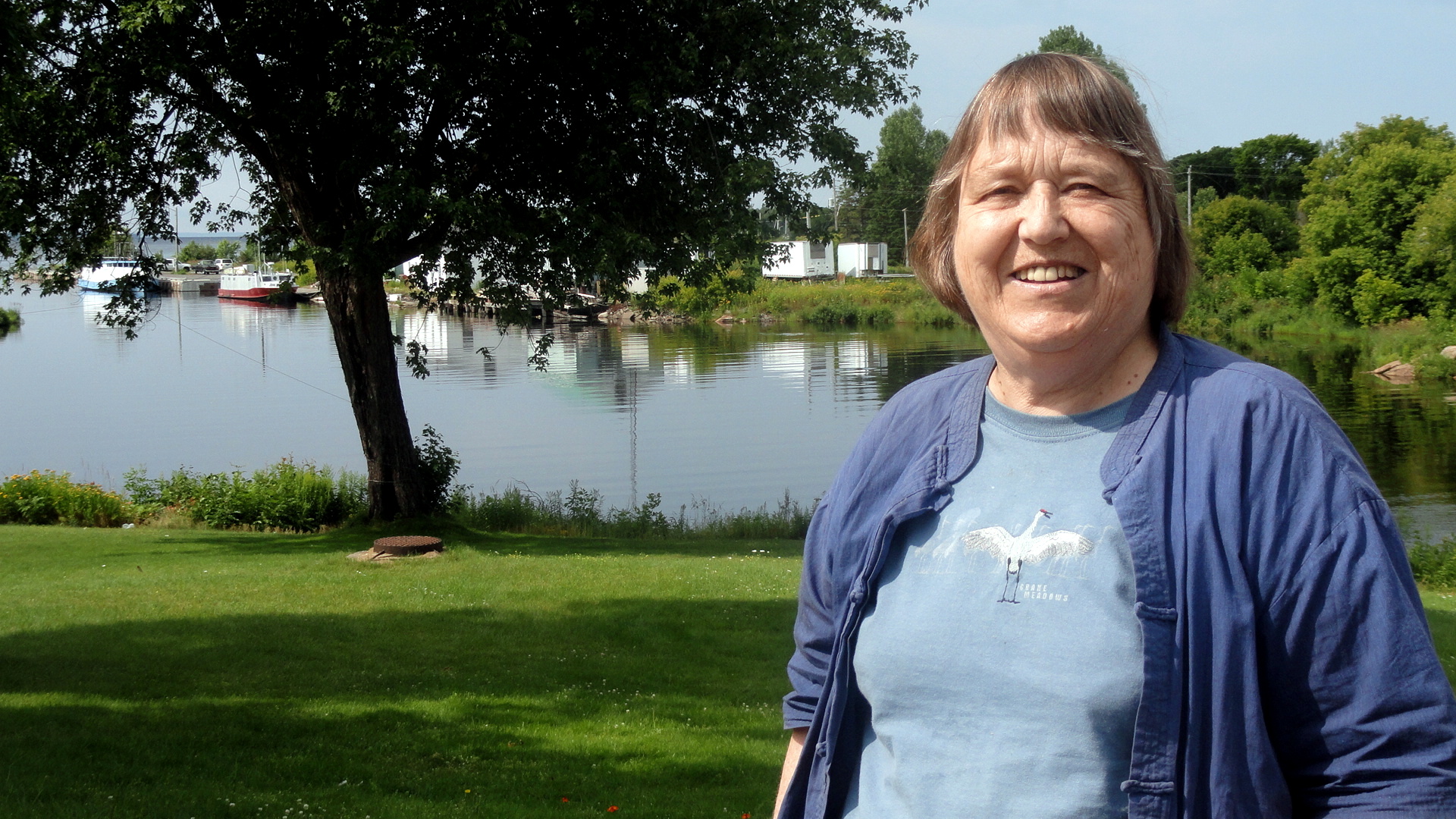
The road trip continued….although it takes me far longer than I’d wish to get these photos sorted and up here for you to enjoy! After leaving upstate New York, Mom and I decided that we simply couldn’t bear another trip along the usual I-80/I-90 corridor the follows the U.S. southern shore of Lakes Ontario, Erie, and Michigan — our goal was Wisconsin, where we were able to spend a few lovely days visiting my aunt and uncle; and we were departing from Rochester which – by U.S. standards – is quite a piece north…and this led to my crazy idea to explore the northern shore of Lake Huron through Ontario. What a lovely outing it was!

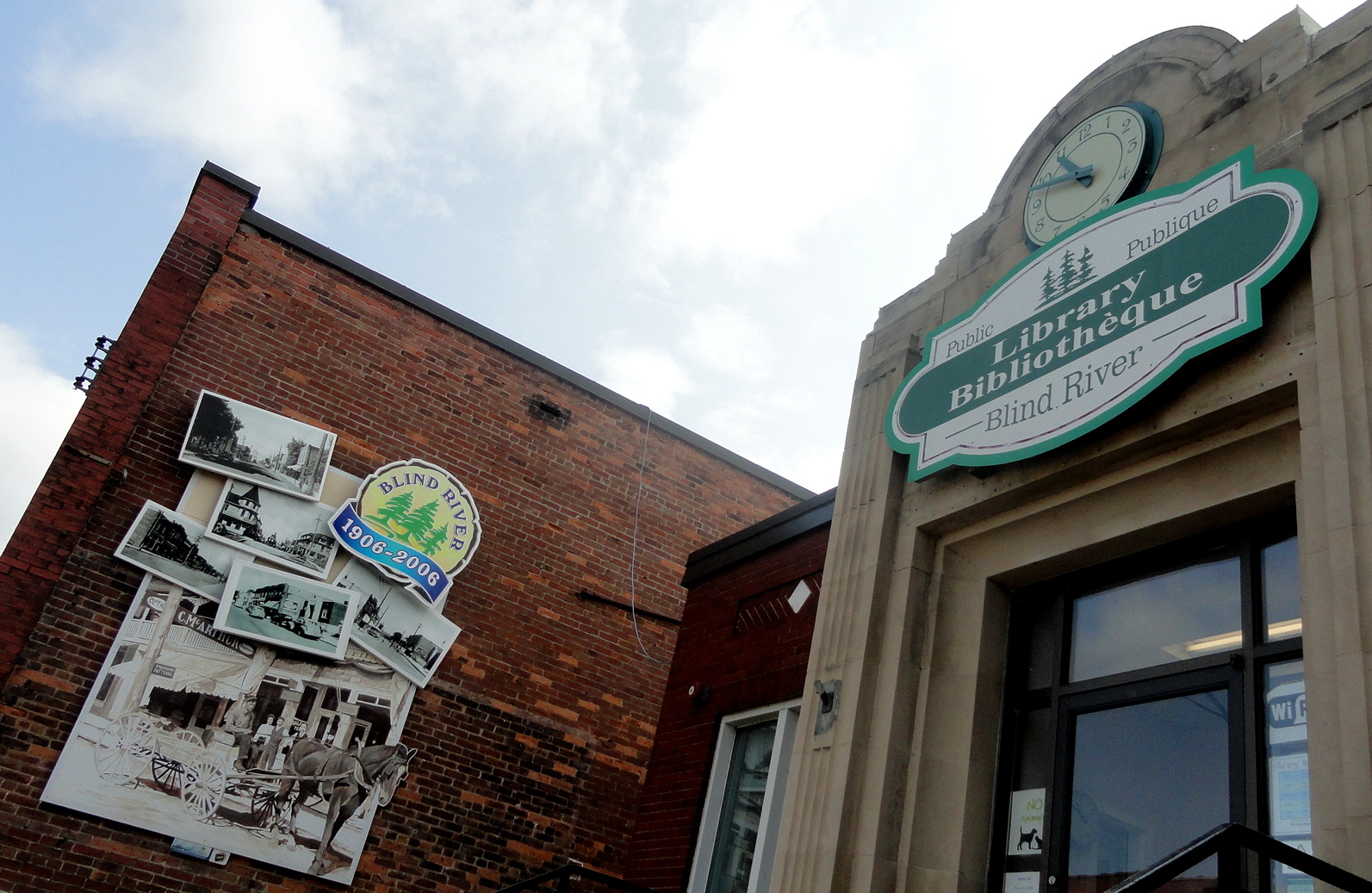
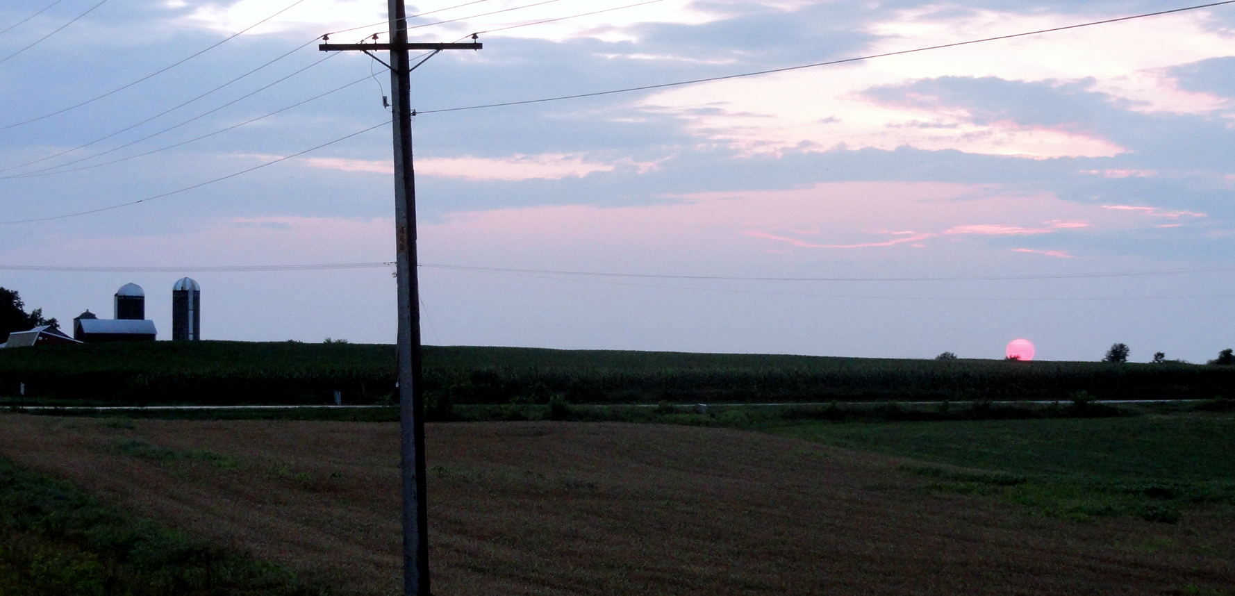
This enabled us to spend a night in the lakeside town of Blind River, ON and to explore portions of that enormous province that I’d never been anywhere near, previously – gaining a more visceral sense of the beautiful, rich rivers and waterways which the Ojibwe and Cree have traveled since long before my ancestors arrived near these shores. I really wish we’d had more time to stay, explore and enjoy high summer along the Canadian shores of North America’s Great Lakes — but the wedding date loomed ever nearer and we had many other people and places on the list before we intended to arrive in Albuquerque. So here, and without much further comment, you can enjoy shots from Blind River, some not-so-great but they are what they are shots taken by Mom as we drove across the international bridge from Canada back into the US where three lakes are all coming very close to one another, along the channel directly connecting Lake Superior to Lake Huron and quite close to where the Edumund Fitzgerald went down in stormy waters back in the 1970s as commemorated in that wonderful song by Gordon Lightfoot…and then some shots from the Lake Michigan shoreline along Michigan’s Upper Peninsula, and one beautiful farm-field sunset shot in Wisconsin. Didn’t get the camera out much more in Wisconsin and this shot doesn’t do justice to the huge midsummer sun sinking below corn fields in real time, but trust me – the upper great lakes region in high summer is pretty wonderful to spend time in.
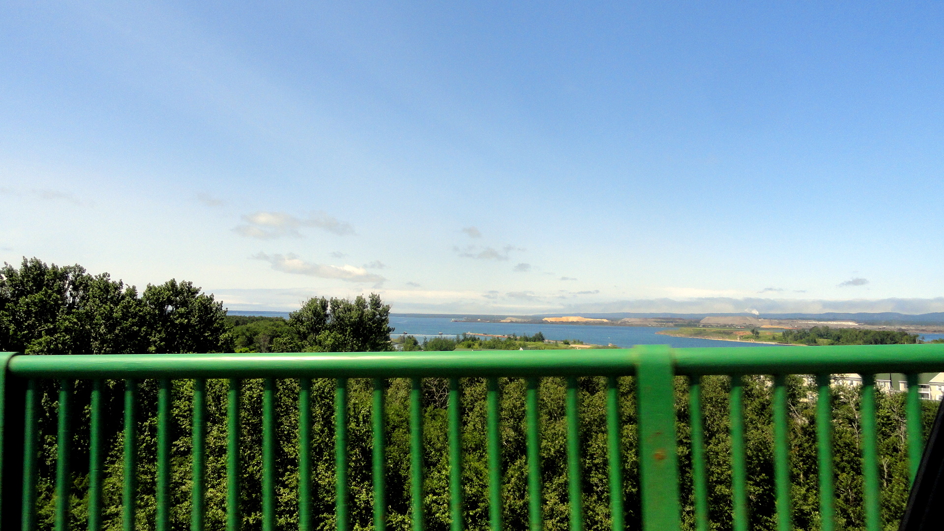


In the photo gallery and below, the three shots taken by Mom from the Sault Sainte Marie Bridge, which connects the nations of Canada and the U.S. across the locks and waterway which link Lake Superior with Lake Huron, you are looking west over Whitefish Bay and it’s maybe conceivable (what do I know?!) the camera sees as far as the water above the spot where the Edmund Fitzgerald was found.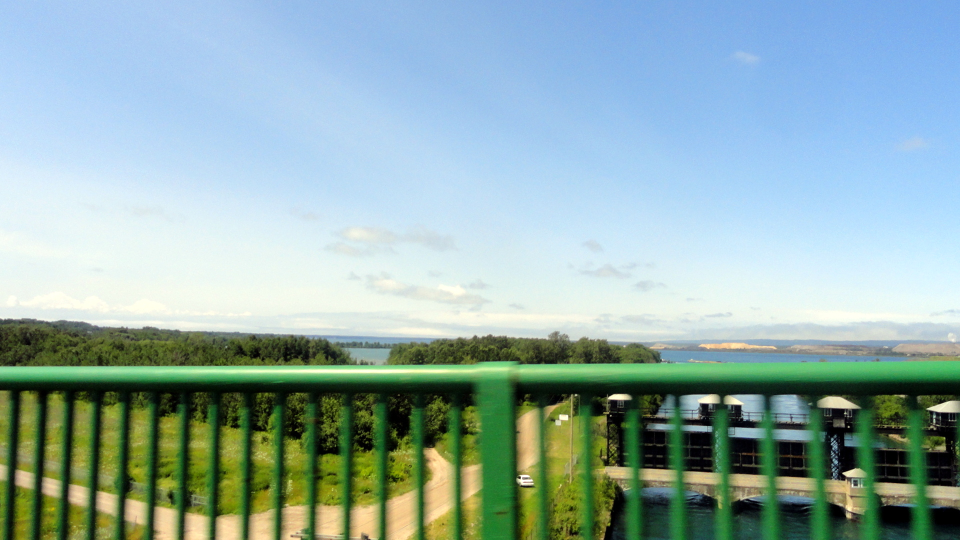
