From The Air.1
 Today marks my 365th day in a row of posts here, and as the day dawns where I’m now living (also, as it happens, when this post will appear for you dear readers), I should be back in the air on yet another weary international flight for work. Or perhaps in another airport for another connection. (I’m scheduling this post before I head to the airport, if you’re curious…)


Urban Canals.120
Country Canals.27
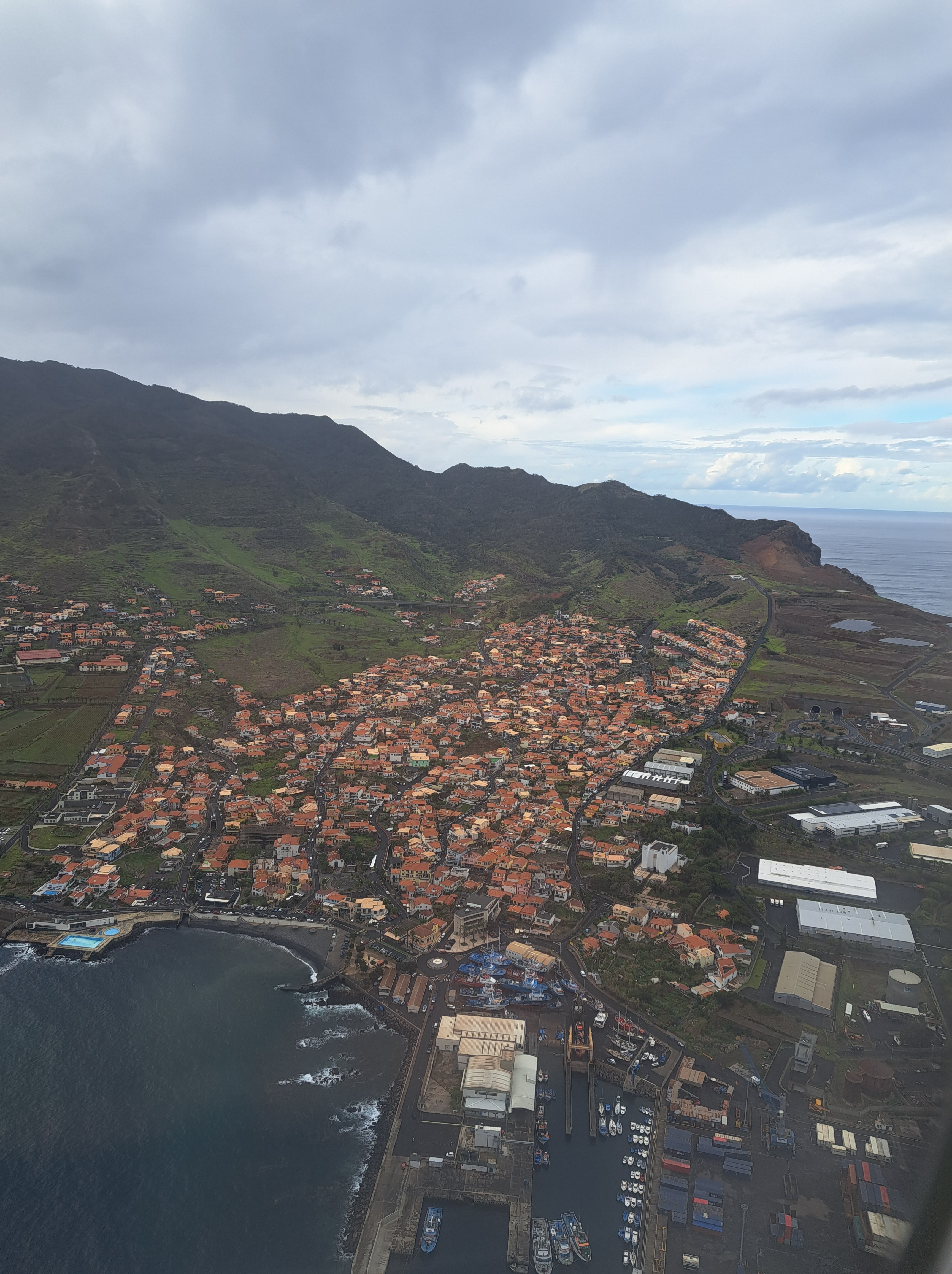
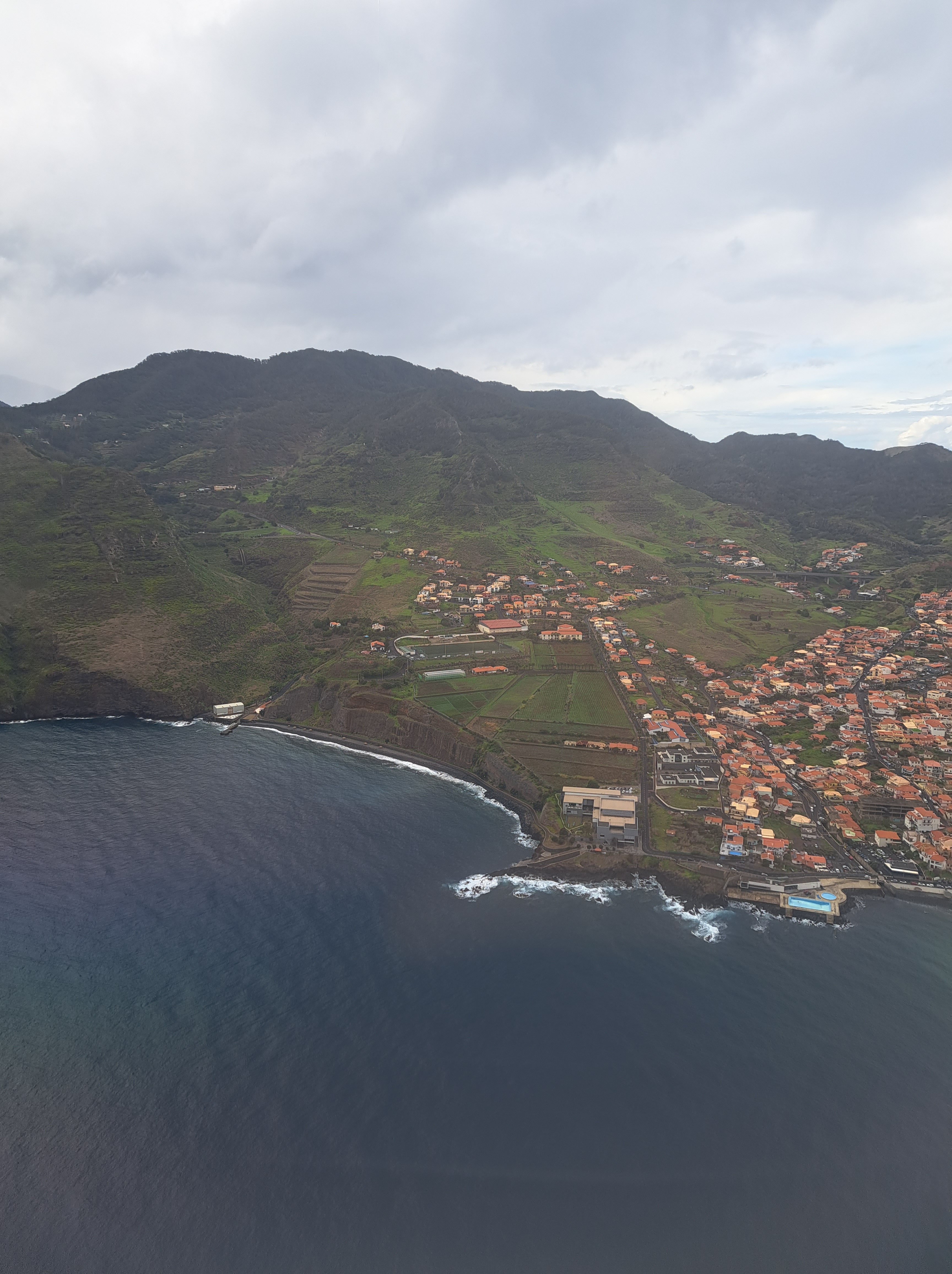
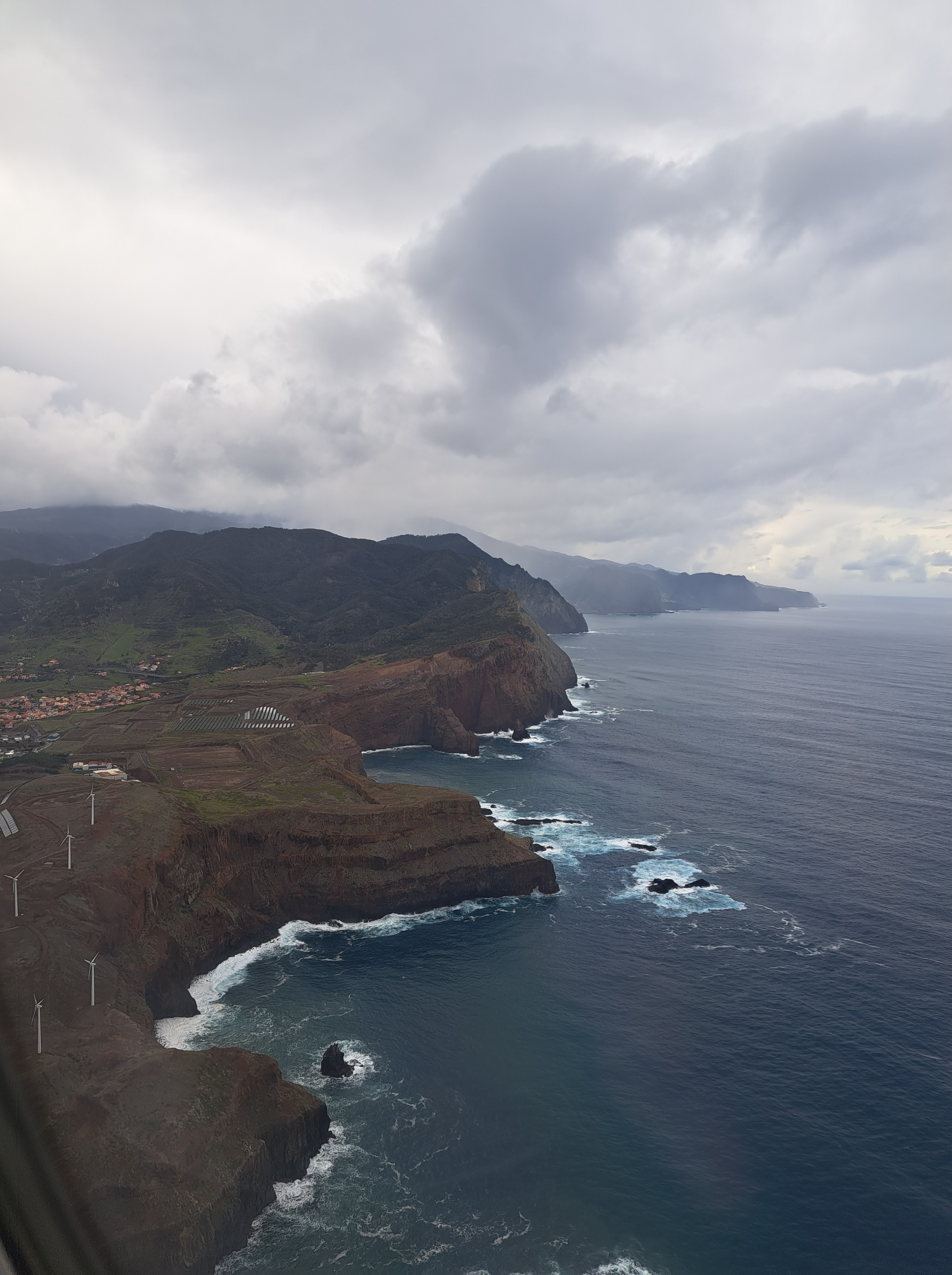
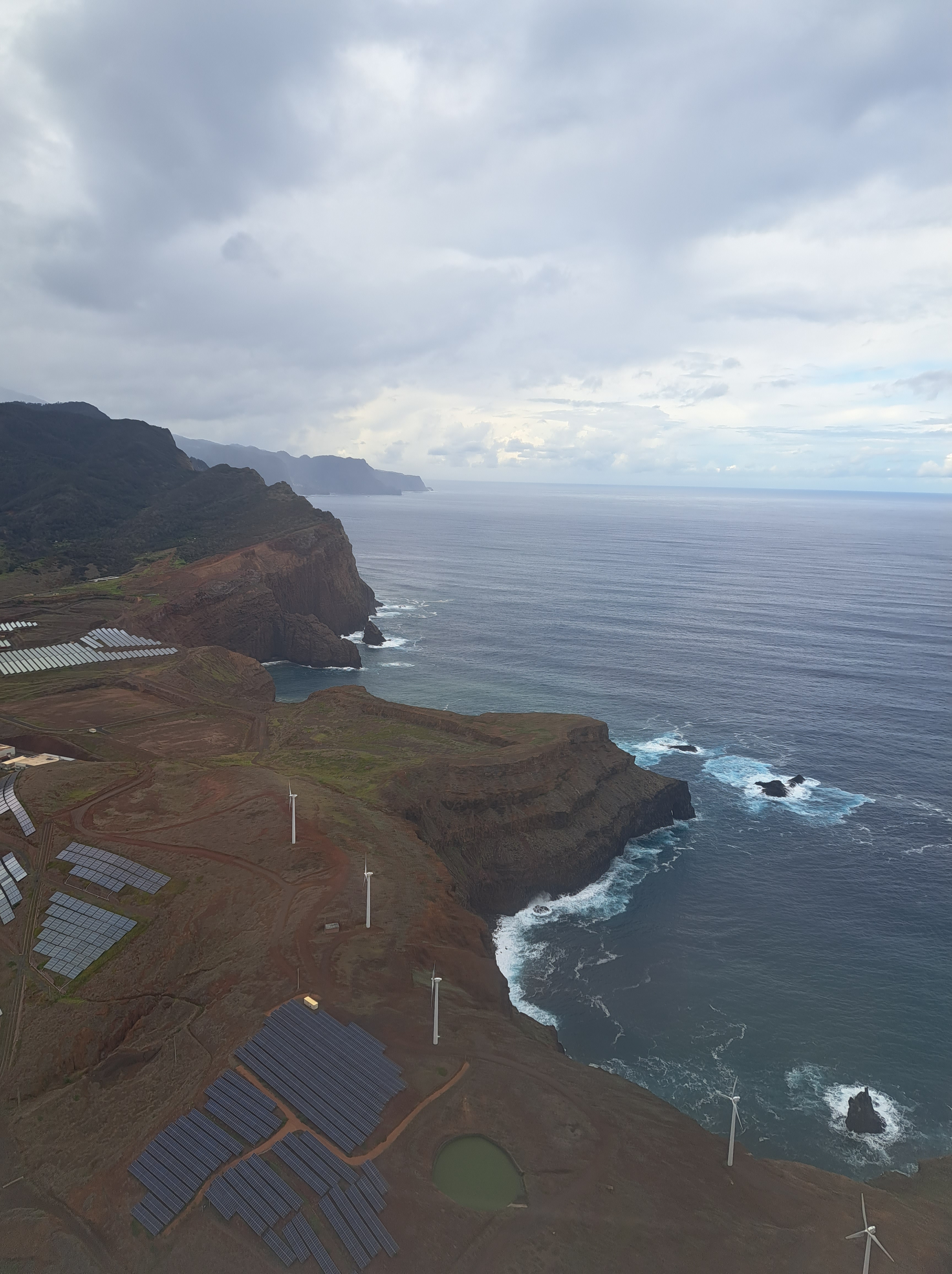
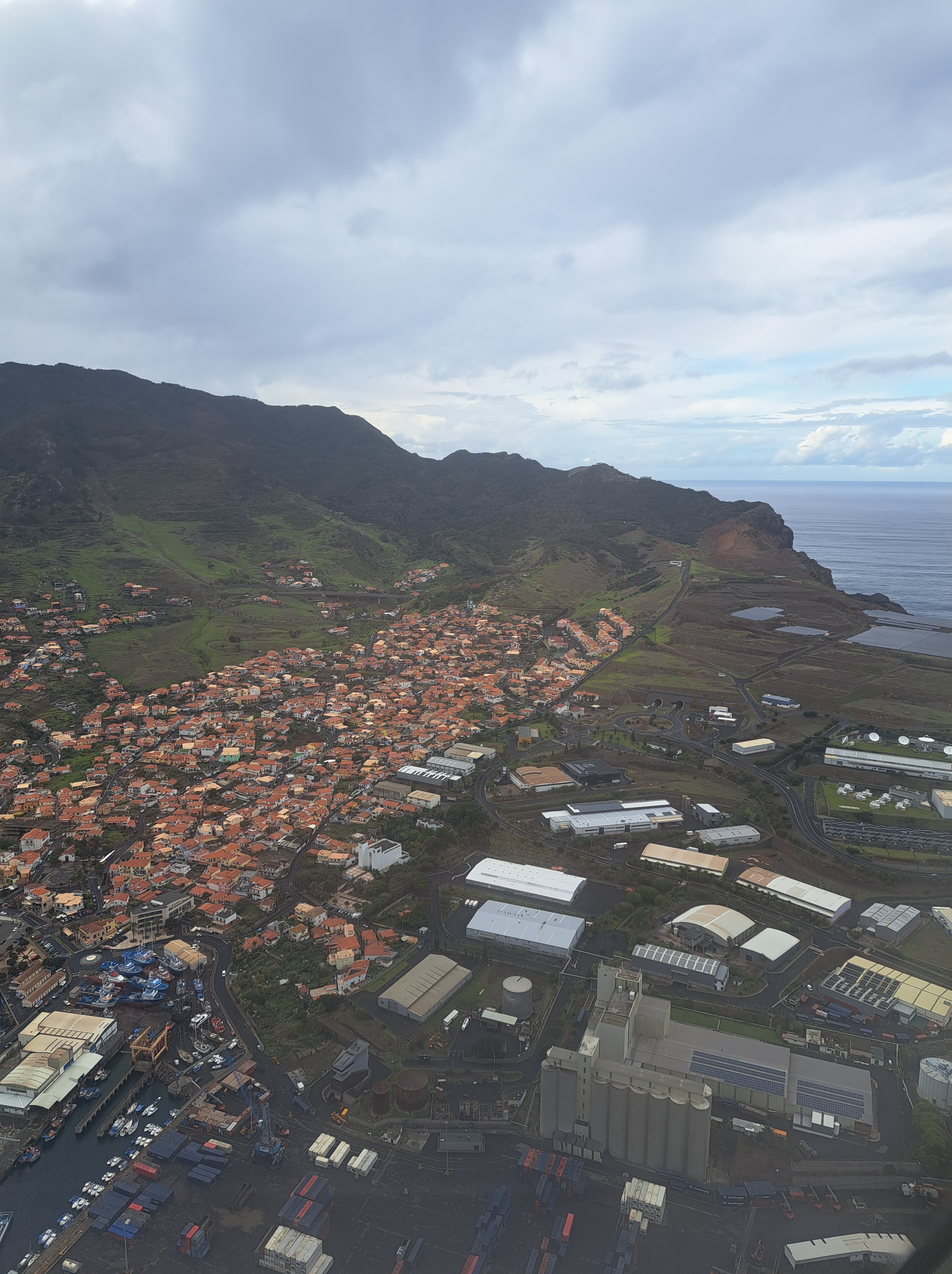
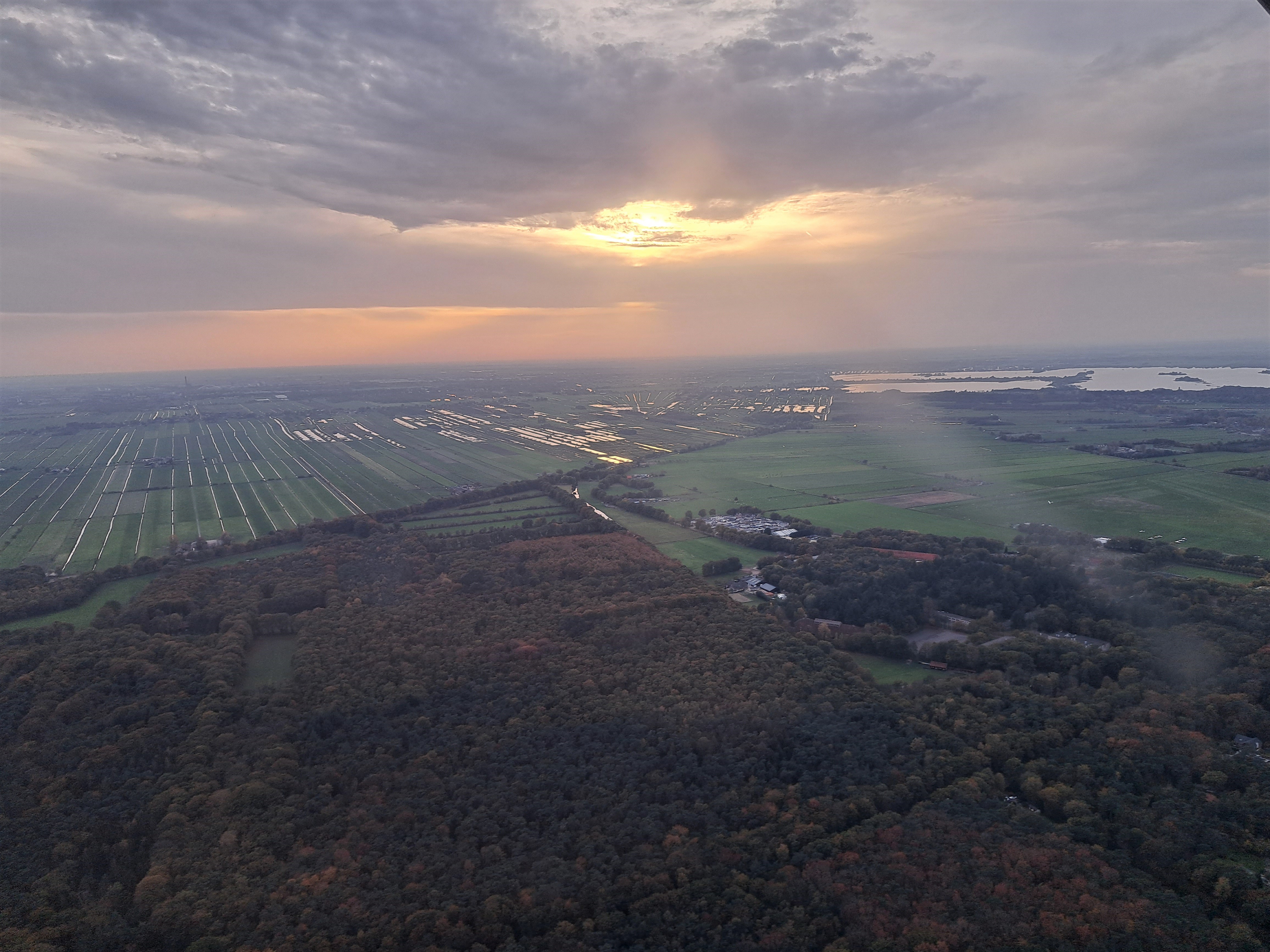
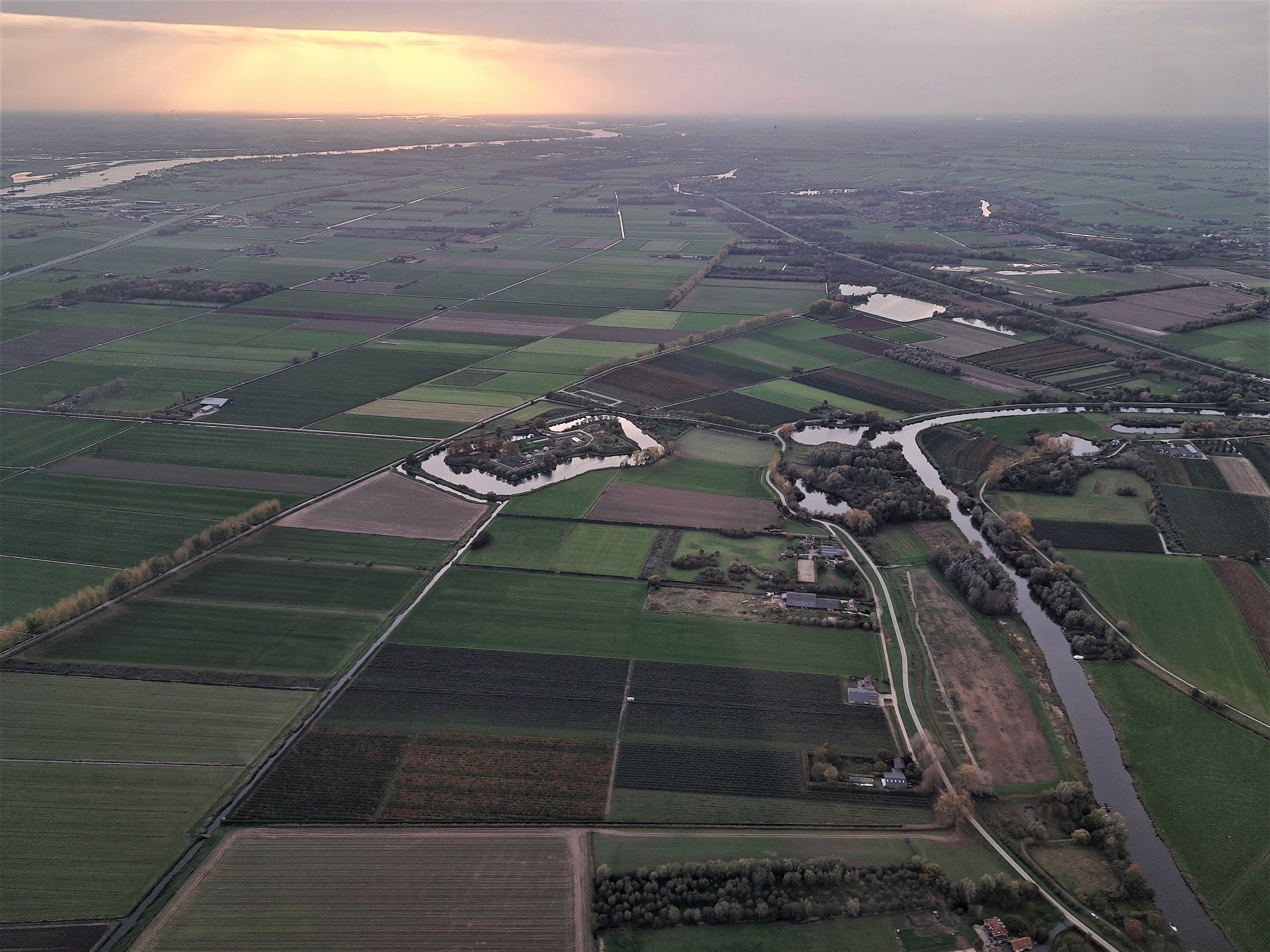
Islands.1
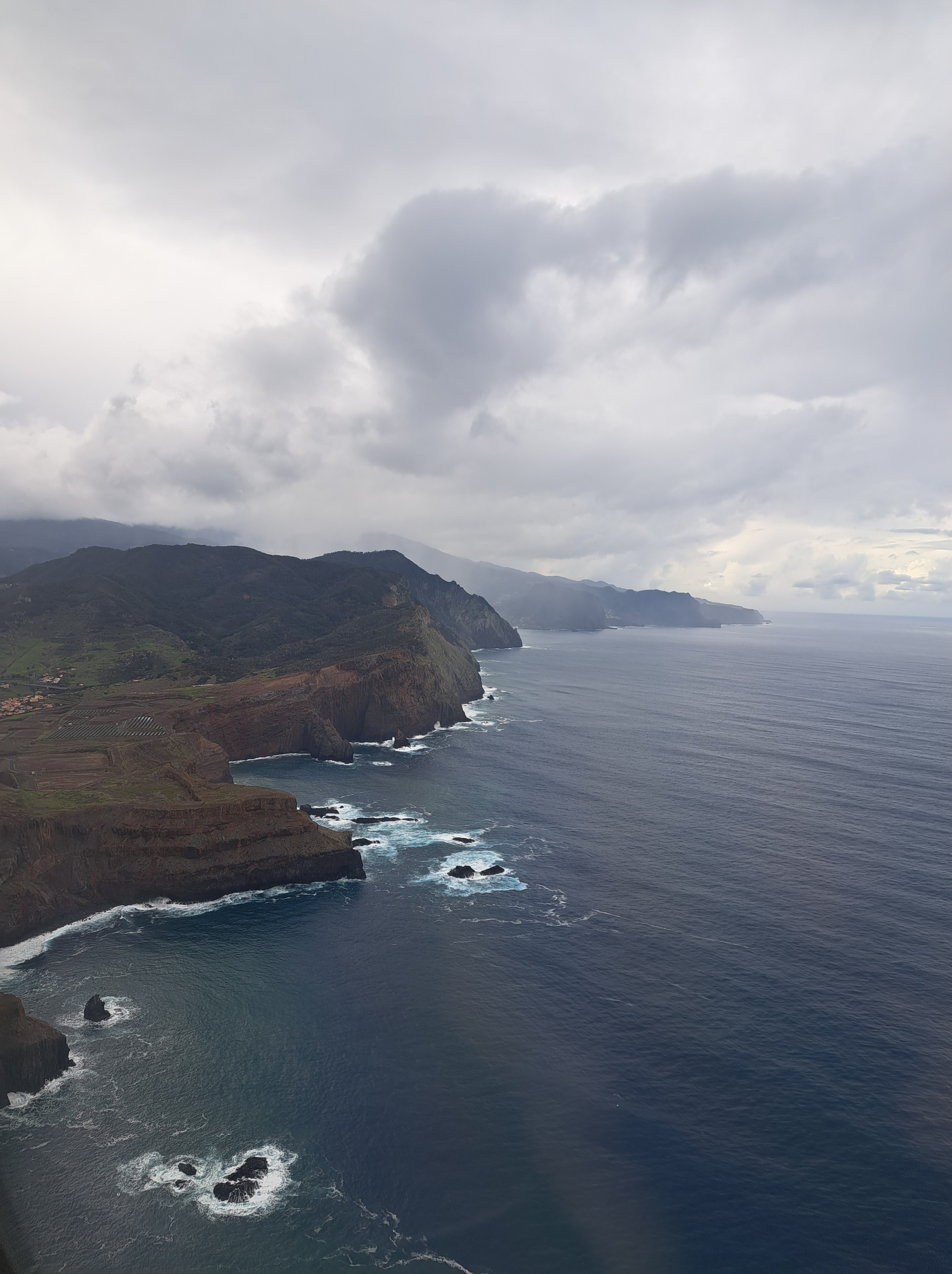
The blog tells me I’ve now posted at least one new post per day, for 317 days in a row. This means I need to cover 48 more days and I’ll hit my 365-day mark in the second half of January, and then I really do think I’ll allow myself another extended break. In the meantime I do keep seeing amazing stuff on walks, from flights, during bike rides…and it’s fun to share. Hope you’ll enjoy these new views. More from this island in the days ahead. (And yep, if you view it in full blog mode, you’ll see the nation and island in the “categories,” otherwise a future post will be less mysterious, I’m sure…).
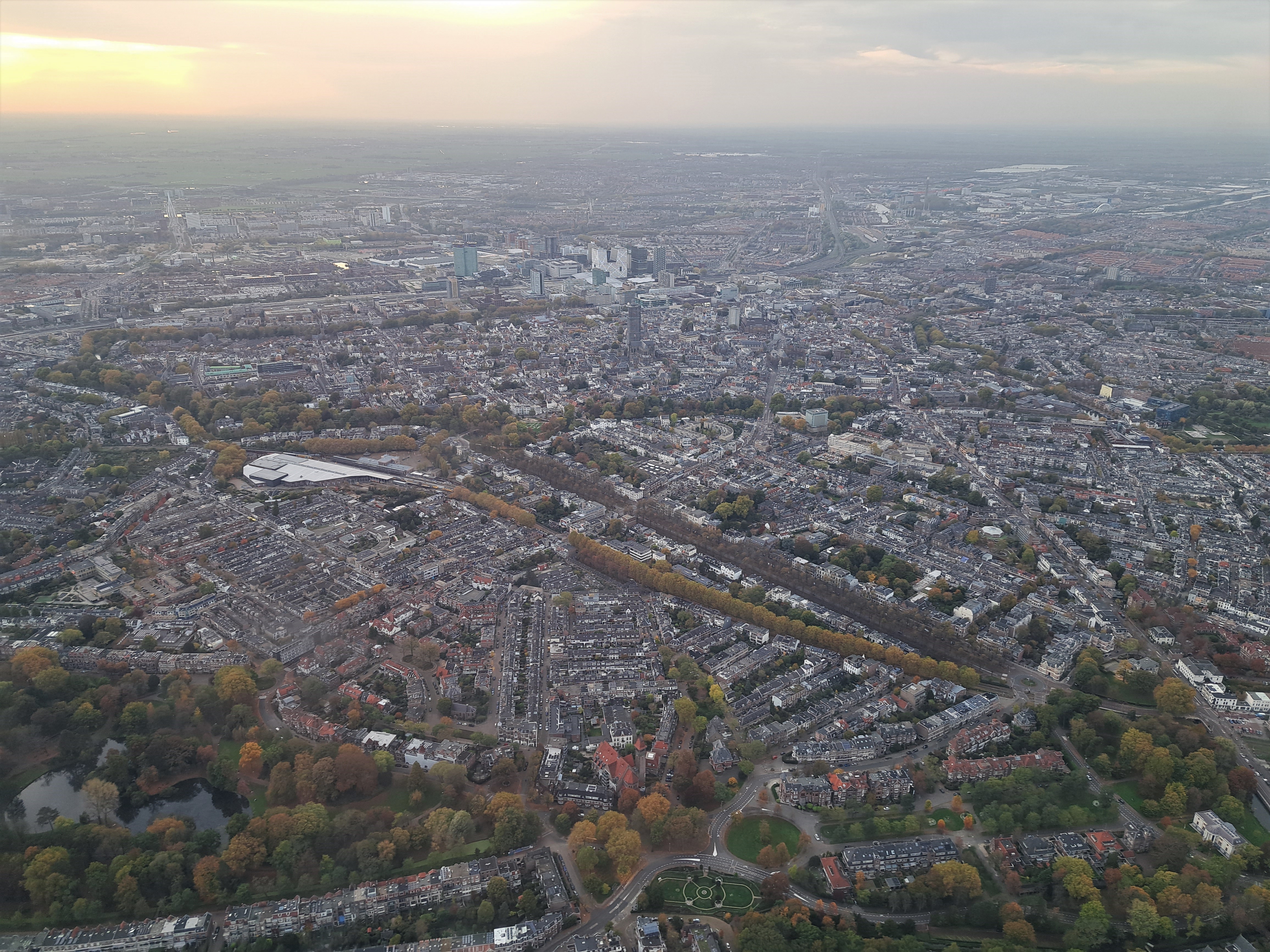
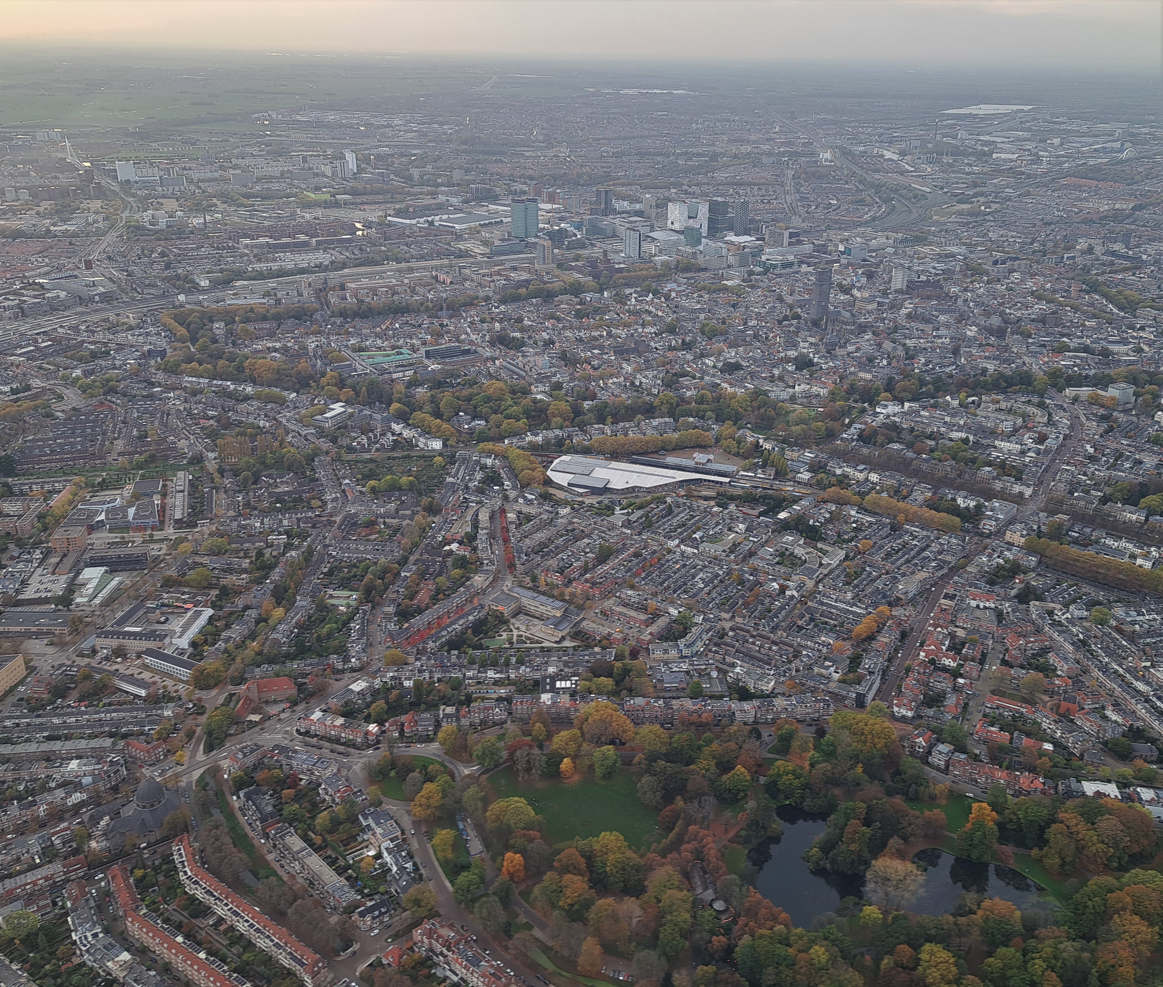
City Views.157
Country Canals.25

Coasting.35
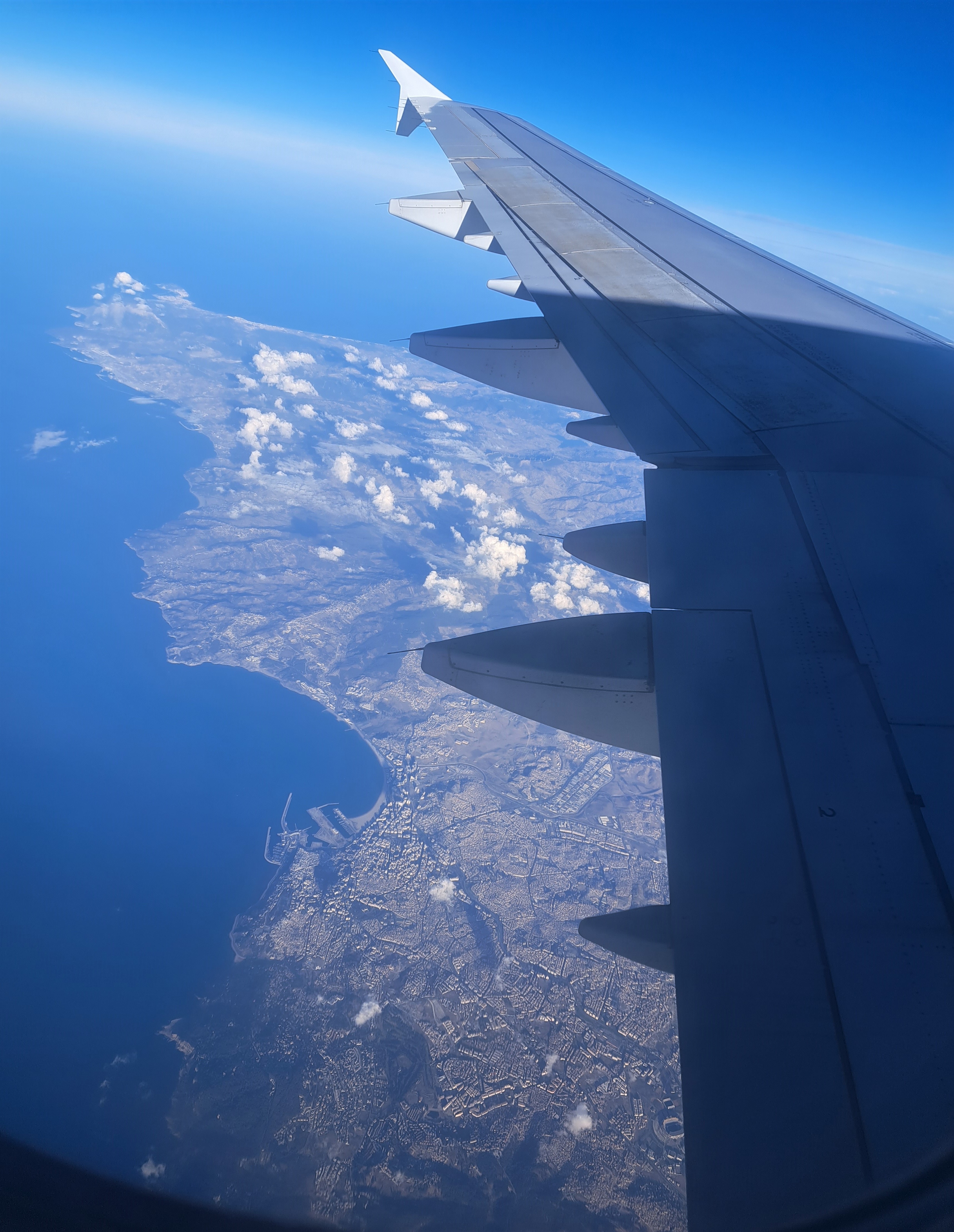
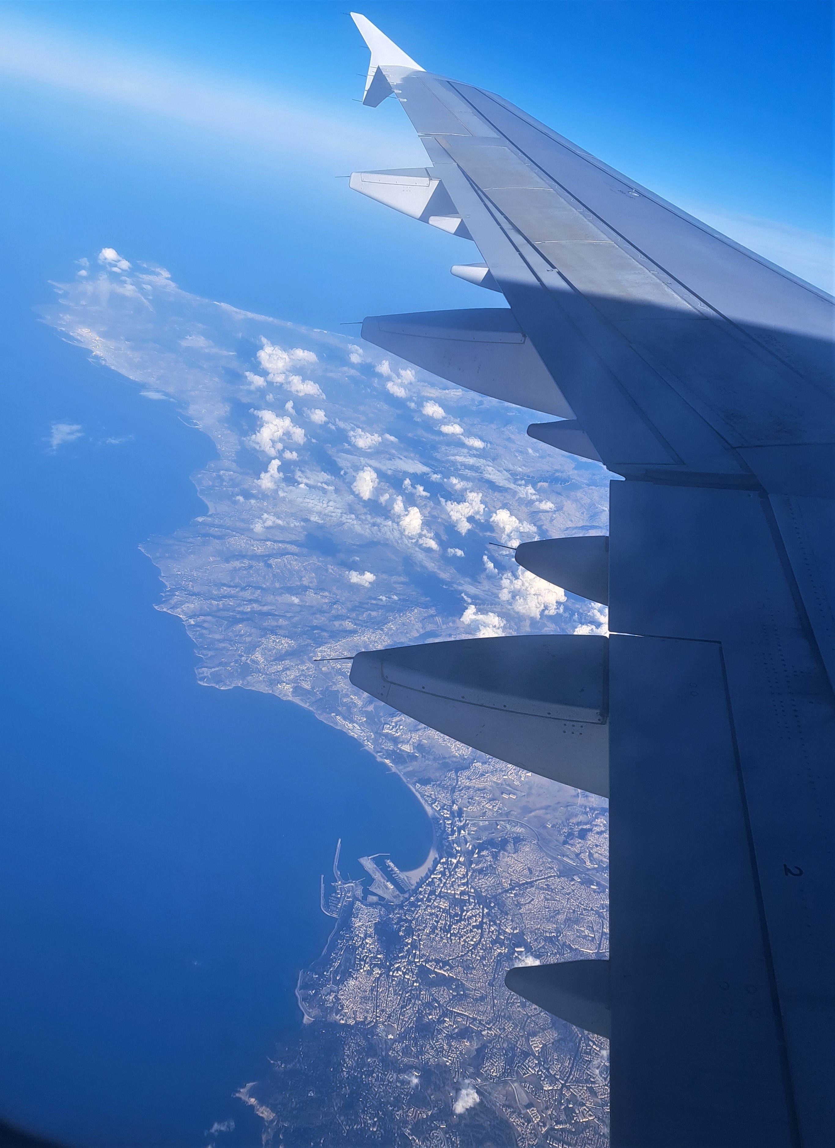
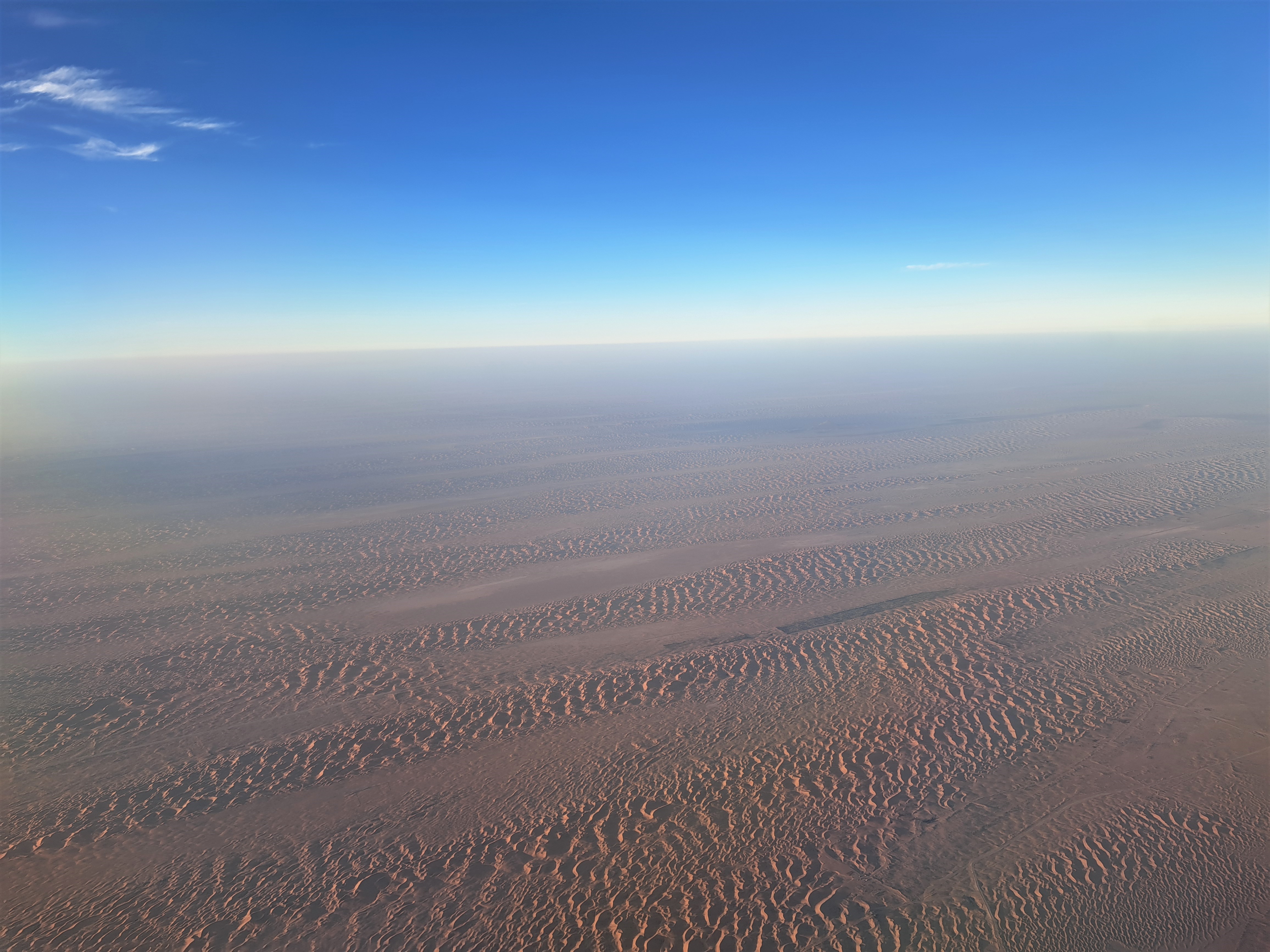
An earlier post noted that I was briefly in Dakar (Senegal) recently. I took these during my flight from Madrid to Dakar, as the plane soared over the coastline of northern Morocco after crossing the Strait of Gibraltar. Since the plane didn’t have in-seat screens, it wasn’t possible for me to pinpoint which city we’re seeing down there but it seems possible it’s Ceuta, one of those little Spanish post-colonial enclaves carved out of the Mediterranean coast of Morocco.
Travel Memories, Known & Unknown
 Imagine, if you will, boarding a series of flights at pretty much midnight in one time zone, to make connections in two different cities and end up landing halfway around the world, quite literally, about 36 hours later. Especially during covid, with all the uncertainties that implies. (For the record: I’m too lazy to capitalize that disease correctly. I also don’t want to give it any more of my time or energy than it’s already taken, nor do I feel it deserves the respect of me spelling it entirely properly. So there.)
So anyway, one gets confused, and apparently one’s phone also gets confused! The phone believes the above photograph was taken before some of the ones below, which I know to be untrue because, well, it’s the only photo for which I have 100% certainty about what it shows: Mt. Diablo during a beautiful sunset on the evening of July 4th this year. Meaning it was taken as the last airplane I boarded that day was approaching the runway at SFO.


So with these three, I’m about 80% confident they all show the shores of Lake Michigan and the general sprawl of Chicago Metro, most likely as we made our approach to O’Hare earlier that same 4th of July. If you click the individual shots, you’ll see the phone’s time-stamp filenames. Which in this case means it looks like they were taken at nearly midnight, while the amount of natural daylight suggests otherwise. Ah, the confusions of time zones and international air travel…
And we finish with these two below, which I’m more than 50% confident were taken somewhere around the general shores-of-the-Black-Sea area, simply because I remember waking up, looking out the window to see a crumpled mountainous landscape, checking the flight-path screen to learn we were somewhere in the region of the Caucasus. That being a part of the world I’ve neither visited on-ground, nor flown over much, I thought “hey, let’s snap a shot or two.” And even though the camera thought it was middle of the day, my body sent me more or less immediately back to sleep and blissful forgetfulness.


Travel Before & After the Smoke Spread


The first and second photos above were taken almost exactly two weeks apart, on September 2nd and 16th respectively, from the skies not at all far from ORD, the main airport in Chicago. The third was taken on the 2nd above the Sacramento-American river delta, which feeds San Francisco Bay, at time a time when smoke was already affecting northern California but hadn’t spread as far and wide. The fourth was taken on the 2nd somewhere above Iowa or Illinois, I’m guessing. On the flight from SFO to ORD (2nd), I didn’t have flight map available readily, so the names of the photos are my guess as to where the plane was when I took the shot. Flying home on the 16th, I know where each shot was taken and you’ll see pretty precise into in the photo names.
As you’ve seen from prior posts, our wildfire season began earlier than usual in Sonoma County and Norther California generally. This brought smoke to our skies, which I’ve already posted about here. While I was enjoying time by Geneva Lake in Wisconsin, more fires started due to more unusually hot and dry weather all over the west coast. Then the smoke spread to many of the midwestern states which … umm, narrowly voted for the president who withdrew the US from the Paris accords. I found the flight home on the 16th so distressing, because the smoke was visible everywhere. How long will a rigid core of Americans continue to think that climate-change denial is good public policy for the nation with the largest economy and carbon footprint globally???
In the gallery below, you can read date and location info in each photo’s name. As you see above, we in California already had smoky skies on the 2nd, but actually when I flew back in on the 16th, an onshore flow had driven the smoke away in my area. For now air quality has been reasonable and the sunsets lovely but not too scary. 🙂 It’s about to get hot and dry again, so please hold the though “no new fires” in your mind, and prayers if you do those. 🙂 Peace and a truly democratic, majority-based outcome for all elections in the world, be it Belarus or the US…


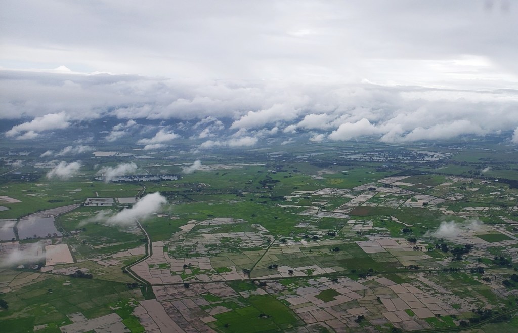
Rivers & Forests in Central African Republic
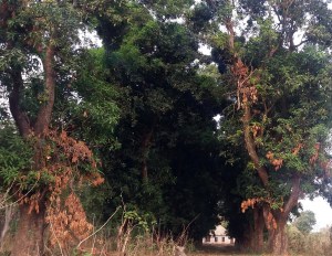
Between February and June, I worked in Central African Republic. I rarely had an opportunity to pull out the camera – combination of very busy, respect for people’s privacy, and some security questions, mostly. Nonetheless, a thing I feel increasingly in today’s global social environment is that, despite social media which claim to connect us all, so very many people especially in the wealthy countries like my own home just simply lack interest or ability to imagine or respect human life as it plays out daily in vastly varied communities spanning this beautiful world. CAR has many challenges – a quick web search will find reports on those challenges easily. But it’s an amazing, enormous, lovely country defined by rivers, forests, and hills which sits quite literally in the heart of Africa, at the meeting of desert-dry north and tropically-moist south, on trade and herding routes which humans have plied no doubt since long before the first Europeans thought of coming to North America. It also has some of the most engaging and resilient citizens I’ve met, many of them colleagues with whom it was a daily pleasure to work.
 Something I love about my current work is that restoring human dignity (even in the most trying moments like conflicts, natural disasters and epidemics) is at its heart. I dearly wish more of us humans found time to deepen our own heartfelt respect and fellow human feeling for everyone – whether in different places or of different convictions. I love how my work connects me to a broader fabric of humanity than most Americans ever have a chance to imagine. This feels so much more meaningful and rich than the “purchase this gadget or app to give your life meaning” approach which seems so to dominate social culture and politics here.
For the first time I am trying some videos here. Friends or viewers from low-bandwidth contexts, tell me if this impedes loading the entire entry or just the videos themselves. I can put them into a separate entry if needed, but as you’ll see, I tried to place them where they inform the photos around them. And if any colleagues don’t agree with me posting any of the party or other photos, just write and I’ll take it down. It’s a fine line, making lives in other parts of the world real vs respecting individual privacy 😊. Peace, out.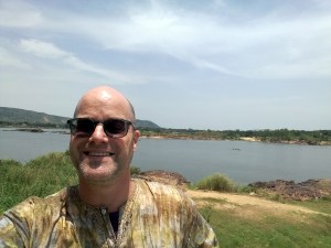


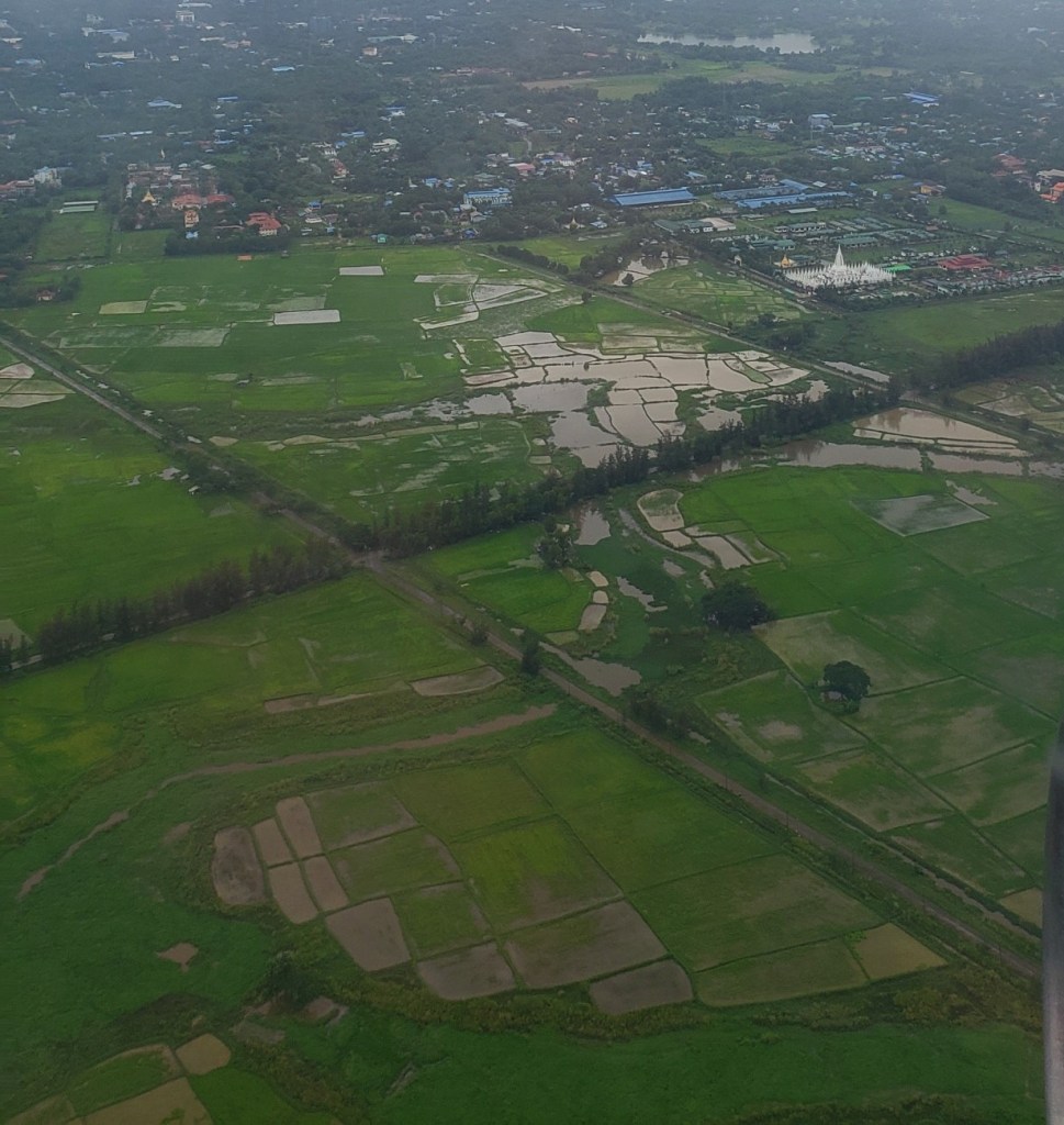
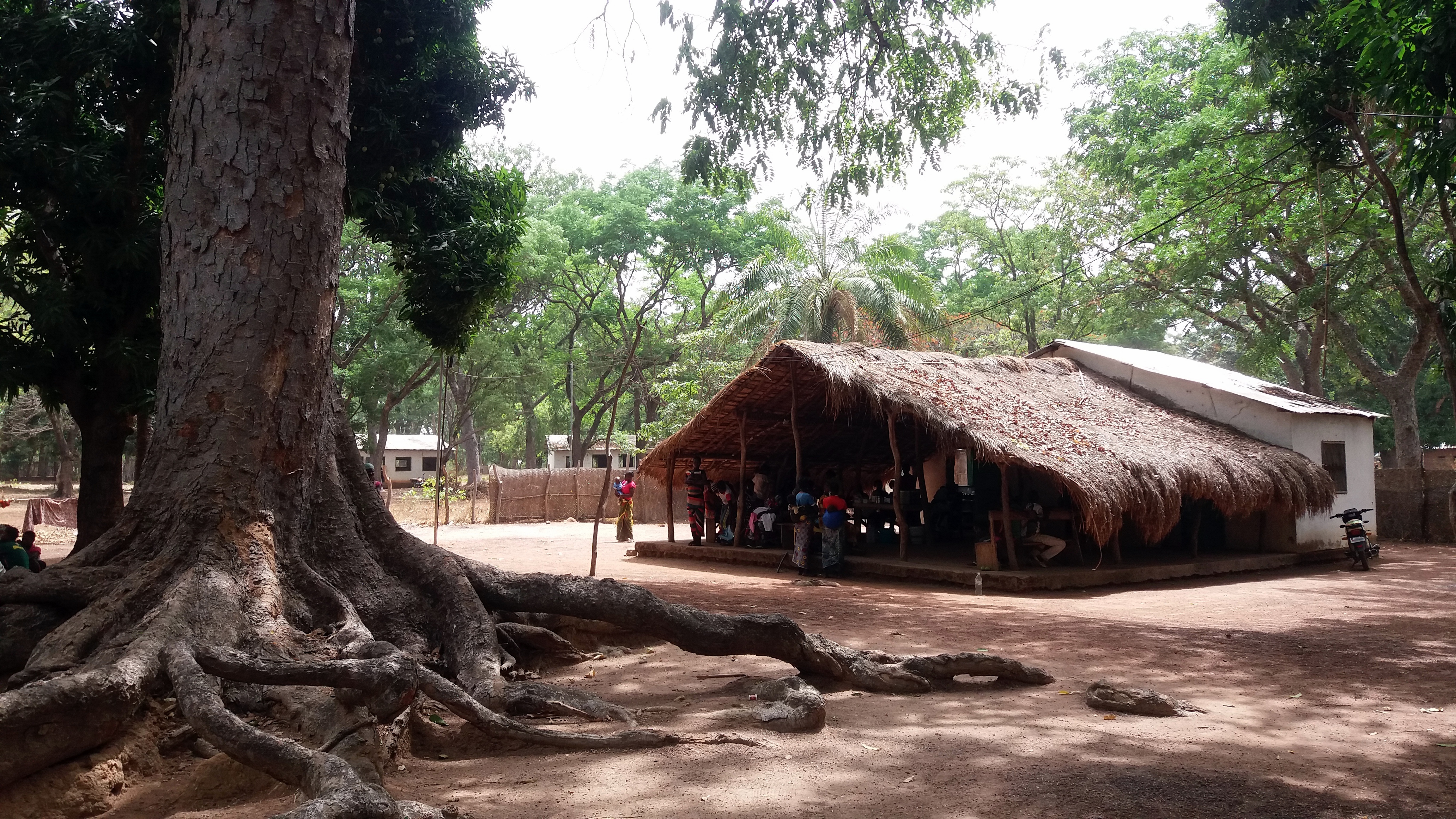
Notice, in the photos above, how the bush rules everywhere, and you can clearly see where human settlement has cut itself a home out of the bush. Where you see a much larger number of houses, we’re close to landing at the Bangui airport.
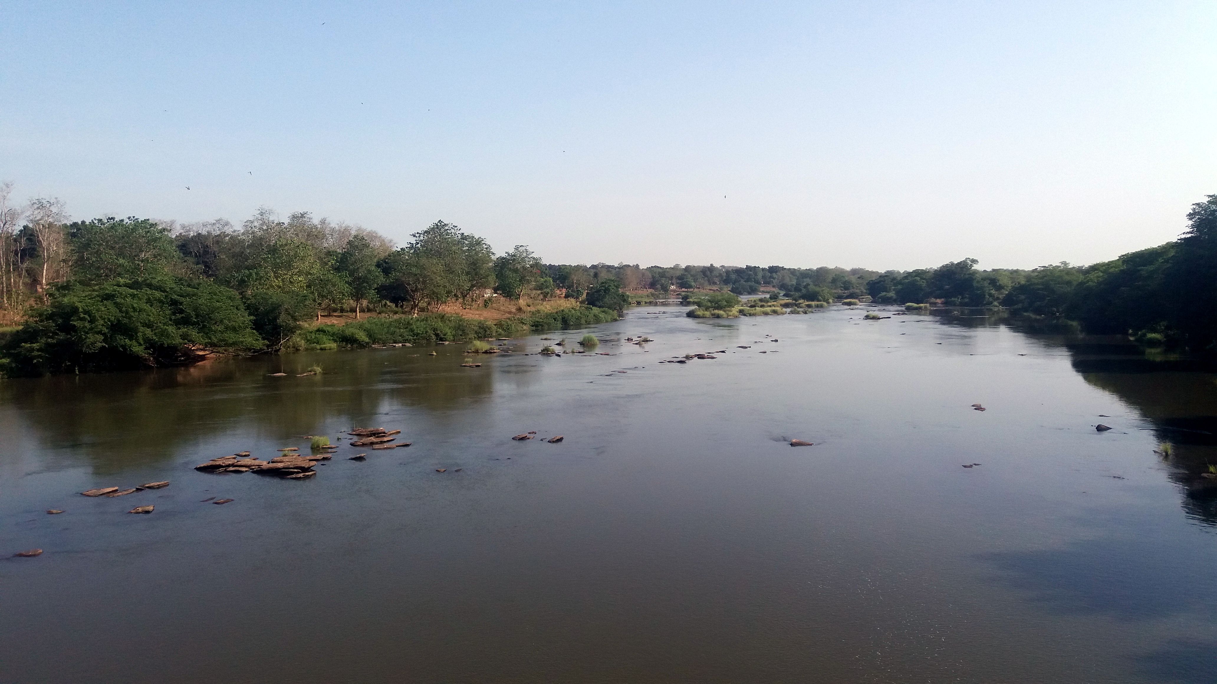


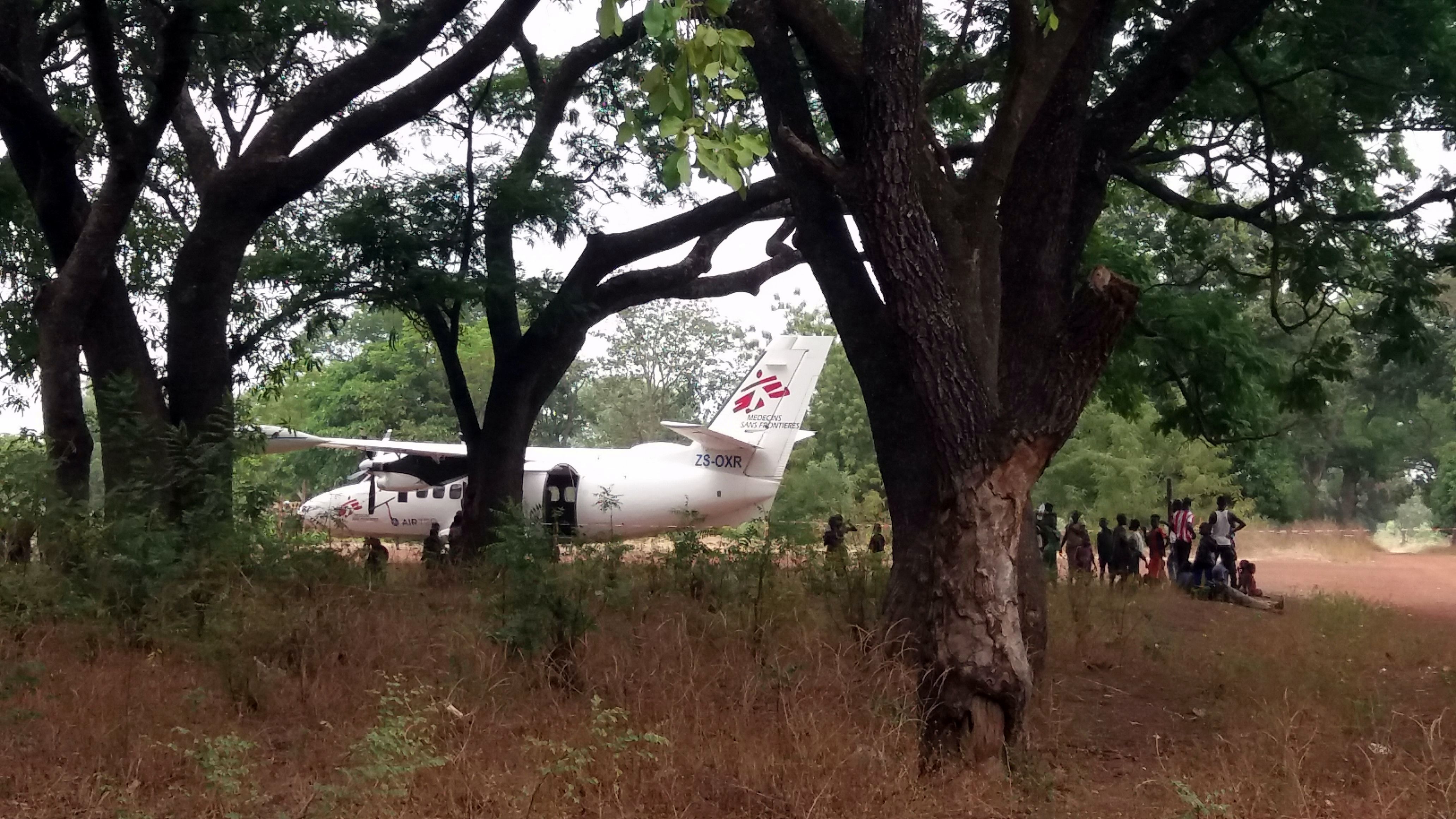
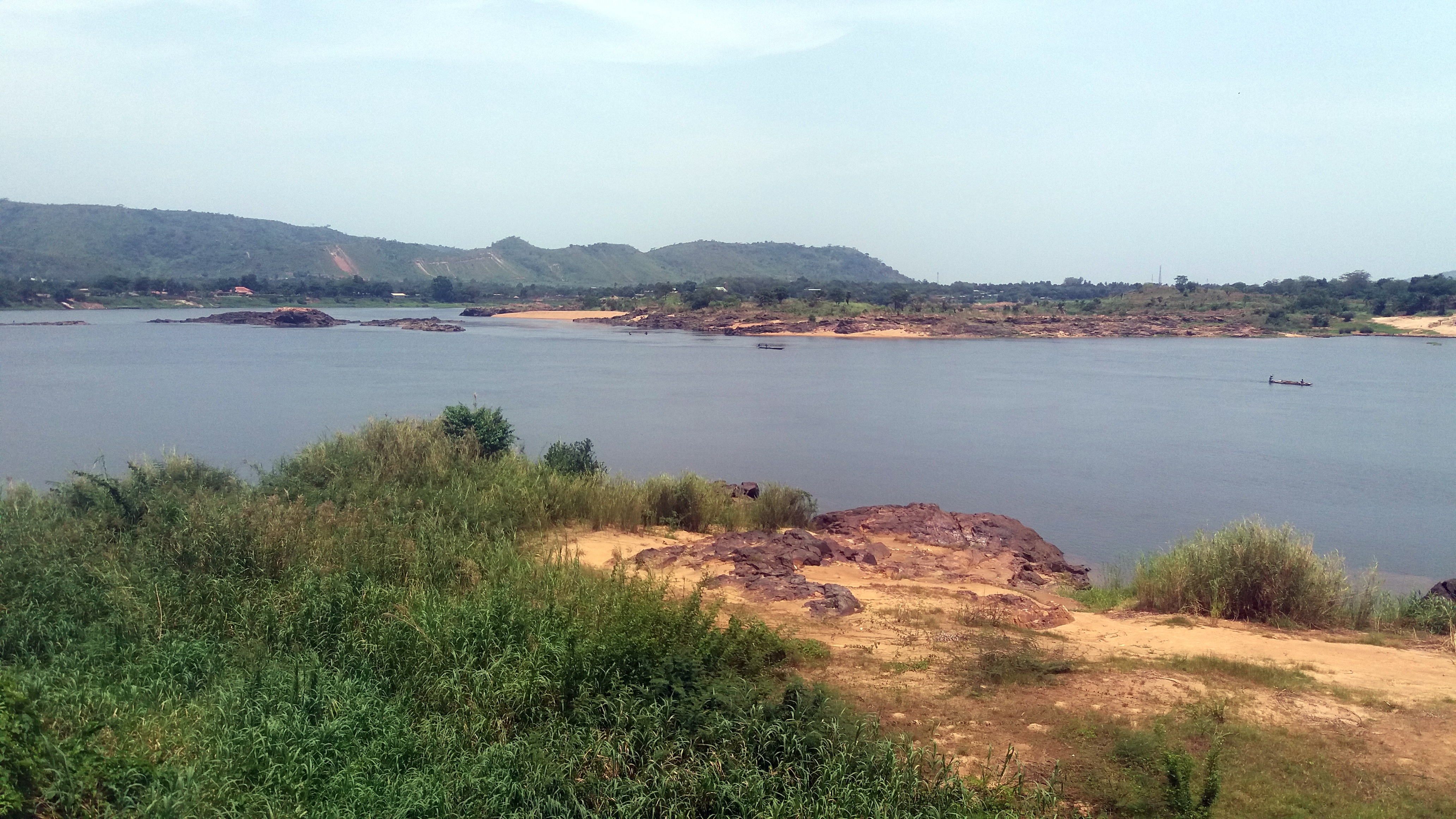
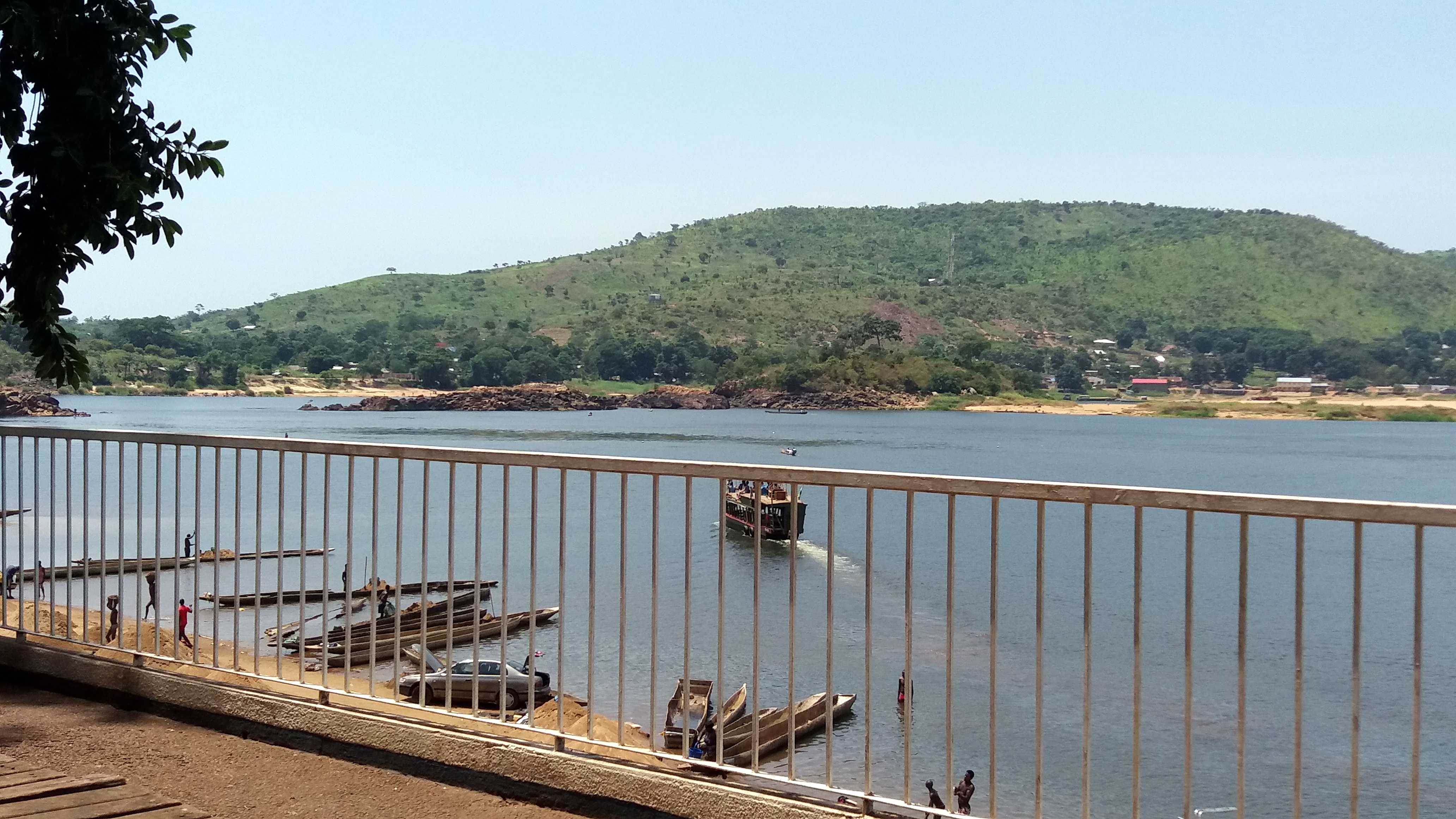
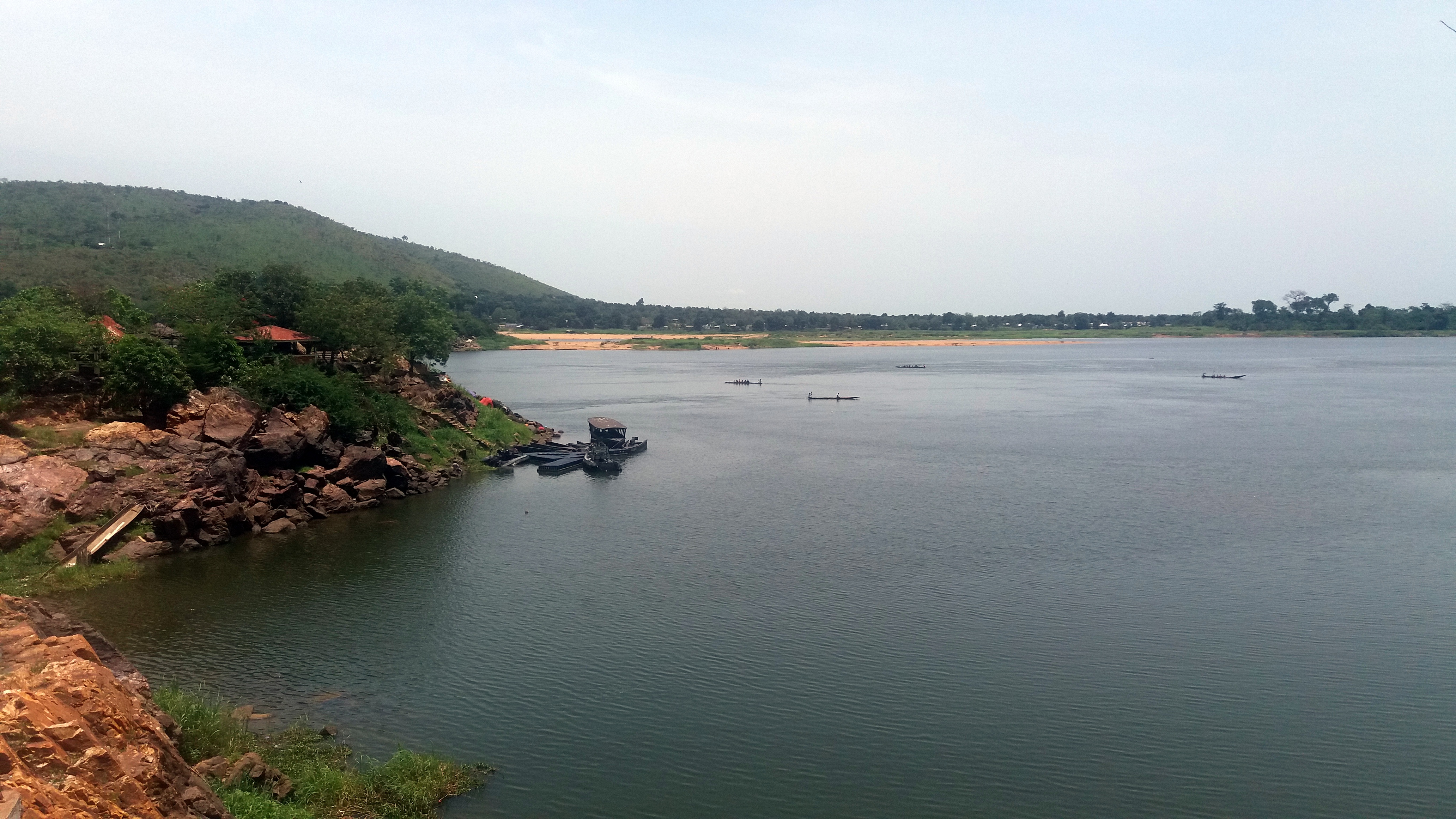
These photos of a broad river with hills on the other side are all from downtown Bangui (the capital of CAR). Across the river is the Democratic Republic of Congo, and the river is the Oubangui, which when it flows into the Congo River a few hundred kilometers downstream of Bangui is the largest tributary to the Congo. Here’s a video, below, which I made just before taking the photo above:


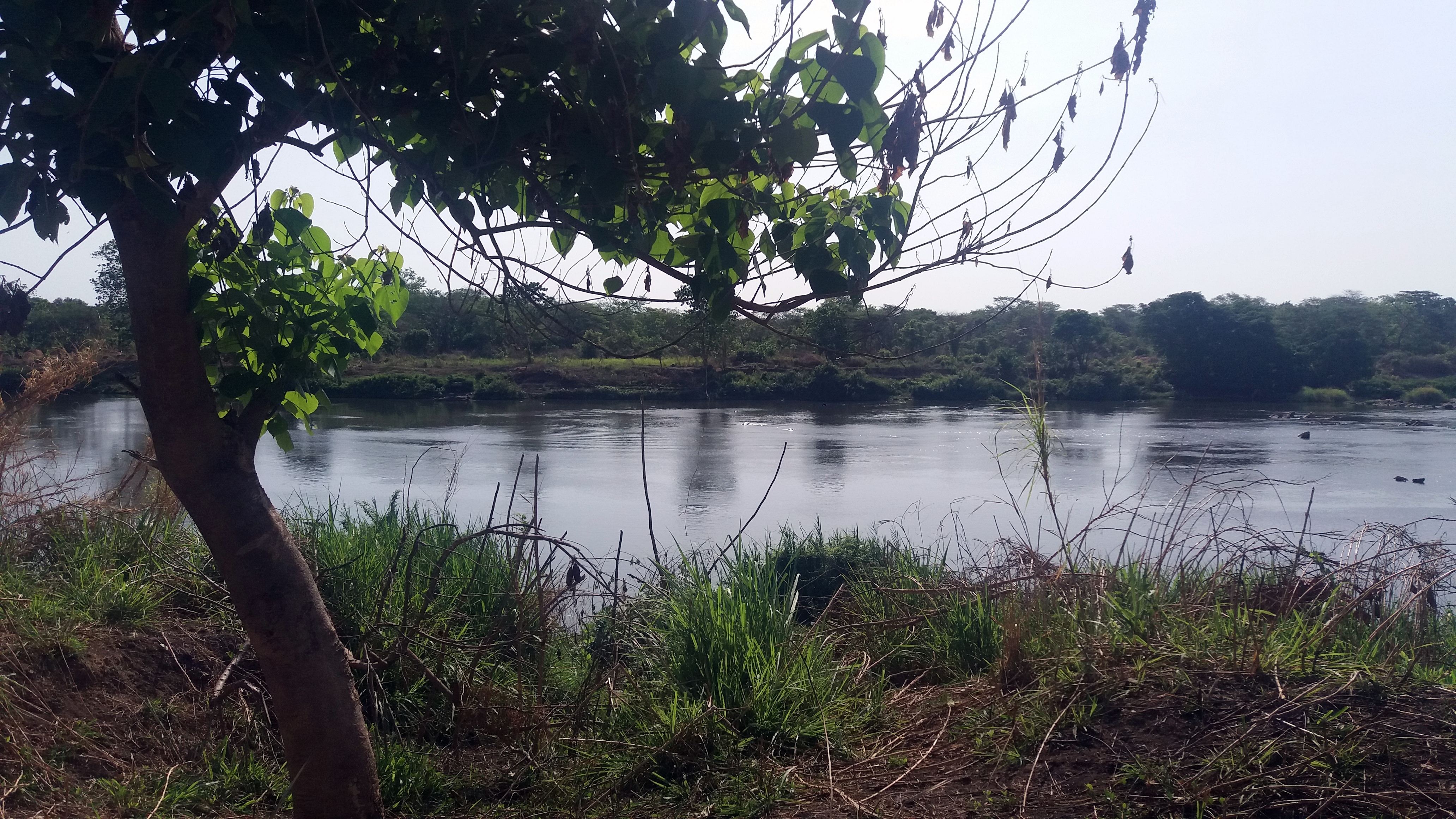
The selfie of me by a river, and the shot of a sunrise over the river, are all the Ouham River near Bossangoa. I sent some friends a photo or two — still photos — and told them there were hippos in the photos. But since the hippos look like rocks until they move (often), people expressed some doubts. Here are the videos, narrated by me and the colleague I did that morning run with:
From Sea to Sierra (SFO->EWR)


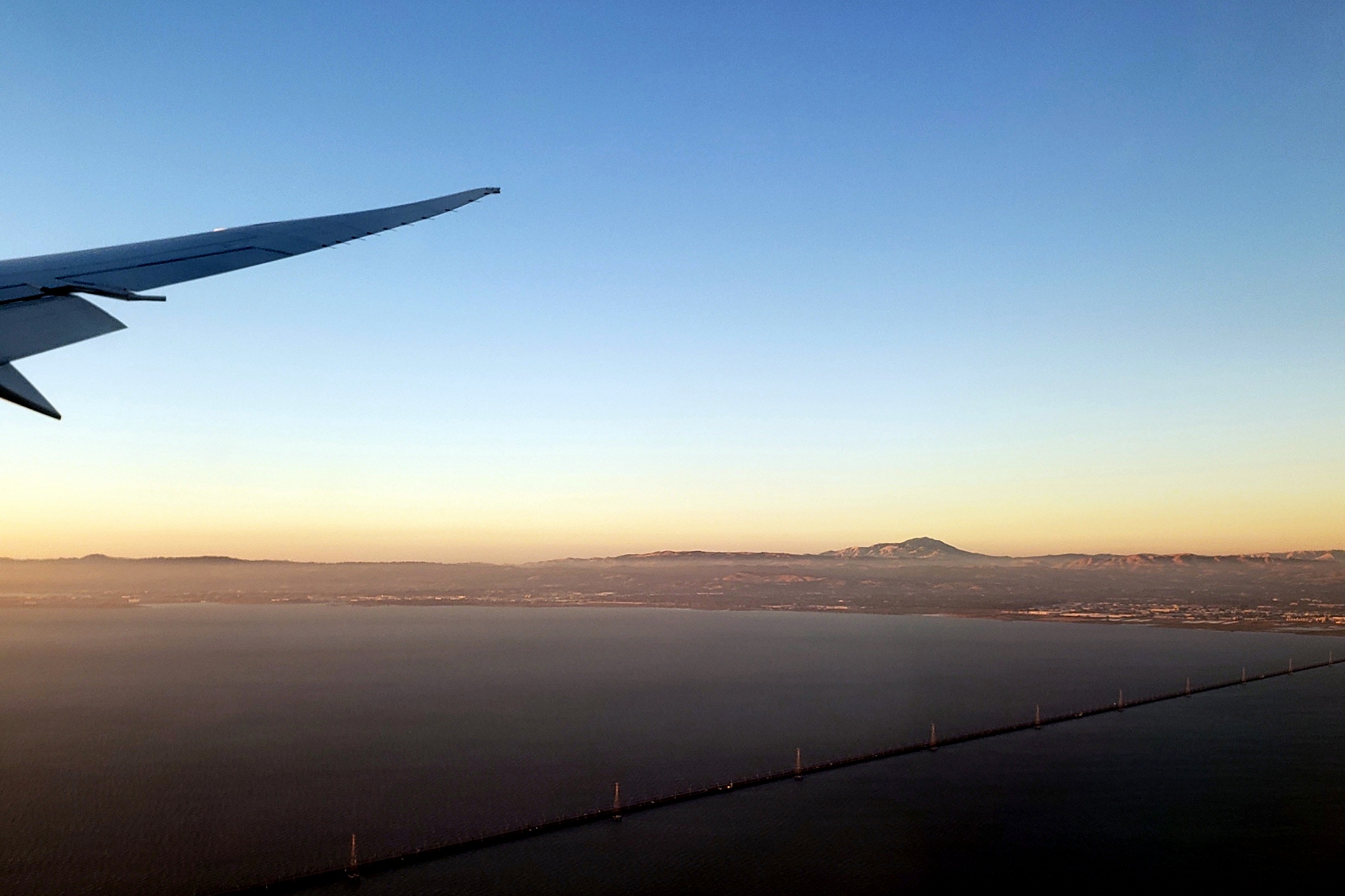
If you haven’t been to the San Francisco Bay Area yourself, and if you wonder why I’m always so happy to get home to it; or why visitors to SF and the bay area so often rave about it — a good place to start is to take in the photo just above. I’m still working my way through photos I took last year, before I headed over to Bangui, where I’ve been now for more than two months. I shot all of the photos in this post during a take-off from SFO en route to EWR last year, in May — but what I’m posting are just photos from the bay area and up til the time we reached the still snow-covered Sierra Nevadas. Since it was nearly a year ago, and this year hasn’t seen as much snow — just remember: it’s last year! Enjoy!


Spring -> Snow -> Beach – In the Air
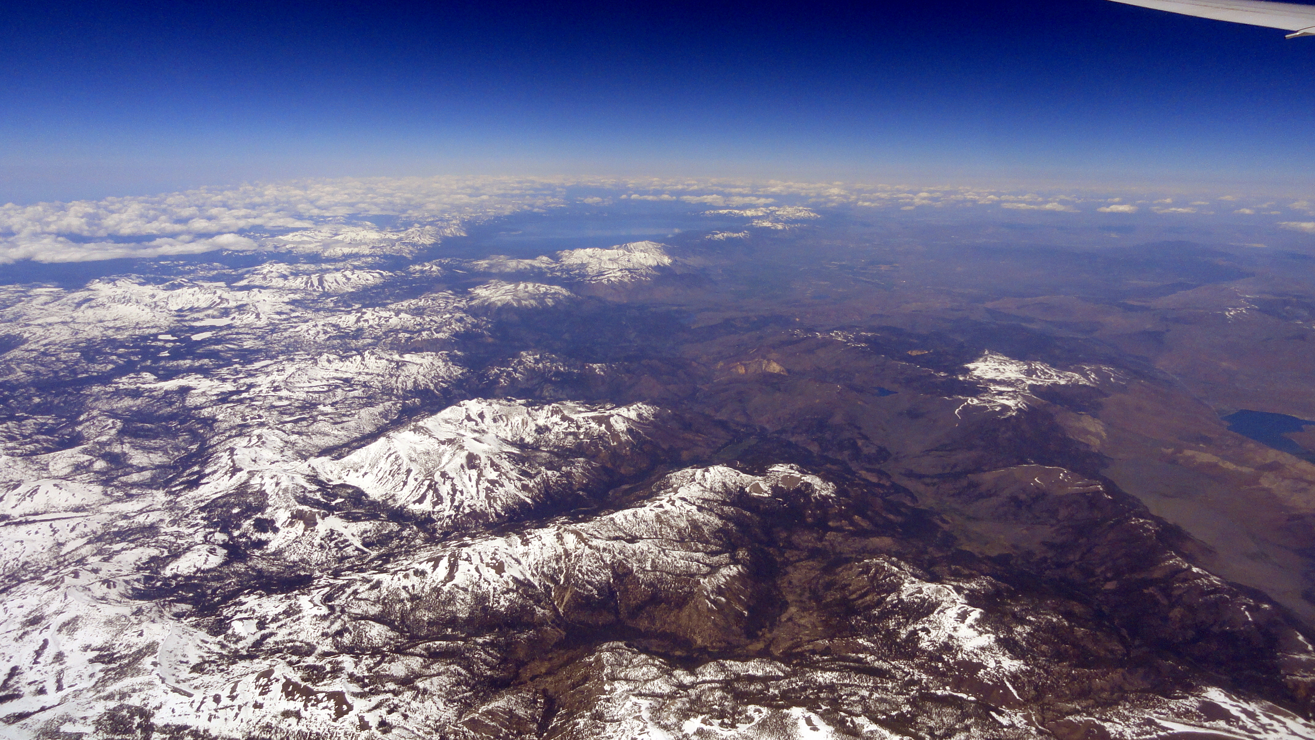
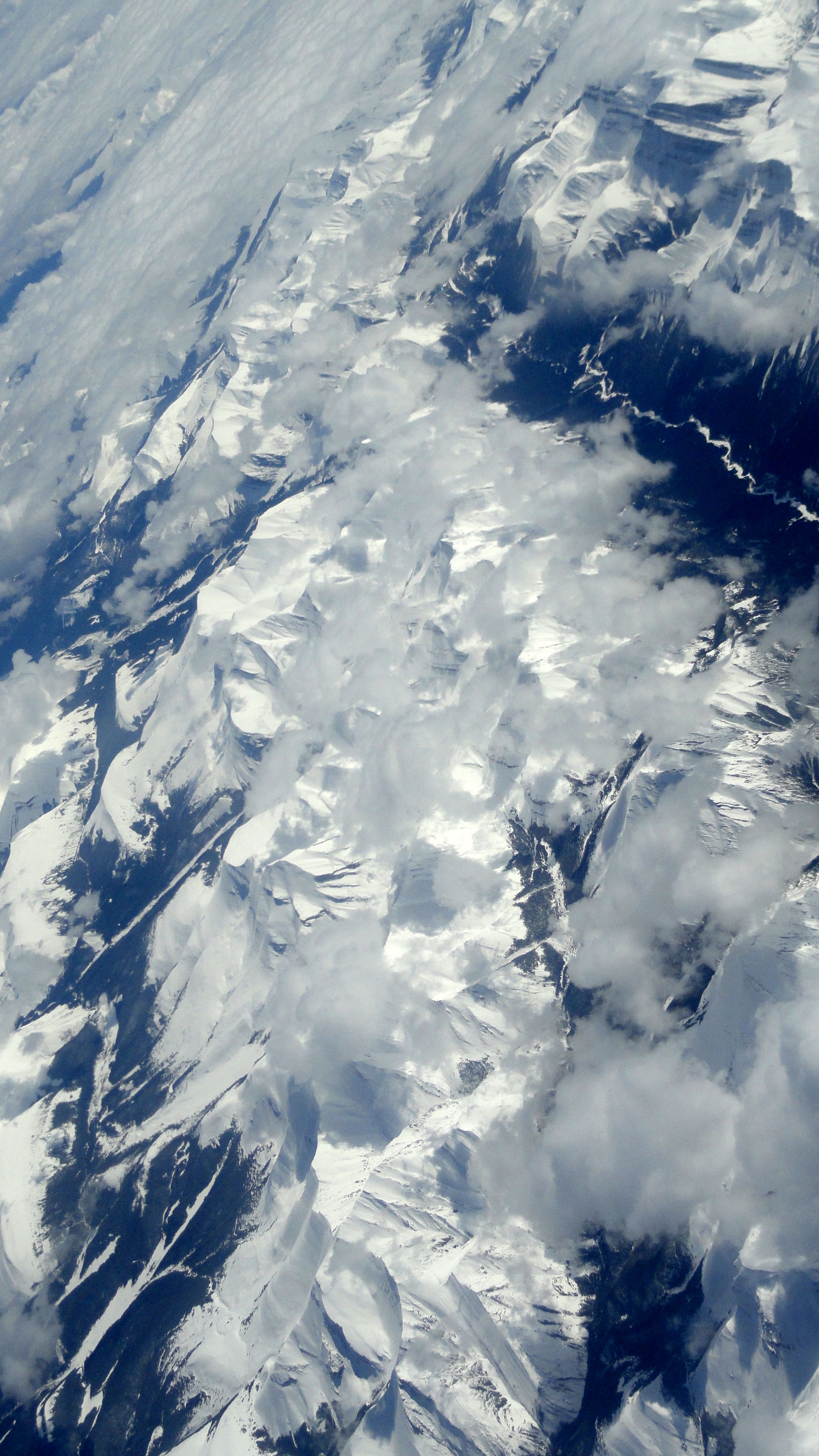
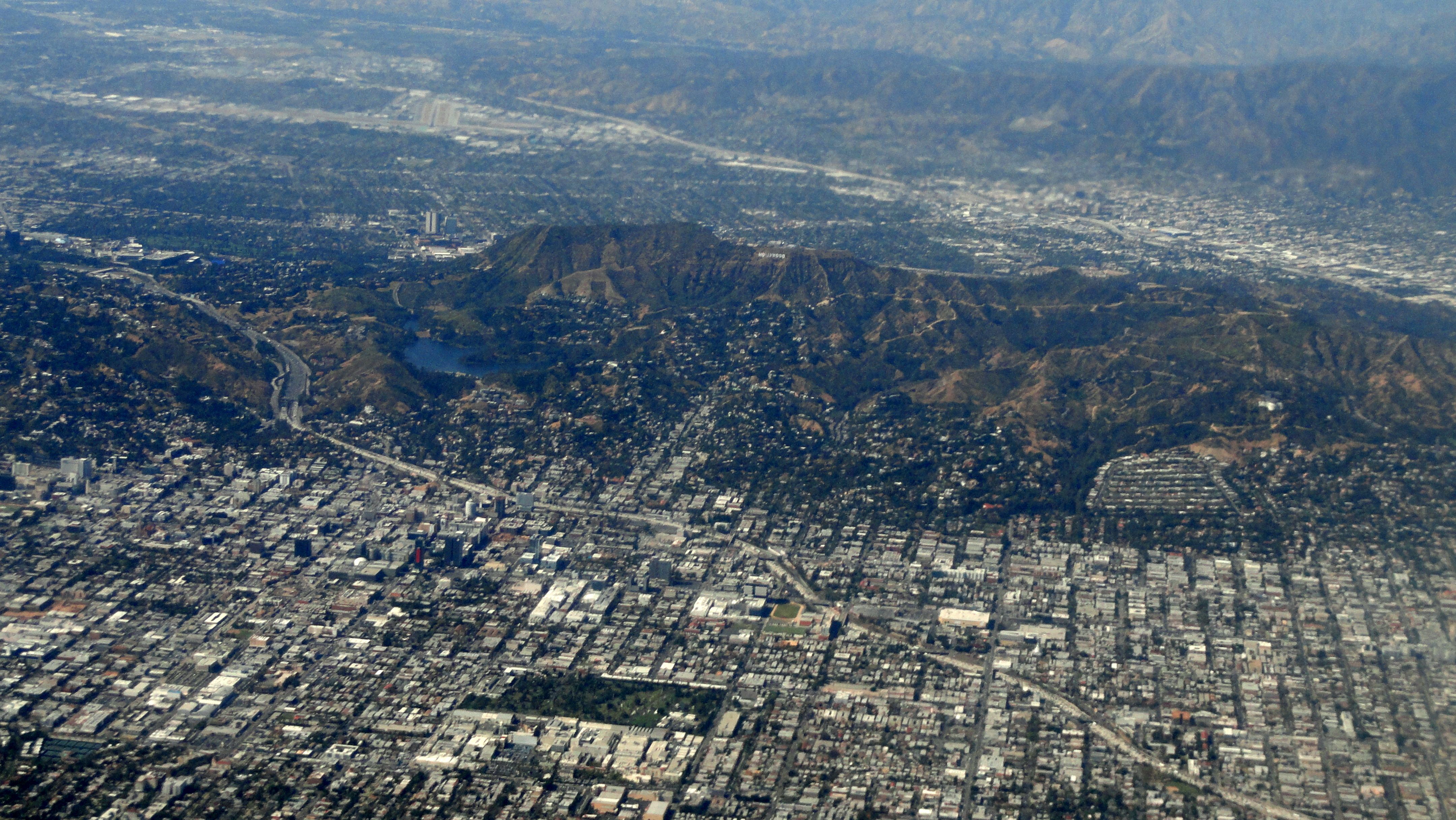 After that last visit to Amsterdam, I flew home to California in late April, the end of a wonderfully wet and snowy rain season on the west coast: which meant lots of much-needed snow even in the mountains of California! As always, I aimed for a window seat and kept my camera handy. I no longer remember the precise route, but I think we went about 1/3 of the way up Greenland and across northern Canada, then angled down around the mountains between British Columbia & Calgary in Canada, and across into the US south of there still angling southwest. The four big photos (above, below, and after the gallery) are out of order — look closely and you’ll see the Hollywood sign on the hills in the photo of LA just above, as the plane flew inland then swung around and line up for the southern runway’s approach route. And I’m fairly sure the photo directly below is from Greenland. (Yes, a thing those from the East Coast of the US may not know is that when flying from the West Coast to Europe, one usually flies over Greenland, as opposed to just south of Iceland which I usually seem to do when flying from NYC.) The shots in the gallery are all in order. I think we crossed the Sierra Nevada south of Yosemite and I was seated as you see on the left of the plane, so I didn’t see Mt Whitney or Yosemite from the air, more’s the pity – the few times I have, my camera has not been handy. Oh well…next time :-). Enjoy!


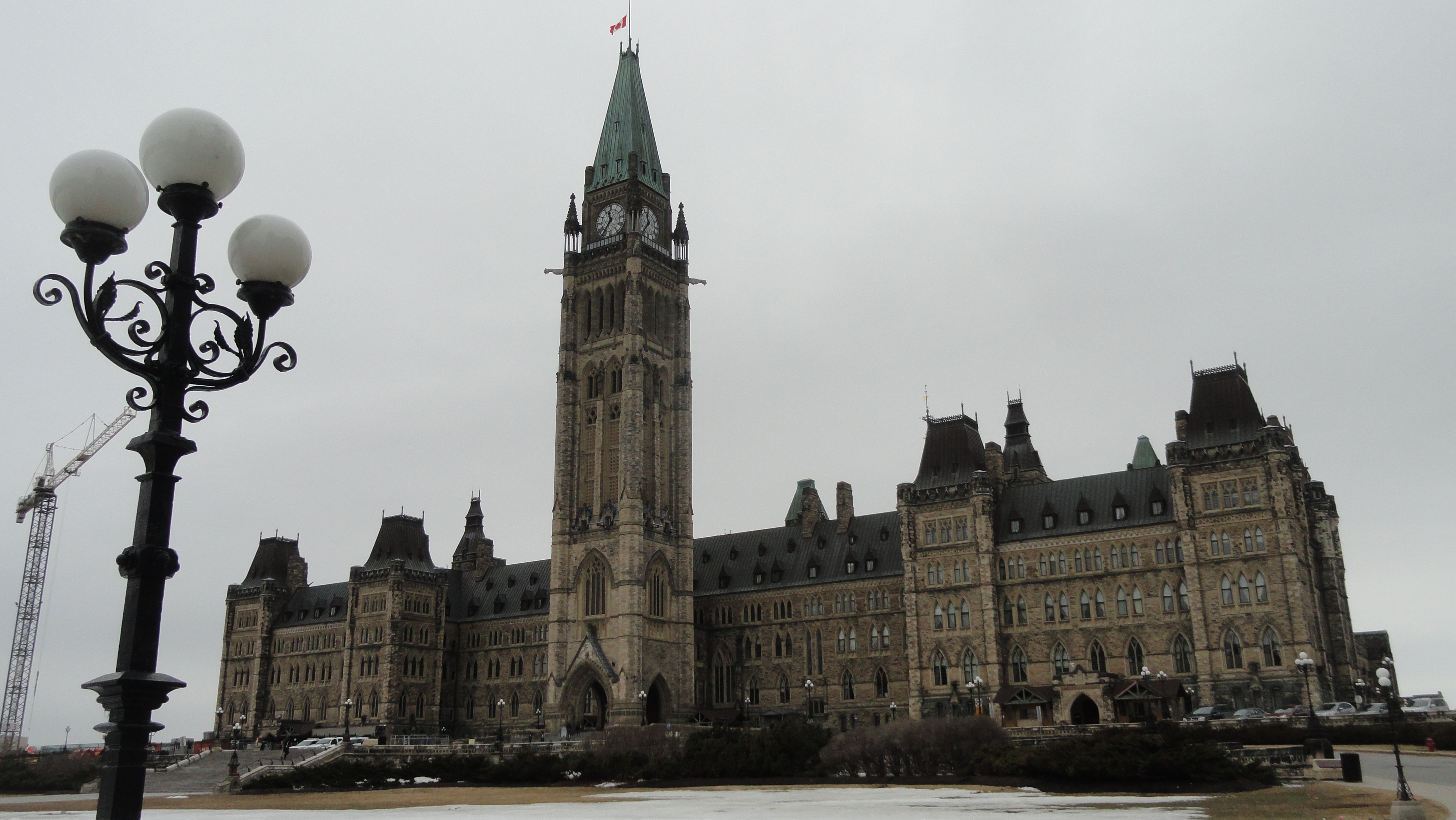
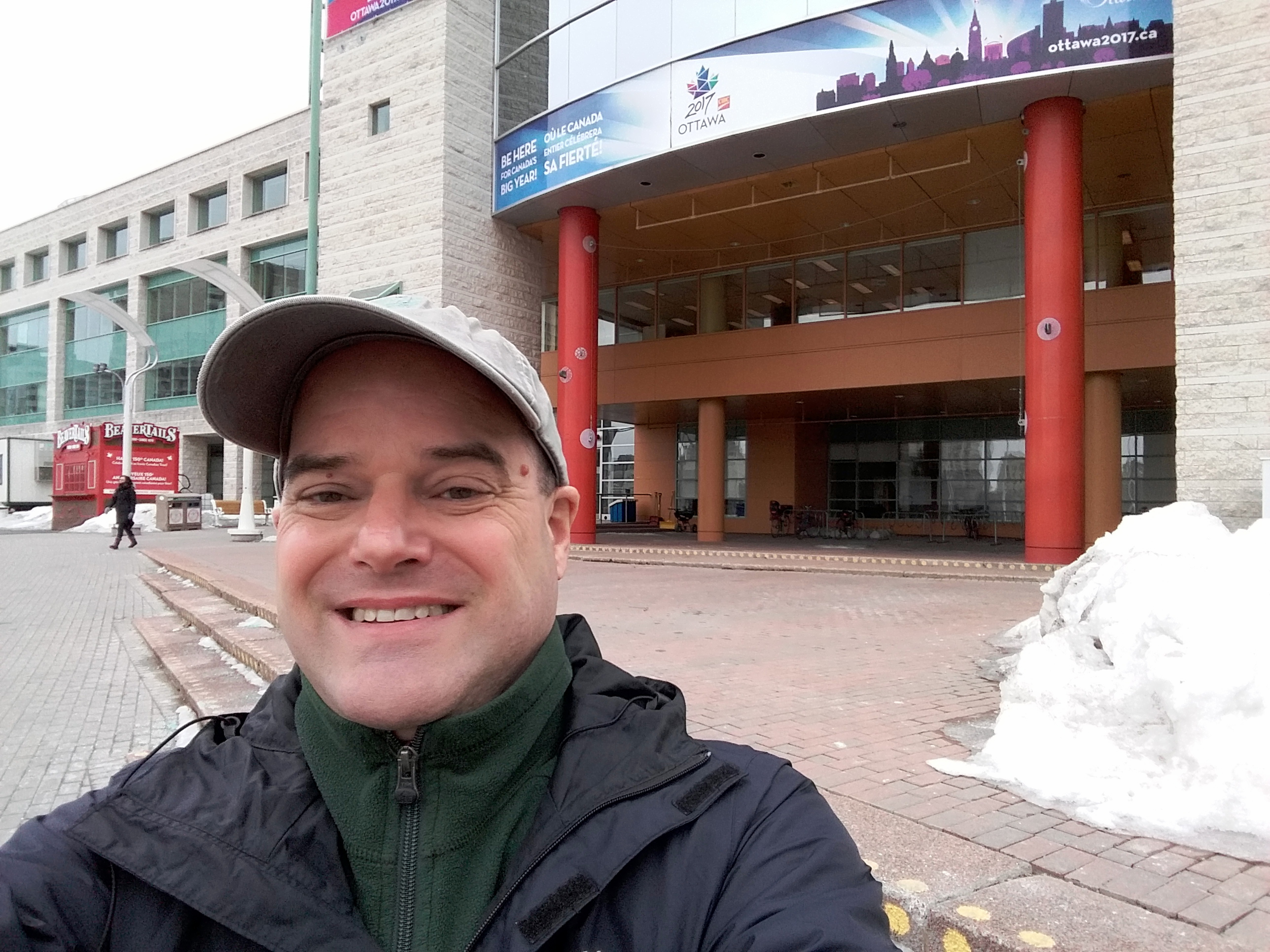
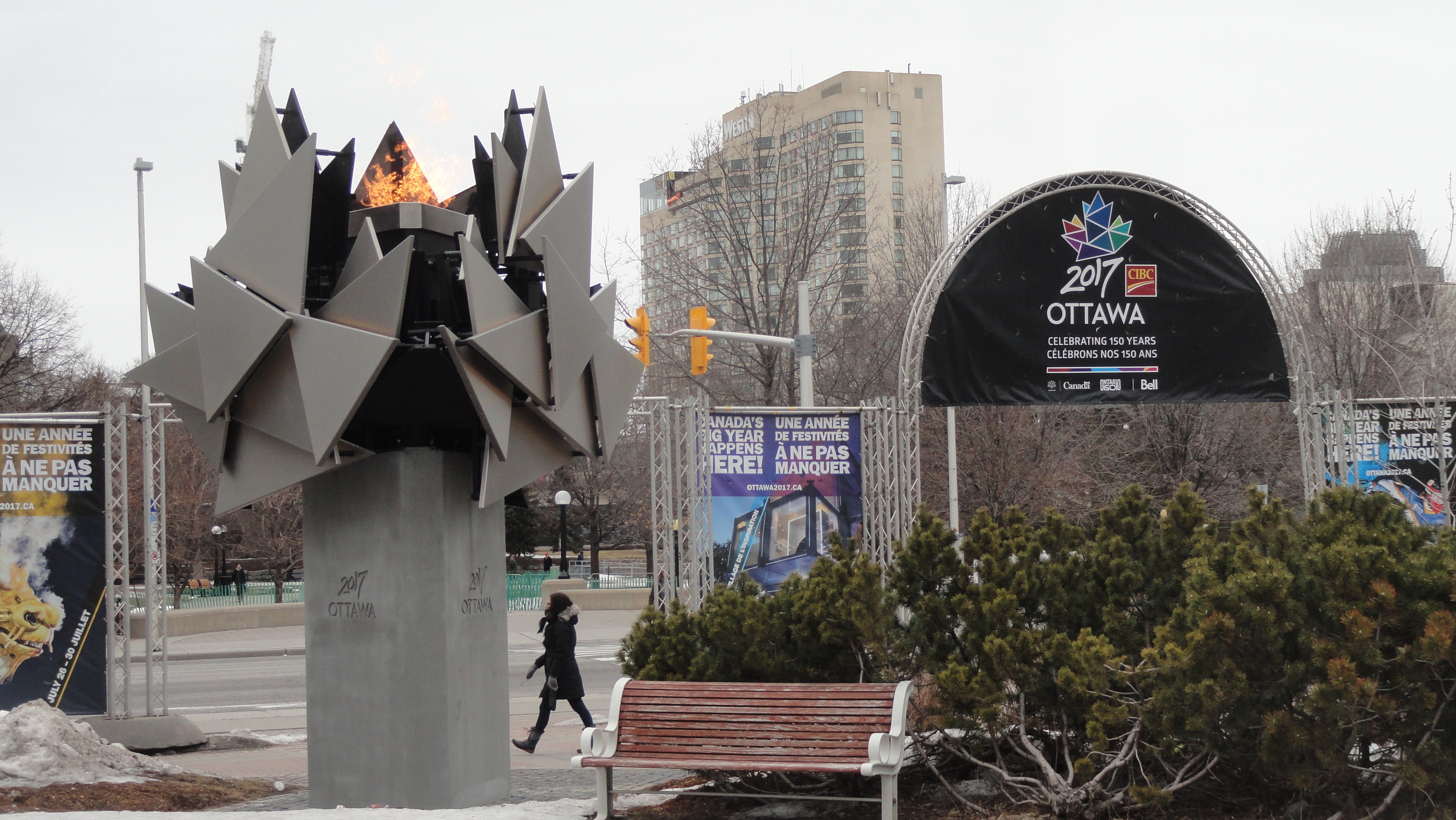
Snowy Spring in Ottawa & Toronto

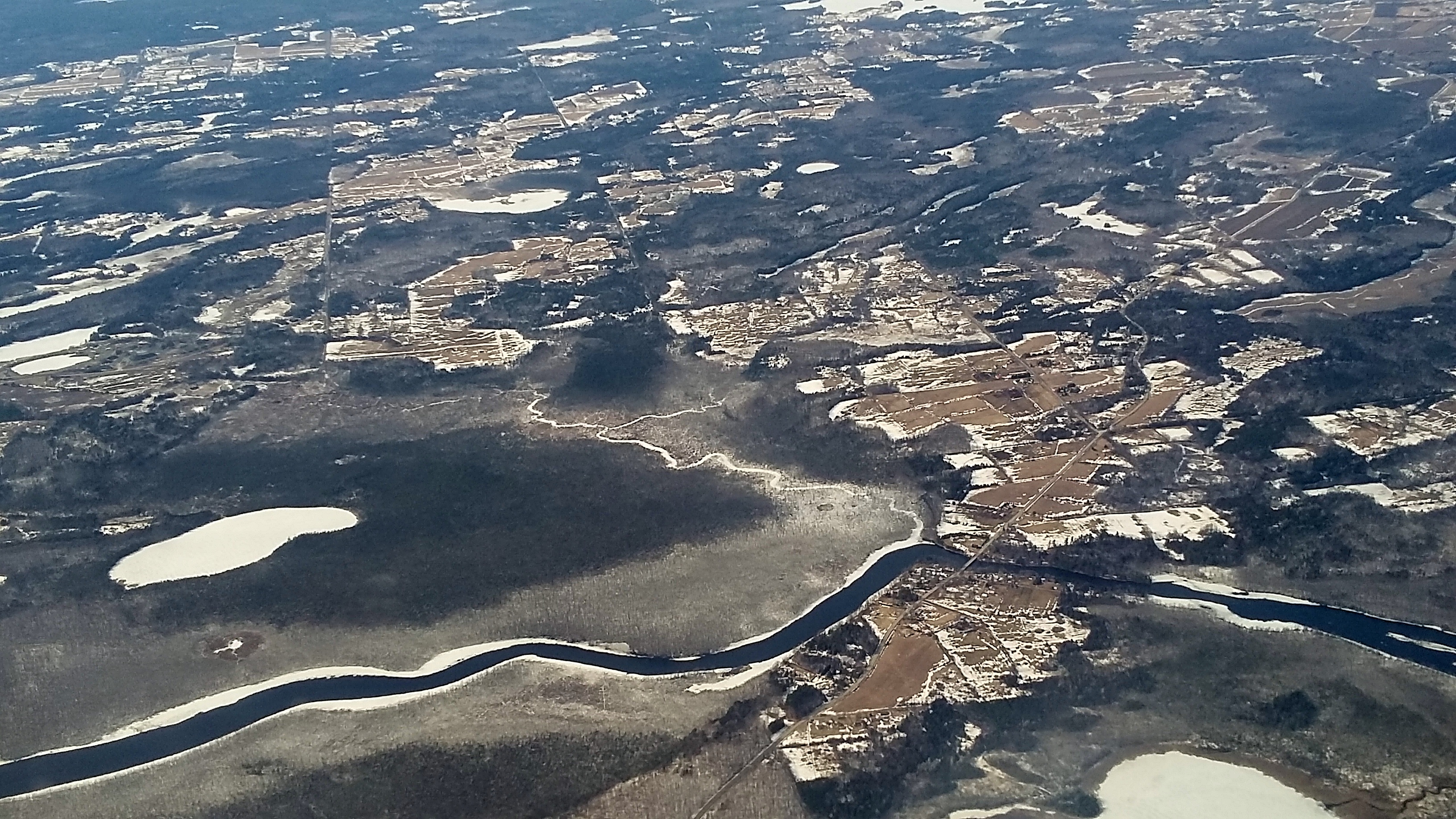
At the end of March, I left my two-year assignment in Haiti. Amazingly, two months have passed since I flew out. I’ve been back and forth across the Atlantic Ocean and the North American continent twice each, since then. This whole post-mission period, however long it will last, all began with a day on which I flew from tropical, hot, dusty and green Port au Prince, to what you are seeing in this post. Since my US base is coastal California, I very rarely bump up against snow and ice. Which made those days in Canada especially interesting and hard to adapt to! I was in both Toronto and Ottawa, for work meetings and some public speaking – you’ll find links to a few of the interviews I did (all in French) in the post just below this, or in the “about Paul and smw, slt” page. For now, just some of the sights of wintry-spring in Toronto, Ottawa, and on the plane between the two — including some shots taken while our plane was being de-iced before takeoff when I left Ottawa, and airplane views of a still-frozen countryside. I hope you’ll enjoy some of these shots despite the gray skies!