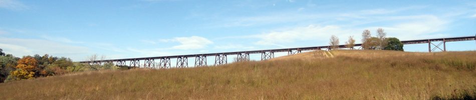
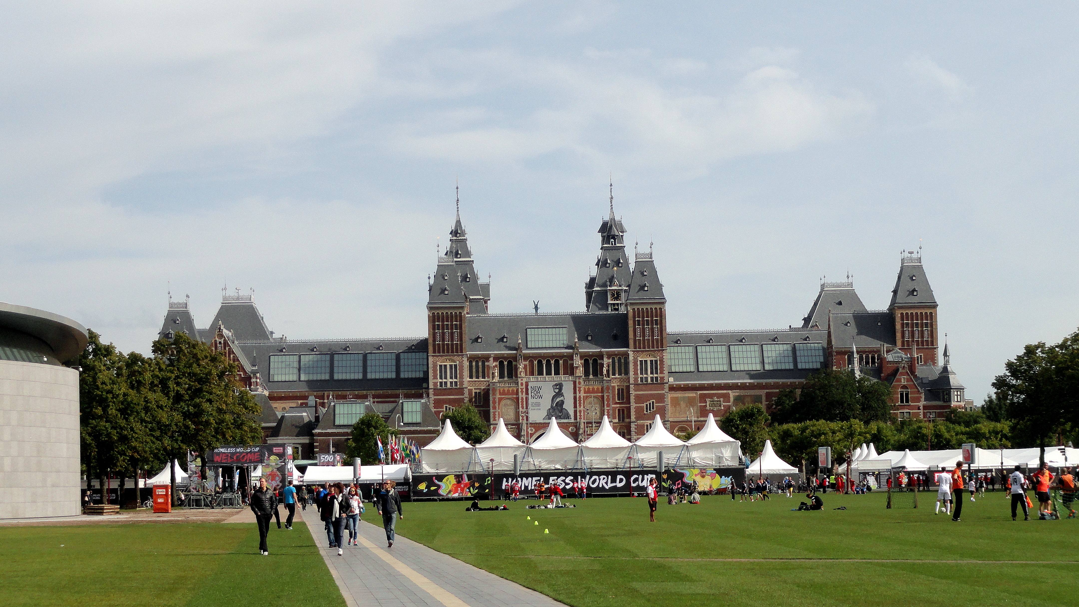
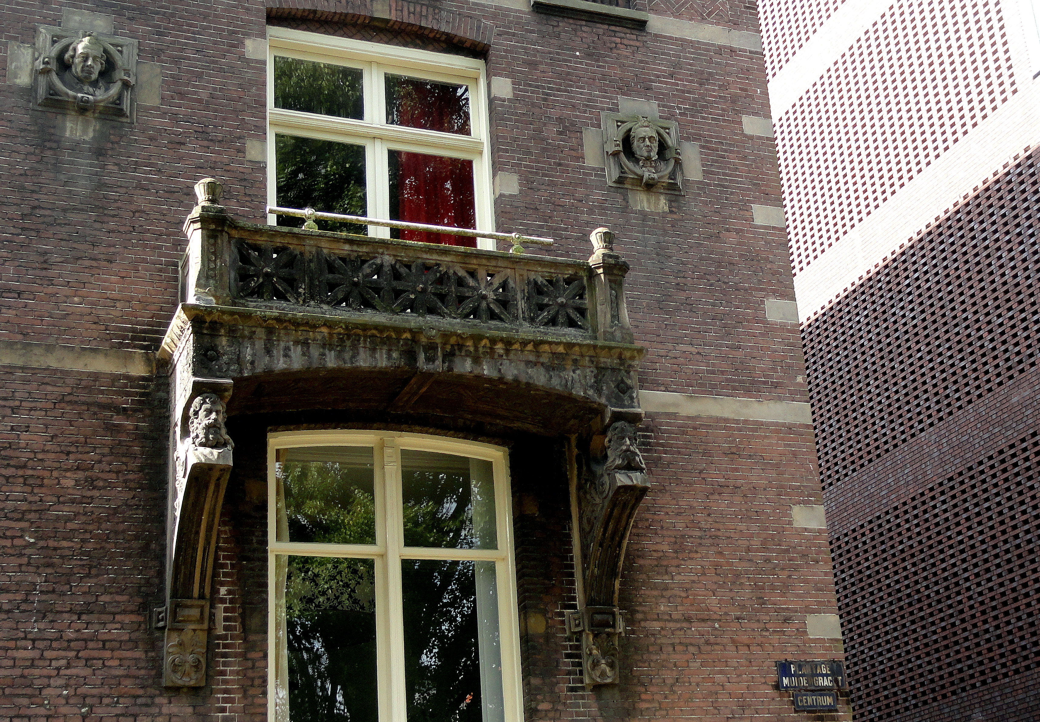
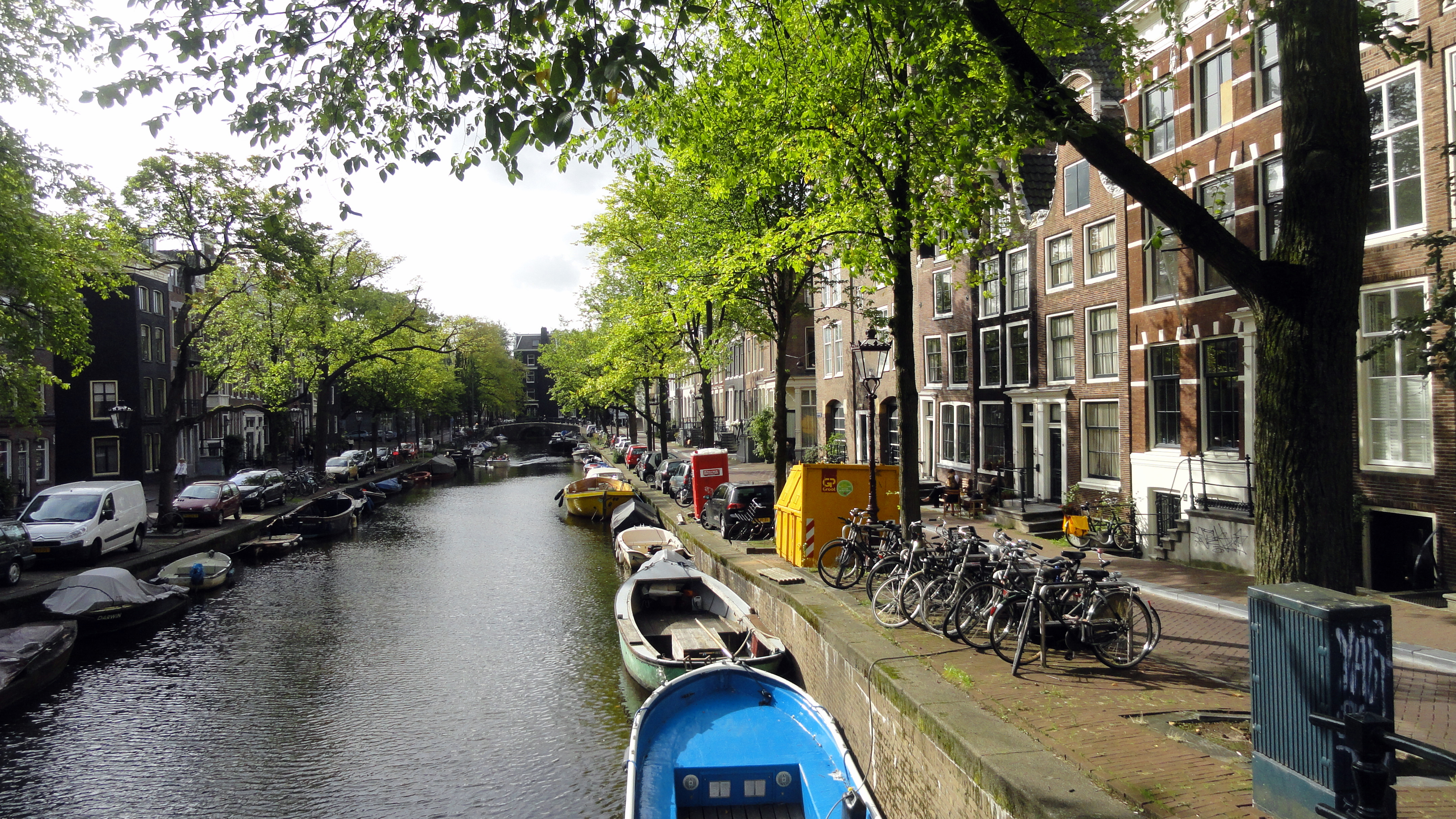
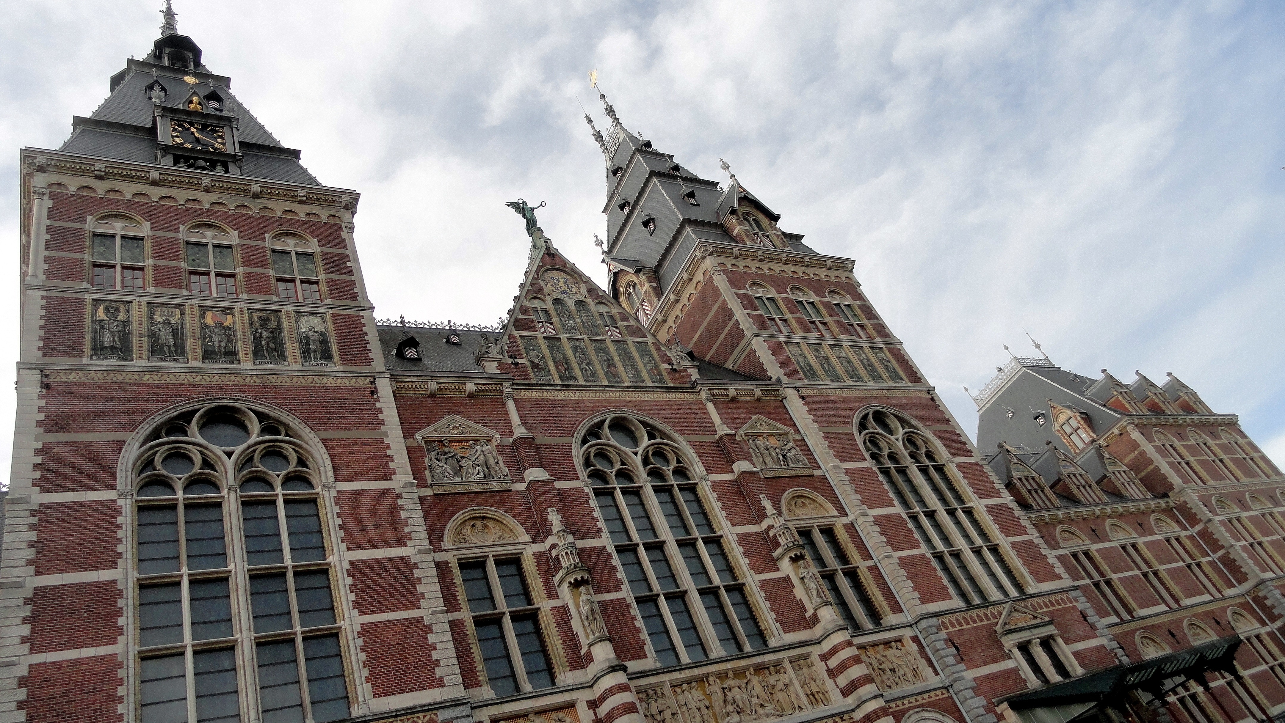
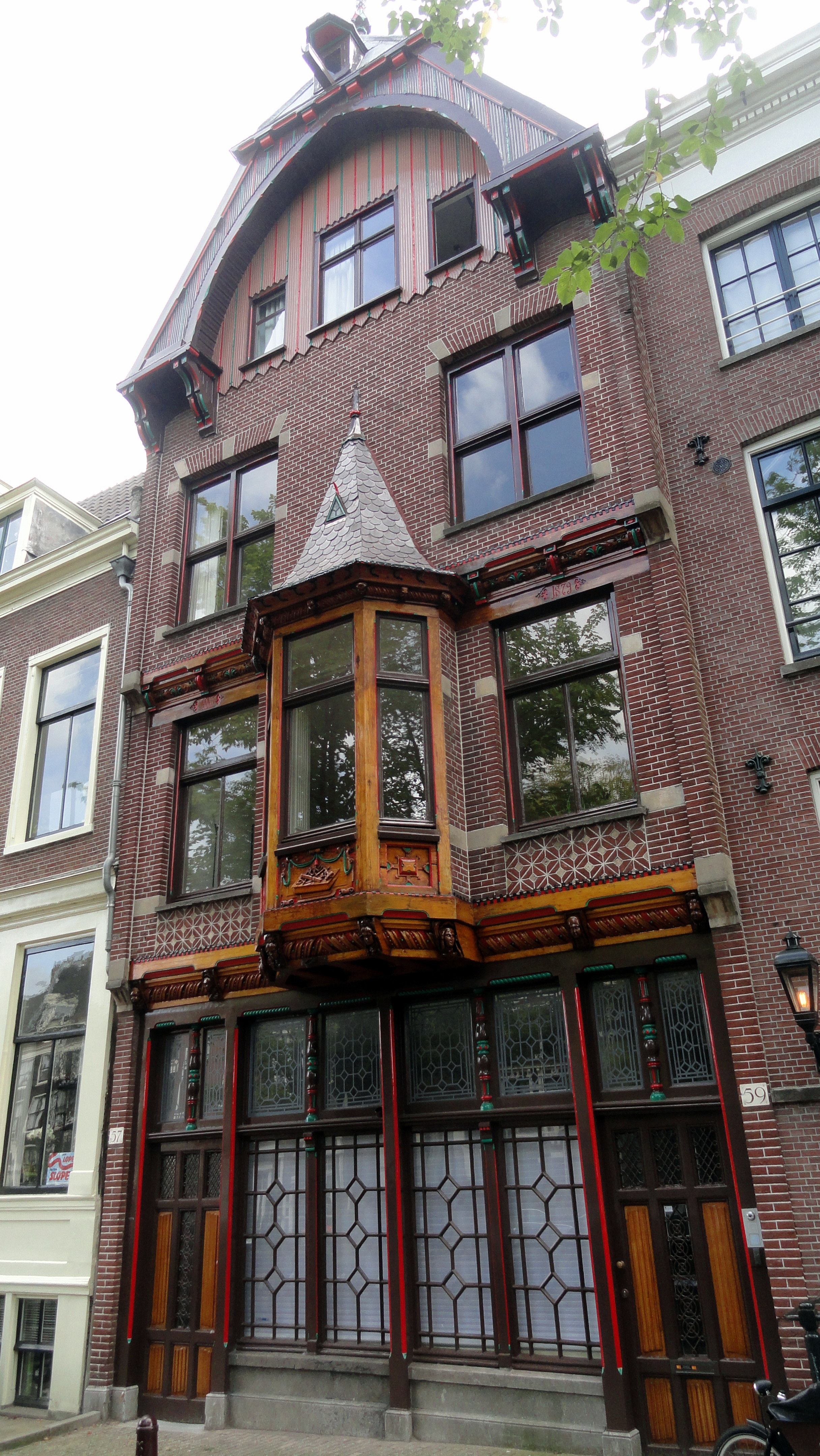
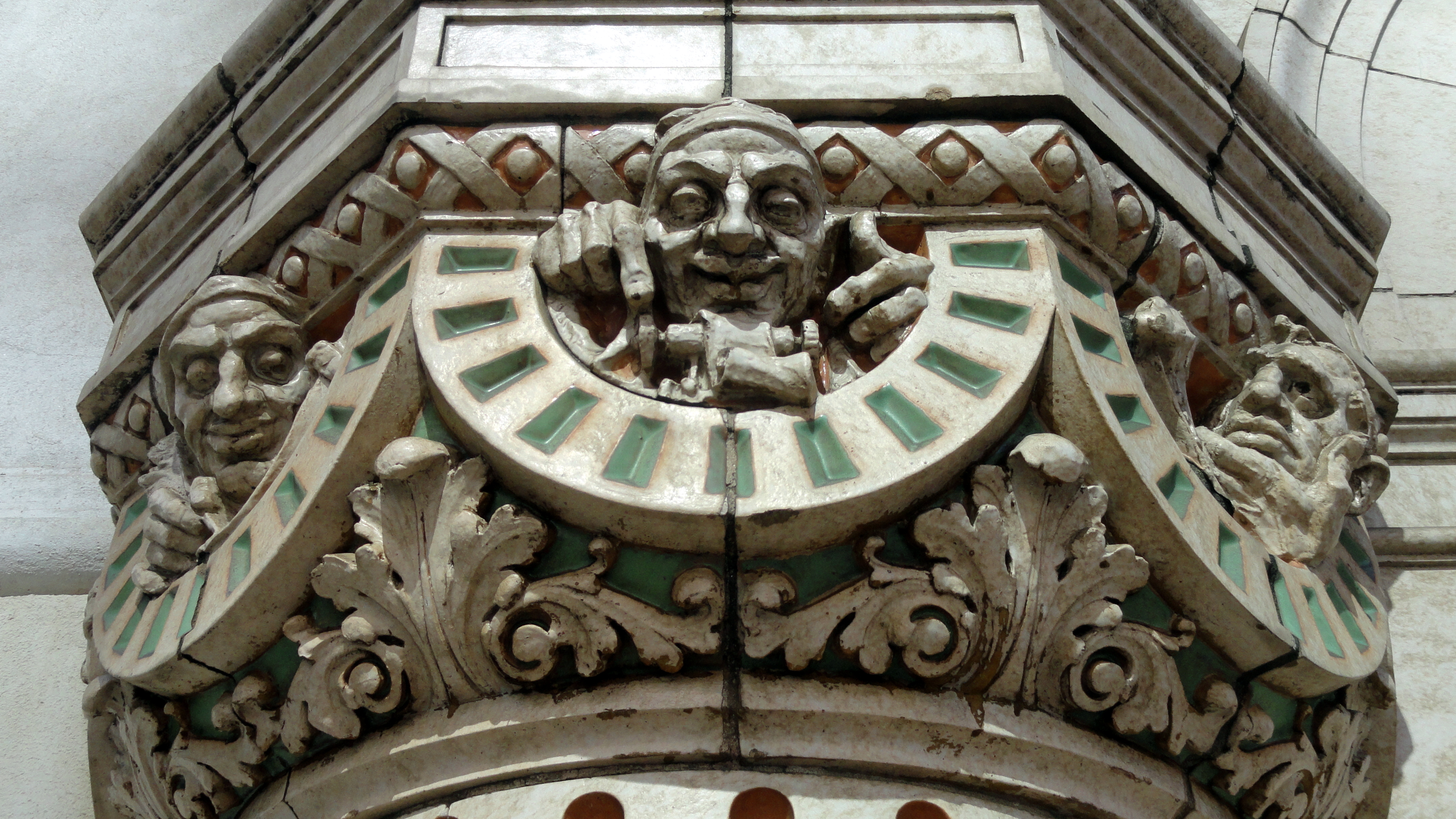
 One thing I’ve loved in my current work is the chance to pass through Amsterdam once or twice a year, depending on length of assignment and timing of planning meetings, etc. Seeing a city regularly over several years, for visits ranging from one or two days to longer than a week, gives a sense of familiarity that also causes me to dig down and try to find details and nuances in buildings, streets, canals, that I might not have noticed before. On my most recent visit, in mid September, I sadly didn’t take my camera out with me on the two or three sunniest days, and many of the others I was just too tired after a long working day to capture much. Still, I did get out and note a new element or two in obscure corners and famous landmarks that might interest my loyal friends and readers here at smw, slt… It’s an endlessly wonderful walking city when the weather’s at least reasonable, and rewards careful slow enjoyment in the quiet side streets and unusual corners.
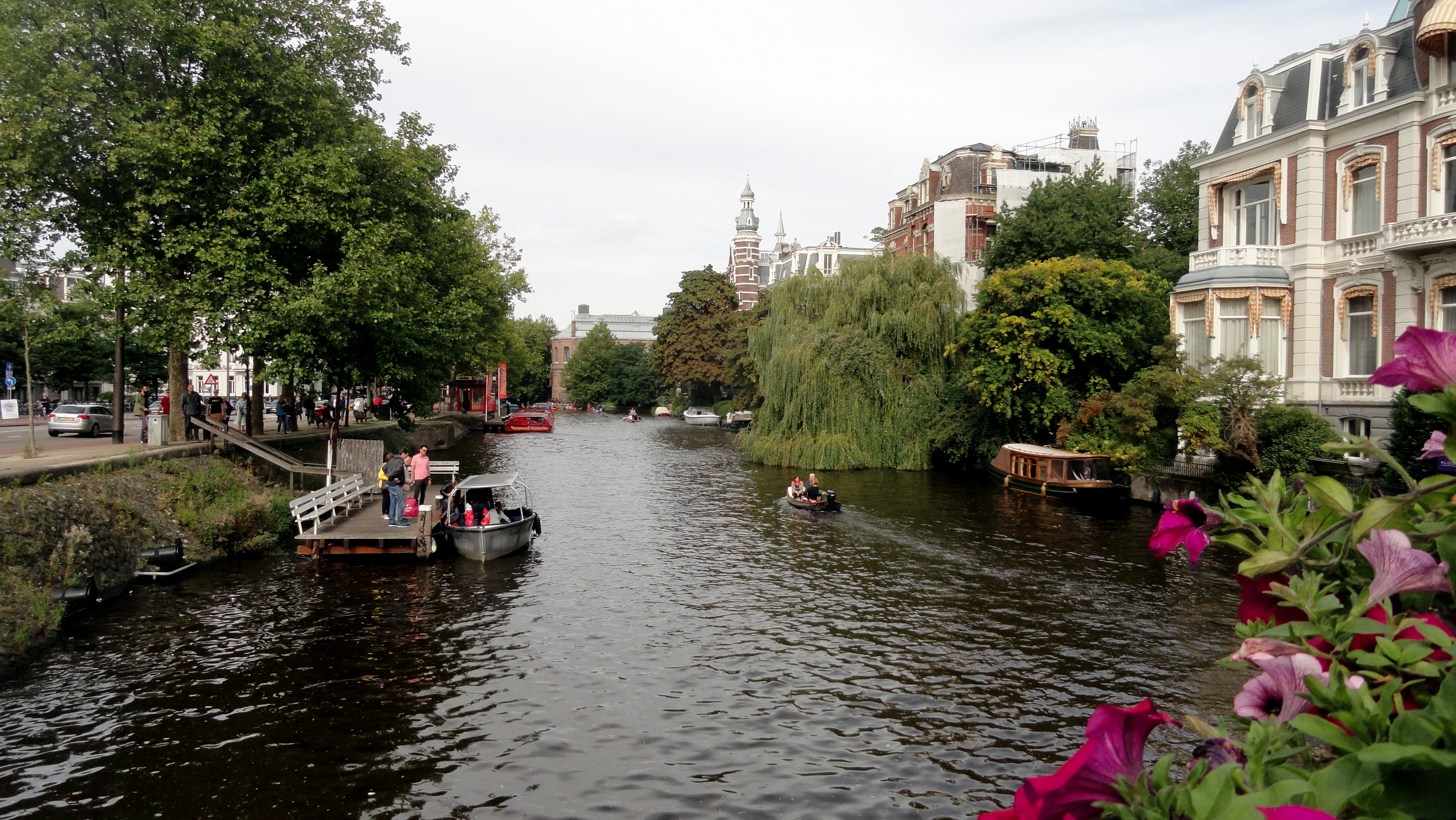
Latest
Angles on Amsterdam
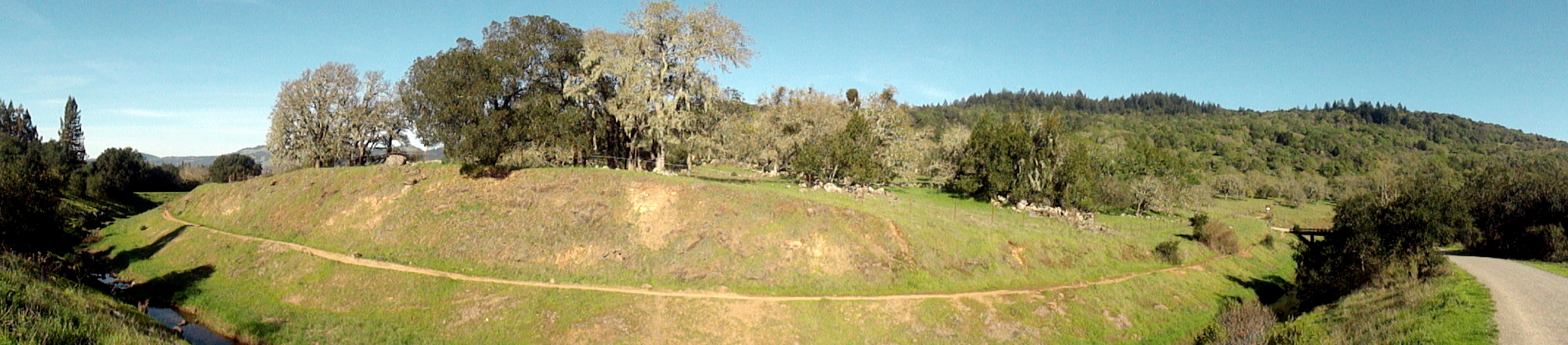
Seasons in Sonoma County
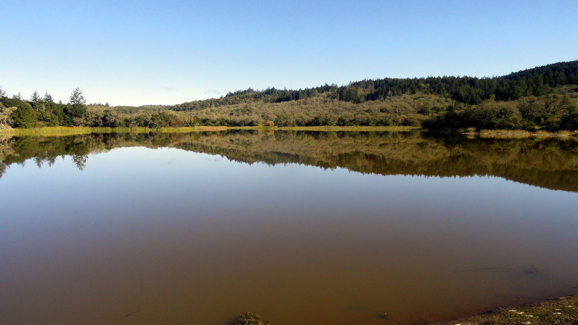
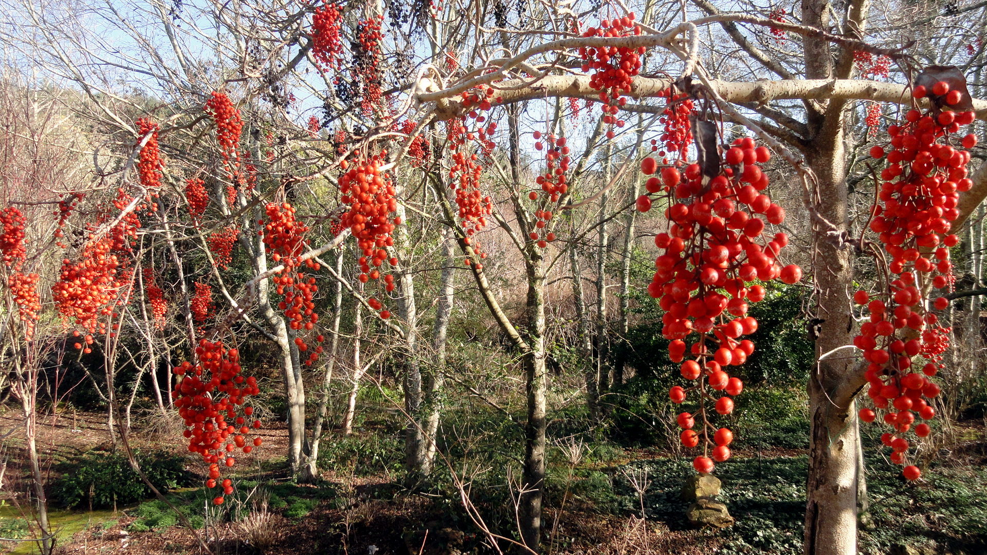
 When I moved from New York City to southern California, a long-time family friend told me I’d miss seasons. While not untrue, this was also not entirely true. The joke among southern Californians at the time was that there were seasons but they were just different from the classic northern four — in LA, one had fire season, mudslide season, etc. Now I’ve spent the past decade and more roaming among assignments mostly well within the world’s tropical bands, I’ve learned more about the seasons not of winter and summer, autumn and spring — but of wet and dry, all too often also of malaria and cholera. As a world we seem also to be learning about the less-bad and even-worse seasons to attempt crossing the Mediterranean in an overcrowded wooden boat in the urgent hope of providing for yourself, your children, your spouse some kind of safety or opportunity more than you and yours face in the horn of Africa or parts of the Arabian peninsula. And meanwhile, would-be presidential politicians in the US whose great-great grandparents left northern Europe as economic migrants wax sanctimonious and try to bar the gates behind them and limit opportunity only to those who look, think and act like them. Ah well: when the politics and pain of the world get too much for me I think about the green grass of winter, and the brown grass of summer, on the hills of California.
Herewith some examples of the same places, at different times of year. And let me add, for blog readers new and returning: I’ve made some changes in design and layout recently. One feature I’m personally addicted to is the header image on this page, which should shuffle through a bunch of different images, changing pretty much each time you come back to it. I’ve tried to pick some of the most interesting things I’ve seen since I started this little blog thing in early 2005…so please, if you see things up there that you especially like, or that you think aren’t strong or interesting enough, drop me a comment or shoot me a note. I’m enjoying fiddling with the design and layout, and always love to hear from readers, whether I’ve met you yet in person or not. Thanks!


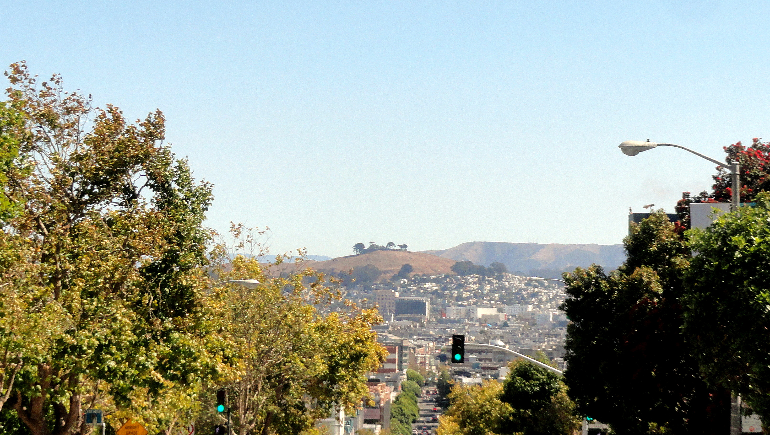
Hills & Halls of San Francisco

Readers may be aware that I’ve recently taken a short holiday from work in Haiti, to soothe my soul and celebrate another birthday in my home counties of the bay area. The airline complicated my return, much to my chagrin, with the silver lining of an extra, unplanned day in the city — which I used to take in a big-screen movie & walk some parts of the city that I frequent somewhat less often. From that day emerged these shots, which I hope you’ll enjoy. 🙂
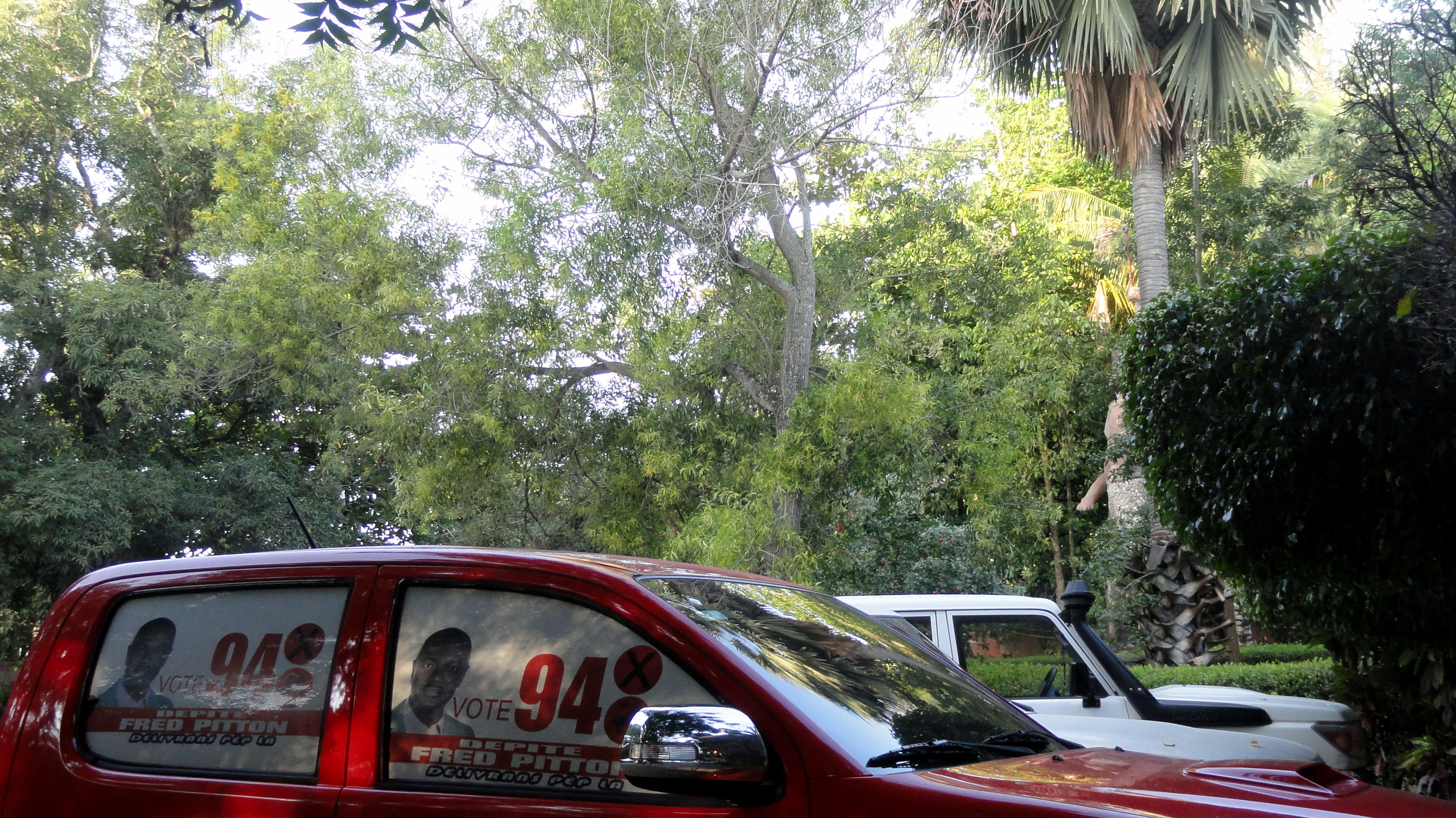
Campaign Season in Haiti
 smw, slt has been on a bit of a holiday back home in northern California. Here in the US I’ve enjoyed the antics of the current republican presidential front-runner – ah, such inanity. Back in Haiti where my work remains, tomorrow will be the first round of elections in what bids to be a remarkable election year: the last time Haitians went to the polls was not long after the earthquake, in late 2010. A president was elected then in a second-round run-off, with substantial and documented influence from the US and the OAS to eliminate one candidate and include that eventual winner in the second round instead. The government led by that president has not managed to realize municipal or legislative elections since then. They’ve been scheduled more than once in past years, but always cancelled before happening. With no electoral mandate remaining, parliament was dismissed in January and the president is ruling by decree, with a stated goal of using that power to ensure elections happen this year before his own electoral mandate runs out. Tomorrow is the first round for 2/3 of the senate (1/3 of them apparently still have legitimate electoral mandates, or some kind of special deal), and all deputies. I’ll fly back on Tuesday, and am following this from a distance with interest.

If the schedule goes as planned, late October will be an even bigger day: second round for these candidates (where no one wins a clear majority), first round for president, and the only round for all the mayors and other municipal posts that have been filled by appointment rather than election since their own elected terms have run out in recent years. Campaign graffiti on walls has been omnipresent in Port au Prince for months already, but formal posters and billboards started springing up everywhere, about a month ago when the official campaign season started – I think July 9 was the date. I’ve really enjoyed watching all the many posters pop up, seeing all the graffiti, and realizing how similar the political slogans are to what I’ve seen in any country anywhere. (My favorite, not yet captured on camera but I’ll try when I get back, is the female candidate for a post in the Western Department of which PaP is part, whose slogan is “Les actions parlent plus fort que les mots ” — actions speak louder than words. I wonder what those actions will/would be if she’s elected!) I really hope that this big electoral season manages to happen fairly and without any major violence or problems, and thought maybe some of my readers would enjoy seeing signs of the season from Haiti, even though I didn’t get as many or as much variety as I’d have liked.


Mountains, Lake, Mountains, Sunsets

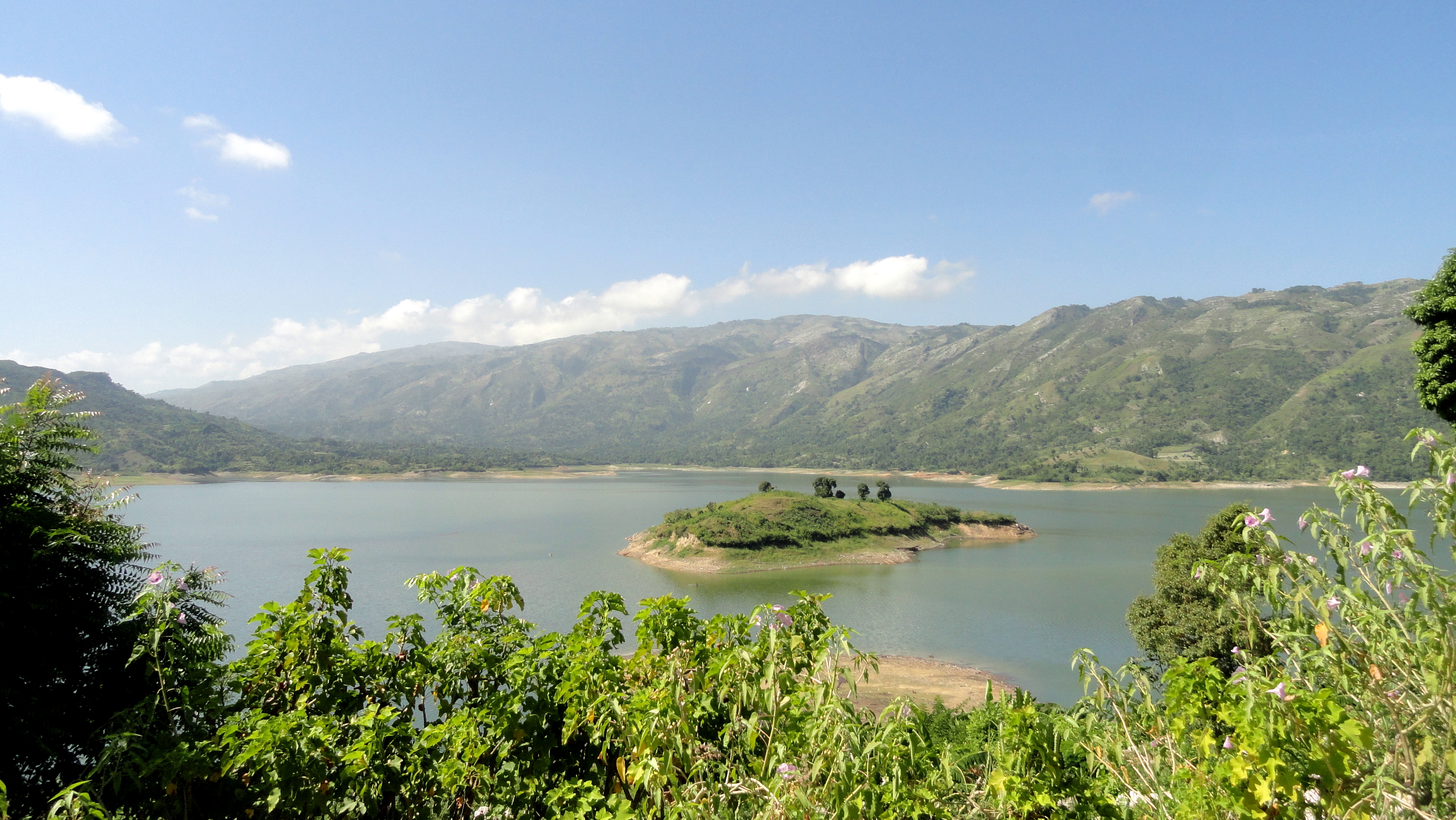
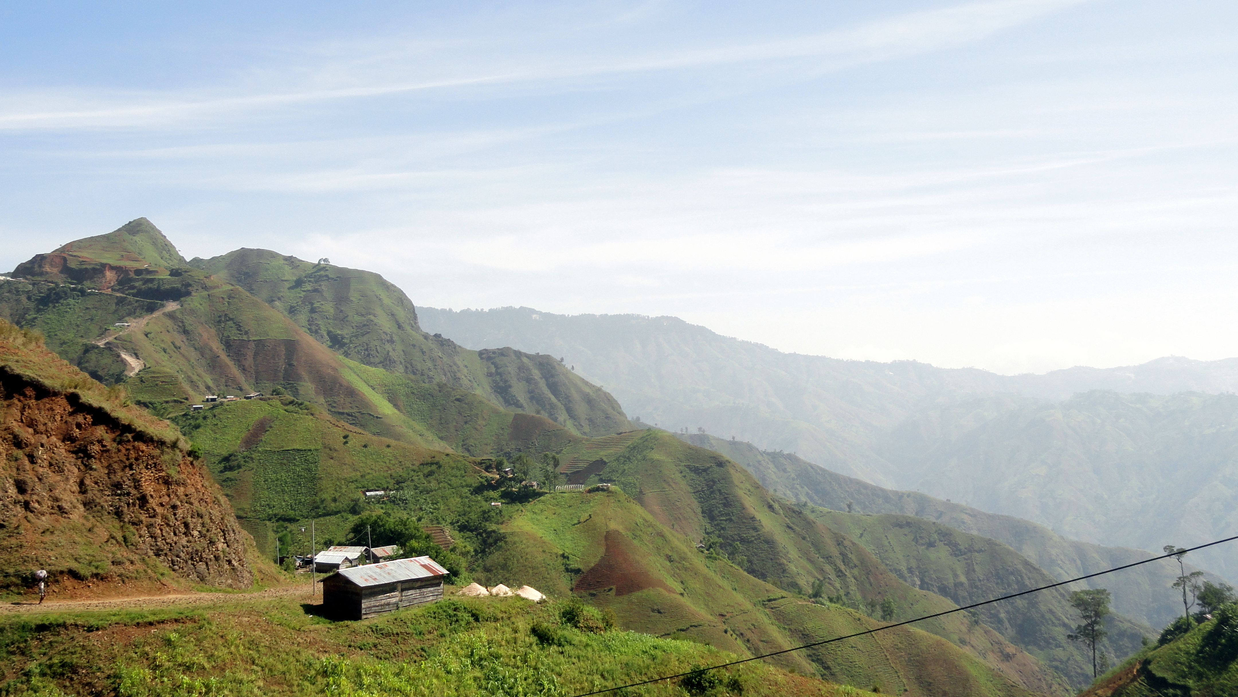
One thing many outsiders (especially in the US) know about Haiti is the popular refrain “mountains beyond mountains,” to describe the highly mountainous terrain most common here. Recently I’ve gotten out again a bit: up to Hinche in the Central Department here, driving through lovely green farming terrain along the way…and, indeed, getting a sense of the mountains which criss-cross this country, rank upon rank. These are mostly just shots taken during the drives, or in and around the hotel we stayed at in Hinche. There are also a few bits and pieces from here in Port-au-Prince and environs, just for fun.
It’s election season, with the first round due on August 9th; I’ve been trying to capture shots of the election posters and so on, and hope to put some of those up for your enjoyment in another post within the next few weeks. Right now, I’m about to take a short vacation back home in California, and I admit I’m excited for some down time. Hope everyone’s well, and enjoy the shots.


Walking to La Visite
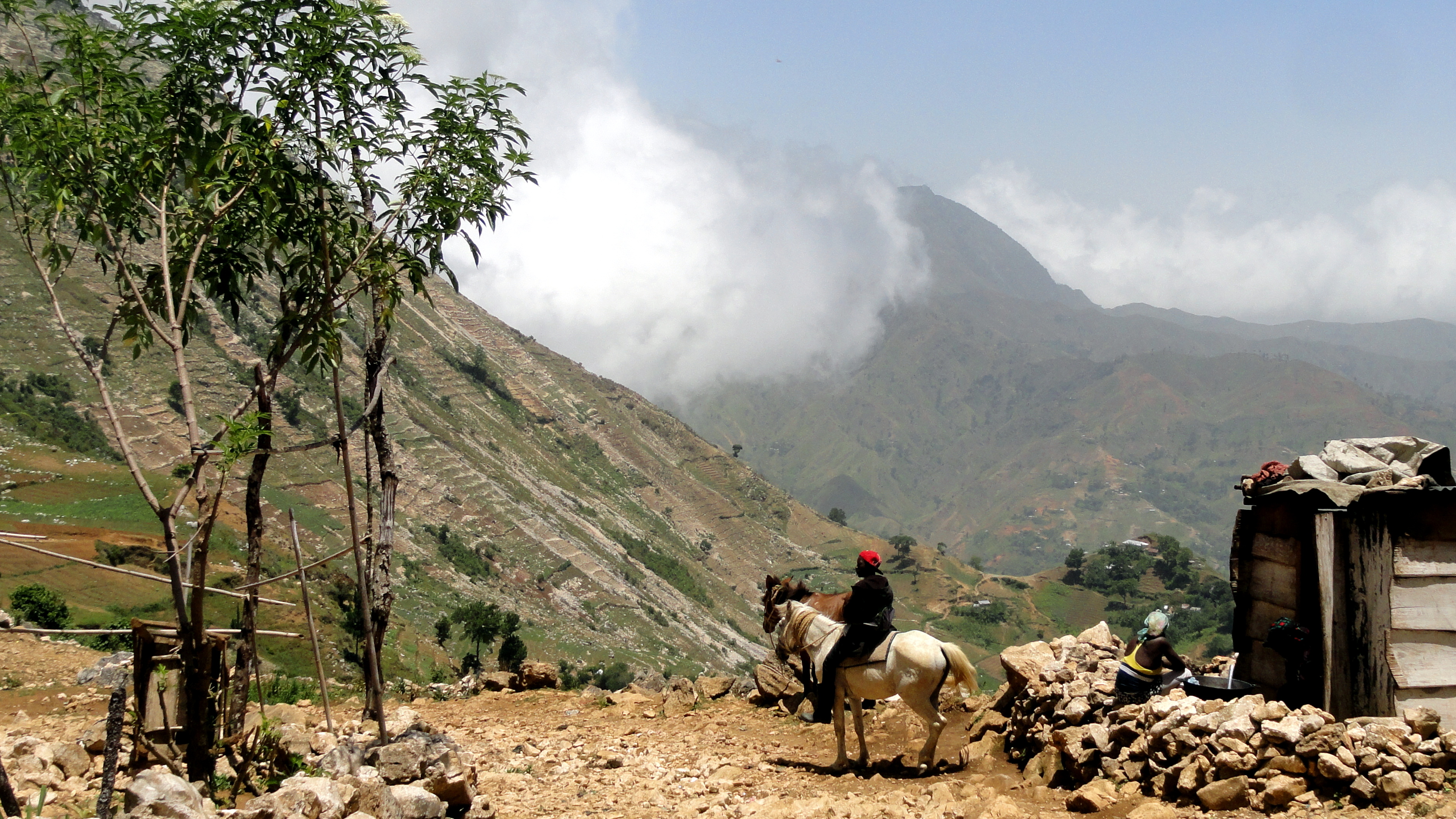
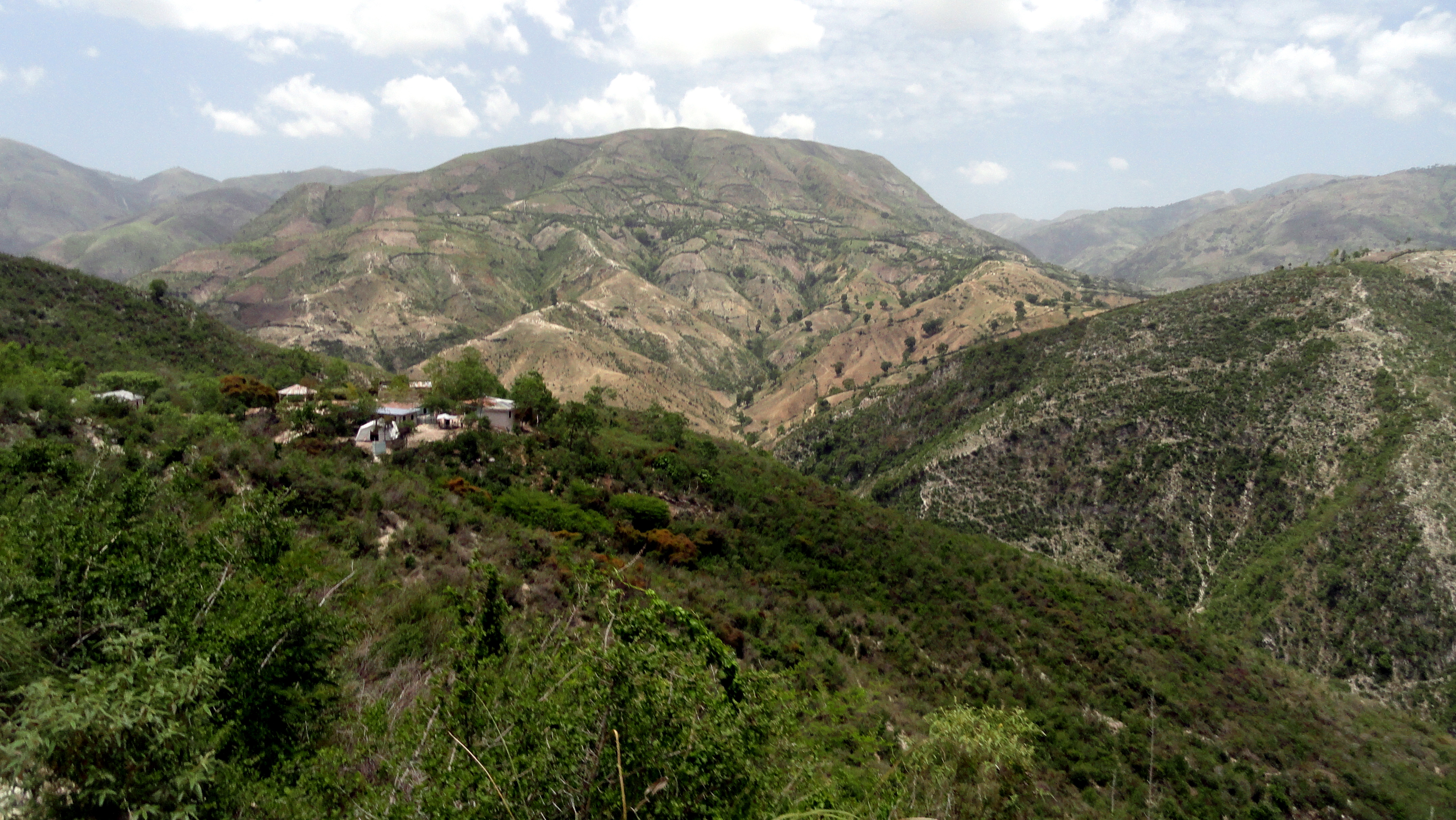
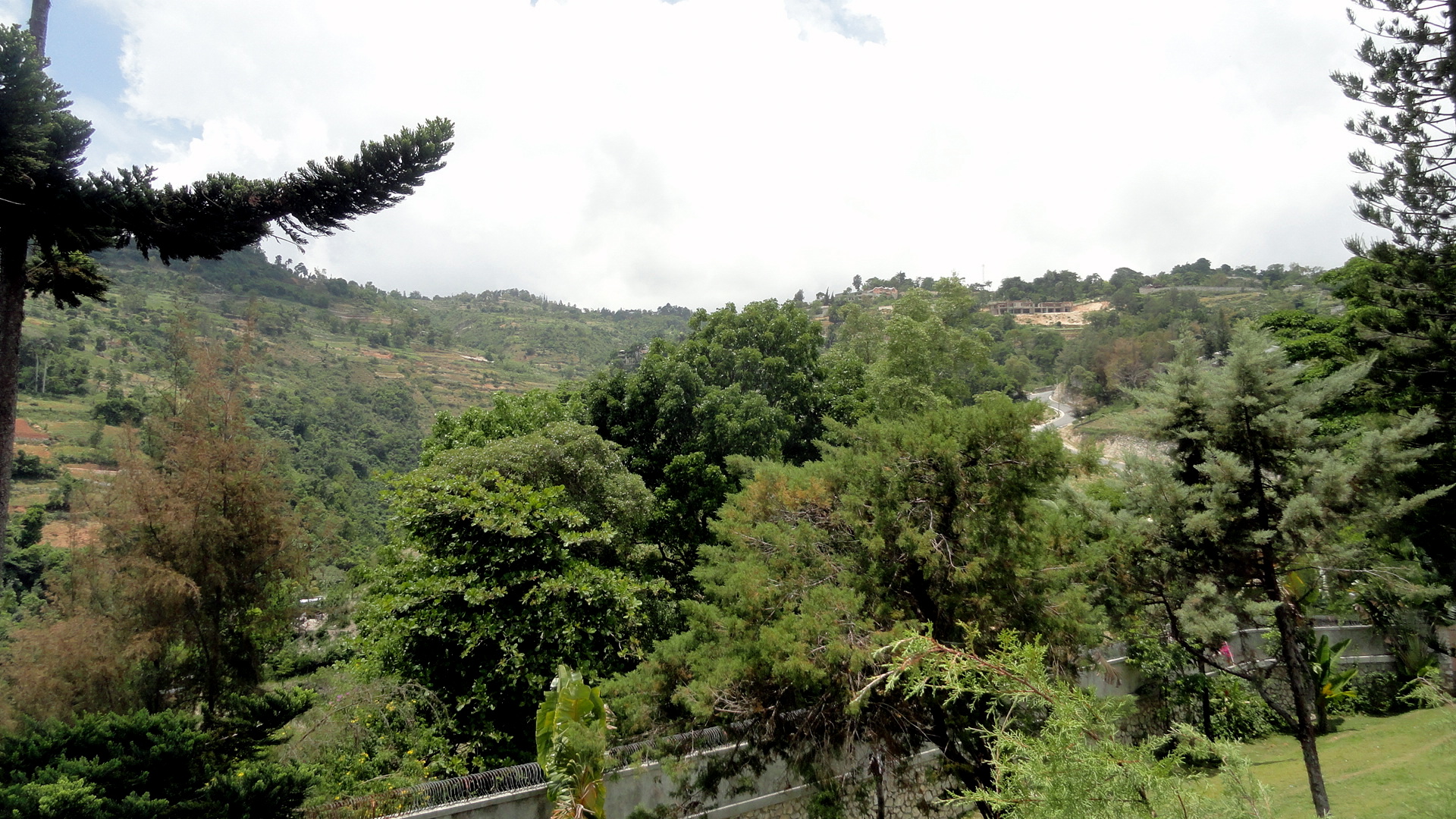
 A thing I learned long ago is that Haiti is almost entirely deforested. In the last post I put up, from a short trip I took up the coast to Arcahaie (about an hour north of PaP), you could see evidence of this fact in the hills I showed. And PaP too is nearly treeless – and full of cars, people, and dust at this time of year. Last weekend four colleagues and I drove to a town about an hour south of PaP, beyond Kenscoff village high in the mountains at the southern base of PaP, to a point where even a good 4wd vehicle really won’t be able to cover the road any more. (As we learned in our onward walk, motorcycles DO make the onward journey, though it’s not one I’d relish making that way.) In any case, the point of being deposited in this little town is that one can – and every weekend some handful of expats living in the capital, and apparently some straight-up tourists as well – do get dropped off in that town and start the walk further south, aiming to end up (after four or five hours of walking in hot sun on mostly shade-free road) and spend the night at what turns out to be quite a lovely little guesthouse set inside what’s now Parc Nationale La Visite. One reads, in a lovely coffee-table book available for sale at the guest house, that the national park is recently created, and that less than 2% of Haiti’s forest is protected. During the visit we played cards and chatted a bit with another American guy who’s part of a program to pay landowners to not cut down their trees for firewood or to sell for making charcoal, construction, etc.
As you’ll see in these shots, the deforested steep mountainsides can certainly be beautiful…but look closely and you’ll also see apparent evidence of erosion, and of rocks left behind in landslides. (Some of the rocks seemed to be eroded lava from more ancient flows, but I’m no geologist so I might be quite wrong.) We wondered how much longer before all the top soil washes into the sea…and without trees to rot and replace it, what will be left? Again, not my area of expertise, but when I consider the amount of agricultural products I saw being carried on people’s heads or panniers on mules, and which we ate during our short stay at the guest house, I hope enough is retained to keep providing PaP etc. with food to eat. (That handful of expats hiking the road weaves into a much larger stream of foot, mule and motorcycle traffic, much of which is clearly geared at getting nice fresh produce to market.) For us it was mainly a lovely 2 days of walking and enjoying beautiful vistas and some stretches of forest which, without realizing it, we’d all grown to miss during our weeks and months on the dusty, busy streets of PaP. I did edit the photos, but not enough, I acknowledge. Sorry – after weeks with little but buildings to look at, I got a bit shutter-happy.

You’ll notice these three shots in a row show the same things from different angles and perspectives. My attempt to give a sense of how things fit together in this steep mountainous zone of windy roads...


Dry Hills of Arcahaie

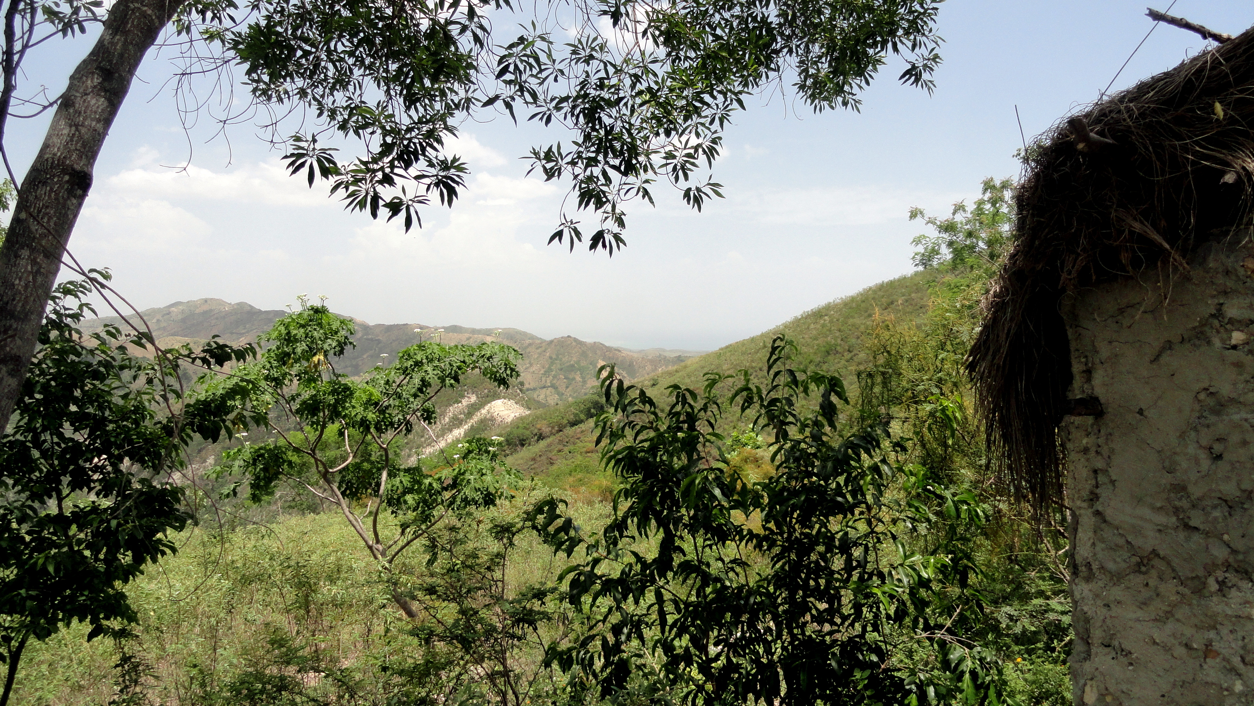
 Arcahaie is a small city on the coast north of PaP, and the first place outside metropolitan PaP that I’ve been so far. This was a work trip, with the team to visit some of the locations where we’ve been supporting oral rehydration points for cholera patients (creating a spot where very sick people can get rehydrated fast, after traveling often quite long distances from even further into the hills you see here on bumpy roads by foot, motorcycle or animal of some sort). The idea is for the staff of these points to get patients well enough to be out of danger and then transfer them to a facility with full care until they’re really well. Anyhoo, though, since this is a personal not a work blog, and since this was the first view I got of those many mountains beyond mountains for which Haiti’s become so well known by so many who’ve never been here, I took my camera and made some photos. And yes, the hills are as sadly deforested as I’ve read…and yes, it was as hot as it looks. (It was brutal.) Still and all, great to get out and about, and the local neighbors we ran into were friendly and interested. One of the kids above took a few selfies and enjoyed looking in the screen after.
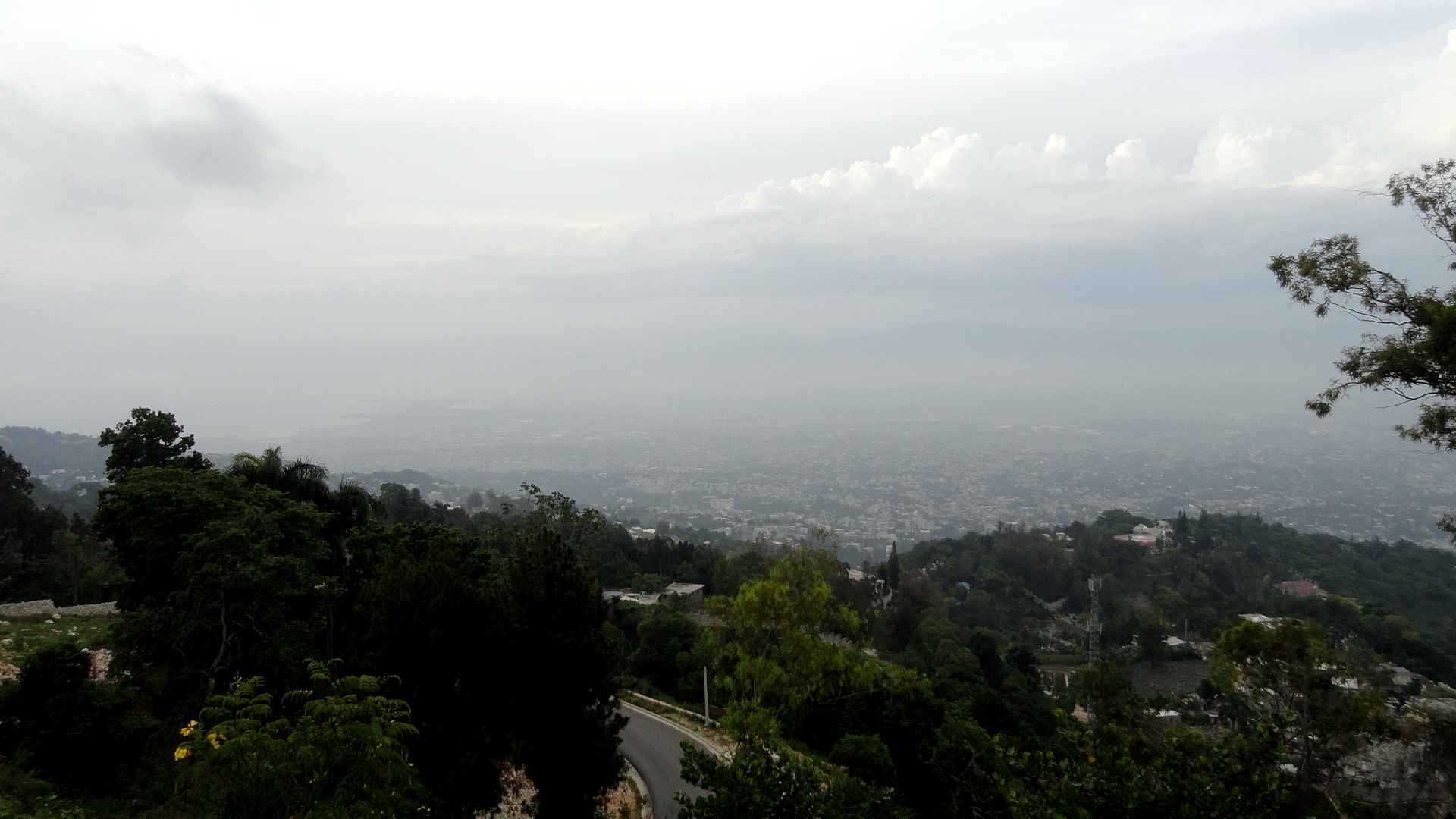
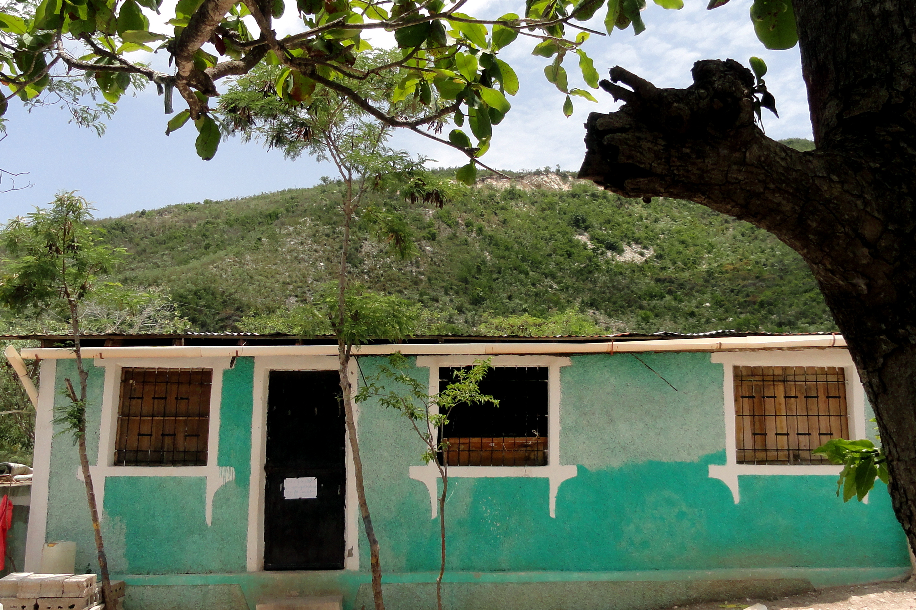 The shot below, and two in the gallery of circles further down, are the only ones in this set from Port au Prince rather than Arcahaie: if you enlarge the shot below, and look closely, you’ll see that there’s a city below and behind the trees & the lovely red flame tree. I drive past this every day on my way to work — that’s the main part of the city of PaP as seen from Montagne Noir which lies directly to the south. I waited and waited and waited for a clearer day, but it’s been hazy and humid most of the time and I worried we’d lose the bright color of the flame tree which makes it so beautiful. Further down are a close up, and a bigger shot, of plants growing from one of the stone retaining & protective walls which surround so many compounds around Montagne Noir.
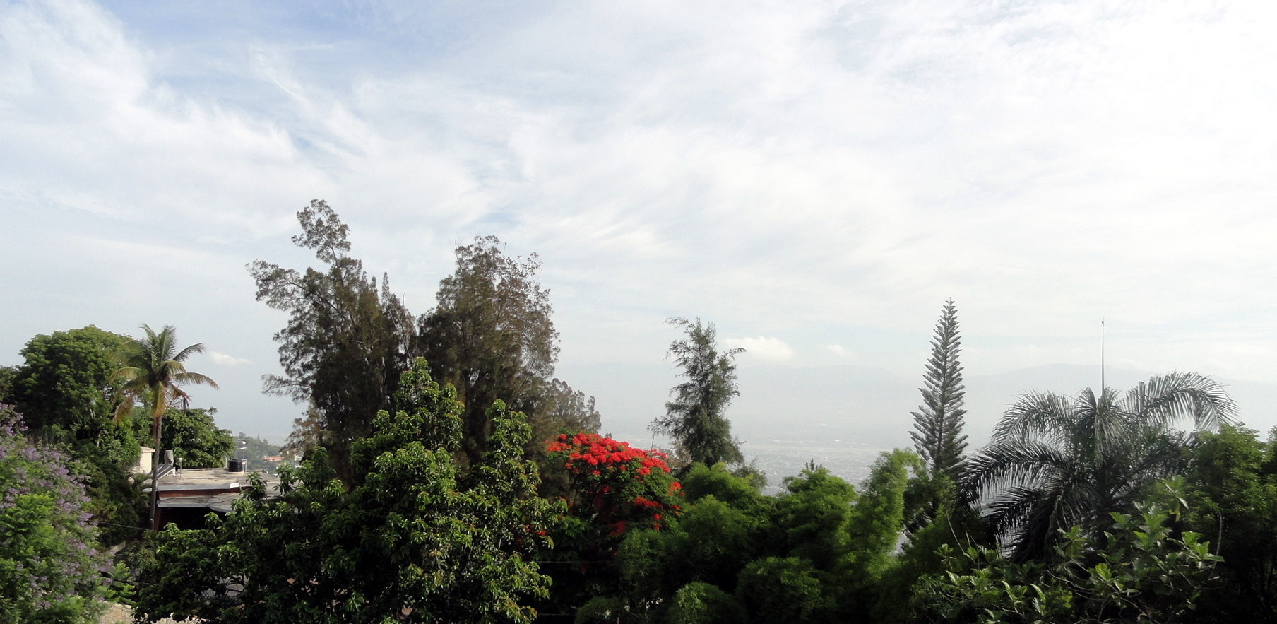


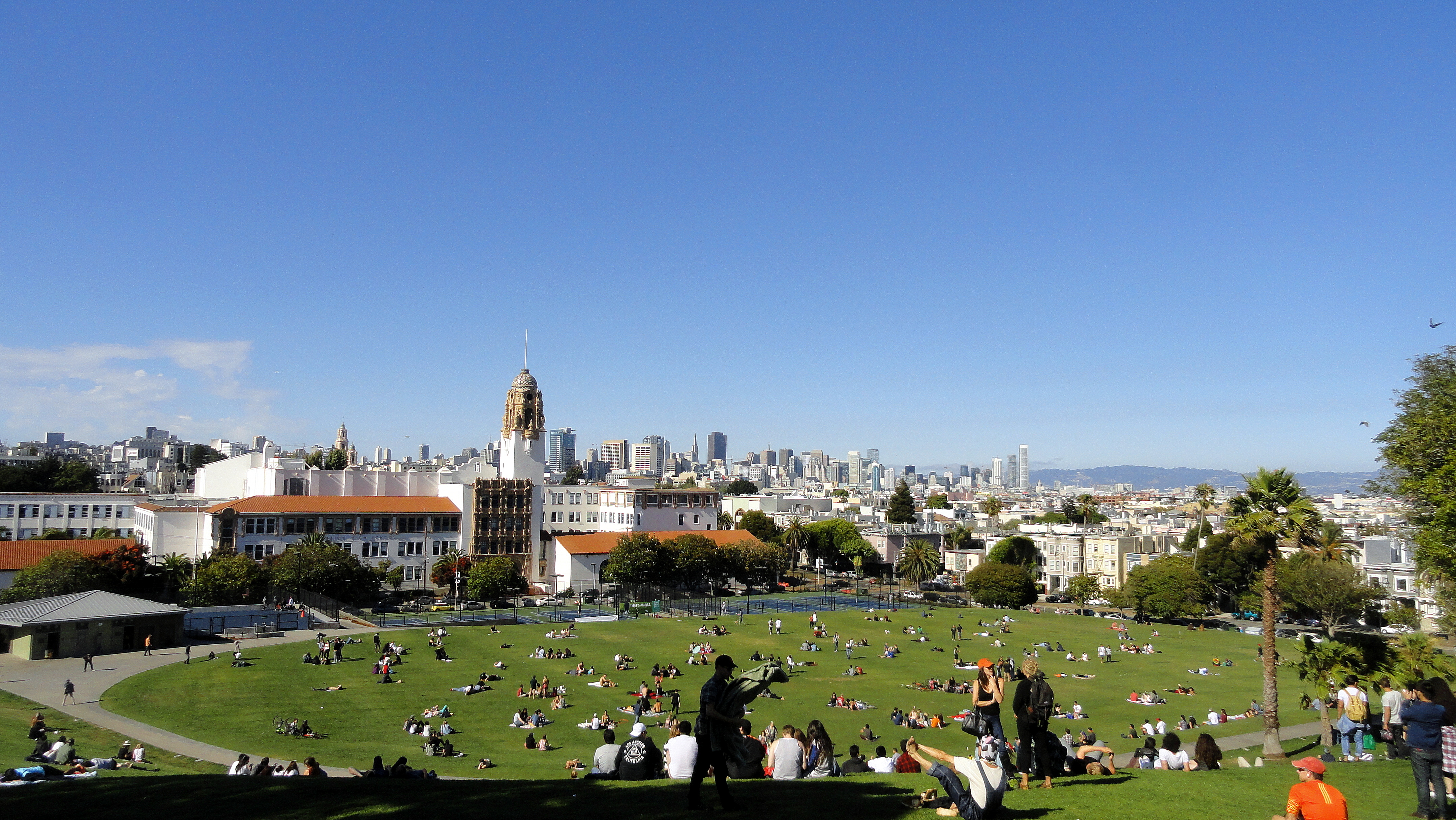
On & Around San Francisco Bay
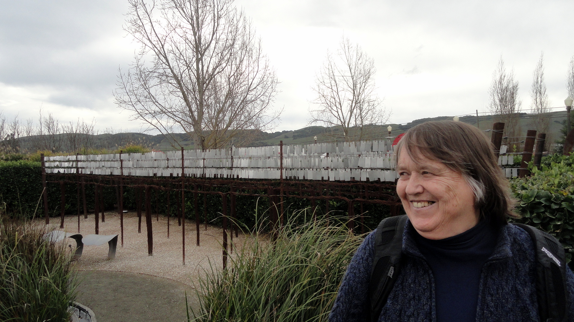
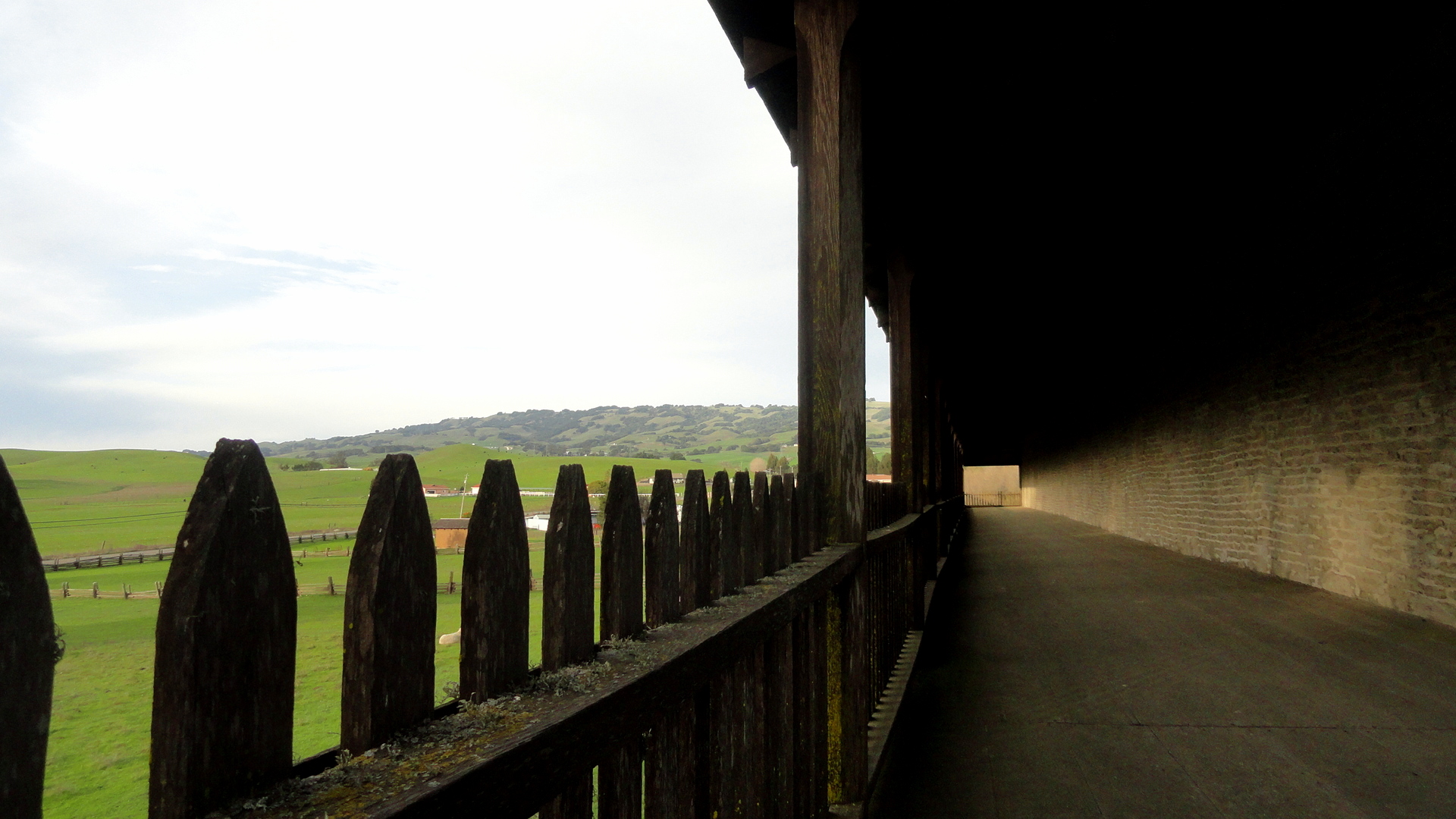
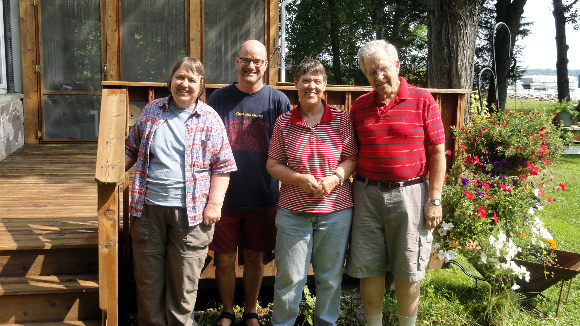
 …plus a few remnants from a series one might call ‘airports of the world.’ smw, slt has not gotten out and about with the camera much these past weeks, but I did realize there was a small cache of photos from some boat trips on the bay, and some hikes in Marin and Sonoma counties, that had not yet been posted. Since I get a bit homesick sometimes when I’m so far away, I’m putting these up so that I have an easy way to scan over them from time to time and remind myself what home looks like. Maybe some of you will enjoy it as well. All the photos have descriptive file names that show up if you hover over them or open them separately, I think. In the slide show below, you’ll see a panorama which goes from the Bay Bridge on the left (east), across the full waterfront of northern SF, to the Golden Gate Bridge & Marin Headlands on the right (west). Further down you’ll see some hiking shots from the trails in Tennessee Valley (Marin county), and Annadel State Park & Hood Mountain Regional Park (Sonoma County). In one of them you’ll see frost on the ground in the shadowy foreground: that was Christmas day last year – ah, how I long for frost on a hot afternoon here in Port au Prince! At the end are some photos of me and friends – at Wolf House in Jack London State Historic Park (Sonoma County) … and, well, me looking as lost as I felt, with some colleagues in Casablanca airport on my way home from Sierra Leone, last December. Our flight out of Freetown had been at some crazy hour like 2 am or 3 am or something, so we took the ferry over to the airport at 10pm or so, and snoozed in the waiting area and then flew for three hours to Casablanca to land at something like 8 in the morning. Oy, airports in which we have waited listlessly: might be a future series, what do you think?


Monuments of Port-au-Prince
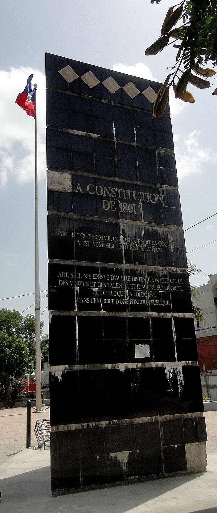
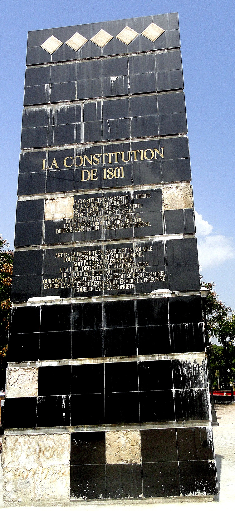
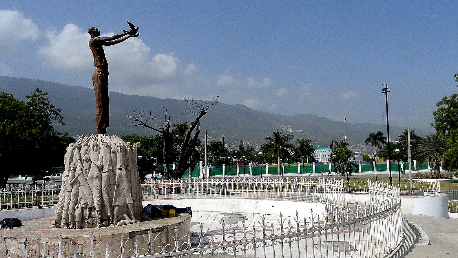 Napoleon Bonaparte wrote the following, in his memoirs from St. Helena: J’ai a me reprocher une tentative sur cette colonie, lors du consulat; c’était une grande faute que de vouloir la soumettre par la force; je devais me contenter de la gouverner par l’intermédiaire de Toussaint. (Thanks to Madison Smartt Bell in whose magnificent historical-fiction trilogy on the Haitian revolution I found that.) He’s basically saying that he made a big mistake trying to reconquer the self-liberated former slaves of this colony, instead of being content to rule the colony through their leader. I took the photos in this entry during a weekend morning exploring the heart of downtown Port-au-Prince, which is well-stocked with monuments to this country’s absolutely astounding history. So I’ll just give a quick and highly selective review of that history and ask a what-if or two.
Imagine that a man born into slavery, and without formal education, rises to a point where he organizes and leads a slave revolt which fights off the Spanish and British, restoring control of Hispaniola (the whole island, at one point) to the French Republic. Toussaint Louverture, spurred by Napoleon’s statement that the colony would need some new laws, then drafts a constitution which leaves the colony basically part of France but with a lot of home rule (some quotes are seen below in the three tall photos); and Napoleon basically responds by sending out a massive fleet, betraying and arresting Toussaint so he dies in prison in France…and then the former slaves of Saint Domingue get really mad, and with the help of yellow fever and the leadership of Dessalines and a few other key formerly-slave generals manage to permanently push the French out of the island, thereby defeating one of the world’s most powerful nations.

 You could be forgiven for thinking such an interesting story would be widely known in the world. You might think the great democratic powers of the day – France and the U.S., eh? – would have welcomed this new republic & bastion of freedom, and developed warm ties of trade and friendship with it. (Especially if you consider that it was Napoleon’s grinding defeat here which forced him to sell the Louisiana territories to the US, step one of our gradual expansion to the Pacific.) You’d be wrong – France ran naval blockades and always threatened invasion until they forced the Haitians to buy themselves free with crippling debts that they were still paying well into the 1900s. (Thought experiment: what if Britain had done the same to us??) The US – with an economy in the south that depended on slave labor and continued to abduct people from West Africa and ship them across the ocean in chains for many more decades – didn’t choose to recognize Haiti’s independence until 1860. (Thought experiment: what if my own ancestors had crossed the ocean in chains and been sold in chains upon landing, rather than being given a homestead of redistributed formerly-Native American lands on the great plains?)
This country has an absolutely amazing history and I find it shocking, if sadly predictable, that its important place in history has rarely been appreciated beyond its shores. It has seemed to me since the 1980s that lots of people outside Haiti are free with opinions about what the country should or shouldn’t do, what’s right or wrong with its government or economic system, etc. – and I really wonder how many of those people with those opinions have taken time to think about (let alone interact respectfully with) the people of Haiti, their history, and their own desires as one of the earliest self-created nations in this hemisphere. Though it’s been shattered by the earthquake and battered by violent changes of government many times in recent decades, Port-au-Prince remains a great place to ponder this country’s rich history…and to hope for a brighter and more prosperous future with, might I add, a bit more external respect shown for this country and its people.


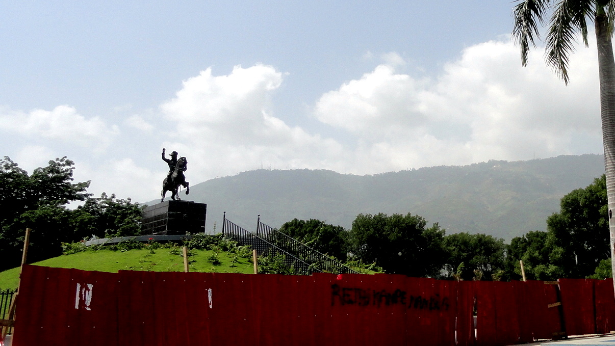
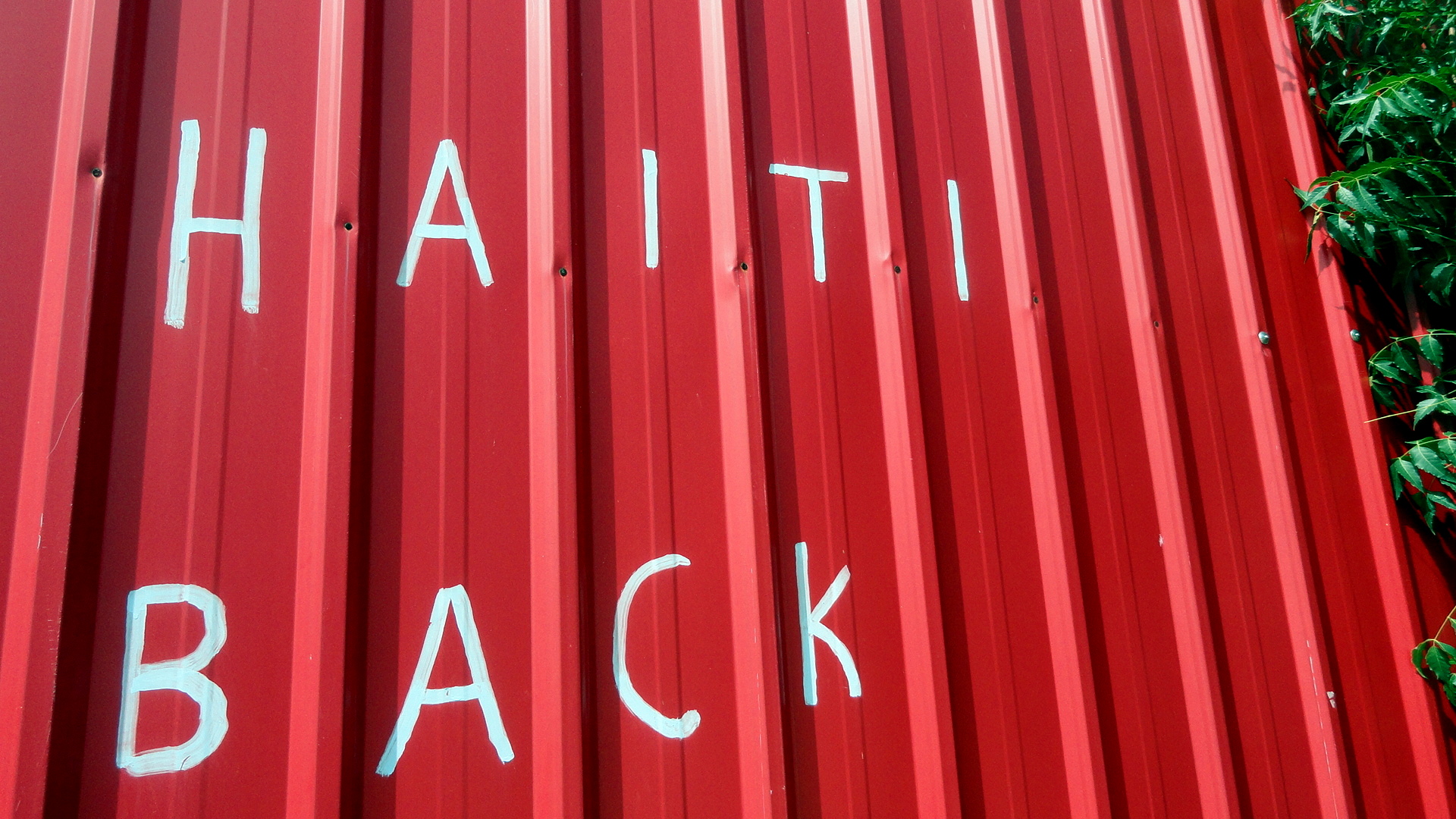
…immediately above is the monument to Dessalines. As you can tell, much of downtown is still under reconstruction but I’m told the pace seems to be picking up. Below is the eternal flame (to honor, I think, the original self-liberating revolutionary ex-slaves), with the new court house next to it; the big statue of the man blowing the conch shell in the Unknown Maroon – maroons being slaves who’d run away to the mountains during colonial times. Further down is a tap-tap with colorful paintings against sexual and domestic violence (which showed up at the opening to our new SGBV clinic), and the lovely old medical school building, which I guess either survived the quake or has been restored more rapidly than many others. The graffiti, I believe, expresses the hope that Haiti’s coming back into its strength again.


Baby Tarantulas on the Mountain
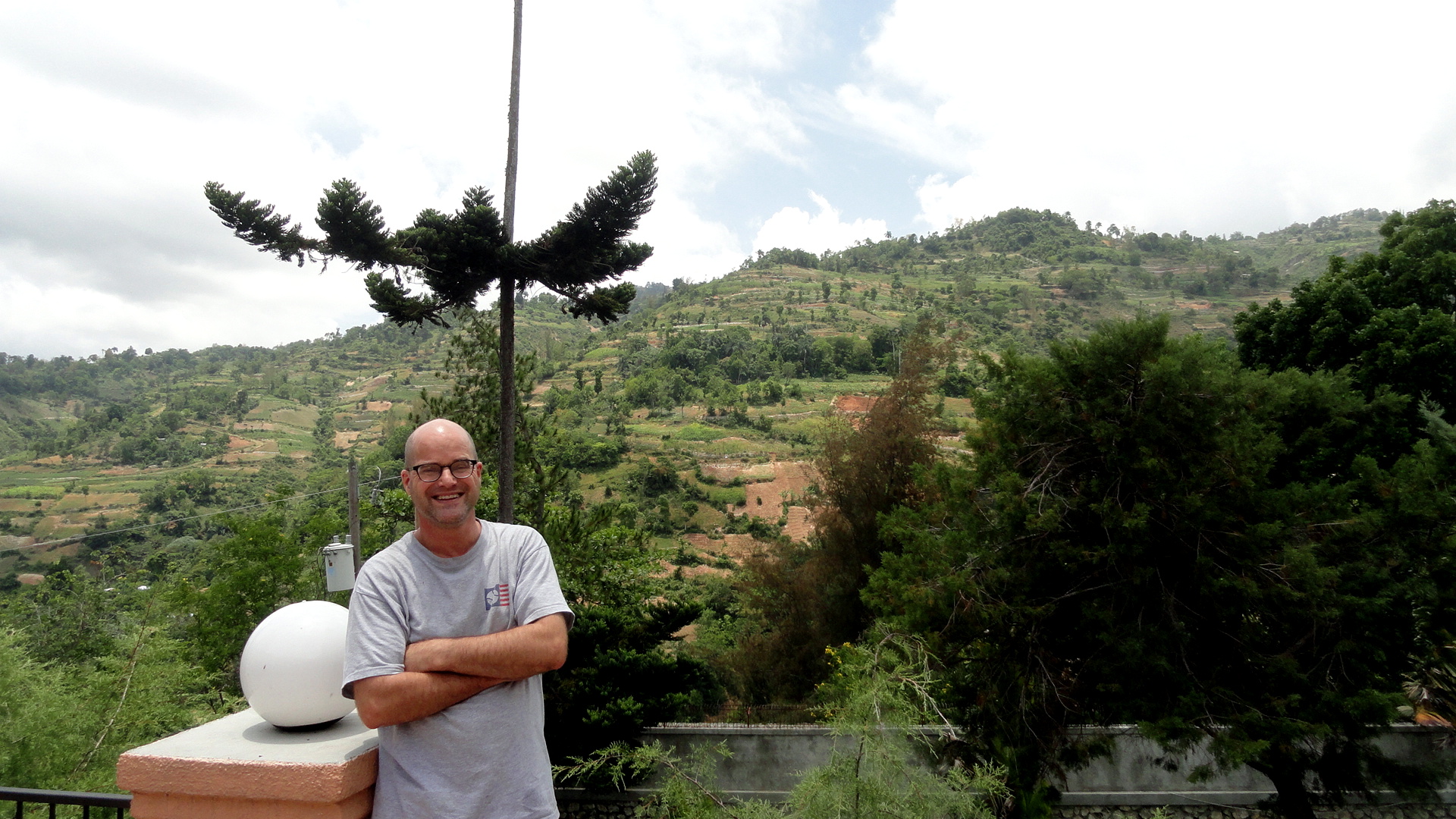
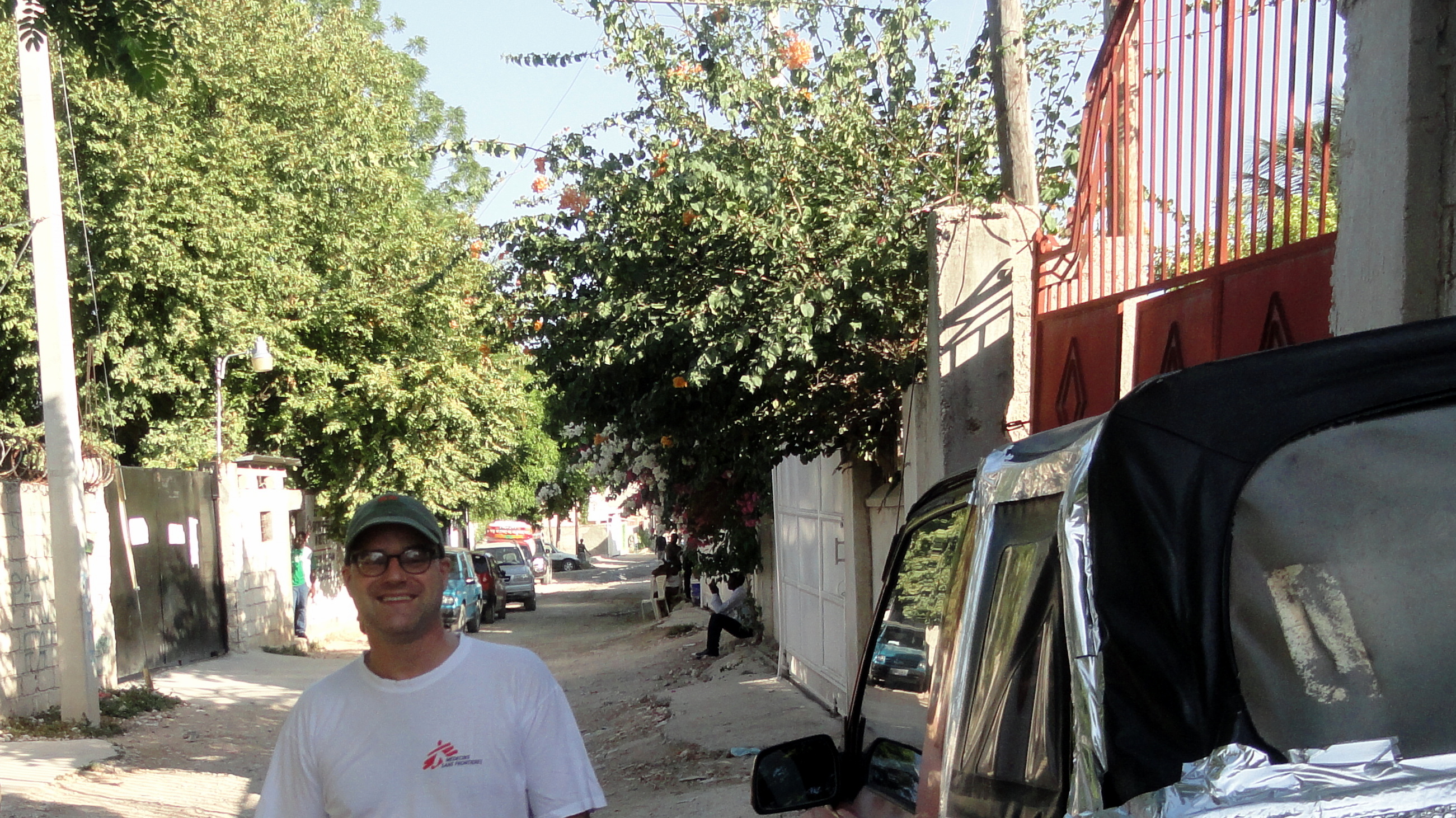
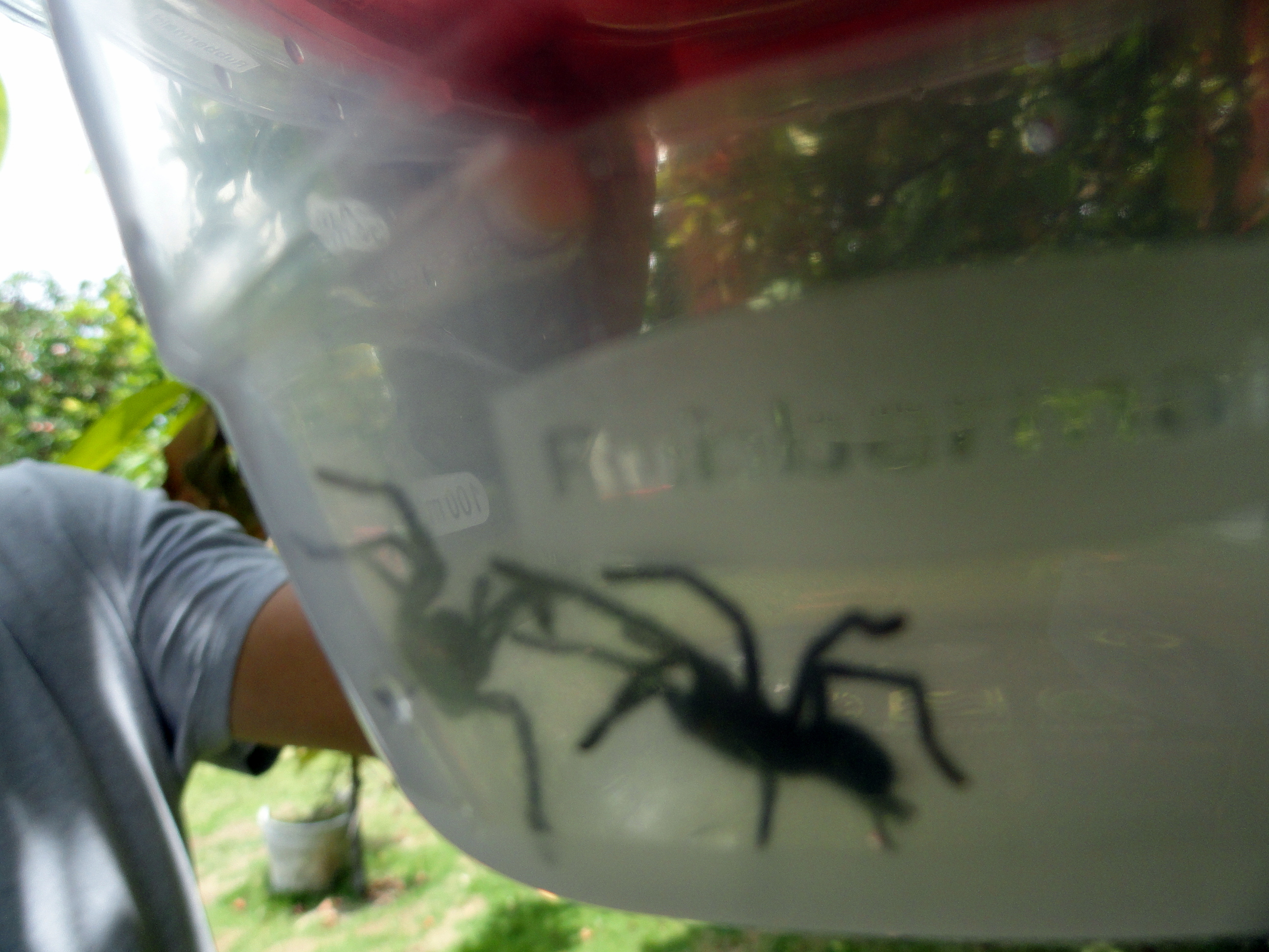 smw, slt is based in Port-au-Prince, Haiti for a while. I’ve been busy meeting new colleagues and partners, and probably won’t post much until I’ve settled down more. However I know a few friends back home wanted at least a view or two of me in my new home-for-a-time. Also, this second weekend here is a long weekend and so I’ve had some time to walk around at least a bit, and although the clouds have built and mugginess makes these views less spectacular than they’d otherwise be, I did catch a few views of the city of P-a-P spread along the plain. Also, the kids of some colleagues discovered a nest of baby tarantulas when they went to get some Malay (or Mountain) apples off the tree in the yard…and though I showed up too late to see the several dozen babies surging up out of the nest, I did snap this shot of a colleague holding two of them in plastic…
Today is jour du drapeau in Haiti, honoring the emblematic moment when Jean-Jacques Dessalines removed the white stripe from the flag of France in 1804 to acknowledge the creation of this new nation whose slave inhabitants had freed themselves from deadly forced labor in the sugar-cane plantations of the most lucrative colony (thanks to all that unpaid, forced labor, don’t ya know) of Europe’s mightiest nation at the time, then removed the remaining whites on the island as well as the white on their new flag. Anyone who hasn’t read up on Haiti’s history will find it well worth studying. And if you’re curious what we’re doing here, check out this from the 2013 annual report (I’d assume 2014’s will be out soon, but I’m only just back on the job and forget the timing of these things): http://www.msf.org/international-activity-report-2013-haiti. In the meantime, peace :-).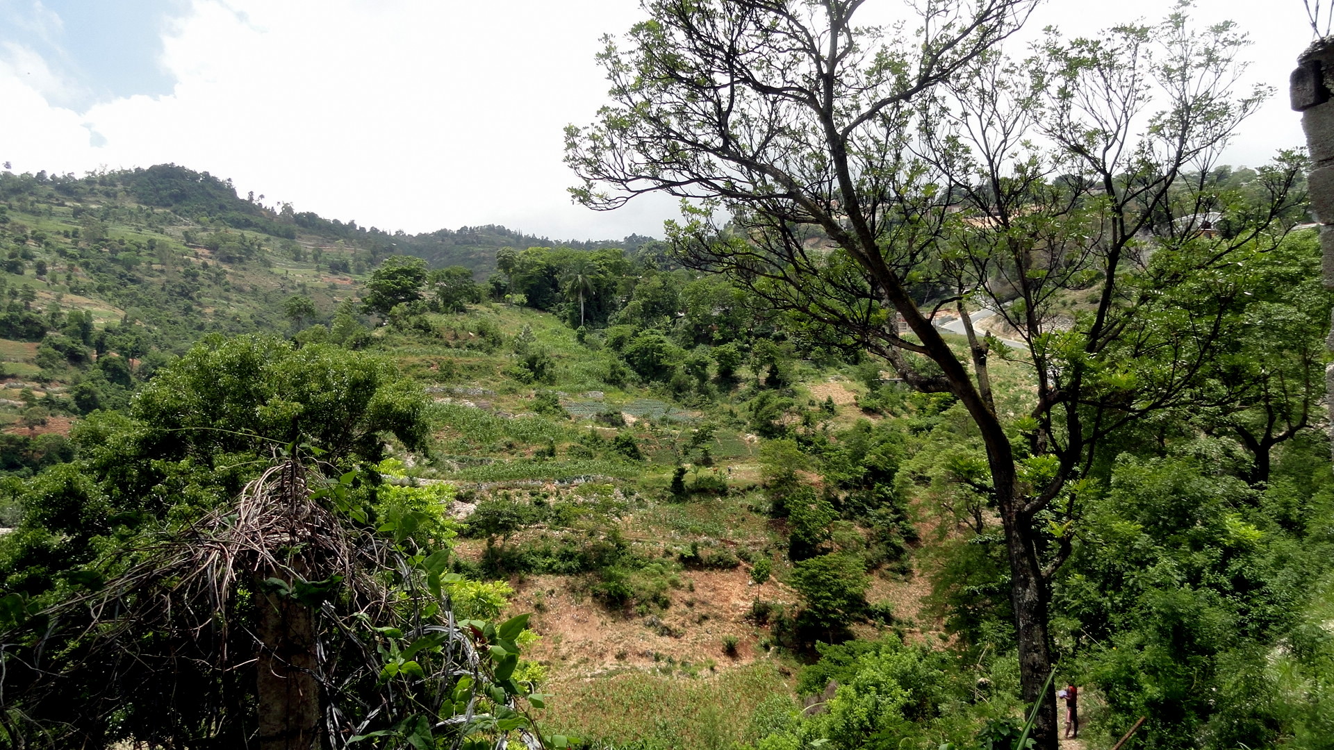

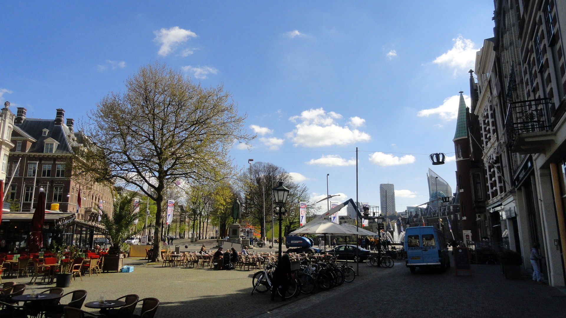
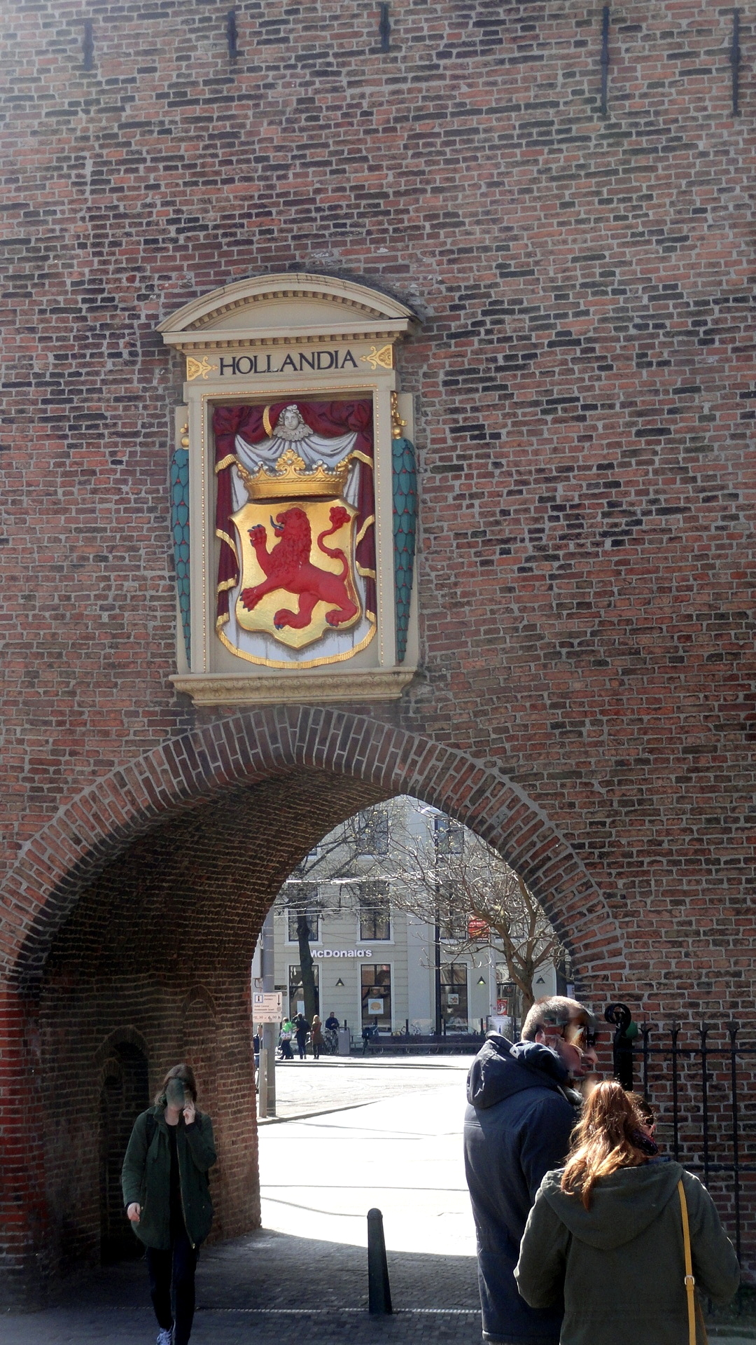
Postcards from The Hague
 During the briefings in NYC and Amsterdam for my new assignment, I had an extra weekend day in the Netherlands, and it being a holiday weekend there, Amsterdam’s hotels were even more than usually full and overpriced. After a quick online comparison, I concluded I could get twice the room for half the price in The Hague, a city I’d always been interested in – historic, reputed to be quite lovely, less than an hour’s train ride away. So I spent the extra night and day in The Hague, taking in museums and walking the old streets of this lovely city which has long been home to the royal family of the Netherlands. Hope you enjoy some of these views.
Today I’ll fly off to the new assignment, from which I’ll try to report a bit more whenever I get time and ability to take some photos, sort them, and share them with you. If you’re curious about where it is and what kind of work we’re doing, check out this link to a recent article covering one aspect of the mission’s work, including some quotes from the colleague whose role I’ll soon be trying to fill: http://www.reuters.com/article/2015/04/17/us-haiti-cholera-idUSKBN0N82O220150417
")


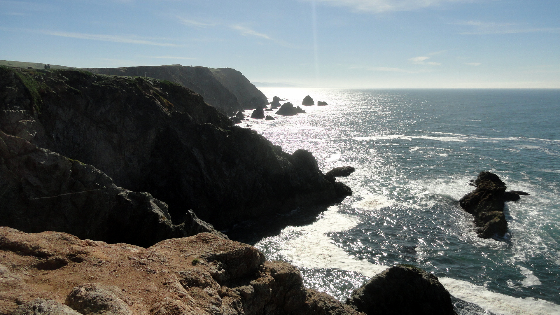
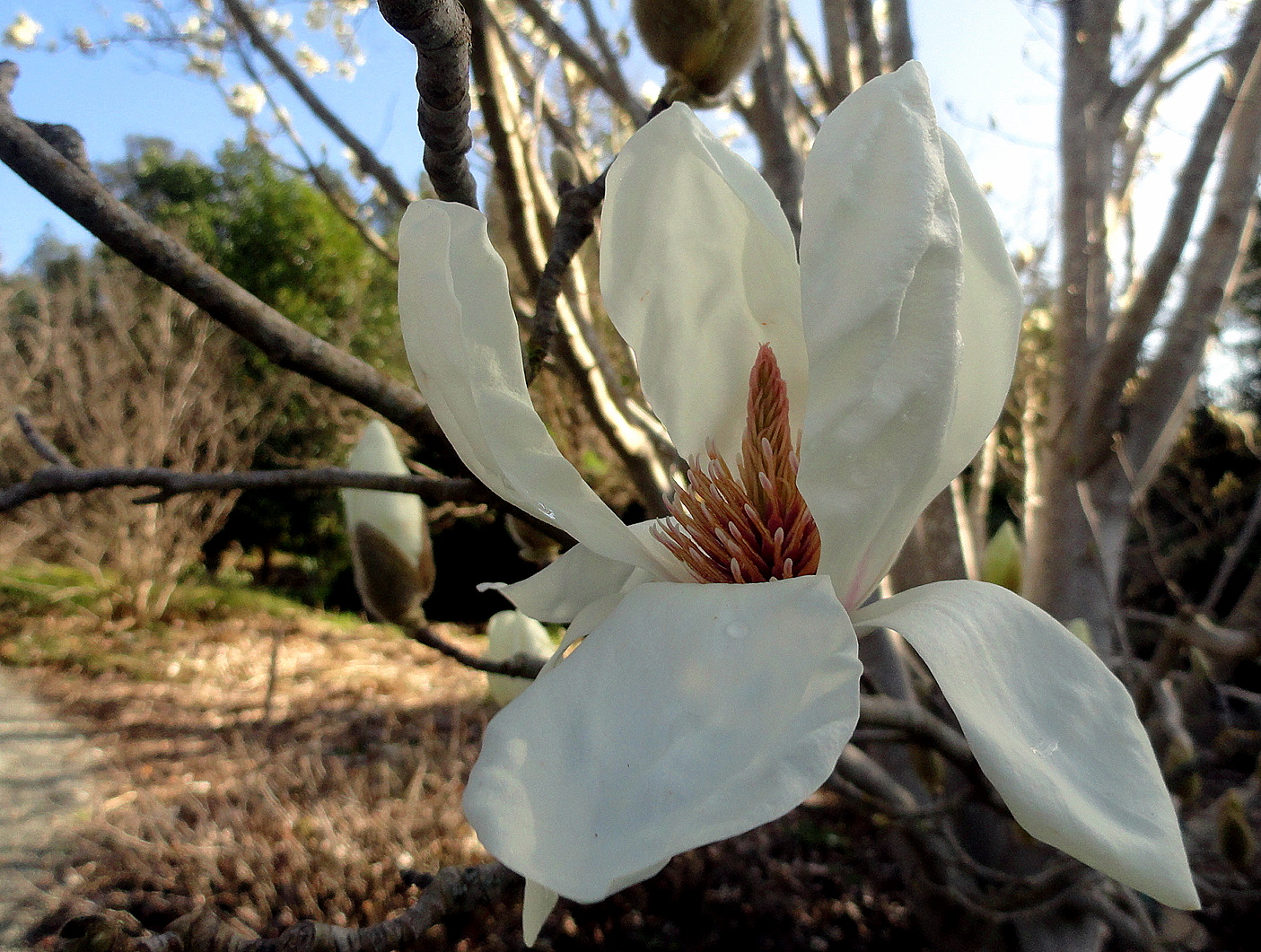
Springtime in Sonoma County
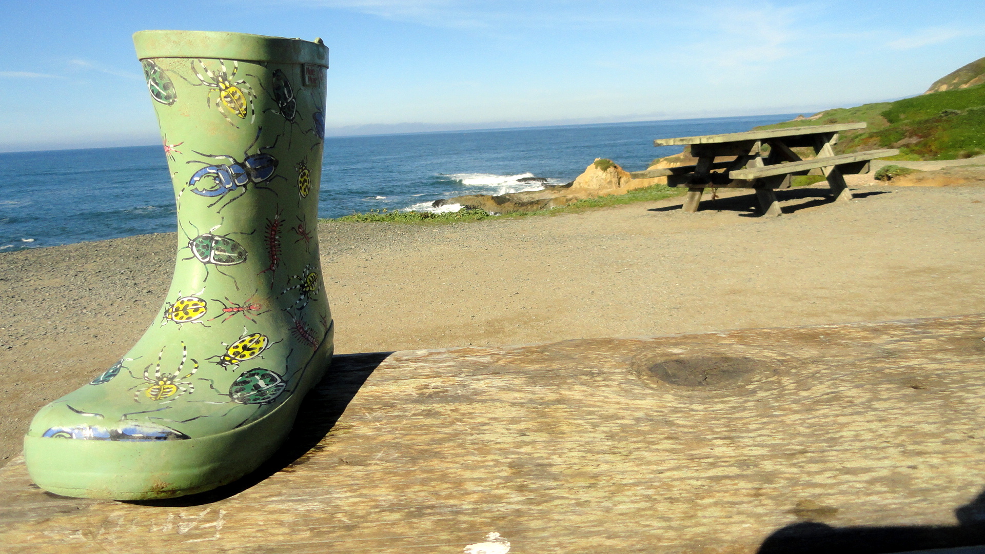 For several months now, smw slt has been calling Sonoma County, in the northern sector of California’s lovely Bay Area, home. It’s an area I’ve always loved and now hope to return to regularly in coming years…during breaks from the upcoming long assignment that’s about to begin. Yep, that’s right, after more than two glorious months of biking, hiking, cooking and quietly attending to the business of having and making friends and pursuing a relatively quiet life, I’m about to pack the bags and hit the airport circuit for more of my beloved work. But before I go, I figured I should pop a few of the scenes I’ve been enjoying these recent months up on the blog, both for myself to scan when I’m feeling homesick, and for anyone who wonders what life looks like an hour’s drive of the city of SF itself. These were all shot between January and March along the coast and in towns and spots around Sonoma County – sadly, I forgot my camera often when I went out by bike or in the car when my mother visited, so for example I have no photos of our lovely day at Fort Ross and at Jenner, where the Russian River meets the ocean. Oh well – that’s called down time for me, to forget the camera! Enjoy, and look for future updates when I get the chance. (And for the record, the painted boot was just sitting there on the picnic table; I did not stage that one. If you don’t see it, try launching this page in a different browser.) Thanks :-).


Goodbye, Uncle Bill
 I’ve woken this morning, for the first time in my life, to a world in which I can’t visit, see or phone my uncle Bill. Having grown up without a father around & with both grandfathers passed before I was eleven, uncle Bill was the only adult male relative that I really felt close to, growing up. I always had the sense – once I grew up enough to take note – that he tried to step in and do what he could for me and my brothers whenever we were together: from miniature golf when I was a kid and we were all visiting our grandparents, to the summers that he and aunt Judy let me spend at their home when I was a teenager which were an opportunity to spend time with my cousins also, to more recent conversations about my humanitarian medical work, given his role as an eminent MD and medical researcher. I know that it’s one of those essential realities of being human, being organic life, that generations succeed each other and, yes, that generational succession means our elders will not always be with us. Since my work takes me so far away, so much of the time these days, this is one of my greatest fears: losing someone dear to me when I’m thousands of miles and many long flights away. I take slim consolation in my own loss this morning, from my very fond memories of the visits I was able to make to Bill and Judy at their lake house in Wisconsin just last summer, and the time spent at that wonderful family reunion (also known as my niece’s wedding) in New Mexico just weeks later. I haven’t seen Bill since, but with me on the continent we’ve talked by phone a few times. I know with time I’ll adapt to the idea that we won’t talk on the phone or see each other in person again, and that Bill will join my grandmother as one of the people with whom I wish I could share the moments when I’m living most richly — as I’ve done since that other sad family reunion nearly 30 years ago when she had left us all. I know that others feel this loss even more deeply than I, and I send my thoughts to all of my cherished extended family this morning, along with some photos I’ve scanned and pulled from my archives. Though I’ve rarely gotten so personal on this blog, uncle Bill absolutely merits special treatment and this review of my lifetime’s worth of memories of the closest uncle I’ll ever have is the best I can do right now. Good bye, uncle Bill…
Many Muddy Misty Magnificent Miles on the Milford Track
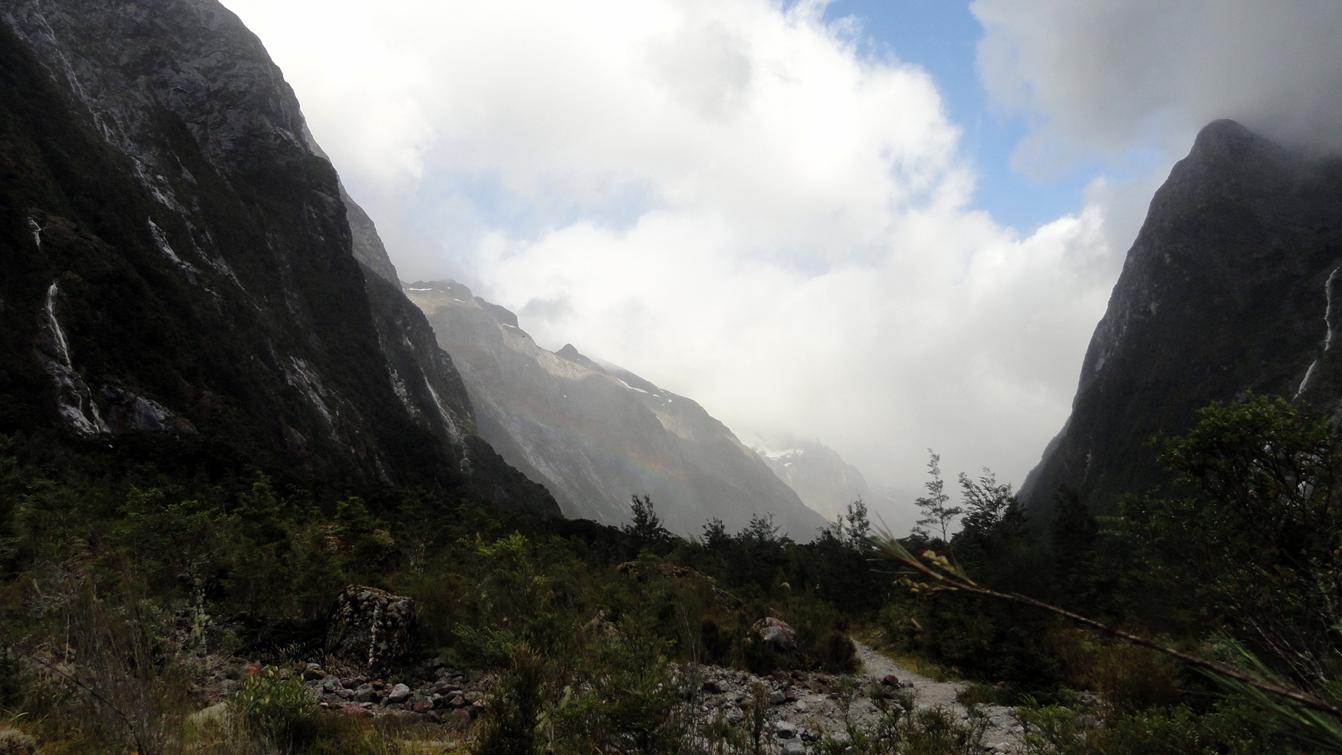
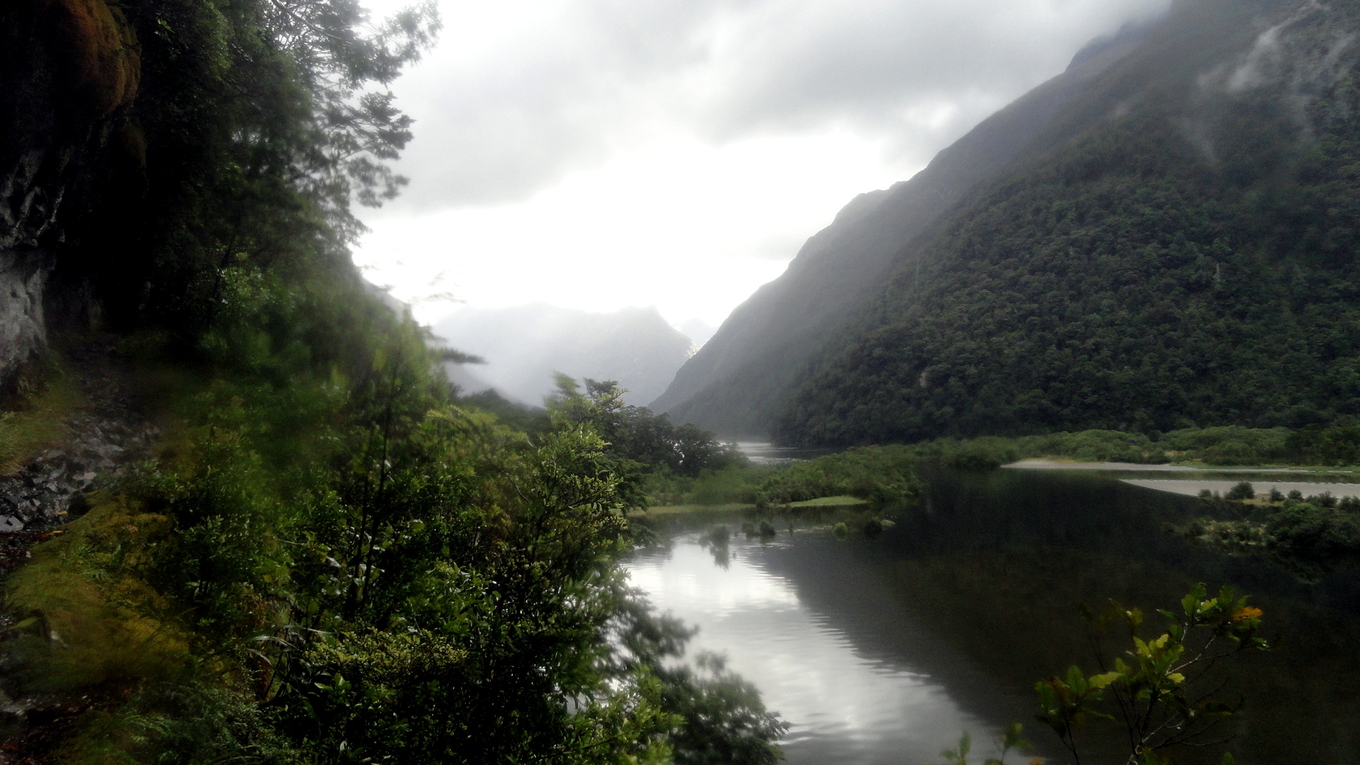
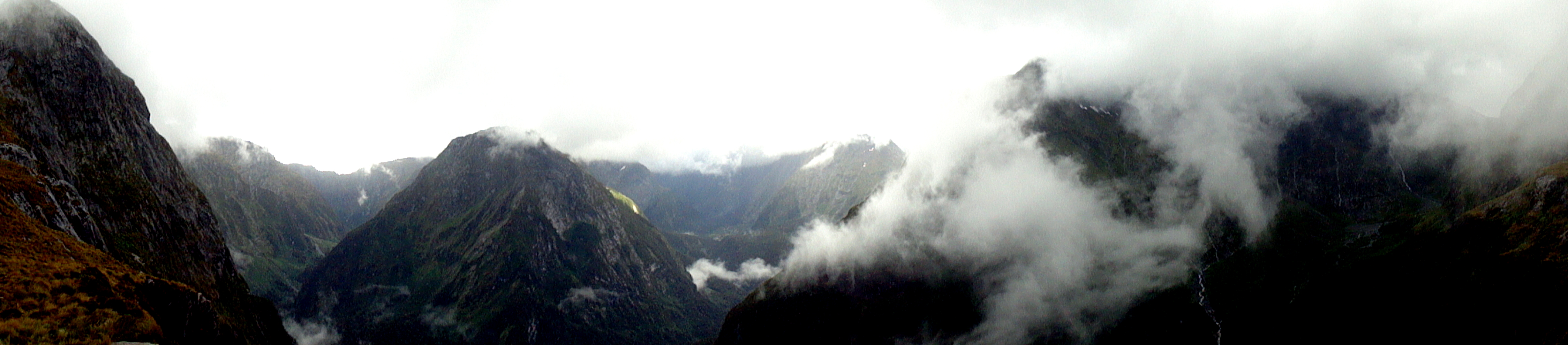
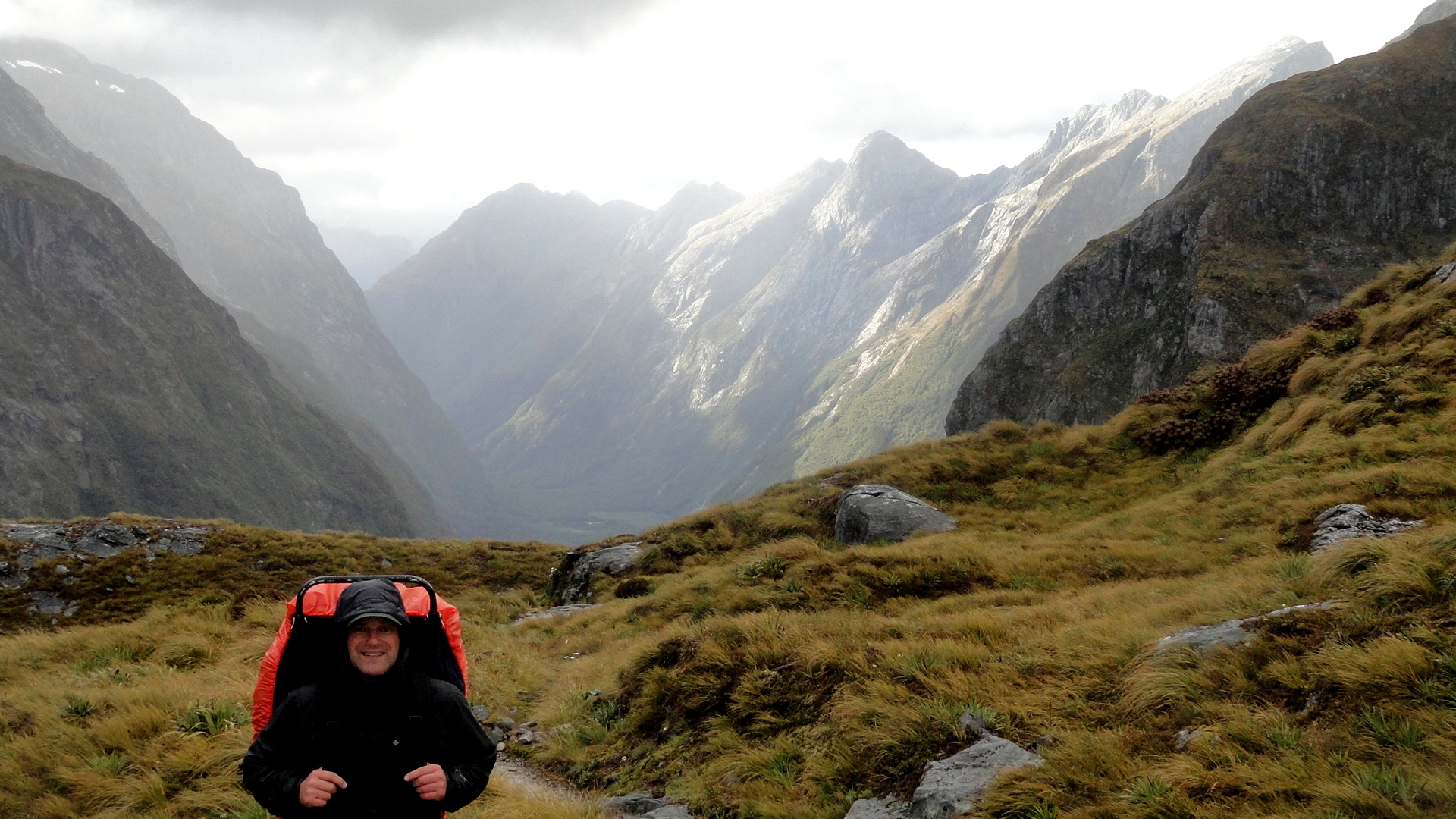
 The Milford Track is the most famous, and most popular, of the Great Walks. It starts at the bottom of the Clinton Valley, formed by the eponymous river which features a few times in the gallery of square photos further down. The first two nights of the three-night, four-day hike are spent within the Clinton Valley, hiking from the boat drop at the northernmost end of Lake Te Anau where the Clinton River feeds it, up to McKinnon Pass where the images above and the whole slide show below were taken. After the slide show, you’ll see a variety of views from other sections of the trail: rivers, waterfalls, dramatic valleys and trail segments snuggled into a rock face alongside the Arthur River at the end of the track, where it meets up with Milford Sound. Milford Sound has been cited by many magazines as one of the most beautiful places on earth; and Milford Track as has been cited as one of the most spectacular hikes on earth. I certainly found McKinnon pass to be one of the most spectacular places I’ve ever seen, and I found many of the miles along the Clinton Valley quite beautiful in an ever-changing, other-worldly manner that was different yet again from the other-worldliness of the glaciers featured in my last post.
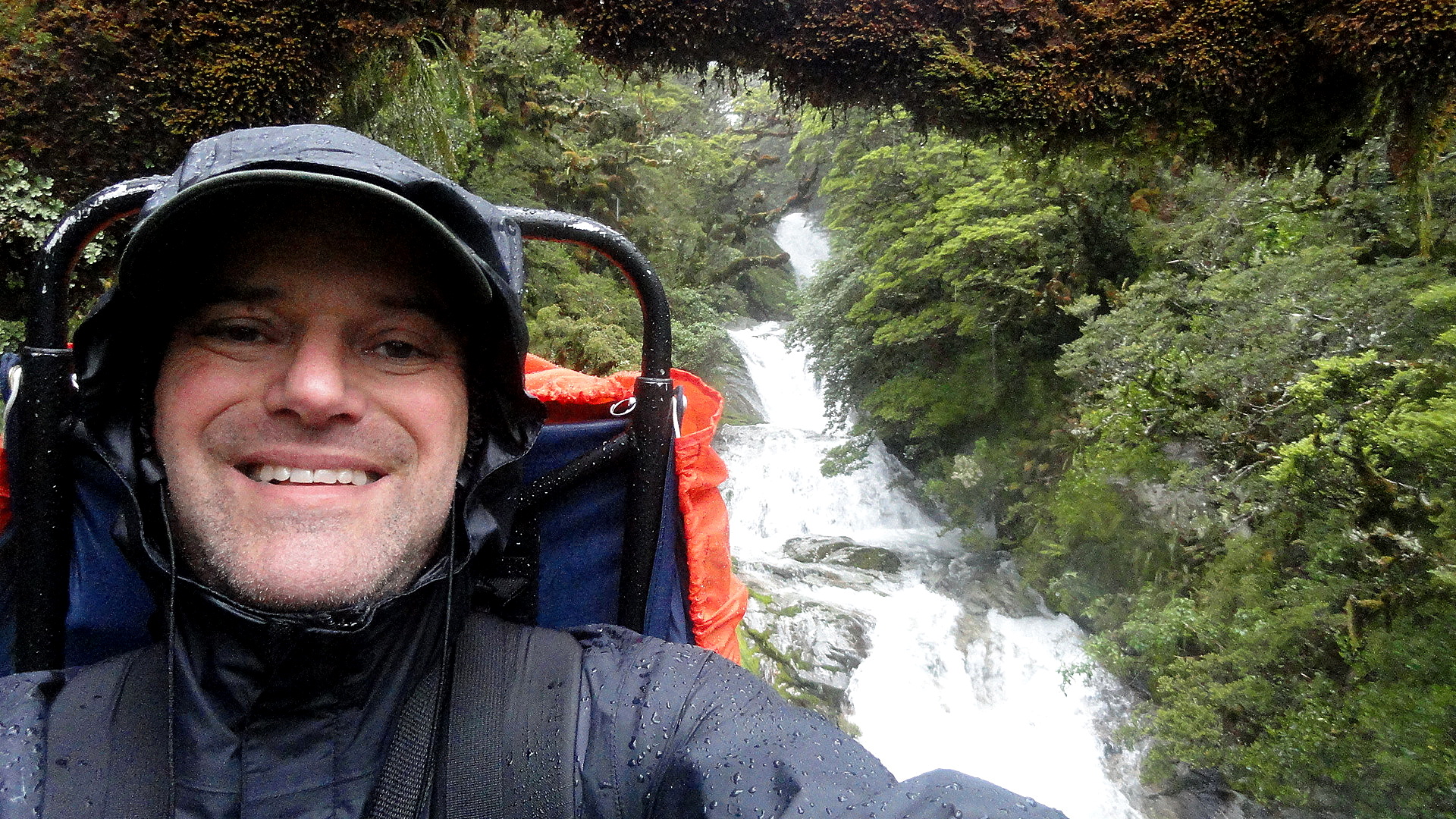
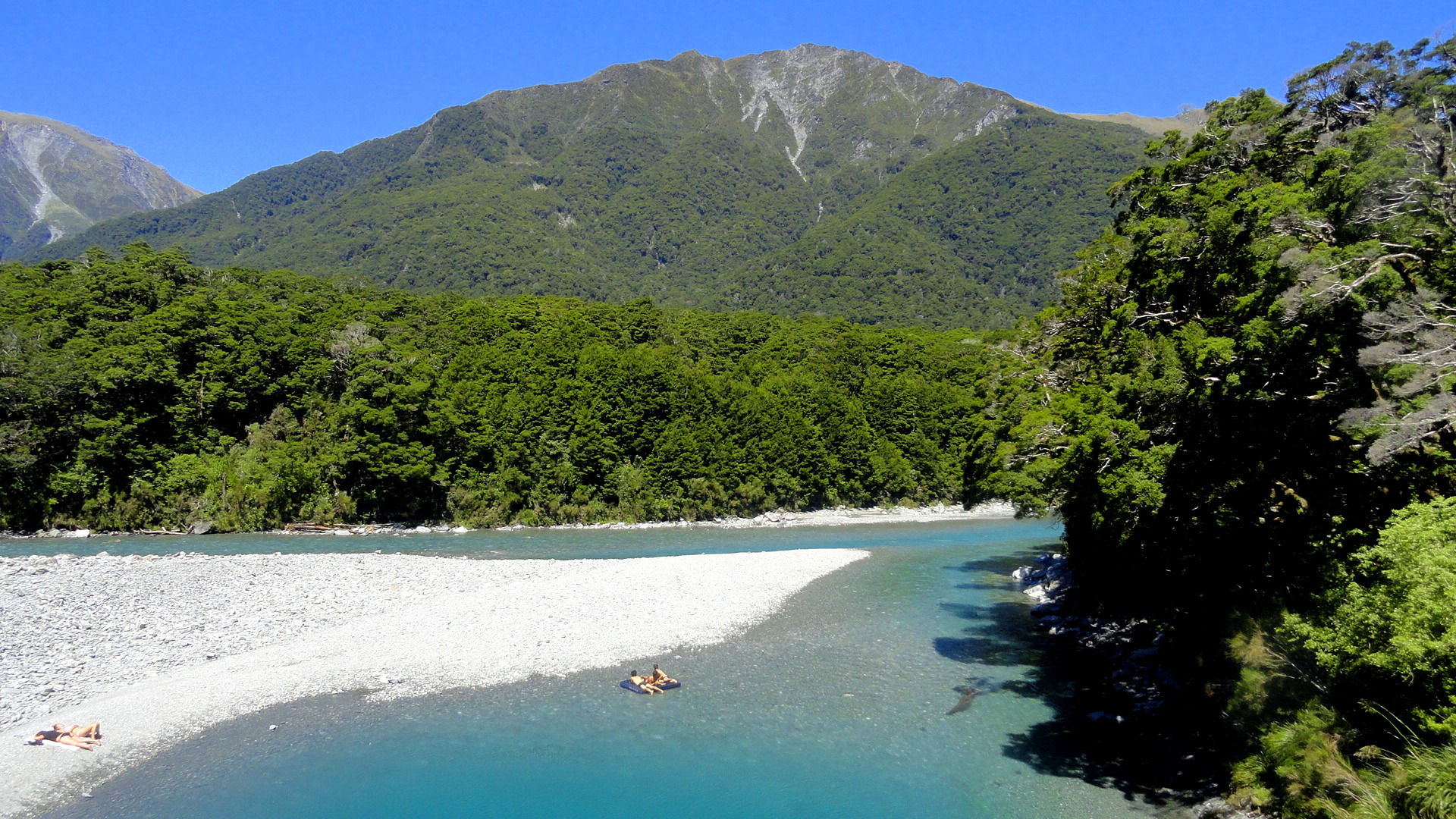
But allow me to say this, of the Milford Track: it is indescribably wet. We hiked it in the midst of the southern summer, during peak season. Peak season is also, strangely, the rainiest season; but even the driest season has plenty of rain. And the drier winter season is, we were told, the season of such landslides as the one just below where you see the trail marker placed to navigate walkers across the rubble field. I can imagine that a mostly-dry hike over this trail would be an unbelievably great experience. And I can certainly attest the truth of that oft-quoted adage that rain makes waterfalls, which are the joy of the trail. But can I just say that my own brain can only really appreciate xx-many waterfalls, and after a certain point both my feet and my soul wish to be dry, warm and comfortable again? So I ended this trail – which, indeed, gave me more spectacular scenery than most other hikes I’ve done – with the sense that it won’t likely call to me again…whereas the Abel Tasman, for all its comparatively mundane (hah!) scenery, is one I’d readily return to again and again – in part because it’s just so much more warm and comfortable as a hiking experience. (Even the Kepler, another Great Walk within the extraordinary Fiordland National Park, showcases a wider range of terrain with a lower preponderance of heavily rainy days — witness this post: https://somuchworldsolittletime.wordpress.com/2009/03/05/kepler-track-fiordland-national-park/
But don’t get me wrong: even the most amazing of these photos (some of which still give me vertigo) can’t convey the gift of being present to feel and hear the roar of wind and rain, marvel at the shifting windows of sunlight along a mountainside, or see a rainbow materialize above one of those windows…with the sense perhaps you’re the only human positioned so as to appreciate that particular ephemeral wonder. Whatever the case, I encourage anyone who loves the great outdoors and appreciates natural beauty to bump NZ up your must-visit list, if you’ve not done so already. Feel free to research on this blog (from 2009, 2013-14, and 2015!) some of the many wonders you might consider experiencing in person. Enjoy. 🙂
…about the blurry spots you’ll see in some of the rainier images: my camera has survived but there were days where the lens never really got dry. Most of the rain-splattered photos are deleted, but I felt some of these convey what words cannot about the omnipresence of water at times…


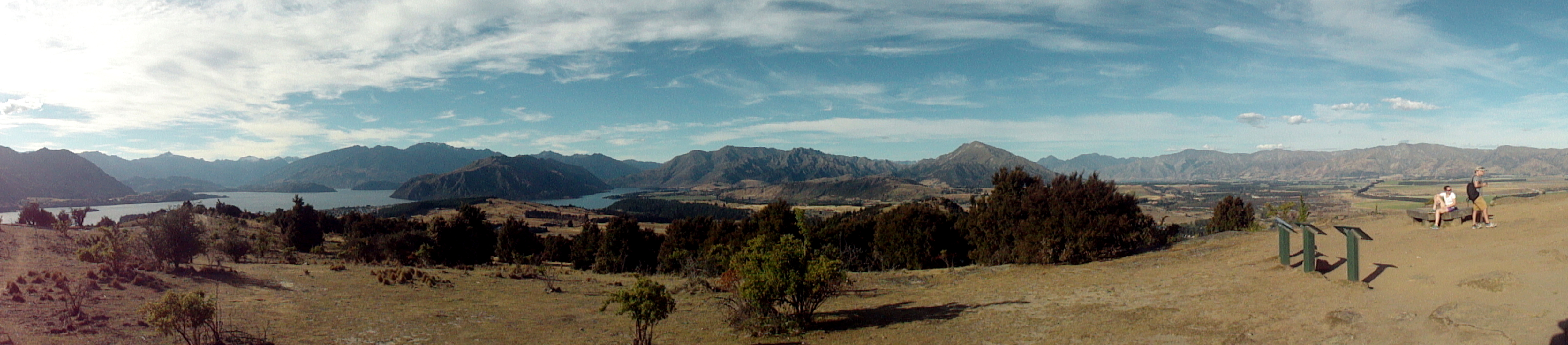
Two Glaciers, Many Streams & Towering White-Tipped Peaks…

 …must mean we’re on the wild southwestern coast of NZ! In this entry you’ll see photos from both Franz Josef & Fox Glaciers, as well as shots from the temperate rain forest to which these glaciers descend at their lowest, warmest level where they’re melting all too rapidly these days, what with holes in the ozone layer and global warming more generally. There are also views from the Haast Highway along the south coast, and up and over the Haast Pass alongside Mt Aspiring National Park into the town of Wanaka. They all have names that identify them. To put this in some perspective, think of the last entry (or scroll down to it) and understand that we did a fairly substantial last-morning hike along the nearly-tropical-seeming Abel Tasman Coast track, grabbed a water-taxi back to Motueka, hopped in the car and stopped for some berries and dinner along the drive south, then spent the night a short walk downriver from the ice cave at Franz Josef Glacier just below. It’s really quite unreal and surreal at the glaciers because, despite significant melt and receding up their canyons to higher ground, they still descend to the level where rich dense temperate rain forest grows and unusual-sounding birds call, and it just feels utterly other-worldly. Certainly this close to sea level, this far downhill from their main bodies, neither of these will stand out if side-by-side with other, bigger glaciers you might have seen…but the clear way they’ve affected the landscape and the simple fact that a short walk away one is enveloped in dense temperate rainforest is pretty amazing.


